ALPINISM FEDERATION OF KRASNODAR TERRITORY
REPORT ON THE ASCENT TO CHUGUSH PEAK (3238 m) VIA THE SOUTHEAST RIDGE, Presumably Category 2B, combined. First ascent.
Team leader – Ivan Sergeyevich Kuchkin Sochi 2020
Ascent Details
- Western Caucasus, Krasnaya Polyana area, Achipse gorge, section 2.1 of the mountain peak route classifier.
- Peak: Chugush, 3238 m.
- Route: via the Southeast Ridge
- Category of difficulty: presumably 2B
- Route type: combined
- Route elevation gain: 600 m. Route length: 1700 m. Length of Category III sections: 480 m. Length of Category IV sections: 20 m. Average steepness of the route: –45°
- Pitons used on the route: U-shaped – 1 pc. Rock pitons – 3 pcs. Nuts – 4 pcs. Anchor pitons – 0 pcs., incl. T.O. – 0 pcs. Bolt pitons – 0 pcs., incl. T.O. – 0 pcs. Slings – 5 pcs. Pitons left on the route: 0 pcs.
- Team's total climbing hours: 6 hours.
- Descent from the summit: via the ascent route.
- Team composition:
Leader:
Ivan Sergeyevich Kuchkin – Candidate Master of Sports
Team members:
- Andrey Ivanovich Morozov – Candidate Master of Sports (1st category instructor)
- Nikolay Gennadyevich Ovchinnikov – 3rd sports category
- Anna Vladimirovna Fedorova – 3rd sports category
- Date of ascent: July 26, 2020. Departure from campsite: 5:30 AM Arrival at the summit: 8:30 AM Return to campsite: 11:30 AM
- Alpinism Federation of Krasnodar Territory (within the framework of the NAO Krasnaya Polyana mountaineering event)
Equipment List
- Main rope 50 m.
- Set of nuts.
- Rock pitons – 3 pcs.
- Friends – 3 pcs.
- Quickdraws – 5 pcs.
- Station loops – 4 pcs.
- Locking carabiners – 12 pcs.
- Descender – belay device – 4 pcs.
- Ice screws – 2 pcs.
- Ice axes – 4 pcs.
- Crampons – 4 pairs.
- Backpacks – 4 pcs.
- Tent – 2 pcs.
- Sleeping bag – 4 pcs.
- Sleeping pad – 4 pcs.
- Stove – 1 pc.
- Gas cylinder – 1 pc.
- First aid kit – 1 pc.
Area Description
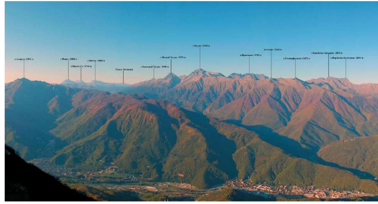
The Chugush mountain range is part of the immediate mountain surroundings of Krasnaya Polyana and is one of the most beautiful peaks of the Caucasus Nature Reserve. The highest peak of the range, Chugush itself (3238 m), is surrounded by the peaks of Yuzhny Chugush (2760 m), Zapadny Chugush (2700 m), and Vostochny Chugush (2675 m). The range is part of the Chugush ridge. This ridge, stretching about 14 km from northwest to southeast, separates the basins of the Berezovaya and Chessa rivers. To the northwest, it is bounded by the mouths of these rivers, which flow into the Belaya River. The southeastern boundary of the ridge and the Chugush range is the Chugush Yuzhny pass – a low point in the Main Watershed Ridge 2 km southeast of Chugush peak. Chugush peak is also the highest point of the Republic of Adygea.
General photo of the peak with nearby peaks marked
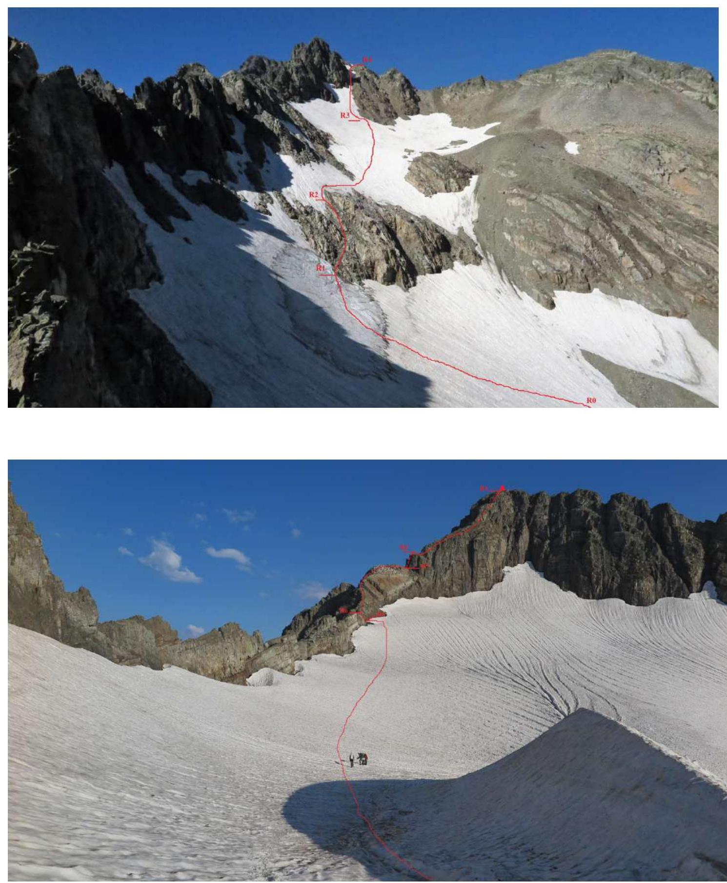
General photo of the route

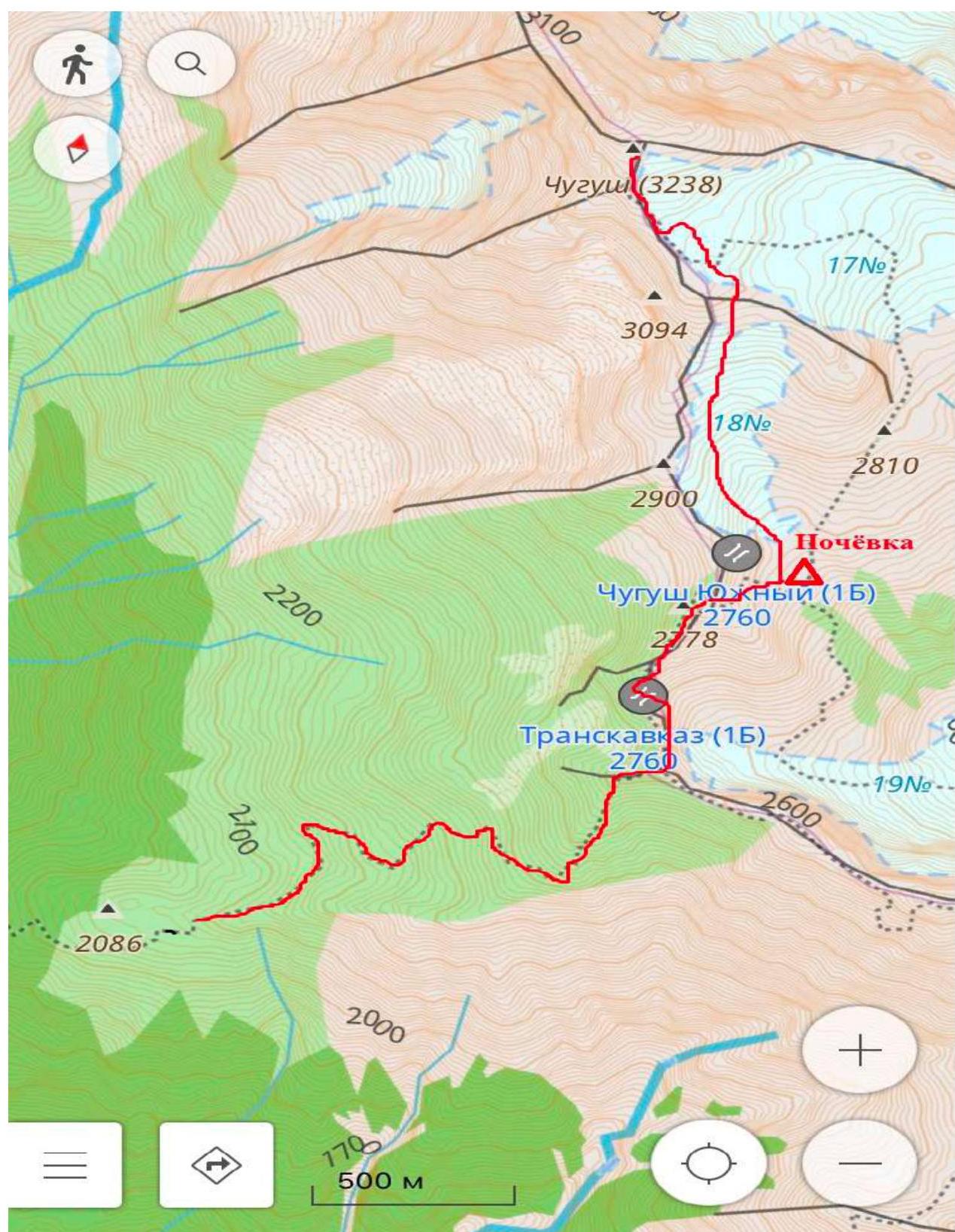
Route map
Route diagram in UIAA symbols
| Pitons | Nuts | Ice screws | Section | Length (m) | Steepness | Difficulty |
|---|---|---|---|---|---|---|
| 3 | 3 | R8–R9 | 200 | 55–60° | 3–3+ | |
| 1 | 1 | R7–R8 | 25 | 70° | 4+ | |
| R6–R7 | 150 | 40–45° | 2–3 | |||
| R5–R6 | 5 | 60° | 3 | |||
| R4–R5 | 300 | 25° | ||||
| R3–R4 | 250 | 45–50° | 2–3 | |||
| R2–R3 | 300 | 35° | ||||
| R1–R2 | 50 | 35° | 2 | |||
| R0–R1 | 450 | 30° |
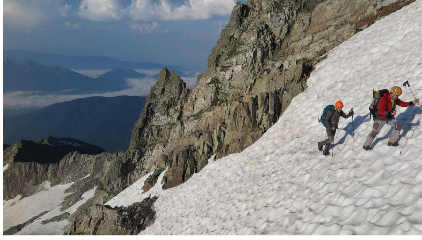
Approach to the campsite under the route.
Drive by off-road vehicle to the barrack, from which a trail leads to the waterfall on the Berezovaya River and a dirt road to the "Asmanovy" meadows. Walk 40 minutes up the road to the "Asmanovy" meadows. Then, along a simple grassy, later scree ridge with simple rock outcrops, ascend for 1.5–2.5 hours to the watershed ridge connecting Chugush and Assaru. Along the ridge towards Chugush peak (simple rocks, bypassing the gendarmes on the left along the gentle grassy-scree slopes), reach the Chugush Yuzhny pass. From the pass, descend to the moraine at the lower part of glacier No. 18. There are convenient areas for tents under the moraine.
Route description by sections.
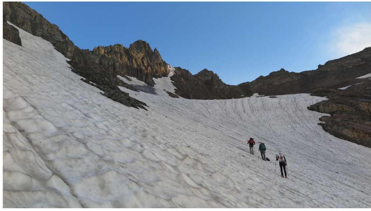
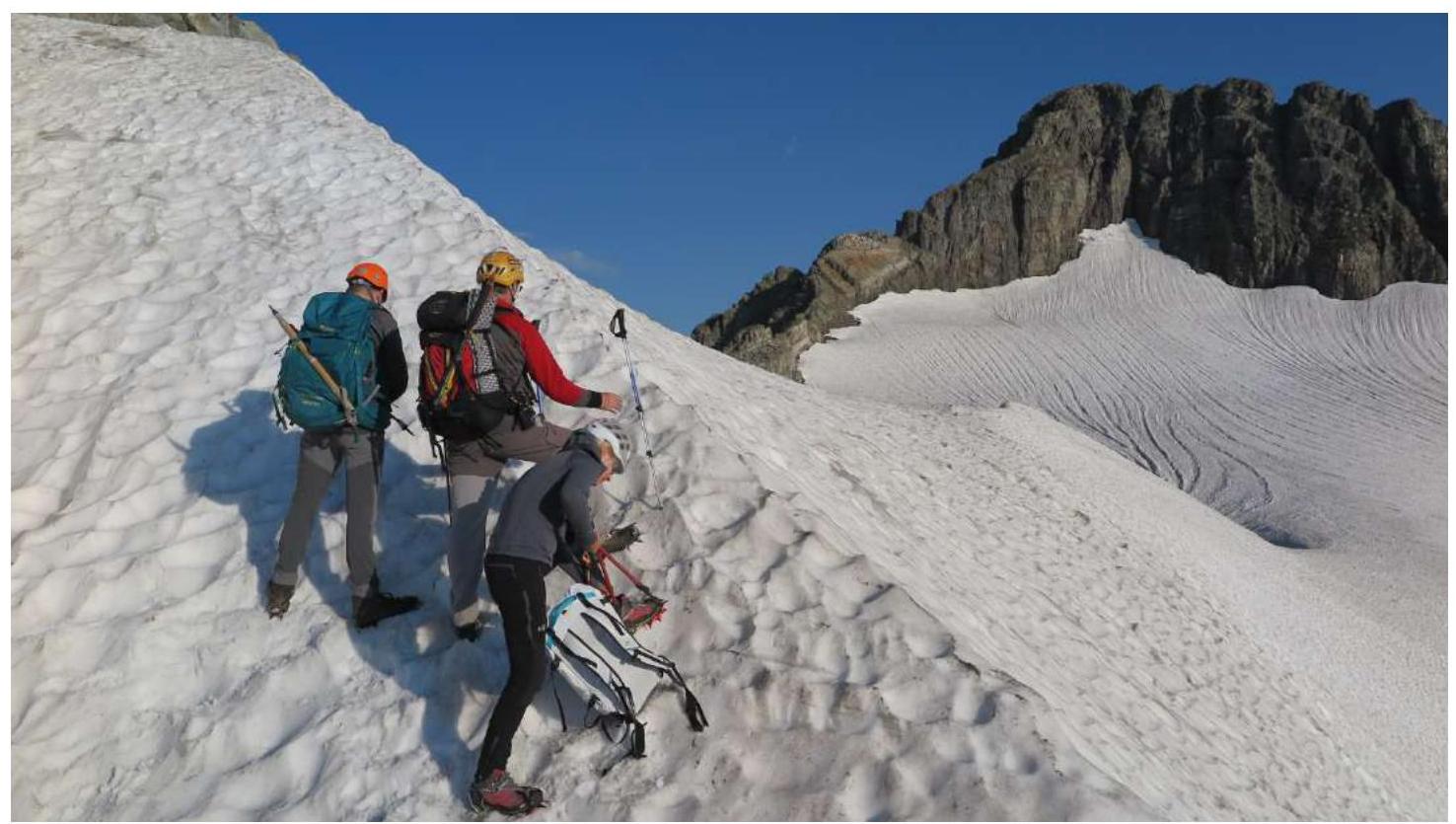
From the campsite, ascend (150 m) along the moraine to glacier No. 18.
R0–R1 (450 m, 30°)
Then move along the glacier (350 m) to the rocks dividing the glacier into two parts.
R1–R2 (50 m, 2, 35°)
On the left side of the rocks, there is an inclined scree shelf (50 m) that leads to the upper part of the glacier.
R2–R3 (300 m, 35°)
Move along the glacier (250–300 m) towards the snow-ice couloir leading to the saddle with glacier No. 17.
R3–R4 (250 m, 3, 45–50°)
Ascend (250 m) along the couloir (belay, ice axes) to the saddle.
R4–R5 (300 m, 25°)
From the saddle, move onto glacier No. 17 and proceed (300 m) towards the col between peak 3094 m on the left and Chugush peak on the right.
R5–R6 (5 m, 3, 60°)
Reach the col via a small wall (5 m) at the simplest spot (depending on the season, a crevasse may form).
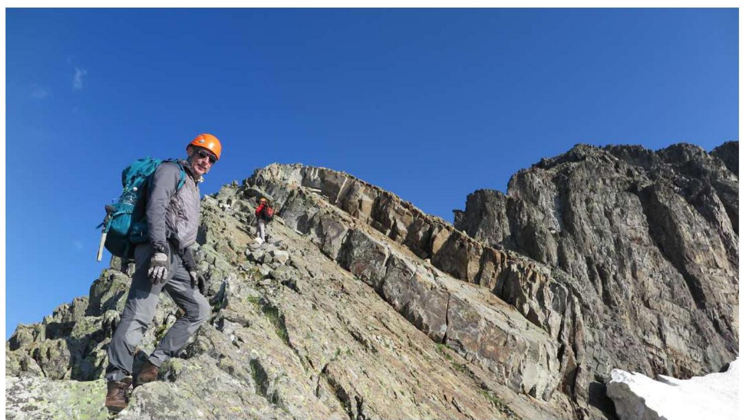
R6–R7 (150 m, 2–3, 40–45°)
Along the ridge, proceed (150 m) towards Chugush peak to a wide inclined rock shelf before a 10 m vertical wall. From here and above, the ridge becomes more complex.
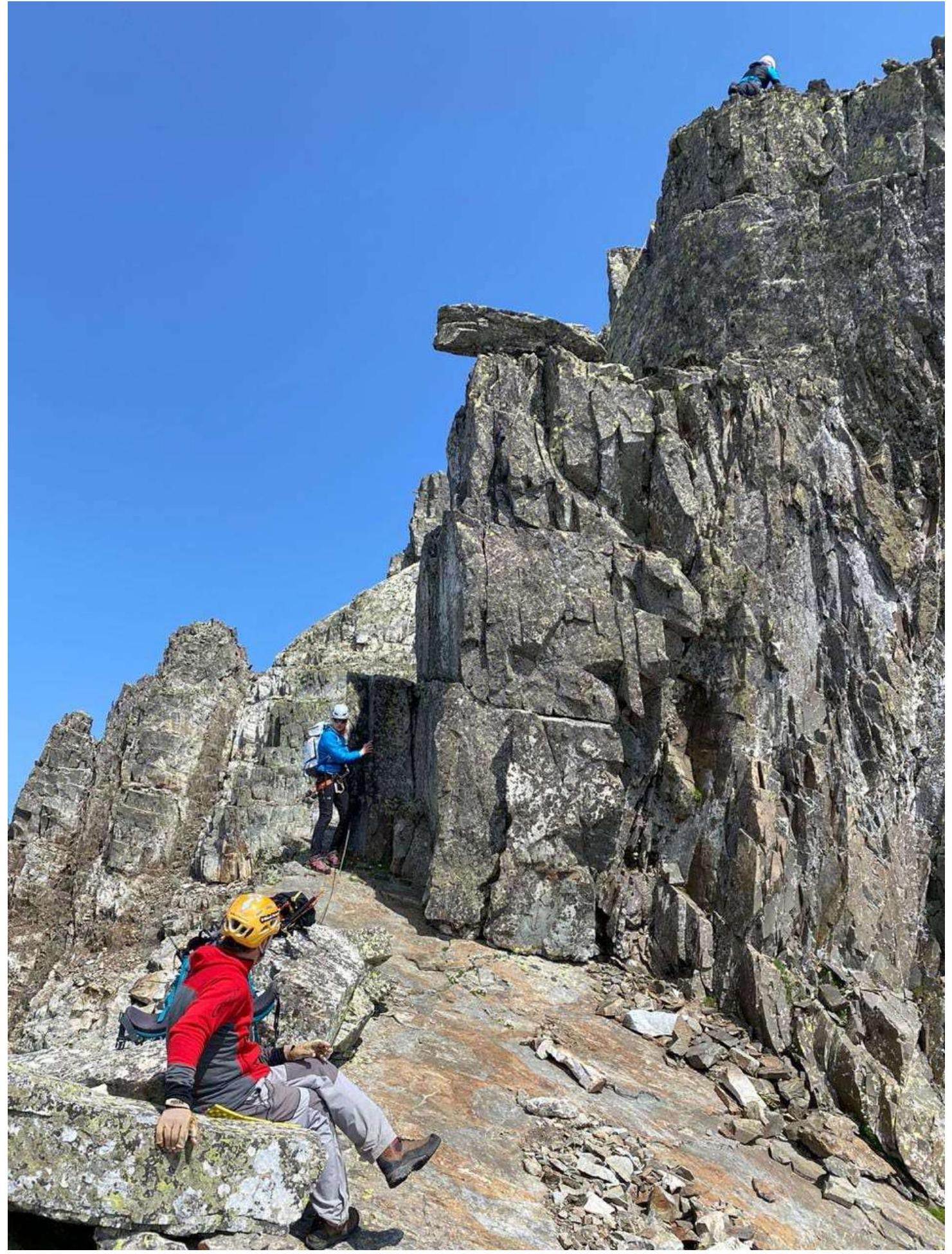
R7–R8 (25 m, 4+, 70°)
The wall is bypassed on the left along the shelf (10 m) and then to the right via an internal corner, reaching a small rock shoulder. Then the route goes along the left part of the S ridge. Avoid going onto the ridge!
R8–R9 (200 m, 3–3+, 55–60°)
From the rock shoulder, move along an inclined scree shelf (60 m). Then up and to the right (120 m) via rocks and rock shelves on the SW slope of moderate complexity (belay, loose rocks!) to reach the summit.
Descent from the summit.
Descend via the ascent route.
Route photos
R2–R3
R3–R4
Saddle
R6–R7
R7–R8
R8–R9

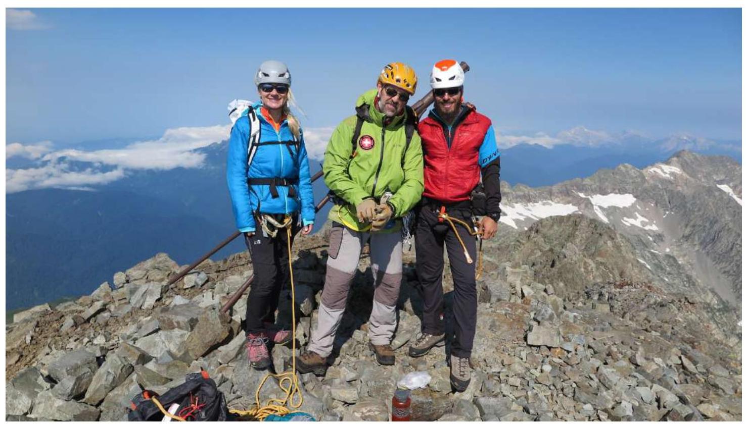
Summit photo
Team members' addresses
354003, Sochi, Vishnevaya St., 29–82, phone +79182020200, ivan_sochi@mail.ru