MOUNTAINEERING FEDERATION OF KRASNODAR TERRITORY
REPORT
ON THE ASCENT TO FISHT PEAK (NORTH-WEST) VIA THE RIGHT PART OF THE WESTERN WALL ROUTE OF APPROXIMATE 4B DIFFICULTY CATEGORY (SECOND ASCENT) BY THE TEAM FROM ALPINISM CLUB "SHTURM", KRASNODAR ON MAY 27, 2018
2018
I. ASCENT PASSPORT
| 1. General Information | ||
|---|---|---|
| 1.1 | Full Name, Sports Rank of the Leader | Anatoly S. Barabash, 2nd sports rank |
| 1.2 | Full Name, Sports Rank of Participants | Mikhail N. Ivashchenko, CMS |
| 1.3 | Full Name of Coach | Dmitry S. Shaulsky |
| 1.4 | Organization | Regional Public Organization "Mountaineering Federation of Krasnodar Territory", Alpinism Club "Shturm", Krasnodar |
| 2. Characteristics of the Ascent Object | ||
| 2.1 | Region | Western Caucasus, Krasnodar and Stavropol territories up to Marukh pass |
| 2.2 | Valley | Fisht-Oshtenovsky massif |
| 2.3 | Section Number according to the 2013 Classification Table | 2.1 |
| 2.4 | Name and Height of the Peak | Fisht (North-West) 2581 m |
| 2.5 | Geographic Coordinates of the Peak (latitude/longitude) | 43°57′52.51″N, 39°53′03.80″E |
| 3. Route Characteristics | ||
| 3.1 | Route Name | Via the right part of the Western wall (A. Antoshin, 2009) |
| 3.2 | Proposed Difficulty Category | 4B |
| 3.3 | Route Exploration Level | Second ascent. The first ascent was made in 2009. |
| 3.4 | Terrain Characteristics | Rock |
| 3.5 | Height Difference of the Route (altimeter or GPS data) | 480 m |
| 3.6 | Route Length (in meters) | 850 m |
| 3.7 | Technical Elements of the Route (total length of sections with different difficulty categories, indicating terrain type: ice-snow, rock) | Category I rock – 590 m. Category II rock – 55 m. Category III rock – 10 m. Category IV rock – 65 m. Category V rock – 85 m. Category VI (A1) rock – 20 m. |
| 3.8 | Average Route Steepness, (°) | 40° |
| 3.9 | Average Steepness of the Main Route Part, (°) | About 75° |
| 3.10 | Descent from the Peak | Via the Western wall (V. Shipilova) 4A category |
| 3.11 | Additional Route Characteristics | No water or snow in summer and autumn |
| 4. Team Actions Characteristics | ||
| 4.1 | Time of Movement (team's walking hours, in hours and days) | 13 hours (including 9 hours to the peak), 1 day |
| 4.2 | Overnights | No overnights |
| 4.3 | Route Preparation Time | - |
| 4.4 | Start of the Route | 06:00, May 27, 2018 |
| 4.5 | Reaching the Peak | 15:00, May 27, 2018 |
| 4.6 | Return to the Base Camp | 20:00, May 27, 2018 |
| 5. Weather Conditions Characteristics | ||
| 5.1 | Temperature, °C | - |
| 5.2 | Wind Speed, m/s | - |
| 5.3 | Precipitation | - |
| 5.4 | Visibility, m | - |
| 6. Person Responsible for the Report | ||
| 6.1 | Full Name, Phone, e-mail | Mikhail N. Ivashchenko, |
| +7(906) 431-55-03, indeeccc@gmail.com |
II. ASCENT DESCRIPTION
1. Characteristics of the Ascent Object
1.1. General Photo of the Peak:
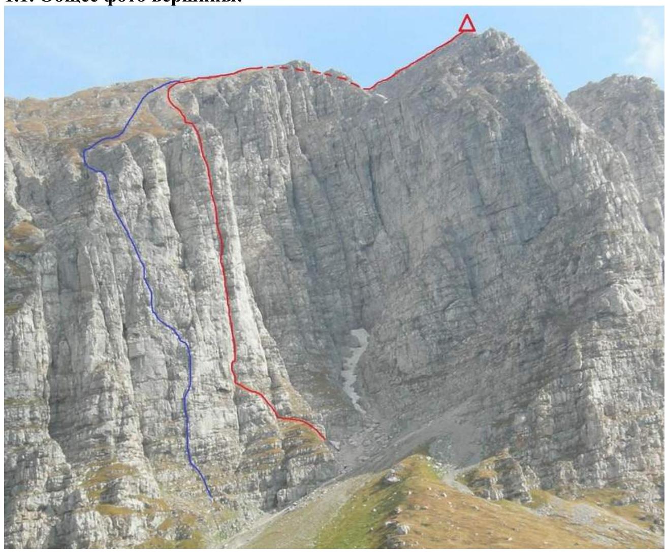
Photo #1 – General photo of Fisht peak (NW) (2581 m). Taken on October 5, 2009, from the west from the trail at a distance of about 700 m.
- route via the Western wall (V. Shipilov, 2009), 4A category
- team's route – via the right part of the Western wall (A. Antoshin, 2009), approx. 4B category
1.2. Route Profile Photo
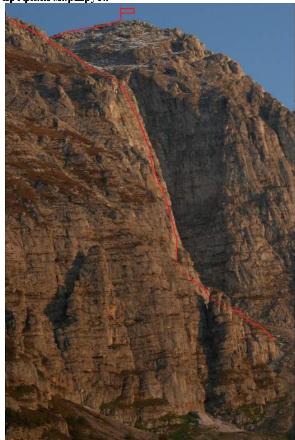
Photo #2 – Photo of the route profile from the left. The route goes through the right part of the light-gray wall in the center of the photo. The terrain does not allow for a full-profile photo: from the left, a bastion on the left part of the Western wall blocks the good view, and there's no way to take a photo from the right due to the difficulty of approaching the couloir between the Western ridge of the peak and the Western wall.
1.3. Drawn Route Profile
The profile was not made, as the proposed route category is below 5A. The approximate steepness of the main wall part (R1–R6) is about 75°.
1.4. Photopanorama of the Area
The photopanorama is not provided, as Fisht peak (NW) is included in the Electronic Russian Classifier of Routes to Mountain Peaks.
1.5. Map-Scheme of the Ascent Object. Approach Description
From Chernigovskoe village along a gravel ( местами грунтовой, каменистой) road past the turn to Otдалённый settlement to the end of the road (erosion) towards the former Vodopadisty refuge (area of Psekhsky waterfall) (about 40 km).
Then on foot along the trail towards the waterfalls (Fisht peak (S)). On the clearing near Vodopadisty refuge, turn right towards the former Lunny Poliana refuge (in the direction of Cheressky pass).
When level with Fisht peak (NW), move along the grassy slope under the wall (about 6 km, about 2 hours).
Note:
- In summer 2018, construction work began on the road section from the erosion to the refuge.
- The current state of the approach should be clarified.
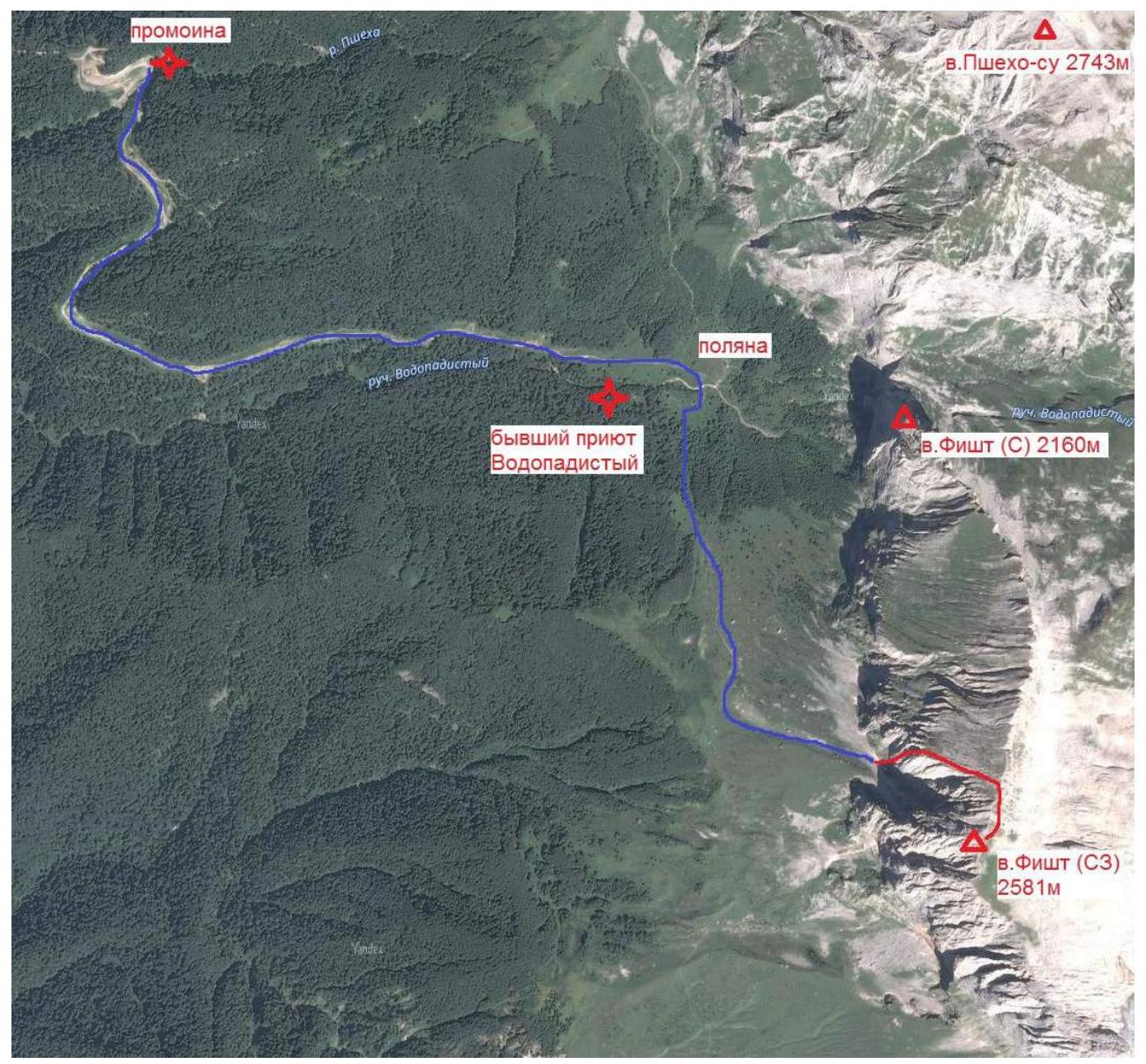
Photo #3 – Map-scheme of the approach to the route.
- approach from the erosion under the route (about 6 km) – team's route
2. Route Characteristics
2.1. Technical Photograph of the Wall Part of the Route (Photo #4)
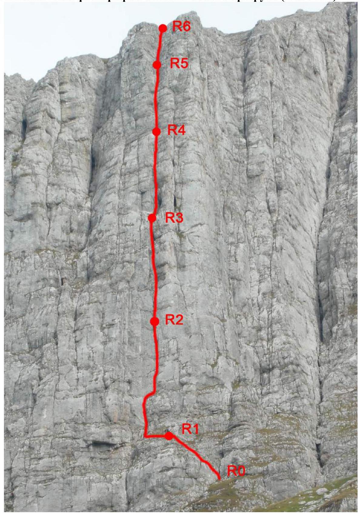
2.2. Route Scheme in UIAA Symbols
(see next page) *number of pitons excluding belay points.
| Section # | Name and Number of Pitons* | Route Line in UIAA Symbols, Belay Points, Characteristics in Symbols | Difficulty | Section Length, m | Steepness, ° |
|---|---|---|---|---|---|
| R7–R8 | - | - | 1 | 200 m | 30° |
| R6–R7 | - | - | 1 | 350 m | 30° |
| R5–R6 | 1 — | - | 5 | 12 m | 80° |
| - | - | 2 | 10 m | 45° | |
| R4–R5 | 1 | - | 3 | 10 m | 50° |
| 2/2 | - | 6 (A1) | 5 m | 95° | |
| 2 3 | - | 4–5 | 30 m | 80° | |
| R3–R4 | 1 3 | - | 4–5 | 20 m | 80° |
| 3/3 | - | 6 (A1) | 10 m | 95° | |
| 2 | - | 5 | 10 m | 90° | |
| - | - | 2 | 7 m | 45° | |
| R2–R3 | 1 | - | 4 | 7 m | 65° |
| 2 | - | 5 | 7 m | 90° | |
| 1 | - | 4 | 2 m | 100° | |
| 4/3 | - | 5–6 (A1) | 10 m | 90° | |
| 2 | - | 4 | 13 м | 70° | |
| 2 | - | 5 | 7 m | 90° | |
| R1–R2 | 2 | - | 5+ | 30 m | 85° |
| 1 | - | 4 | 20 m | 75° | |
| R0–R1 | 1 | - | 1–2 | 80 m | 40° |
3. Team Actions Characteristics
3.1. Brief Description of the Route Passage. Photo Illustrations
| Section # | Description | Photo # |
|---|---|---|
| R0–R1 | Left – up along the ledges intersected by walls into the lower part of a pronounced crack | - |
| R1–R5 | Up the crack, passing small overhangs (rock is complex, with some passages using artificial aids). The crack widens into a chimney in places. | 5–11 |
| R5–R6 | Along a gentle section, then up a chimney to reach the "roof". | 12 |
| R6–R8 | Across simple rocks and grassy slopes of the "roof" to the ridge. Along the ridge to the right to the peak. | 13, 14 |
Note: The photographs do not indicate the start and end points of the sections or the team's movement lines to avoid cluttering the images, as the movement line is unambiguous – along the pronounced crack. The next station is not always visible from the previous one due to the crack being intersected by overhangs and ledges. Necessary explanations are provided in the photo captions.

Photo #5 – Middle part of section R1–R2. Intermediate belay on an intermediate piton.
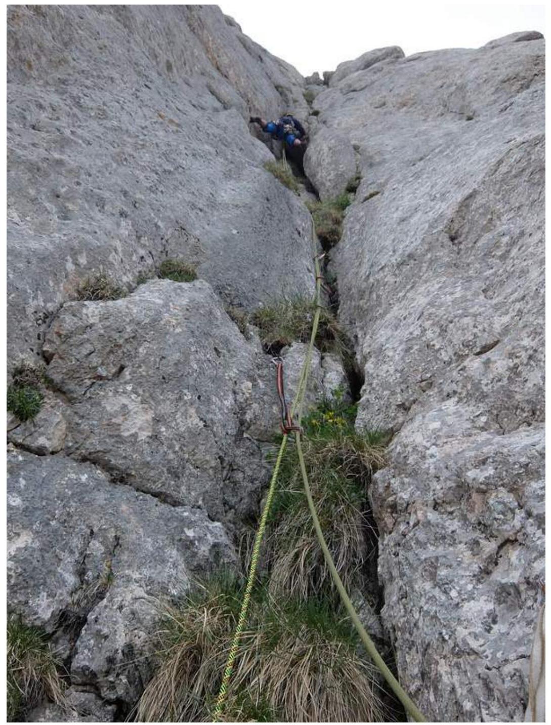
Photo #6 – Upper part of section R1–R2. Approach under the overhang.
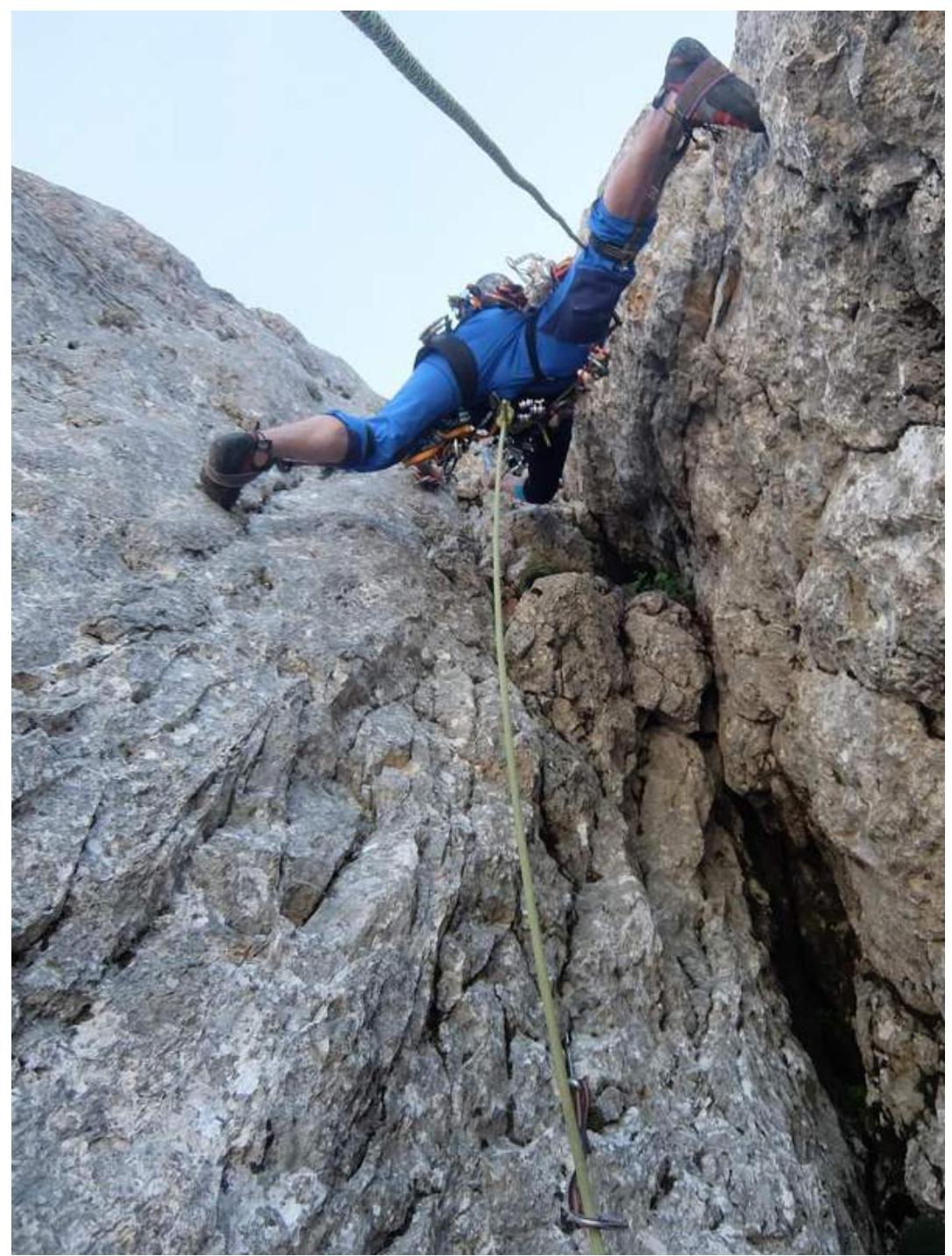
Photo #7 – Start of section R2–R3. Passage of a hanging chimney.
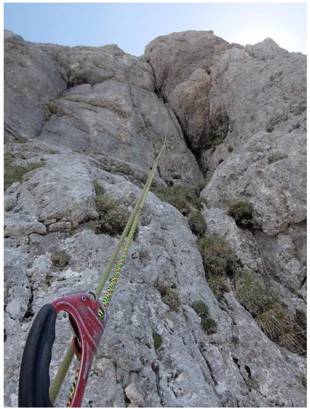
Photo #8 – Lower part of section R3–R4. The wall ends with a not very steep but smooth overhang.
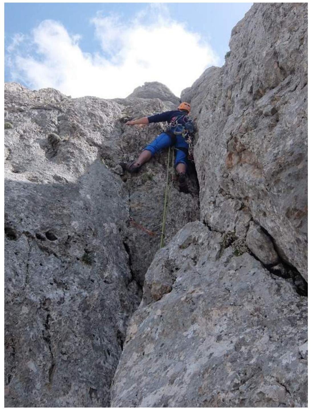
Photo #9 – Upper part of section R3–R4.

Photo #10 – Lower part of section R4–R5.
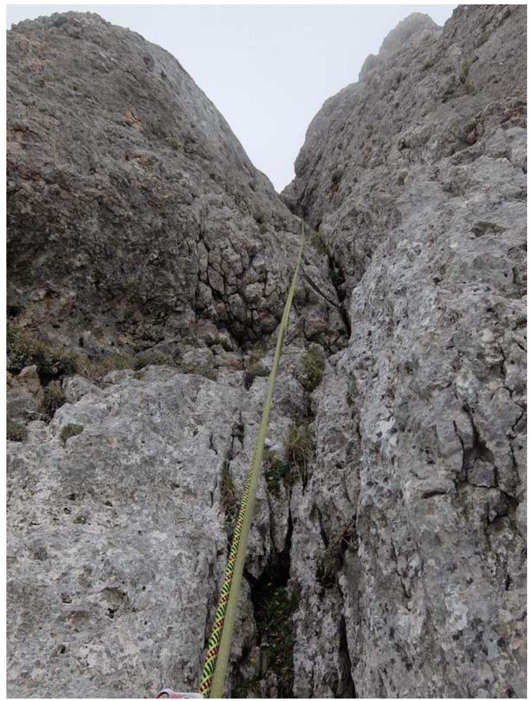
Photo #11 – Upper part of section R4–R5. The terrain becomes less steep.

Photo #12 – Section R5–R6. Chimney passed by stemming.
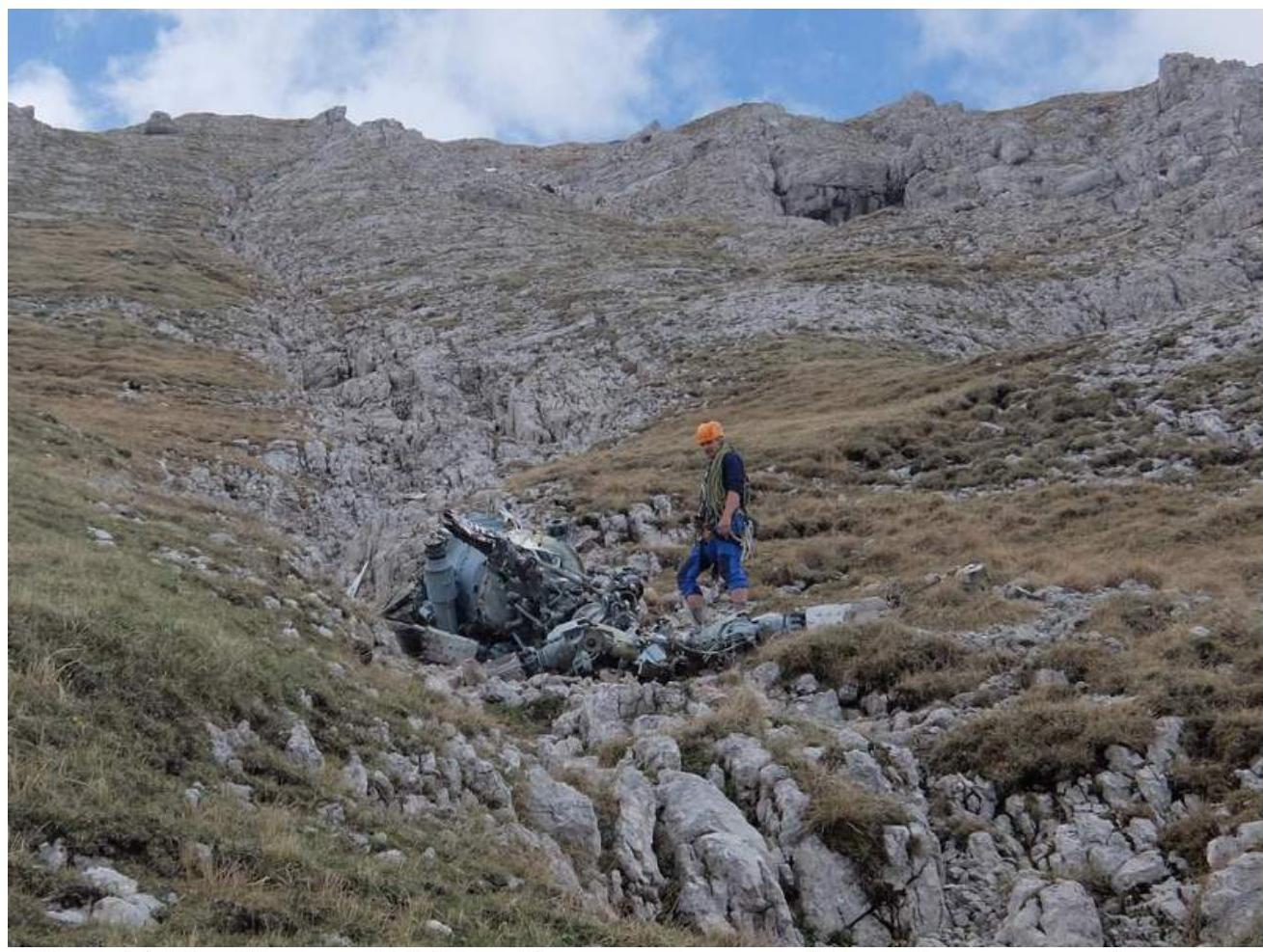
Photo #13 – Section R6–R7. "Roof". Anatoly Barabash near the wreckage of the Ka-32S helicopter that crashed on September 4, 2003.
3.2. Team Photo on the Peak
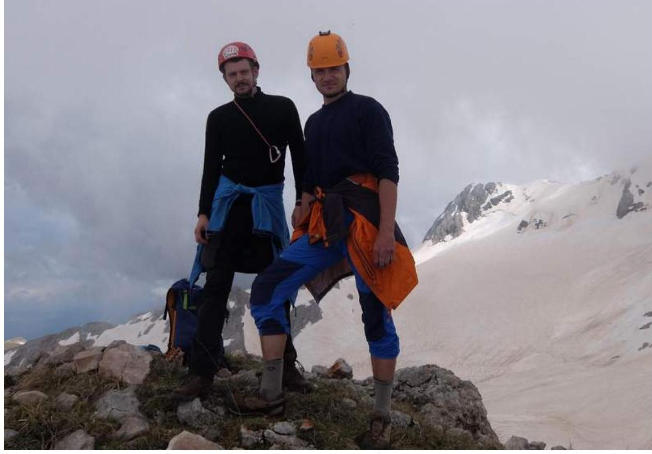
Photo #14 – Team photo on the peak. In the background, Fisht peak (Main) 2867 m is visible. Left to right: Mikhail Ivashchenko, Anatoly Barabash.
3.3. Route Safety Assessment. Communication on the Route. Recommendations for Subsequent Climbers. Information on Descent from the Peak. Conclusion on the Preliminary Route Assessment
- The route can be considered sufficiently safe – "live" stones are present but in moderate amounts. The route goes through a long internal corner (sometimes turning into a chimney), but the corner is interrupted by ledges and overhangs, so the risk of dropping a stone on participants below is small. However, it is not recommended to pass this route in a large group of more than 3–4 people.
- Due to several overhangs, visual control of the leader is impossible on a significant part of the route. Voice communication may be difficult in strong winds.
- Phone communication with the "Beeline" operator is possible at the peak.
- Anchor pitons are suitable for belaying on the route, and it is desirable to have at least 10 of them. The first ascensionists installed one bolt hanger at each station.
- It is convenient to descend from the peak via the 4A category route along the 3rd wall (V. Shipilov), which has more convenient ledges. However, it should be noted that finding the start of the descent from the "roof" can be problematic in poor visibility. When ascending along the "roof" in poor visibility, it is recommended to build cairns for orientation. Alternatively, one can descend via the ascent route. Additionally, in case of necessity, it is possible to descend to the east towards the Big Fishtinsky glacier and then towards the Fisht refuge – this path, although it will exclude rappelling down the wall, will be very long and time-consuming. Moreover, Fisht mountain is located on the territory of a reserve, where entry is prohibited without passes.
- To assess the route's difficulty, the team used the experience of previous ascents of similar difficulty on peaks: Fisht, center of the W wall (A. Spivets, 2011), 4A category Fisht (NW) 3rd wall (V. Shipilov, 2009), 4A category MNR (SW) S ridge (A. Nagorsky, 1975), 4A category Dolomites (C) 3rd wall ("book") (A. Fesenko, 1959), 4B category Erydag 3rd wall (A. Nezametinov, 1979), 4B category This route is noticeably more complex than the neighboring route along the 3rd wall (V. Shipilov, 2009). The key section consists of three ropes of equal difficulty with steep and complex terrain, requiring good climbing skills, use of artificial aids, and organization of belays. The route is logical and beautiful – the crack crosses the entire wall part of the route from bottom to top. After analyzing these routes, taking into account the first ascensionists' proposal, the team concluded that the route's difficulty is not less than 4B category routes and somewhat exceeds 4A category routes.
4. Weather Conditions Characteristics
4.1. Weather Conditions During the Ascent
Weather conditions during the ascent were satisfactory. Confirmation of the data is not required.