- Climbing area: Caucasus, Krasnodar region to Marukh pass, 2.1.
- Summit name: p. 2160 m (Fisht massif). Route name: Via the North-West edge of the Western wall of the Northern shoulder of Fisht peak, dedicated to the memory of rescuer S.N. Plyushchenko.
- Category: 6A cat. diff., first ascent.
- Route type: Technical rock climbing.
- Route height difference: Route length: 640 m (GPS) Section length: 590 m. V cat. diff. – 115 m; VI cat. diff. – 100 m; VI+ cat. diff. – 205 m. Average slope: – main part of the route: 85° – entire route: 76°
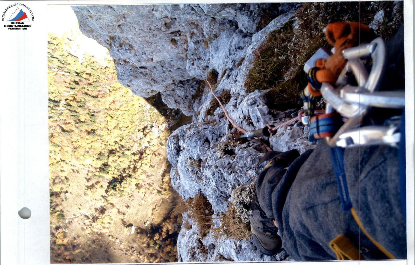
- Pitons left on the route: – total: 36 – including bolted pitons: 27 – of which for rappel organization: 12 – rock pitons: 9 – placements for sky hooks: 312 Used during ascent: – artificial protection points (including removable bolted pitons): 20 – sky hooks: 2 – cams: from № 2 to № 6
- Team's total climbing hours: 108 hours, 9 days (with wall preparation up to 12 hours per day).
- Team leader: Afanasyev Viktor Yuryevich – Master of Sports Team members: Golubev Dmitry Yuryevich – Candidate for Master of Sports, Shemyakin Alexey Vladimirovich – 1st sports category, Noskov Alexey Mikhailovich – Candidate for Master of Sports
- Coach:
- Work on the route: Started on 06.10.2006. Reached the summit on 14.10.2006.
Description
From Chernigovskoe village to Otdalenny settlement (Apsheronsky district) past the structures of the Maykop water pipeline, towards the Maykop pass, Fisht-Oshten mountain group, then along the tract to the source of the Vodopadisty stream (Vodopadny bivouac).
From the bivouac along the trail along the Vodopadisty stream under the wall and to the right under large green ledges. To the left of them is the start of the route, section R0, 10 meters of 6th grade climbing through an overhang and exit to large inclined ledges. Along them 35 m of easy climbing, 2nd cat. diff., section R1–R2 (rockfall hazard, piton protection).
Further:
– exit to a negative wall to the left of a large yellow scree overhang (difficult climbing with artificial aids) section R2–R3, – then to the right above the overhang along the negative wall to an inclined green ledge section R3–R4 (difficult climbing with artificial aids), – from there along the green ledge in the shape of a "sickle" upwards under a large internal corner, ledge section R4–R5 (piton protection possible), – from the ledge through the overhang, along the internal corner along the negative wall (use of cams inside the corner possible) upwards to the next overhang (piton protection) and exit to a large inclined green ledge – 1st control point, section R5–R6, – further from the ledge through a small internal corner, along the negative wall to a small overhang section R6–R7 and along the way to the left under a large hanging internal corner section R7–R8 (use of artificial aids, rock pitons in the upper part), – from here upwards along the corner, and then to the right onto a ledge section R8–R9–R10 (use of cams inside the corner possible).
Section R2–R9 has an overall slope of 93°.
Continuation:
– from ledge R10 along an inclined slab to the left through a series of internal corners (piton protection, cams) under the wall section R10–R11, – further along the inclined slab into an internal corner R11–R12 (piton protection) and along a series of internal corners to simple destroyed rocks, onto a large green ledge section R12–R17 (pitons, cams), – from the ledge along easy rocks exit to a ridge, overgrown with grass, and then along the ridge to the summit 150–200 m.
Descent along the ascent route or onto the Big Fishtinsky glacier and further to Fisht bivouac.
Route scheme in UIAA symbols
| Length (m) | Slope (°) | Category | Section |
|---|---|---|---|
| 45 | 50° | II | R17 |
| 45 | 45° | II | R16 |
| 30 | 85° | V | R15 |
| 15 | 90° | V | R14 |
| 30 | 90° | VI | R13 |
| 15 | 75° | VI | R12 |
| 45 | 70° | VI | R11 |
| 45 | 50° | V | R10 |
| 25 | 80° | V | R9 |
| 20 | 95° | VI+ | R8 |
| 27 | 95° | VI+ | R7 |
| 18 | 100° | VI+ | R6 |
| 45 | 95° | VI+ | R5 |
| 45 | 95° | VI+ | R4 |
| 30 | 95° | VI+ | R3 |
| 20 | 70° | VI+ | R2 |
| 35 | 40° | II | R1 |
| 10 | 95° | VI | R0 |
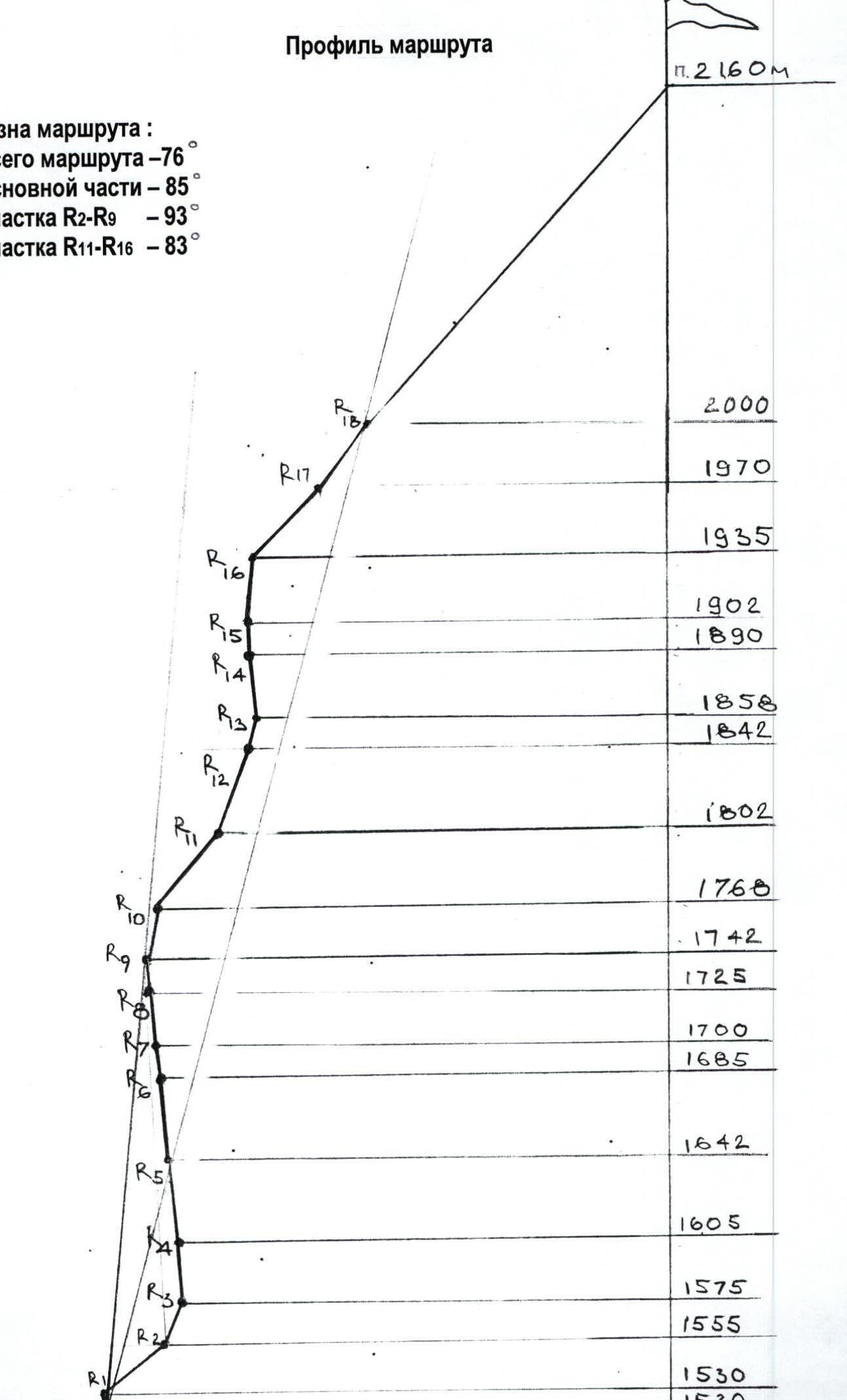
Route profile
Route slope: entire route – 76° main part – 85° section R2–R9 – 93° section R11–R16 – 83°
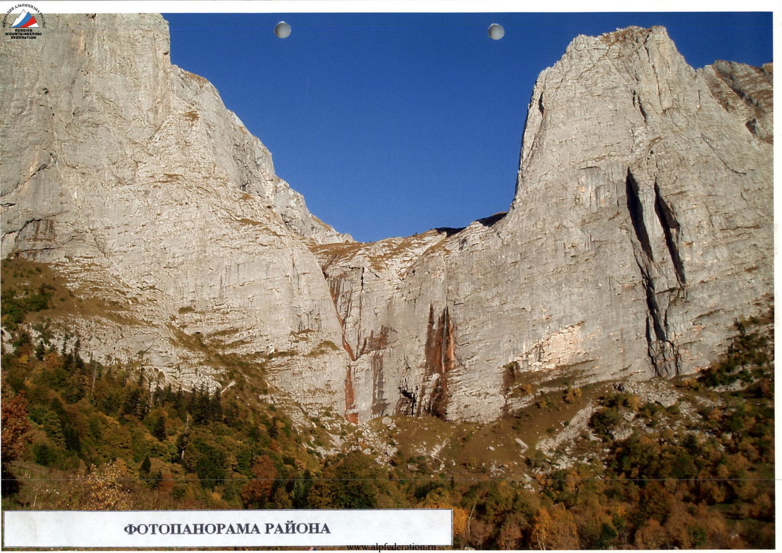
Panoramic view of the area
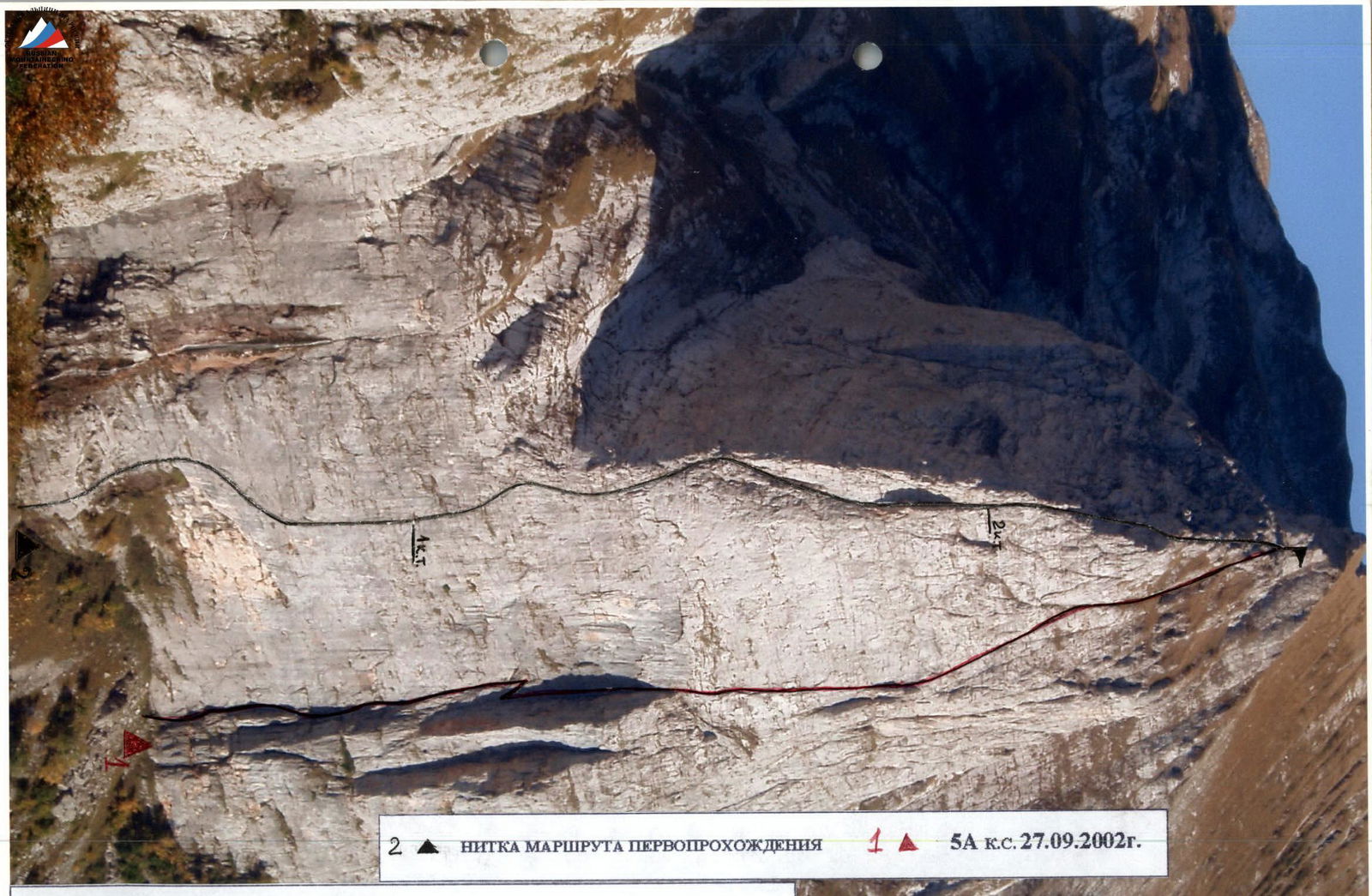
General photo of the summit, route thread

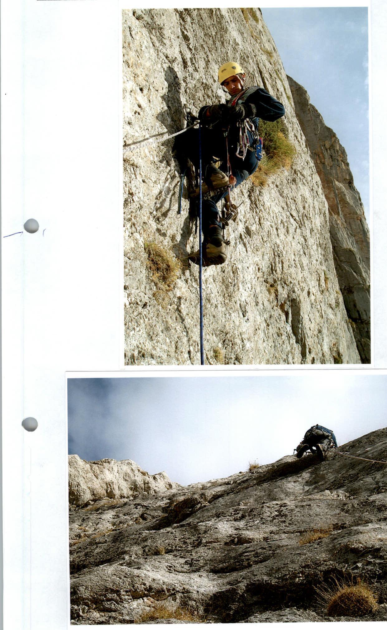
Section R2–R4 (double team work)
Section R4
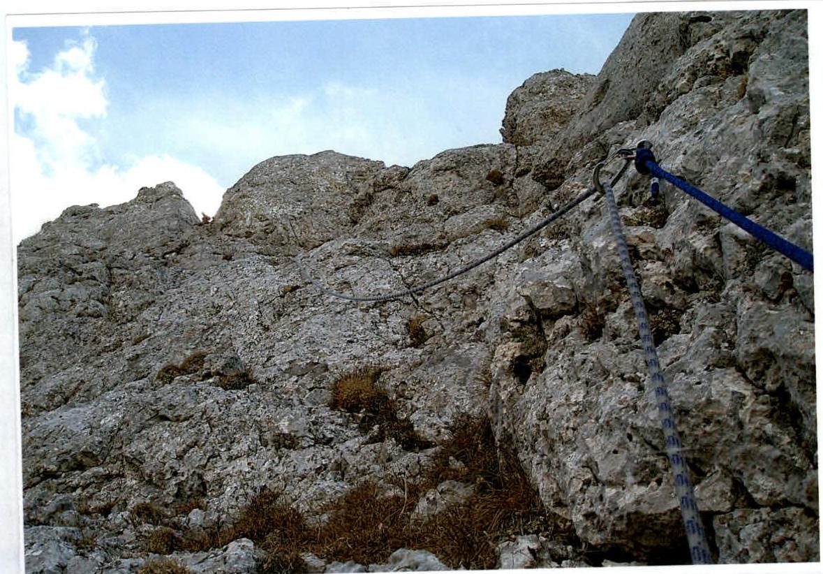
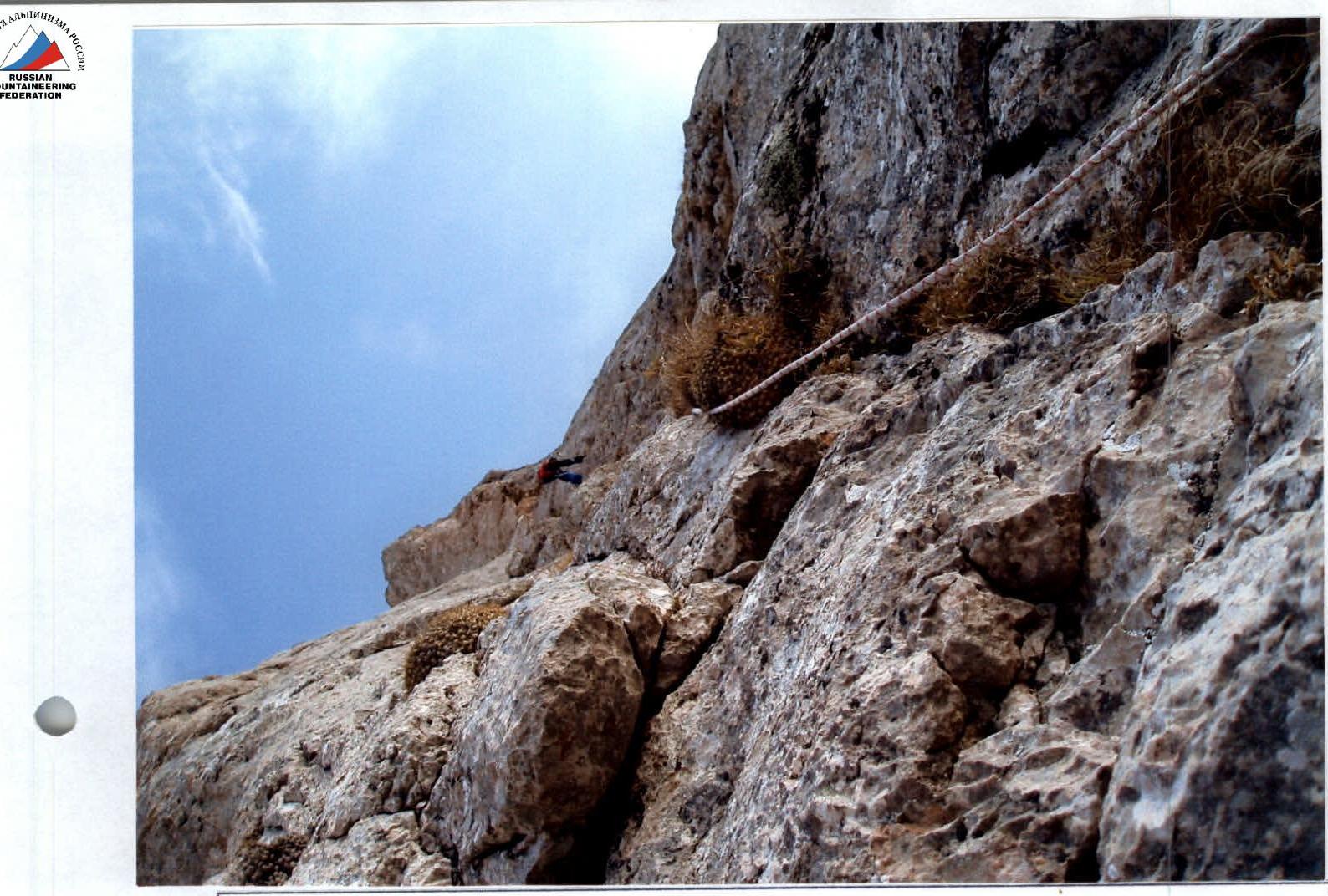
Section R7–R8
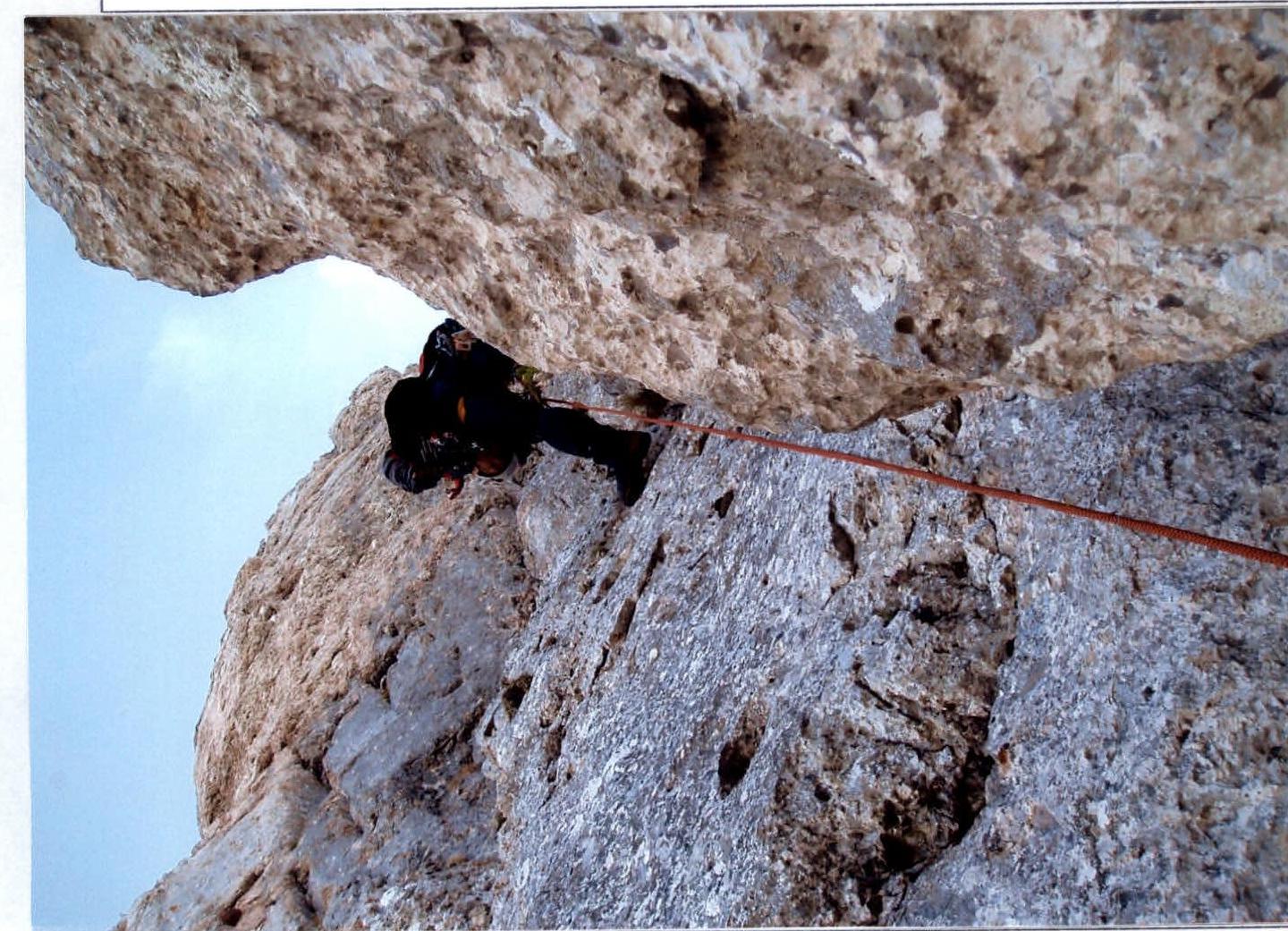
Section R10–R11
Section R17–R18