Report
on the ascent of Mt. Fisht North (2160 m) via the southern edge, approximately 3A–3B cat. diff., completed by the team of the KubSTU "Shturm" mountaineering club, Krasnodar, Krasnodar, 2016
Ascent Passport
-
Western Caucasus, Krasnodar Krai, 2.1
-
Peak Fisht North (2160 m) via the southern edge.
-
Proposed category – 3A–3B cat. diff. (first or second ascent*).
-
Route type: rock climbing
-
Route height difference – 330 m
Route length – 470 m. Section lengths:
- 4 cat. diff. – 30 m
- 6 cat. diff. – 10 m. Average route steepness – 50°
-
Pitons left on the route: 0.
-
Team's climbing hours (to the summit): 4.5 hours.
-
Descent from the summit: via the ascent route
-
Leader: Dmitry Shaulsky, Candidate Master of Sports
Participants: Mikhail Ivashchenko, Candidate Master of Sports, Andrey Kapustin, Candidate Master of Sports
-
Coach: Oleg Akhtyrsky, Master of Sports, 1st category instructor.
-
Start of the route: 12:30, September 5, 2015.
Summit reached: 17:00, September 5, 2015. Descent: September 6, 2015.
-
Organization: Regional Public Organization "Federation of Mountaineering of Krasnodar Krai"
KubSTU "Shturm" Mountaineering Club, Krasnodar
-
Responsible for the report: M. Ivashchenko, indeeccc@gmail.com
* Description of the circumstances of the first ascent is provided in the "Description of the Climbing Object" section on page 6.
General Photo of the Summit
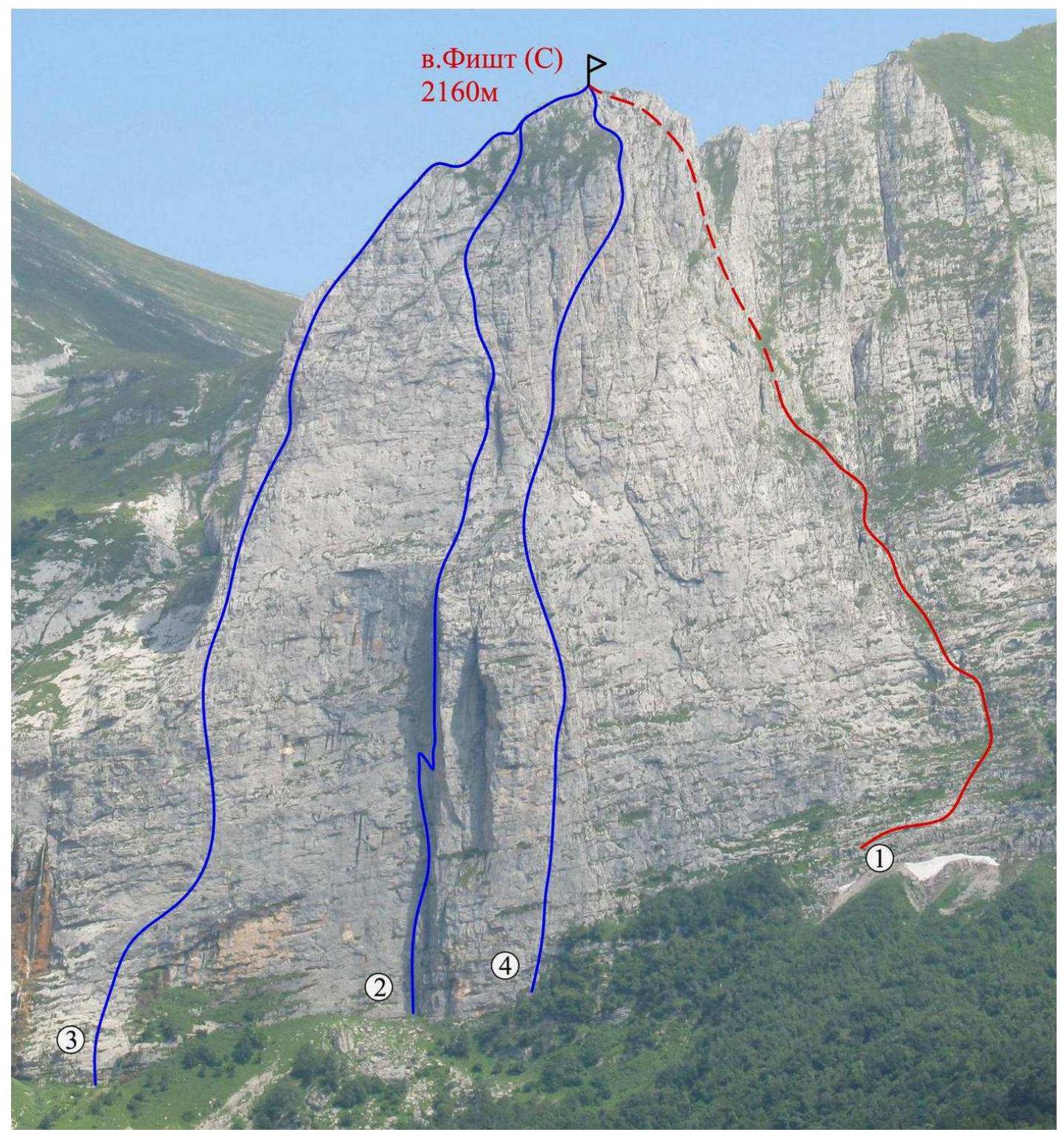
Figure 1 – Fisht (N) from the west
- Via the S edge, approximately 3A–3B – route climbed by the team;
- Via the 3 wall, 5A (A. Andryushchenko, 2002);
- Via the NW edge of the 3 wall, 5A (V. Afanasyev, 2006);
- Via the center of the 3 wall through the "bastion" 6Az (A. Spiridonov, 2008).
Photograph of the Route Profile

Figure 2 – Fisht (N) from the southwest. Due to the bend in the route line and its location in the relief depression, it is difficult to present a profile photograph of the route. The provided photograph allows for a more detailed examination of the lower part of the route.
Panorama of the Area
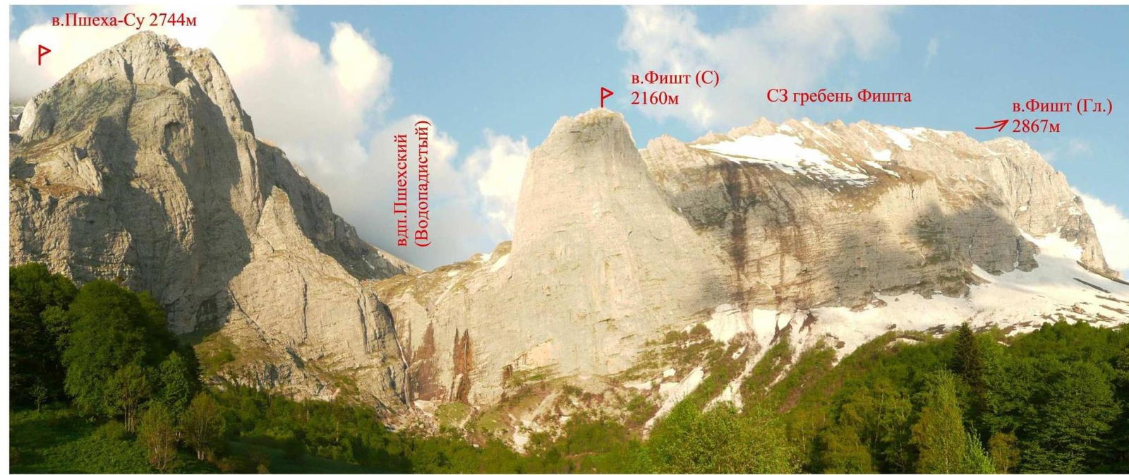
Figure 3 – Photopanorama of the Fisht (N) summit area
Description of the Climbing Object
The area around Fisht (N) is frequently visited by tourists and vacationers attracted by the local landmark — Pshekhsky (Vodopadisty) waterfall, with a cascade height of 165 and 160 m.
The area is easily accessible. In the summer, it is possible to drive to within 4 km of the summit in almost any vehicle on a gravel road. The remaining 4 km are traversed on a good trail (partially a collapsed road) with minimal elevation gain.
Fisht North closes the northwest ridge of Fisht Main. To the left, Fisht (N) is bounded by the Vodopadisty stream, on which the Pshekhsky (Vodopadisty) waterfall is located, separating the summit from the slopes of Pshekha-Su mountain. To the right, Fisht (N) is bounded by a large couloir-slope, distinguishing the summit in the Main Fisht ridge.
The following routes have been classified to the summit:
- via the west wall, 5A cat. diff. (A. Andryushchenko, 2002);
- via the northwest edge of the west wall, 5A cat. diff. (V. Afanasyev, 2006);
- via the center of the west wall through the "bastion," 6Az cat. diff. (A. Spiridonov, 2008).
The first ascent of the summit, and possibly the first passage of the route laid by our team, was made by the duo Yu. Koshelenko – M. Astakhov on October 18, 2001. A report on the ascent was not submitted to the classification committee. An excerpt from Yuri Koshelenko's report on the expedition to the Fisht massif area in 2001, in which the ascent of Fisht (N) is mentioned:
"...Misha and I climbed a new route on the north tower, from which the Fisht ridge begins, making a first ascent. It was from this that I planned to start exploring the area, since there are simply no easy, pedestrian paths from the peaks and ridges of this ridge, resembling a Chinese dragon. This route was of auxiliary significance; we planned to use it as a descent route. From below, the length of the karst slope with an average steepness of 45–50° was estimated by us to be approximately 6–7 rope lengths; it turned out to be twice as much. This was a pleasant surprise; the Fisht scales were growing. On the summit, we built a cairn and left a note in it..."
In the lower half of the route, rappel rings and a driven rock hook were found.
On the south edge, no signs of passage were found.
Description of the Approach to the Route and Descent from the Summit
From Chernigovskoe village (Apsheronsky district):
- 5 km on asphalt road
- 37 km on dirt mountain road to a gully on the road
- then on foot for 1 hour to the "Vodopadisty" shelter
From the shelter, turn right and ascend on a forest trail. After exiting the forest, turn left and approach the large couloir-slope to the right of Fisht (N) via uneven terrain without a trail (alpine meadows) (about 1 hour from the shelter).
It is also possible to approach the waterfall from the shelter and then move right along the wall, choosing passages through rock steps; however, the path is significantly complicated by thickets of bushes and trees.
Descent from the summit is via the ascent route.
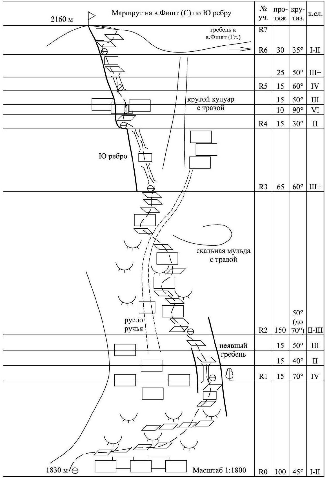
Map-Scheme of the Ascent Area
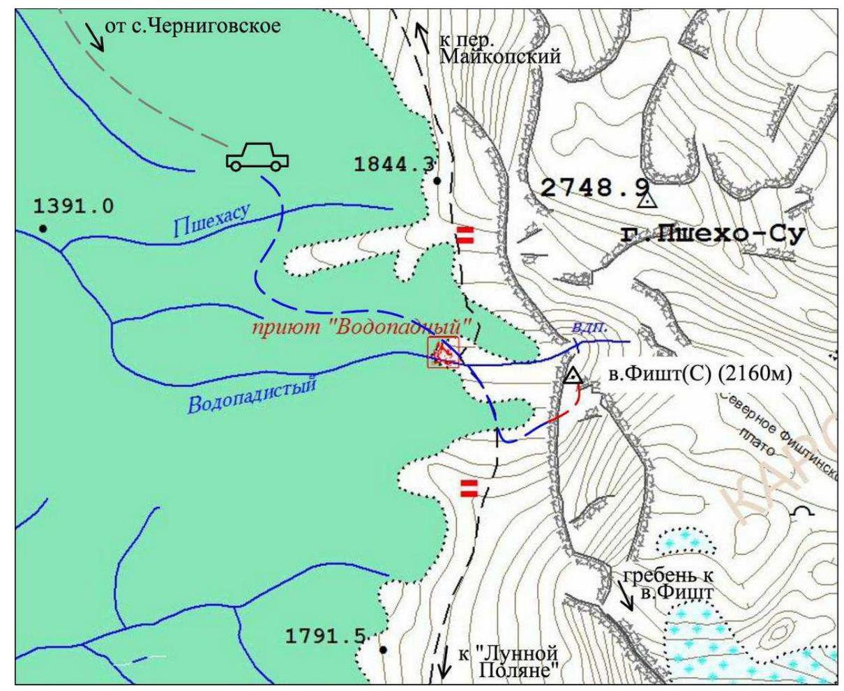
Figure 4 – Map-scheme of the Fisht (N) area. Legend:
- approach by vehicle
-
-
-
- approach on foot
-
-
-
-
-
- route
-
-
Route Diagram in UIAA Symbols
Technical Photograph of the Route
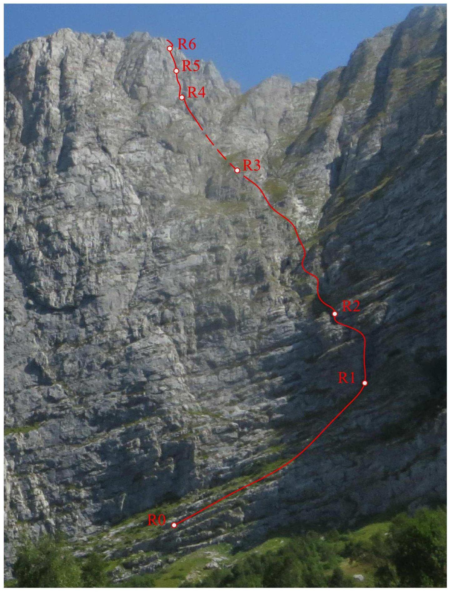
Figure 5 – Technical photograph of the route via the southern edge
Route Description
The start of the route is in the left part of the large couloir-slope, where the rock step descends to its minimum. R0–R1 — 100 m, 45°, I–II. Via a system of ledges intersected by short walls and "ram's foreheads" up to the base of a steep gully in the right part of the couloir-slope. R1–R2 — 15 m, 70°, IV; 15 m, 40°, II; 15 m, 50°, III. Climb the steep gully via a moderately complex chimney. Then, via a system of ledges and walls, move left-up along the left part of the indistinct ridge. R2–R3 — 150 m, 50° (sections up to 70°), II–III. Move along diverse terrain (ram's foreheads, walls, ledges, chimneys) along the stream bed. Initially, to the right of the stream, then cross the stream at a convenient location. Continue ascending to the left of the stream to the right part of the base of the south edge. R3–R4 — 65 m, 60°, III+. Climb a discontinuous chimney-gully to the right of the south edge to a small shoulder on the edge. R4–R5 — 15 m, 30°, II; 10 m, 90°, VI; 15 m, 50°, III.
Approach the steep belt crossing the south edge. Then, via a complex wall with a small internal angle.
R5–R6:
- 15 m, 60°, IV
- 25 m, 50°, III+
Via a chimney-gully to the right of the edge, then through short walls (loose rocks!) exit onto steep, discontinuous ledges.
R6–R7:
- 30 m, 35°, I–II
Via ledges, move right-up in a spiral to a flat area on the summit.
Route Characteristics
The route can be conditionally divided into two sections:
- the couloir-slope bounding the summit to the right;
- the south edge leading to the summit.
The route may be suitable for training ascents by sports teams. The route can also be used as a simpler descent route compared to the west wall.
It is also necessary to consider that:
- In winter conditions, the snow cover on the grassy slopes can be hazardous.
- During active snowmelt, streams may flow actively in the lower part of the route.
The key section of the route requires good climbing skills and organization of belays.
Note from the Summit
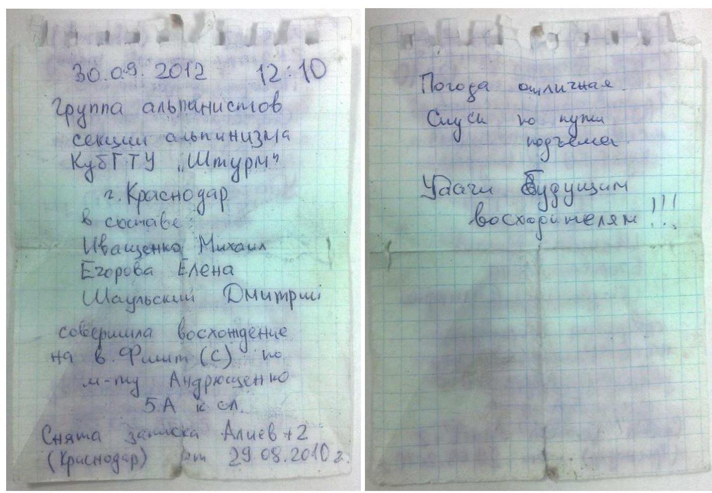
Figures 6, 7 – Photographs of the note from the summit
Photo Illustrations
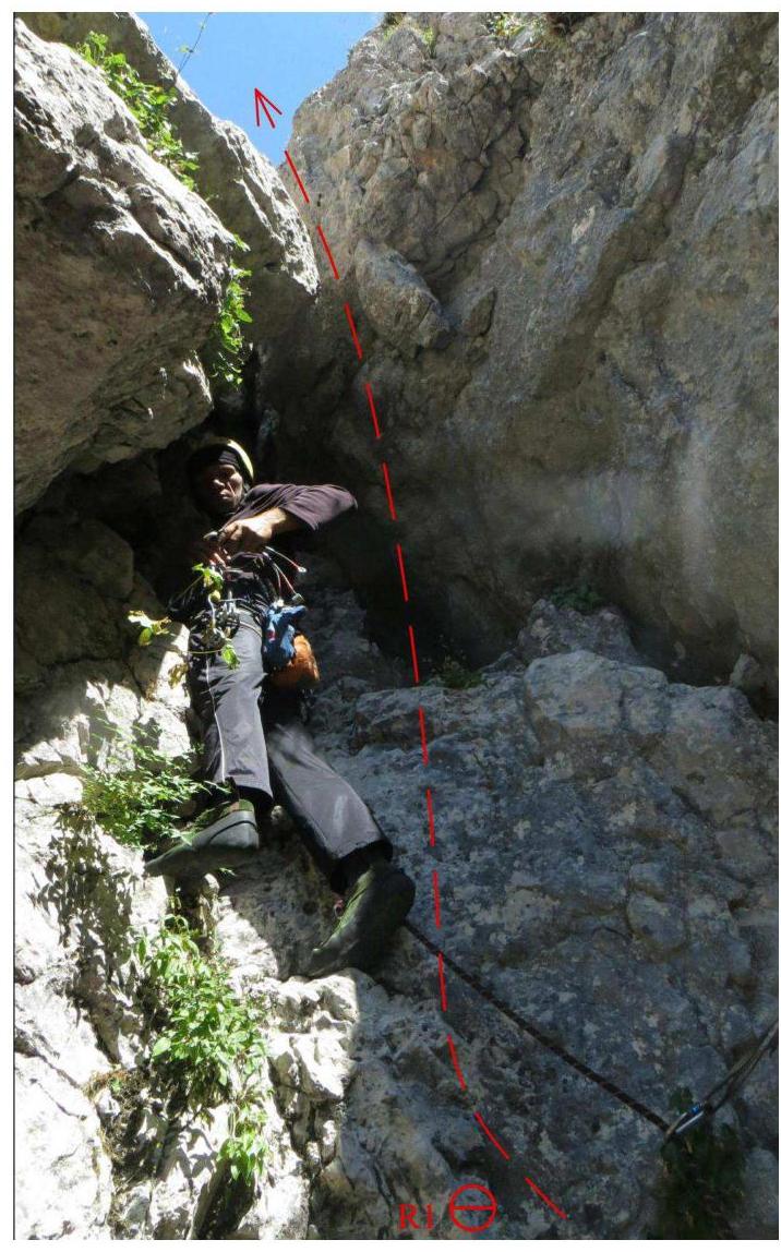
Photo 1 – Exit from the gully via a chimney on section R1–R2.
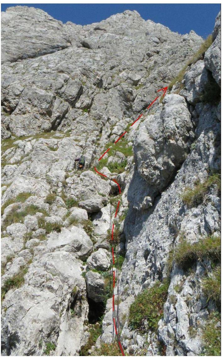
Photo 2 – Lower part of section R2–R3.
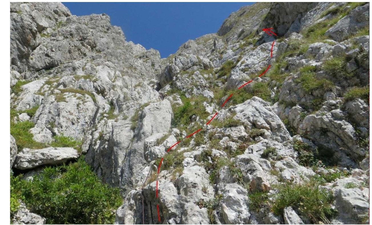
Photo 3 – Middle part of section R2–R3. Bypass to the right of the threshold on the stream.
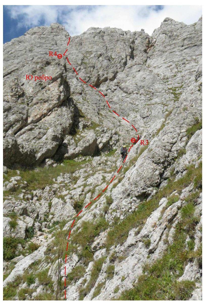
Photo 4 – Upper part of section R2–R3. Approach to the base of the south edge.
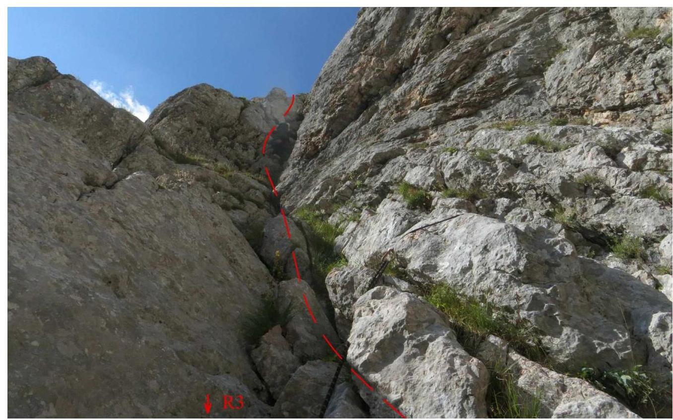
Photo 5 – Passage of the chimney-gully on section R3–R4.
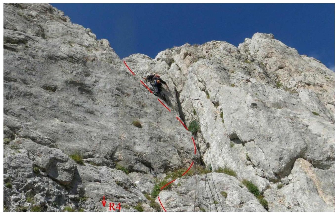
Photo 6 – Section R4–R5. The "key" of the route – a complex steep wall.
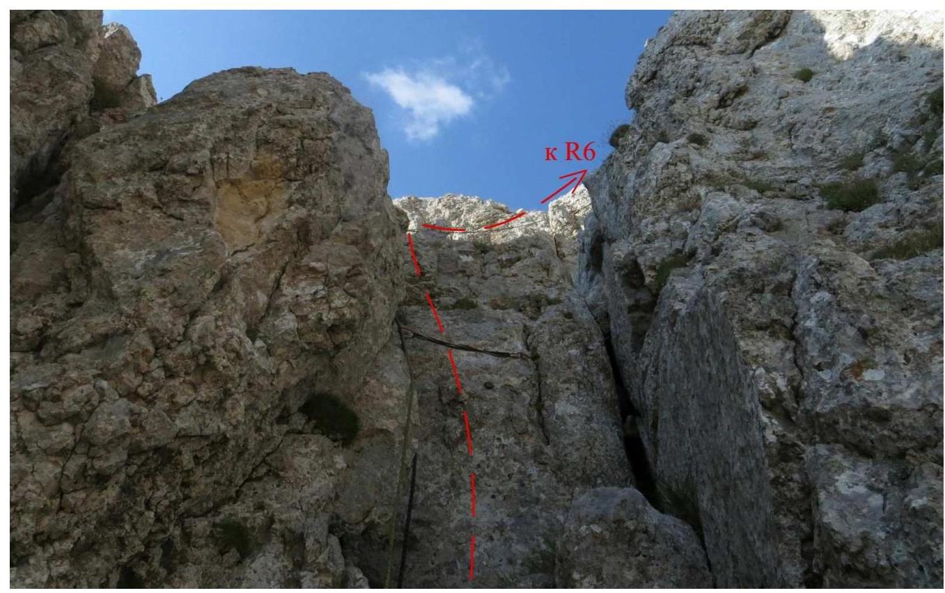
Photo 7 – Chimney on section R5–R6.
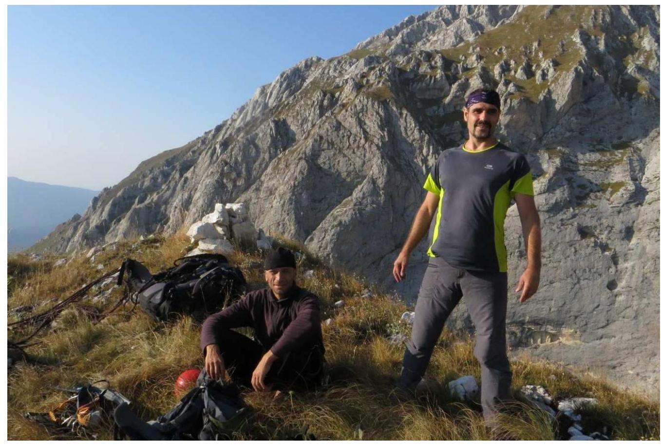
Photo 8 – At the control cairn on the summit. In the background, the slopes of Pshekha-Su. In the photo:
- Dmitry Shaulsky
- Andrey Kapustin (photo by Mikhail Ivashchenko).
General Conclusion on the Route
When determining the route's difficulty, the team used the experience of previous ascents. Considering the geographical location, climatic conditions, and terrain specifics of the Fisht-Oshten massif, the team primarily examined routes of similar difficulty previously climbed by team members in the area:
Fisht via the NE ridge, 2B cat. diff.; Oshten via the right part of the NW wall, 2B cat. diff.; Fisht (M) via the 3 ridge, 2B–3A cat. diff. (non-cat.); Fisht via the SE wall, 3A cat. diff.; Fisht via the 3 edge, 3B cat. diff. The team also considered routes of similar terrain in other mountain areas. For example, the MNR massif was taken as a comparison due to its similar short rock routes of 3 cat. diff.:
MNR (SW) from the south via the couloir of the V ridge, 3A cat. diff.; MNR (NE) via the S edge, 3A cat. diff.; MNR (C) via the S ridge, 3B cat. diff.; MNR (NE) via the S ridge, 3B cat. diff.;
After analyzing these routes, the team concluded that the route to Fisht (N) via the south edge exceeds the difficulty of the mentioned 2B and 3A cat. diff. routes and is comparable to 3B cat. diff. routes.
The route features diverse rock terrain and complex climbing on the key section, requiring:
- good climbing skills;
- the ability to organize belays.
This route cannot be recommended for training groups; however, it is of interest to sports teams as an object for training ascents.
Based on the above, the team proposes classifying this route as 3A–3B cat. diff.