Report
on the ascent to Mt. Fisht (2867 m) via the right part of the Eastern wall, second ascent, approximately 5B cat. dif. not classified (V. Nedelkin, 80), made by the team of the KubSTU "Shturm" mountaineering section
Ascent Passport
- Western Caucasus, Krasnodar Krai, 2.1
- Fisht peak (2867 m), right part of the eastern wall (V. Nedelkin, 80)
- Proposed category - 5B cat. dif. (second ascent) - not classified
- Route type: rock
- Route height difference - 940 m Route length - 1800 m Wall section height difference - 650 m Wall section length - 850 m Section lengths: cat. dif. 5 - 210 m, cat. dif. 6 - 40 m Average steepness: main part of the route - 65°, inner angle - 83°. Total route - 45°
- Pitons used on the route (including in the denominator for ITO): rock - 32/2; chocks - 56/4; removable bolts - 1 (at the bivouac); Left "pitons" on the route: rock - 1.
- Team's total climbing hours: 16 hours, 2 days. Number and characteristics of bivouacs: one bivouac - in a hammock.
- Descent from the summit: via route 1B* cat. dif. Down the slope.
- Leader: Artem Alekseyevich Spesivtsev, CMS. Participant: Mikhail Nikolayevich Ivashchenko, CMS.
- Coach: Dmitry Sergeyevich Shaulsky, CMS.
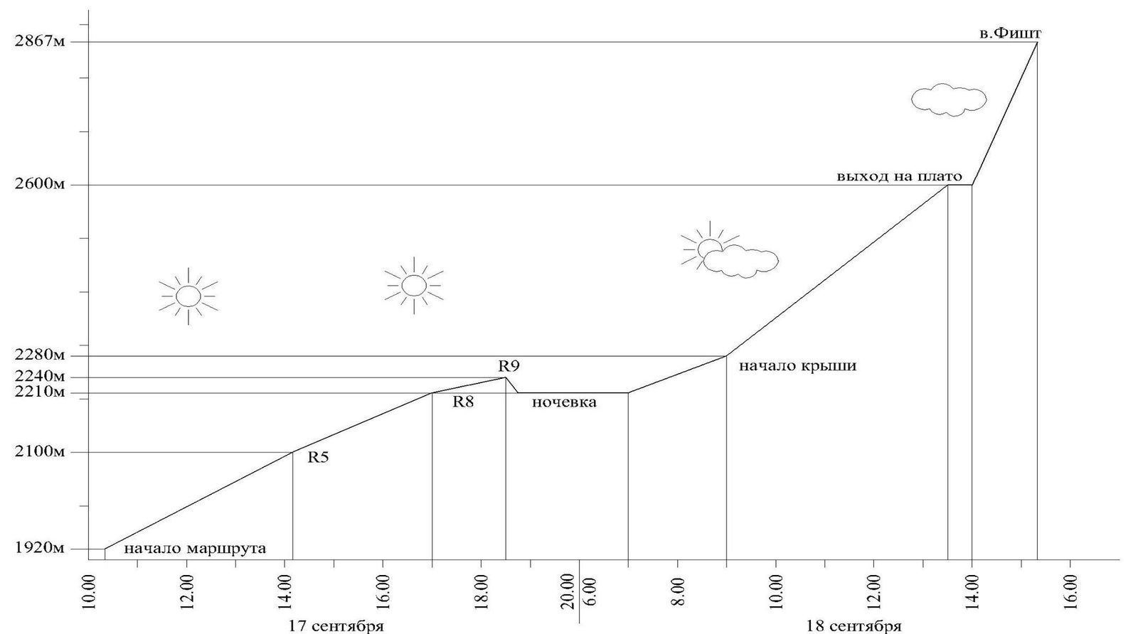
- Start of the route: 10:20, September 17, 2010. Reached the summit: 15:20, September 18, 2010. Returned to the "Fisht" bivouac: 18:20, September 18, 2010.
- Organization: KKOO "Federation of Alpinism of Kuban", Krasnodar. www.alpinism.ru↗, alp.kuban@mail.ru
- Responsible for the report: M.N. Ivashchenko. alp.kuban@mail.ru
General Photo of the Summit
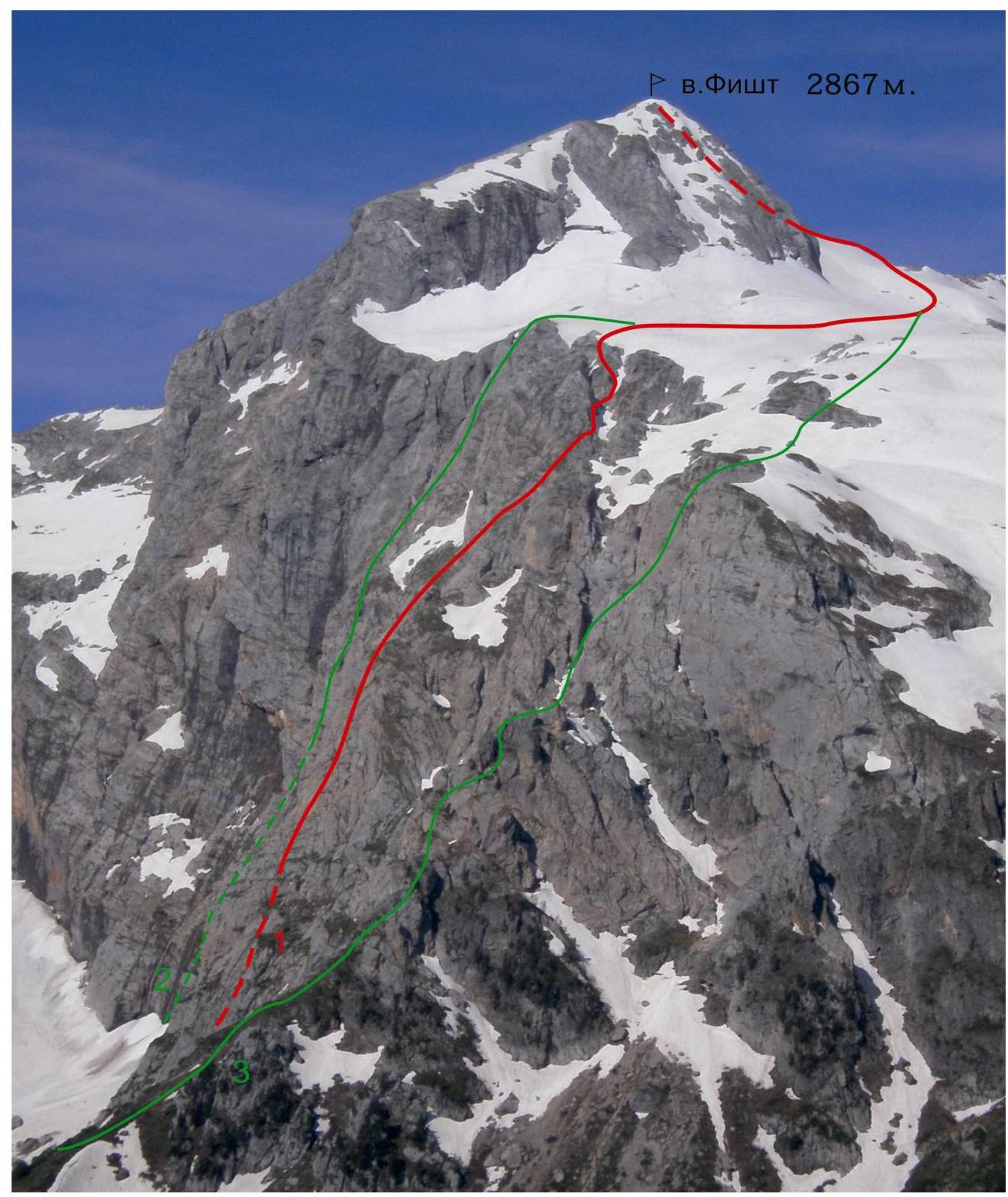
Figure 1 — View of Mt. Fisht from the northeast (taken from the Armenian Pass, June 12, 2009)
- 1 — right part of the E wall (V. Nedelkin, 80) - route taken by the team
- 2 — E wall, 5A (A. Andryushchenko, 85)
- 3 — NE ridge, 2B (A. Noskov, 85)
Photo of the Wall Profile
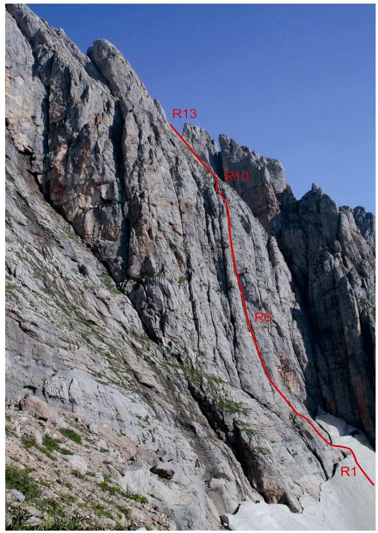
Figure 3 — Photo of the E wall profile from the left (taken from the moraine of the Small Fishtinsky glacier, August 25, 2008)
Drawn Route Profile
The profile shows the wall section of the route up to the exit to the plateau.
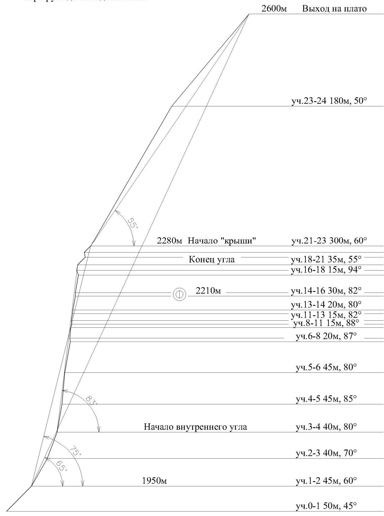
Scale 1:3000
Panoramic Photo of the Massif
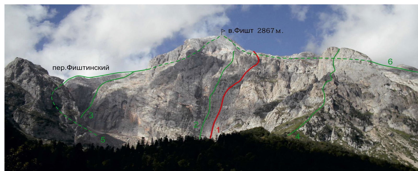
Figure 2 — View of Mt. Fisht from the east (taken from the "Fisht" bivouac, September 19, 2010)
1 — right part of the E wall (V. Nedelkin, 80) - route taken by the team 2 — E wall, 5A (A. Andryushchenko, 85) 3 — SE wall, 3A (M. Foigel, 2001) 4 — NE ridge, 2B (A. Noskov, 85) 5 — SE ridge, 2A* (V. Taranenko, 84) 6 — N slope, 1B* (V. Taranenko, 85)
Ascent Graph
Description of the Approach to the Route
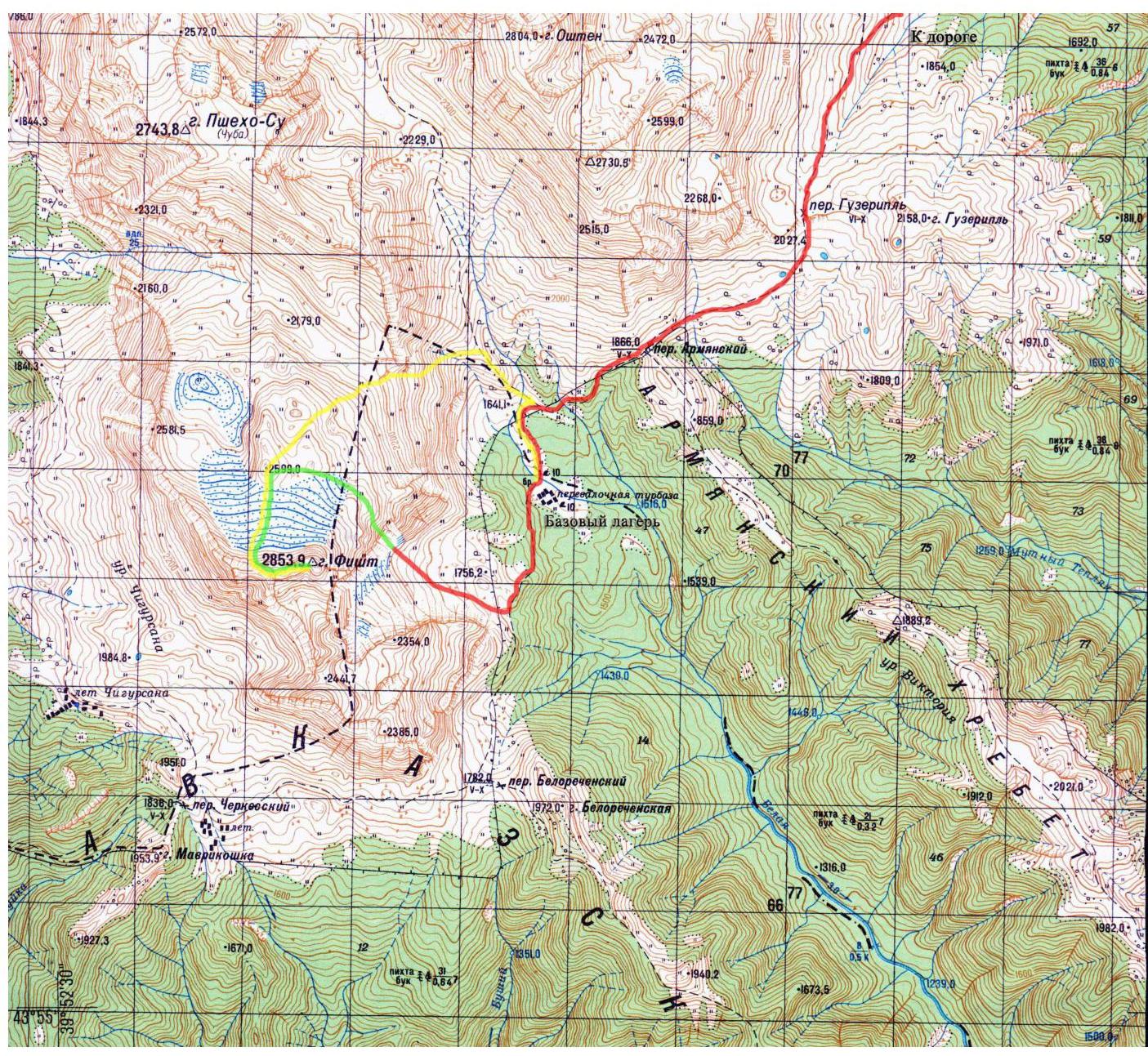
Ascents to Mt. Fisht usually start from the "Fisht" bivouac located directly under the slopes of Mt. Fisht. It's more convenient to get here through the Guzeripl settlement.
To get to the "Fisht" bivouac, you can follow these steps:
- Turn right at the first T-junction after entering the Guzeripl settlement.
- Drive along the asphalt road past the "Partizansky" bivouac until it ends (about 24 km).
- Then walk along the marked trail, through the Guzeripl and Armenian passes, bypassing the slopes of Mt. Oshen to the left, to the "Fisht" bivouac.
From the end of the road to the "Fisht" bivouac - 3.5-4 hours of walking (about 10 km).
From the "Fisht" bivouac, follow the marked trail leading to the Belorechensky Pass. At the marked point, turn right towards the Small Fishtinsky glacier. Then straight along the trail, and then along the talus under the eastern wall of Mt. Fisht. From the "Fisht" bivouac - 1 hour.
Map of the Area
 Approach === Route === Descent
Route Diagram in UIAA Symbols
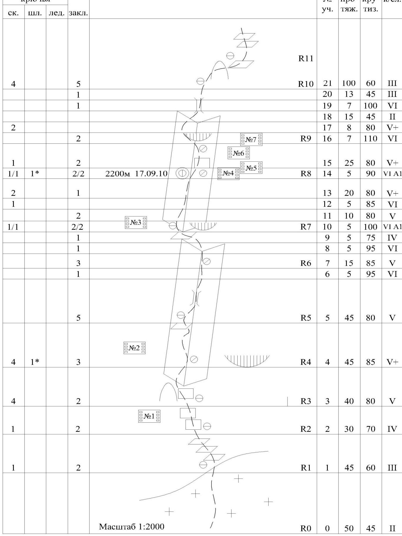
| Pitons | Section # | Length | Steepness | Cat. Dif. | ||||
|---|---|---|---|---|---|---|---|---|
| rock | bolt | ice | chock | |||||
| R0 | 50 m | 45° | II | |||||
| 1 | 2 | R1 | 45 m | 60° | III | |||
| 1 | 2 | R2 | 30 m | 70° | IV | |||
| 4 | 2 | R3 | 40 m | 80° | V | |||
| 4 | 1* | 3 | R4 | 45 m | 85° | V+ | ||
| 5 | R5 | 45 m | 80° | V | ||||
| 3 | R6 | 15 m | 85° | V | ||||
| 1 | 5 m | 95° | VI | |||||
| 1 | 2 | R7 | 5 m | 95° | VI | |||
| 1 | 5 m | 75° | IV | |||||
| 2 | 5 m | 100° | VI A1 | |||||
| 1/1 | 1* | 2/2 | R8 | 25 m | 80° | V+ | ||
| 2 | 1 | 5 m | 90° | VI A1 | ||||
| 2 | R9 | 8 m | 80° | V+ | ||||
| 2 | 2 | 7 m | 110° | VI | ||||
| 4 | 5 | R10 | 21 m | 100° | III | |||
| 1 | 13 m | 45° | III | |||||
| 1 | 7 m | 100° | VI | |||||
| 1 | 15 m | 45° | II | |||||
| 8 m | 80° | V+ | ||||||
| 8 | 14 | R12 | 200 m | 60° | IV | |||
| 2 | 4 | R16 | 180 m | 50° | II | |||
| R19 | 400 m | 15° | I | |||||
| R20 | 120 m | 50° | II | |||||
| R21 | 300 m | 10° | I | |||||
| R22 | 130 m | 15° | I |
Technical Photo of the Route
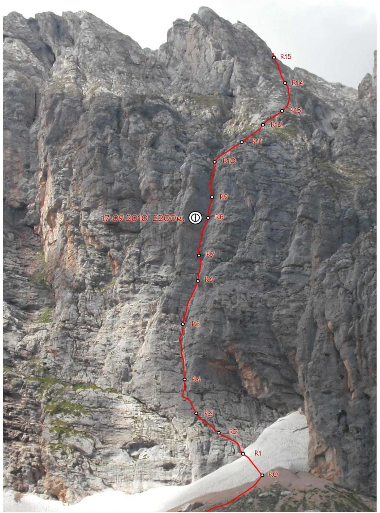
Figure 4 — Technical photo of the eastern wall (taken from under the eastern wall, June 12, 2009)
Route Description
R0–R1 — 50 m, 45°, II. Along the snowy slope to a rock shelf, bypassing the randkluft to the right. R1–R2 — 45 m, 60°, III. Left-up, bypassing the walls along the shelves under a large rusty overhang. R2–R3 — 40 m, 70°, IV. Left-up, along the walls alternating with shelves, towards a large inner angle. R3–R4 — 40 m, 80°, V. To the start of the angle, along the angle to the top of the break. R4–R5 — 45 m, 85°, V+. Along the angle, sometimes along its left wall to the second shelf. R5–R6 — 45 m, 80°, V; 5 m, 95°, VI. Along the angle (sometimes a chimney), exit to the station through a small overhang. R6–R7 — 15 m, 85°, V; 5 m, 95°, VI; 5 m, 75°, IV. Along the angle through the overhang, then left-up to a shelf. R7–R8 — 5 m, 100°, VI A1; 10 m, 80°, V; 5 m, 85°, VI; 20 m, 80°, V–V+. Up through the overhang and further along the angle. Control tour. R8–R9 — 5 m, 90°, VI+ A1; 25 m, 80°, V+. Along the angle under the cornice. R9–R10 — 7 m, 110°, VI; 8 m, 80°, V+; 15 m, 45°, II; 7 m, 100°, VI; 13 m, 45°, III. Along the angle left-up through the cornice, then up along the wall and slope to a hanging chimney, then along it and to the slope on a shelf.
R10–R12 — 100 m, 60°, III — right-up along the walls and shelves under the "roof" tower (sometimes with grass on the shelves, insurance issue!).
R12–R16 — 200 m, 60°, IV — right-up along the walls and shelves, bypassing the tower to the right (sometimes with grass on the shelves, insurance issue!).
R16–R19 — 180 m, 50°, II — from the right side of the tower along the walls of the gullies and along the slope, exit to the tower.
R19–R20 — 250 m, 15°, I — along the talus slope and further along the glacier, exit under the NW ridge. Connection with route 1B*.
R20–R21 — 130 m, 50°, II — along the rocky slope, ascent to the NW ridge.
R21–R22 — 300 m, 15°, I; 130 m, 20°, II. Along the rocky ridge, exit to the summit of Fisht.
(From November to June, the section R19–R21 is a snowy slope, and R21–R22 is a rocky-snowy ridge).
Route Characteristics
The route passes through a large inner angle of the right part of the eastern wall of Mt. Fisht from there, exits to the plateau of the Big Fishtinsky glacier, and then along the NW ridge leads to the summit. On the plateau, the route connects with the route along the N slope 1B* cat. dif.
The entire route can be divided into three sections:
- wall, length 365 m, steepness 75° (including the inner angle, length 245 m, steepness 83°);
- "roof", length 480 m, steepness 55°;
- plateau and ridge, length 950 m.
On the route, one control tour is left - on the shelf R8, below the cornice (on a bolt).
There is a possibility for setting up tents on the plateau and ridge. On the wall, sitting bivouacs are possible on the shelves R5, R8, and on the "roof" shelves.
There is no water along the wall section until the exit to the plateau. In spring and early summer, water in the form of snow is possible in the lower part of the "roof".
In terms of weather, the most favorable periods for the ascent are:
- August
- early September
At other times, the area is characterized by afternoon precipitation.
It is recommended to pass the route as a pair, as the stations on the wall section are mostly inconvenient.
The rocks of Fisht are distinguished by a large amount of grass growing from the cracks even on sheer sections, which sometimes causes problems with movement and insurance.
Friends and anchor pitons are well applicable on the route.
Note from the Summit
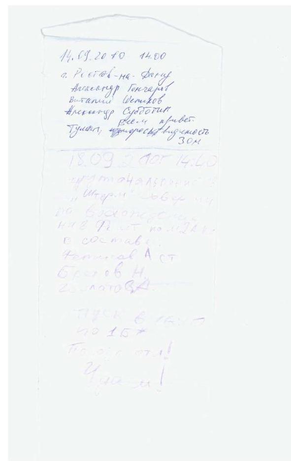 "September 14, 2010, 14:00, Rostov-on-Don"
Alexander Goncharov, Vitaly Shipilov, Alexander Subbotin. Hello everyone. Fog, drizzle, visibility 30 m.
"September 18, 2010, 14:40. A team of climbers 'Shturm' made an ascent to Mt. Fisht via route 2A cat. dif. as part of:
- Fetisov A. lead
- Brekhov N.
- Gorlatov A. Descent at 16:10 via 1B*. Weather excellent! Good luck!" No control tours were found along the route, so the team left a control tour on the shelf R8.
Photo Illustrations
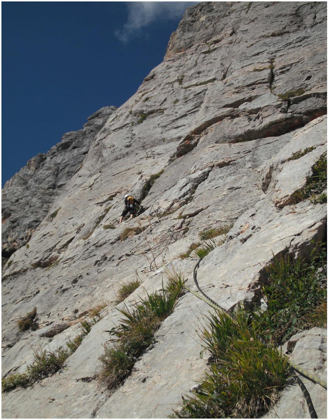
Photo 1 — Section R2–R3. Beginning of the large inner angle.
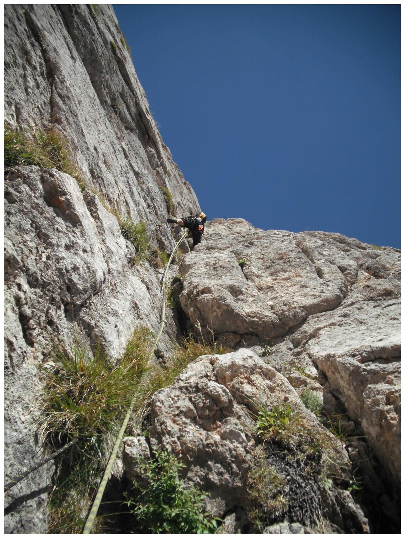
Photo 2 — Section R4–R5. Spesivtsev working in the angle.
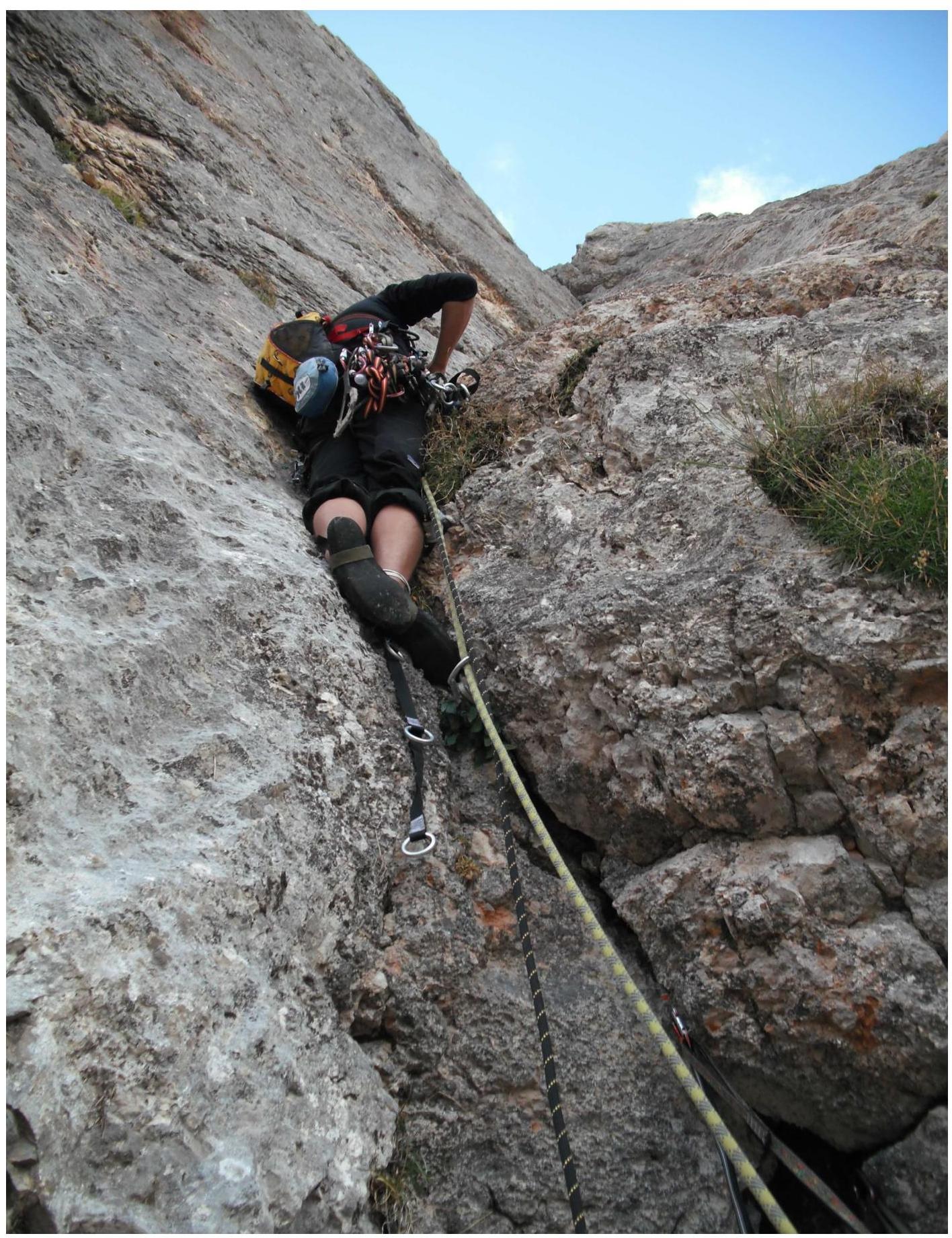
Photo 3 — Section R7–R8. Spesivtsev passes the overhanging section using ITO.
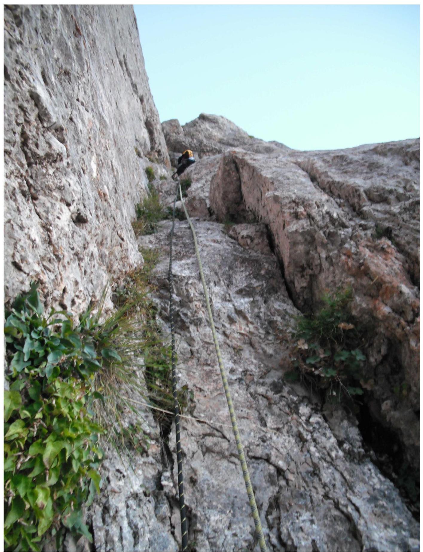
Photo 4 — Section R8–R9.
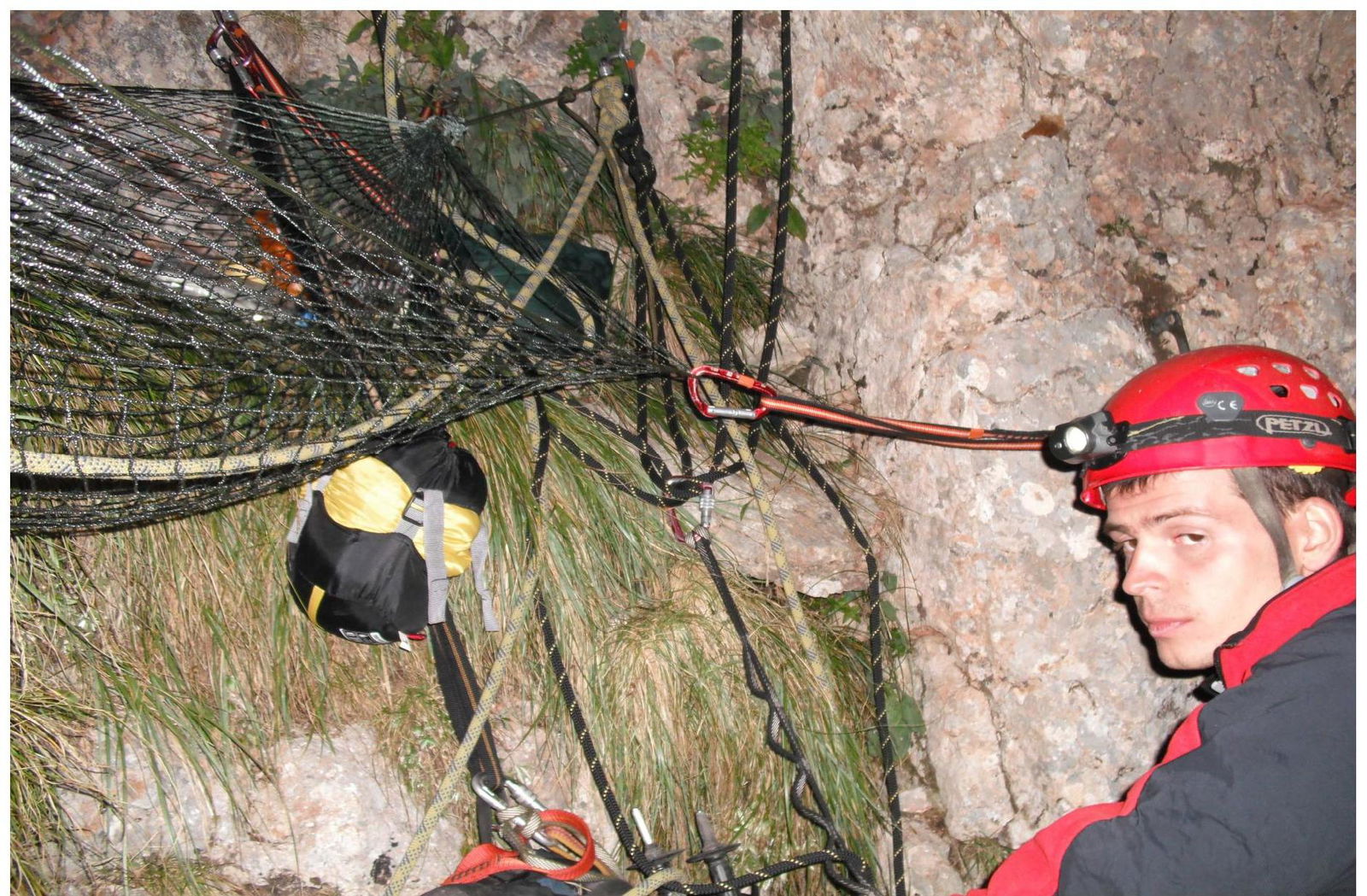
Photo 5 — Bivouac R8.
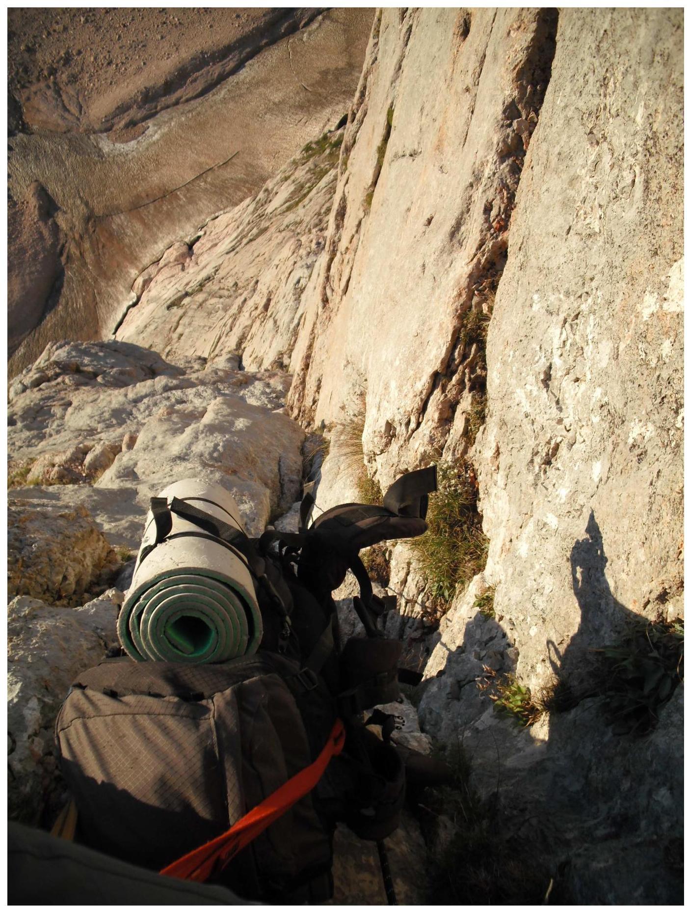
Photo 6 — Photo of the route from above, from section R8–R9.
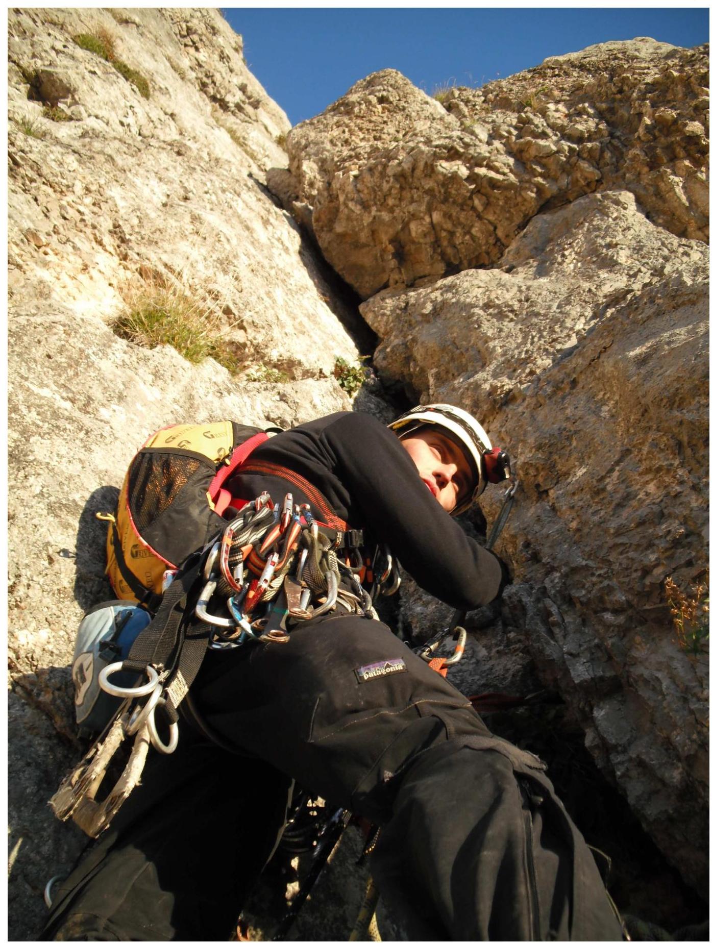
Photo 7 — Section R9–R10. At the station under the cornice.
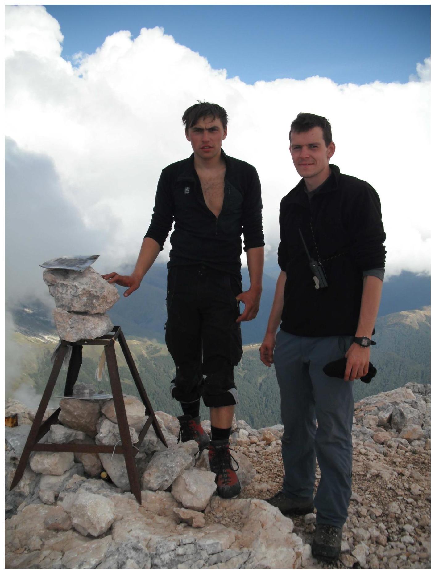
Photo 6 — Photo of the group on the summit
General Conclusion on the Route
The route along the right part of the E wall has an independent thread throughout the wall. It is completely separated by the terrain from neighboring routes, and there is no possibility of transitioning to it from other routes.
On the left, the route is limited by the route along the E wall (A. Andryushchenko, 85) by a counterfort, and on the right - by a smooth wall with overhangs. The "roof" is a tower limited on the sides by gullies.
The thread of the route appears logical and beautiful. The route is safe in the second half of summer. In spring and early June, preliminary observation of the route is recommended, as falling stones are possible on the "roof" due to snowmelt.
When determining the complexity of the route, the team used the experience of previous ascents:
Dalar NE edge 5B Shokoladny SW wall 5B Fisht E wall 5A Kirpich NW wall 5A Shchurovsky 3 wall 5A Dolomites (S) center of bast. 3 walls 5A Uilpat 3rd key. S ridge 5A
After analyzing these routes, the team concluded that the route on Fisht along the right part of the E wall exceeds in complexity the routes of 5A cat. dif. and is not inferior to the routes of 5B cat. dif.
To pass the route, good climbing and ITO skills are required. Additionally, the route poses tasks for climbers related to the tactics of ascent, associated with problems in organizing bivouacs, lack of water, and characteristic unstable weather for the area.
Based on the above, the team proposes to classify this route as a 5B cat. dif. route.