Report on the first ascent of the SW couloir of Mt. Bolshoy Thach (2368.4 m) via the "Bashnya" route, approximately category 3B, completed by M.V. Bogatyrev, A.Yu. Burlev, and Yu.A. Menyayev on February 4, 2008.
Table of Contents:
- Ascent Passport
- Maps of the Area
- Brief Characteristics of the Area
- Approach Description
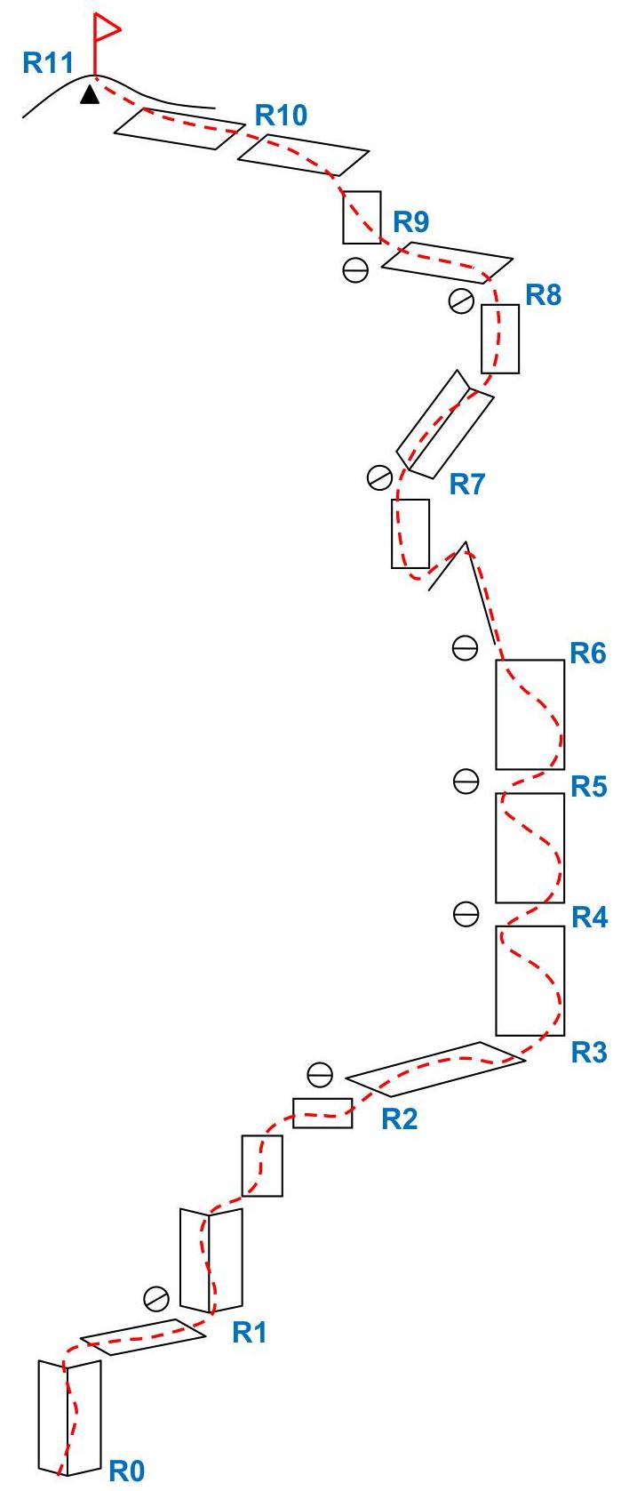
- Route Diagram in UIAA Symbols
- Summary Table of the Route
- Route and Descent Description
- Route Photos
- General Conclusion on the Route
- Group Photo
- List of Abbreviations Used
Ascent Passport
- Ascent Type: Technical
- Ascent Area: Western Caucasus
- Peak, Route: Mt. Bolshoy Thach (peak 2368.4 m) via SW couloir
- Estimated Difficulty Category: 3B, first ascent
- Wall Height Difference: 275 m Route Length: 430 m. Average Steepness of the Entire Route: 55°
- Equipment Used on the Route (total):
Pitons:
- Rock
- Bolts
- Ice Friends and Stoppers: 23
- Number of Climbing Hours/Days: 8 hours/0 days
- Leader: M.V. Bogatyrev (Candidate for Master of Sports)
Participants:
- A.Yu. Burlev (3rd sports category)
- Yu.A. Menyayev (3rd sports category)
- Departure for the Route, Summit, and Return: February 4, 2008
Report on the first ascent of the SW couloir of Mt. Bolshoy Thach (2368.4 m) via the "Bashnya" route, approximately category 3B, completed by M.V. Bogatyrev, A.Yu. Burlev, and Yu.A. Menyayev on February 4, 2008.
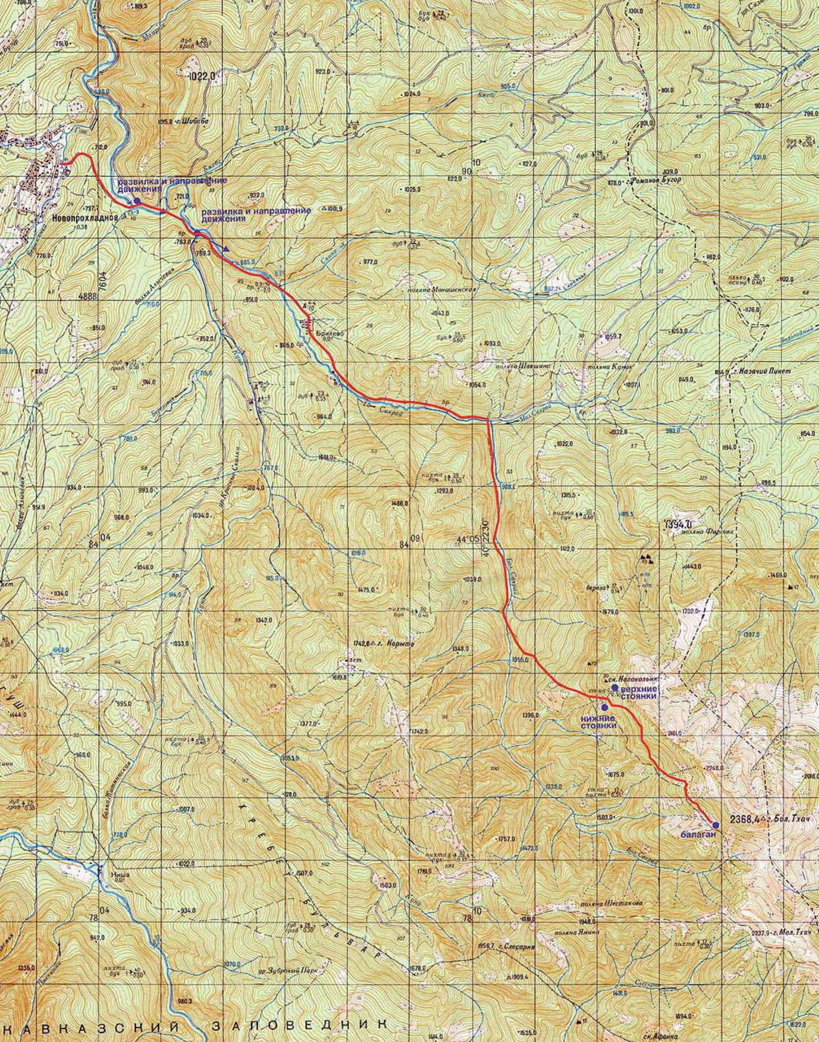 Fig. 1 (previous page). Diagram of movement from Novoproxladny settlement (Sakhray) to camping sites — upper and lower camps, and the balagan.
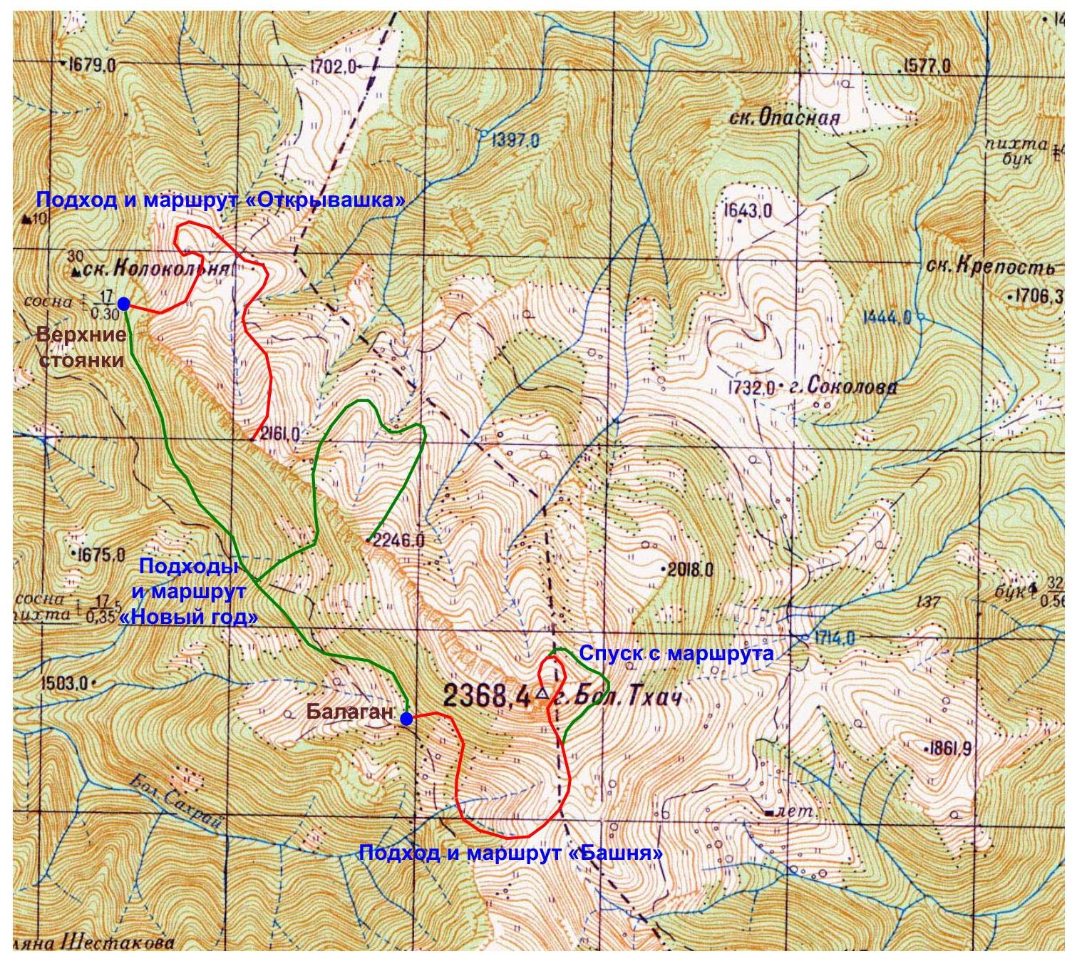
Fig. 2. Geographic map of the Mt. Bolshoy Thach area and routes "Otkryavashka", "Novy God", and "Bashnya" from the camping sites to the three main peaks.
Brief Characteristics of the Area
Mt. Bolshoy Thach (2368.4 m) is located in the "Bolshoy Thach" natural park. This picturesque massif is situated on the border between the Republic of Adygea and the Mostovsky district of Krasnodar Krai. Its characteristic silhouette, formed by asymmetrical peaks (gentle to the north and steep to the south) of the Bolshoy and Maly Thach mountains, is visible from many settlements and ridges of the Western Caucasus. The main orographic unit of the area is the Front Range, on which the peaks of Kazachiy Piket (1184 m), Bolshoy Thach (2368.4 m), Maly Thach (2238 m), Asbestnaya (2285 m), and Acheshbok (2486 m) stand out (from north to south). To the east of Acheshbok, the ridges of Agige (2311 m) and Sunduki (2200 m) branch off. Bolshoy and Maly Thach are known to locals as the Big and Small Bald mountains, as the geographical toponym is not widely known. To the west, the massif is bounded by the Sakhray river basin (a tributary of the Belaya), and to the east by the Khodz river basin (a left tributary of the Laba). The height difference between the summit of Bolshoy Thach and the riverbeds of the surrounding rivers is about 1 km. The average annual air temperature at the nearby Kisha weather station (1500 m above sea level) is +6.9 °C, with 854 mm of precipitation per year. Snow falls in November–December, and a continuous snow cover persists until mid-April. The vegetation is represented by fir forests, which are replaced by high-mountain maple, birch, and aspen at higher elevations, and by meadows at around 1600 m, some of which are significantly degraded due to livestock grazing. Many meadow areas are clearly defined by the terrain and have their own names: Kunske, Baronovy, Knyazheske, Firsova, Sokolova. The wildlife is diverse, with large animals including bison, deer, chamois, roe deer, wild boars, bears, and wolves. The local population is primarily engaged in cattle breeding and logging, but recreational activities were once developed, and there was a hostel on the Kunske meadows serving a horseback riding route for the "Romantika" tourist base.
The wall of Bolshoy Thach is 10–12 km long, with a height difference of 100–300 m. The wall structure varies from destroyed rocks with grass to sheer walls and "mirrors". There are fairly logical gullies. "Mirrors" often have overhanging cornices of varying sizes. The area is interesting for rock climbing of relatively short lengths (from 3 to 10 ropes) and is also promising for sport climbing, provided there is a quality approach to route preparation and protection. The downsides of the area include its remoteness, the length of the approach, and the relatively short length of the routes. On not very steep sections, protection is complicated due to the lack of cracks (sheep's backs) and the destructiveness of the rock. As the steepness of the sections increases, the wall's solidity improves, and good placements for protection gear appear. Protection on "mirrors" is also challenging.
The most convenient path to Thach starts from the Novoproxladny settlement. Tourists and locals call it Sakhray. It should not be confused with Ust-Sakhray, a settlement about 15 km from Novoproxladny. The road to Novoproxladny passes through Dakhovskaya. The main road goes to Guzeripl, and the required road turns left. There is a road sign. Almost immediately after Dakhovskaya, the road changes from asphalt to a good dirt road that a loaded car can navigate without significant problems. If traveling by public transport, a bus leaves from Maikop around 4 pm to Novoproxladny. The area is also accessible from another direction: by bus on the Labinsk–Mostovskoy–Uzlovoy route, and then by logging trucks or on foot. The road to Thach begins at the end of the settlement. After crossing the river by bridge, one needs to move along the road to the right. The road leading left leads to Ust-Sakhray after 12 km. On the return trip, it's easy to get lost and take this road. A landmark on of the return trip is a sign saying "Protect the forest". Seeing it, one should immediately turn left, where the bridge will be. Incidentally, Novoproxladny has a logging farm, so cargo trucks that can reach Tayvan often go to the Thach area. Tayvan is the confluence of the Maly and Bolshoy Sakhray rivers. It is there that one should turn off the main road. However, let's return to the beginning of the path. The road after the settlement is in much worse condition than before it. Here, one can travel by cargo trucks and an UAZ, or on foot for 2 to 3 hours. The road to Tayvan is fairly straightforward and well-traveled. Sometimes it runs directly along the riverbed. There are fords and detours along the bank. At one point, there is a fairly clear fork (which is not clear on the return trip and does not pose a "danger"). One needs to go left, down. A landmark for the correct direction is a gazebo on the right and a cairn. Tayvan is easily recognizable by a significant widening of the road, or rather, the space to the right. Here, one needs to turn right, cross the river by ford, and continue straight along the overgrown forest road. There is another road to the right and up, but it is not needed. After about 15 minutes, there will be a gazebo on the right and a sign saying "Natural Park Bolshoy Thach". Behind them, the road goes along the river and eventually ends. Then, one needs to simply follow the riverbed where it's convenient. After 50–60 minutes of normal walking, one needs to look for a left turn uphill. The landmark is a small cairn, but there's no certainty it will be there forever, as a flood could wash it away. After the turn, there is a marked trail leading to Bolshoy Thach. At one point, when emerging onto a small meadow, there is a fork. One should go left and up. The trail down and to the right is also supposedly correct—it makes a detour and returns to the main trail, but there's no certainty about this. The entire journey along the marked trail takes about 3 to 4 hours.
There are several camping sites under the wall. The first ones, by common names, are the lower camps. The path to them lies along an abandoned logging road (the marked trail goes straight, and the road turns right), and then through a meadow and a stream into the forest. Another way is to go up the trail, and near a tree with a mark, there is a right turn (there's also a spot for one tent and a fire pit). One needs to follow this trail, cross the stream, traverse the meadow, and enter the forest a bit. There will be a spot for 3–4 tents, a fire pit, and a canopy. The second camping sites are actually under the wall of Bolshoy Thach. The marked trail eventually leads to a meadow from which the leftmost part of the wall of the rock massif is visible. The trail to the right turns towards the "Vetreny Balagan" — these are the third camping sites, 2 hours walk from the turn. To the left, on the upper camps, a rock called "Kolokolnya" rises. The lower camps, unlike the upper ones, are closer to the water. If routes are planned in the right part of the wall of the rock massif, it makes sense to spend the night at "Vetreny Balagan" — there's a stove and bunks, and water and firewood are relatively close. From the balagan, there is a panorama of the middle part of the wall of Bolshoy Thach.
Approach Description
The approach to the ascent route begins from the "Vetreny Balagan" camping site. One needs to start moving to the right relative to the rock wall of the massif (if standing facing Bolshoy Thach) and follow the marked trail into the forest strip. Gradually, the trail rises and after 30 minutes of walking leads to the Thach pass, which connects the Bolshoy and Maly Thach mountains (see Fig. 3). On the pass, one needs to turn left at a right angle and move along a grassy-stony slope for about 20 minutes until reaching the rock wall of the Bolshoy Thach massif. The steepness of the ascent will gradually increase and reach about 30°. Here, a gap in the wall will be visible, representing an almost vertical inner corner that is uniquely identifiable visually from afar (see Fig. 6). The ascent should start along this inner corner.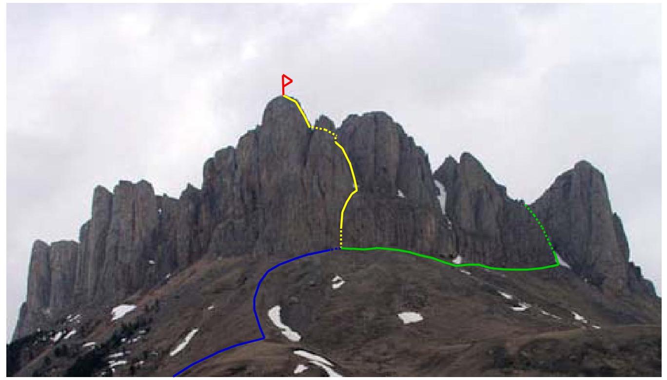
Fig. 3. Panoramic view of Mt. Bolshoy Thach and tactical plan of the "Bashnya" route (color обозначения: blue — approach, yellow — ascent path, red — summit, green — descent; solid line — visible part of the route on the figure, dotted — invisible part).
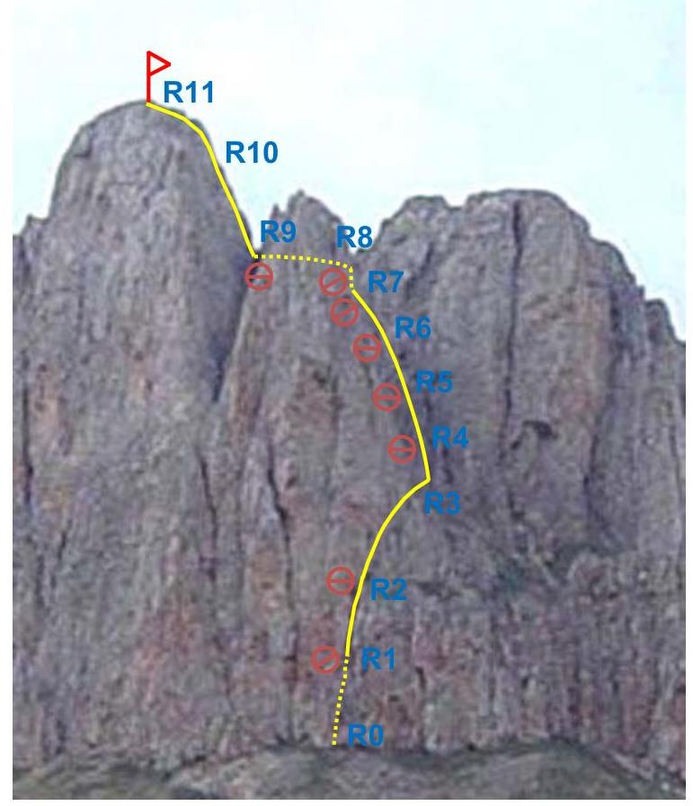
Route Diagram in UIAA Symbols
Summary Table of the Route
| Rock Pitons, Bolts, Ice Pitons | Friends | Stoppers | Section Number | Difficulty Category | Length | Steepness |
|---|---|---|---|---|---|---|
| 1 | 2 | 3 | 4 | 5 | 6 | 7 |
| 0 | 0 | 0 | 11 (R10–R11) | 1 | 50 m | 20° |
| 0 | 0 | 0 | 10 (R9–R10) | 1–2 | 50 m | 30° |
| 0 | 0 | 1 | 9 (R8–R9) | 2 | 30 m | 20° |
| 0 | 5 | 3 | 8 (R7–R8) | 4 | 20 m | −10° (100°) |
| 0 | 0 | 2 | 7 (R6–R7) | 3 | 20 m | 70° |
| 0 | 0 | 0 | 6 (R5–R6) | 2–3 | 50 m | 60° |
| 0 | 0 | 0 | 5 (R4–R5) | 2 | 50 m | 50° |
| 0 | 0 | 0 | 4 (R3–R4) | 1–2 | 50 m | 40° |
| 0 | 0 | 2 | 3 (R2–R3) | 1 | 60 m | 30° |
| 0 | 4 | 2 | 2 (R1–R2) | 4 | 30 m | 80° |
| 0 | 3 | 1 | 1 (R0–R1) | 3–4 | 20 m | 70° |
Route and Descent Description
The route begins with an almost vertical inner corner led to by the ascent from the Thach pass (see Fig. 3), connecting the Bolshoy and Maly Thach mountains. Climbing from the pass towards the rock wall of the Bolshoy Thach massif, one should always be guided by this inner corner (see Fig. 4), which is uniquely determined visually from any point along the way. The ascent along the inner corner constitutes the 1st section of the ascent (R0–R1, 3–4, 20 m, 70°), at the end of which a station is organized on a small inclined shelf behind a rock outcrop.
Next, there is an ascent along the inner corner of the 2nd section (R1–R2, 4, 30 m, 80°), which is the first key section (see Fig. 5). Here, one needs to be extremely attentive and, towards the end of the 2nd section, gradually shift to the right, moving along the crack departing from the inner corner to the right (see Fig. 6). At the end of the 2nd section, on a horizontal shelf behind a rock outcrop, a station is organized.
From here, one needs to move to the right along a scree grassy-stony shelf (see Fig. 7) of the 3rd section (R2–R3, 1, 60 m, 30°) to a wide gully. The following sections are laid out along it:
- 4th (R3–R4, 1–2, 50 m, 40°)
- 5th (R4–R5, 2, 50 m, 50°)
- 6th (R5–R6, 2–3, 50 m, 60°) The sections differ only in the gradual increase in the angle of steepness. Climbing the gully requires extreme caution due to slippery grassy areas, loose rocks, and scree along the way. In winter, the gully is covered with a thick layer of snow (see Fig. 8), and there is a risk of triggering an avalanche.
Upon reaching the rock ridge from which the 7th section (R6–R7, 3, 20 m, 70°) begins, one needs to climb as high as possible along it, then cross it, and continue climbing another couple of meters up and inwards — until a grotto about the height of a person appears. From it, one can enter the cave system of the Bolshoy Thach massif.
Here begins the 8th section (R7–R8, 4, 20 m, −10° (100°)), which is the second key section (see Fig. 9). The ascent occurs along a negative inner corner, and towards the end of the section, one needs to shift to the right, aiming for the exit to an inclined shelf. The organization of stations at the beginning and end of this section is done using extremely inconvenient rock outcrops.
From this inclined shelf, the summit becomes visible (a characteristic sign is a stick sticking up), towards which one needs to move along the 9th section (R8–R9, 2, 30 m, 20°).
Further, after overcoming a small ascent at the beginning of the 10th section (R9–R10, 1–2, 50 m, 30°), one needs to reach the summit along the 10th and 11th (R10–R11, 1, 50 m, 20°) sections (see Fig. 10), which is the highest among the peaks of Mt. Bolshoy Thach (2368.4 m).
The descent is carried out along a narrow gully located to the right of the ascent gully (see Fig. 3). This gully, whose angle of steepness gradually decreases from 70° to 30°, leads directly to the foot of the rock walls of the Bolshoy Thach massif and is very convenient for descent. Movement along the gully requires extreme caution due to:
- slippery grassy areas,
- loose rocks,
- scree, and in winter, the gully is covered with a thick layer of snow. The descent along it leads significantly to the right of the Thach pass, so one needs to move along the rock wall of the Bolshoy Thach massif, visually orienting towards the ascent to the pass. From it, one can return to the "Vetreny Balagan" camping site along the approach path.
Route Photos
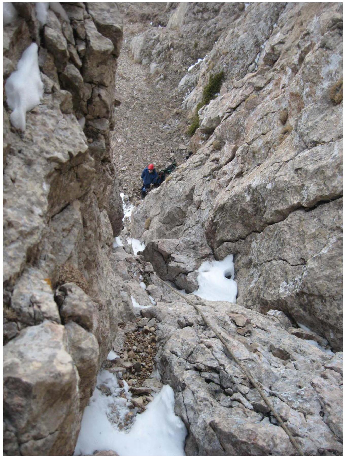
Fig. 4. Fragment of Section №1 (R0–R1).
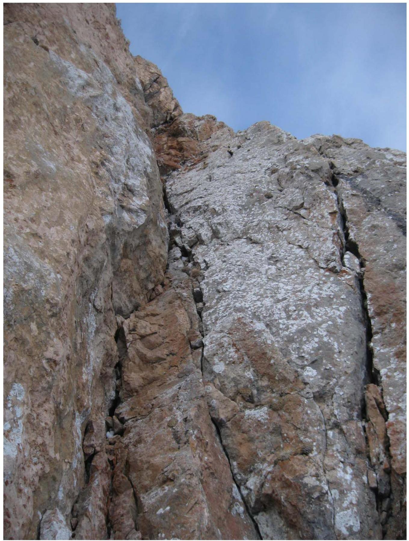
Fig. 5. Section №2 (R1–R2) — first crux. Report on the first ascent of the SW couloir of Mt. Bolshoy Thach (2368.4 m) via the "Bashnya" route, approximately category 3B, completed by M.V. Bogatyrev, A.Yu. Burlev, and Yu.A. Menyayev on February 4, 2008.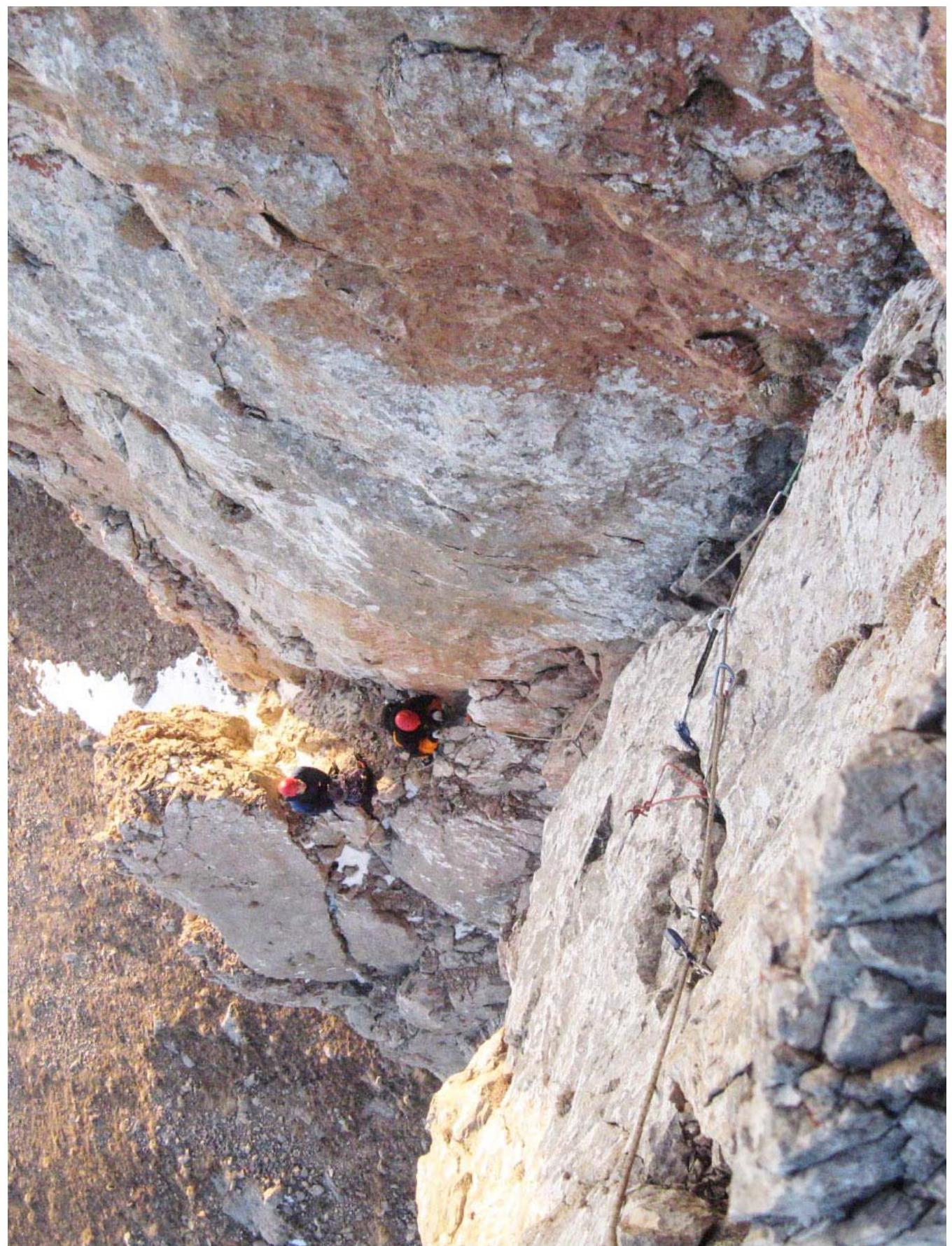
Fig. 6. Sections №1 and 2 (panoramic view). Report on the first ascent of the SW couloir of Mt. Bolshoy Thach (2368.4 m) via the "Bashnya" route, approximately category 3B, completed by M.V. Bogatyrev, A.Yu. Burlev, and Yu.A. Menyayev on February 4, 2008.
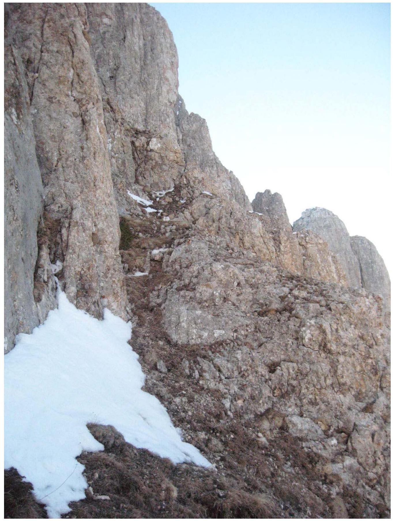
Fig. 7. Section №3 (R2–R3).
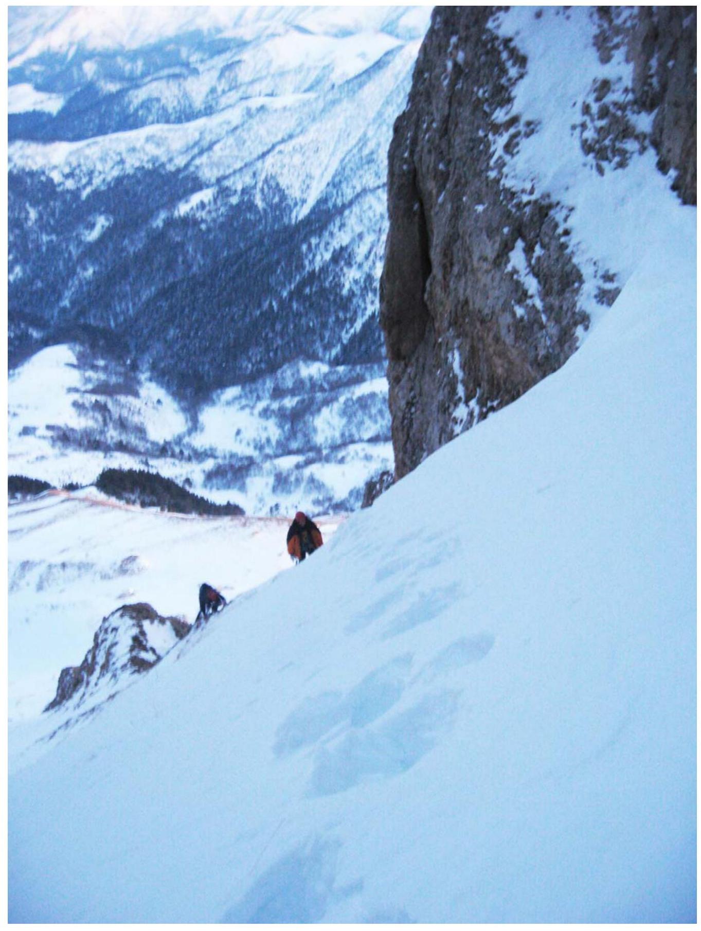
Fig. 8. Section №5 (R4–R5). In appearance, sections №4, 5, 6 (R3–R4–R5–R6) are very similar and differ only in steepness. Report on the first ascent of the SW couloir of Mt. Bolshoy Thach (2368.4 m) via the "Bashnya" route, approximately category 3B, completed by M.V. Bogatyrev, A.Yu. Burlev, and Yu.A. Menyayev on February 4, 2008.
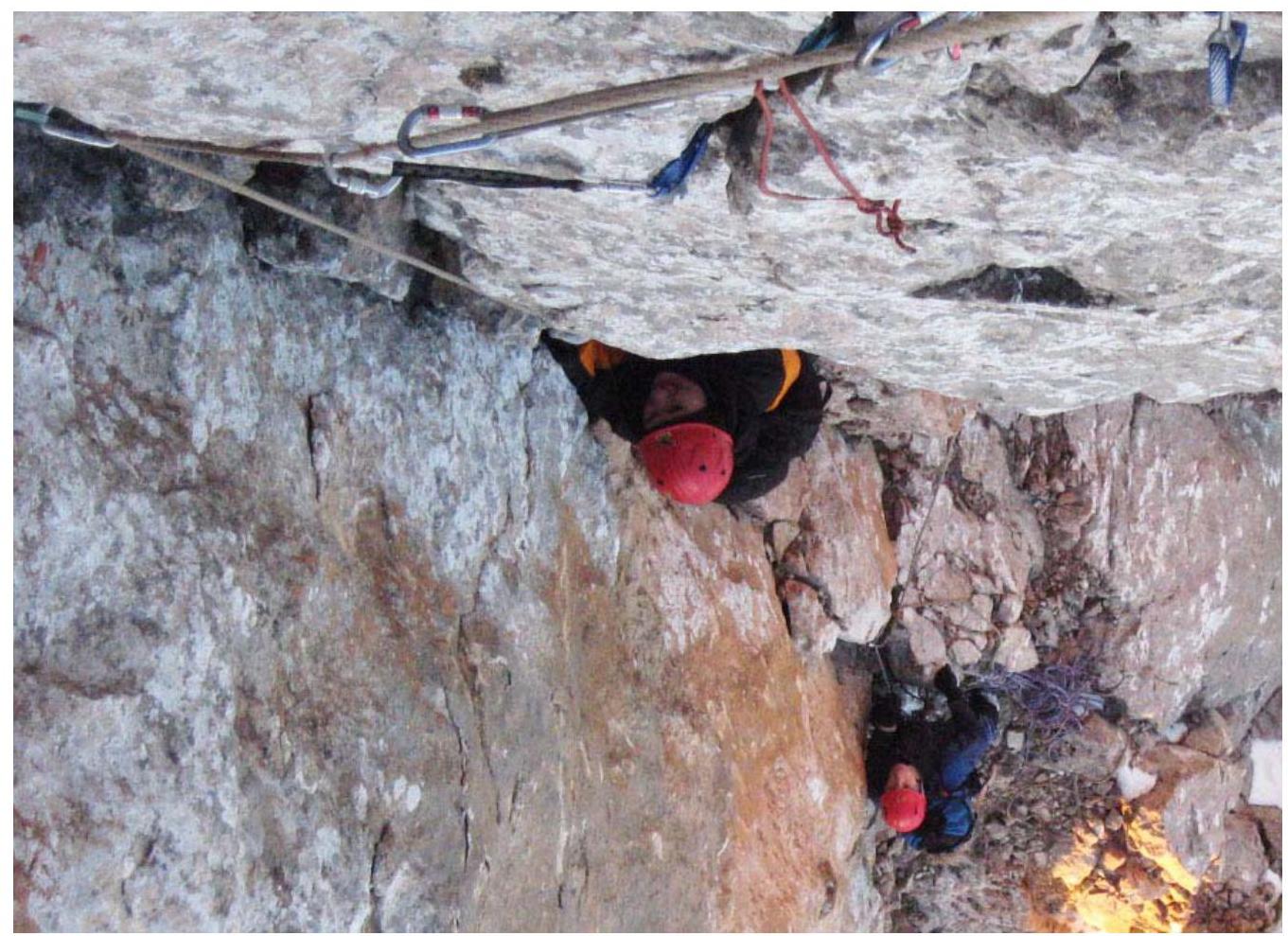
Fig. 9. Section №8 (R7–R8) — second crux.
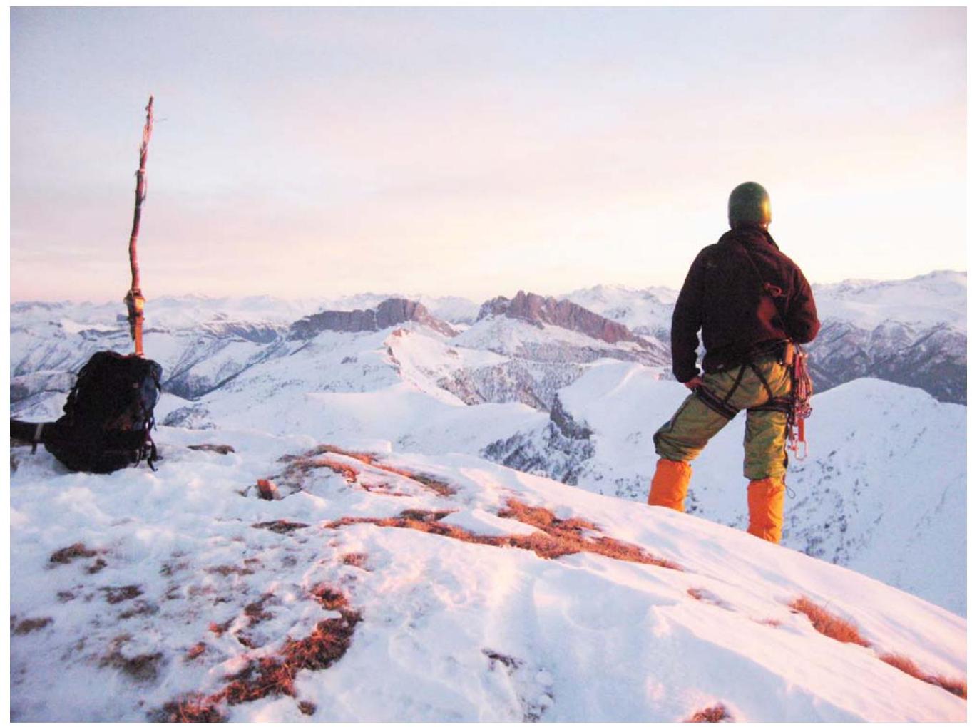
Fig. 10. The highest peak of Mt. Bolshoy Thach (2368.4 m).
General Conclusion on the Route
The "Bashnya" route along the SW couloir of Mt. Bolshoy Thach is a technically interesting route. During the ascent, it is fairly logical and safe for prepared participants. Moreover, the identification of locations for station organization is completely obvious.
The choice of the route name "Bashnya" was not made by the first ascent participants by chance. As this route involves ascending to the highest peak of Mt. Bolshoy Thach (2368.4 m), and the climb to this summit on almost all rock sections is practically vertical, with a steepness angle reaching 80°. Additionally, there is a section with a negative angle of 10°.
It should be noted that the route will be significantly complicated during rain or fog, especially on the second key section, as it is quite damp here even in good weather. Furthermore, during winter ascents on sections R3–R6, one needs to be extremely cautious and move exclusively in rope teams, as the snow cover in the gully can lead to an avalanche hazard.
Assessing the route, the first ascent participants compared it to the following previously climbed routes:
- MNR via the "Konfetka" route — 4A category
- Small Domбай with Chuchkhur pass — 4A category
- "Kirpich" via the right part of the 3rd wall — 3B category
- Main Domбай — 3B category
- Bolshoy Thach via the "Novy God" route — 3A category
- Mshatka-Kaya via the "Vilkа" route — 3A category
- Shogenzukova via the S ridge — 2B category
- Kurmychi via the 3rd slope of the N ridge — 2B category
Based on the analysis, the group believes that the "Bashnya" route corresponds to the 3B category and can be recommended as a sufficiently interesting route for sports ascents.
Thus, currently, three routes have been laid out on Mt. Bolshoy Thach. Moreover, it should be noted that they allow for ascents to the three highest peaks of Mt. Bolshoy Thach (see Fig. 2):
- "Otkryavashka" route, 2A category (2161.0 m)
- "Novy God" route, 3A category (2246.0 m)
- "Bashnya" route, 3B category (2368.4 m)
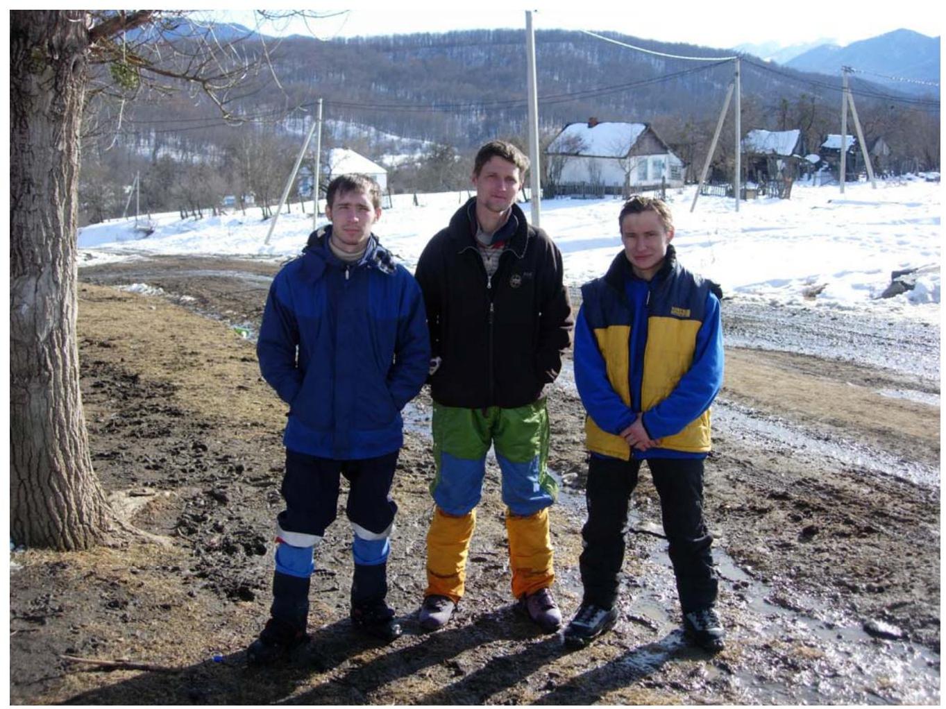
Fig. 11. Participants of the first ascent (from left to right): A.Yu. Burlev, M.V. Bogatyrev, and Yu.A. Menyayev in Novoproxladny settlement (Sakhray), February 7, 2008.
List of Abbreviations Used
cat. complexity — category of complexity; s.r. — sports rank; Mt. — mountain; SW, S, W, N — southwest, south, west, north; ETO — artificial point of support; UIAA — International Climbing and Mountaineering Federation.