Report
on the ascent to the summit "skala Goryacheva" 3138 m via the eastern ridge presumably 1B category, first ascent
Ascent Passport
- Region: Western Caucasus, Arkhyz area, Sofiyskoe valley, section 2.1 of the mountain summit route classifier.
- Summit: "skala Goryacheva" (3138 m), via the eastern ridge.
- Proposed category: 1B, first ascent.
- Route type: combined.
- Height difference: 300 m Route length (technical part): 500 m. Average steepness of the technical part: 30 °.
- Pitons left on the route: 0 "Pitons" used on the route: 8 (loops, chocks) Bolts and ITO were not used.
- Total time: 13 hours, 1 day.
- Descent from the summit via the southern couloir.
- Leader: Dergachev Andrey Viktorovich, 1st sports category, instructor category III. Participants: R. Gromov, zn.; D. Gromov, zn.; A. Zakharov, zn.; G. Kotenko, zn.
- Date of ascent: May 8, 2015. Departure from the assault camp: 5:00 Reaching the ridge (start of the technical part): 9:30 Reaching the summit: 13:00 Return to the assault camp: 18:00
- Federation of Alpinism of Krasnodar Krai.
- Responsible for the report: Dergachev A.V. aderg@narod.ru
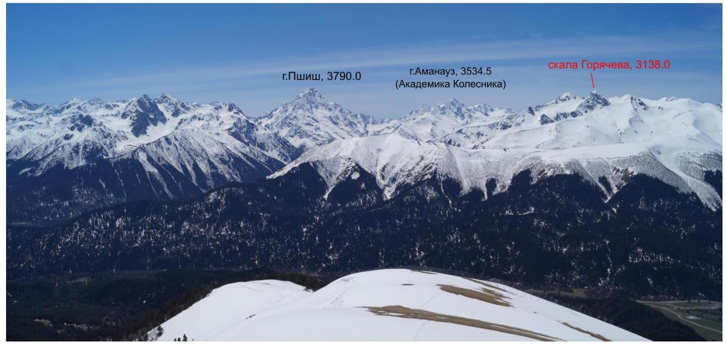
Fig. 1. General view of the "skala Goryacheva" area from the north (from the slopes of the Abishira-Akhuba ridge). May 3, 2015.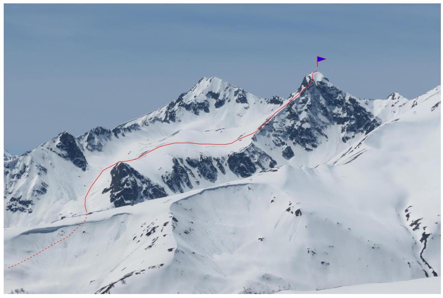
Fig. 2. View of "skala Goryacheva" from the north (from the slopes of the Abishira-Akhuba ridge). May 3, 2015.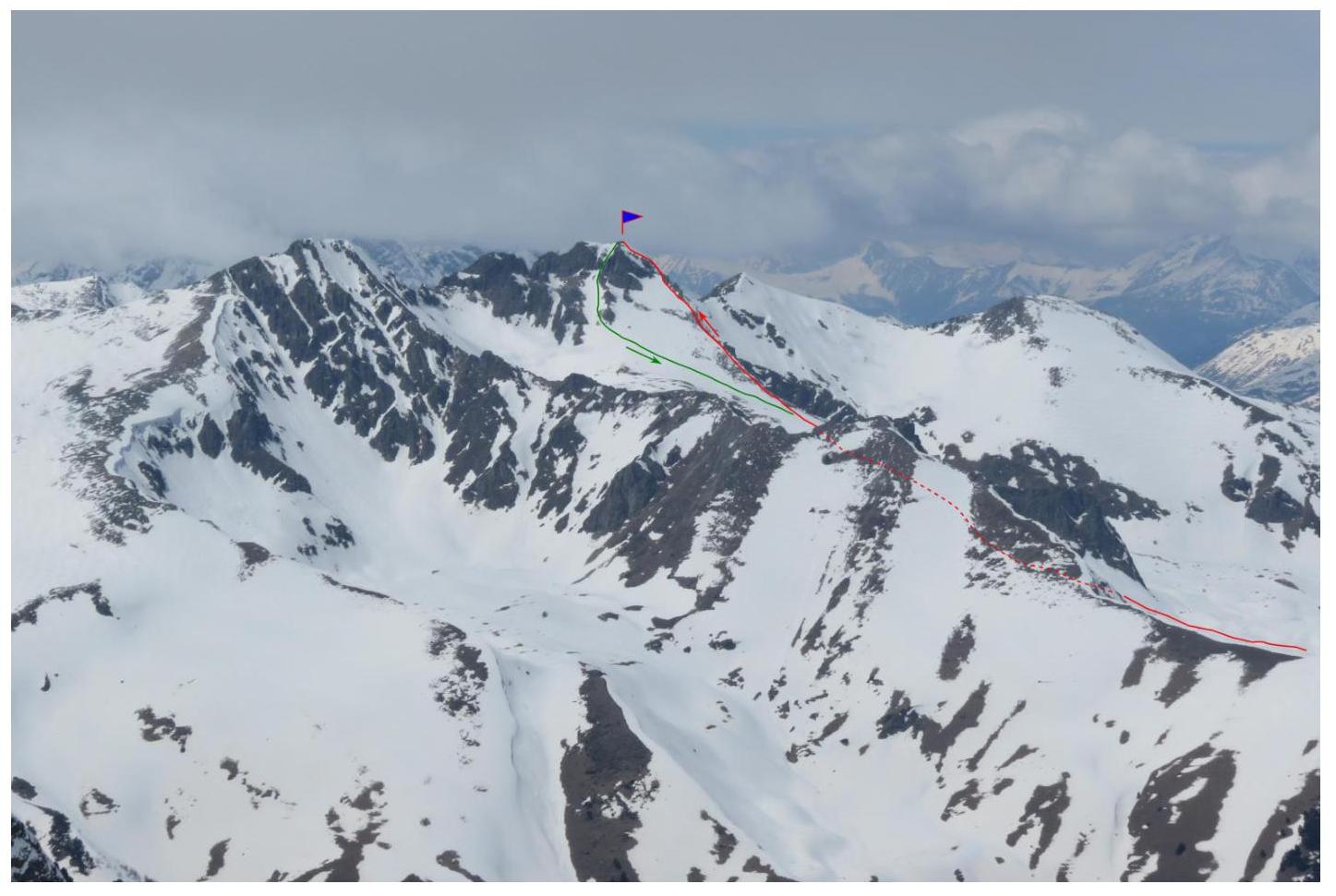
Fig. 3. View of "skala Goryacheva" from the southeast (from the summit of BSD). May 6, 2015.
Geographical description of the area and the ascent object
The ascent object - the summit "skala Goryacheva" (3138 m) is located in the Zelenchuksky district of the Karachay-Cherkess Republic, in the Gabulu ridge of the Western Caucasus.
The ascent was made from the side of the Pshysh river. The conditional assault camp (start of the hike) was located at the intersection of the road and the Gabulu-Chat stream.
Path to the assault camp: from the Arkhyz settlement by car on the asphalt road to the bridge over the Arkhyz river - 4 km, then on a dirt road (high-clearance vehicle recommended) to the Gabulu-Chat stream - 6.5 km. A full-fledged camp (overnight stay) can be set up at the intersection of the road and the Gabulu-Chat stream.
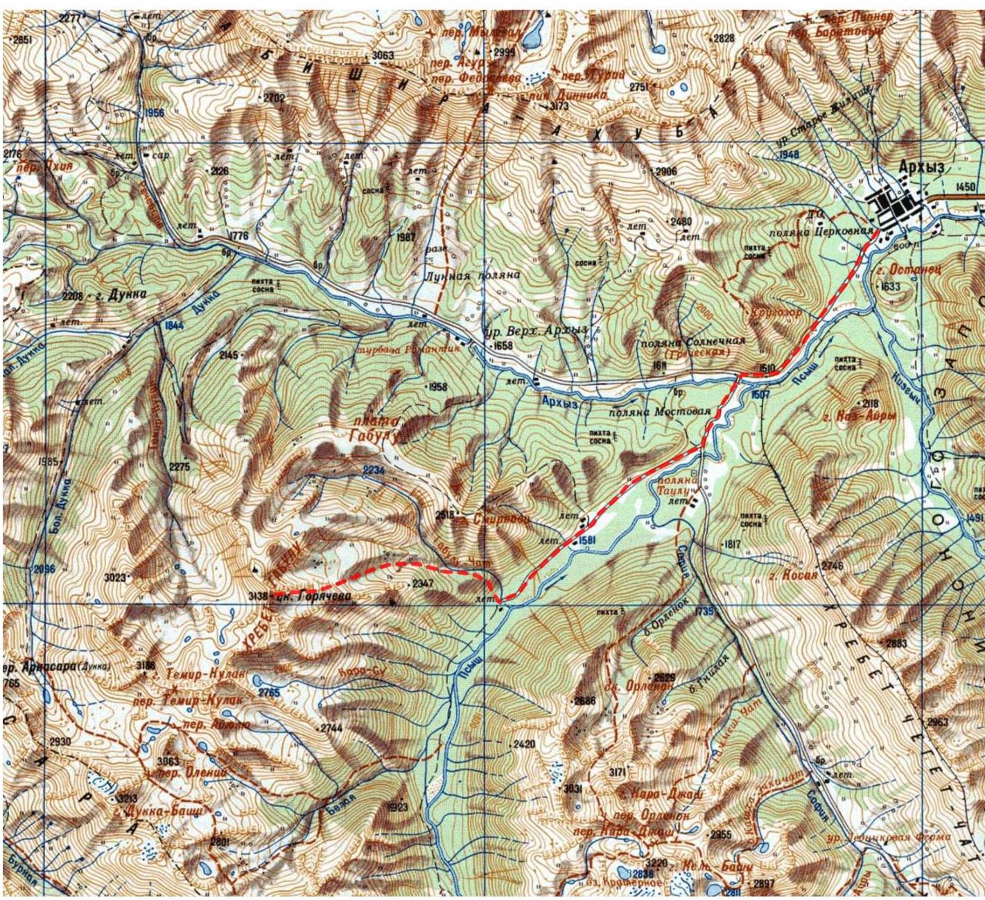
Fig. 4. Overview map of the area
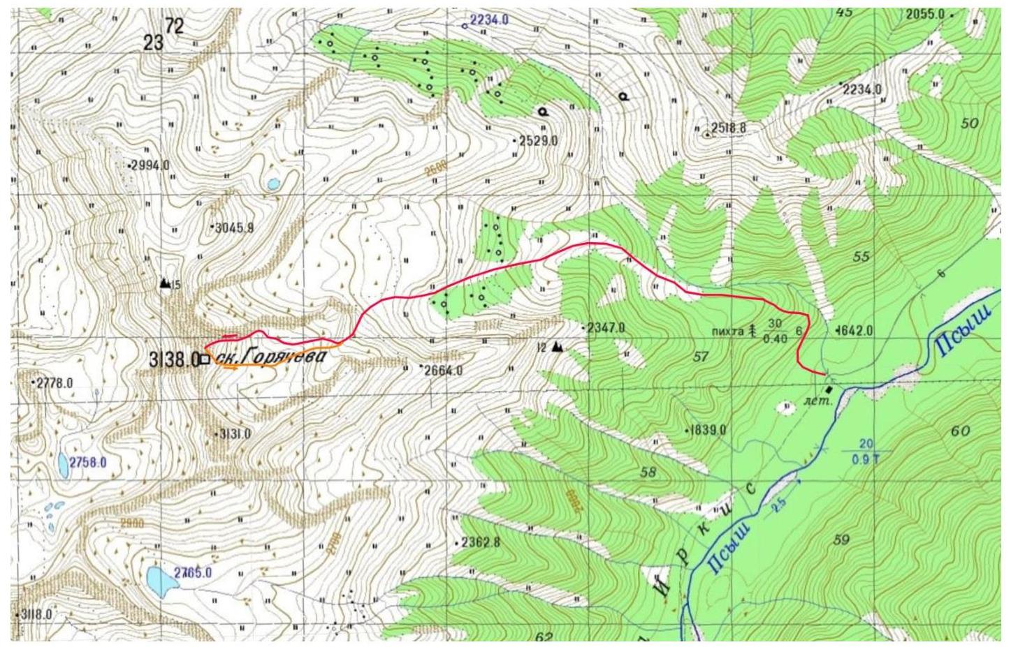
Fig. 5. Ascent route diagram
Table 1. List of technical sections of the route
| Section | Length, m | Steepness, degrees | Terrain type | Category | Number of pitons |
|---|---|---|---|---|---|
| R0–R1 | 200 m | 25 ° | Rocky-scree ridge | 1 | 0 |
| R1–R2 | 100 m | 30 ° | Rocky ridge, snow bypass | 2 | 2 |
| R2–R3 | 80 m | 35 ° | Rocky ridge | 2–3 | 6 |
| R3–R4 | 120 m | 20 ° | Snowy rocky ridge | 2 | 0 |
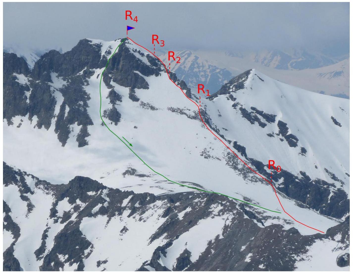
Fig. 6. Ascent route photoscheme
Description of the approach to the start of the technical part of the route
From the assault camp, a logging road goes along the right (orographic) bank of the Gabulu-Chat stream. The road leads to the alpine meadow zone. Then ascend along the right tributary of the Gabulu-Chat river towards two rocky teeth. Pass between the teeth and ascend the right slope to a gentle grassy-scree ridge. Cross it and approach the eastern ridge of "skala Goryacheva" (start of the technical part). The lower part of the ridge is scree, the upper part is rocky with snowy sections. From the assault camp: 4 hours.
Description of the route passage
Section R0–R1. Ascend the scree ridge towards the rocky section. 25 °, 200 m, 1. Section R1–R2. On the left side of the rocky ridge, traverse via snow. Belay via ice axe and rocky outcrops. 30 °, 100 m, 2. Section R2–R3. Ascend simple rocks to the right onto the rocky ridge, then up the ridge. Belay via rocky outcrops and chocks. 35 °, 80 m, 2–3. Section R3–R4. Ascend the snowy rocky ridge and snowy slope to the summit. 20 °, 120 m, 2.
Descent via the southern couloir. 50 m down from the summit to a scree ledge on the left side of the couloir, then rappel 40 m to a snowy slope. Down the snow to the scree plateau and further along the ascent path.
Route photographs
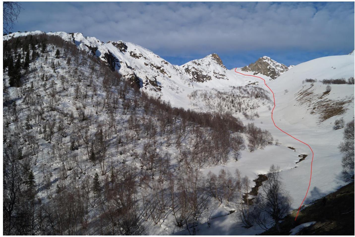
Fig. 7. Approach to the route along the right tributary of the Gabulu-Chat river
Fig. 8. Approach to the start of the route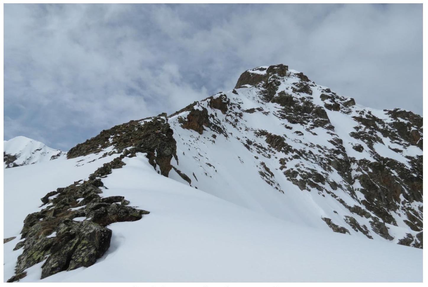
Fig. 9. Eastern ridge of "skala Goryacheva"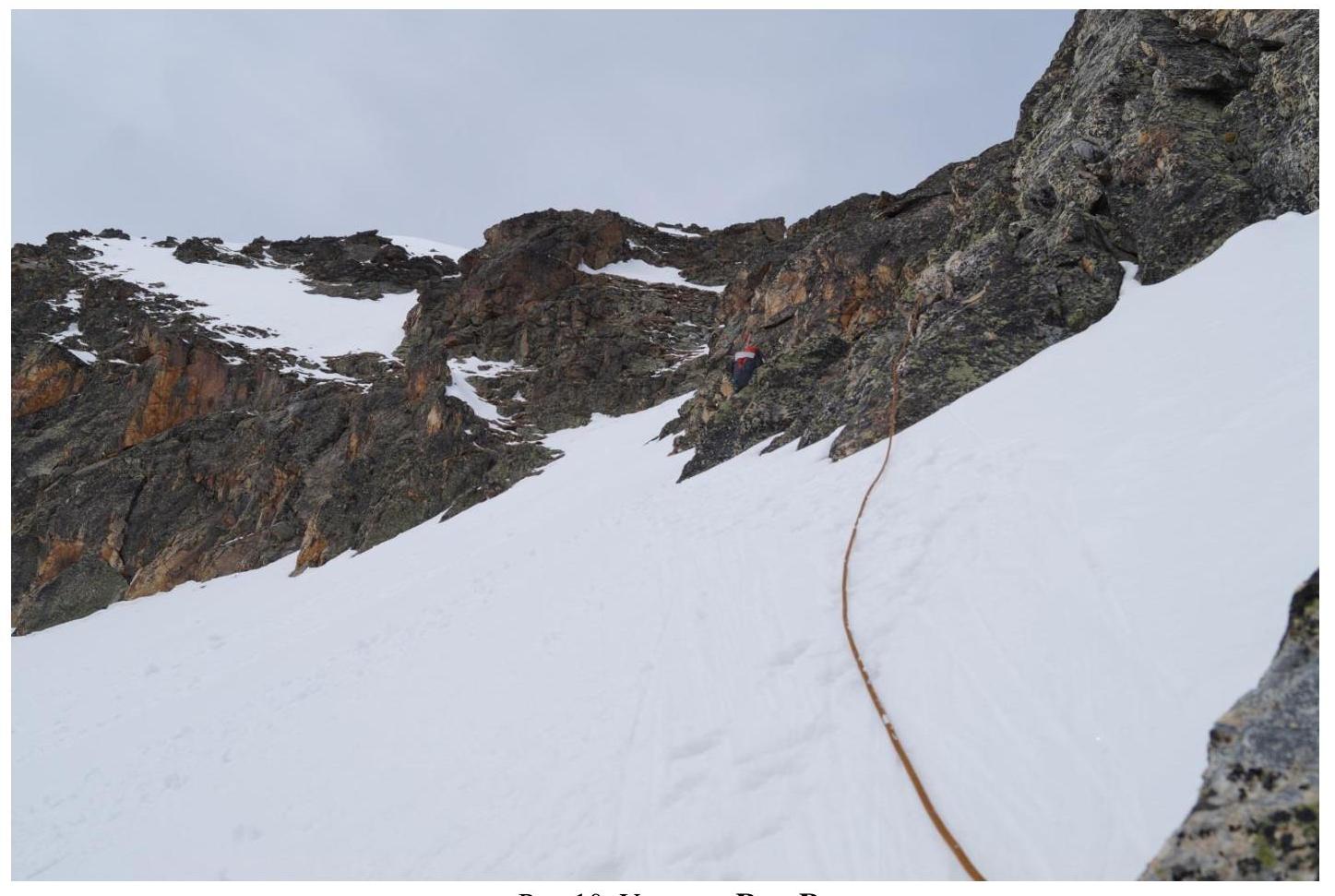
Fig. 10. Section R1–R2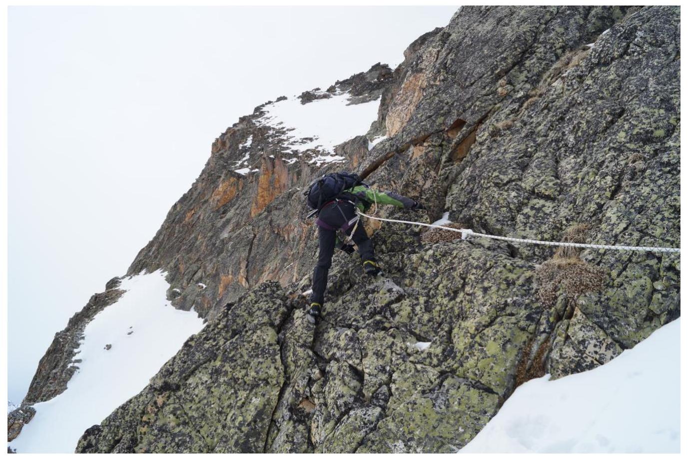
Fig. 11. Section R2–R3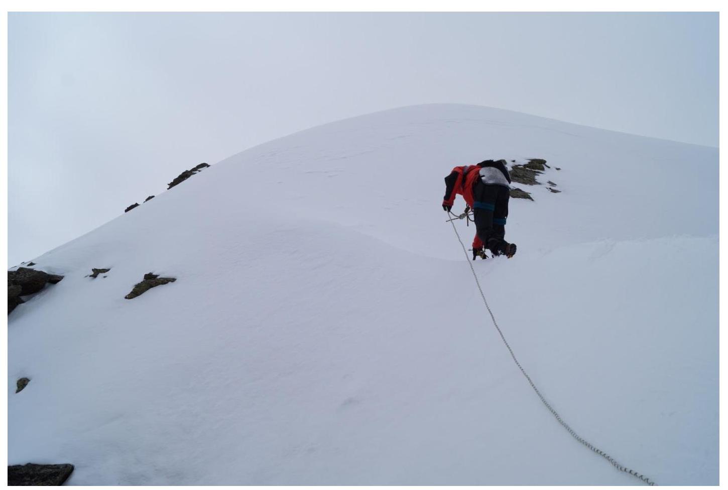
Fig. 12. Section R3–R4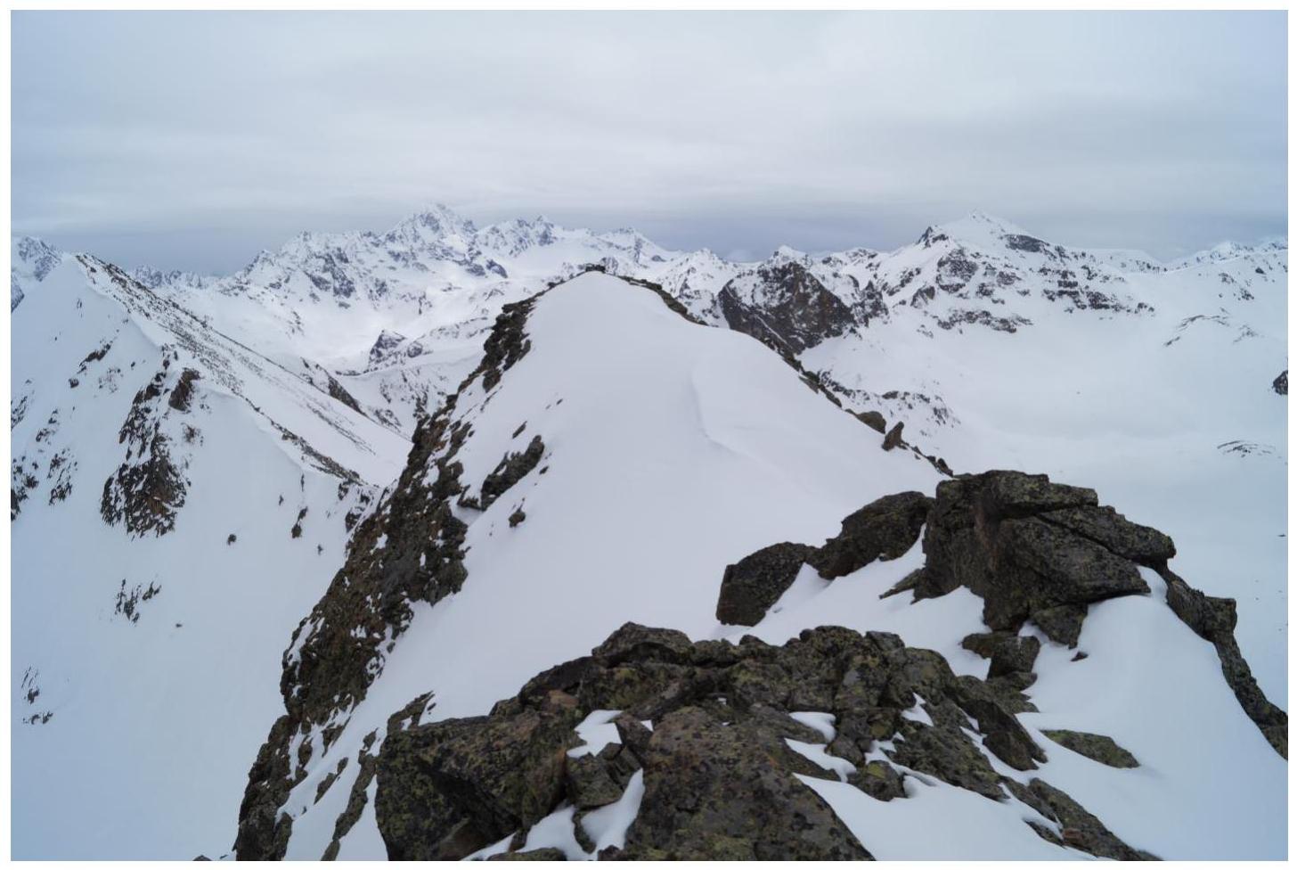
Fig. 13. View from the summit towards the "geodetic summit"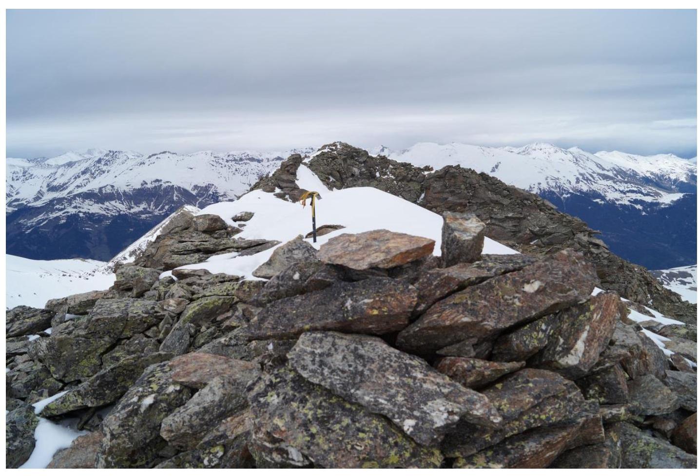
Fig. 14. View from the "geodetic summit" towards the main summit
Fig. 15. Group on the summit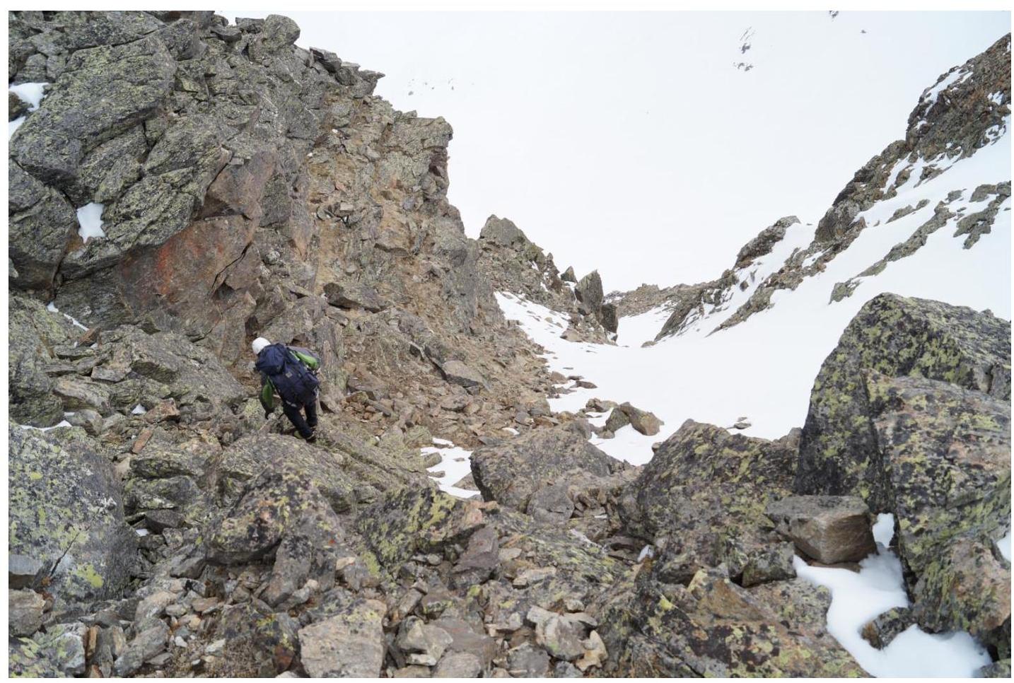
Fig. 16. Descent from the summit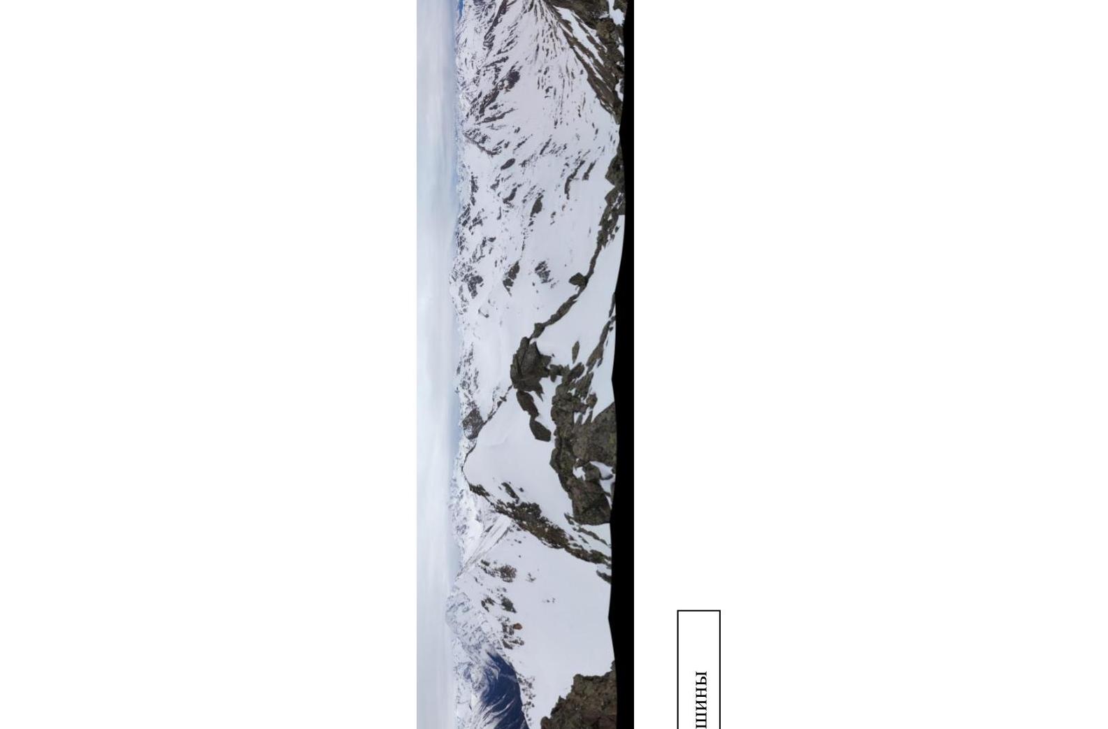
Fig. 17. Panorama from the summit
General conclusions
"Skala Goryacheva" has two summits of approximately equal height, 70 m apart. Both summits have cairns (no notes found). Visually and according to GPS, the summit reached via the eastern ridge (northern) is about 1 m higher. However, the southern summit has a characteristic geodetic cairn with a vertical stone and is marked on the map as "skala Goryacheva". The col between the summits is straightforward and almost without a drop, so for route classification, it does not matter which summit is considered the main one. We considered the northern summit as the main one and left a note in its cairn. The nearest classified routes in the area: Dorbun Gl. via the S. ridge 2A category, Orlenok V. via the SE ridge 1B category, 3206 (Bolgaro-Soviet Friendship) via the W. ridge 1B category. The route similar in difficulty to the one climbed is the route to v. 3206 (BSD) via the W. ridge 1B category. Based on the objective difficulty of the technical part of the route to the summit "skala Goryacheva" via the eastern ridge and comparing it with other routes climbed by the participants (the route to v. 3206 (BSD) was climbed two days earlier), it is proposed to classify it as 1B category.