| CLIMBING CLASS | — rock |
|---|---|
| CLIMBING AREA | — Western Caucasus, Arkhyz, northern spur of the Sofiyskiy ridge between the valleys of the Pshysh and Sofiya rivers |
| PEAK, ROUTE |  3011 Gonorama ODINOVA (first ascenders' proposal) via the North-Eastern ridge 3011 Gonorama ODINOVA (first ascenders' proposal) via the North-Eastern ridge |
| ASSUMED DIFFICULTY CATEGORY | — 3A (winter) |
| ROUTE CHARACTERISTIC | — rock, ridge, absolute height difference 600 m |
| PITS SET | — 19 (pits + placements) |
| NUMBER OF TRAVEL HOURS | — 8 h (from the start of the route to the summit) |
| NUMBER OF OVERNIGHT STAYS | — not required on the route |
| CLIMBING LEADER | — Zaporozhchenko E.V., Candidate Master of Sports, instructor |
| PARTICIPANTS | — Lebedev V.V. — Candidate Master |
| — Fedorov B.V. — Candidate Master | |
| — Koblyakov V.M. — Candidate Master | |
| — Runich A.V. — Candidate Master | |
| — Medyanikov V.V. — 1st Class | |
| TEAM COACH | — Master of Sports of the USSR Popov V.P. |
DATE OF DEPARTURE ON THE ROUTE AND RETURN — January 16, 1982.
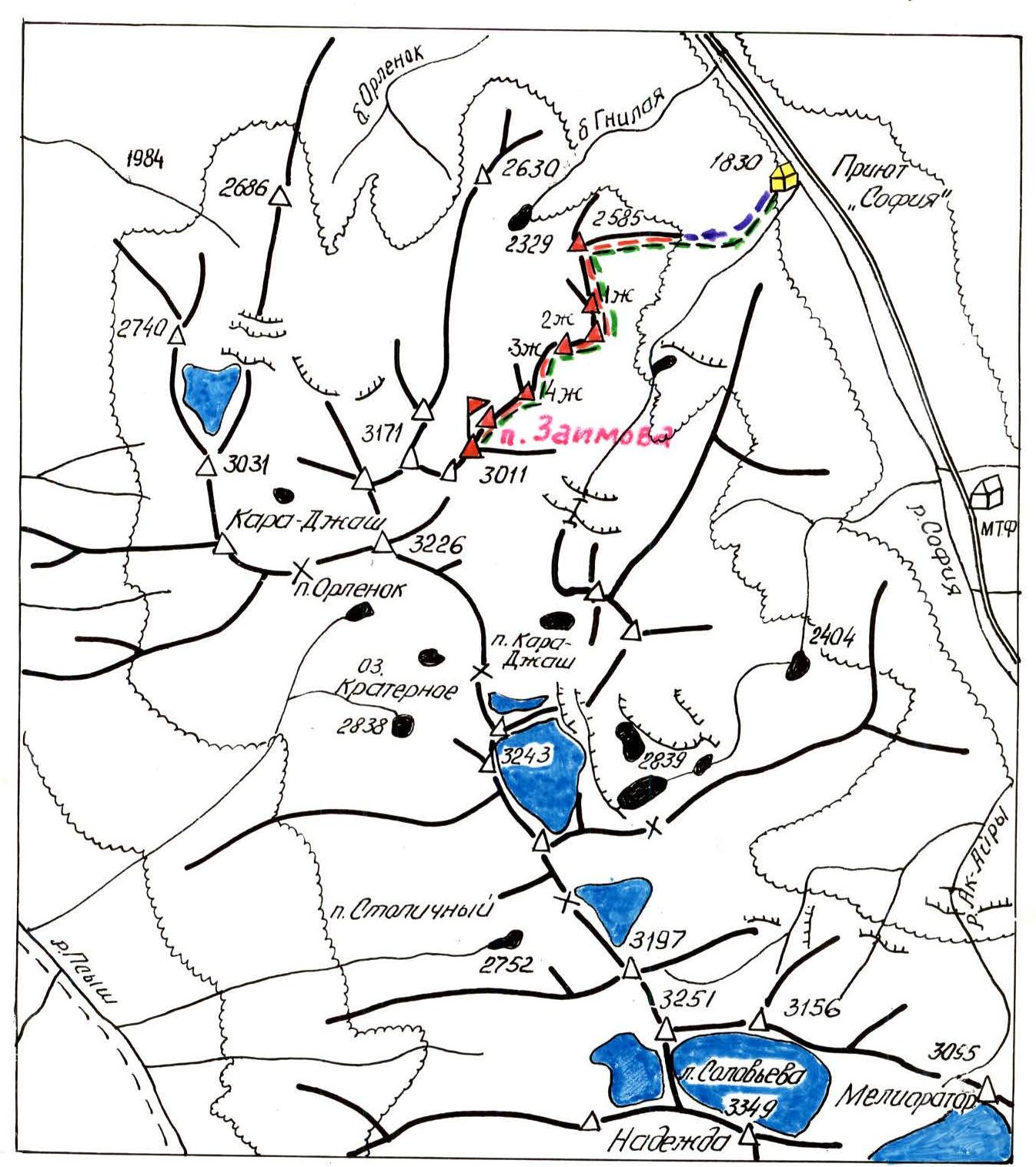
Legend
- Base camp
- Path to the start of the route
- Ascent path on the route
- Descent path to the base camp
- Ridges and peaks
- Glaciers
TABLE of the main characteristics of the first ascent route to General Zaimov Peak
| Date | Designation | Average steepness, ° | Length, m | Relief | Difficulty | Condition | Weather conditions | Rock and placements | Ice | Pitons |
|---|---|---|---|---|---|---|---|---|---|---|
| January 16, 1982 | R0–R1 | 45°, knife – 20° | 150 m, knife – 200 m | Steep rocky ridge turning into a rocky "knife" | 4 | Snow-covered rocks | Light snow | 3 | – | – |
| R1–R2 | 25° | 230 m | Narrow rocky ridge with gendarmes | 4 | —"— | —"— | 3 | – | – | |
| R2–R3 | 45° | 60 m | Wall at the base of the gendarme, rocky "knife" and narrow rocky ledge | 4 | —"— | —"— | 3 | – | – | |
| R3–R4 | 50° | 180 m | Steep and narrow rocky ridge | 4 | —"— | —"— | 3 | – | – | |
| R4–R5 | Bypassing the gendarme – 20°, wall+slope – 55° | Bypassing the gendarme – 120 m, wall+slope – 55 m | Narrow ledge, wall, steep snow-covered slope | 4 | —"— | —"— | 7 | – | – | |
| R5–R6 | 35° | 200 m | Steep ridge, flattening after the subpeak | 4 | —"— | —"— | – | – | – |
Photos
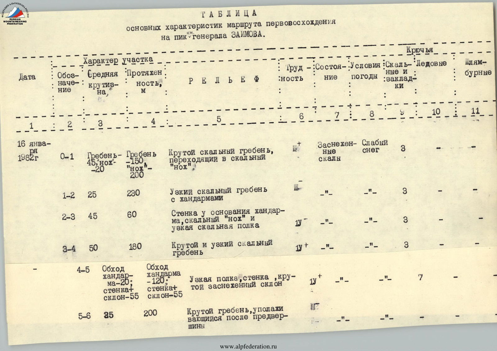
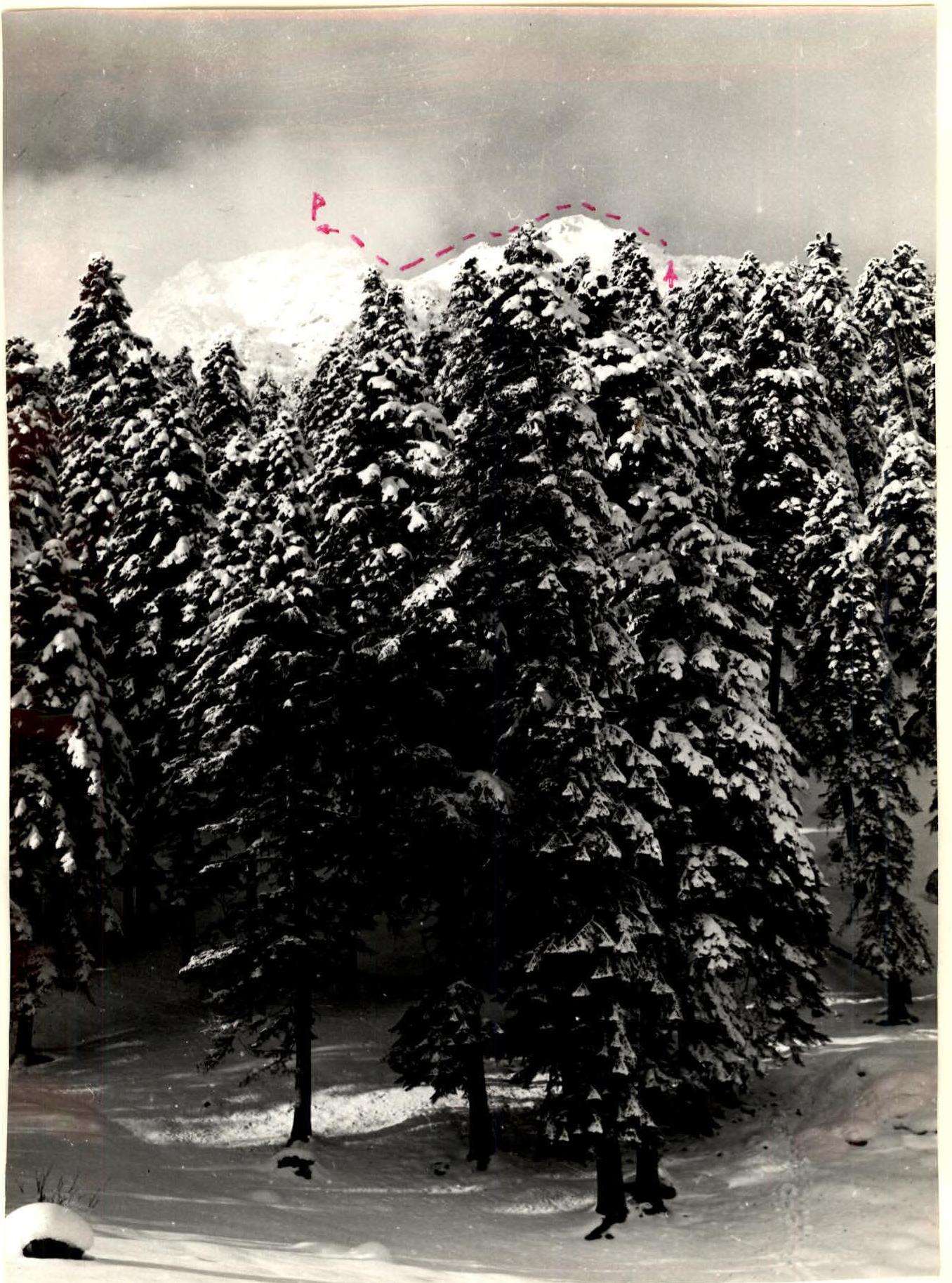
Photo 2. View of the summit from the "Sofiya" shelter 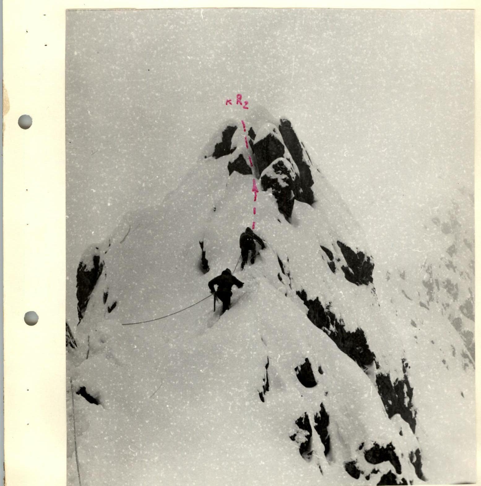
Photo 3. Second gendarme 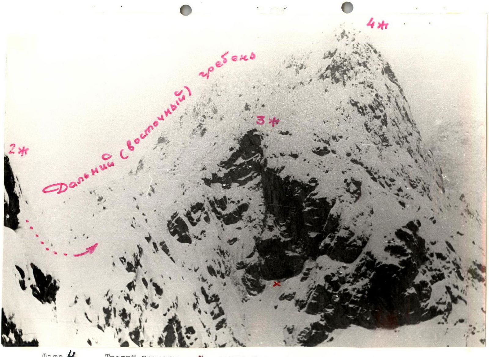
Photo 4. Third gendarme. X — half-cave 
Photo 5. Fourth gendarme