- Krasnaya Polyana, Achishkho massif, Beshenka stream valley, 2.1/2008.
- "Volchiy Zub" peak, 2190 m., SE edge.
- Proposed category: 2B, first ascent.
- The route is rocky.
- Height difference: 250 m.
Length: 400 m. Length of V category section: 10 m. Average steepness of the main part of the route: 45°.
- No equipment left on the route.
- Time taken: 3 hours.
- Leader: Koshelenko Yu. — Honored Master of Sports.
Participants:
- Takzhanov Yu. — Master of Sports in rock climbing
- Shmigelsky S. — 2nd sports category
- Coach: Koshelenko Yu.
- Departure for the route: June 20, 2010.
Route started: 11:00. Reached the summit: 15:00. Returned: 17:00. Descent from the summit via the NW slope.
- Combined team: Rostov-on-Don — Sochi.
- Responsible for the report: Koshelenko Yu.,
ykoshelenko@gmail.com
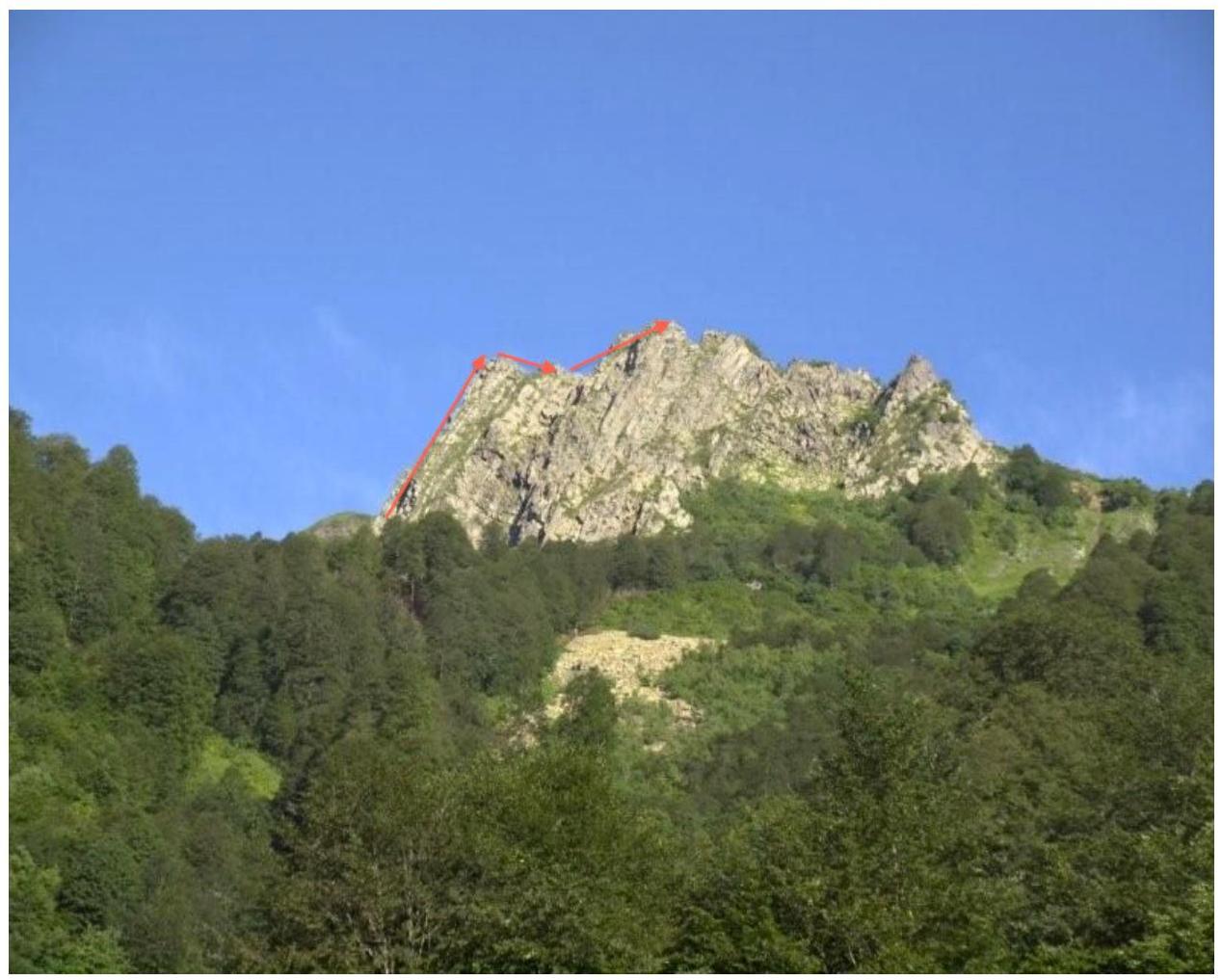
Achishkho massif, "Volchiy Zub", a characteristic rocky peak, is located above
Krasnaya Polyana, the team's route.
The route leads to the SE summit, and then to the Main summit.
SE-Main.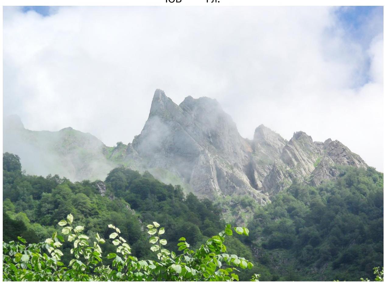
View from the SE, the route goes to the pointed SE summit via a characteristic
internal angle and then to the main summit. Map of the area. Krasnaya
Polyana.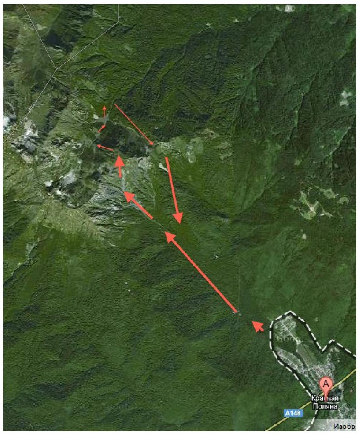
List of sections:
- route to the pointed SE summit
- movement along the characteristic internal angle
- transition to the main summit
| N | Length | Steepness | Character of relief | Category | Number of pitons |
|---|---|---|---|---|---|
| 1 | 100 | 40 | rocks with grass | 1-2 | 0 |
| 2 | 150 | 55 | rocks with grass | 3-4 | 12 |
| 3 | 50 | 80 | rocks | 4–5 (10 m) | 3 |
| 4 | 100 | 30 | ridge | 1-2 | 0 |

4 Volchiy Zub main
- The route starts from a couloir that rises upwards to the right in the direction of movement from the "Beshenka" stream.
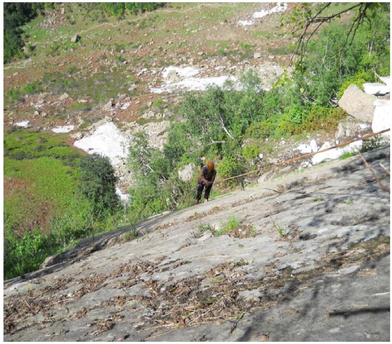
- Section 1: несложные поросшие травой скалы около 100 м выходят на кант ЮВ стены.
- Section 2: внутренний наклонный угол, подходит к вершинной башне.
- Section 3: несколько перехватов тянут на 5а, в целом лазание не сложное.
- Гребень between the SE and Main summits, category 1.
- Спуск with the Main summit to the NW, via наклонным плитам, 3 rappels of 30 m.
The route's difficulty can be compared to:
- "Vilka" on Mshatka in Crimea
- 26 on Chegetkaru with a traverse in
Prielbrusye.
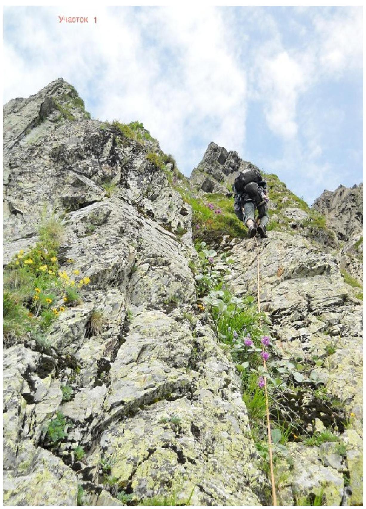
Photo illustration
of the report.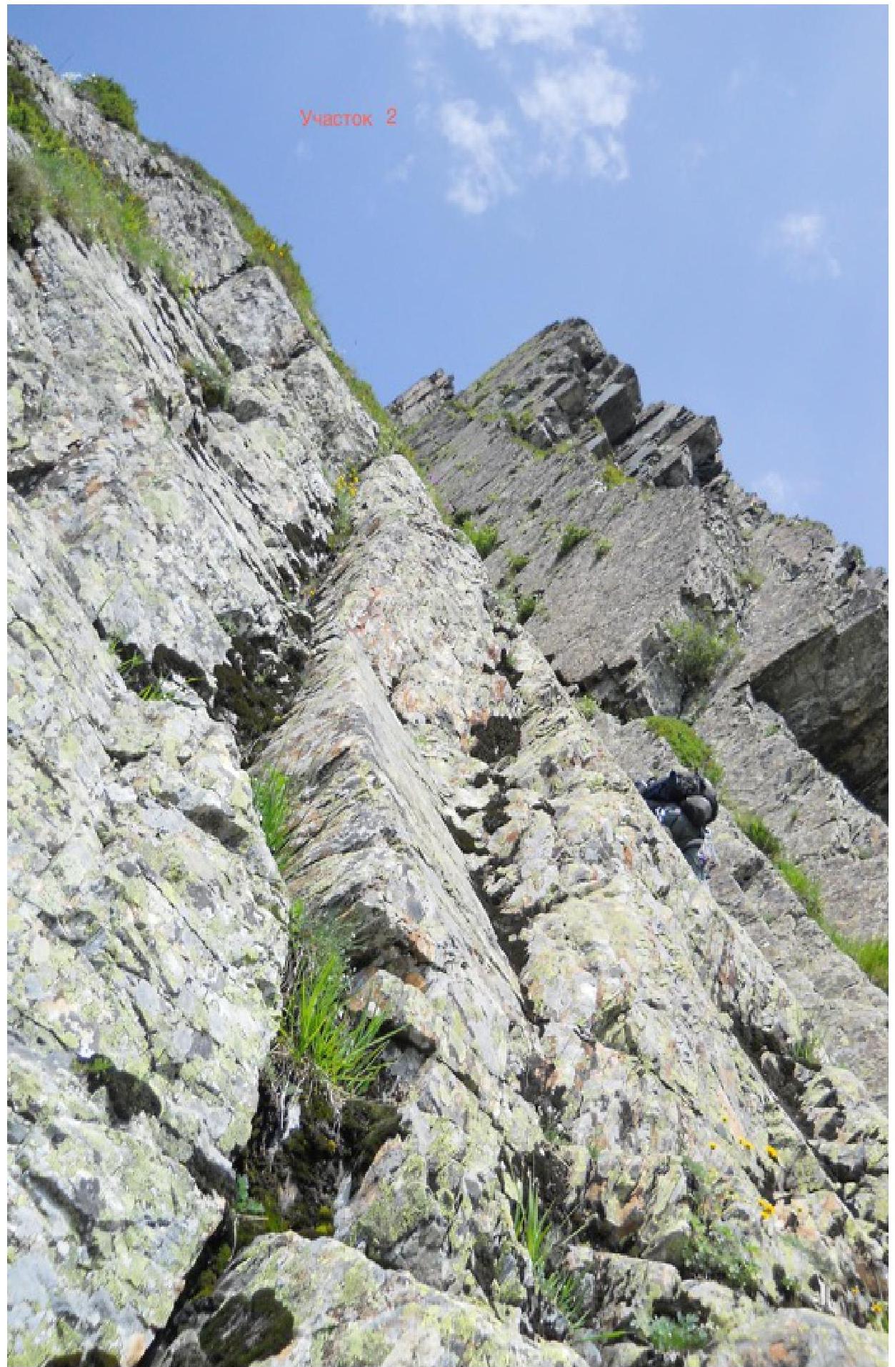
Section
2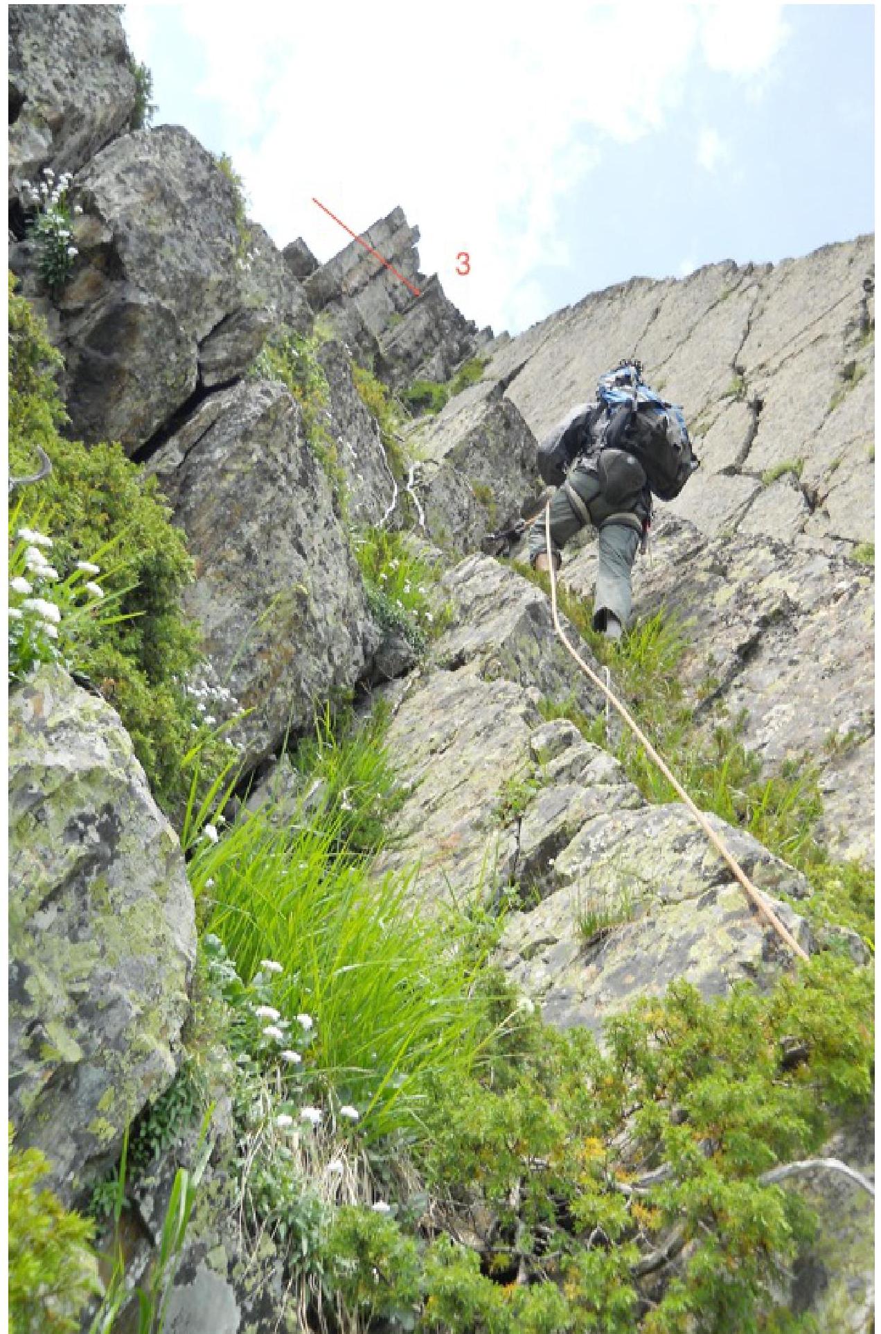 Гребень
между
вершинами.
Гребень
между
вершинами. Вершина.
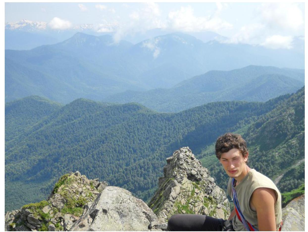 Спуск.