ASCENT DOCUMENT
-
Ascent type: rock climbing.
-
Ascent area: Arkhyz, Stavropol Krai, from the Kardyvach mountain area to Marukh Pass.
-
Peak, its height, and ascent route: VELINGRAD PEAK, 3160 m, via the north-eastern ridge.
-
Estimated difficulty category: 1B.
-
Route characteristics:
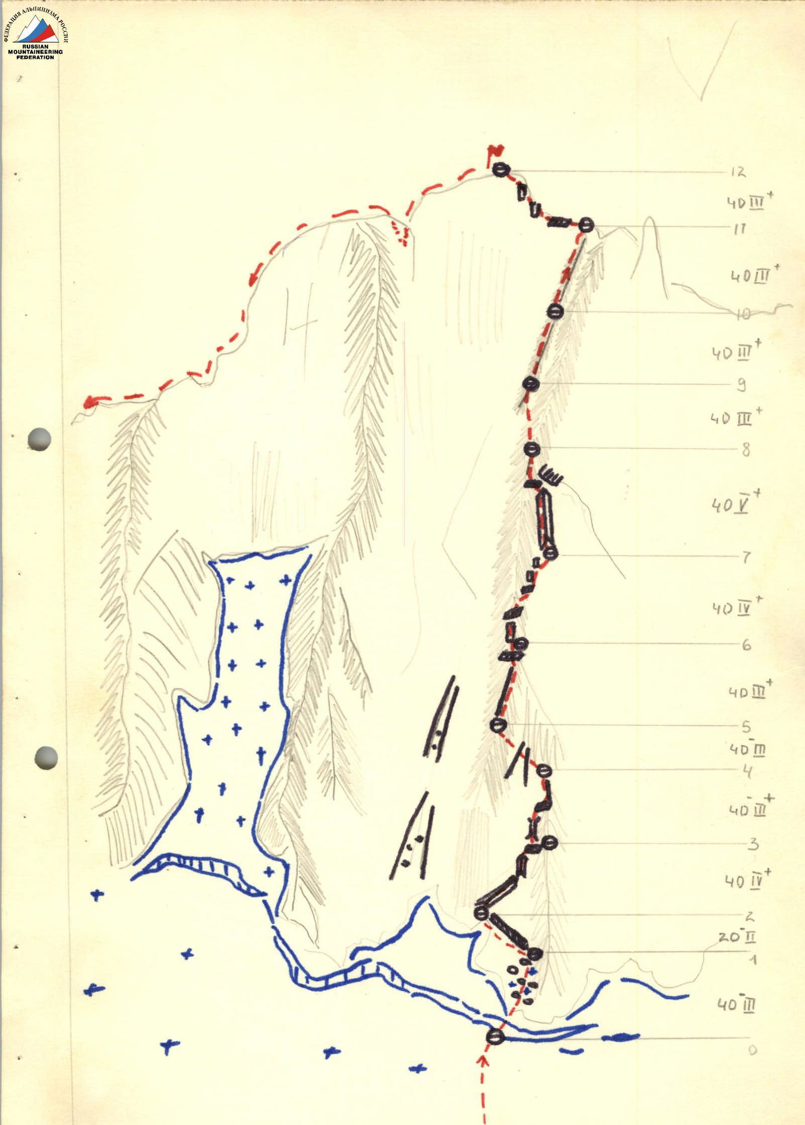
Elevation gain: 410 m, average steepness: 30° Route length:
D.F.C. 1 2 3 4 5 6 m 210 160 5 - - -
-
Piton usage:
FOR PROTECTION FOR CREATING I.T.O. rock 4 ice none bolt none -
Total climbing hours: 12 hours.
-
Number of nights and their characteristics: none.
-
Surname, name, patronymic of the leader and participants, and their sports qualification:
SHALOVAY VALENTIN PETROVICH — Master of Sports BOBLEV VLADIMIR DMITRIEVICH — 3rd sports category SAVVIN SERGEY GEORGIEVICH — 3rd sports category ZAKHAROV SERGEY VLADIMIROVICH — 3rd sports category
-
Team coach: GORDA R.A.
-
Date of departure and return: September 14, 1978.
DESCRIPTION
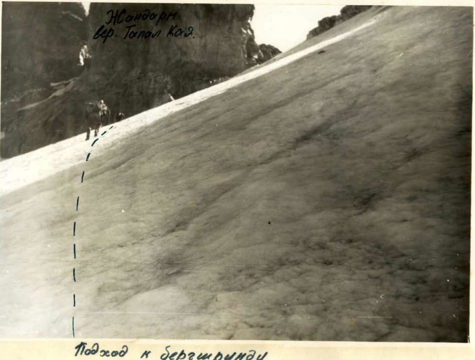
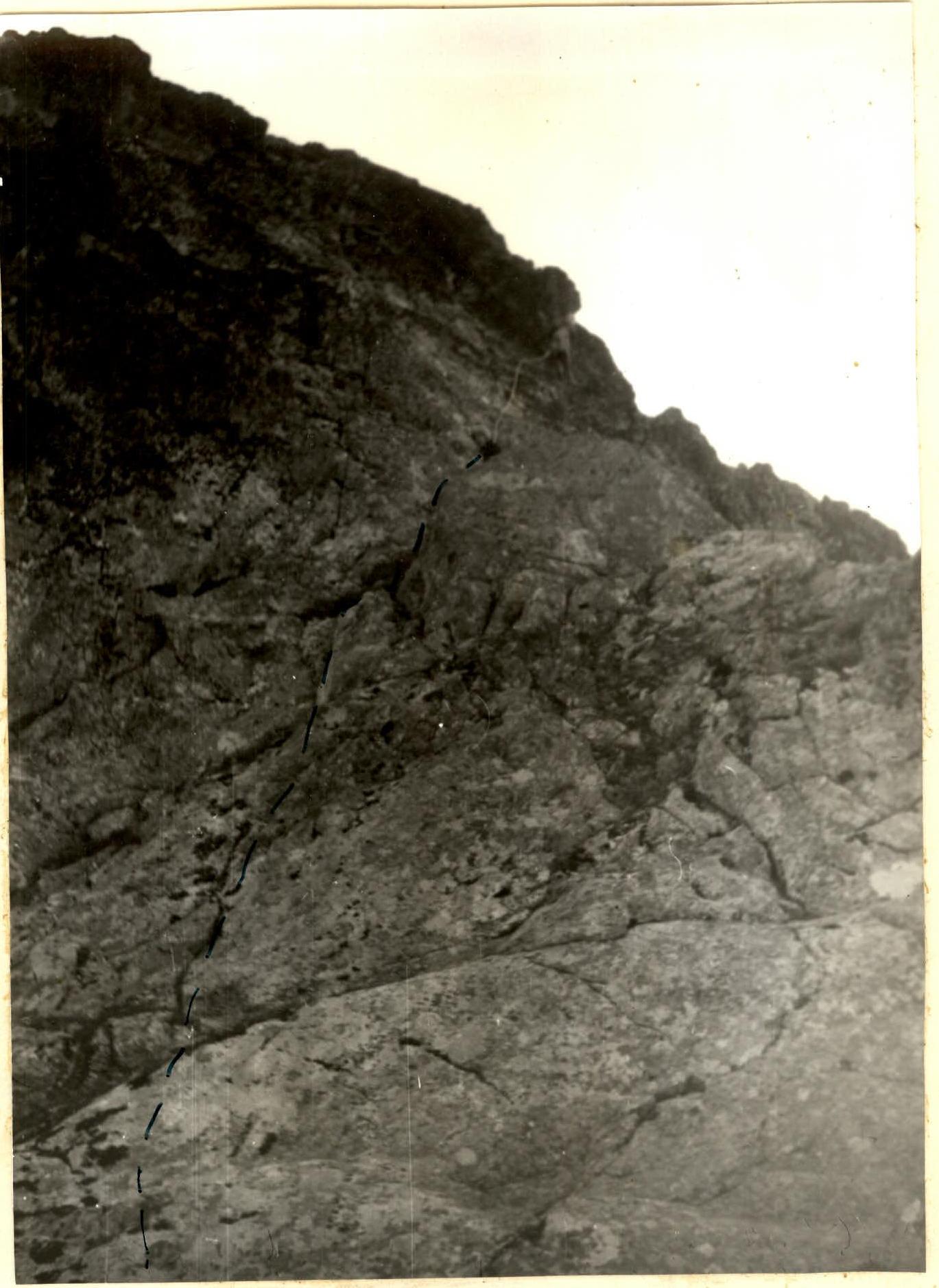
First ascent of a nameless peak, named Velingrad Peak, via the north-eastern ridge, approximately 1B difficulty category. From the base camp to Sofiysky glacier — 4 hours. The glacier is crossed from west to east, to the right of the central part of the upper plateau, avoiding crevices and heading towards a small peak called Topal-Kaya, to a large boulder on the glacier. The route begins from the boulder and initially heads towards the saddle between Topal-Kaya and Velingrad. Between these peaks, a snow slope is cut by a wide bergschrund. Up to the bergschrund, the snow slope has a steepness of 35–40°. Move in teams towards the left edge of the bergschrund, under the large "gendarme" of Topal-Kaya. The bergschrund is traversed near the rocks with a descent into it. The descent is made from a small rock ledge to a depth of 8 m. Protection!!! From the bergschrund, along the rocks, straight up, exiting onto a snow slope, which leads to the saddle. Reaching the saddle takes 1 hour. From the saddle, move right along a heavily destroyed, gentle ridge to a small overhanging rock, which is bypassed on the left via a ledge. Further along a wide ridge to gentle, smoothed rocks forming a small wall with a steepness of 60°. Up the wall "head-on" for 3–4 m, then left for 3 m, exiting onto a large boulder. Convenient protection spot! From the spot, move right and up 18–20 m along the wall with a steepness of 60–65° to a gentler slope. Then straight up 10–12 m (piton!) to a narrow, gentle ledge that goes left. From it, up to the ridge. The ridge is wide, heavily destroyed with depressions up to 7–8 m. Along the ridge, 2 rope lengths to the pre-summit "gendarme", which is slightly lower than the summit. It is bypassed on the left with a descent down into a dip of 2–3 m. From the dip, up along the right side of the outer corner of the wall, 10–15 m high with a steepness of 75–80°, then straight up the corner to the summit. Piton protection!! The summit is slightly dome-shaped with steep walls on all sides. At the highest point, a cairn is built. The peak's height is 3110 m. The ascent from the saddle to the summit took 2 hours. Descent via the ascent route. The descent to the glacier takes 1–1.5 hours.
Gendarme Topal Kaya peak.
Approaching the bergschrund
On the route