REPORT
on the first ascent of the route
to the summit
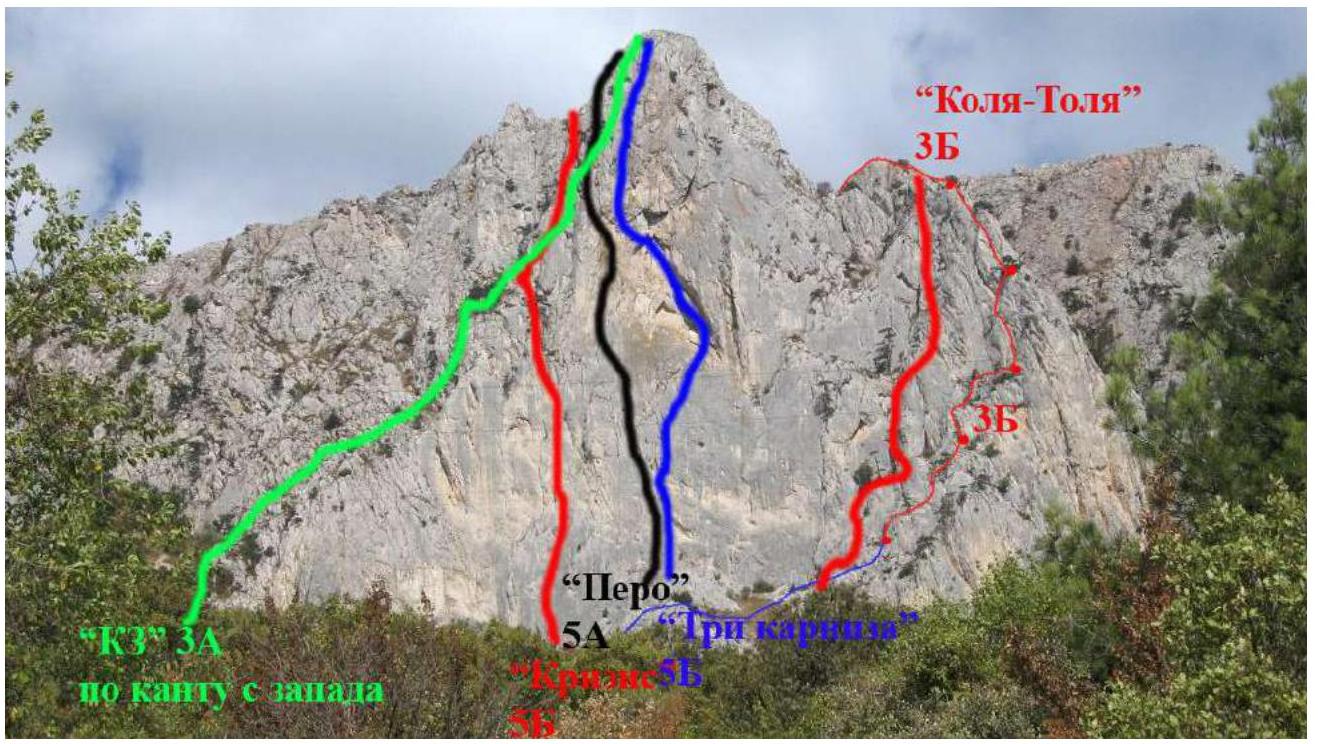
Maly Kilse-Burun 600 m
Republic of Crimea, Foros settlement area
route "K3"
along the western edge
proposed 3A category of difficulty (rock climbing) May 16, 2023
Participants:
Temerev Ivan Mikhailovich, Master of Sports, Saraev German Igorevich, 2nd sports category, Tarasova Olga Sergeevna, 3rd sports category, Zverev Oleg Valentinovich, 3rd sports category, Moskalenko Viktor Evgenievich, 3rd sports category, Panova Elena Mikhailovna, 3rd sports category
I. ASCENT DOCUMENTATION
| № | 1. General Information | |
|---|---|---|
| 1.1 | Full name, sports rank of the leader | Temerev Ivan Mikhailovich, Master of Sports |
| 1.2 | Full name, sports rank of participants | Zverev Oleg Valentinovich, 3rd sports category, Saraev German Igorevich, 2nd sports category, Tarasova Olga Sergeevna, 3rd sports category, Moskalenko Viktor Evgenievich, 3rd sports category, Panova Elena Mikhailovna, 3rd sports category |
| 1.3 | Full name of the coach | Temerev Ivan Mikhailovich, Master of Sports |
| 1.4 | Organization | Tomsk Alpinism Federation and KAIS MEI |
| 2. Characteristics of the Ascent Object | ||
| 2.1 | Region | Crimea, Foros |
| 2.2 | Ridge | Southern coast of Crimea |
| 2.3 | Section number according to the 2020 classification table | 1. CRIMEA |
| 2.4 | Name and height of the summit | Maly Kilse-Burun, 600 m |
| 2.5 | Geographical coordinates of the summit (latitude/longitude), GPS coordinates | N 44.410638 E 33.81906 |
| 3. Characteristics of the Route | ||
| 3.1 | Name of the route | "K3" along the western edge |
| 3.2 | Proposed category of difficulty | 3A |
| 3.3 | Degree of route development | First ascent |
| 3.4 | Nature of the route terrain | Rock climbing |
| 3.5 | Elevation gain of the route (GPS data) | 260 m |
| 3.6 | Length of the route (in meters) | 337 m |
| 3.7 | Technical elements of the route (total length of sections of varying difficulty with terrain type) | Entirely rock climbing: I category - 50 m, II category - 110 m, III category - 50 m, IV category - 50 m, IV+ category - 52 m, V category - 15 m |
| 3.8 | Descent from the summit | Along the trail on the yayla towards the road to Baydarskie Vorota |
| 3.9 | Additional route characteristics | |
| 3.10 | Equipment used | Rock anchors (10 pcs.), set of friends, set of stoppers, 12-15 quickdraws |
| 4. Characteristics of the Team's Actions | ||
| 4.1 | Time on the move (team's climbing hours) | 7 hours |
| 4.2 | Overnight stays | -- |
| 4.3 | Start of the route | 10:00, May 16, 2023, beginning of work on the route |
| 4.4 | Reaching the summit | 16:00 - first, 17:30 - last |
| 4.5 | Return to base camp | 19:00 |
| 5. Person responsible for the report | ||
| 5.1 | Full name, e-mail | Temerev I.M., ivantem@ngs.ru |
II. ASCENT DESCRIPTION
1. Characteristics of the Ascent Object
1.1. General photo of the summit
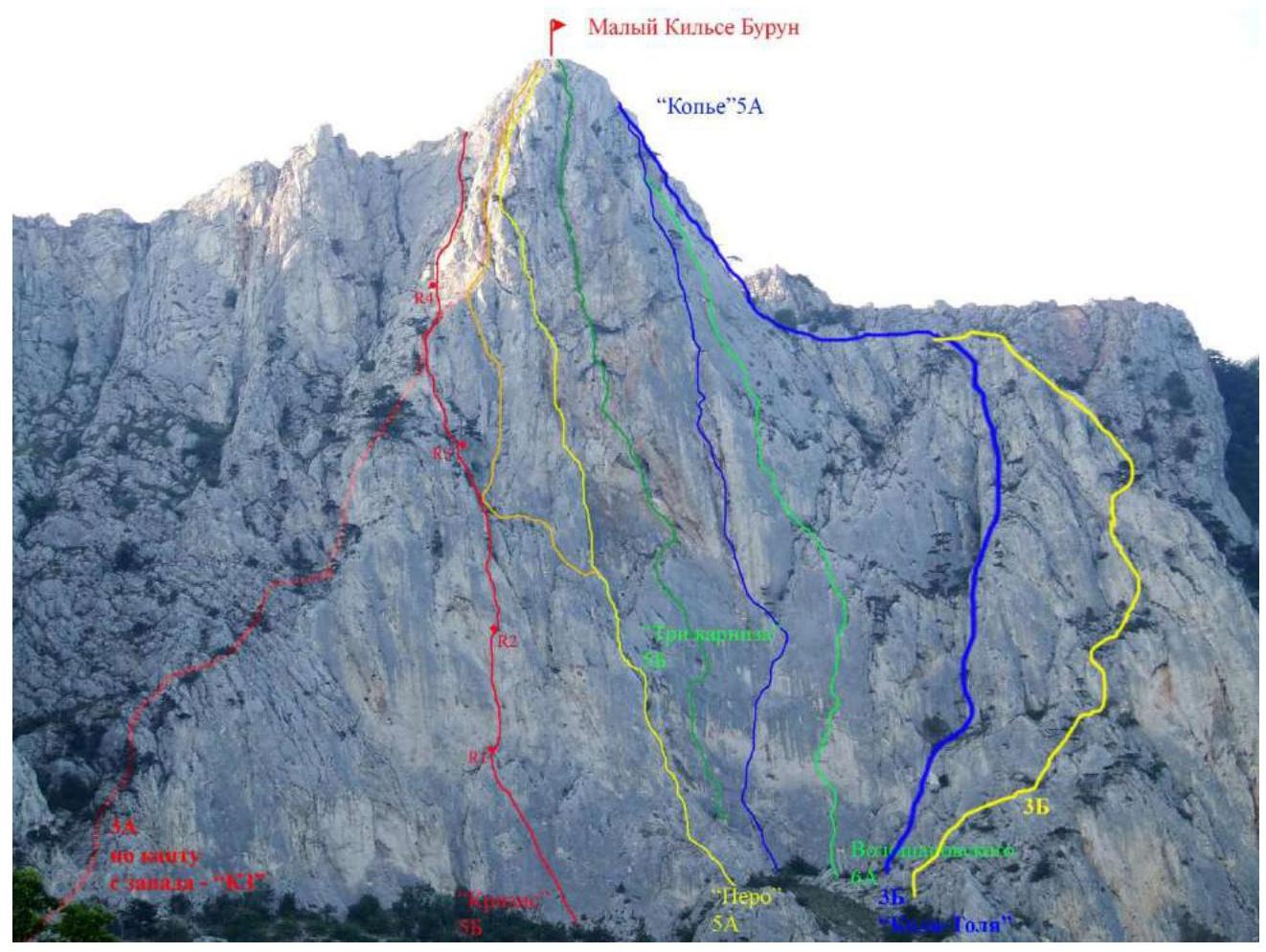
1.1.1. General photo of the summit
1.2. Technical description of the route:
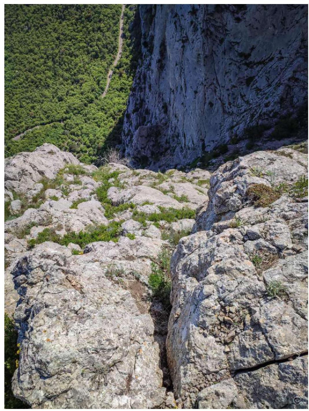
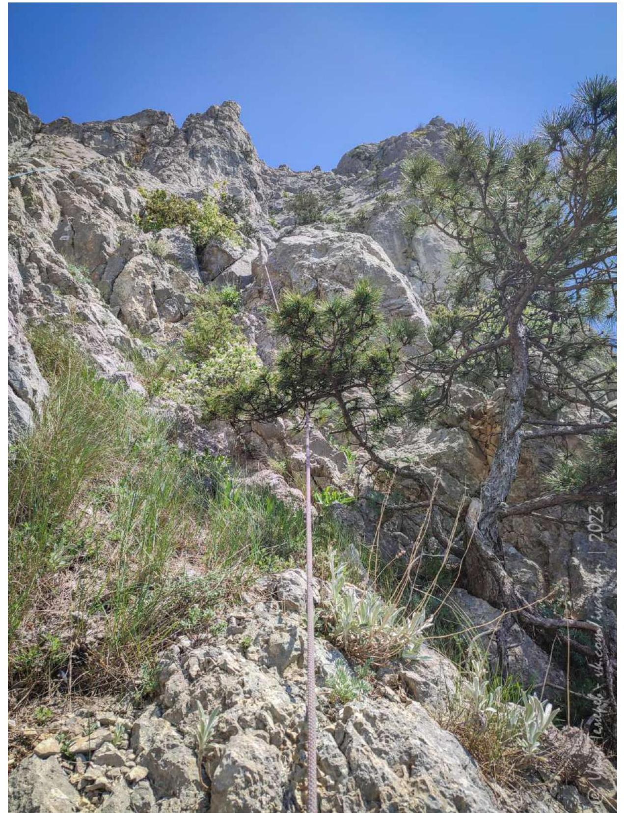
Turn off the upper highway onto the trail leading to the Kiev couloir. The start of the route is after the end of the steep southern wall of Maly Kilse-Burun at the entrance to the couloir along the western edge.
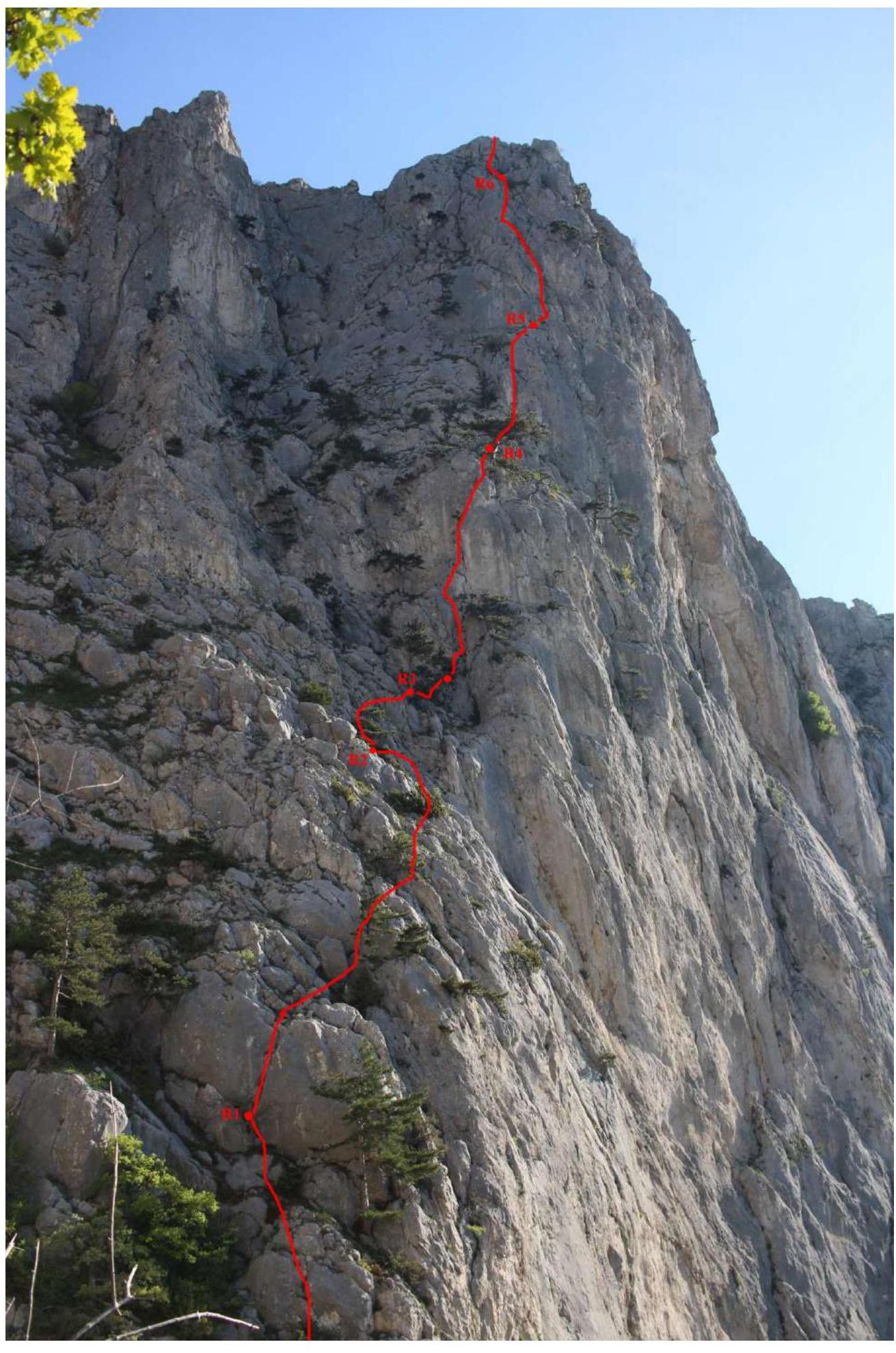
R0-R1: 55 m. Easy climbing on broken rocks 45-65° (II). Station on a tree before the wall.
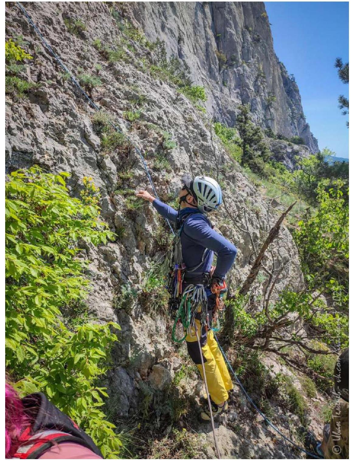
R1-R2: 55 m. 8 m wall with a crack 90° (III). Then straight up 45° (I-II). Station on a tree.
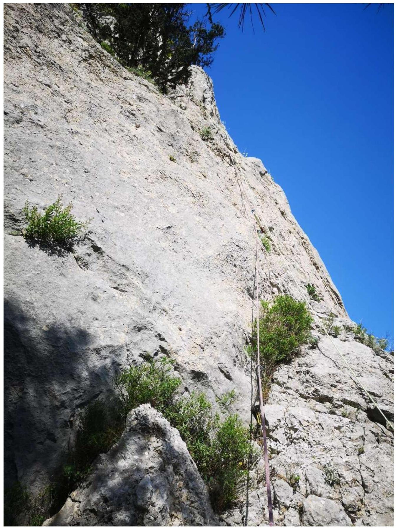
R2-R3: 30 m. Traverse right and slightly up (I-II). Station on a large pine tree. After gathering the rope, move 10 m forward (easy) to a small pine tree under the key section. When working on the rock, it is recommended not to have more than one person on this station at a time - falling rocks are possible from above.
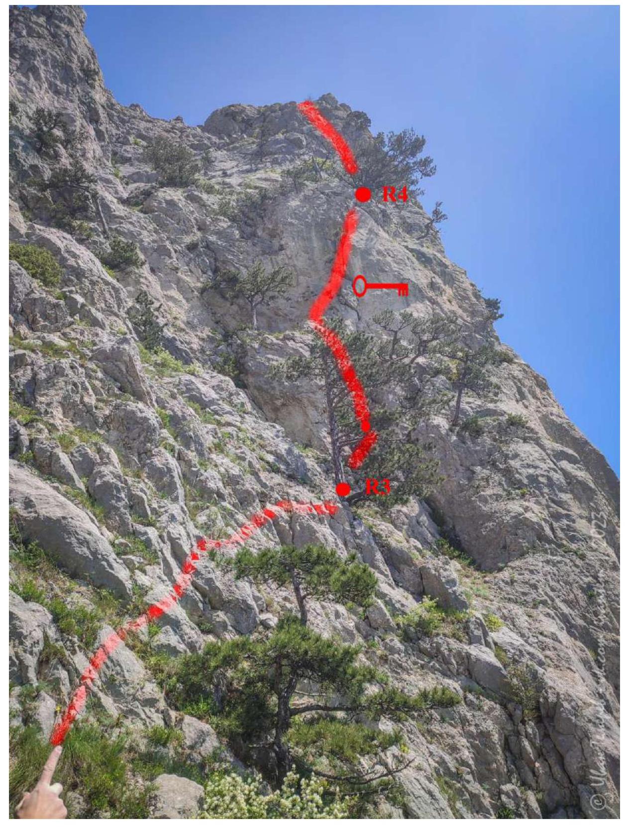
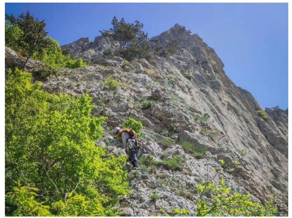
R3-R4: 40 m. Key section of the route:
- Up the inner corner and left to a ledge in a rock mulde 12 m (IV+)
- Then right and up the slab 3 m (V)
- Up the inner corner another 20 m (IV)
- And 10 m (III)
Station on a thick pine tree. Protection: 3 stoppers, three anchors, and two camalots. Many loose rocks, climbing requires utmost care!
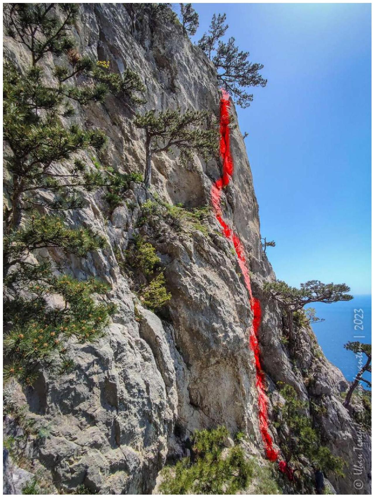
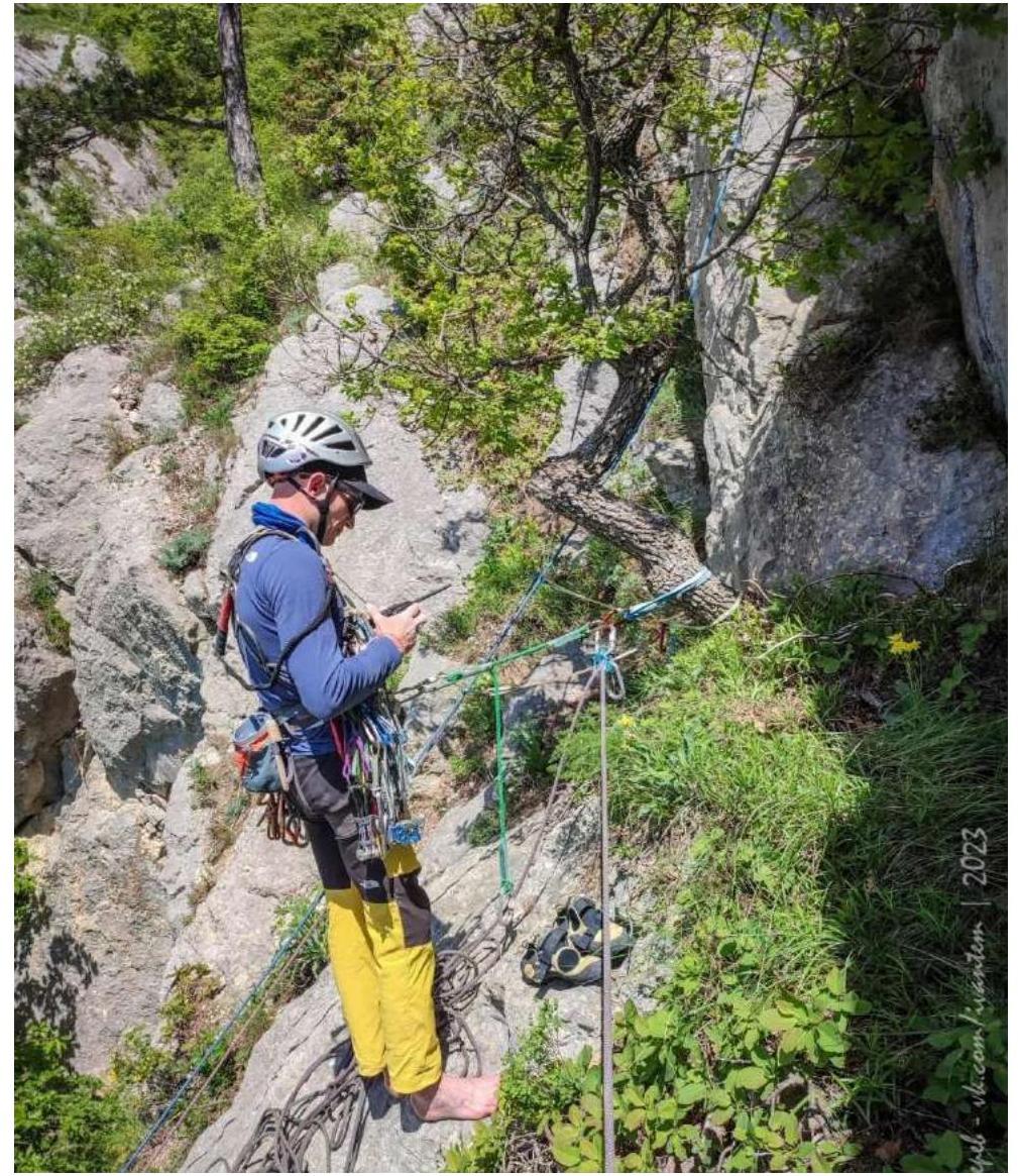
R4-R5: 50 m. 10 m walking under the wall with a crack. Then up 40 m 70-90° (IV+). Protection: two anchors, two friends, tree. Station: bolt and friends on a sloping slab under a vertical wall.
R5-R6: 55 m.
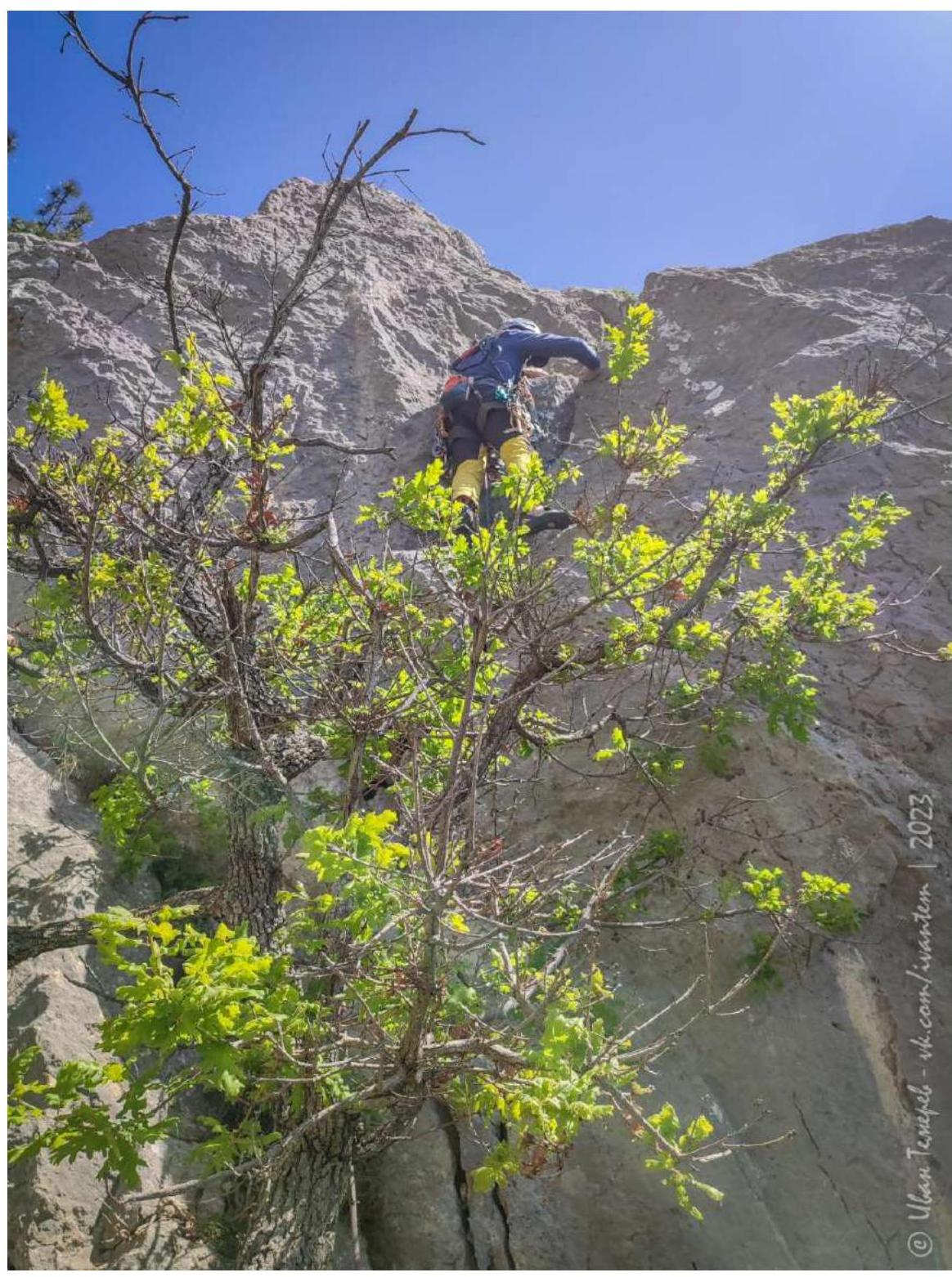
- Right into the inner corner on a vertical wall 10 m 90° (V) - friend, anchor.
- Then up and left 20 m 80° (IV) - two friends, two stoppers, anchor - wide chimney.
- After the "tooth" up the wall to the right 10 m 80° (IV).
- 15 m on cascades 70-80° (III). Station on the right on own protection on a ledge in small bushes.
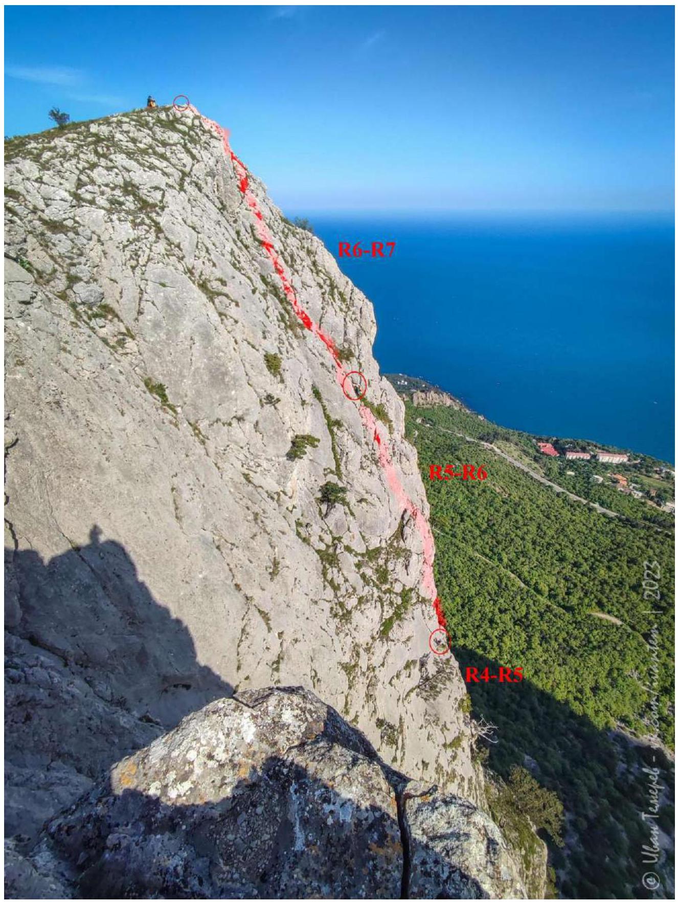
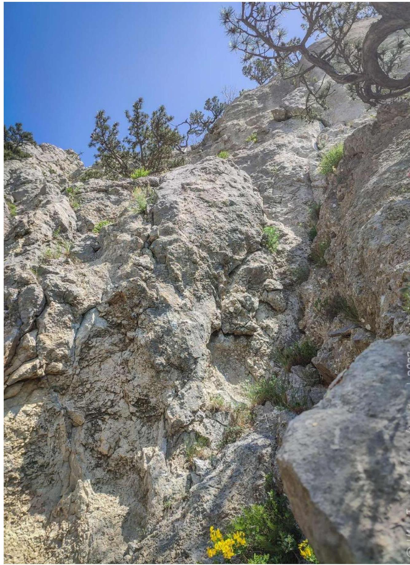
R6-R7: 30 m.
On slabs and walls with grass 70-60° (II-III). Loose rocks are present. Exit onto the yayla. There is a glued anchor and a bolt on the summit.