
Report on the Ascent to the Summit of Ay-Petri Eastern via the Eastern Part of the Wall on the Route "Prazdnik Neposlushaniya" 6A Category of Complexity by the Team from Mukhalatka Settlement from 14:00 on March 14, 2020, to 17:00 on March 15, 2020
I. Ascent Passport
| 1. General Information | ||
|---|---|---|
| 1.1 | Full Name, Sports Rank of the Leader | Lisin Alexander Alexandrovich, Candidate for Master of Sports |
| 1.2 | Full Names, Sports Ranks of Participants | Vlasenko Alexey Sergeevich – no rank, Umnov Anton Sergeevich – no rank, Lisin Alexander Alexandrovich – Candidate for Master of Sports |
| 1.3 | Full Name of Coach | Kruglov Yuri Igorevich – Master of Sports |
| 1.4 | Organization | none |
| 2. Characteristics of the Ascent Object | ||
| 2.1 | Region | Russian Federation, Crimean Federal District, Miskhor Settlement |
| 2.2 | Valley | |
| 2.3 | Section Number according to the 2013 Classification Table | |
| 2.4 | Name and Height of the Summit | Ay-Petri Eastern 1100 m, via the eastern part of the wall, route by Michel Mischelevich, Kiev |
| 2.5 | Geographical Coordinates of the Summit (latitude/longitude), GPS Coordinates | |
| 3. Route Characteristics | ||
| 3.1 | Route Name | "Prazdnik Neposlushaniya" |
| 3.2 | Proposed Category of Complexity | 6A |
| 3.3 | Degree of Route Exploration | Second Ascent |
| 3.4 | Nature of the Route Terrain | Rocky |
| 3.5 | Height Difference of the Route (altimeter or GPS data) | |
| 3.6 | Route Length (in meters) | 315 m |
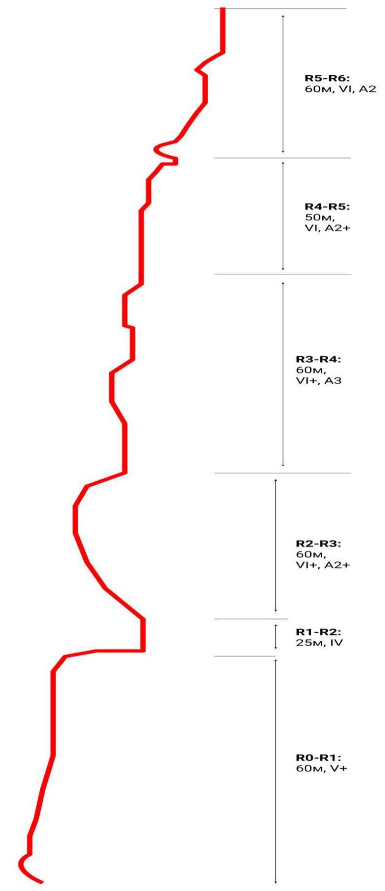
| 3.7 | Technical Elements of the Route (total length of sections of varying complexity with indication of terrain type: ice-snow, rocky) | IV category rocky – 25 m. V-VI category rocky – 290 m. Rocky VI, A3 – 60 m |
| 3.8 | Average Steepness of the Route, (°) | 85 ° |
| 3.9 | Average Steepness of the Main Part of the Route, (°) | 90 ° |
| 3.10 | Descent from the Summit | Via Koreizskaya Trail, no category |
| 3.11 | Additional Route Characteristics | Presence (absence) of water |
| 4. Characteristics of Team Actions | ||
| 4.1 | Time of Movement (team's walking hours, in hours and days) | 17 hours |
| 4.2 | Overnights | no |
| 4.3 | Time of Route Processing | no |
| 4.4 | Exit to the Route | March 14, 2020, at 08:30 |
| 4.5 | Summit Ascent | March 14, 2020, at 19:00 |
| 4.6 | Return to Base Camp | March 15, 2020, at 16:00 |
| 6. Responsible for the Report | ||
| 6.1 | Full Name, e-mail | Lisin A. A. lisinkaldun@yandex.ru |
II. Ascent Description
1. Characteristics of the Ascent Object. Mount Ay-Petri Eastern, "Prazdnik Neposlushaniya" (M. Voloshanovsky, 2013), 300 m, VI+, A3, 6 sections
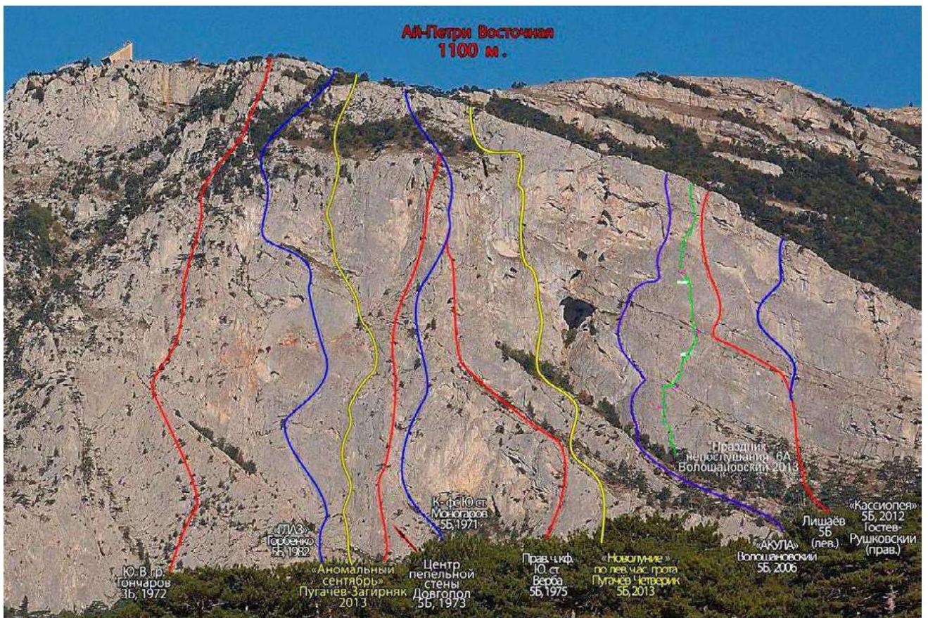
The summit of Ay-Petri Eastern is located above the Miskhor settlement. The height above sea level is 1100 m, with a maximum wall height difference of about 450 m. The rock is mainly monolithic.
- The left part of the massif has classic routes of medium complexity.
- The central part of the massif is rarely visited, featuring the most complex routes.
- The right part of the wall, known as the Eastern Bastion, is very rarely visited and mysterious in terms of routes.
General observations about the wall:
- Comparable in length to Forcant, but wider.
- Possibly a leader in terms of architecture in Crimea, especially noticeable when walking nearby.
- Among the least visited, along with Alupka wall, Big Canyon group, Spirada, and Demerdzhi.
The approach to the wall is via Koreizskaya Trail, also known as Miskhorskaya Trail, which is the shortest route to the summit of Ay-Petri. The trail is not difficult and is well-trodden. The trail length is 11 km, taking 3-4 hours. The final ascent is steep and challenging.
Key landmarks:
- Fork in the road on the 8th km of the new Sevastopol highway
- Spring near the forester's gazebo
- Second spring
- Voronya Rock
- Pine tree
- Airplane
- Thousand-year-old yew
- Ay-Petri teeth
- Meteorological station
From Alupka, Miskhor, Gaspra, and Koreiz, it's best to ascend Ay-Petri via Koreizskaya Trail, starting where the Sevastopol highway branches off towards Gaspra, Miskhor, and Koreiz.
From the fork (stone signpost "Sevastopol-72 — Yalta-9"), follow a noticeable dirt road. Landmarks include arrow signs and Voronya Rock, visible from the highway to the right of the Ay-Petri wall.
Ascending from the forest along the ledge leading to Miskhor Grotto, notice the rocks appearing to the right, 10-15 m to the right of the trail. Initially, the first 30-40 m are gentle and low, then they become a monolithic overhang directly from the ground.
Proceeding along the overhang towards Miskhor Grotto for 30-40 m, you'll reach the most extensive flat area (resembling a camping spot), 15-20 m before extensive ivy growth. Generally, it's 30-40 m to the right of the start of "Acula".
The route's start is marked. Begin from a tree (black strap around the trunk), whose upper branches touch the vertical rock. The route's start is clearly visible – a long gap on an inclined slab with a tree 30 m above ground. To the left is a smooth monolith.
Drawn profile of the route
2. Route Characteristics
Technical photo of the route.
Technical photo of the route.
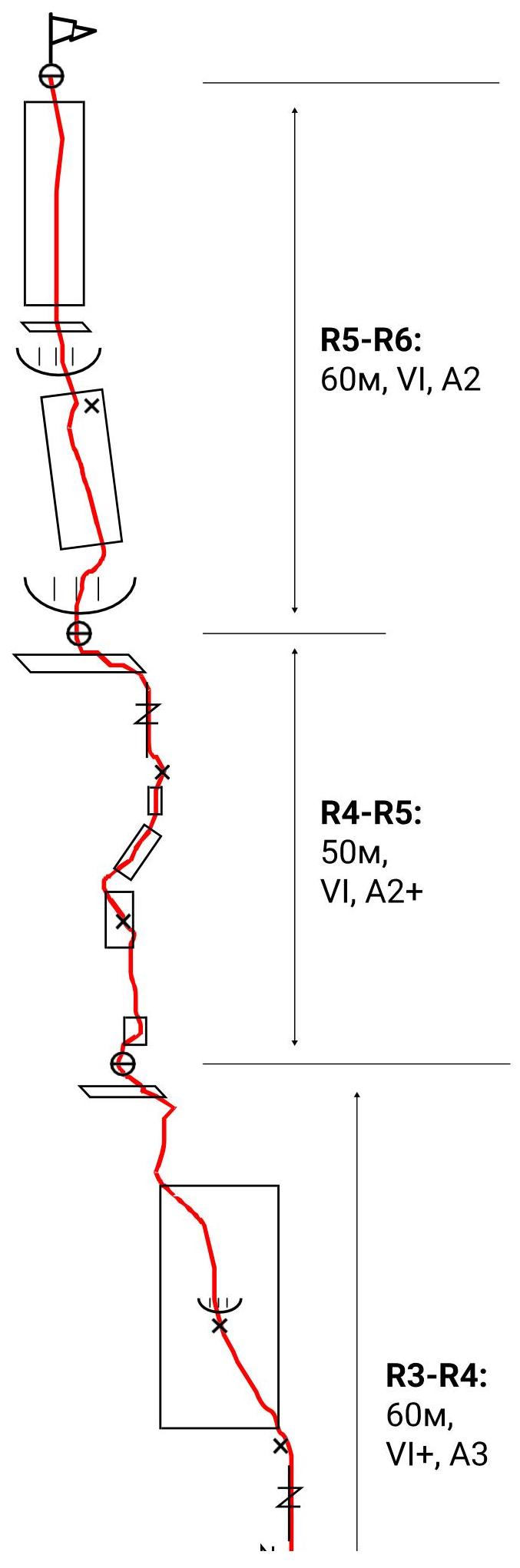
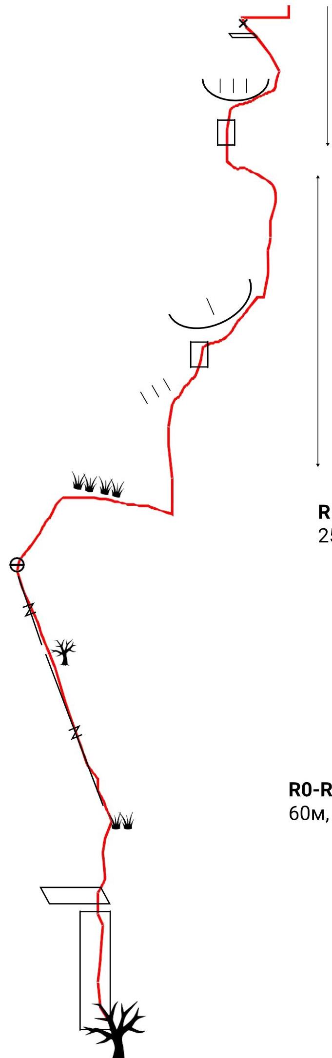
ROUTE SCHEME
R2–R3: 60 m, VI+, A2+
R1–R2: 25 m, IV
R0–R1: 60 m, V+
| Section # | Name and Number of Pitons Bolts as Intermediate Belay Points (and Stationary Pitons) | Anchor Pitons and Fifths (including ITO) | Friends (including ITO) | Stoppers (including ITO) | Skyhooks | Section Complexity in Symbols | Section Length, m | Steepness, ° |
|---|---|---|---|---|---|---|---|---|
| 1 | - | 5 | 6 | 1 | - | V+ | 60 | 80 |
| 2 | - | 1 | 1 | - | - | IV | 25 | 60 |
| 3 | 1(1) | 9(7) | 8(6) | 2(2) | - | VI+, A2+ | 60 | 95 |
| 4 | 3(1) | 10(10) | 5(5) | 4(4) | 12 | VI+, A3 | 60 | 90 |
| 5 | 2(1) | 8(6) | 3(3) | 2(2) | 7 | VI, A2 | 50 | 90 |
| 6 | 1 | 3 | 5(2) | - | - | VI, A2 | 60 | 85 |
3. Characteristics of Team Actions
| Section # | Description | Photo Number |
|---|---|---|
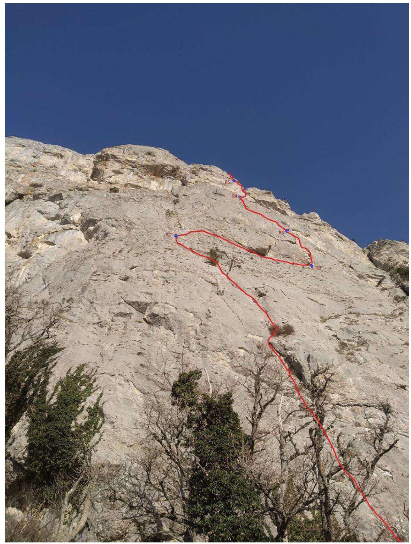
| R0–R1: 60 m, V+ | First, climb the tree to the upper branches, then transfer to the wall. Along the destroyed slab (15 m V+), reach a ledge. From it, approach the angle between the chip and the wall and then along it (10 m V) exit right onto the top of the chip. Then, through a system of cracks, left-up to a dry pine and further to a juniper (15 m V). Next, along an inclined crack (15 m V) to its end. Station slightly higher on a ledge (bolt present). | Photo 1, 2 |
| R1–R2: 25 m, IV | From the station, right-up along slabs and ledges (7 m IV) to a large inclined shelf. Along it, right-down (18 m no category) to a tree. Station. There's a bolt on the wall. | Photo 3, 4 |
| R2–R3: 60 m, VI+, A2+ | From the shelf up under the cornice (7 m VI+ A1) to a local piton. Then ITO right under the cornice (10 m A2). Next, along a slab (12 m VI A2) to a bolt. After it, under the second cornice. Under it, right (12 m A2+), exit into a vertical inner corner. Up it (10 m VI A2). Through simple rocks, reach a large shelf. Station, two bolts. | Photo 5, 6 |
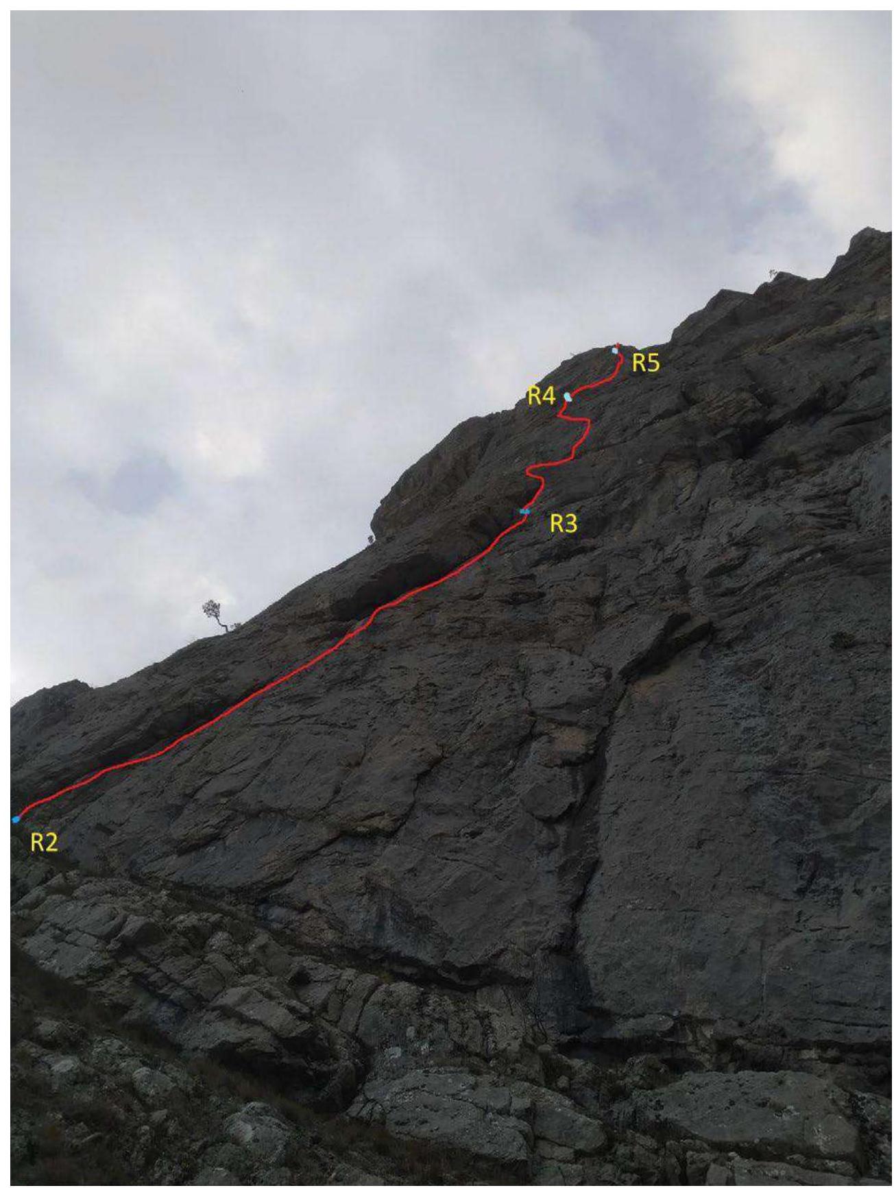
| R3–R4: 60 m, VI+, A3 | Along a slab 5 m to approach under an overhang. Immediately behind the overhang, a hole for a skyhook. Through a local piton, approach under the cornice. Under the cornice, right | 5 m A2. Further up along a slab and up-left along a wide crack (7 m) to a ledge (bolt). From the ledge, traverse (5 m V+) along a horizontal crack to a system of monolithic cracks. Up them (10 m A2) to a bolt. From it, up and slightly left, 4 skyhook moves along holes to a small crack under an anchor. From it, more holes in the direction of a small cornice (bolt). After it, along holes left-up (small crack for a pair of anchors) to a small inner corner-chip. Along it, 5 m to exit onto a shelf. Station on bolts. Rope is tangled, use extending loops. |
| R4–R5: 50 m, VI, A2+ | From the station, up two holes to a crack. Along it, 5 m to exit onto a gentle destroyed slab with cracks and chips. Up it, 15 m (alternating between climbing and ITO, bolt present). From a small ledge, right-up along holes (12 m A2+, local piton) to exit into a hollow. Along it, 3 m to approach a bolt. From it, exit left onto a crack. Further up along a hanging, sometimes interrupted, and rotated crack (10 m A2+). After it, a climb left-up onto a large shelf under the cornice. Station on bolts. | Photo 9, 10 |
| R5–R6: 60 m, VI, A2 | Through the cornice directly (VI, A2) and then up along slabs 12 m (alternating between climbing and ITO) to approach under the second cornice. Climbing through the cornice (V+) and then along cracks and slabs (20 m V) up (not going right into a large chimney) to exit onto a plateau. Station on the nearest tree. | Photo 11, 12 |
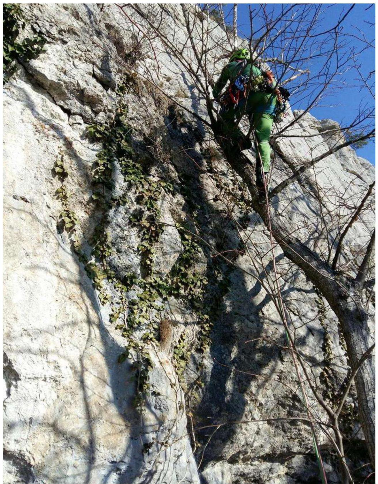
Photo 1. Start.

Photo 2. View down from R1.
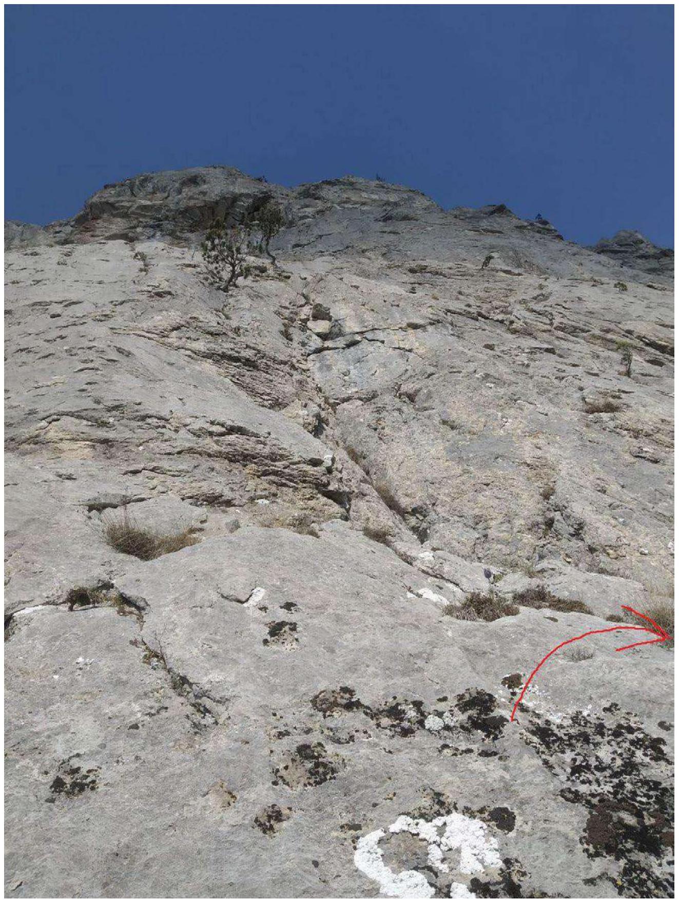
Photo 3. View up from R1. Climb right, along the arrow.
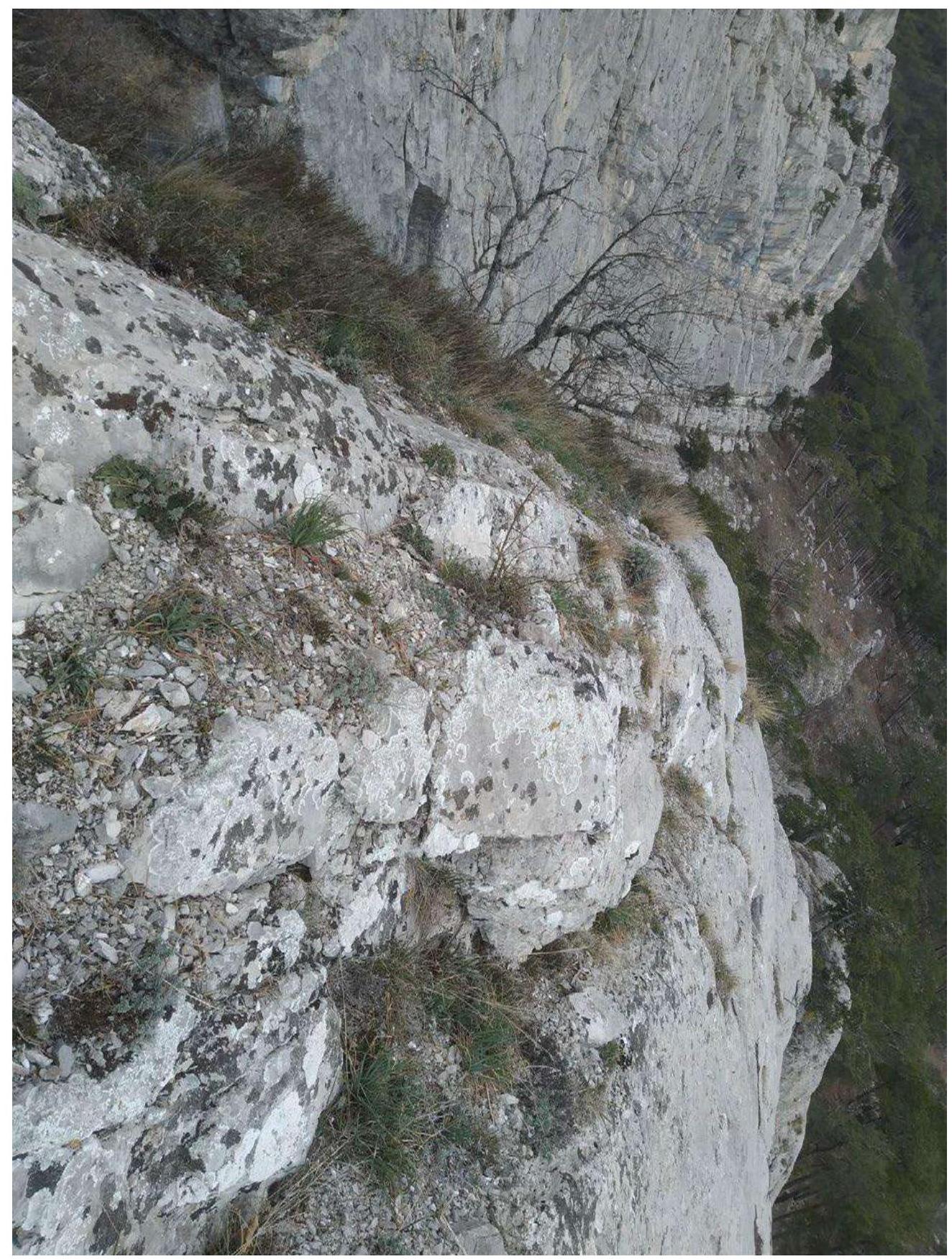
Photo 4. R1–R2, inclined shelf.
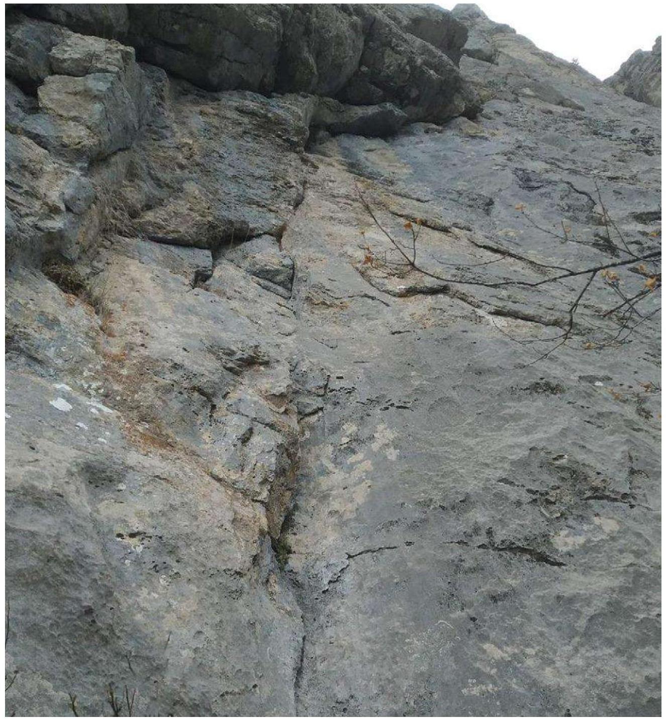
Photo 5. R2
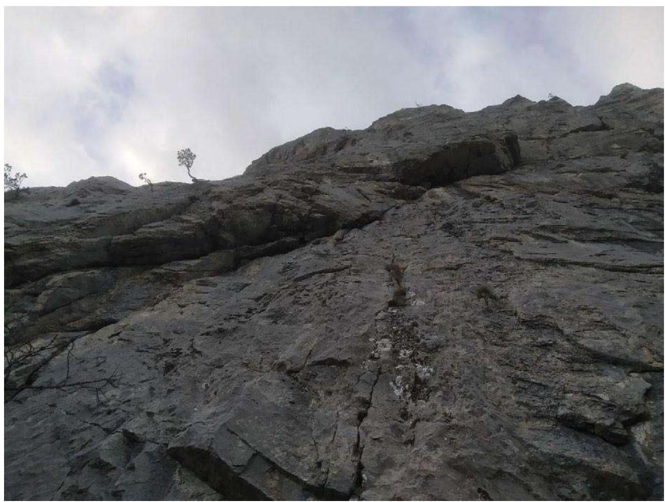
Photo 6. Cornices on R2–R3, side view.
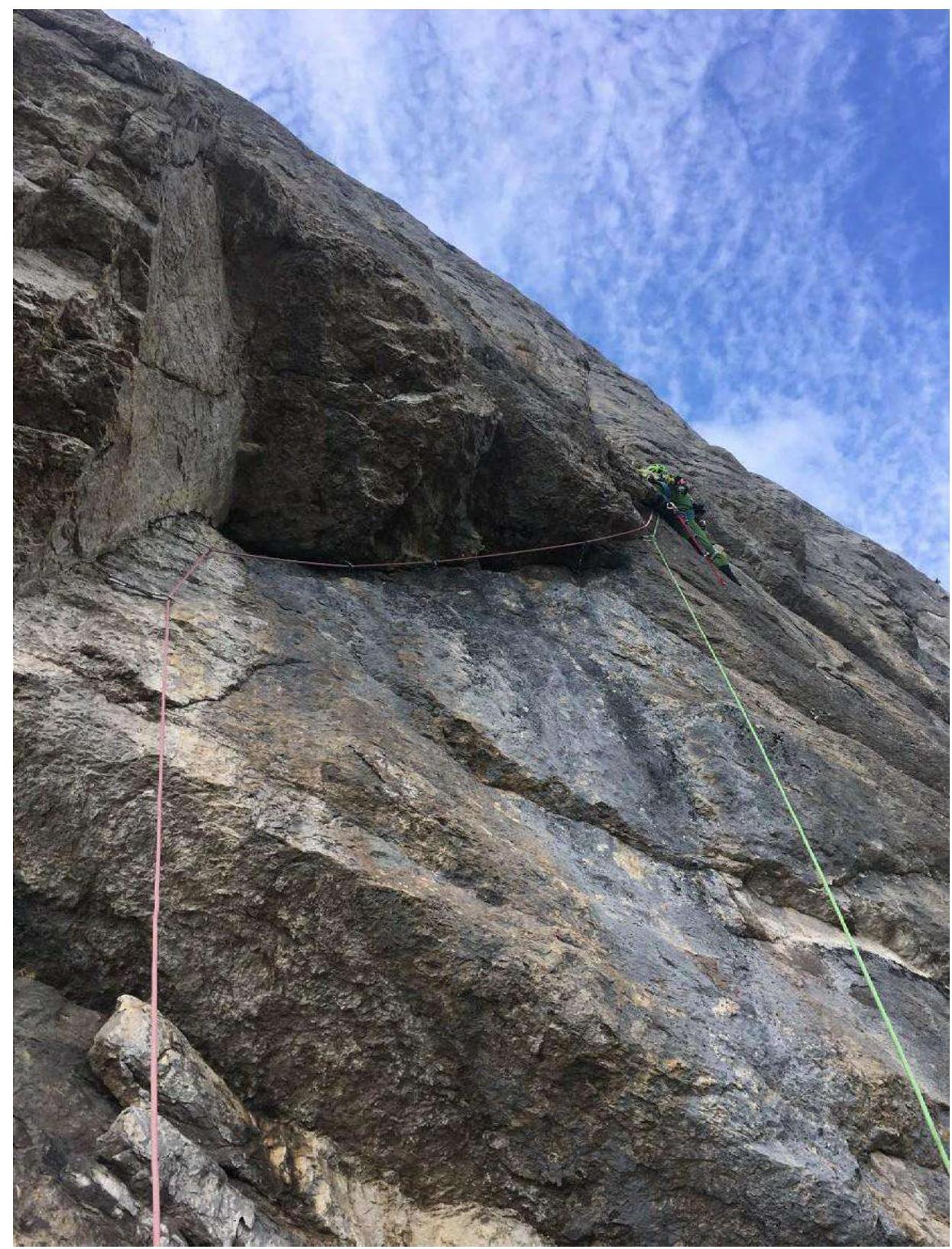
Photo 7. Start of R3–R4.
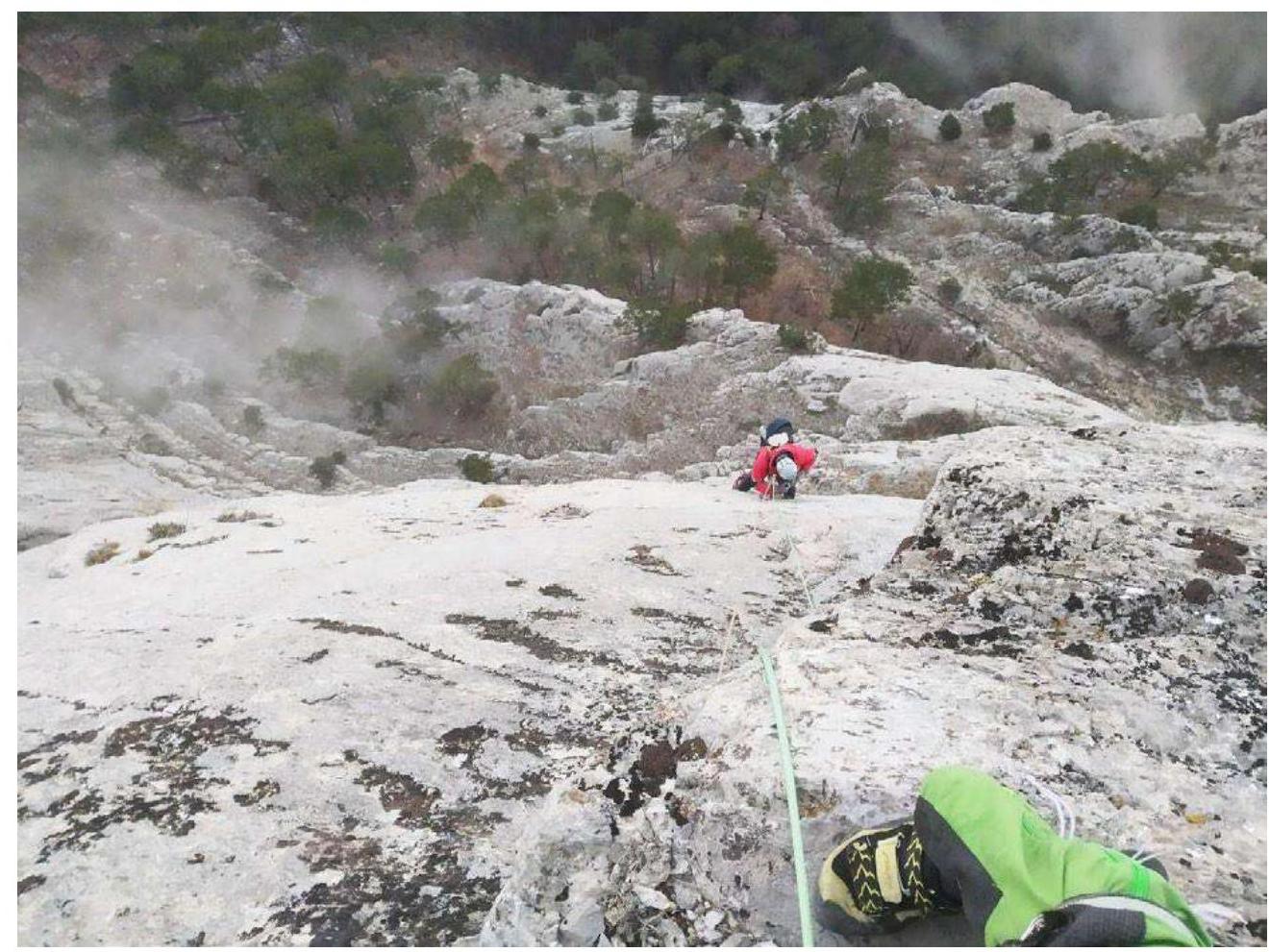
Photo 8. View down from R4.
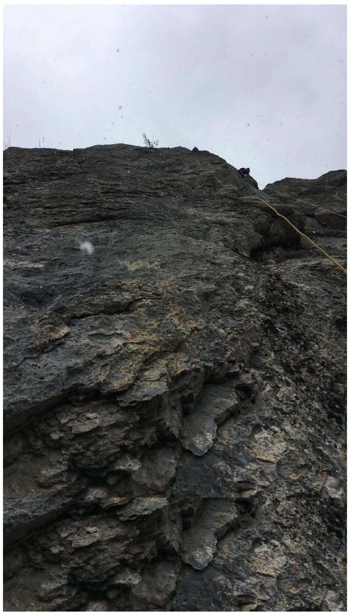
Photo 9. On R4–R5.
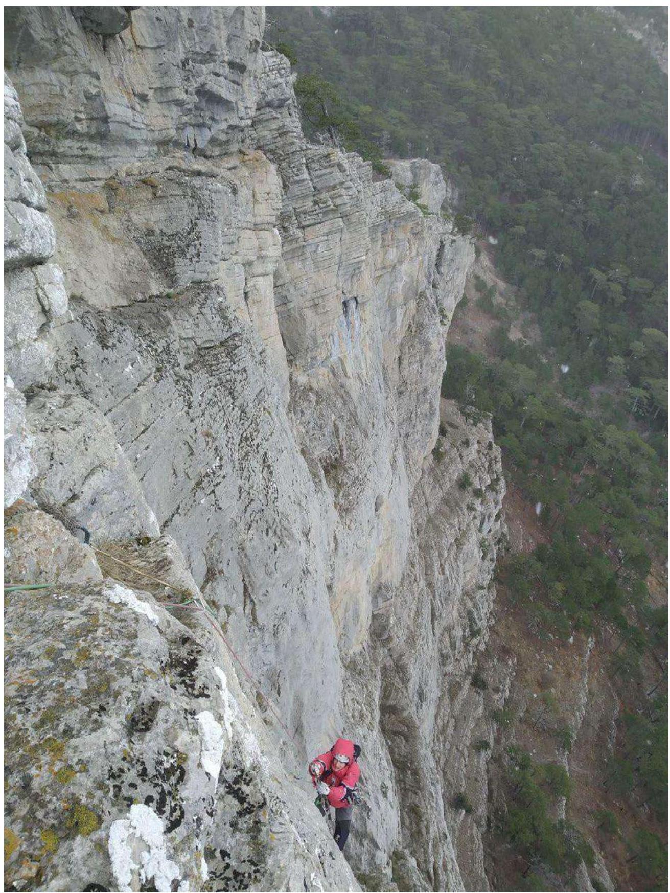
Photo 10. View down from R5.
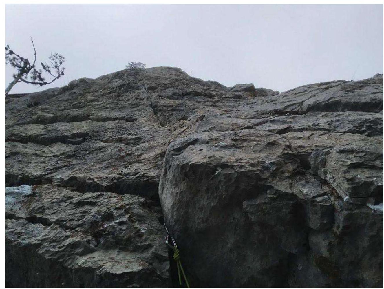
Photo 11. View up from R5.
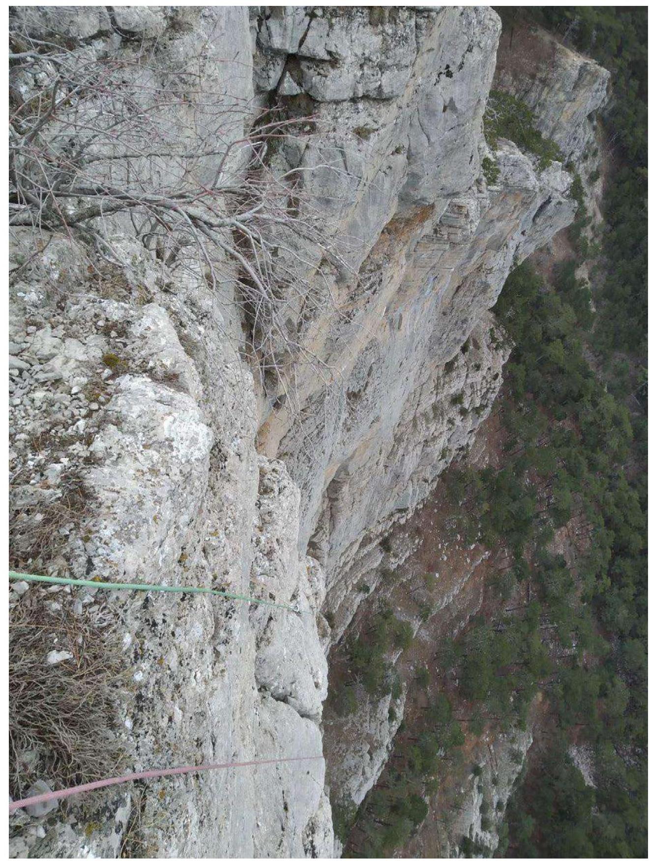
Photo 12. R5–R6, exit to plateau.
3.2 Photo of the team on the summit at the control tour

3.3. The route is quite monolithic. Small sections of destroyed rock are encountered on R1 and R5. There are no rockfall hazard sections.
Cellular communication is good throughout the route. To pass the route, one needs experience with rocky sixth-category climbs. There are quite complex ITO sections on overhangs and large gaps between bolts with skyhook moves between them.
Upon reaching the plateau, move right-down the slope, exit onto a well-equipped tourist trail (Koreizskaya Trail).
- The trail is noticeable.
- The trail is quite popular. It leads to the South Coast Highway near the Koreiz stop. The descent to the highway takes about 1.5 hours.
Compared to other Crimean sixth-category routes, this one is quite complex. There are rather complex and long ITO sections. It requires climbers to have good mastery of various techniques for moving on rocky terrain.
Comments
Sign in to leave a comment