Triangle — 8
Author: Alexander Lavrinenko («Одессит»), Odessa
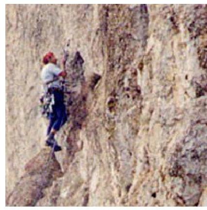
Photos by Aleksey Zhilin
Gora Treugolnik (Triangle Mountain, 1000 m above sea level) is located above the settlement of Parkovoe, 2 km west of Marcheki. The wall has a western orientation, so it is almost invisible from the lower road.
The wall's length in the central part is >400 m, height difference is >300 m.
The best way to approach the wall is through the quarry. From the spring up the scree — 15 minutes to the wall.
On the wall:
- 2 routes of 6th category of complexity
- 3rd category route goes along the SW ridge.
The wall still offers many opportunities for first ascents.
Grischenko Route 6A, VI, A3, 420 m
The route starts at an inclined internal corner, 20 m up to the right, exit onto an inclined, interrupted ledge. Along the ledge left up to a bollard. Station.
- R1 (40 m, 60°, IV): From the station left up through a crack 10 m, then along a slab exit to an internal corner.
- R2 (30 m, 65°, V, A1): Further along the corner 20 m with some aid, the corner ends with a small cornice, after passing it, move up to the right 10 m, station on a ledge.
- R3 (40 m, 80°, VI, A2): From the station to the right up, difficult transition to a crack, then along the crack, slightly overhanging in the upper part, exit to a large pine tree.
- R4 (50 m, 85°, VI, A2): From the pine tree up along the rocks of moderate difficulty exit to the ridge. Along the ridge approach the 2nd wall ascent and descend left onto a large inclined shelf.
- R5 (70 m, 40°, I–II): From the shelf up along a crack 15 m, further the crack ends, from here a small pendulum (5 m) left and up, the rocks are fragile, difficult to organize protection. Station on a long narrow shelf.
- R6 (45 m, 70°, VI): From the station up along a cleft — cornice, approach under the cornice. Station on a bollard.
- R7 (45 m, 80, VI): From the station up 10 m under the cornice, which is passed in the right part. Above the cornice traverse right 10 m onto an inclined shelf with a tree.
- R8 (30 m, 85, VI, A3): From the station 10 m up along a crack, then along a steep wall exit to the base of an internal corner, along the corner, overhanging in the upper part, exit to a tree.
- R9 (50 m, 85, VI, A3): From the station 10 m up along a crack, then along a steep wall exit to the base of an internal corner, along the corner, overhanging in the upper part, exit to a tree.
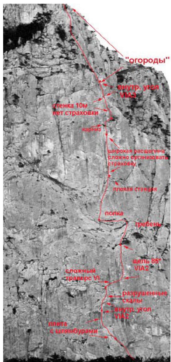
Further along easy rocks up 150 m to the summit. 10 hours. All stations on the route need to be reinforced. It is recommended to take several bollard pitons.
Simplified variation:
- Start on the right part of the wall via a couloir
- Then along a system of internal corners (IV–V)
- Exit onto a shelf in the middle of the route
The route is rarely climbed (last time, I think, there was an attempt in 2000).
Forostyan's route is climbed even less frequently, starts 100 m left of Grischenko's route. In the middle part of the wall, a large chimney is visible, through which the route passes.
Last ascent:
- May 2000
- Pugachev — Belkov (Donetsk)
-
10 hours of climbing time