Ascent Report
Team from St. Petersburg on peak 973 m, via the north wall, approximately 4B category of difficulty, July 27, 2015, first ascent
Ascent Passport
- Region: Lovozerskie Tundra Mountains, 1st Raslak Cirque area, Raslak stream (tributary of Sergevan River), section 8.7 ECTM 2011
- Peak 973 m, via the north wall
- Proposed category: 4B category of difficulty, first ascent
- Route type: rock climbing
- Route height difference: 360 m, including 300 m of wall ascent
Route length: 550 m, including 450 m of wall ascent. Length of sections with V difficulty: 70 m, with VI difficulty: 0. Average steepness of the main route section: 67°; total route: 62°
- Pitons left on the route: 1, including 0 bolts
- Team's total climbing hours: 13 hours
- Team leader: Kashevnick A., Candidate for Master of Sports
Team members:
- Budovskaya K., 2nd sports category
- Shamalo V., Master of Sports of Russia International Class
- Coach: Shamalo V., Master of Sports of Russia International Class
- Departure from base camp to the route: 13:30, July 26, 2015
Route started: 14:00, July 26, 2015. Reached the summit: 03:00, July 27, 2015. Returned to base camp: 04:30, July 27, 2015. Descent from the summit: eastward through peak 942 m, then north and west via scree slopes to the 1st Raslak Cirque, easy terrain
- Person responsible for the report: Shamalo V.P. Email: valera-sh@mail.ru, phone: +7 921 955 94 13.
General photo of the summit.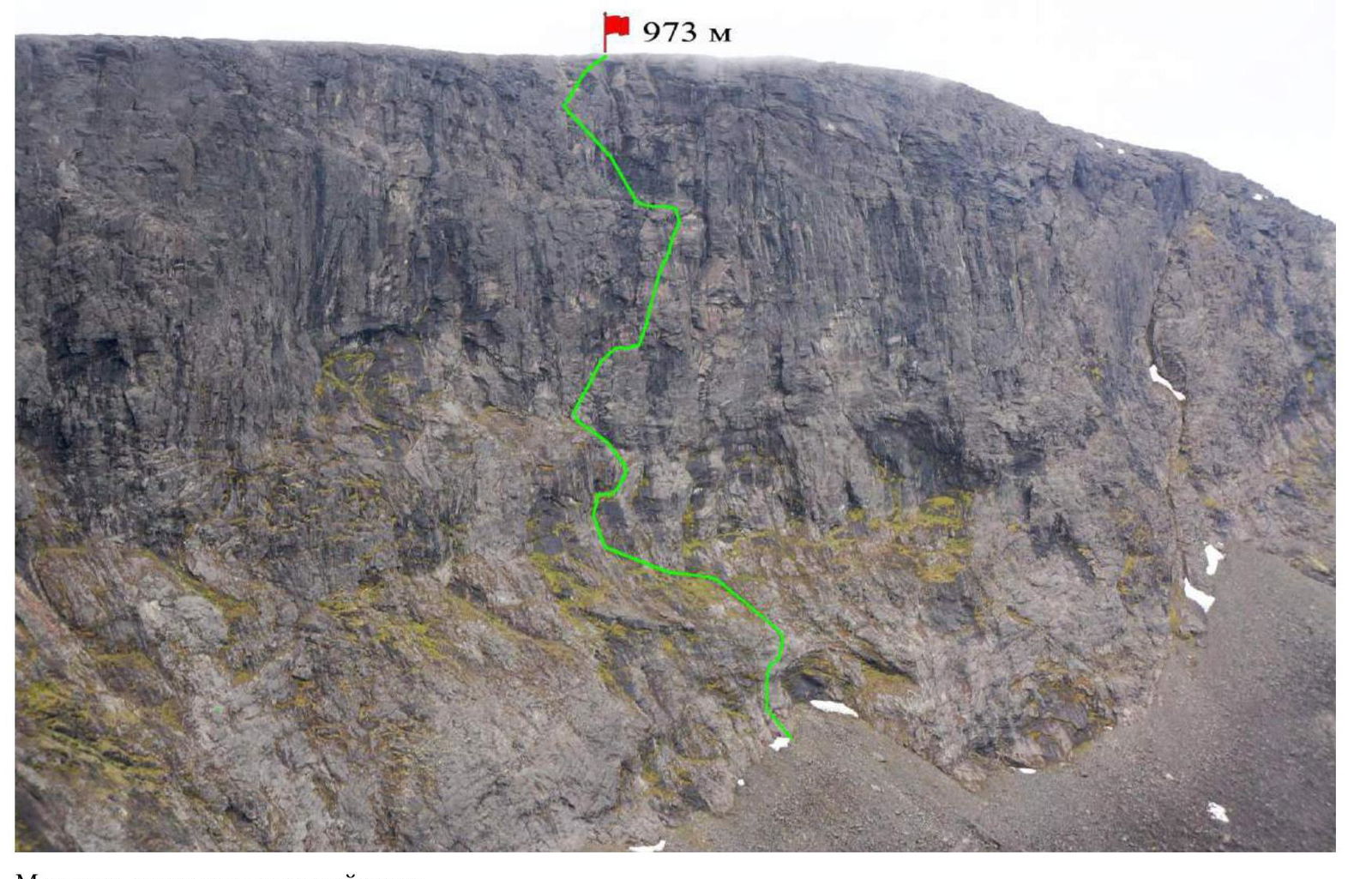
The team's route on the north wall. Photo taken on July 27, 2015, from the 1st Raslak Cirque, approximately 600 m above the base.
Photo of the route profile on the left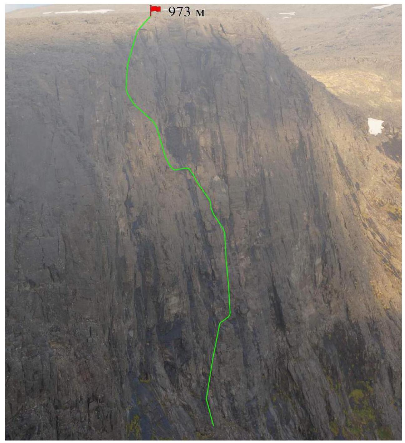
Taken on July 27, 2015, from peak 942 m.
Profile of the lower part of the route on the left. Taken on July 27, 2015, from peak 942 m.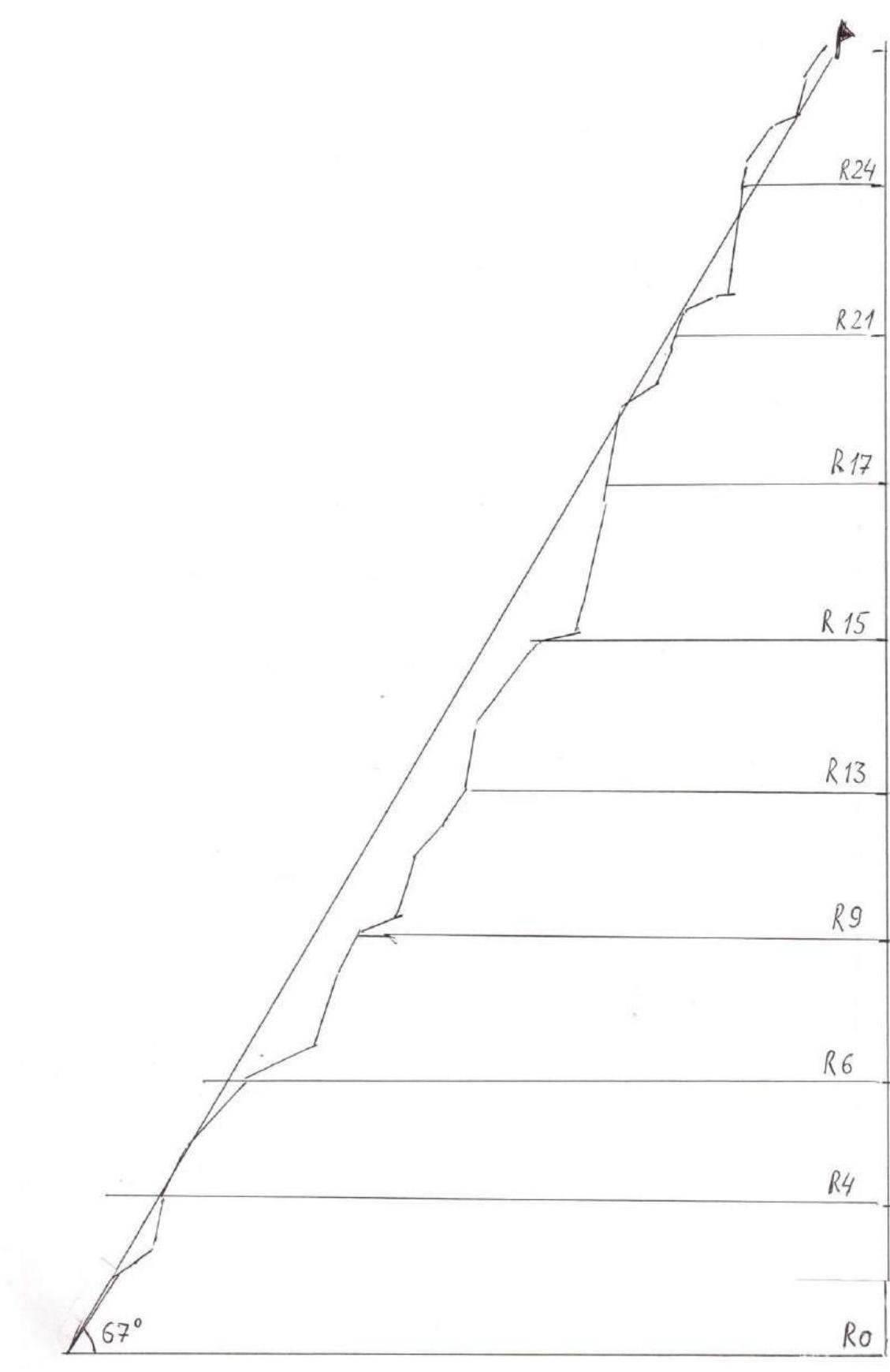
Hand-drawn Route Profile
Panoramic Photo of the Area
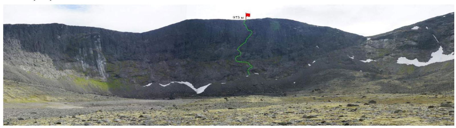
Taken on July 27, 2015, from the 1st Raslak Cirque, approximately 590 m above the base.
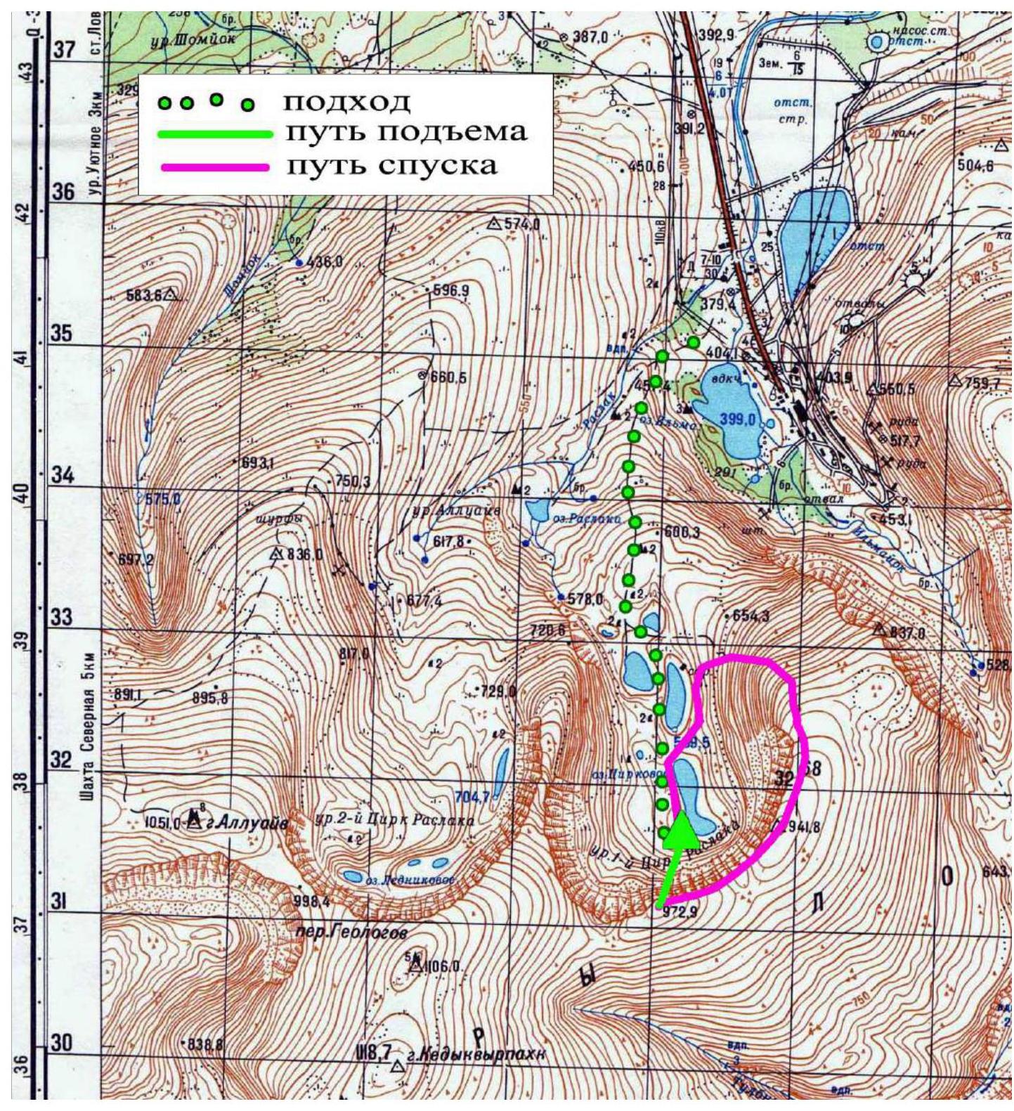
Climbing Area Map
The Lovozerskie Tundra Mountains are located in the center of the Kola Peninsula, east of the Khibiny Mountains, between Lovozero and Umpbozer Lake. The highest peak is Angvundaschorr, 1120.6 m. The most interesting climbs are on the walls around Sengisyyavr Lake, the 1st and 2nd Raslak Cirques, the Rayyavr Lake cirque, and numerous other interesting walls around Seydozero Lake. Wall heights reach up to 400 m, with many steep and complex sections, including overhanging sections up to 50 m long. The difficulty of some routes can reach category 5B.
To reach the Sengisyyavr area and the Raslak Cirques from Olenegorsk, take a car or bus to Revda. To get to the Raslak Cirques, drive towards the Karnsurta uranium mine; about 1 km before Ilma, turn right onto a dirt road. To reach the 1st Raslak Cirque, turn right off the main asphalt road immediately after the bridge over the Raslak stream. The dirt road becomes impassable to regular cars about 500 m later due to a washed-out stream crossing, requiring a 4x4 vehicle. The road then continues into the 1st cirque. The wall is no more than 4 km from the washed-out crossing.
The 1st cirque is very picturesque with several lakes that may dry up by late summer. Two peaks, 973 m and 942 m, are located above the wall. The peaks themselves have been traversed multiple times by tourists from the south and southeast of the 1st Raslak Cirque. However, no information was found about ascents on the cirque's walls before our group.
Overall, the Raslak Cirques' walls are reminiscent of the Foros Canyon, with a similar height difference but more challenging climbing conditions due to moss, lichen, and fewer days of good weather. However, the area is advantageous because it is possible to drive to the base of the wall from St. Petersburg in about 16 hours. Spending 3 days, one can complete a challenging and interesting ascent.
| Section Number | Number of Pitons (Aid Climbing) | UIAA Scheme | Difficulty | Section Length, m | Steepness |
|---|---|---|---|---|---|
| 14 | 5 | III–IV | 30 | 50–60 | |
| 13 | 6 | V | 20 | 75 | |
| 12 | 3 | III– | 15 | 50 | |
| 11 | 2 | III | 10 | 45–50 | |
| 10 | 2 | IV | 15 | 70 | |
| 9 | 1 | I–II | 10 | 20 | |
| 8 | 4 | IV | 10 | 65 | |
| 7 | 8 | IV | 25 | 70 | |
| 6 | 1 | I–II | 15 | 10–30 | |
| 5 | 3 | II–III | 30 | 40–45 | |
| 4 | 5 | III+ | 20 | 60 | |
| 3 | 4 | IV | 10 | 70 | |
| 2 | 3 | II–III | 20 | 40 | |
| 1 | 4 | III–IV | 20 | 60 | |
| 27 | 3 | III– | 20 | 50 | |
| 26 | 3 | III+ | 15 | 60 | |
| 25 | - | II | 5 | 25 | |
| 24 | 2 | III+ | 10 | 50 | |
| 23 | 12 | V | 45 | 75–80 | |
| 22 | 1 | II | 5 | 20 | |
| 21 | 2 | III | 5 | 50 | |
| 20 | 4 | IV– | 10 | 65 | |
| 19 | 2 | III | 10 | 60 | |
| 18 | 2 | II | 10 | 20–30 | |
| 17 | 5 | V | 15 | 75 | |
| 16 | 8 | IV | 40 | 70 | |
| 15 | 2 | II | 10 | 20–30 |
Technical Route Photo
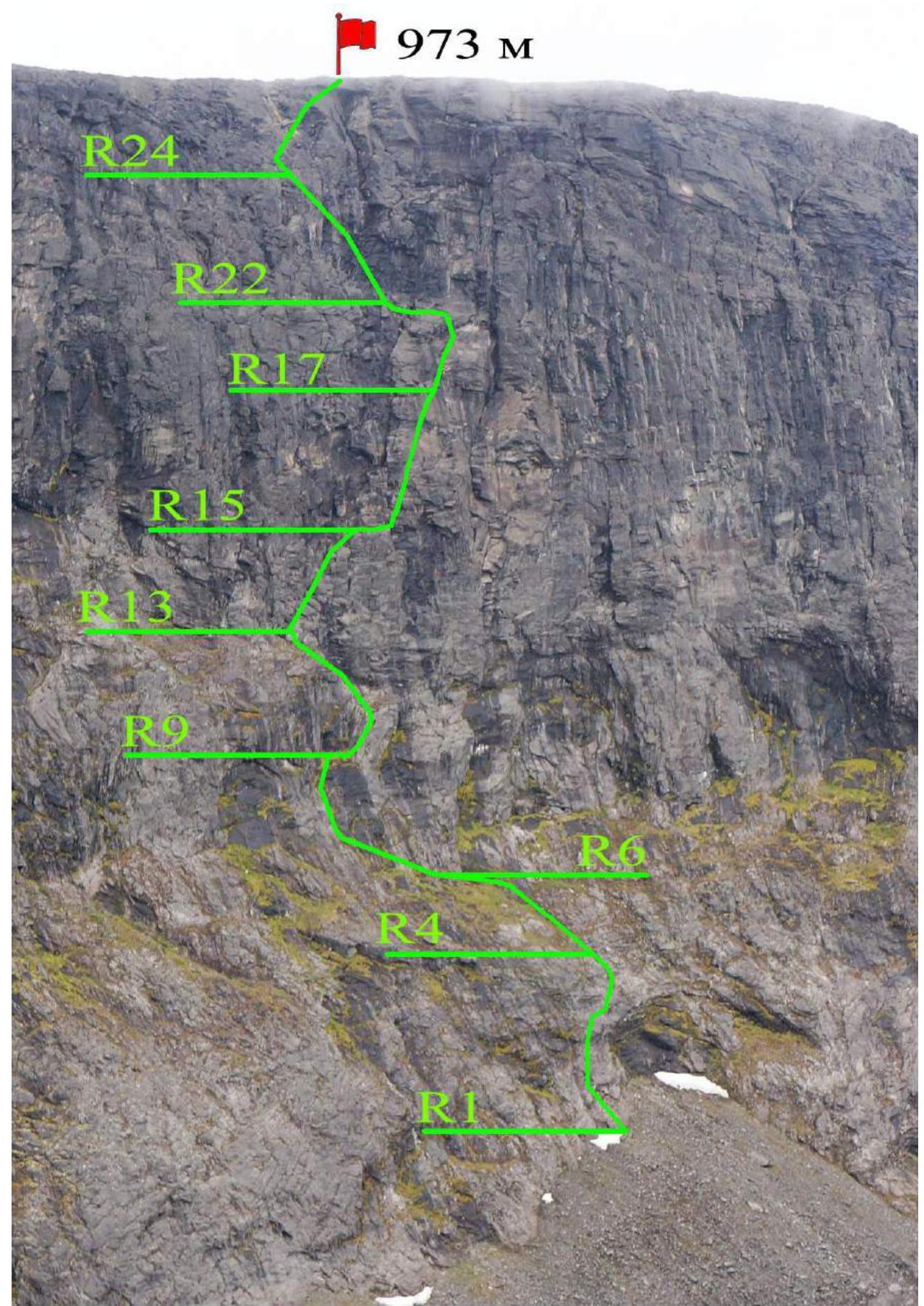
Photo taken from the 1st Raslak Cirque, approximately 600 m above the base, on June 13, 2015. The team arrived at the ascent area by car on the afternoon of July 25, 2015. At that time, the Lovozerskie Tundras were experiencing the end of the polar day, with the sun setting below the horizon for a very short period. The nighttime was not completely dark. In the nighttime, it was slightly cooler. The team couldn't drive into the 1st Raslak Cirque due to a poor stream crossing, so they had to approach the wall on foot, about 4 km. By evening, they set up camp directly under the wall. Visibility was poor that day.
On the afternoon of July 26, visibility improved, and the participants carefully examined the wall and chose their route. They started the ascent at 14:00 after climbing up the scree. The first three rope lengths were led by Valery. Initially, the route was not very steep but was covered in wet grass and loose rocks. It became steeper and drier further up, transitioning into pleasant rock climbing. Starting from the 4th rope length to the summit plateau, Anton led.
On the upper part of the route, all participants except the first climber ascended using top-rope climbing.
The team reached the summit on the night of July 27. They descended by bypassing the cirque to the east, via peak 942 m. They returned to their camp early in the morning, rested for a few hours, and then returned to their car and left.
The weather during the ascent was relatively good, with occasional light precipitation, weak winds that strengthened only near the summit.
The route appears logical; any significant deviation to the right or left would significantly complicate the climb. Loose rocks were encountered on almost all sections, especially at the bottom and on ledges. The rockfall hazard was moderate; rocks rarely fell on their own, but climbers could dislodge them onto each other, requiring great care. The terrain was diverse, with many cracks and crevices suitable for:
- anchors,
- cams,
- nuts of various sizes.
The route clearly surpasses in difficulty the numerous "category 3" routes in the Khibiny Mountains climbed by participants but is slightly less challenging than "category 5" routes, primarily due to the lack of extended vertical sections.
Photo Report
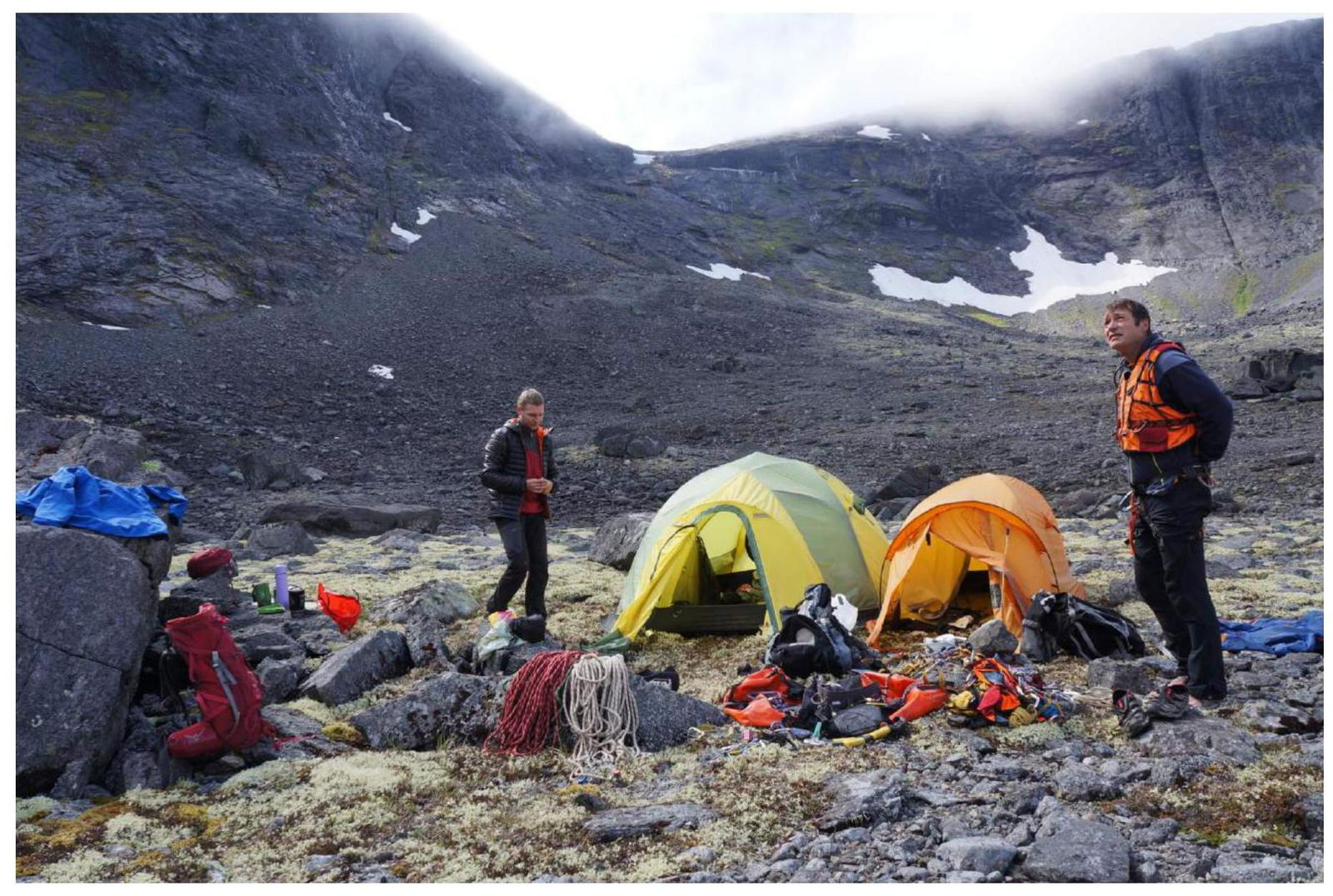
Photo 1. Base camp. July 26, 2015, approximately 600 m above sea level.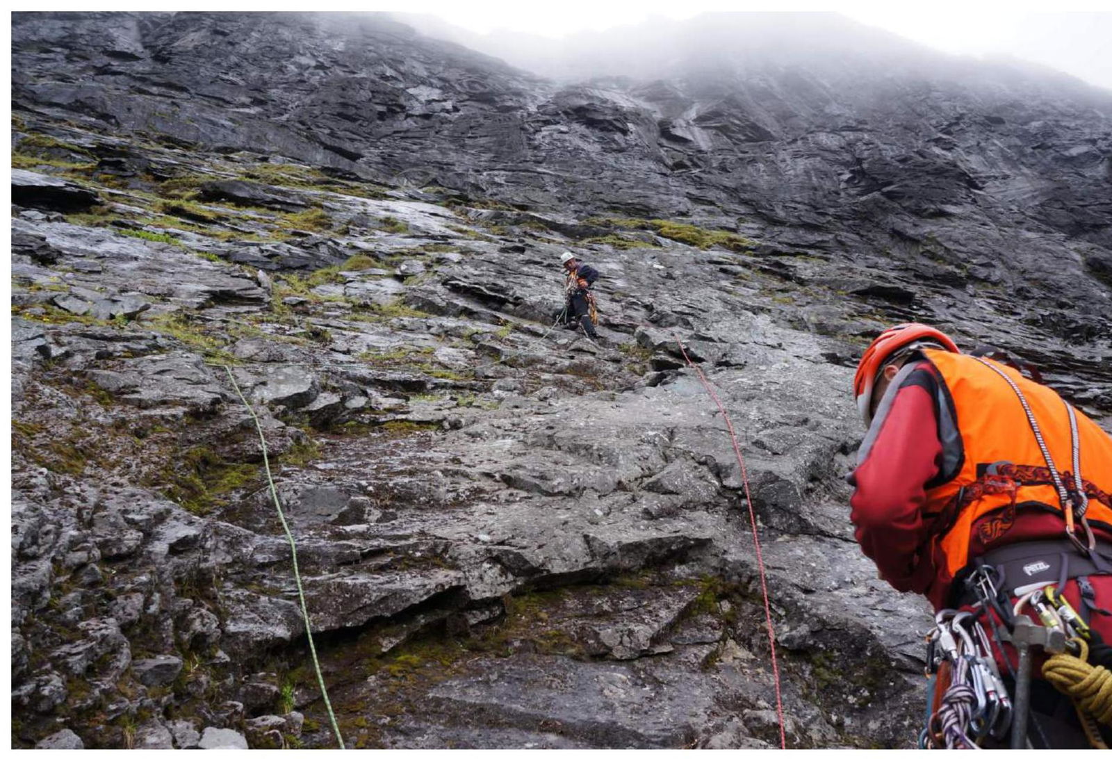
Photo 2. Start of the route.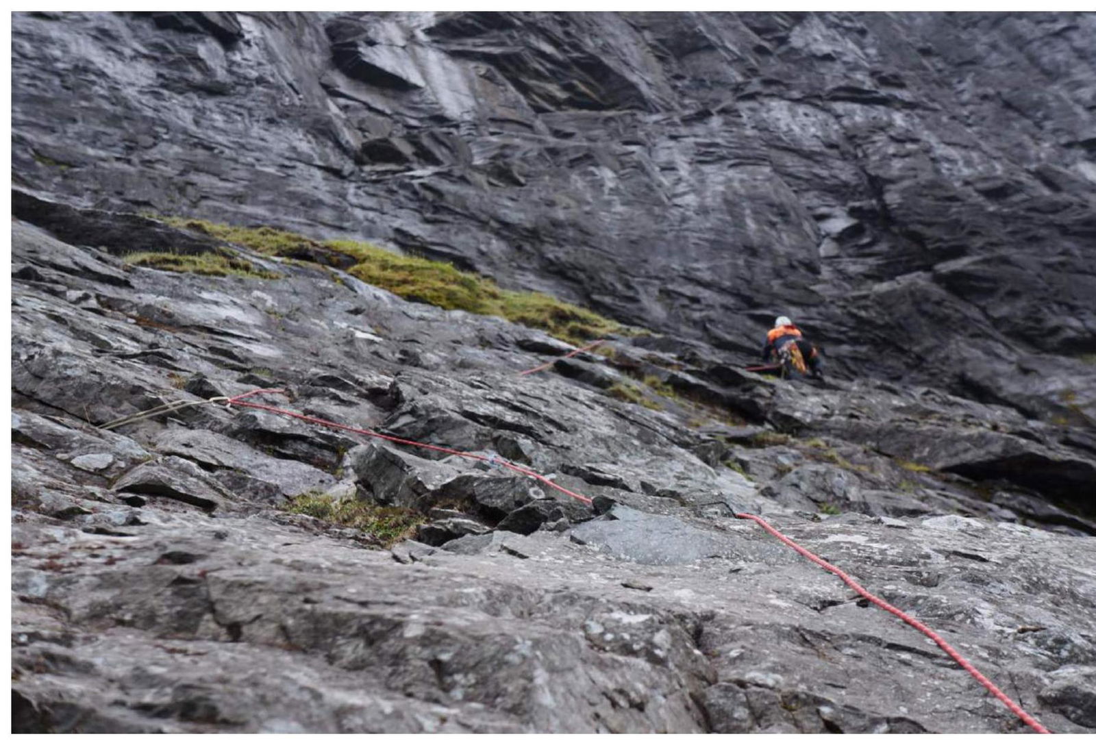
Photo 3. On section R2.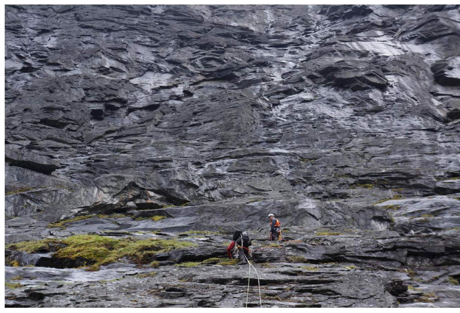
Photo 3. On section R5.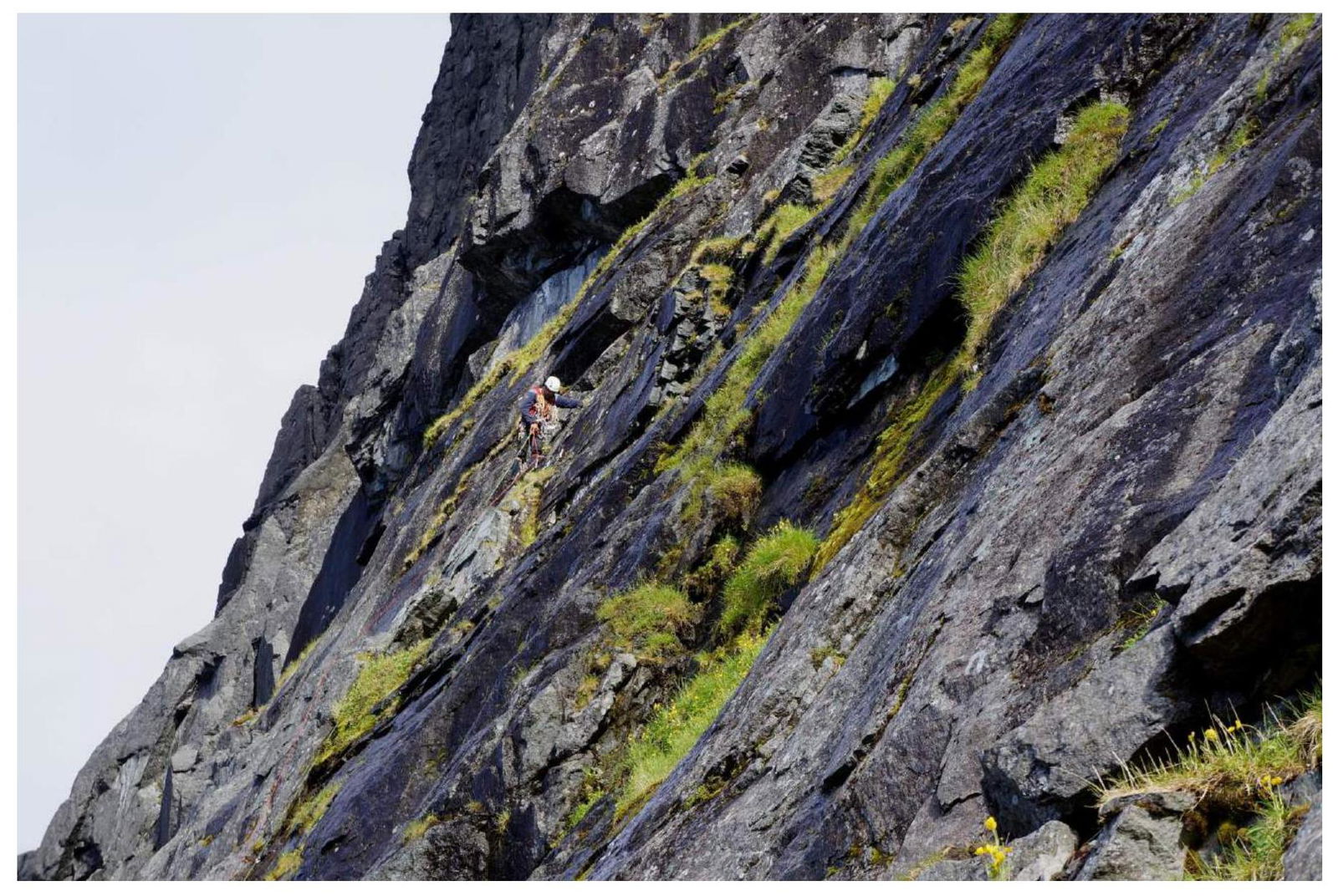
Photo 4. At the start of section R7.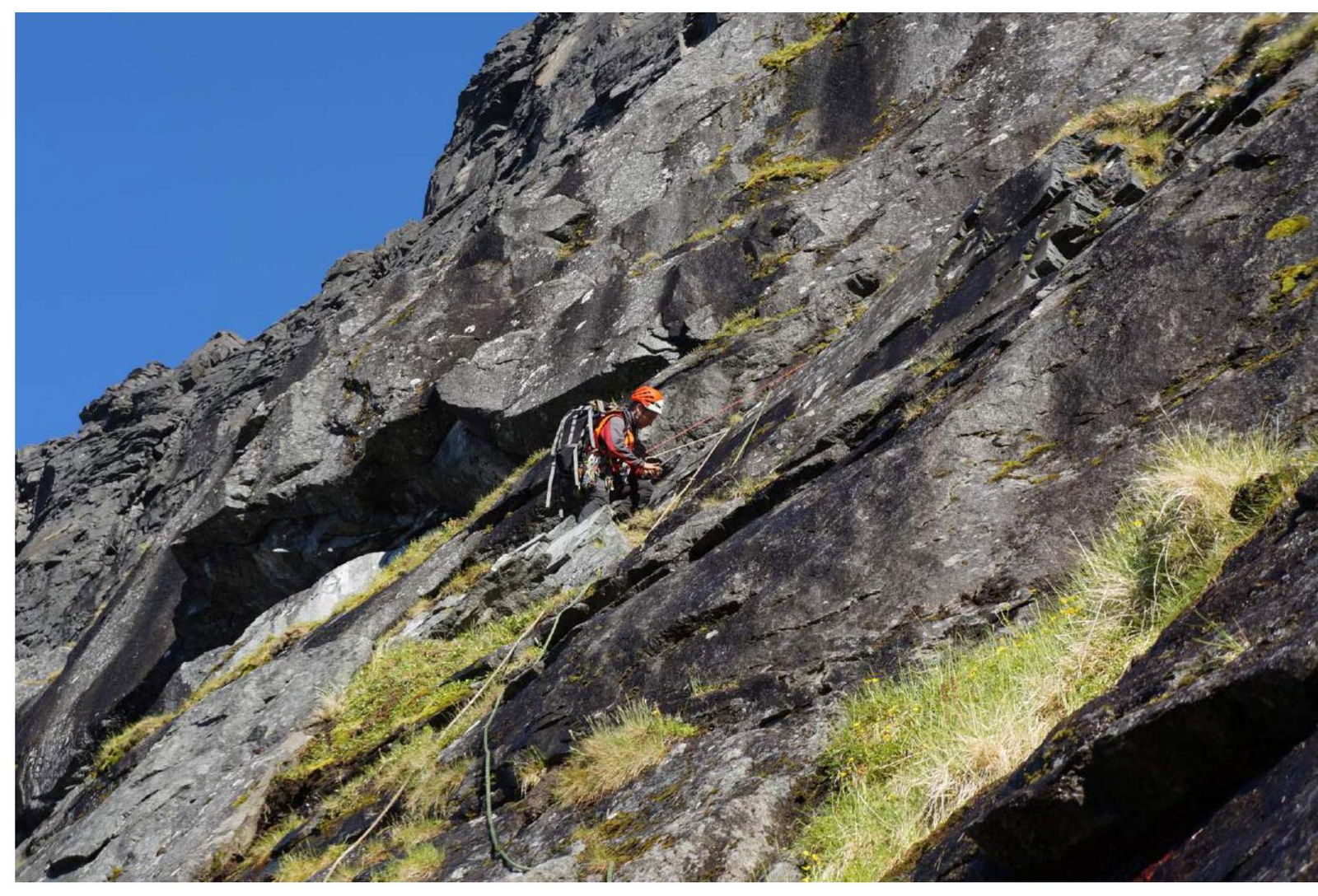
Photo 5. At the start of section R7.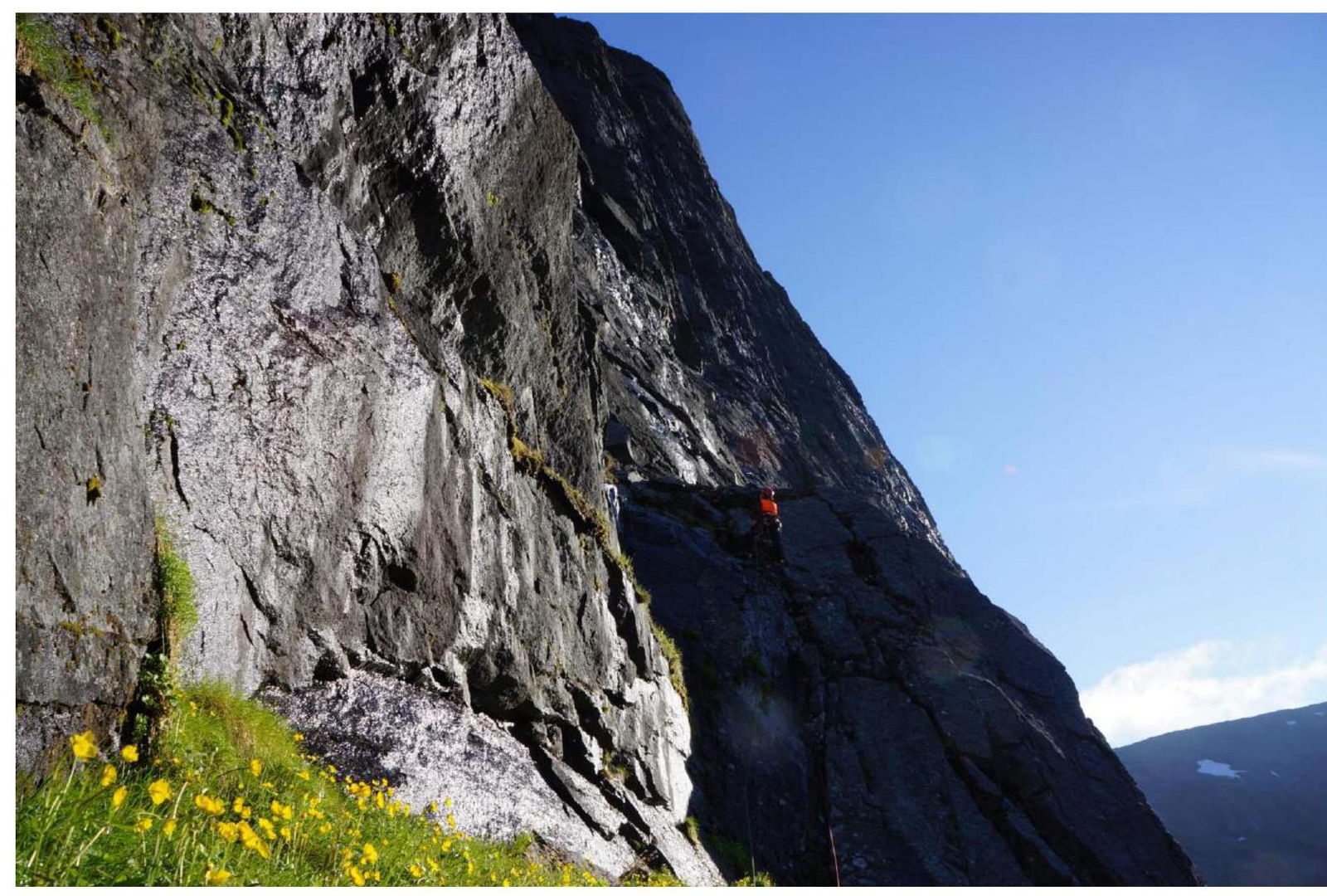
Photo 6. Anton on section R10.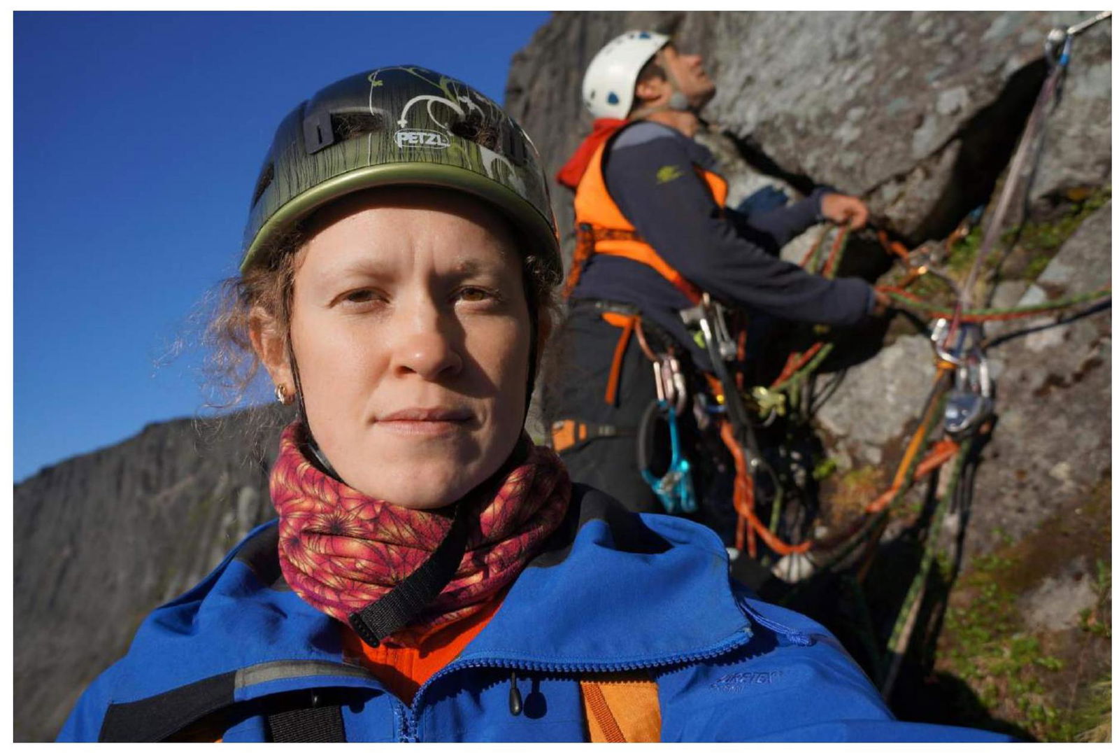
Photo 7. Kristina and Valery at the belay station at the end of the 4th rope, sections R12–R13.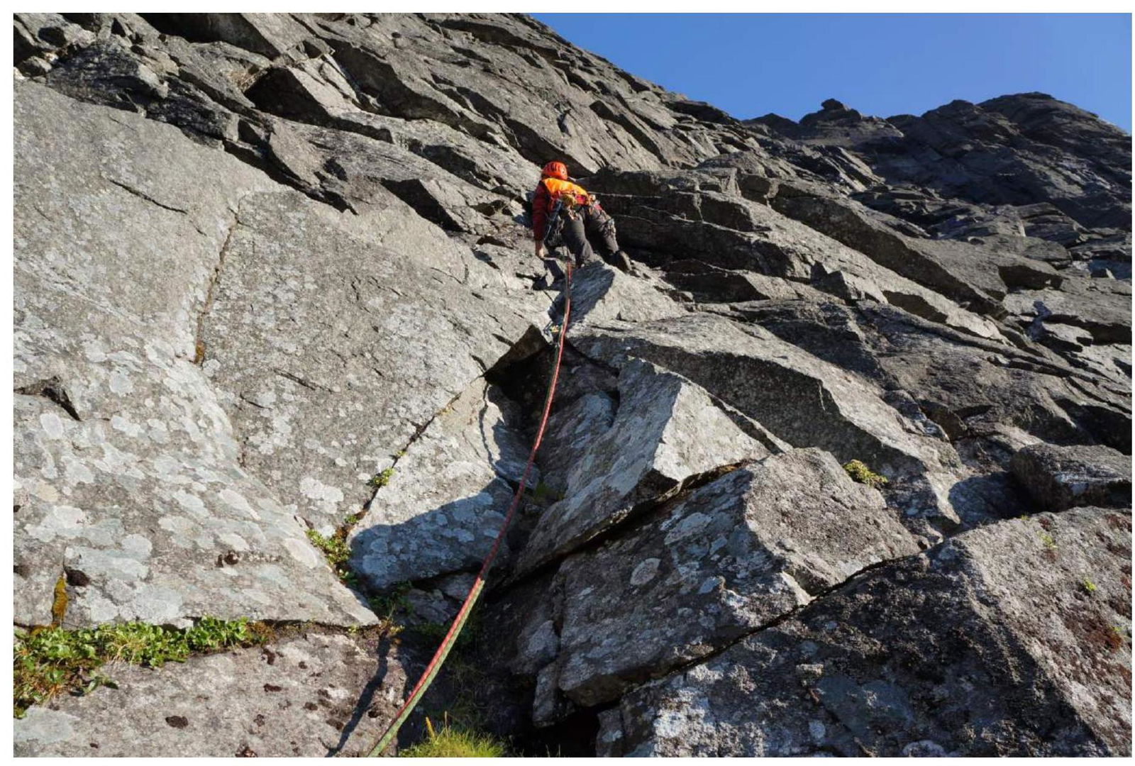
Photo 8. Section R13.
Photo 9. Upper part of section R14.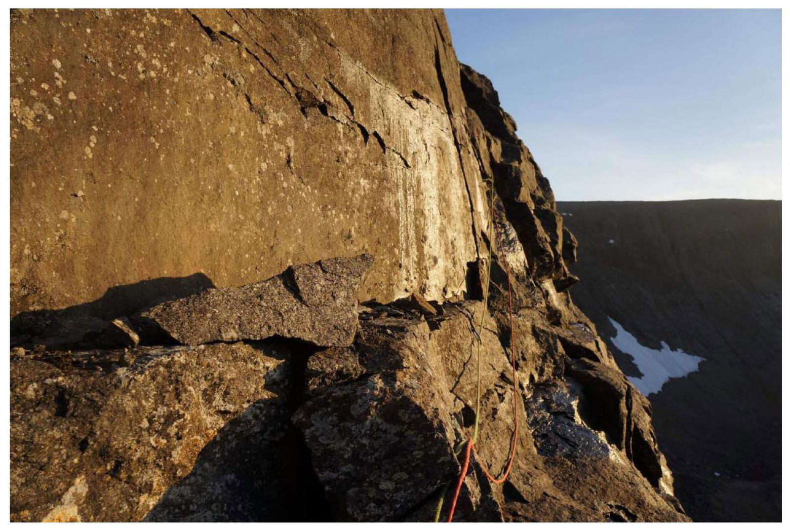
Photo 10. Ledge on section R15.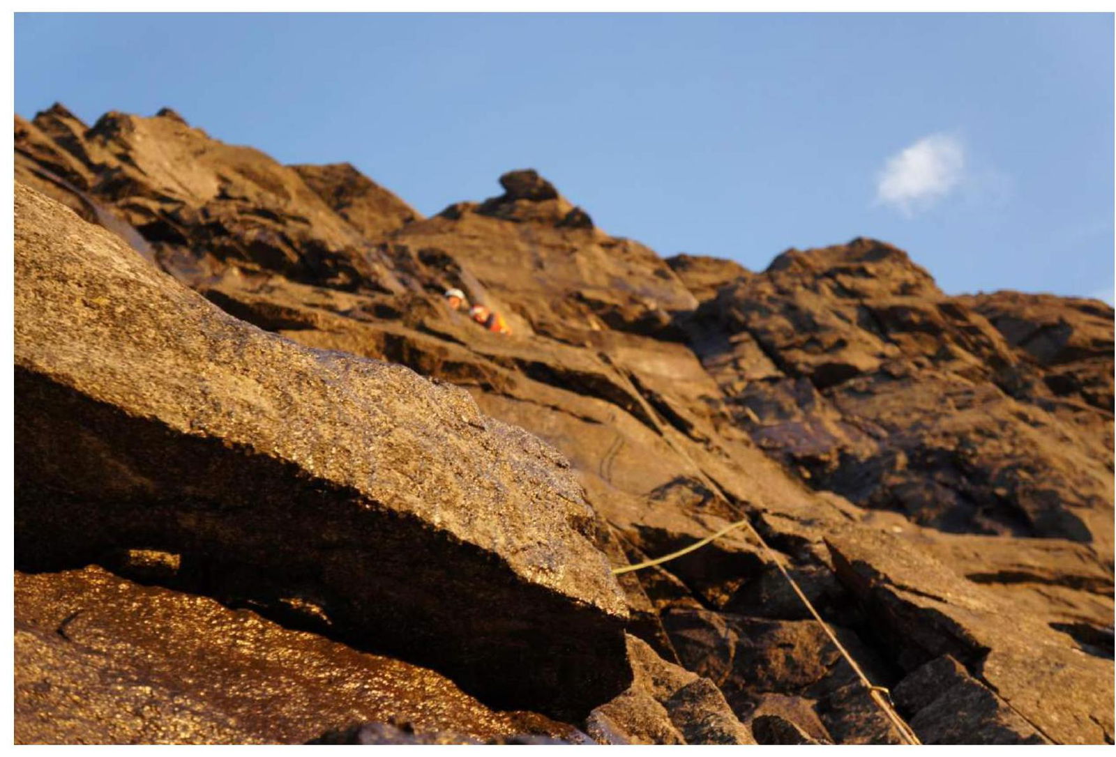
Photo 11. Section R16.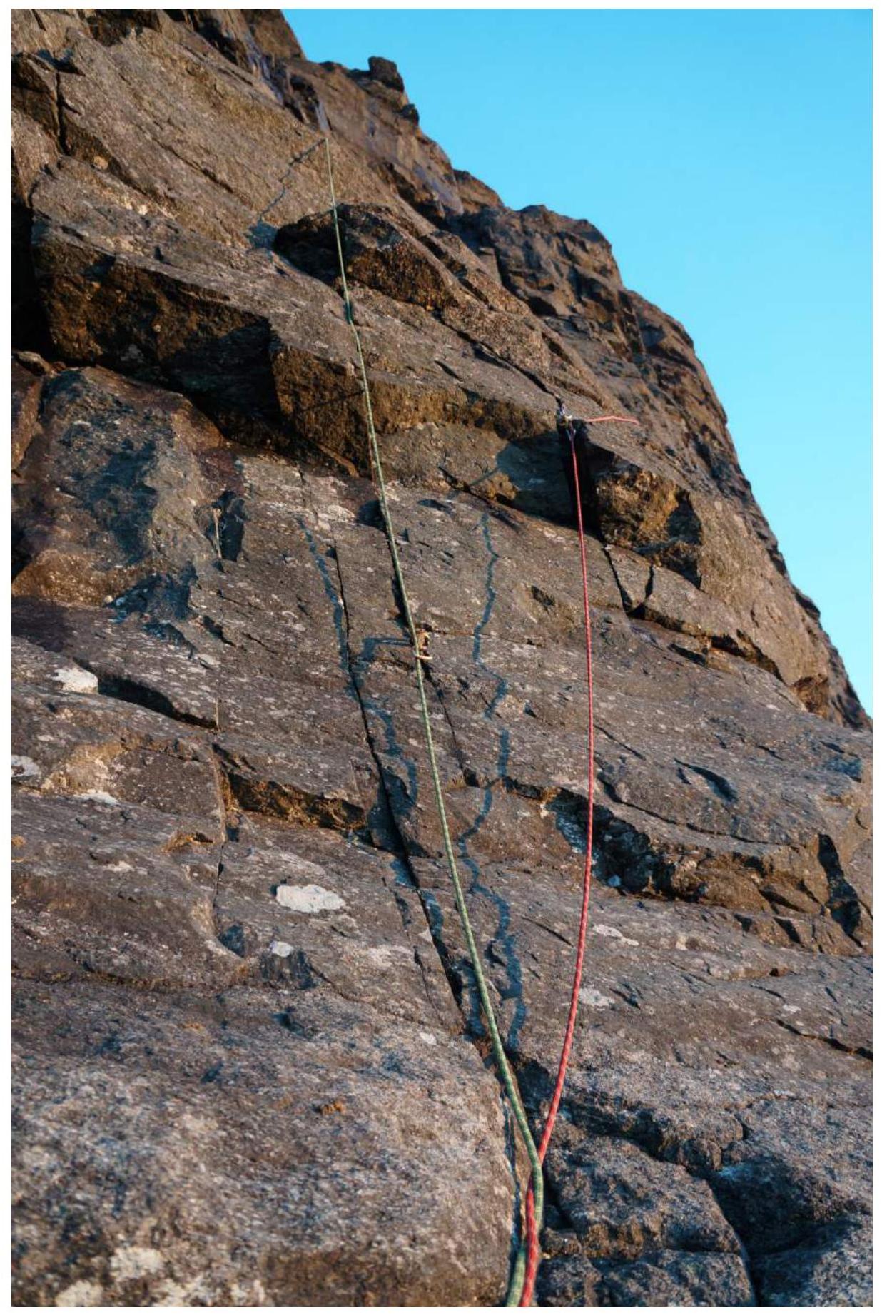
Photo 12. Section R17.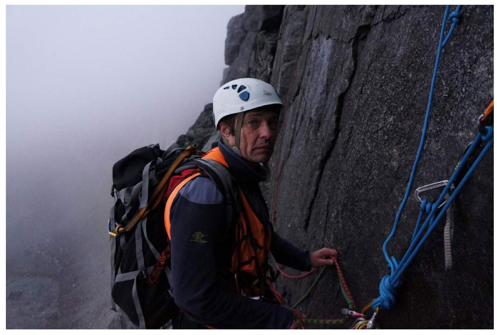
Photo 13. On the ledge of section R22.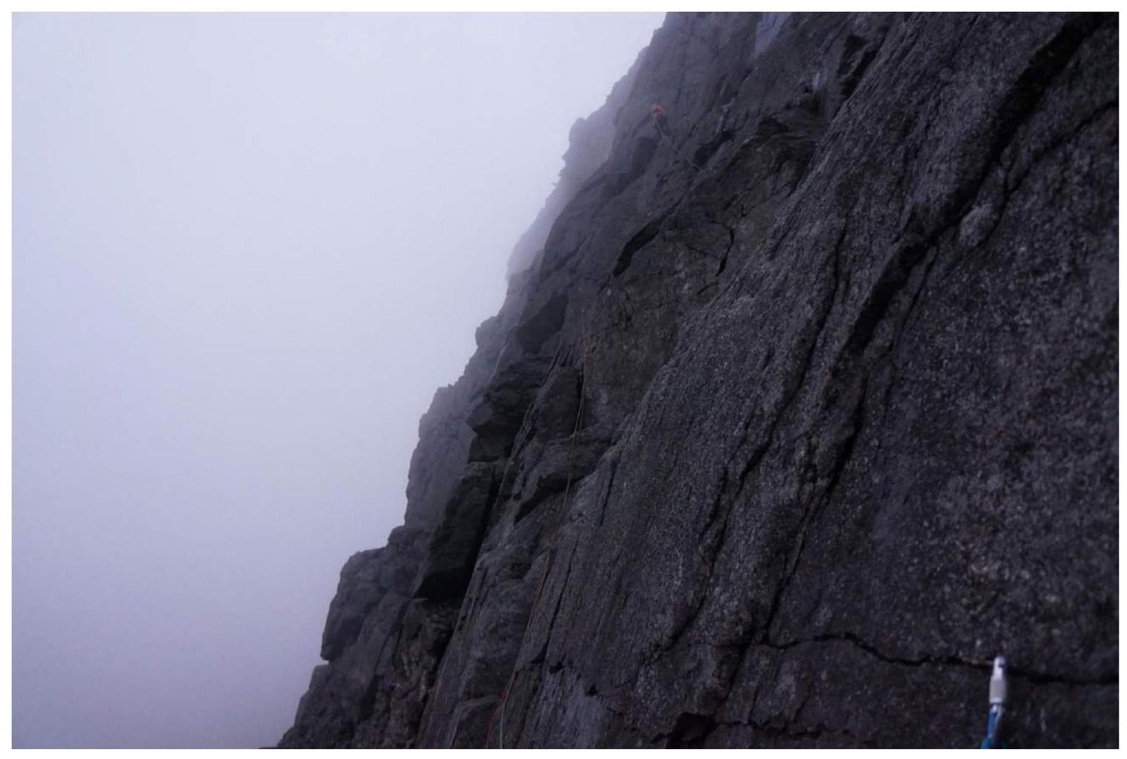
Photo 14. Section R23.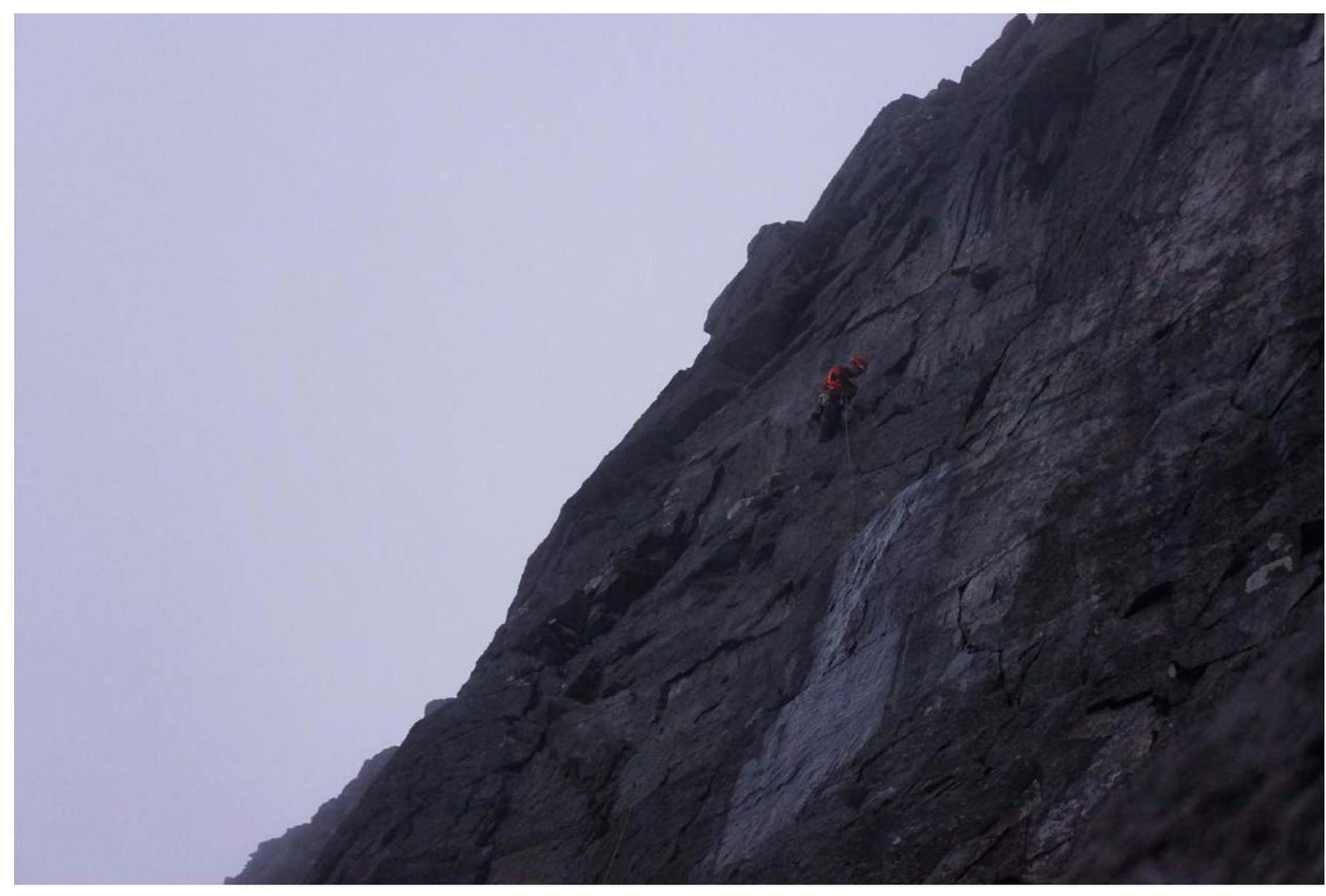
Photo 15. Upper part of section R23.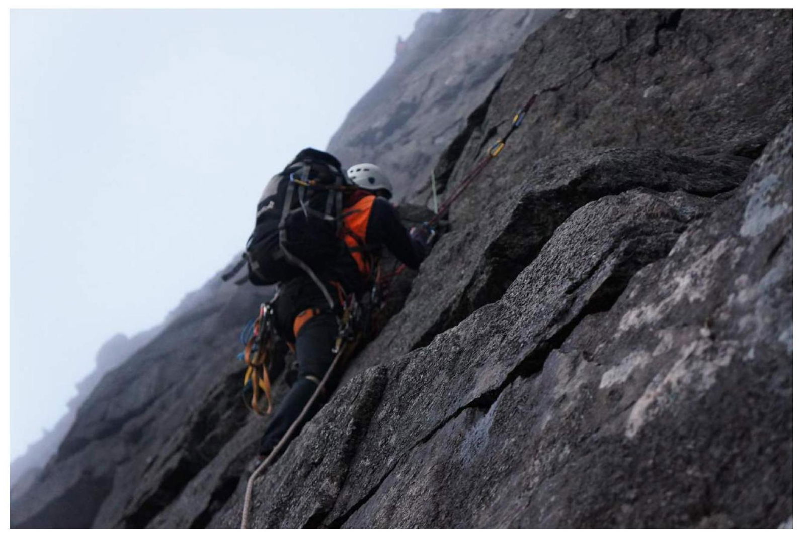
Photo 16. Section R24.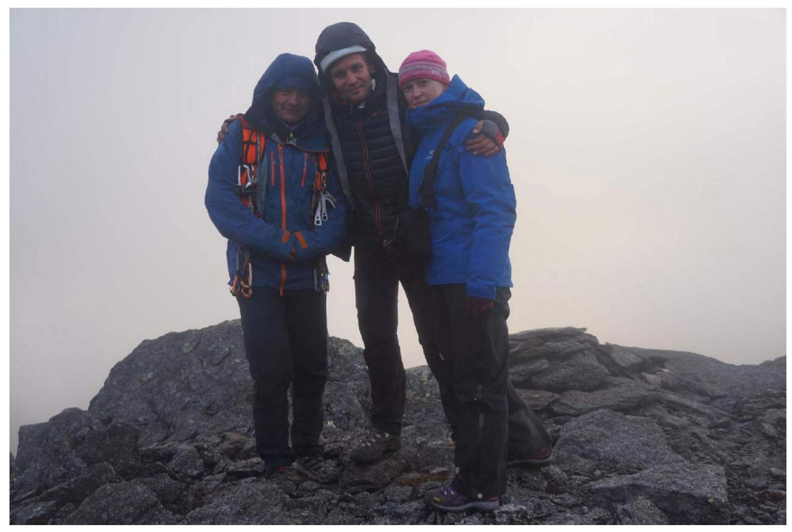
Photo 17. At the summit.


