
Report
Teams from St. Petersburg
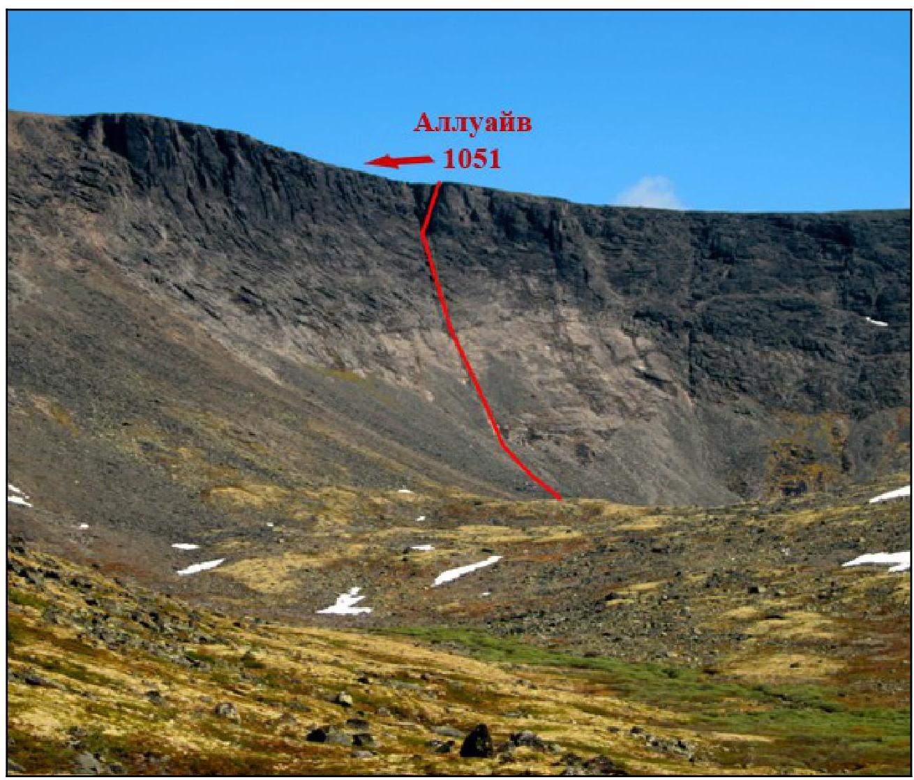
Ascent to Mt. Alluayv, 1051 m
Route via the crack on the southern wall, 2A category of difficulty, June 24, 2012, first ascent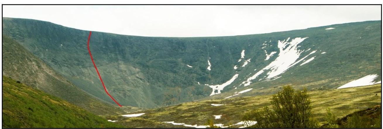
St. Petersburg, 2012
Ascent Passport
- Region: Lovozerskie Tundry mountains, Azimuth river valley, nearest section 8.6 ECTM, 2011
- Mt. Alluayv, 1051 m, via the crack on the S wall, "Keksik"
- Proposed - 2A category of difficulty, first ascent
- Route character - rock
- Height difference of the route: 350 m, including wall section - 280 m
Route length: 780 m. Average steepness: main part of the route - 55°; entire route - 30°
- Pitons left on the route: none
- Team's walking hours: 1 h 45 min
- Leader: Shamalo V.P., MSМК (Master of Sports in Mountaineering)
Participants: Ivanova-Efimova E.N., 3rd sports category
- Coach: Timoshenko T.I., MS (Master of Sports)
- Exit to the route from the Base Camp (BC): June 24, 2012, 12:00
Route started: June 24, 2012, 13:45. Reached the summit: June 24, 2012, 15:30. Returned to BC: June 24, 2012, 17:30. Descent from the summit: via the western slope of Mt. Alluayv, scree, grassy slopes, n/k (non-categorized)
- Organization: FASIL St. Petersburg
- Responsible for the report: Ivanova-Efimova E.N. Email and phone: lswm@ya.ru, 8964-325-73-92
General photo of the summit
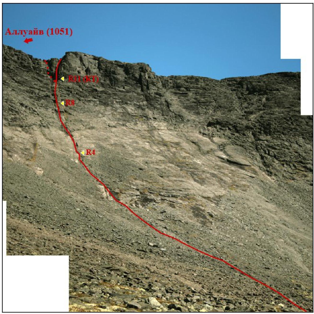
Route via the crack on the southern wall on June 24, 2012, photo from the S cirque, 700 m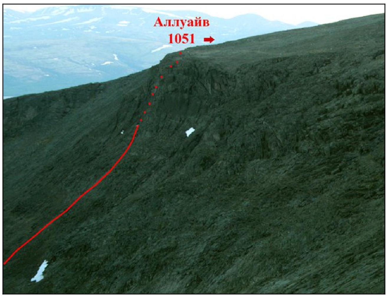
Route profile on the right
Route via the crack on the southern wall on June 24, 2012, photo from the Geologov pass, height around 1000 m
Photopanorama of the area
Route via the crack on the southern wall of the cirque
June 24, 2012, photo from the S cirque, height around 700 m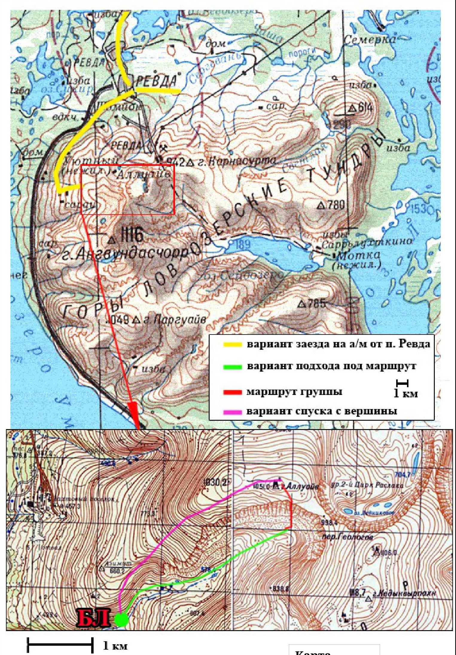
Map
Area overview
Lovozerskie Tundry mountains are located in the center of the Kola Peninsula, east of the Khibiny mountains, between Lovozero and Umbozero lakes. The highest peak is Angvundaschorr, 1120.6 m.
Most interesting for ascents:
- walls around Sengisyavr lake,
- 1st and 2nd Raslak cirques,
- Rayyavr lake cirque,
- walls around Seidozero lake.
Wall heights reach 400 m, with many steep and complex sections, and even extended overhanging sections up to 50 m long. The difficulty of individual routes can reach 5B category.
To reach the Azimuth river valley, from which the route starts, one can take a car or a bus from Olenegorsk to Revda. Then, turn right onto a road, and after an abandoned combine, turn left uphill into the Azimuth river valley.
In the valley, there is a forest in the lower part, with many convenient places for a base camp.
One can also:
- Drive a car onto the plateau near Mt. Alluayv.
- From there, descend into the Azimuth river valley via the western ridge.
In winter, it is more challenging to get there due to roads being snowed under.
Ascent scheme
| Section # | Length | Steepness | Terrain characteristics | Category of difficulty | Number of pitons |
|---|---|---|---|---|---|
| R1 | 100 | 20-25 | small and medium scree | n/k | - |
| R2 | 35 | 30 | inclined slab | I | - |
| R3 | 50 | 25-30 | small and medium scree with slab outcrops | n/k | - |
| R4 | 50 | 30-40 | slab | I | - |
| R5 | 10 | 60 | rocks | III | 2 |
| R6 | 30 | 45 | combination of ledges and walls | II | 1 |
| R7 | 10 | 40 | ledge | I | - |
| R8 | 10 | 60 | rocks | II | - |
| R9 | 15 | 30 | ledge (grassy slope) | I | - |
| R10 | 20 | 45 | rocks | II | 1 |
| R11 | 80 | 30 | ledge (grassy slope) with a cairn | I | - |
| R12 | 15 | 50 | couloir | II | - |
| R13 | 40 | 40 | dry couloir | I | - |
| R14 | 15 | 50 | rocks | II | - |
| R15 |
Descent via the western slope of Mt. Alluayv, scree and grassy slopes, n/k
8
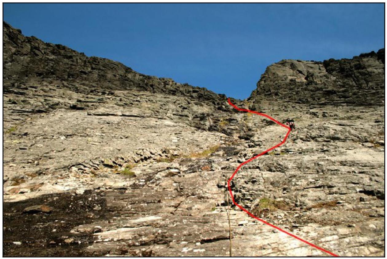
Technical photograph of the route. Route via the crack on the southern wall of the cirque on June 24, 2012, taken at the foot of the wall
Ascent description
Mt. Alluayv, 1051 m, is located in the western part of the Lovozerskie Tundry.
The group made a first ascent via a route we decided to name "Keksik".
The Base Camp (BC) was located at an altitude of 500 m on the right bank of the Azimuth river, 3-4 km from the mountain.
The weather was ideal for the ascent - the sun was shining, and the sky was only slightly covered with a haze of clouds.
When approaching the southern wall of the cirque, we noticed a dark "+" to the right of the supposed route. A route via the crack was obvious, standing out against the relatively smooth and steep slabs.
The wall was lit by the sun, making the ascent very comfortable, and there were thin streams running almost everywhere on the route.
At the bottom, the cirque wall is framed by scree. We left our backpacks at the top of the scree and, taking turns with belays, moved upwards. This type of movement prevailed on the route, except for simple sections where we moved simultaneously.
In the upper part (R8), a cairn was built, and a note was left.
Overall, the route turned out to be easier than it looked from below. The slabs were dry, making it relatively easy to move.
In the upper part of the route, there are options for passage:
- to the right
- to the left
Both options appear to be of similar difficulty. We preferred the right option.
After reaching the plateau, it was necessary to walk another 300 m to the NW to reach the summit. Near it, there is a pile of stones about 6 m high and a concrete pillar, where a note was left.
The descent from the summit was via the gentle western slope of Mt. Alluayv.
The route is relatively safe from rockfall. However, in winter, snow slabs can slide down the slabs.
The crack is clearly visible on the wall, making orientation not a significant problem.
Photo illustrations of the report
Slabs in the lower part of the
route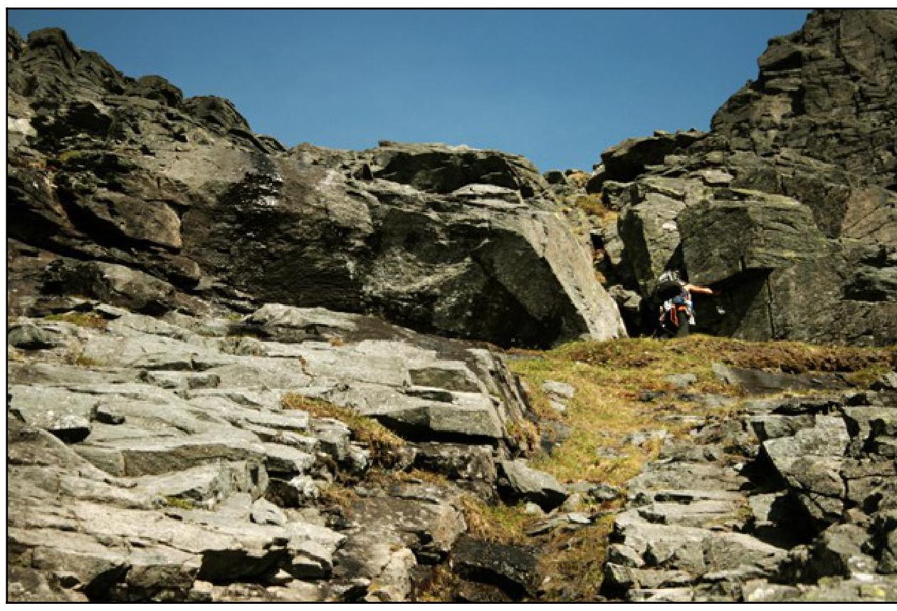
Ledge before
R8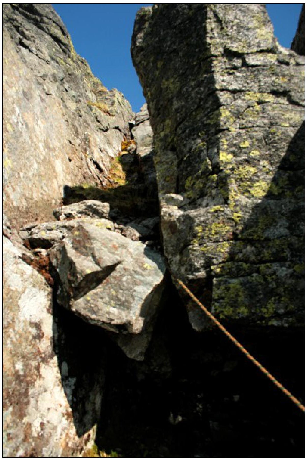
Rocks at
R8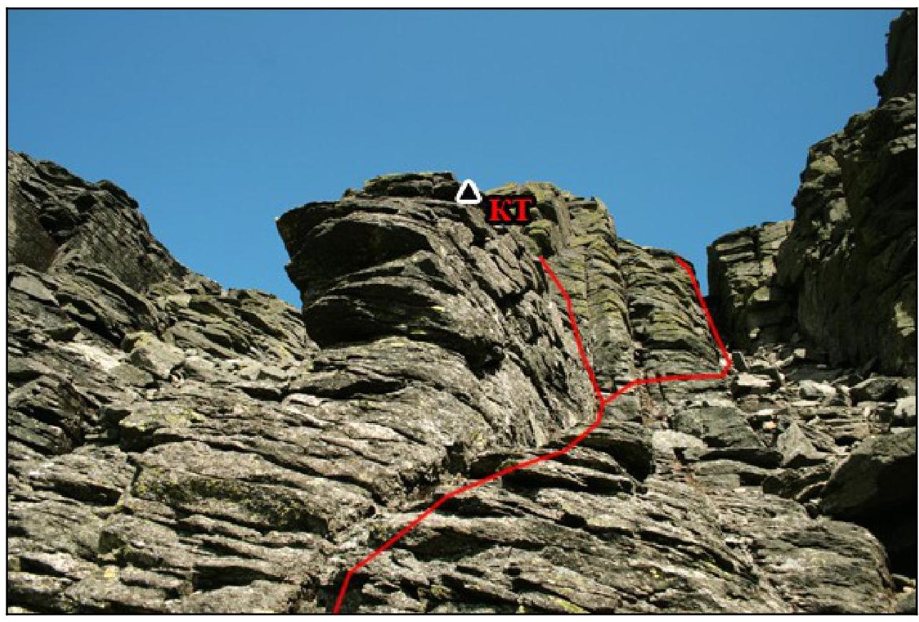
Section R11: Before reaching the plateau, there are options for passage, approximately equal in difficulty. The group chose the right one - with a stone stuck between the
rocks
At the summit of Mt. Alluayv
Comments
Sign in to leave a comment