
Report on the First Ascent to the Summit of Aikuayvenchorr Eastern Ridge via the Route "Left of the Central Counterfort of the Northern Wall of the Eastern Spur" Category 2B by the Team of UTS FAMO "Khibiny-23" from 19.07.2023 to 19.07.2023
I. Ascent Passport
| № | 1. General Information | |
|---|---|---|
| 1.1 | Full Name, Sports Rank of the Leader | Patutinskiy Aleksandr Nikolaevich 1st sports rank |
| 1.2 | Full Name, Sports Rank of the Participants | Ivanova Tamara Nikolaevna III sports rank, Serenkov Semen Maksimovich III sports rank |
| 1.3 | Full Name of the Coach | Bernatskiy Sergey Igorevich Master of Sports |
| 1.4 | Organization | Federation of Alpinism of Murmansk Region |
| 2. Characteristics of the Ascent Object | ||
| 2.1 | Region | Khibiny |
| 2.2 | Valley | Other routes |
| 2.3 | Section Number according to the 2020 Classification Table | 8.4.2 |
| 2.4 | Name and Height of the Summit | Aikuayvenchorr Eastern 858 m |
| 2.5 | Geographical Coordinates of the Summit (Latitude/Longitude), GPS Coordinates | - |
| 3. Characteristics of the Route | ||
| 3.1 | Name of the Route | "Left of the Central Counterfort of the Northern Wall of the Eastern Slope" |
| 3.2 | Proposed Category of Difficulty | 2B |
| 3.3 | Degree of Route Exploration | First Ascent |
| 3.4 | Nature of the Route Terrain | Rock |
| 3.5 | Height Difference of the Route (data from altimeter or GPS) | 306 |
| 3.6 | Length of the Route (in meters) | 600 |
| 3.7 | Technical Elements of the Route (total length of sections of varying difficulty with indication of terrain type (ice-snow, rock)) | Category 1 rock — 355 m, Category 2 rock — 150 m, Category 3 rock — 45 m, Category 4 rock — 10 m, Movement on closed glacier — 0 m |
| 3.8 | Descent from the Summit | along the NE edge of the Eastern spur of Aikuayvenchorr |
| 3.9 | Additional Characteristics of the Route | Mossy rocks, wet ledges, and chimneys |
| 4. Characteristics of the Team's Actions | ||
| :--: | :--: | :--: |
| 4.1 | Time of Movement (team's walking hours, in hours and days) | 9 hours 30 minutes |
| 4.2 | Overnight Stays | Kirovsk, 25 km |
| 4.3 | Start of the Route | 5:00, July 19, 2023 |
| 4.4 | Reaching the Summit | 12:00, July 19, 2023 |
| 4.5 | Return to the Base Camp | 14:30, July 19, 2023 |
| 5. Person Responsible for the Report | ||
| 5.1 | Full Name, e-mail | Patutinskiy A.N. aleks_patutinskii@mail.ru |
II. Description of the Ascent
1. Characteristics of the Ascent Object
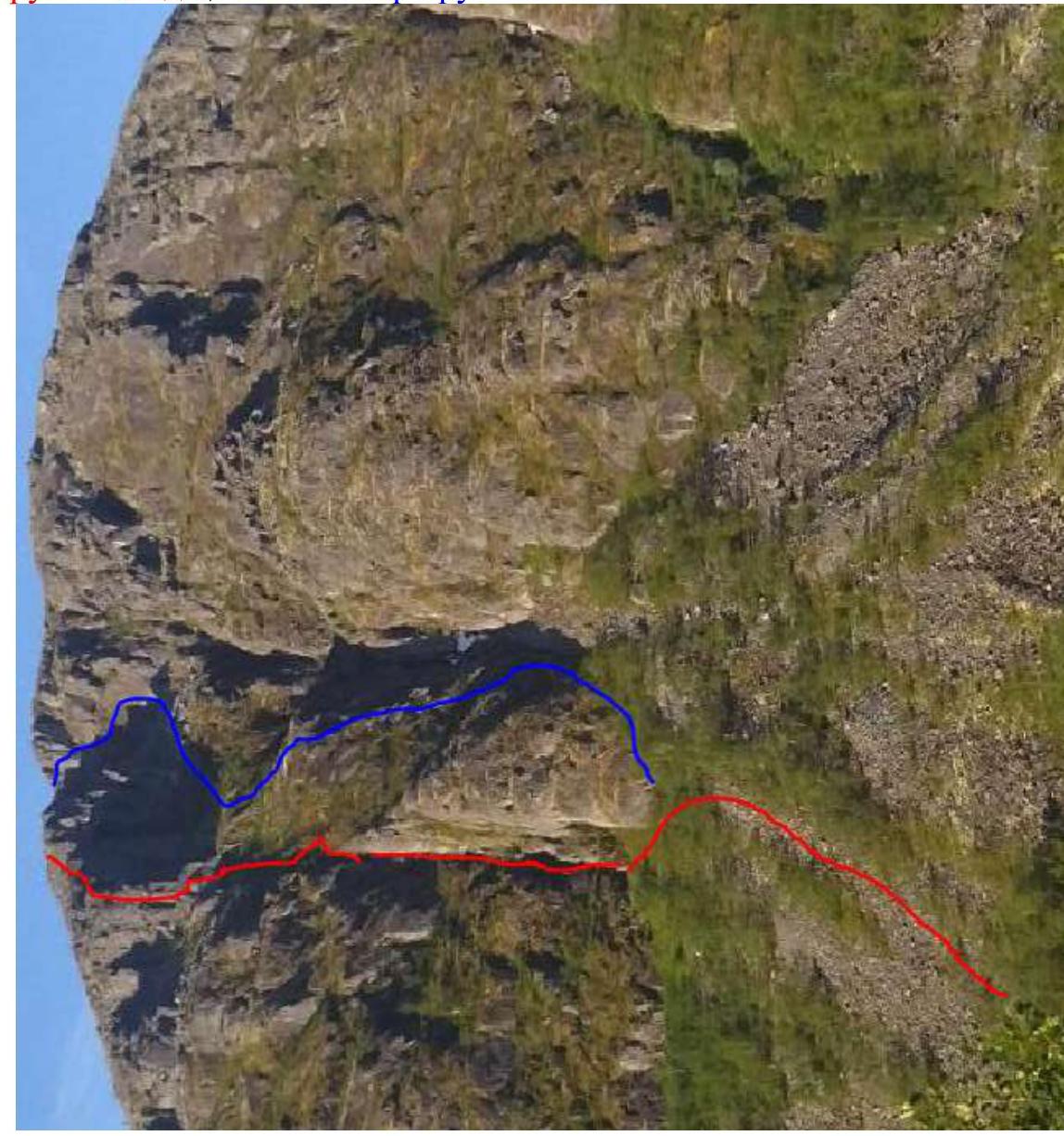
1.1. General photo of the summit.
Red — team's route, blue — "Lis" route
1.2. Profile of the route.
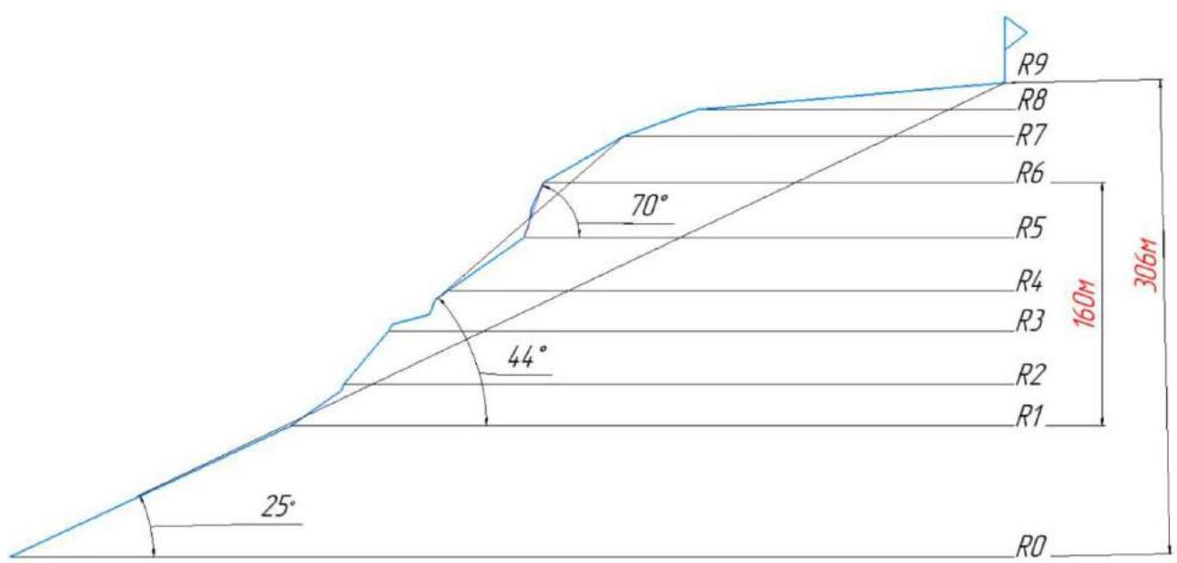
Angles indicated: 25° — overall angle of the route, 44° — angle of the technical part, 70° — angle of the key rope R5–R6.
1.3. Photopanorama of the area.

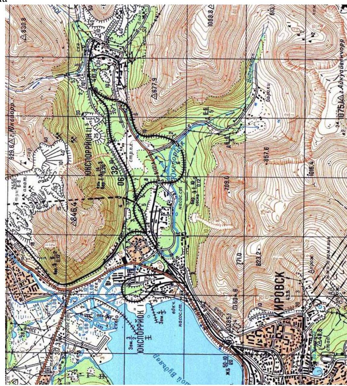
1.4. Map of the area.
2. Characteristics of the Route
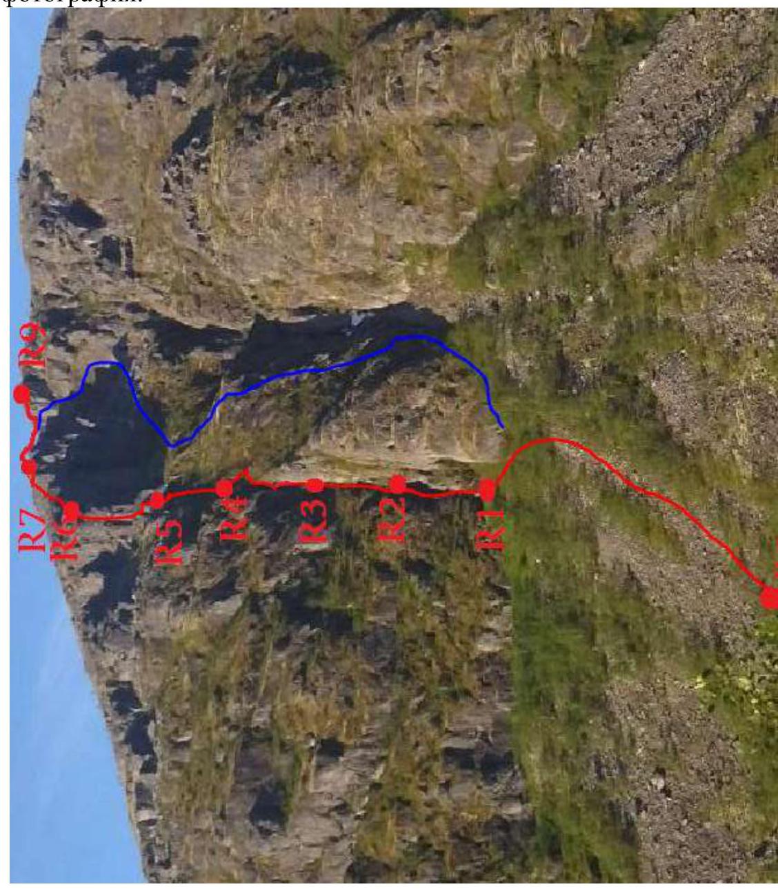
2.1. Technical photograph.
2.2. Technical characteristics of the route sections.
| Section № | Nature of the Terrain | Category of Difficulty | Length, m | Type and Number of Pitons |
|---|---|---|---|---|
| R0–R1 | Medium talus. Station on anchors. | 1 | 200 | 0 2 |
| R1–R2 | Inclined ledge overgrown with grass and bushes, abutting a wall. Climb the wall on the right side. Exit to the ledge. Station on anchors. | 1+/2 2+/3 | 35 5 | 1 2 2 |
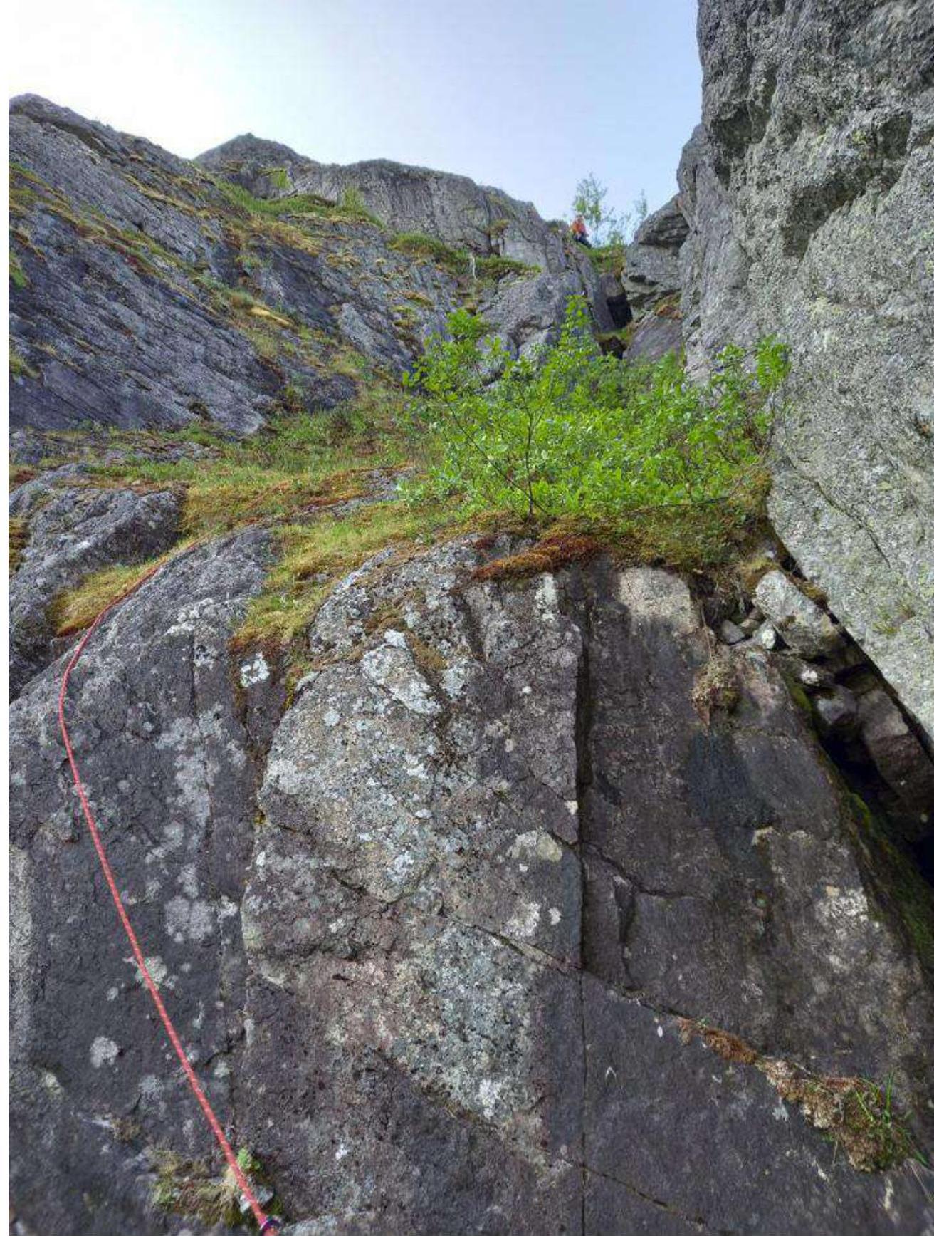
| R2–R3 | Inclined ledge overgrown with grass and bushes, turning into an internal corner. Wet even in dry weather. Station on anchors. | 2 | 45 | 2 2 |
| R3–R4 | Inclined slab. Small wall. Climb on the left side. Inclined grassy ledge abutting a chimney. 2 chimneys separated by an inclined ledge. Then up the grassy ledge to the left towards the nearest rocks. Station on anchors. | 3–3–1 3/3+ 1 | 2 3 25 10 10 | 2 2 0 7 0 2 |
| R4–R5 | Along the rocks — up the grassy ledge (leaving rocks on the left), overgrown with bushes, approach the bastion. Station in the corner on a boulder or anchors. | 1+ | 60 | 0 |
| R5–R6 | Up the internal corner to the ledge. On the right side of the wall to the ledge. Internal corner: lower part of the corner. Upper part of the corner. Station on a boulder. | 3+ 3 4 3/3+ | 5 3 12 18 | 3 2 6 4 |
| R6–R7 | Along the sloping ledge with medium and large talus | 2 | 60 | 1 |
| R7–R8 | Along a large grassy ledge separated by a 2 m wall. | 1+ | 50 | 0 |
| R8–R9 | Along the ledge towards the summit. | non-technical | 200 | 0 |
2.3. UIAA scheme.
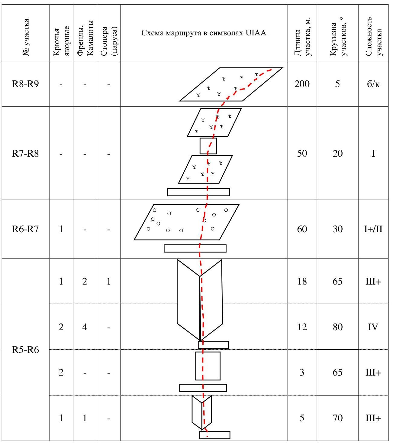
| Section № | Anchor Pitons | Friends, Camalots | Stoppers (sails) | Route Scheme in UIAA Symbols | Section Length, m | Section Steepness, ° | Section Difficulty |
|---|---|---|---|---|---|---|---|
| R4–R5 | - | - | - | 60 | 35 | 1+/2 | |
| R3–R4 | 2 | - | - | 10 | 35 | 1+/2 | |
| 3 | 4 | - | 10 | 70 | 3+ | ||
| - | - | - | 25 | 15 | 1 | ||
| 2 | 1 | - | 5 | 60 | 3– | ||
| R2–R3 | 4 | - | - | 45 | 50 | 2+ | |
| R1–R2 | 4 | - | - | 4 | 70 | 2+ | |
| - | - | - | 40 | 35 | 2 | ||
| R0–R1 | 2 | - | - | 200 | 20–25 | 1 | |
| R8–R9 | - | - | - | 200 | 5 | non-technical | |
| R7–R8 | - | - | - | 50 | 20 | 1 | |
| R6–R7 | 1 | - | - | 60 | 30 | 1+/2 | |
| R5–R6 | 1 | 2 | 1 | 18 | 65 | 3+ | |
| 2 | 4 | - | 12 | 80 | 4 | ||
| 2 | - | - | 3 | 65 | 3+ | ||
| 1 | 1 | - | 5 | 70 | 3+ |
3. Characteristics of the Team's Actions
3.1. Brief description of the route passage.
The route is interesting and logical. The terrain is quite diverse:
- ledges
- internal corners
- chimneys
The key to the route is excellent preparation for category 3A. I would say it is comparable in terms of climbing level to the keys of 3A. The route is recommended for teams with a leader having a strong climbing level (3+/4 trad). Recommended movement scheme: independent rope teams, chimneys and key sections — "rope team by rope team". The start of the route is 30 m to the left of the "Lis" route. The line is clearly visible while moving along the railway tracks, from where the three main parts of the route can be seen:
- A large internal corner within which R1–R4 pass
- Grassy ledge R4–R5
- Rocky bastion R5–R7.
Further movement towards the summit after R7 does not present technical difficulties. Anchors work well on the route, can be used without bending. It will also be useful to have a set of camalots (№0.5–3 BD). №2, 3 can be placed in many places, will be needed to pass the lower half of the key corner (double №2 won't be superfluous).
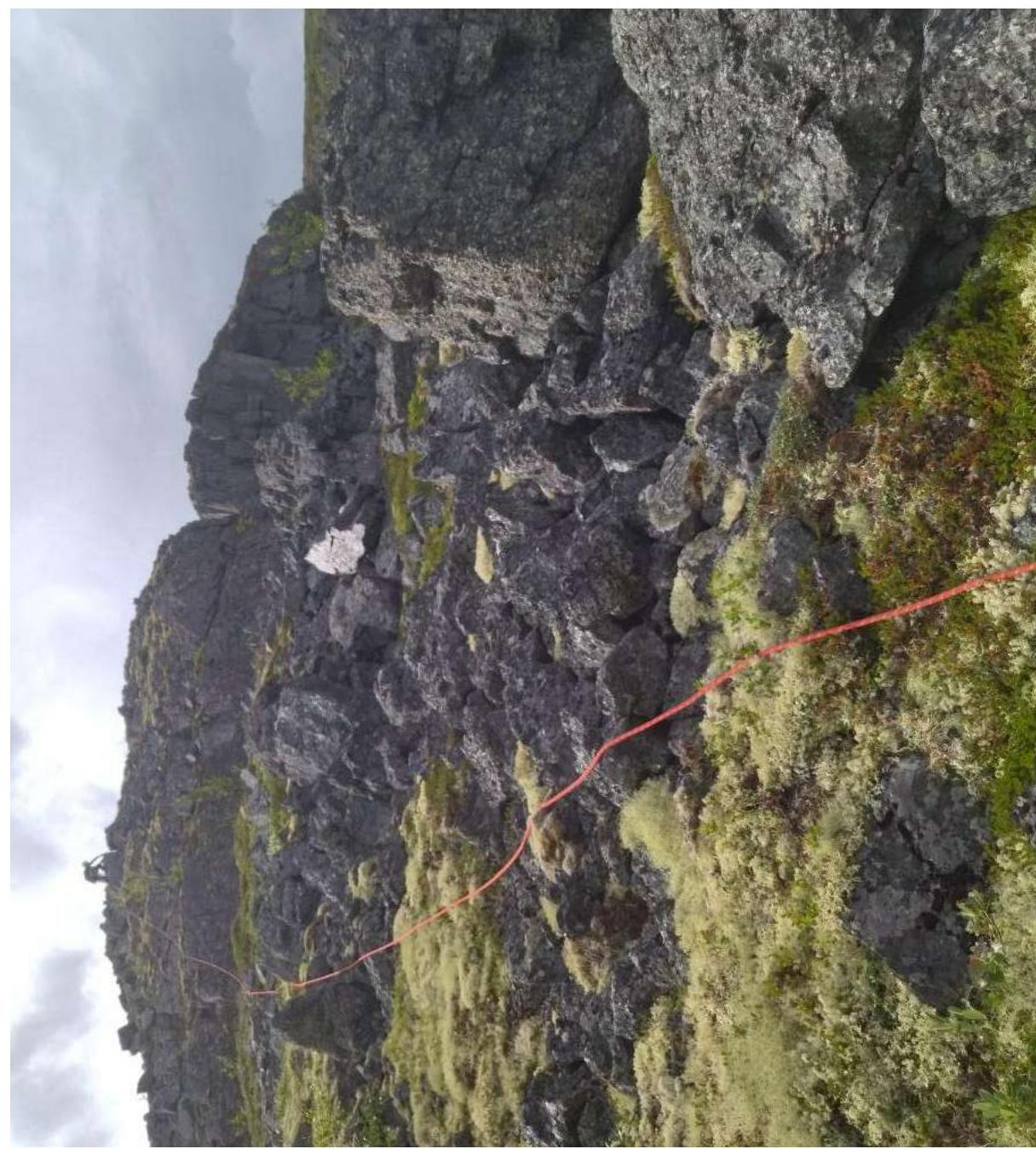
R1–R4
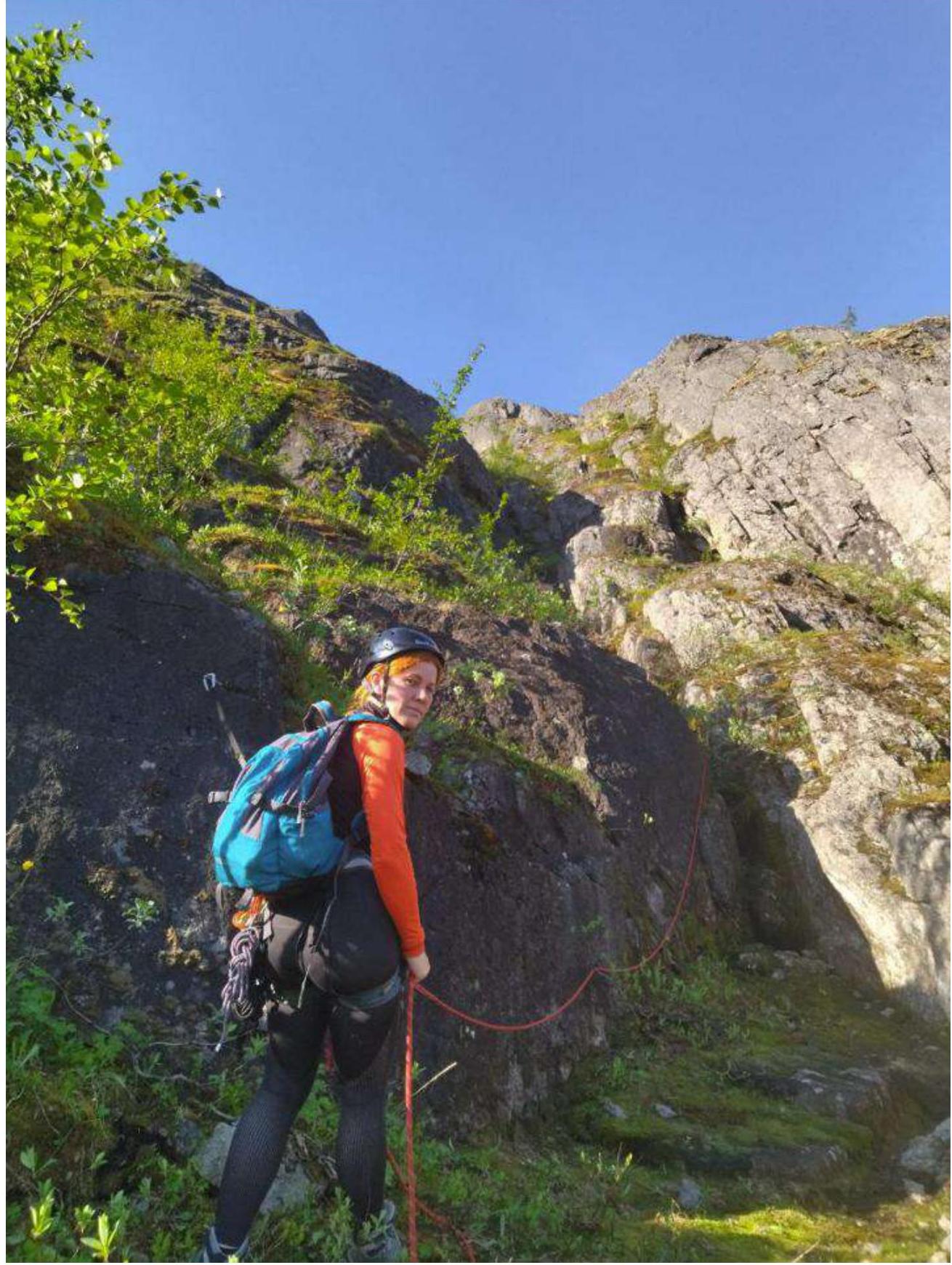
R2 towards R3
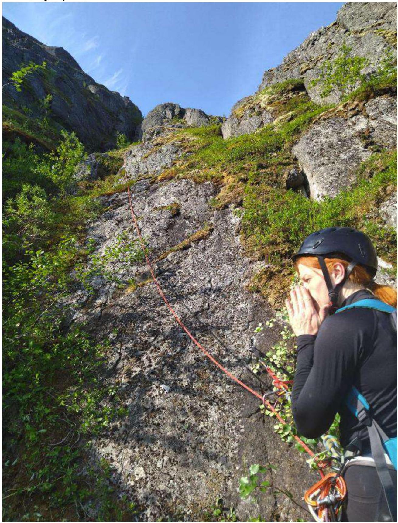
From the middle of R2–R3 to R3
R3–R4
R3–R4 Chimneys
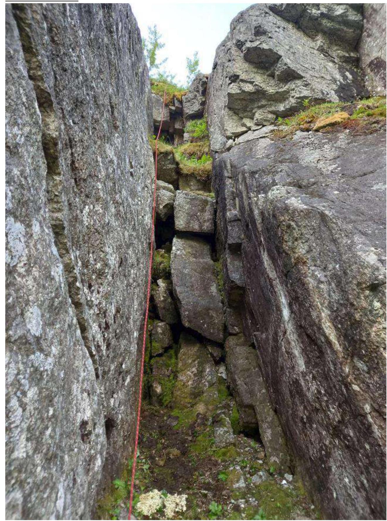
R3–R4 view of the 1st chimney from above
}{("width":1310,"height":1747,"format":"Jpeg","uri":"https://summitx.info/media/1/XbZAu9NwSE8pyFu9jNMExL4mXHs1tiAB/img-11.jpeg","id":64807321} ↗)
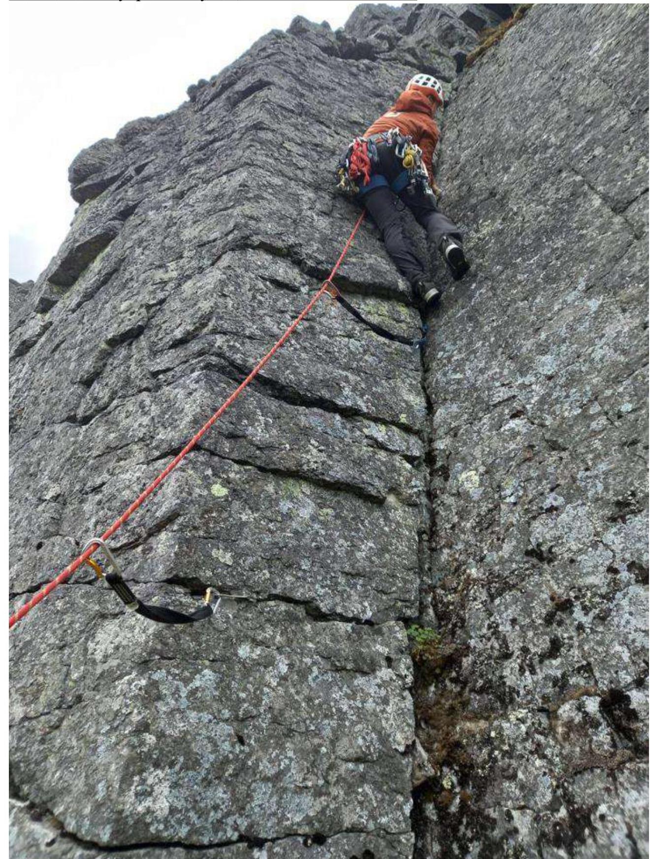
R5–R6
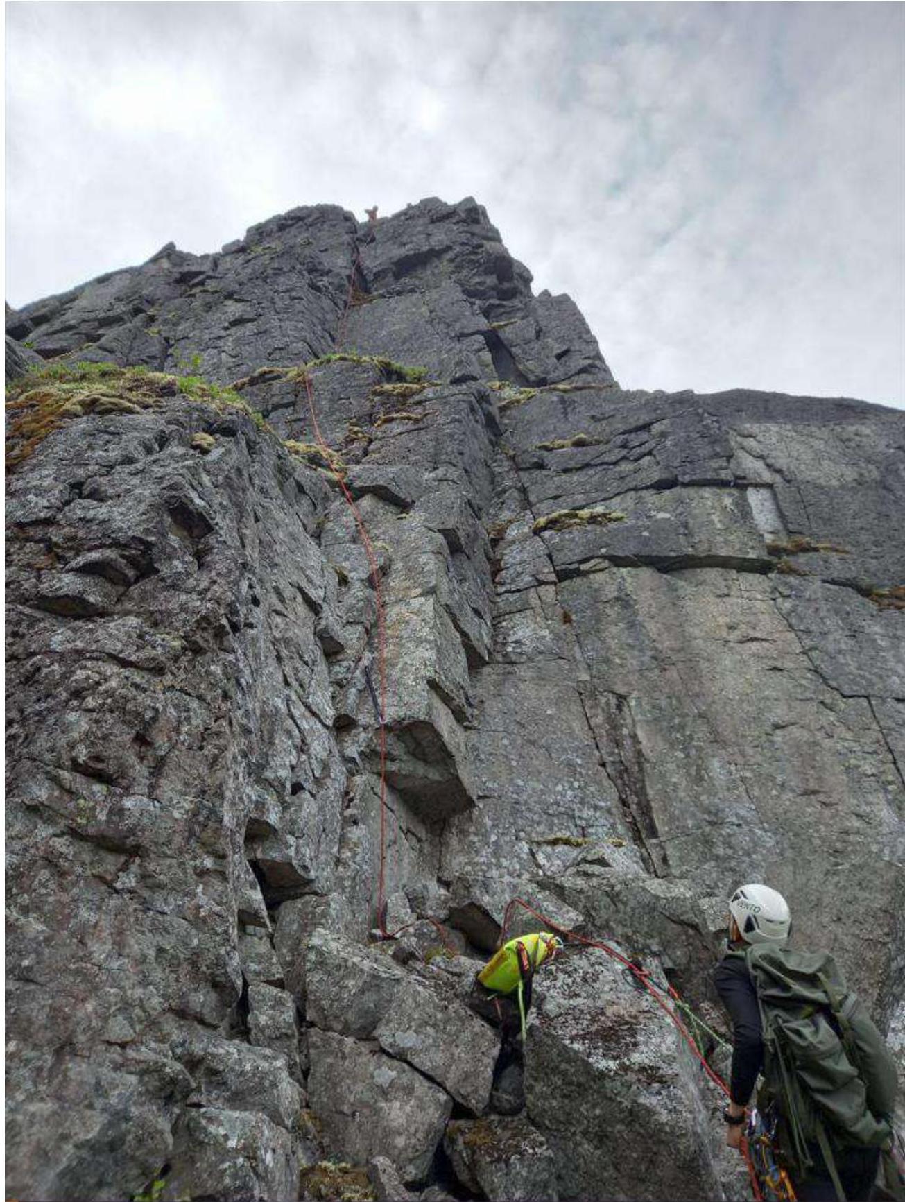
R5–R6 2nd internal corner, lower part. Key.
R7–R8
| Section № | Description | Photo Number |
|---|---|---|
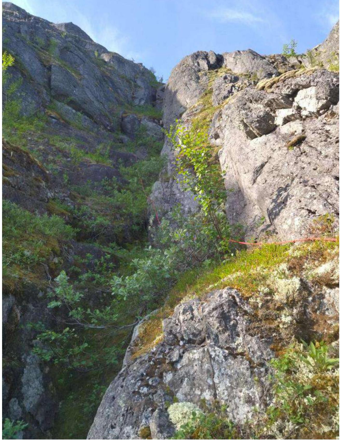
| R0–R1 | Approach on medium talus overgrown with moss. Live rocks present. Slippery in rain. On R1, a convenient ledge to hang gear and tie in. Station on 2 anchors. | Technical photograph. |
| R1–R2 | From the station, either through a 1.5 m chimney or over a "goat's head" to the base of a grassy ledge overgrown with bushes. Up the ledge until it abuts a wall. Climb the wall on the right side. Protection with anchor pitons. Exit to the ledge. Station on 2 anchors. | R1–R2 |
| R2–R3 | From the station, slightly left and up the grassy ledge turning into a large internal corner with grassy ledges overgrown with bushes and "cat coils" inside. Protection with anchors as needed. Exit to the ledge on the right side of the corner. Station on 2 anchors. | R2 towards R3, From the middle of R2–R3 to R3 |
| R3–R4 | Along the 2nd "cat coil" approach the wall. Climb the wall on the left side. Then along a pedestrian ledge to the cascade of chimneys. Protection in the 1st chimney on the right wall. Anchors and camalots №1–3 suitable. Climb in opposition with feet to the right. Exit to a sloping ledge. Up the ledge — to the second chimney. In the 2nd chimney, protection on the right side on anchors. DO NOT ENTER UNDER THE OVERHANG. Climb in opposition with feet to the right wall, at the exit the chimney widens, transition to opposition with feet. Exit from the 2nd chimney to the right onto a grassy ledge. Up the ledge, left towards the nearest rocks. Station on 2 anchors. | R3–R4, R3–R4 Chimneys, R3–R4 view of the 1st chimney from above |
| R4–R5 | Movement up along the rocks on a grassy ledge overgrown with bushes. Station on a boulder or 2 anchors at the start of the rocky bastion. | Technical photograph. |
| R5–R6 | Key section of the route. Corner — wall — corner, separated by convenient ledges. Climb everything head-on. Protection in the 1st corner on anchors and medium camalots №0.5–1.0. Protection on the wall — on anchors. Climb the 2nd corner in an off-width position to the left. For protection, use an anchor at the base, further up the corner — camalots №1–3. Exit to the base of an inclined ledge with medium and large talus. Station on a boulder or camalots №0.5–1.0. | R5–R6, R5–R6 2nd internal corner, lower part. Key. |
| R6–R7 | Movement up the ledge with medium and large talus. Sometimes small walls are encountered, not presenting particular difficulty. Exit to a large ledge. Station on a boulder. | Technical photograph. |
| R7–R8 | Movement along grassy ledges separated by a small wall. Exit to a grassy plateau. | R7–R8 |
| R8–R9 | Across the plateau to the left to the triangulation mark. | Technical photograph. |
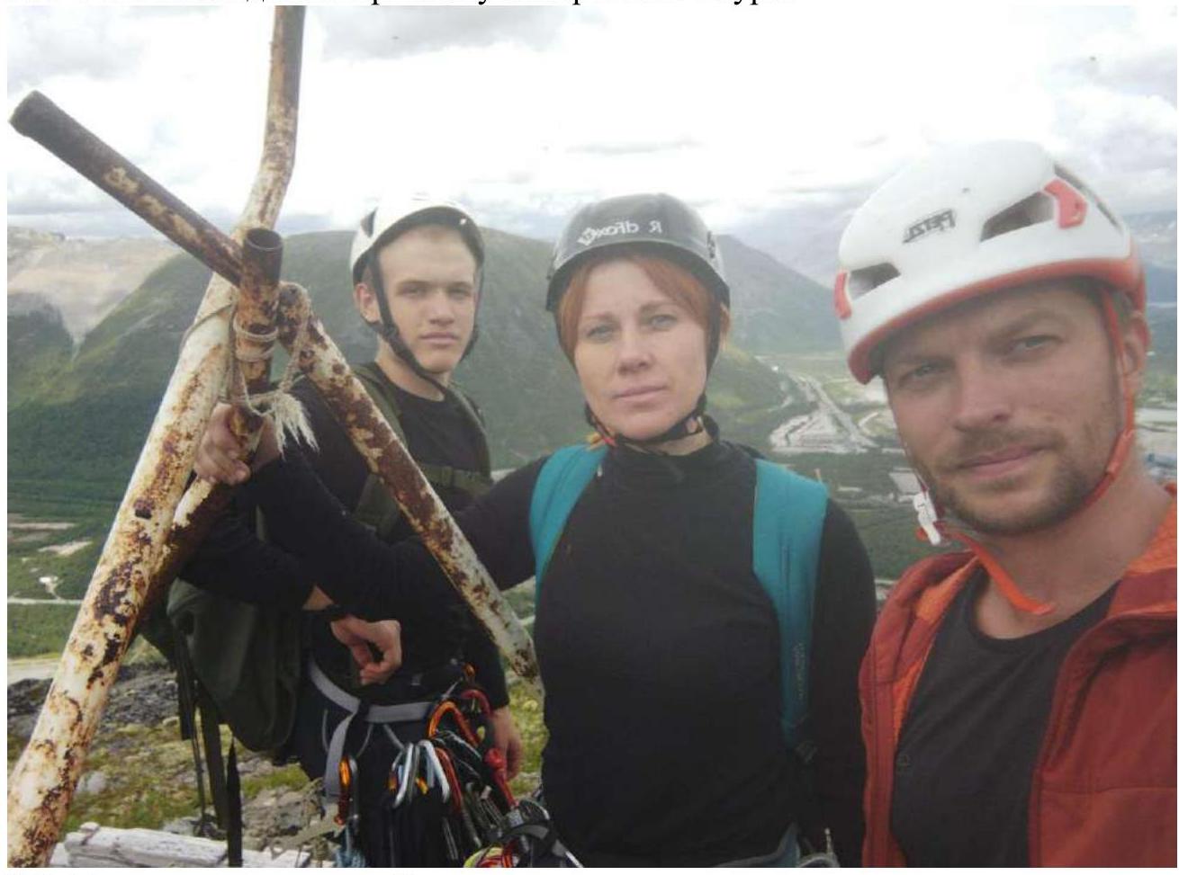
3.2. Photo of the team at the summit by the control tour.
3.3. The route is quite safe in terms of rockfall: there are no lying large and medium stones on the ledges. There is cellular connection on the route. Not recommended in bad weather, as:
- the route has many grassy ledges that will become very slippery in rain;
- it will be difficult to pass the chimneys on R3–R4 in rain;
- it will be difficult to pass the key section R5–R6 in rain.
There are many cracks for anchors along the route.
Descent from the route:
- along the NE edge of the Eastern spur of Aikuayvenchorr
- then to the railway tracks
Emergency descent — via the ascent route.
The route turned out to be much more difficult than category 2B "Roga" and 2B "Dembelsky". The key sections and the overall technical level of the route correspond to 2B in rock areas. The key of the route is more suitable for a complex rope of category 3A.
Comments
Sign in to leave a comment