
REPORT Repeat of the first ascent via the second buttress on the western wall of the northern spur of Mt. Aikuayvenchorr (Eastern) (858 m), VMF Cirque, winter period, "Radist" route, category 2B difficulty level, Aikuayvenchorr Ridge, Khibiny Mountains March 30, 2022 (first ascent)
Leader: Petrova A.M., Murmansk
I. Climbing Report Card
| 1. General Information | ||
|---|---|---|
| 1.1 | Full Name, Sports Category of the Leader | Petrova Alena Mikhailovna, 2nd sports category |
| 1.2 | Full Name, Sports Category of the Participants | Shcherbakov Alexander Vladimirovich, 2nd sports category |
| 1.3 | Coach's Full Name | |
| 1.4 | Organization | |
| 2. Characteristics of the Climbing Object | ||
| 2.1 | Region | Khibiny |
| 2.2 | Valley | VMF Cirques |
| 2.3 | Classification Table Section Number (2013 edition) | |
| 2.4 | Name and Height of the Summit | Aikuayvenchorr |
| 2.5 | Geographical Coordinates of the Summit (latitude, longitude), GPS Coordinates | N67°36′ E33°46′ |
| 3. Route Characteristics | ||
| 3.1 | Route Name | "Radist" |
| 3.2 | Proposed Difficulty Category | 2B |
| 3.3 | Route Exploration Level | First Ascent |
| 3.4 | Terrain Type on the Route | Summer — rocky; winter — mixed terrain |
| 3.5 | Elevation Gain on the Route (altimeter or GPS data) | 575 m |
| 3.6 | Route Length (in meters) | 850 m |
| 3.7 | Technical Elements of the Route (total length of sections with varying difficulty, specifying terrain type: ice-snow, rocky) | I cat. diff. — rocks — 10 m. II cat. diff. — rocks — 210 m. III cat. diff. — rocks — 113 m. IV cat. diff. — ice/rocks/combination — 7 m. V cat. diff. — ice/rocks/combination — ... m. VI cat. diff. — ice/rocks/combination — ... m. Rocks VI, A3 — ... m. Rocks VI, A4 — ... m. |
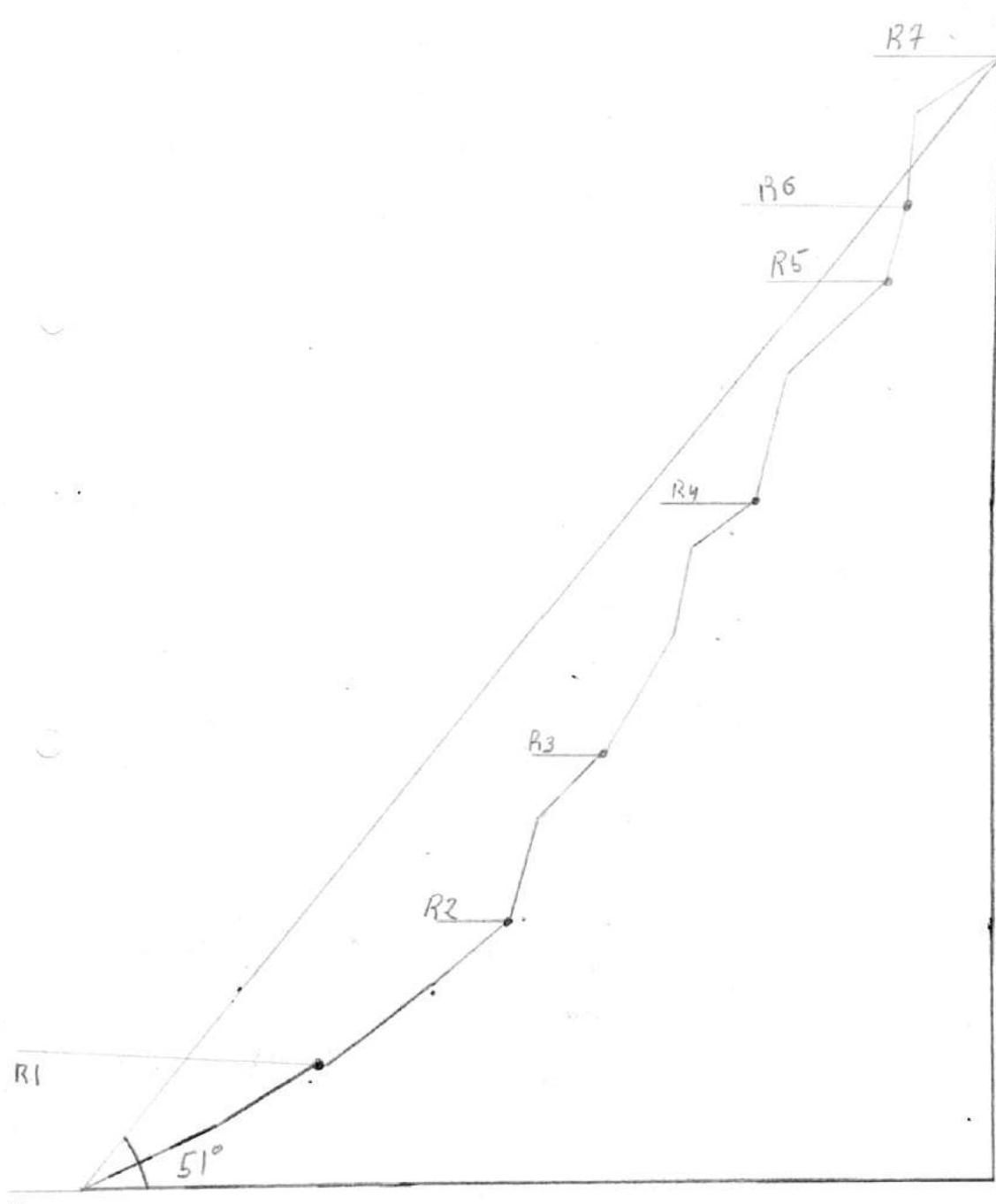
| 3.8 | Average Slope of the Route, ° | 51° |
| 3.9 | Average Slope of the Main Part of the Route, ° | 55.4° |
| 3.10 | Descent from the Summit | Category 0 difficulty level down to VMF Cirque. In winter, descent is possible along the cableway line on the southern ski slope. |
| 3.11 | Additional Route Characteristics | See below. |
| 4. Team Actions Characteristics | ||
| 4.1 | Time in Motion (team's total climbing hours, in hours and days) | 6 hours — main part, 10 hours — total time |
| 4.2 | Overnight Stays | Any part of the cirque |
| 4.3 | Route Preparation Time | ... hours, ... days |
| 4.4 | Start of the Route | 7:00, March 30, 2022 |
| 4.5 | Summit Arrival | 13:00, March 27–30, 2022 |
| 4.6 | Return to the Base Camp | 17:00 |
| 5. Weather Conditions Characteristics | ||
| 5.1 | Temperature, °C | -8 °C |
| 5.2 | Wind Speed, m/s | 3 m/s |
| 5.3 | Precipitation | Snow |
| 5.4 | Visibility, m | 500 m |
| 6. Report Responsible Person | ||
| 6.1 | Full Name, e-mail | Shcherbakov A.V. tahtar1054@mail.ru |
II. Climbing Report
On March 30, 2022, an ascent was made on this route to check its condition during the winter period. Multiple reviews from training groups that have climbed the route indicate that the difficulty level increases by half a category in winter, corresponding to category 2B.
On key sections:
- Ice formation appears;
- Enhanced safety measures are required;
- Passage of key sections becomes impossible without the use of ice tools and crampons.
The conclusions after the ascent are described in the report's conclusion.
1. Characteristics of the Climbing Object
1.1 Map-Scheme of the Region
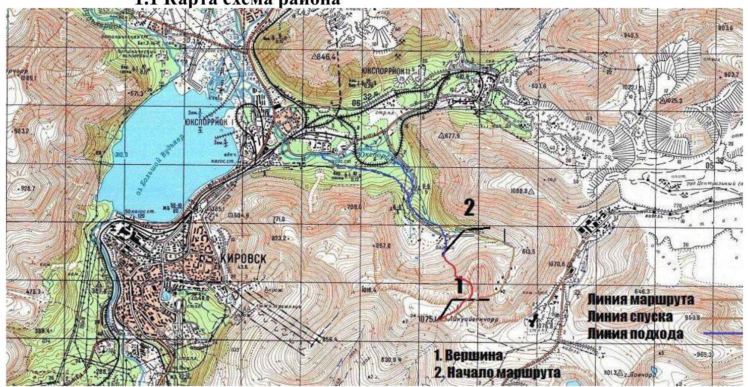
The route is located in the Khibiny mountain range, in its southwestern part. The nearest settlement is the town of Kirovsk. The starting point is considered to be Kirovsk or any residential object (tourist base, hotel) in the administrative district of Kirovsk. Travel time by car to the start of the approach is 10–20 minutes. Then, on foot, 40–50 minutes to the VMF Cirques to the start of the route. The approach is made along an old dirt road from the railway tracks. Move into the cirque and cross the river at any convenient place, then continue towards the northern wall of Mt. Aikuayvenchorr.
1.2 Panorama of the Region
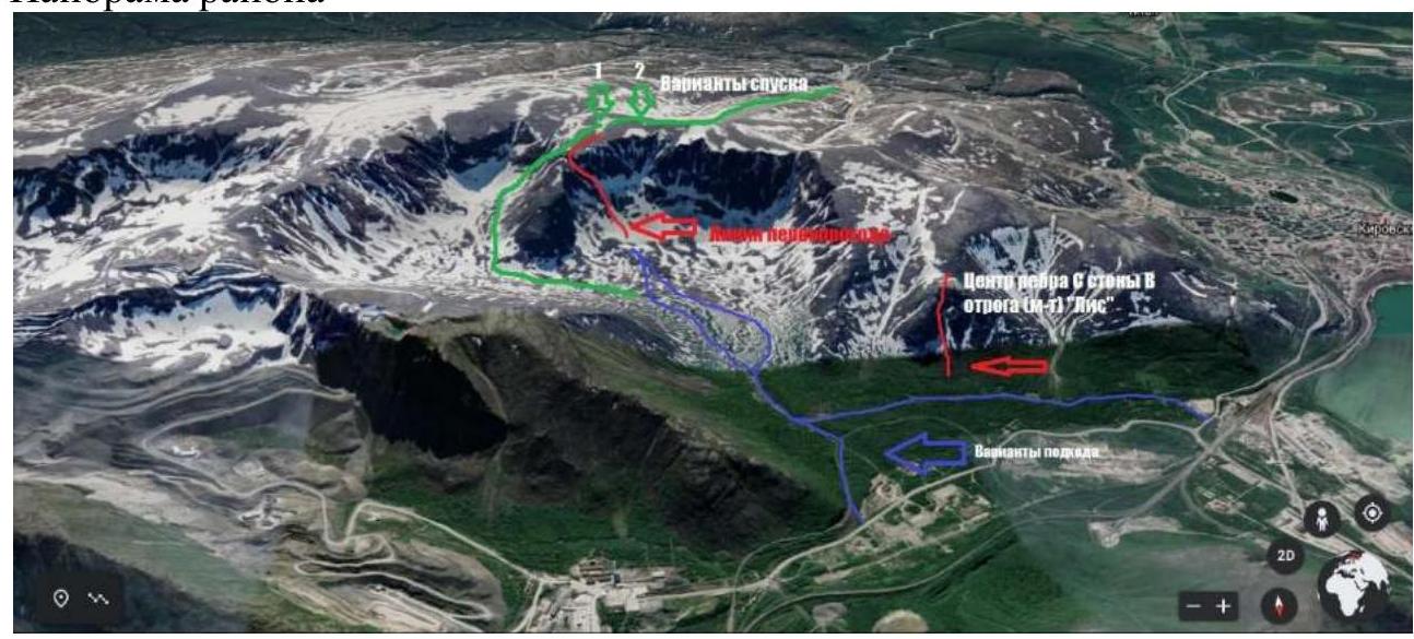
The nearest route, "Central Edge of the S wall of the E spur" (route "Lis"), is indicated on the panorama.
Descent options are also indicated.
- Option 1 is convenient in summer.
- Option 2 is recommended in winter and during unfavorable avalanche conditions.
In winter and spring, the descent can be rockfall-prone. Approach options are equally convenient in winter and summer. Snowshoes or skis are recommended in winter.
2. Route Characteristics
| Section # | Notes on Movement and Belay Options | Section Description | Route Line in UIAA Symbols | Section Difficulty | Section Length, m | Steepness, ° |
|---|---|---|---|---|---|---|
| R6–R7 | 2 loops, 4 nuts | From the saddle, slightly to the right upwards, along a vertical slab along a crack. Then exit to an inclined slab. At the top, there is a drilled station on bolts and plenty of terrain for setting up a station. Then exit to the plateau and path to the summit. | 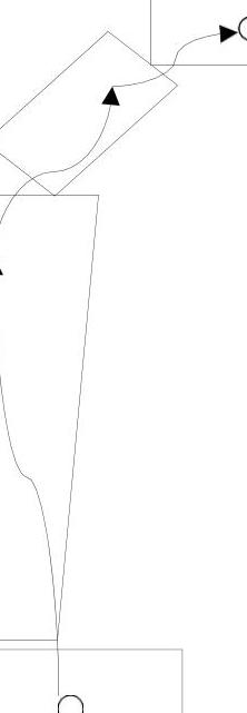 | II–IV | 10 m, 7 m | 45°, 85° |
| R5–R6 | 1 loop, 1 nut | Climb up and descend into the saddle and set up a station. There is a convenient place. | III | 10 m | 75° | |
| R4–R5 | 2 nuts, 1 loop. Alternating. | To the right of the chimney upwards with an exit to a ledge 15 m, 80°, III cat. diff., then along the ridge to the saddle 100 m, II cat. diff. | II–III | 100 m, 15 m | 40°, 80° | |
| R3–R4 | Belay using terrain. Alternating along ledges. | Upwards with an exit to a ledge 15 m, 80°, III cat. diff., then along the ridge to the saddle 100 m, I cat. diff. Move upwards, shifting to the right along ledges. | II–III | 100 m, 15 m, 70 m | 40°, 80°, 60° | |
| R2–R3 | Alternating movement. 1 loop, 3 nuts. | Along the inner corner — stay to the right upwards. Then exit to an inclined ledge and continue moving upwards. | 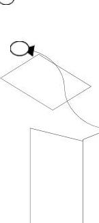 | III | 10 m, 8 m | 45°, 75° |
| R1–R2 | Simultaneous movement, belay using terrain. | Along несложным скалам вверх по гребню, придерживаясь правой стороны. Примерно через 30 м на участке с отколовшейся скалой у стенки по полке пройти налево. |  | II | 30 m, 20 m, 50 m | 40°, 30°, 35° |
| R0–R1 | Simultaneous movement, belay using terrain. In winter, belay via ice axe is possible. | From the buildings upwards, movement through snow, exit to the ridge. There is a characteristic platform for group gathering. |  | I/Н/К | 10 m, 200 m | 30°, 25° |
3. Team Actions Characteristics
| Section # | Description |
|---|---|
| R0–R1 | From the ruined building, climb upwards R0–R1. Pay attention to the snow condition. Staying to the right. Climb up to a stone ledge. Good place for group gathering. |
| R1–R2 | Move along the snowy ledges of the wide counterfort, staying to the right. At a characteristic place with a detached piece of rock, turn left and continue moving upwards. Movement is simultaneous. |
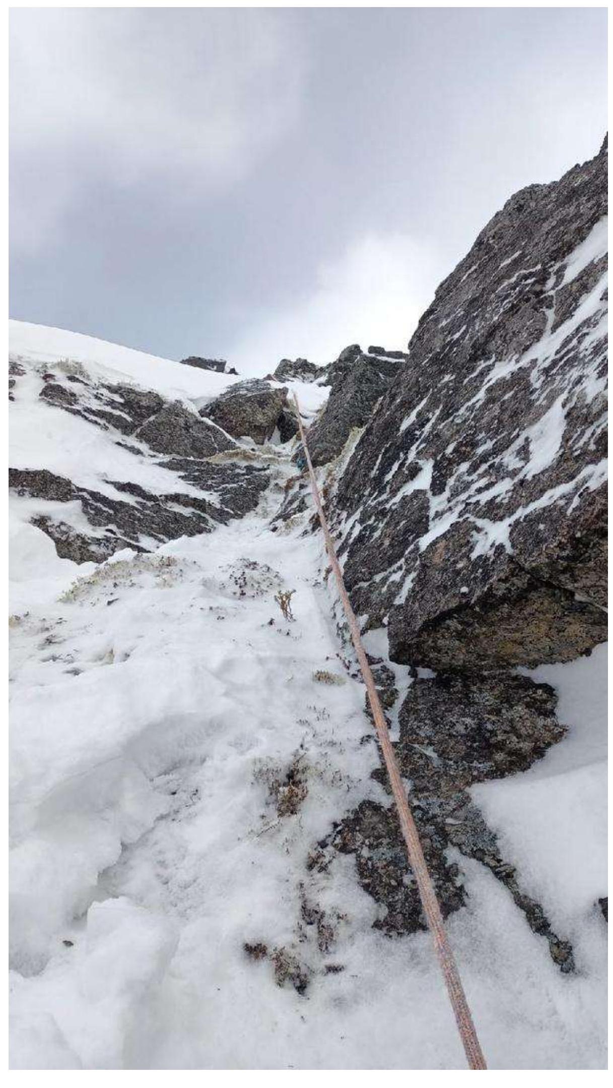
| R2–R3 | Staying to the right of the inner corner, exit to a ledge. Alternating movement. Used 3 Friends #4 and #5. Use of ice tools. |
| R3–R4 | Alternating movement along inclined slabs and ledges. Slabs are snow-covered. Adequate belay is absent. Avoid strong traverses to the sides. |
| R4–R5 | Along the right wide wall of the chimney, move upwards; in the middle part, there is a narrow ledge and terrain for setting up belay points. Then exit to the left onto a wide inclined ledge. The ledge is practically absent — covered with snow. Used 2 Friends #4 and #5. At the end of the section, belay — a loop on a stone. Terrain belay is possible. Use of ice tools. |
| R5–R6 | Snow cornices are present. Descent into the saddle via rappelling, belay via a loop. |
| R6–R7 | Station on two medium-sized nuts. Key section. Stay on the crack while climbing the wall. To the right, there are ledges. It is convenient to place tools. To the left and right, there are couloirs. Couloirs are prone to avalanches. Used Friend #3 and #4. After exiting to the ledge, belay via stones or ice axe. Then exit to the plateau and path to the summit. |
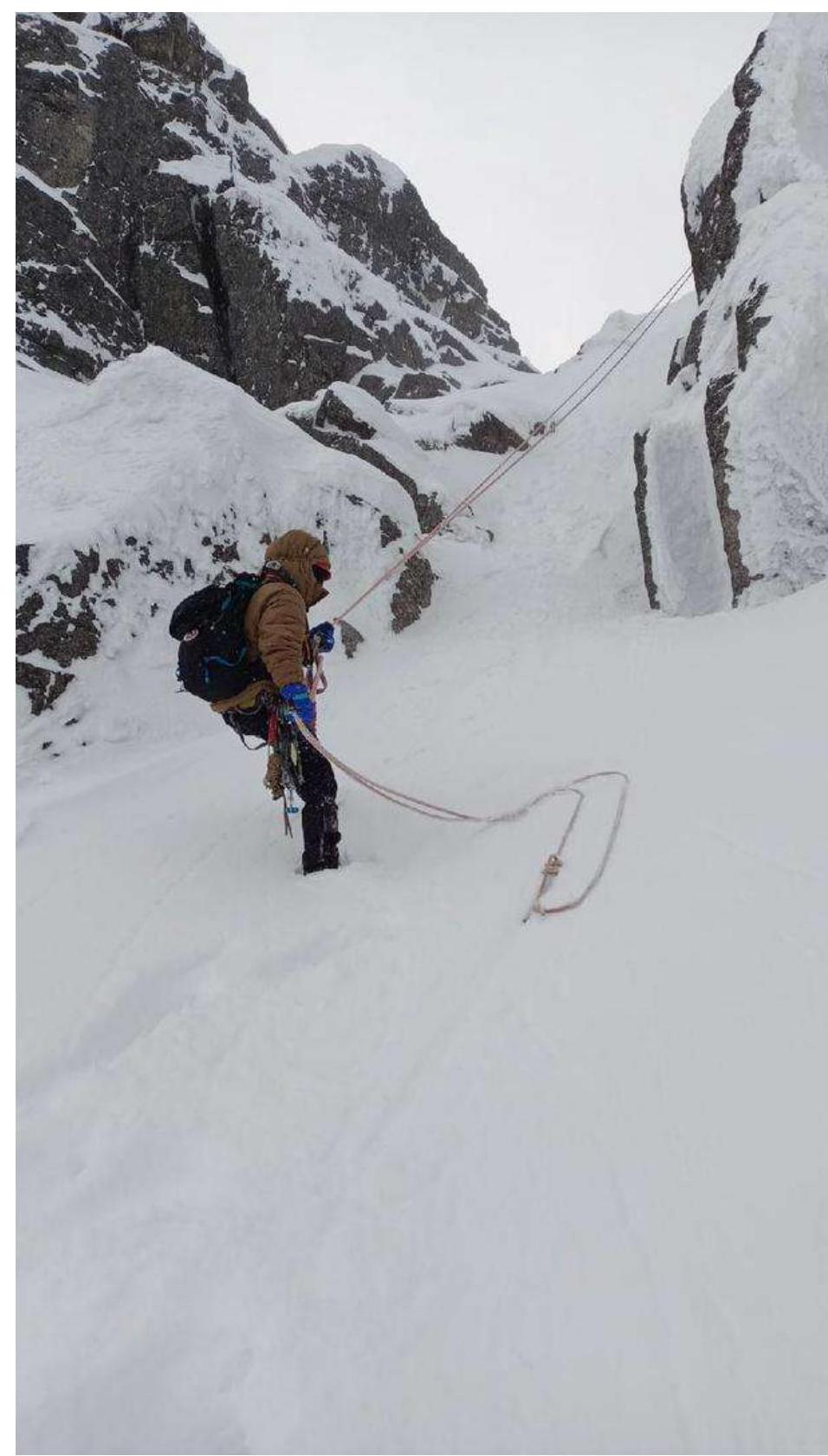
R0–R1. Snow and icy crust require roping up and the use of crampons and ice axe.
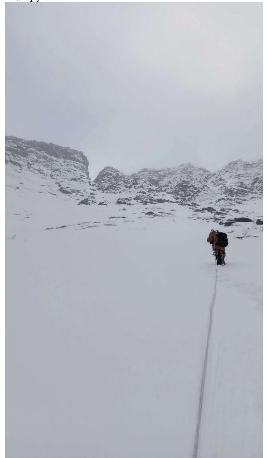
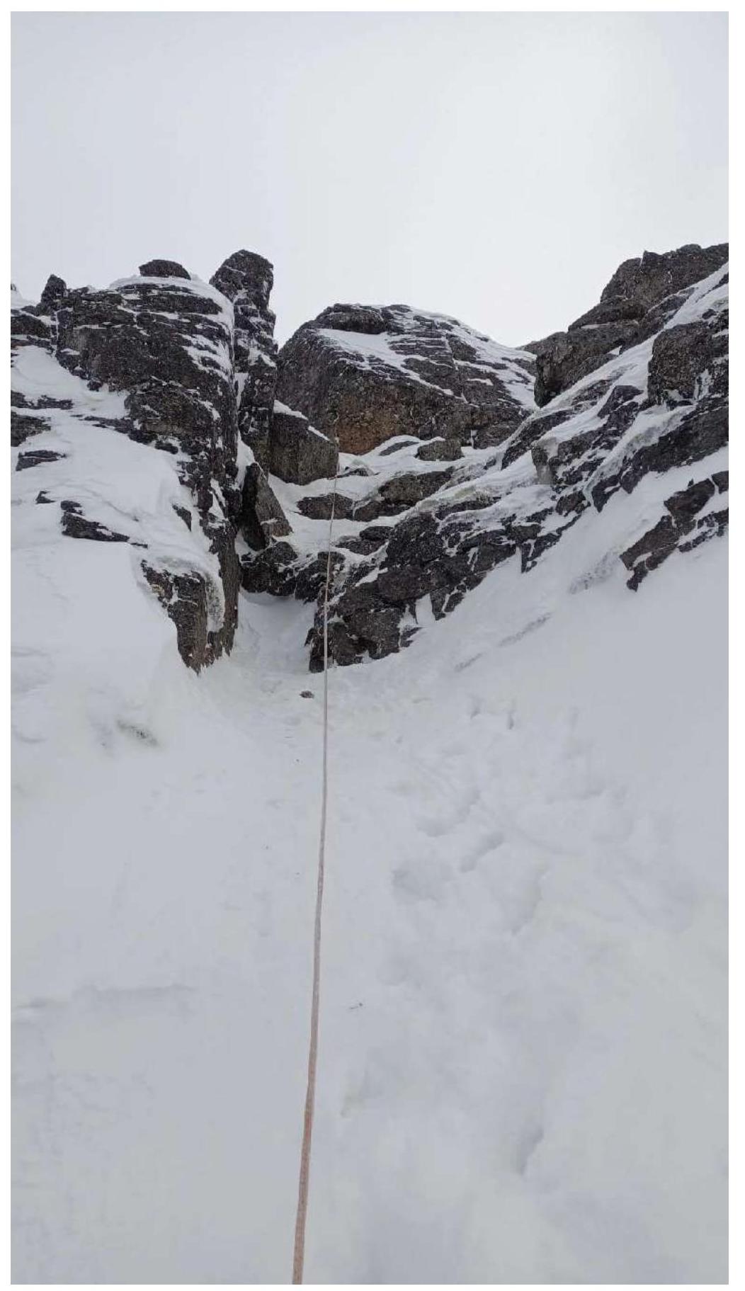
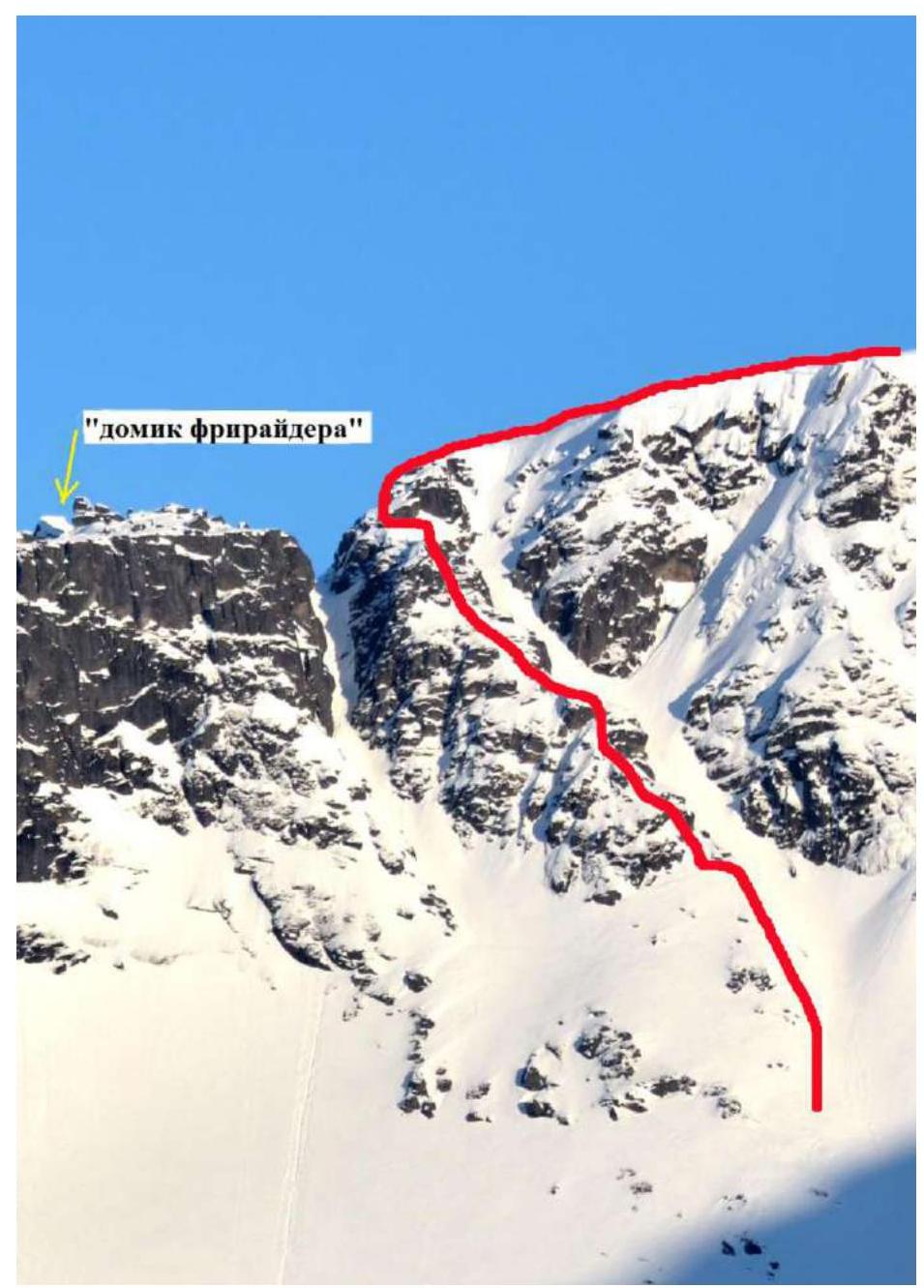
 Overview photograph up to mark R4.
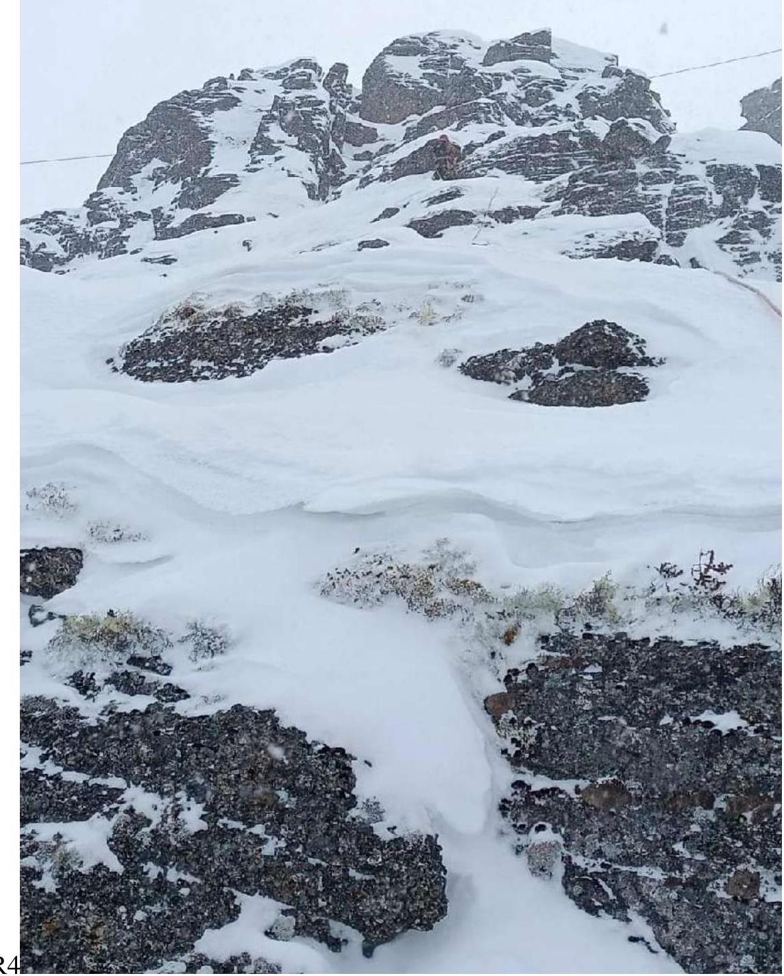
 R5–R6. Exit to the saddle.
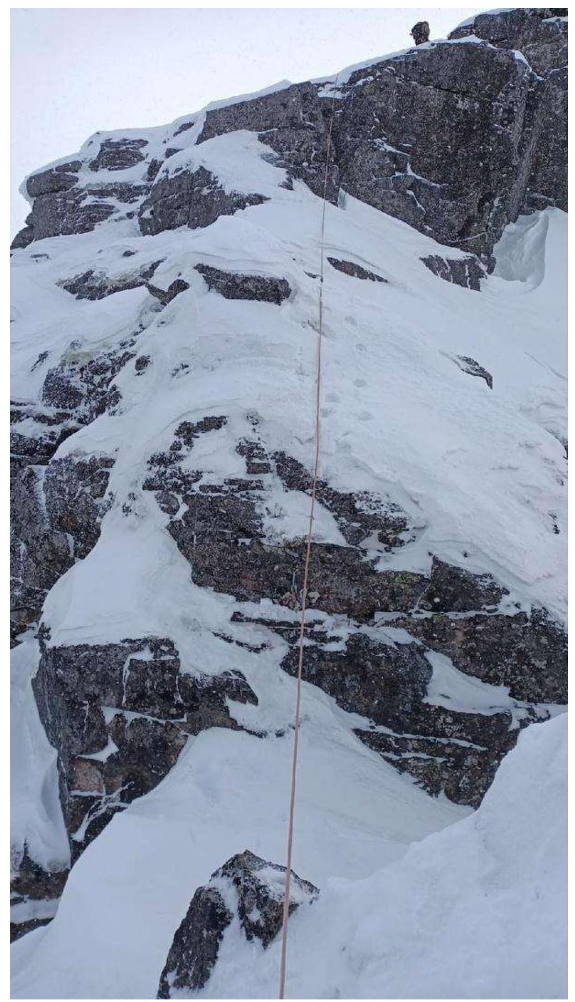 Photograph from an elevation, before the saddle.

The exit to the saddle is complicated by the presence of snow cornices and a steep snow slope. Climbing is possible with the use of ice tools. The passage speed is twice as long as in summer. Descent into the saddle in three steps does not provide a safe descent; in winter, rappelling is necessary.
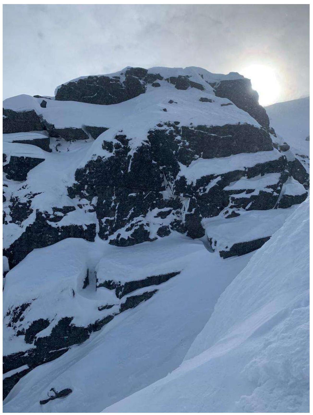
 View from above, before rappelling, at the last rocky wall.
 Route profile.
3.3. Safety Assessment, Tactical Plan, and Recommendations for the Route.
At 7:00, we were at the start of the route, in the VMF Cirque. At 7:30, we passed the snow field on the approach and began work on section R1. The passage of sections R4–R5–R6 took twice as long as in summer. It was necessary to clear gaps from ice to set up belay points. R6–R7 also requires careful passage and the use of ice tools and crampons on rocks.
At 13:00, we were at the summit. At 13:30, the descent began. At 14:10, we were in the second cirque, and at 17:00, we exited the valley to the car. Weather conditions were good throughout the route.
The team's equipment: a set of " Vento Paрус" nuts, 4 medium-sized Friends, 2 rigid universal hooks, 2 anchor hooks, 2 ropes of 50 m, crampons, and ice tools, personal equipment.
Sections R0 to R5 also do not cause problems in navigation. Before exiting to the saddle, move carefully.
When exiting to the saddle, stay to the right, and before the key section, from the saddle, do not try to bypass the wall via the couloir, as snow accumulation is possible in winter.
After exiting to the plateau, take Kirovsk as a landmark and move until a non-characteristic rise to the summit.
During the descent in winter, assess the avalanche situation. An alternative descent is possible in poor weather conditions and unsatisfactory group condition. To do this, take a direction to SW or 10–11 o'clock from Kirovsk and move until the upper station of the chairlift, approximately 30–40 minutes, and descend along the southern side of the "Bolshoy Vudyavr" ski resort.
The route is safe to climb, but in winter, it is necessary to assess the avalanche situation and the duration of daylight. In poor visibility (fog, dark time of day), landmarks for descent can be the lights of Kirovsk and the nearest mine. On the route, there is partial mobile coverage by the Megafon operator, and on the summit — by all operators. The route is visible from the valley up to the exit to the saddle.
Conclusion
The route is pleasant and logical. In summer, it is classified as 2A; in winter, it is necessary to classify the route as 2B. This is because in winter, there are sections of significantly more complex climbing than in summer, not corresponding to the complexity of 2A sections.
The time taken to complete the route increases. The route is necessary for the development of this mountain region, as the number of 2A and 2B category routes in the Khibiny Mountains is extremely low. Considering that most gatherings in the Khibiny Mountains take place during the winter-spring period, using this route as 2A — especially the first 2A — is incorrect.
The route, with its sections of III category difficulty, corresponds to routes of category 2B. This opinion is formed by our personal experience, route assessment, and numerous reviews from climbers — sports category athletes and instructors.
I believe that the route should be classified as 2B in winter.
Comments
Sign in to leave a comment