REPORT
ON THE FIRST ASCENT TO THE SUMMIT OF VUDYAVRCHORR MALY VIA THE ROUTE "ALONG THE RIGHT CHIMNEY OF THE EASTERN WALL" CATEGORY 2B COMPLEXITY BY THE TEAM OF UTS FAMO "KHIBINY-22" FOR THE PERIOD FROM AUGUST 17, 2022 TO AUGUST 17, 2022
2022
I. ASCENT DOCUMENT
| № | 1. General Information | |
|---|---|---|
| 1.1 | Full name, sports rank of the leader | Patutinskii Alexander Nikolaevich 1st sports rank |
| 1.2 | Full name, sports rank of the participants | Preobrazhenskii Alexander Olegovich – III sports rank, Dolya Vladimir Vladimirovich – III sports rank, Tarasov Arsenii Aleksandrovich – III sports rank, Melashenko Maria Evgenievna – III sports rank, Kostrik Mikhail Aleksandrovich – III sports rank. |
| 1.3 | Full name of the coach | Payashev Yuri Mikhailovich |
| 1.4 | Organization | Federation of Alpinism of Murmansk Region |
| 2. Characteristics of the Ascent Object | ||
| 2.1 | Region | Khibiny. Takhtarvumchorr Ridge |
| 2.2 | Valley | Ganechina Cirque |
| 2.3 | Section number according to the 2020 Classification Table | 8.4.1. |
| 2.4 | Name and height of the summit | Vudyavrchorr Maly 1065 m. |
| 2.5 | Geographical coordinates of the summit (latitude/longitude), GPS coordinates | - |
| 3. Route Characteristics | ||
| 3.1 | Route name | Along the right chimney of the Eastern wall. |
| 3.2 | Proposed category of complexity | 2B |
| 3.3 | Degree of route development | First ascent. |
| 3.4 | Route terrain characteristics | Rocky. |
| 3.5 | Route elevation gain (data from altimeter or GPS) | 260 m. |
| 3.6 | Route length (in meters) | |
| 3.7 | Technical elements of the route (total length of sections of various complexity categories with terrain characteristics (ice-snow, rocky)) | Category I rocky – 570 m. Category II rocky – 120 m. Category III rocky – 60 m. Category IV rocky – 0 m. Movement on closed glacier – 0 m |
| 3.8 | Descent from the summit | Through Geografov Pass. |
| 3.9 | Additional route characteristics | Mossy rocks. Wet internal corners and chimneys with running streams. |
| 4. Characteristics of the Team's Actions | ||
| 4.1 | Travel time (team's walking hours, in hours and days) | 7 hours. |
| 4.2 | Overnights | Ford near Lake Maly Vudyavr |
| 4.3 | Route entry | 6:30, August 17, 2022 |
| 4.4 | Summit attainment | 11:00, August 17, 2022 |
| 4.5 | Return to base camp | 13:30, August 17, 2022 |
| 5. Responsible for the report | ||
| 5.1 | Full name, e-mail | Patutinskii A.N. aleks_patutinskii@mail.ru |
II. Ascent Description
1. Characteristics of the Ascent Object
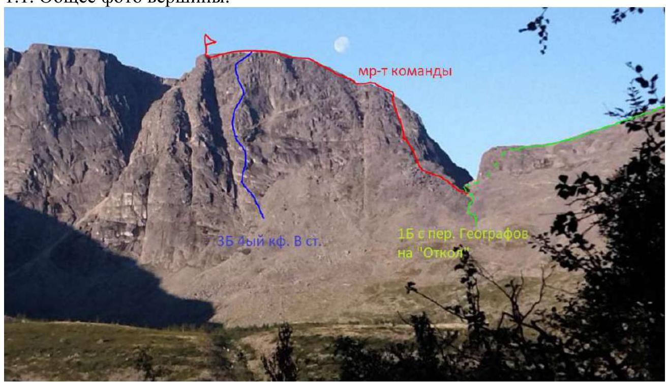
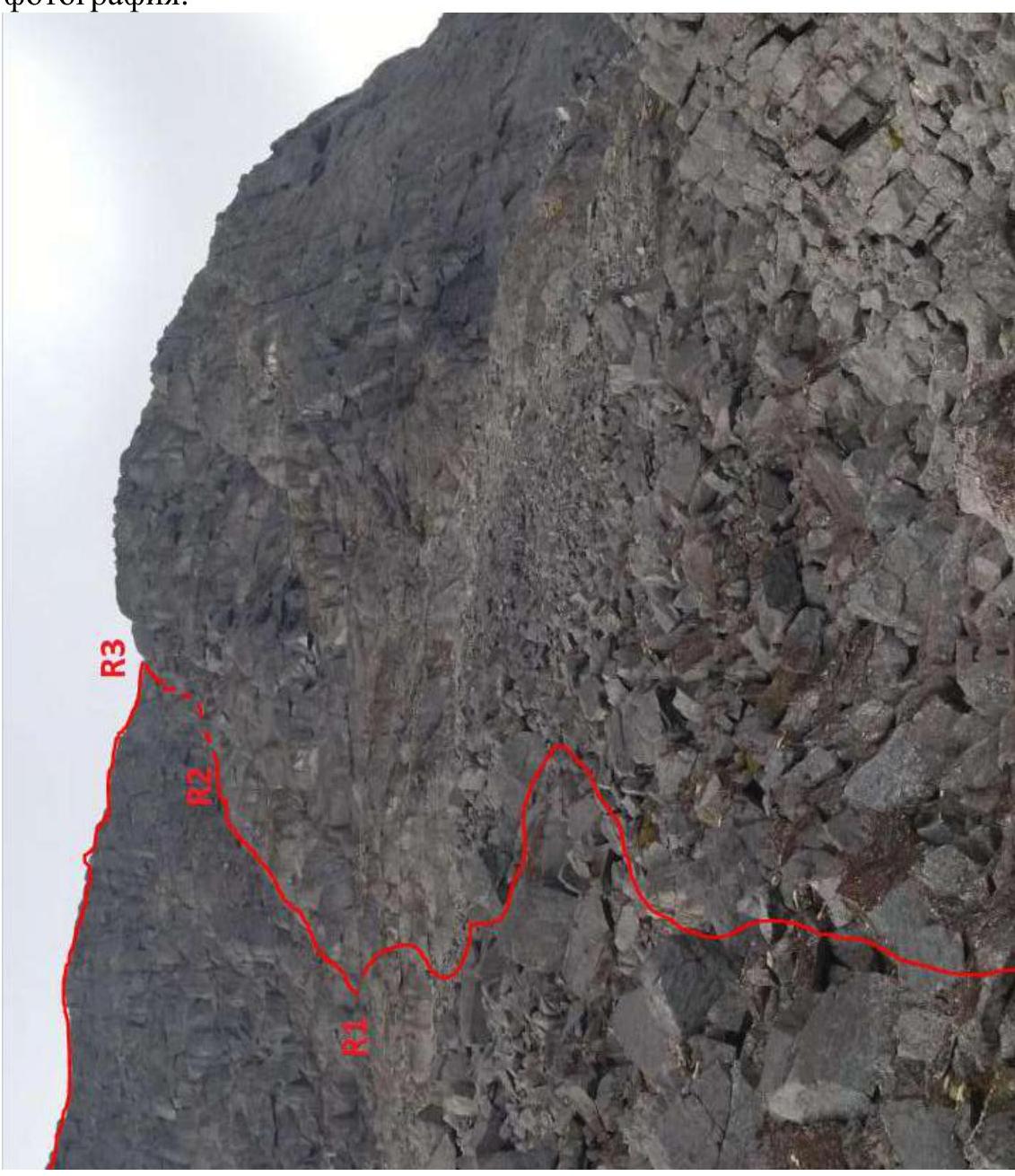
1.1. General photo of the summit.
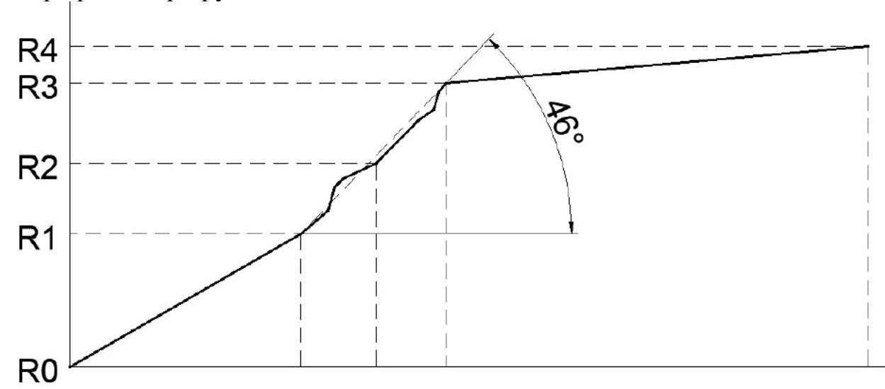
1.2. Route profile.
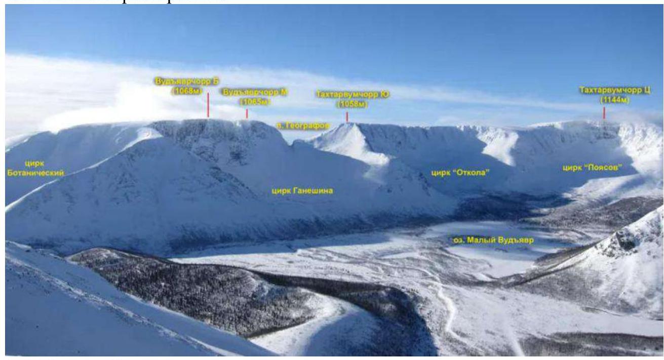
1.3. Photopanorama of the area.
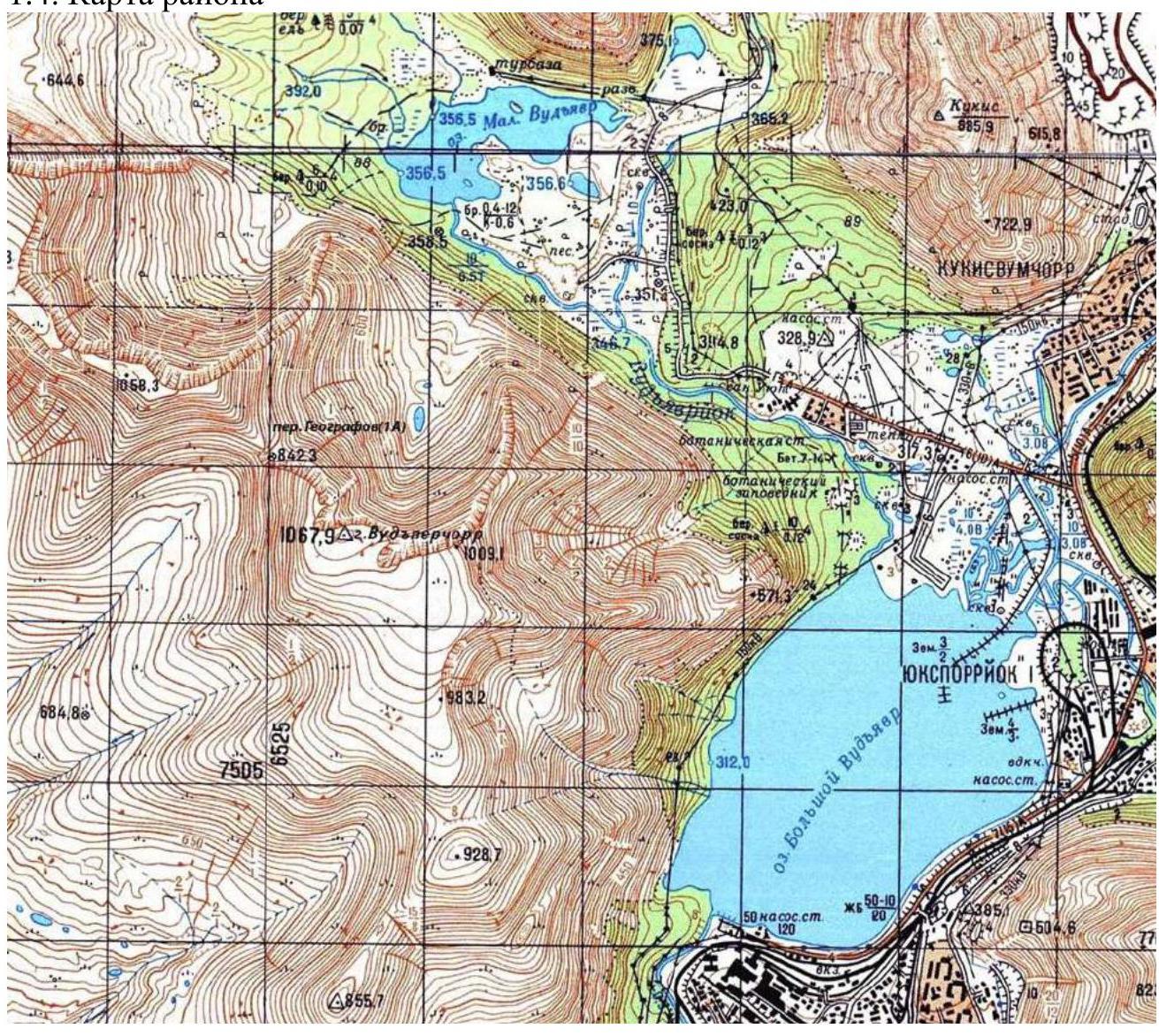
1.4. Area map
2. Route Characteristics
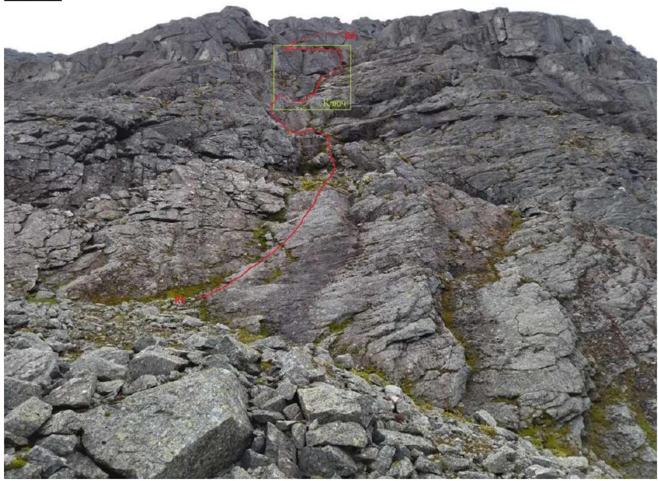
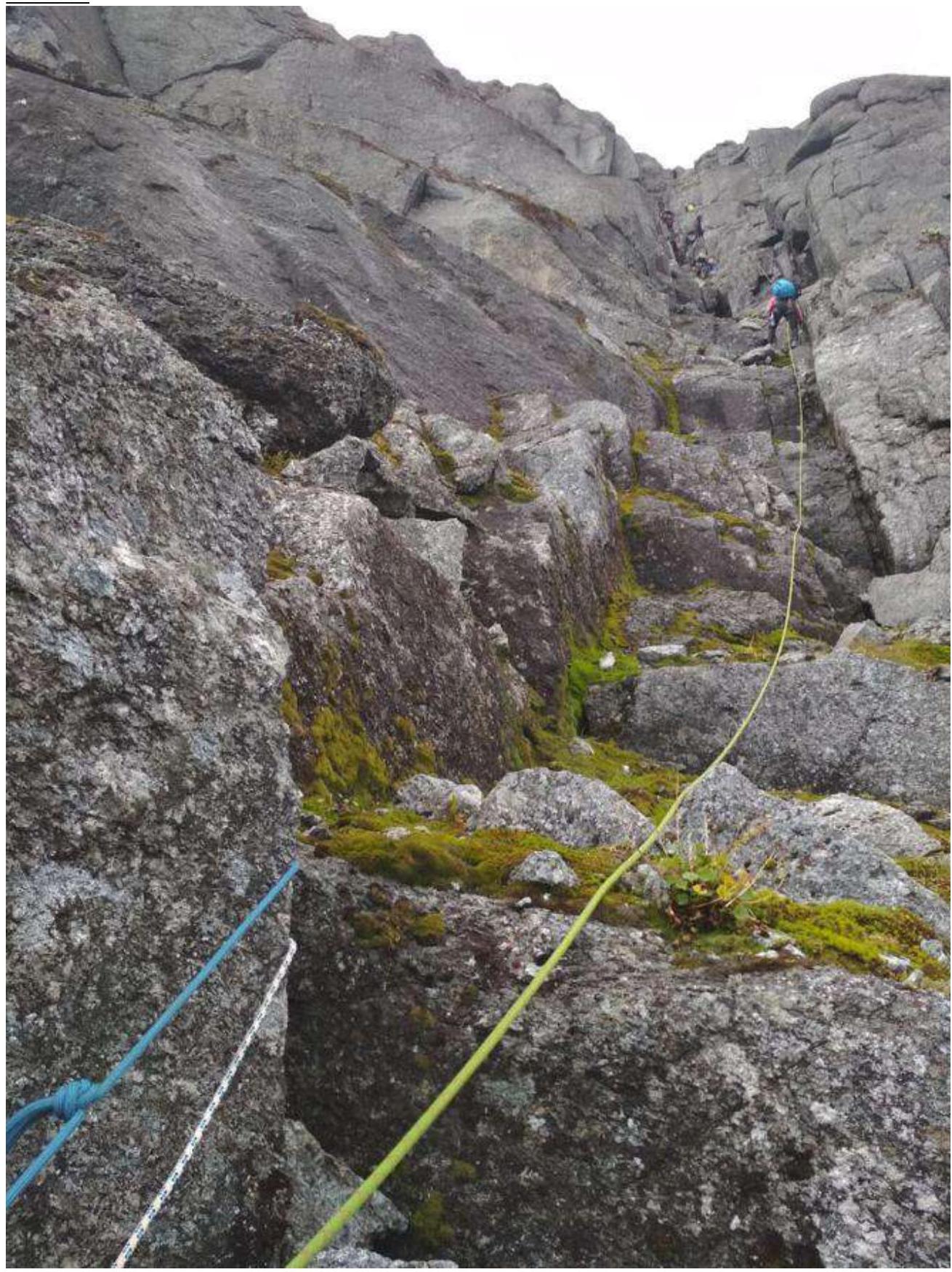
2.1. Technical photograph.
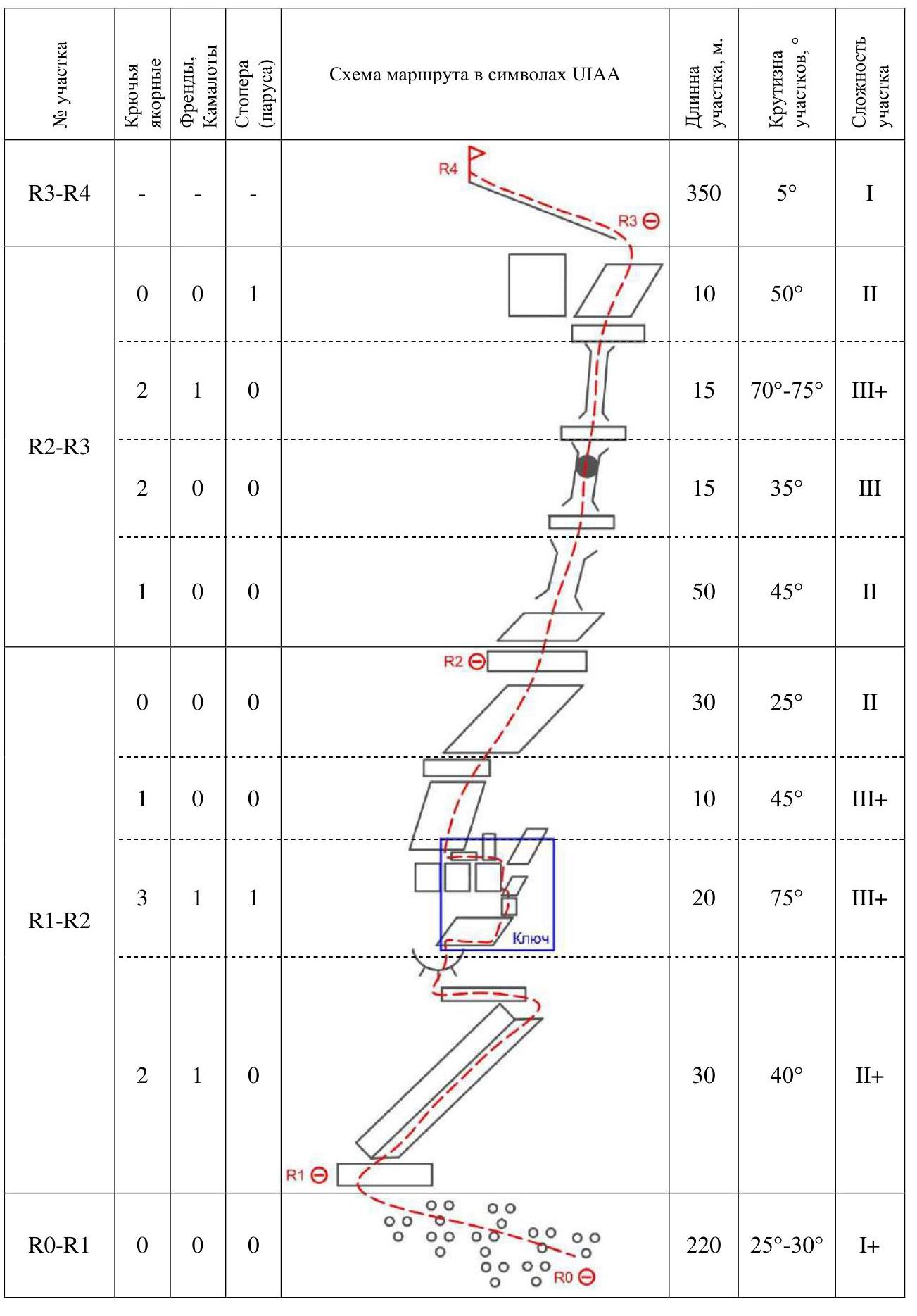
2.2. Technical characteristics of route sections.
| Section | Terrain characteristics | Complexity category | Length, m | Type and number of hooks |
|---|---|---|---|---|
| R0–R1 | Large and medium talus | 1+ | 220 | 0 |
| R1–R2 | Wet, moss-covered rocks. Streams. Internal corner, system of ledges, sheep's foreheads, and small walls. Exit to a large grassy ledge. | 2+/3+ | 90 | 9 |
| R2–R3 | System of 3 wet chimneys separated by ledges. | 2/3+ | 90 | 7 |
| R3–R4 | Walking ridge. | 1 | 350 | 0 |
2.3. UIAA Scheme
3. Characteristics of the Team's Actions
3.1. Brief description of the route passage
The route is interesting and logical. The terrain is quite diverse: ledges, chimneys, sheep's foreheads, and rock formations.
An excellent route for preparing for the first 3A. The route is recommended for groups with a strong climbing level: Category III complexity for each participant.
Recommended movement pattern: independent rope teams or "rope team by rope team."
The route is located in the Ganechina Cirque. The line is clearly visible while approaching Geografov Pass.
Approach:
- The approach to the wall begins from the trail leading to Geografov Pass, along large and medium talus.
Technical section of the route (R1–R3):
- Begins on a large grassy ledge, convenient for hanging equipment and tying in.
- Passes through wet, moss-covered rocks.
- Streams are present.
- On the key section R1–R2, 3 points were established:
- a loop on a rock before a sheep's forehead (wall),
- an anchor after passing this forehead (wall),
- a cam №1 (red) when exiting to the ledge.
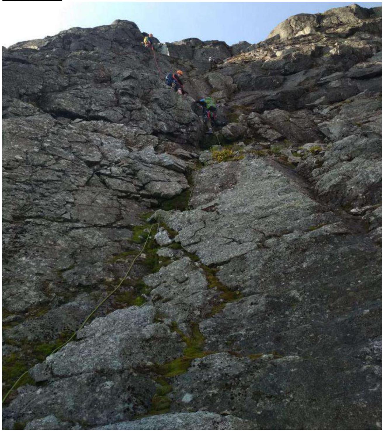
When passing this chimney section R2–R3 (key), it is necessary to organize belays on anchor hooks. The ridge does not present technical difficulties.
R1–R2:
 Exit from R1:
 Key R1–R2:
 R2–R3:
| Section | Description | Photo number |
|---|---|---|
| R0–R1 | Approach to the wall. Large and medium talus. Simultaneous movement. There are large loose rocks. | Technical photograph. |
| R1–R2 | Wet rocks even in good weather, covered with moss. Wide open internal corner; sheep's foreheads (small walls), separated by horizontal and sloping ledges; long mossy chimney. Exit to a large grassy ledge. Organization of a station. Simultaneous movement is possible for groups capable of climbing keys 3/3+ on wet, slippery rocks. Station R2 should be organized NOT under the beginning of the chimney (protection from rockfall). | R1–R2, Exit from R1, Key R1–R2. |
| R2–R3 | System of 3 chimneys separated by ledges: 1. Wide, 2. With a plug, 3. Narrow. Key R2–R3. | R2–R3. |
| R3–R4 | Ridge. Does not present technical difficulties. | Technical photograph. |
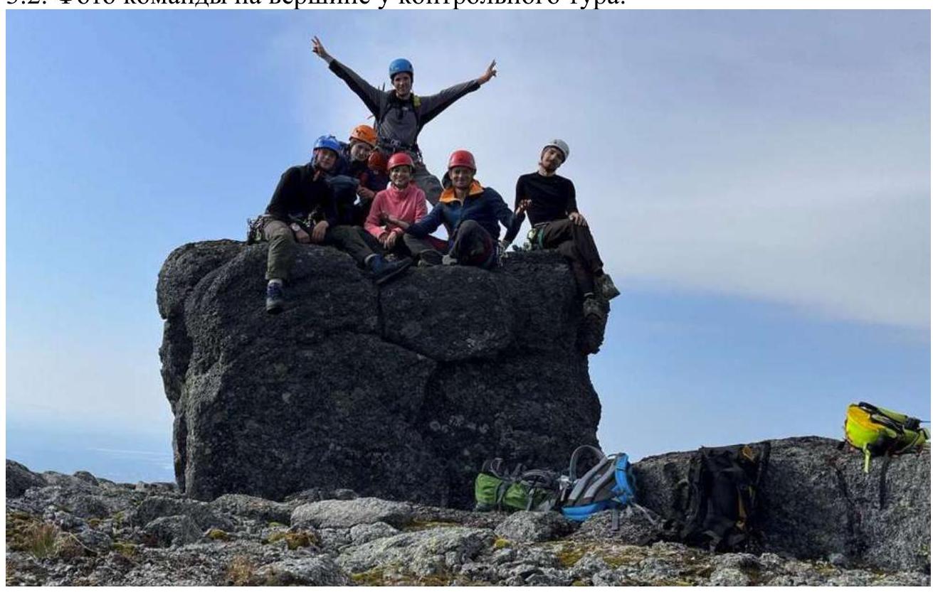
3.2. Photo of the team at the summit with the control tour.
3.3. The route is quite safe in terms of rockfall: there are no large or medium rocks on the ledges, but station R2 should still be set up away from the beginning of the chimney. There is cell phone coverage on the route. Also, radio communication is available between the route and Lake Vudyavr M.
It is not recommended to pass in bad weather:
- key R1–R2
- the chimney immediately following it (sloping ledge without pronounced holds).
From R2 to the summit, it is possible to ascend even in bad weather: the chimneys are quite reliable (convenient) in terms of placements. Along R2–R3, there are many cracks for anchors.
Descent from the route:
- Through Geografov Pass.
- Via 2A through the avalanche gully.
The route turned out to be much more complex than 2B "Roga," more complex than 2B "Bantik," and similar in complexity to 2B "Dembel'skii." The key sections and overall technical level of the route correspond to 2B in rocky areas.


