RPO "Mountaineering Federation of Murmansk Region" Championship of the Northwestern Federal District in mountaineering, technical class
Report
On the ascent of the Murmansk Region team to Takhtarvumchorr ridge, Southern peak to "Otcol" via the center of the northern wall, Afanasiev V.Yu., 2004 - 5A cat. diff.
Team Leader
Druzhkin Andrey Sergeevich
Participant
Fedorishin Alexey Leonidovich
Coach
Kurdiy Alla Andreevna
Person responsible for the report
Druzhkin A.S., dalar08@mail.ru
Murmansk, 2023
Ascent Details
-
Region — Russian Federation, Kola Peninsula, Khibiny mountain range, section 8.6.
Peak — Takhtarvumchorr ridge, 1143 m via the center of the northern wall "Otcol". Route by Afanasiev V.Yu., 2004 - 5A cat. diff.
-
Route type — rock climbing.
-
Route characteristics:
elevation gain — 350 m. route length — total 430 m. Average steepness of the wall section — 85°, total 79°. length of sections: 5 cat. diff. — 210 m, 6 cat. diff. — 75 m.
-
Equipment used on the route: stoppers (camalots) — 3/54; anchor hooks — 17; intermediate bolts — 2. Bolts used — 0. Left behind — 0.
-
Time taken: 5 hours 40 minutes, without preparation.
-
Team Leader: Druzhkin Andrey Sergeevich — 1st sports category (Murmansk) Participant: Fedorishin Alexey Leonidovich — 1st sports category (Murmansk)
-
Team Coach:
Kurdiy Alla Andreevna — Candidate Master of Sports (Murmansk)
-
Departure date:
On the route (start of work on the route) — at 8:30, June 25, 2023. On the summit — at 13:45, June 25, 2023. Descent to base camp — at 16:30, June 25, 2023.
-
Person responsible for the report: Druzhkin A.S., dalar08@mail.ru
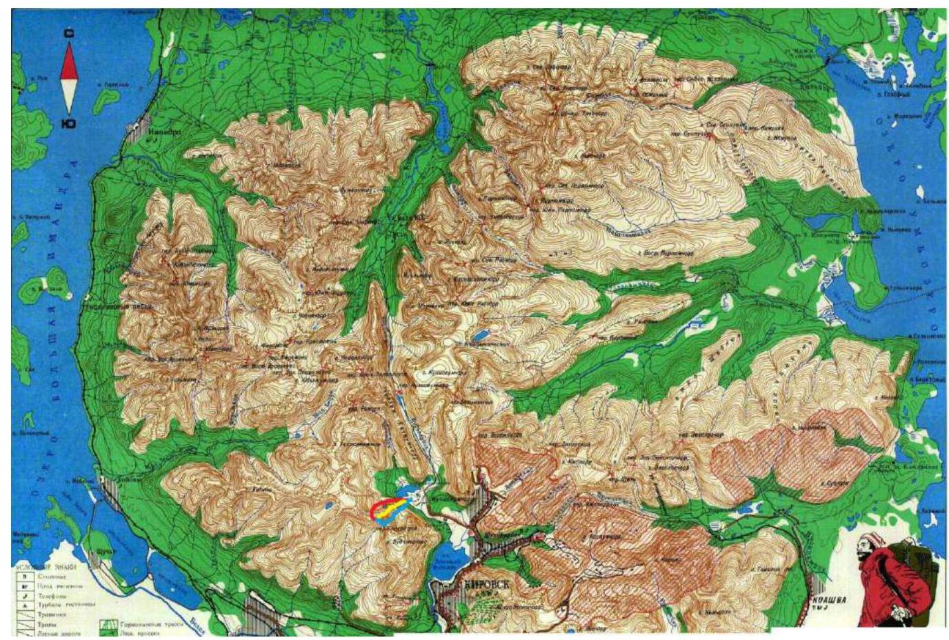
Map of the Ascent Area
Map of the area. Scale 1:100 000.
The first approach route is shown in red (part of the path can be traversed by a high-clearance vehicle).
The descent route via Geografov Pass is shown in blue. The descent route via the southeastern spur of Takhtarvumchorr ridge is shown in yellow.
Photos of the Route and Area
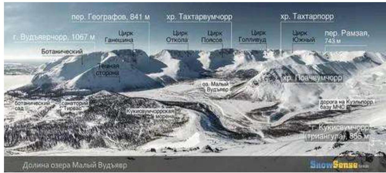 General panorama of the area
 © Rosafree.livejournal.com
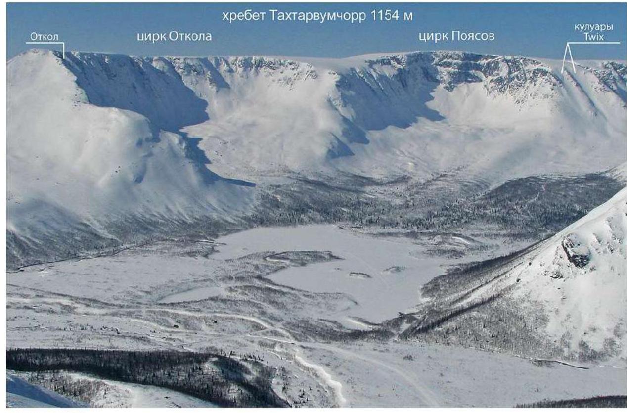
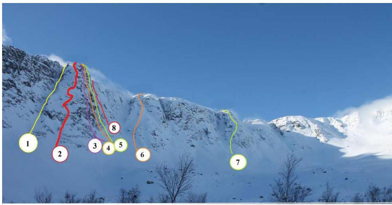
Panorama of "Otcol" cirque and "Poyasov" cirque
© Rosafree.livejournal.com
Panorama of "Otcol" cirque and "Poyasov" cirque
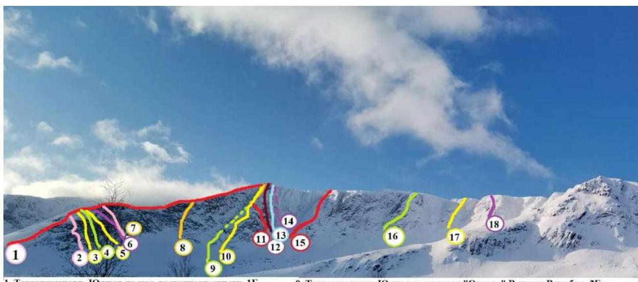
- Takhtarvumchorr, Southern peak via southeastern spur, 1B
- Takhtarvumchorr, Southern peak via center of N wall to W ridge (route "Roga"), 2B
- Multipitch "Borealiz"
- Multipitch
- Takhtarvumchorr, Southern peak via center of N wall to W ridge (route "Iksy"), 2A
- Takhtarvumchorr, Southern peak via crack on N wall of eastern spur (route "Rasshelina"), 2A
- Takhtarvumchorr, Southern peak via center of N wall of eastern spur right of the crack (route "Po osypi")
- Takhtarvumchorr, Southern peak via right part of N wall of Eastern spur (route "Mokryy ugol"), 3B
- Takhtarvumchorr, Southern peak via "Otcol" couloir to W ridge, 2Bz
- Takhtarvumchorr, Southern peak via "Otcol" to W wall, 3A
- Takhtarvumchorr, Central peak via left part of N wall "Otcol" (route "Olenevod"), 3B
- Takhtarvumchorr, Southern peak via left part of N wall "Otcol", 4B
- Takhtarvumchorr, Southern peak to "Otcol" via center of N wall, 5A
- Takhtarvumchorr, Central peak, "Otcol" couloir from N, 2Bz
- Takhtarvumchorr, Central peak, left part of central kf. to S cirque wall, 2B
- Takhtarvumchorr, Southern peak, center kf. of "Otcol" cirque (route "Olympic"), 2B
- Takhtarvumchorr, Southern peak via center kf. right of center kf. of "Otcol" cirque (route "Bayatik"), 1B
- Takhtarvumchorr, Southern peak, 2nd kf. of W part of "Otcol" cirque wall (route "Dembelsky"), 2B
List of Routes on Takhtarvumchorr Ridge
- S. Takhtarvumchorr, via "Otcol" couloir to W ridge, 2Bz
- S. Takhtarvumchorr, via "Otcol" to W wall, 3A
- C. Takhtarvumchorr, left part of N wall "Otcol" (route "Olenevod"), 3B
- S. Takhtarvumchorr, via left part of N wall "Otcol", 4B
- S. Takhtarvumchorr, to "Otcol" via center of NE wall, 5A
- C. Takhtarvumchorr, via left part of central kf. to S cirque wall, 2B
- S. Takhtarvumchorr, via center kf. of "Otcol" cirque (route "Olympic"), 2Bz
- C. Takhtarvumchorr, "Otcol" couloir from N 2Bz
List of Routes in "Otcol" Cirque of Takhtarvumchorr Ridge
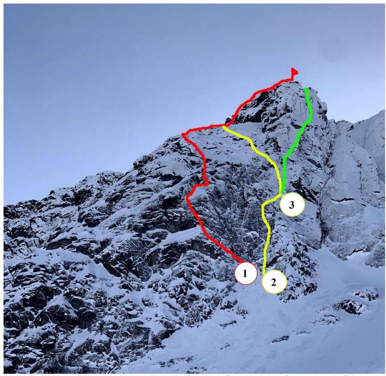
- Takhtarvumchorr, Central peak entity left part of N wall "Otcol" (route "Olenevod"), 3B
- Takhtarvumchorr, Southern peak via left part of N wall "Otcol", 4B
- Takhtarvumchorr, Southern peak to "Otcol" via center of N wall, 5A
General view of "Otcol" and routes from the northern side
Technical photo of the route
 General view of "Otcol" with the route.
Description of the Ascent Area and Brief Route Characteristics
Khibiny is the largest mountain range on the Kola Peninsula, located beyond the Arctic Circle. The highest point is Yudyuchvumchorr, 1200.6 m.
The mountaineering area can be reached by:
- rail transport — by train to Murmansk, with a change in Apatity;
- air transport — to Murmansk or directly to Apatity (Khibiny airport).
- Then by taxi or bus to Kirovsk — 20 km.
In Kirovsk, there are buses from all cities of Murmansk region. By car, it is easy to reach Kirovsk.
There are no mountaineering camps in the area. Accommodation can be found in Kirovsk, Kukisvumchorr (25 km), and surrounding areas.
The climate is subarctic. In winter, the snow cover reaches 3 m, often accompanied by strong winds.
One of the advantages of the mountain range is the possibility of climbing without acclimatization. However, due to the climate, the subjective perception of altitude on the Khibiny plateau corresponds to 2000–2500 m, similar to the Caucasus, which is a significant advantage for short-term mountaineering events. In winter, Khibiny offers great opportunities for ice climbing on:
- mountaineering routes;
- prepared rock climbing routes.
The approach to "Otcol" cirque is best organized from the "Tirvas" sanatorium. From the sanatorium, follow the dirt road to a characteristic left turn; in winter, the road is snow-covered. After crossing the main road, ford a shallow river (in winter, cross on a snow bridge) and continue straight into the valley along the old dirt road to Maly Vudyavr Lake and the source of the Vudyavryok River.
A camp can be set up both after and before the crossing.
In summer and winter, the river is crossed by fording. In winter, it is possible to pass on the lake ice.
Approach to "Otcol" cirque: from the crossing, continue along the old dirt road, after about 300 m, turn left and start climbing. Continue climbing, rounding the spur on the right, and enter the cirque. Caution! In winter, there is a risk of avalanches from the spur. The average time to approach from Maly Vudyavr Lake to the start of the route is 1.5–2 hours.
In the "Otcol" cirque and on the N wall of the eastern ridge, there are more than 15 routes, including:
- 2 multipitches.
The route by Afanasiev V.Yu., 2004 — 5A cat. diff. passes through the central part of the N wall "Otcol" and represents a very logical line, including technical climbing using IT (A2+/A3). This line attracts climbers with its logic and complexity. The route is generally monolithic, except for the lower chimney — an internal corner located on section R2–R3. With sufficient preparation, the route can be climbed free-climbing, except for the key section — the slab on R6–R7, 20 m.
There is a possibility to organize a bivouac on a ledge on R6 and R11. In summer, there is no water on the wall.
Weather conditions during the ascent — no precipitation, average temperature +10–12 °C. Due to the northern orientation of the wall, it is necessary to bring warm clothing.
Tactical Actions of the Team
In summer 2023, the Mountaineering Federation of Murmansk Region planned a trip to the Russian Mountaineering Championship in the technical class at the "Uzkol" alpine camp. After a course of training and training ascents, the team climbed the route Takhtarvumchorr ridge, Southern peak to "Otcol" via the center of the N wall, 5A cat. diff.
The team consisted of two people. All participants had 1st sports category at the time of the ascent. Before the ascent, the team successfully completed several climbs and had climbing experience (5B).
The object of the ascent — the N wall "Otcol" — attracted the team's attention with its:
- monolithic nature;
- logic;
- beauty of the line.
The route can be climbed free-climbing on-sight (estimated complexity of sections up to 6B/6C).
One of the main goals of the ascent was to practice simultaneous movement on complex terrain and to climb the chosen route as much as possible free-climbing.
We believe that the plan to climb the route on the N wall "Otcol" 5A cat. diff. free-climbing, in simultaneous technique, was successful. The route was climbed entirely simultaneously and at a high pace — 5 hours 45 minutes without preparation, with a sufficient level of safety. The route was almost entirely climbed free-climbing, except for:
- the key section on R6–R7 — a smooth slab;
- one step on IT at the beginning of R8 due to equipment transfer.
The most complex and interesting sections, according to the team, are:
- R4–R5;
- R6–R7;
- R7–R8.
The key part of the route, located on R6–R7, is a section of a smooth slab about 20 m, which is climbed using:
- hole skyhooks;
- fifi hooks;
- anchor hooks;
- camalots.
The complexity level is assessed as A2+/A3 with a real possibility of a large fall over a ledge. There are no stationary bolts.
For the route, the team used two single dynamic ropes. The movement scheme was simultaneous.
Work on the route began at 8:30 on June 25, 2023, and the summit was reached at 13:45 on June 25, 2023. The team returned to the base camp on Maly Vudyavr Lake at 16:30. All waste accumulated during the ascent was taken down and disposed of.
According to the team, the route is very logical, with a constant bias to the right. The level of free-climbing on pitches is from 6a to 6b+. When climbing the wall, camalots and anchor hooks were mainly used for organizing belay points and stations.
During the ascent, the team used a description compiled by the first ascenders, which fully corresponds to the complexity categories of the sections, their length, and technical difficulties. The route was climbed entirely according to the description.
Emergency exit from the route: via the ascent route, considering the constant bias of the route to the right. From the summit — via Geografov Pass.
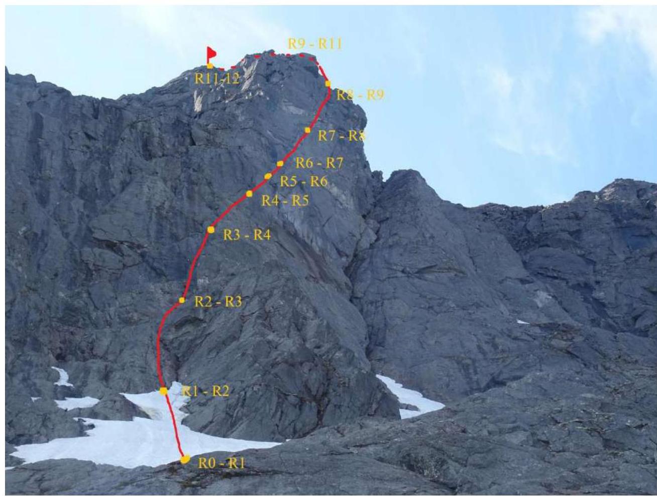
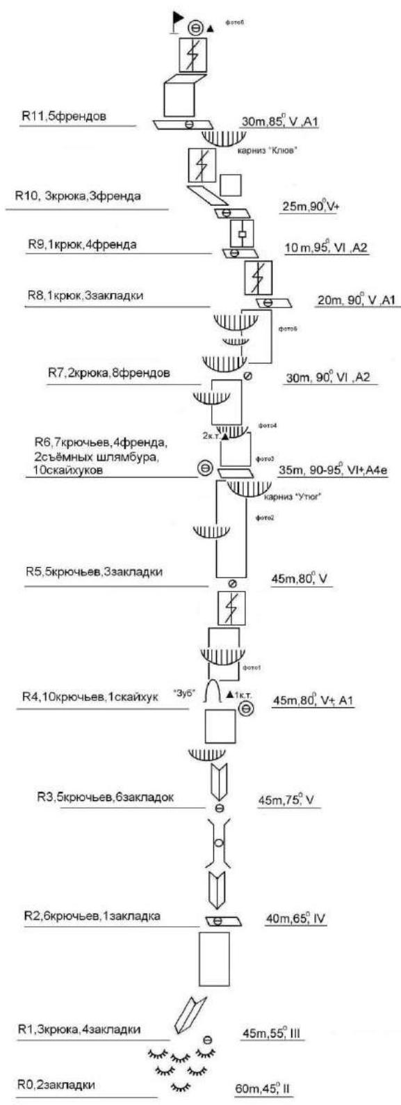
Ascent graph for Takhtarvumchorr ridge, Southern peak to "Otcol" via the center of the N wall, 5A cat. diff.

UIAA Scheme
Route Description by Sections
The provided UIAA scheme and route description are taken from Afanasiev V.Yu.'s description, 2004. It accurately describes the route line. The lengths of the sections correspond to the description. However, considering the simultaneous movement of the group, the stations were organized on sections of:
- 25 to 35 m.
Approach to "Otcol" cirque from Maly Vudyavr Lake (1 hour). Crossing the slope under the N wall of "Otcol" (30 minutes).
R0–R1: Climbing "barraniy lby" to the base of the internal corner. 60 m, 45°, II cat. diff.
R1–R2: Climbing the internal corner to a ledge. Chimney climb 45 m, 55°, III.
R2–R3: Climbing the internal corner through a chimney. 40 m, 65°, VI. Dangerous due to rockfall!
R3–R4: Climbing, bypassing a cornice on the left, to a ledge ("zub"). Control tur №1. 45 m, 75°, V.
R4–R5:
- Climbing a slab under a cornice.
- Bypassing the cornice on the left via a series of walls.
- Reaching an inclined ledge. 45 m, 80°, V+, A1. Free-climbing level 6a+–6b (French scale). Poor protection. There is a bolt on the section before the cornice.
R5–R6:
- Climbing a series of inclined ledges to the right and up.
- Reaching a ledge. 45 m, 80°, V+.
R6–R7: Climbing a vertical smooth slab up to a hanging internal corner. Using skyhooks. Then moving right and up along the corner. Control tur №2. Climbing a series of vertical slabs and cornices to a micro-ledge. 35 m, 90–95°, VI+, A2+–A3. There is a bolt on the ledge.
R7–R8: Climbing up under cornices via a slab with cracks for fifi hooks. Along the base of the cornice to the right and up. Through the cornice, reaching a ledge. 30 m, 90°, VI, A2. Free-climbing level 6a+–6b (French scale).
R8–R9: Climbing a slab with cracks up. 20 m, 90°, V, A1. Free-climbing level 6a+.
R9–R10: From the ledge, climbing a slab with cracks. IT. 10 m, 95°, VI, A2. Free-climbing level 6a+–6b (French scale).
R10–R11: Climbing an inclined slab, then up, bypassing a characteristic cornice ("klyuv") on the left. 25 m, 90°, V+.
R11–R12: Reaching the summit via a series of slabs and cracks. 30 m, 85°, V, A1. Free-climbing level 6a+ (French scale). Control tur is laid out with stones on the plateau.
Rock on the route:
- partially smoothed;
- protection is sparse in the lower part;
- section R6–R7 was climbed using skyhooks, anchor hooks, and camalots;
- many crevices for thin hooks;
- all types of hooks and sling elements (fifi hooks, stoppers) are effective.
Additionally:
- the required free-climbing level for the route is 6B;
- in polar day conditions (summer), it is possible to climb the route in a pair in alpine style;
- there is no water on the wall.
Descent from the summit: it is necessary to:
- cross the ridge between "Otcol" and Takhtarvumchorr;
- then descend the southern slope of the eastern spur of Takhtarvumchorr ridge to the cirque under Geografov Pass (Ganechina cirque);
- then to Maly Vudyavr Lake.
Emergency exit from the route: via the ascent route.
Technical Photos
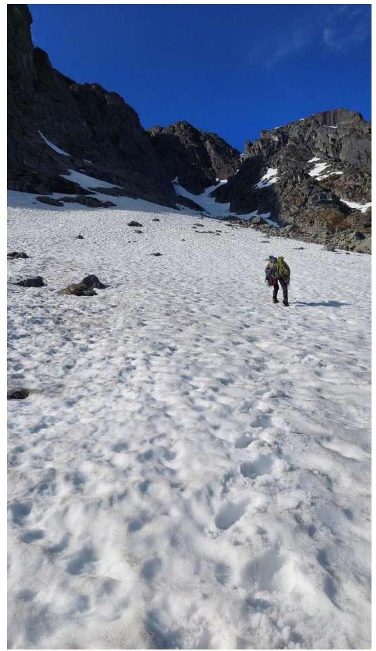 Photo 1. Approach to the route
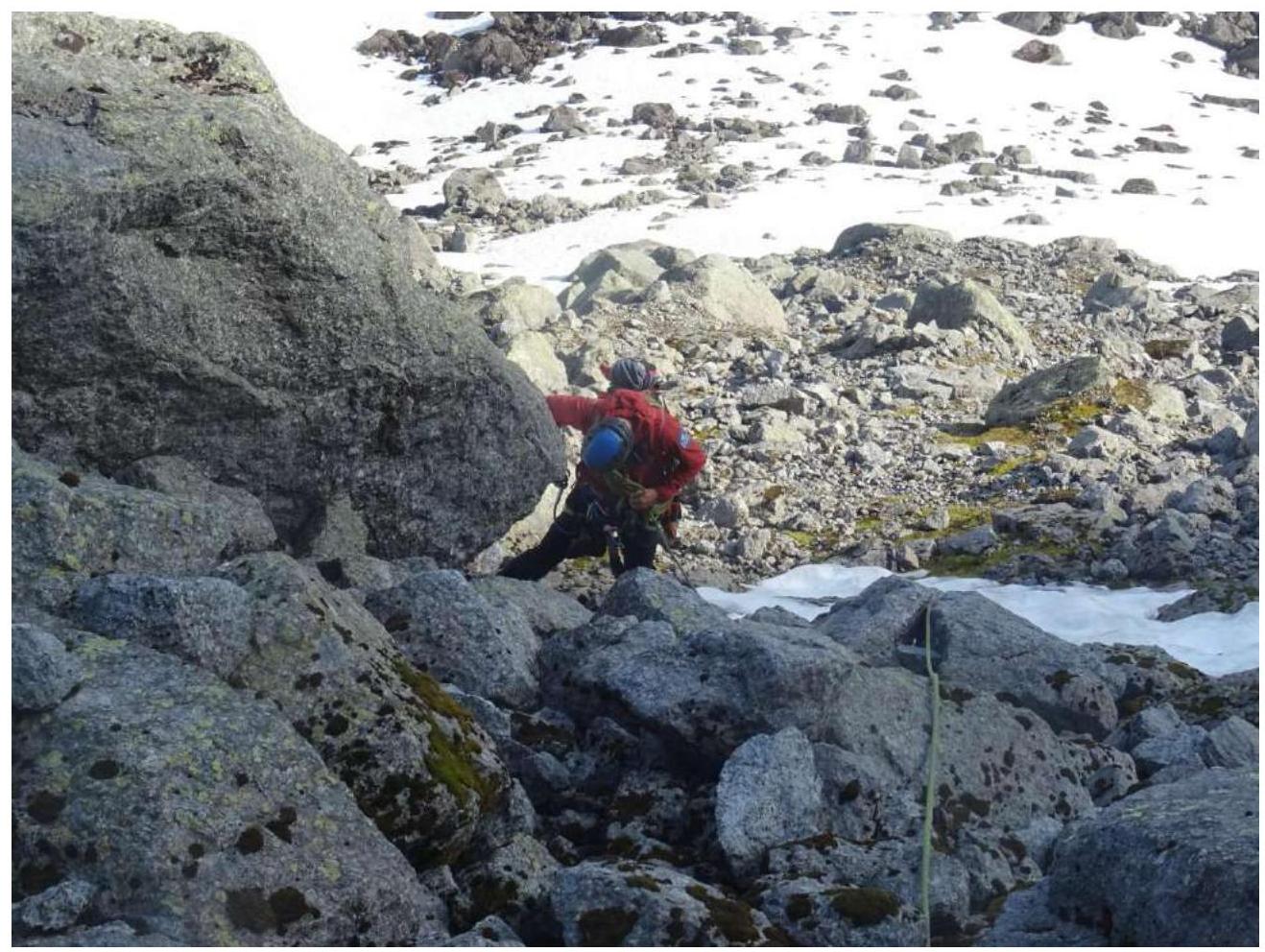 Photo 2. Section R0–R1.
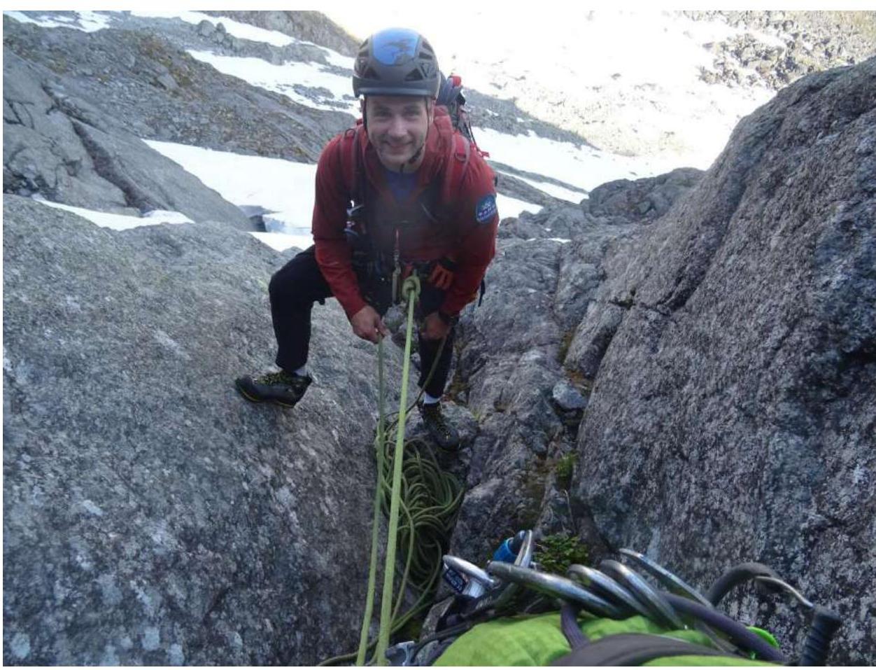 Photo 3. Fedorishin A. on station R1.
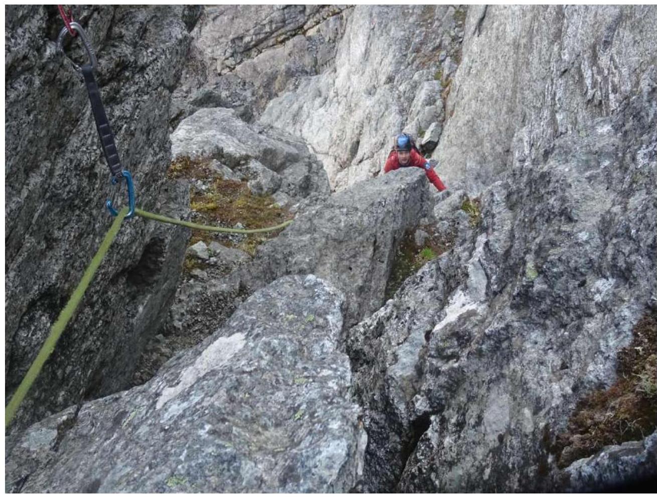 Photo 4. Reaching the "Zub" ledge R4.
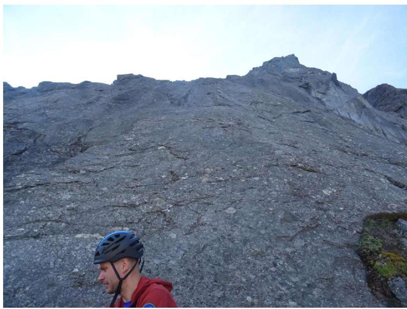 Photo 5. General view from the "Zub" ledge on section R4–R5.
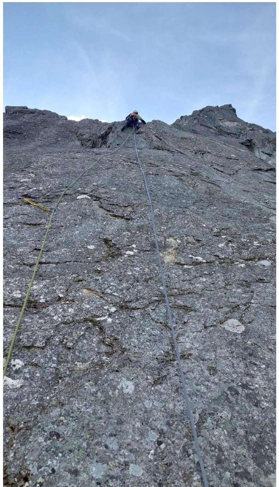 Photo 6. Work on section R4–R5.
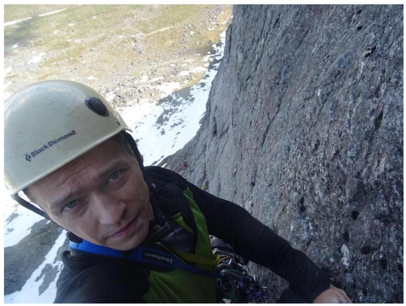 Photo 7. Work on section R5–R6.
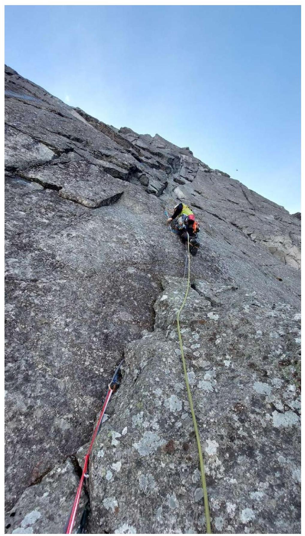 Photo 8. Work on the key section R6–R7.
 Photo 9. Work on the key section R6–R7.
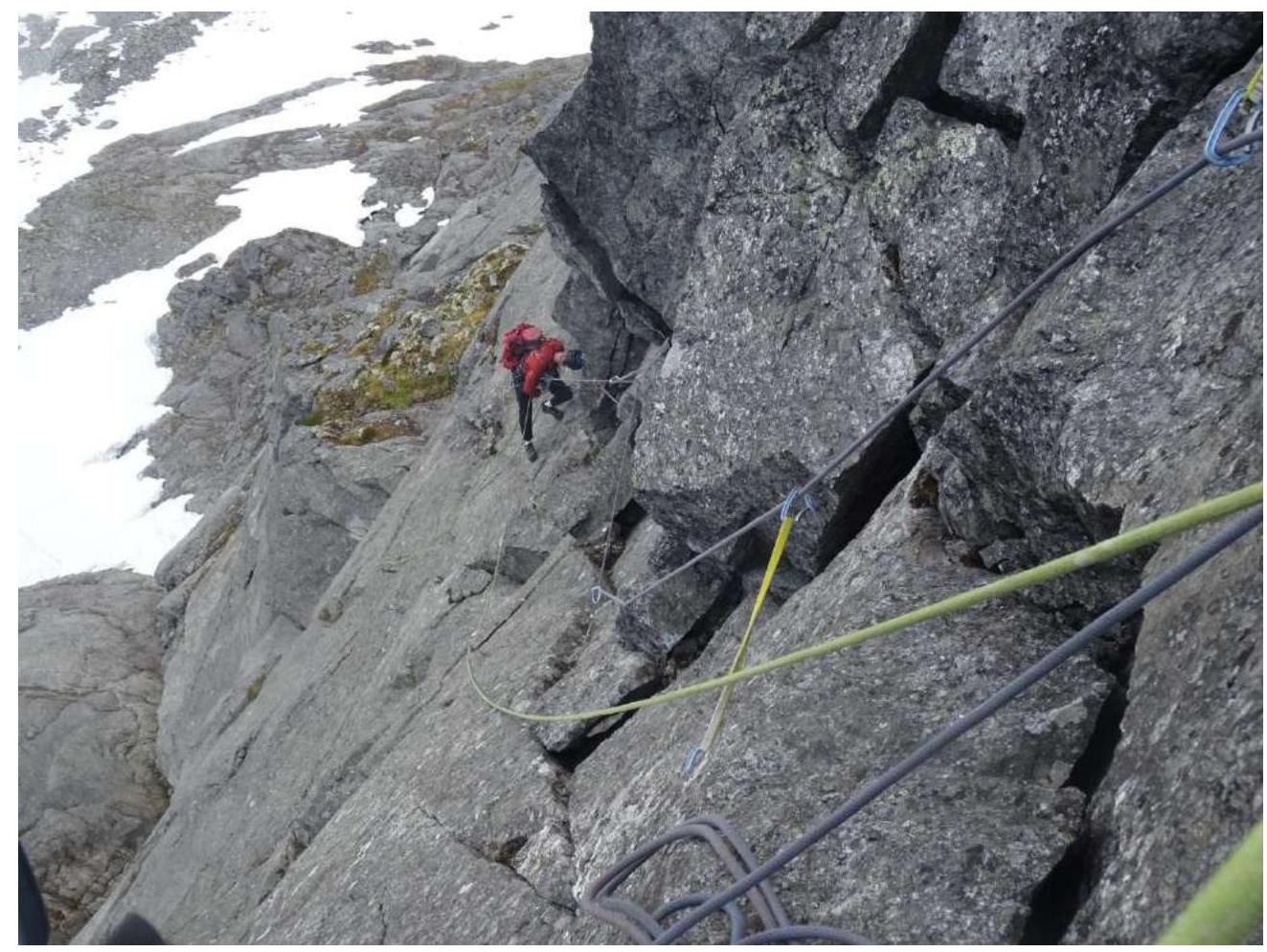 Photo 10. Work on the second half of section R6–R7.
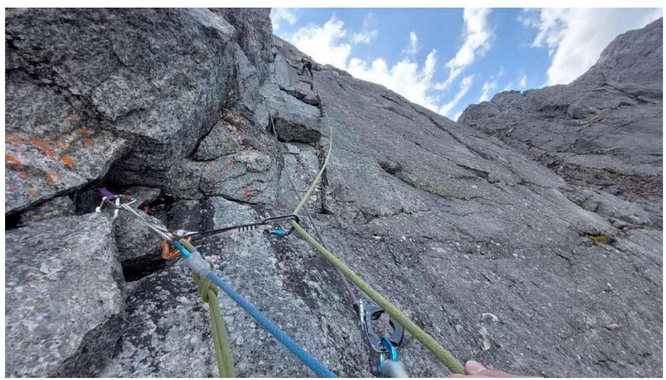 Photo 11. Work on the second half of section R6–R7. View from an intermediate station, leader on R7.
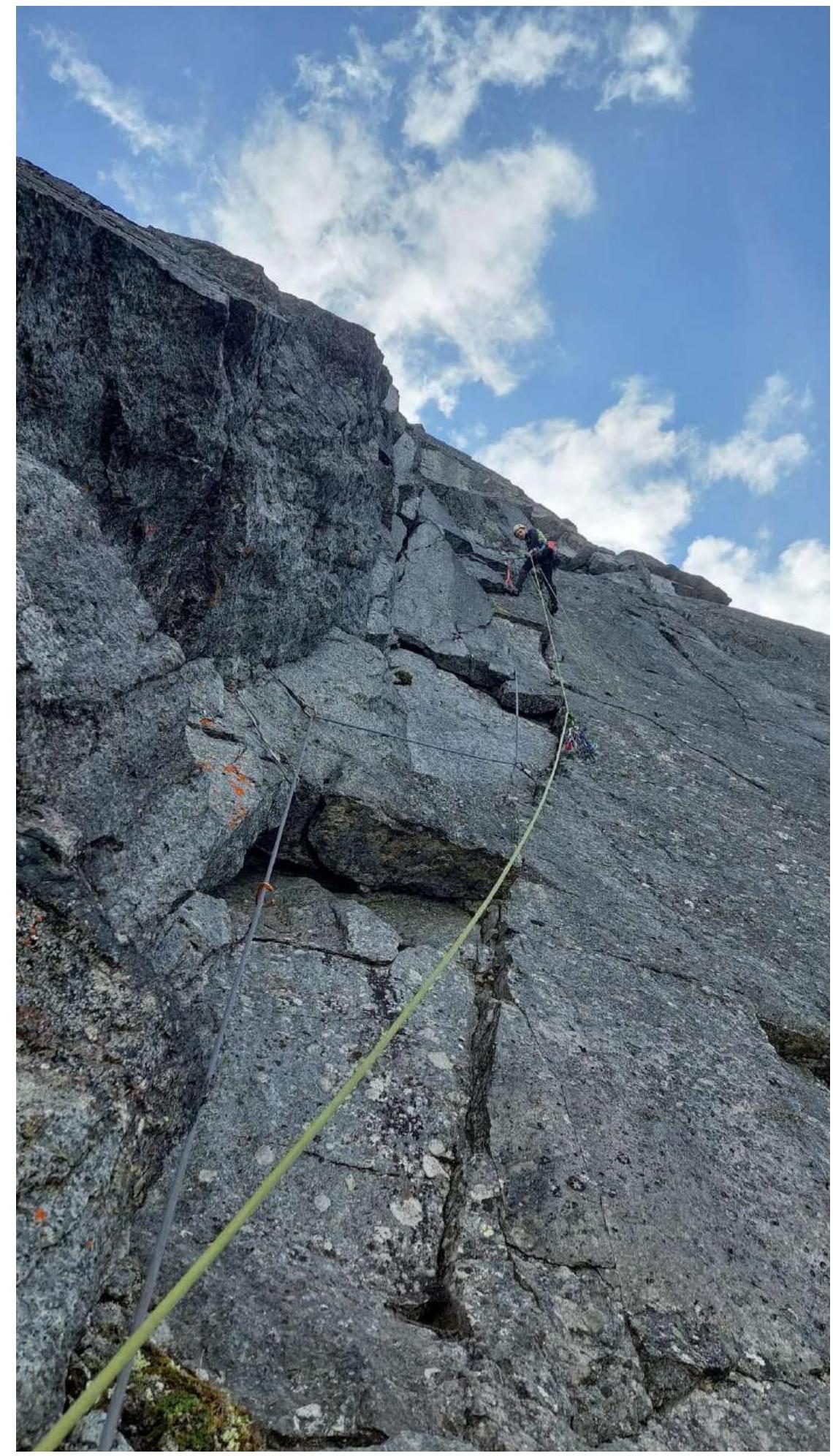 Photo 12. On station R7.
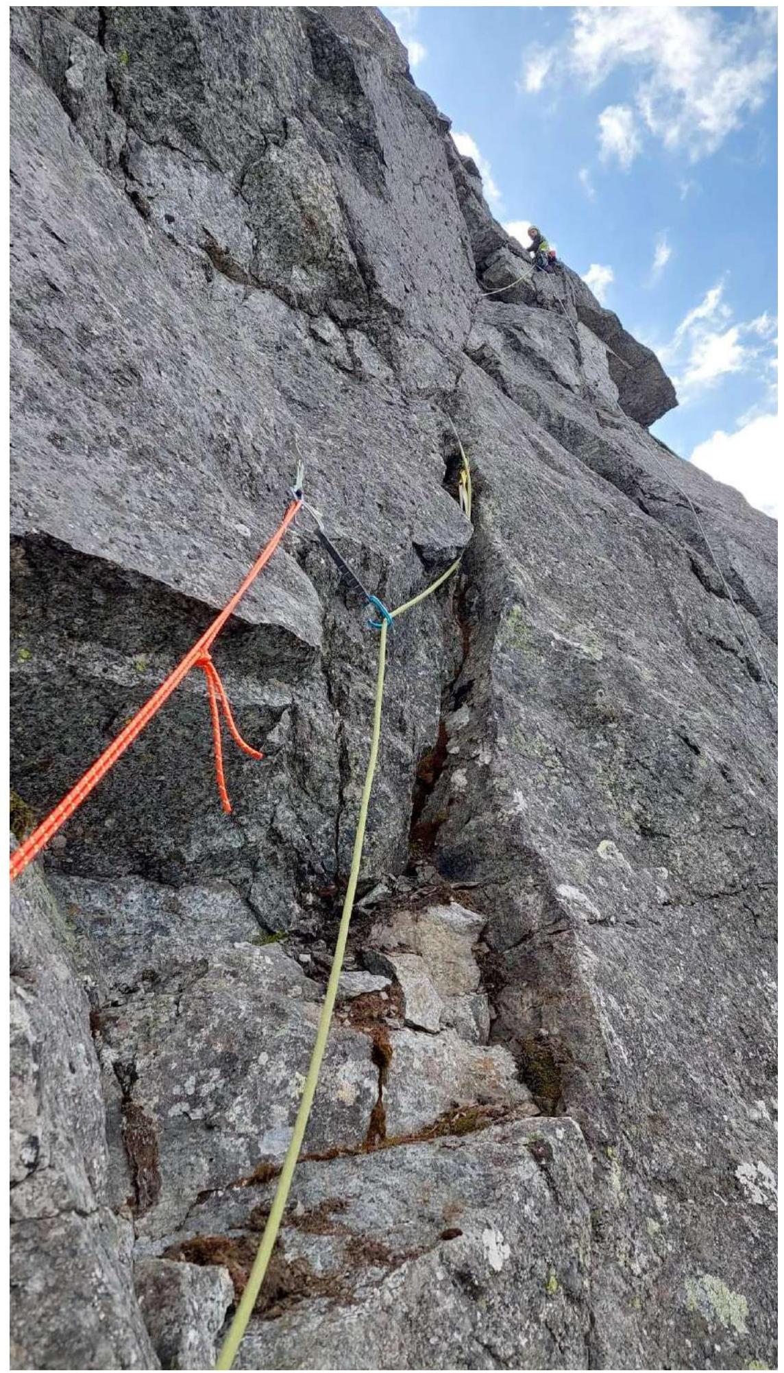 Photo 13. Work on section R7–R8.
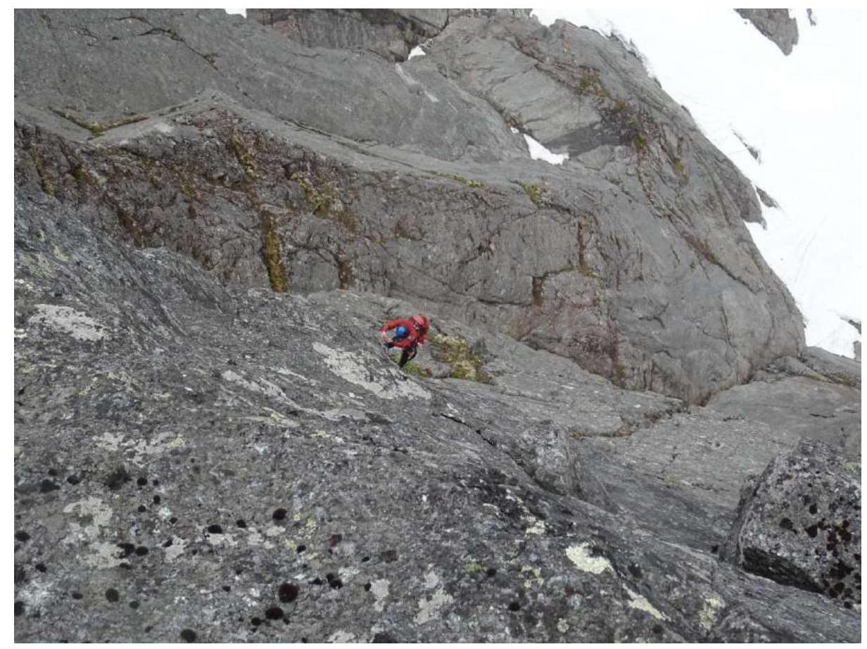 Photo 14. Work on section R8–R9.
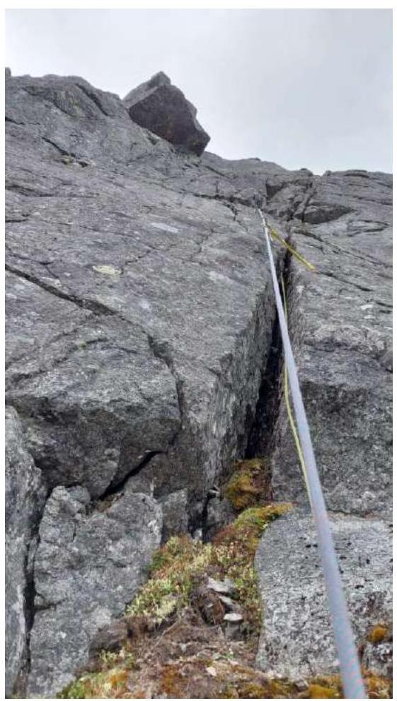 Photo 15. View of section R9–R10. On the left, the landmark — cornice "klyuv", bypass on the left.
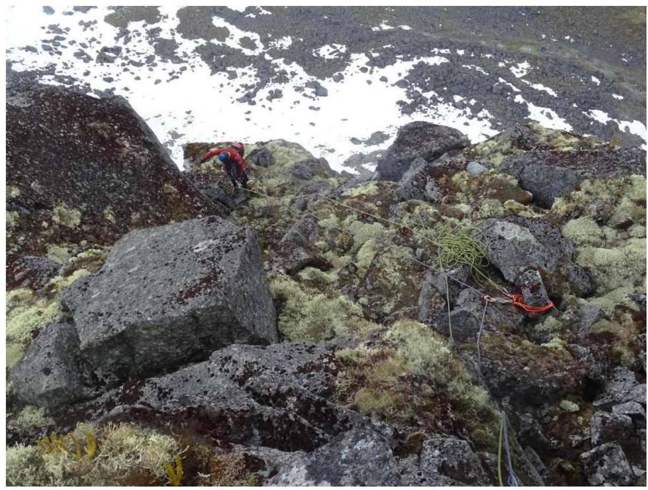 Photo 16. Reaching the ledge on section R11.
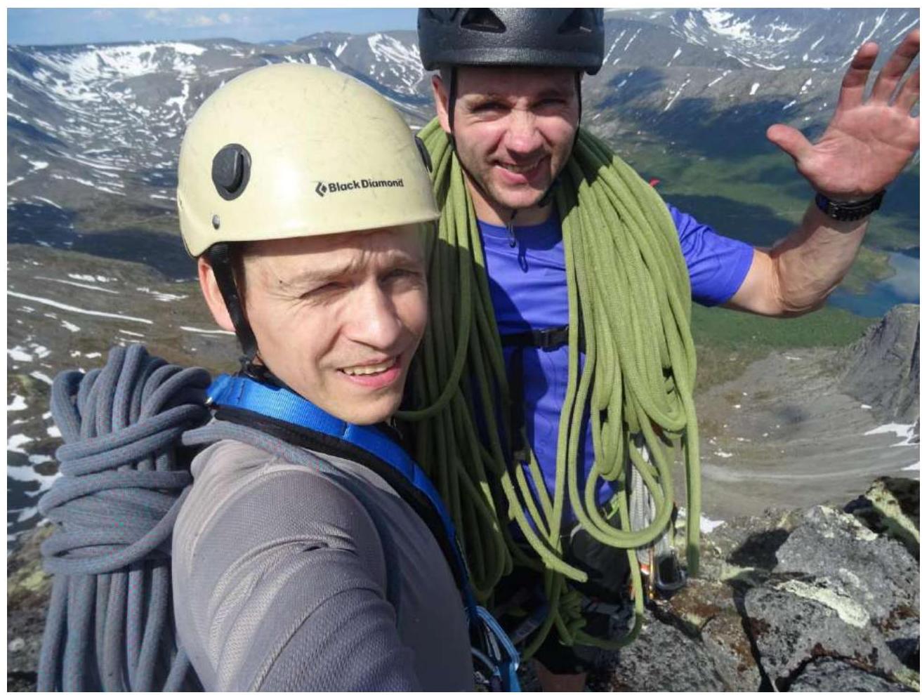 Photo 17. Team on the summit, R12. Left — Druzhkin A.S., right — Fedorishin A.L.


