Report
On the Ascent
via the 2nd counterfort of the eastern part of the "Otkol" cirque wall, Takhtarvumchorr (S) (1058 m)
"Dembelsky" route, cat. 2B Takhtarvumchorr ridge, Khibiny (July 11, 2015, first ascent)
Apatity
2016
Ascent Passport
-
Kola Peninsula. Khibiny mountain range. Section number in the classification table: 8.6.1.
-
Route name — "Dembelsky", Takhtarvumchorr South, 1058 m, via the counterfort of the eastern part of the "Otkol" cirque wall.
-
Proposed category: 2B.
-
Route type: rock climbing.
-
Height difference of the technical part — 240 m.
Length of the technical part of the route — 275 m; length of sections: cat. II — 150 m, cat. III — 125 m; average steepness of the key part — 50°; total route steepness — 35°.
- Pitons used on the route:
- Friends and stoppers — 8 pcs;
- Left behind — 0 pcs.
- Team's walking hours: 3.5 (excluding approach and descent).
- Leader: Goloborodko A. — 2nd sports category;
Participant: Shcherbin I. — 2nd sports category.
- Coach: Ivanov D.
- Time on the route:
Start of the route — 8:00; reaching the summit — 11:30; return to base camp — 13:00. Descent from the summit: via the plateau to the south and then along the NE ridge of Takhtarvumchorr (S) "by lifts" to the Ganesha cirque, then to the valley of Lake Maly Vudyavr.
- Organization: Apatity-Kirov Federation of Alpinism.
- Responsible for the report: Goloborodko A., goloborodkoalex@gmail.com.
Map of the Area
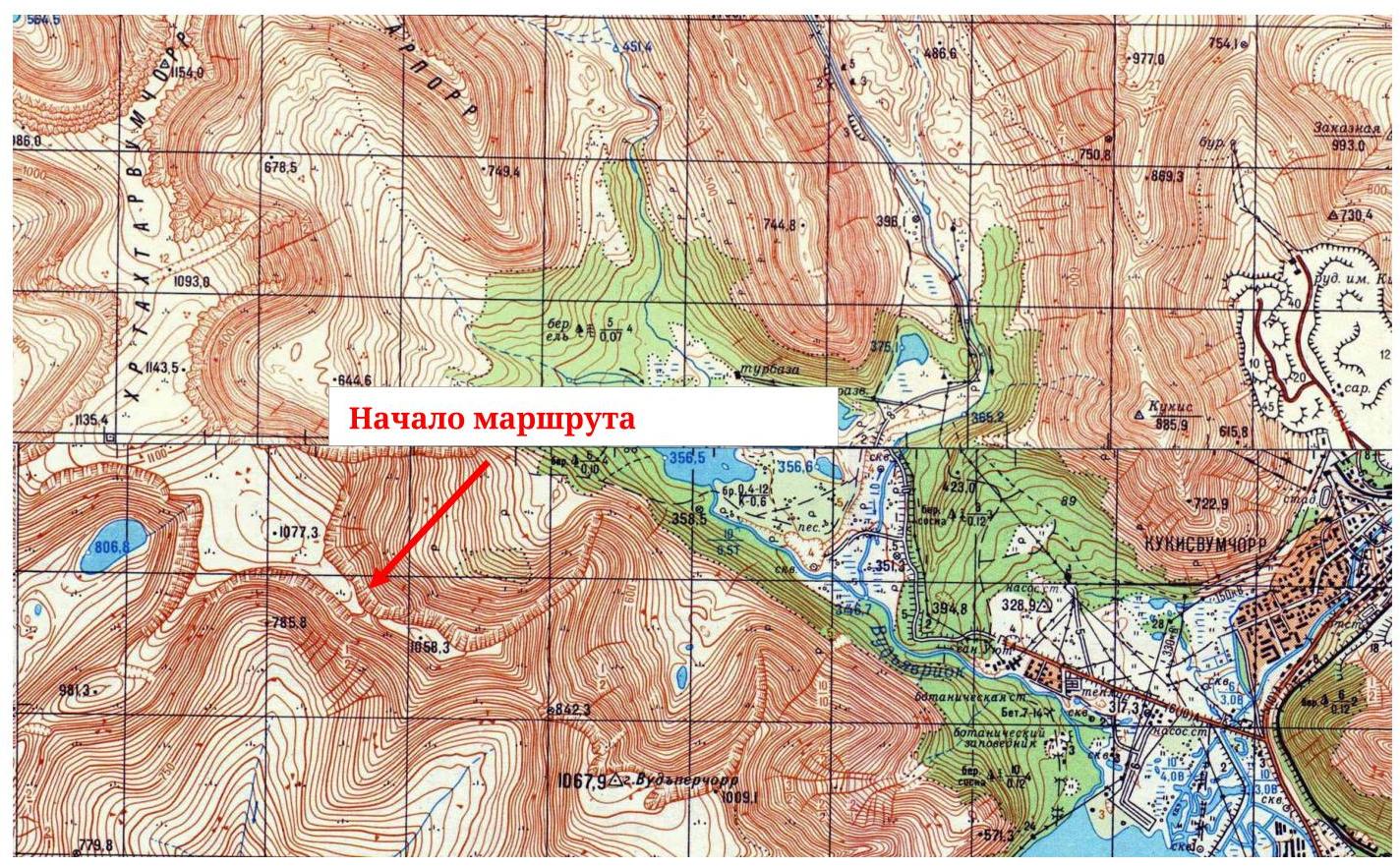
Fig. 1. Map of the area (fragment, scale — 1:50 000)
Panorama
of the area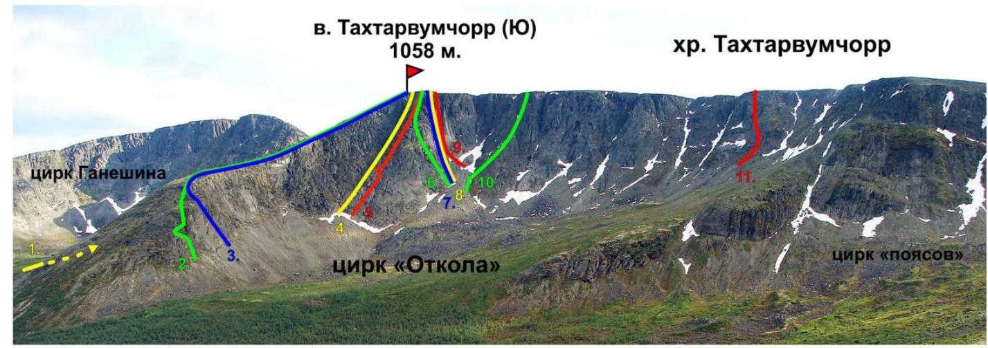
- 1B, to "Otkol" via Geografov Pass, Shumilov O., 1992
- 2B, "Roga", Shumilov O., 1992
- 2A, center of the E wall of the E ridge, Shumilov O., 1992
- 3A, 2Bz, "Otkol" couloir, Shumilov O., 1992
- 3A, to "Otkol" via the E wall, Shumilov O., 1992
- 3B, "Olenevody", Proklov V., 2011
- 5A, "Otkol" via the center of the NE wall, Timoshenko D., 1993
- 5A, "Otkol" via the center of the N wall, Afanasiev V., 2004
- 2Bz, "Otkol" couloir from the north, Balagurin S., 2014
- 2B, "Pravee 'Otkola'", Shumilov O., 1992
- 2B orig., "Dembelsky", Goloborodko A., 2015. Fig. 2. Ganesha cirque, photo from the southern slope of Takhtarporr
Orographic Scheme of the Area
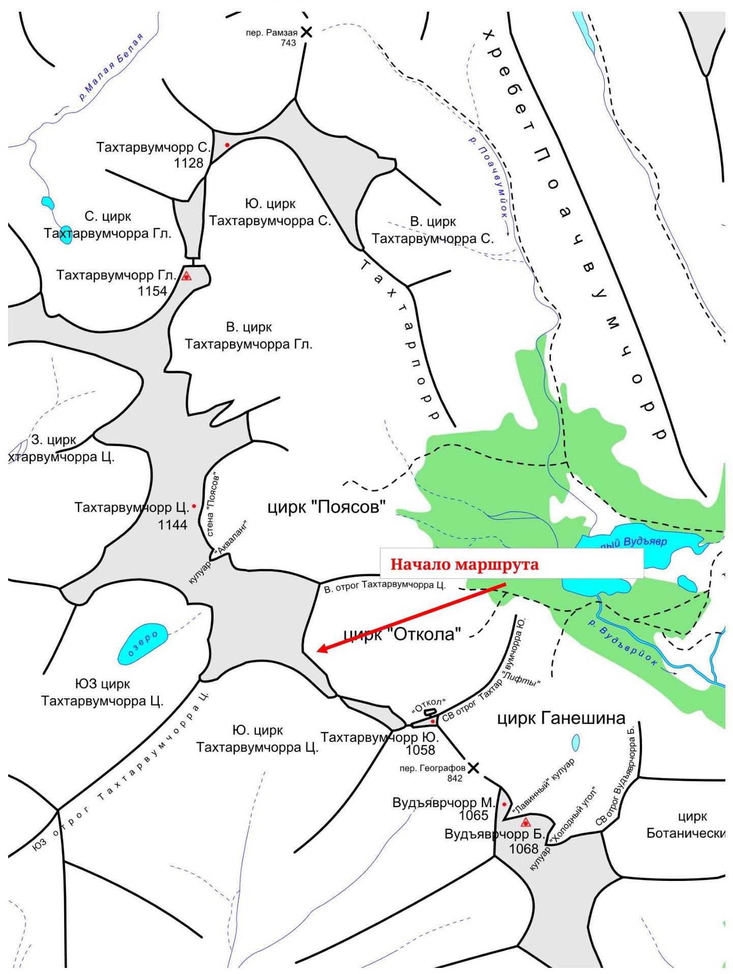 Fig. 3.
Orographic scheme of the central part of the Khibiny
Fig. 3.
Orographic scheme of the central part of the Khibiny
General photos
of the route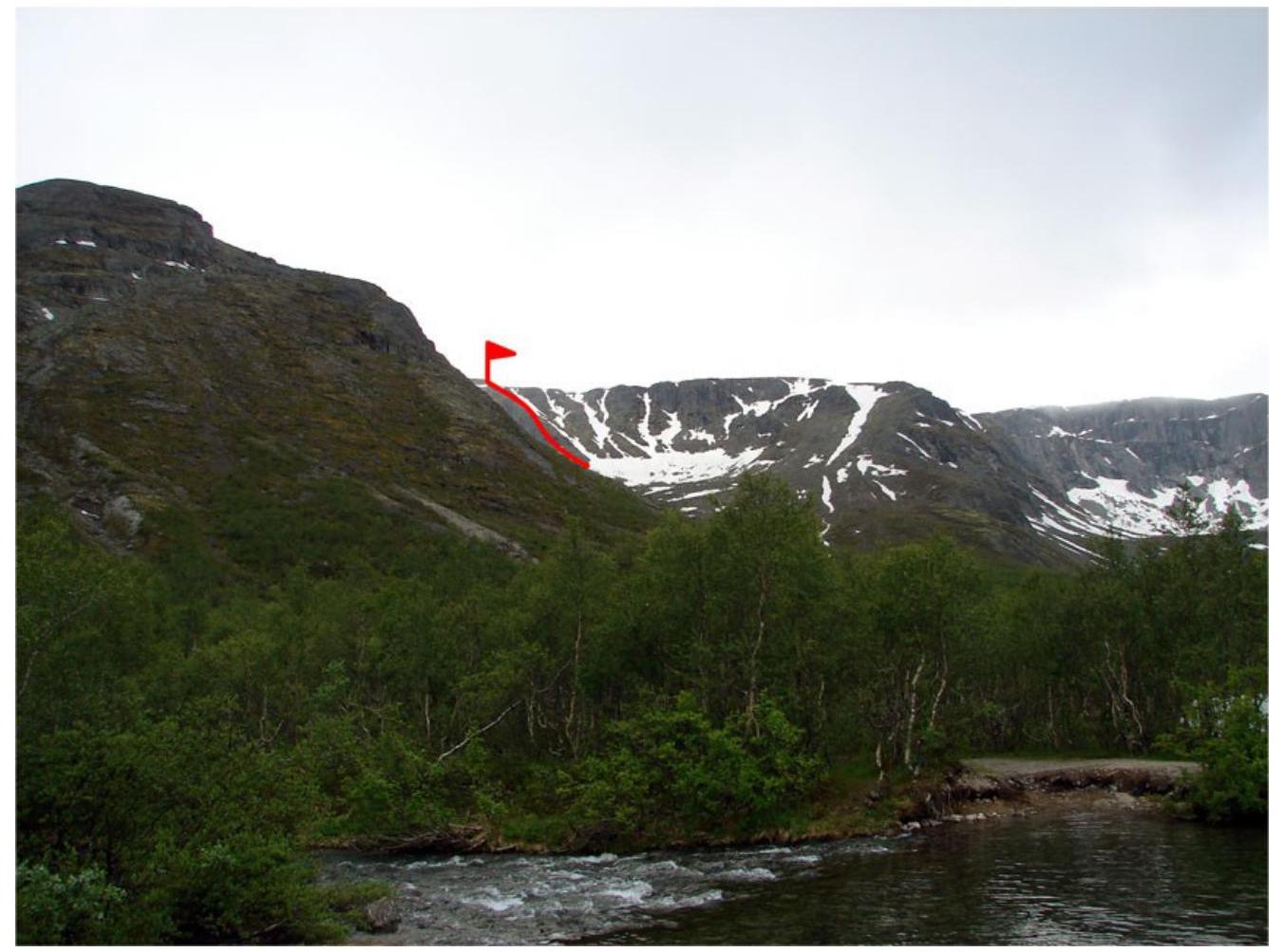
Fig. 4. View of the route from the crossing over the Vudyavryok River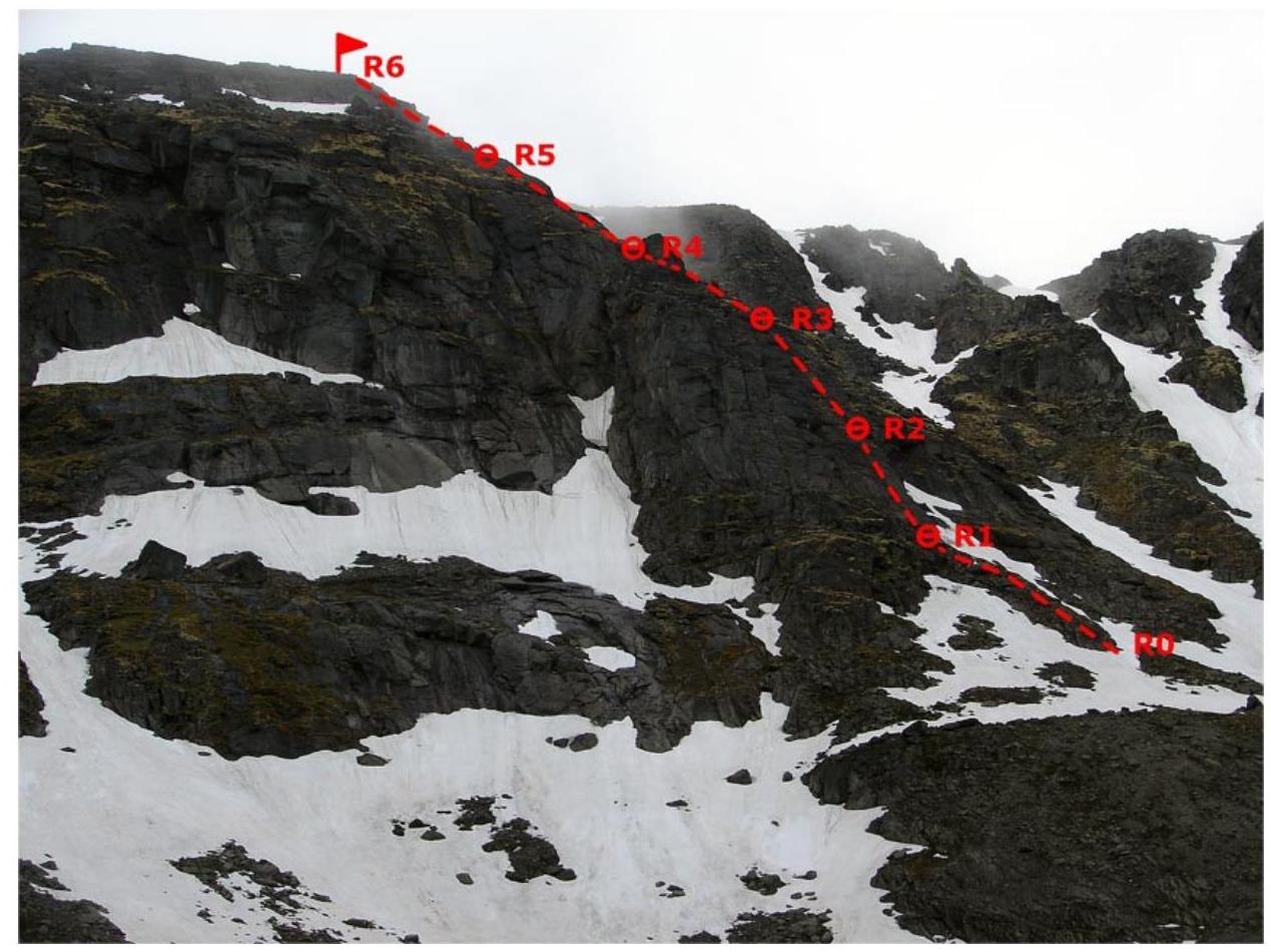
Fig. 5. Route line,
profile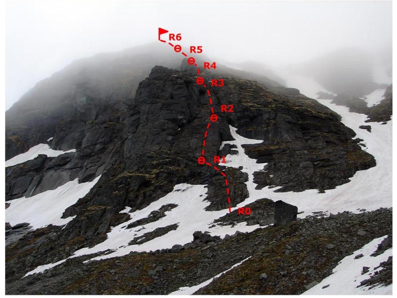
Fig. 6. Route line, front
Route Scheme in UIAA Symbols
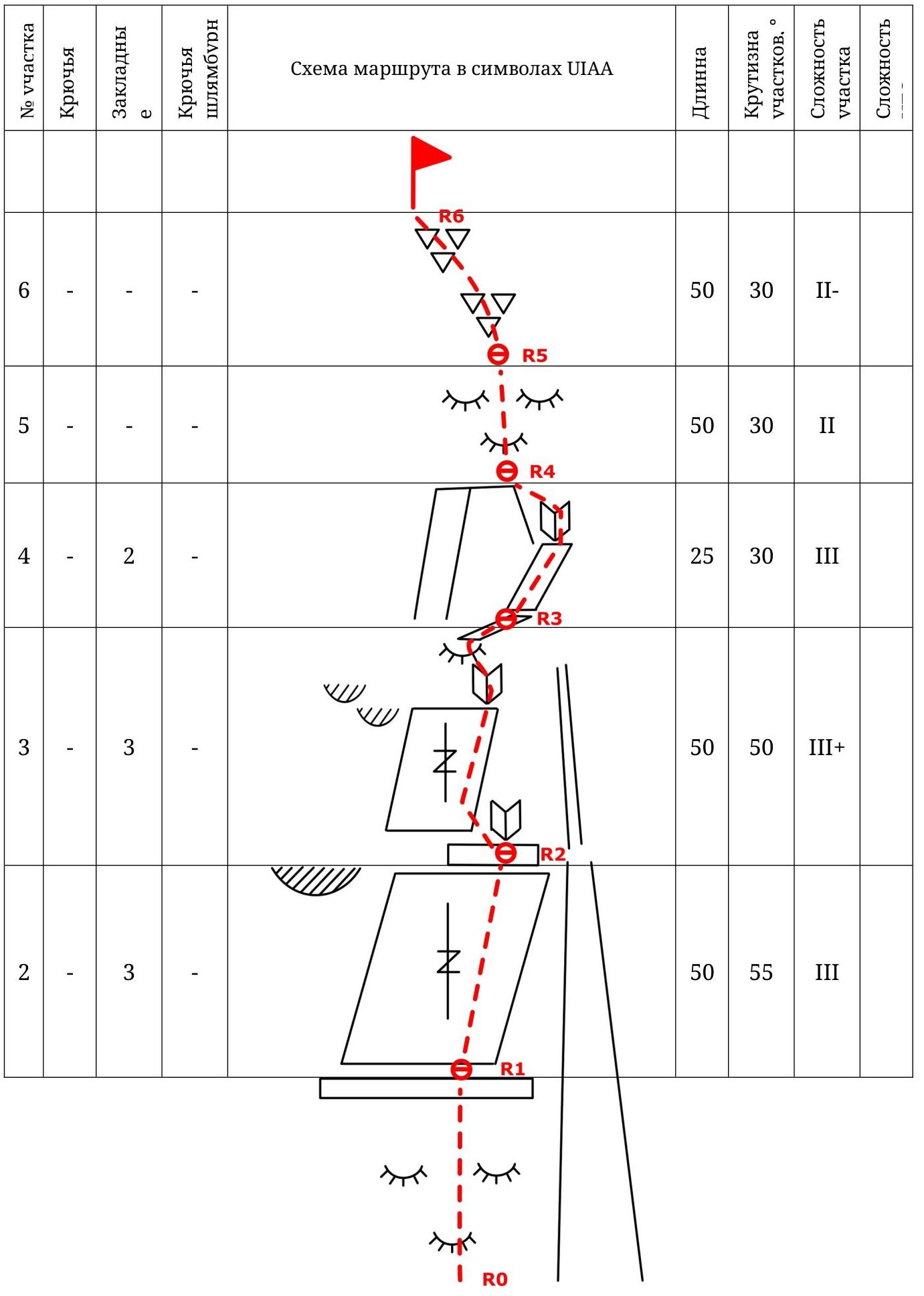
| 1 | - | - | - | 50 | 30 | II |
|---|
Route Description
Approach: from the crossing over the Vudyavryok River along the dirt road to the "Otkol" cirque, then along the trail to the northern part of the cirque (1.5–2 hours); a good landmark for the start of the route is a large solitary stone; from the stone, up the scree to the beginning of the "ram's foreheads".
R0–R1: via a series of "ram's foreheads" to a wide horizontal ledge, 50 m, 30°, cat. II (control point №1 — a pyramid of stones).
R1–R2: along a wide inclined slab, leaving a large cornice on the left, following the right side of the slab, to a horizontal ledge with an internal angle, 50 m, 55°, cat. III.
R2–R3: from the ledge, bypassing the internal angle on the left and reaching an inclined slab, slightly steeper than the previous section, 20 m, 60°, cat. III, leaving two small cornices on the left, through an internal angle (control point №2, a can on a piton), 5 m, 70°, cat. III+, exit to a "ram's forehead" and then to a sloping ledge leading to a "gendarme", 25 m, 45°, cat. II.
R3–R4: bypassing the "gendarme" on the right; through an internal angle and a narrow ridge to the beginning of a series of "ram's foreheads", 25 m, 30°, cat. III.
R4–R5: directly along the "ram's foreheads", 50 m, 30°, cat. II. R5–R6: from the "ram's foreheads" to strongly rugged rocks, 50 m, 30°, cat. II; exit to the plateau (summit point, on a flat stone 20 m from the edge of the plateau).
Descent: along the NE ridge of Takhtarvumchorr South to the Ganesha cirque; alternative descent — along the E ridge of Takhtarvumchorr Central to the "Otkol" cirque.
Emergency descent: via the ascent route.
Recommendations
The route lacks sections of complex climbing, but has many mossy and wet areas that require increased caution during movement. Overall, the route line is safe and logical, with complexity gradually increasing towards the central part.
Equipment for all stations is possible on convenient safe ledges on ledges and stones.
The route is fully passable with protection elements:
- Large stoppers
- Medium and large friends
Recommended walking time — 4 hours.
Photo illustrations of the route
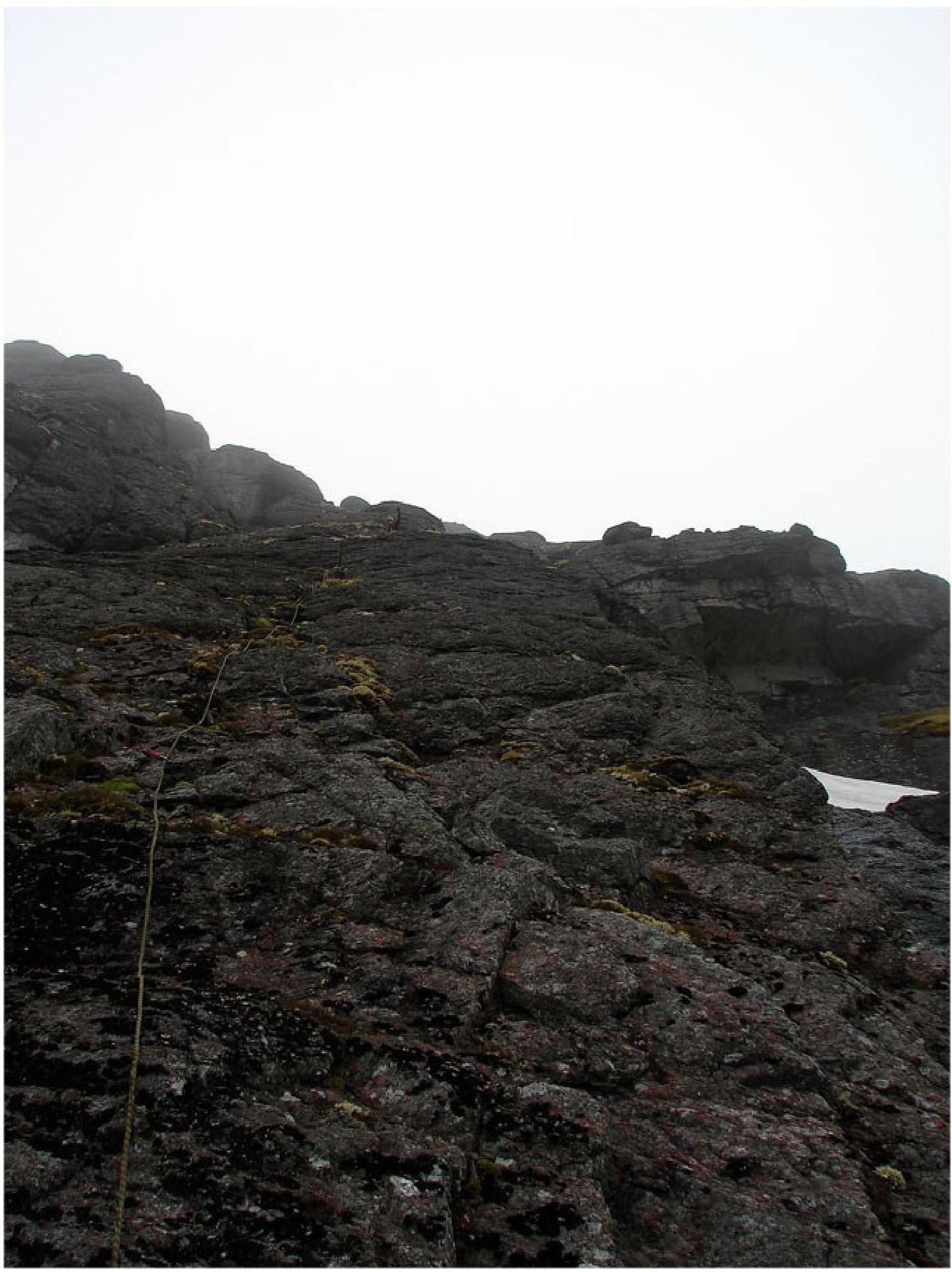
Photo 7. Section R1–R2 from the station
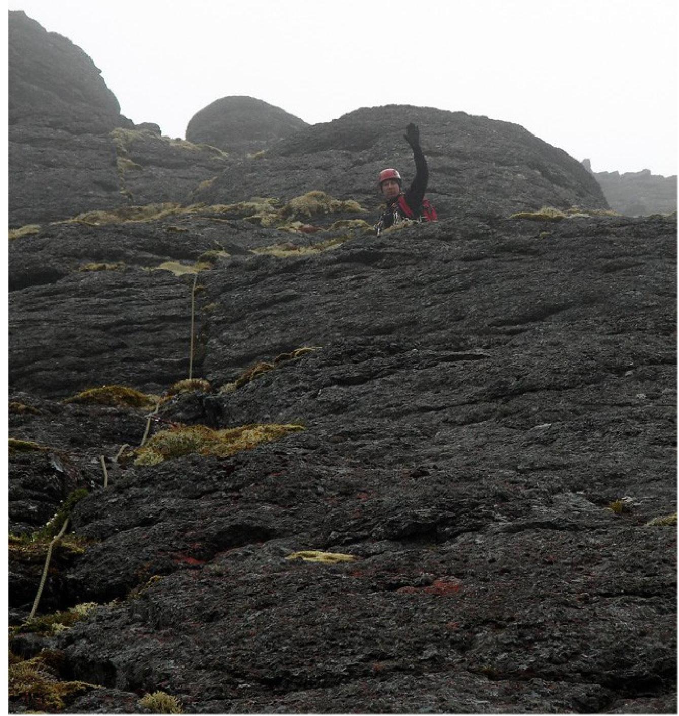
Photo 8. Upper part of section R1–R2 from the
station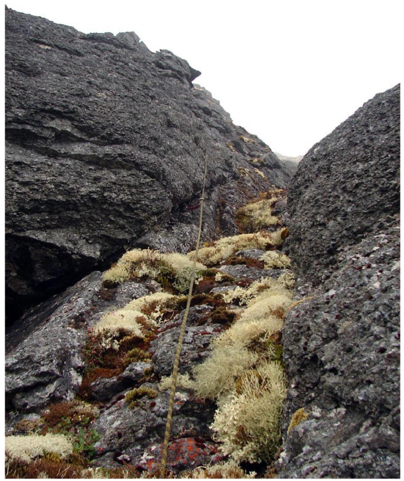
Photo 9. Section R2–R3, exit to the "ram's forehead"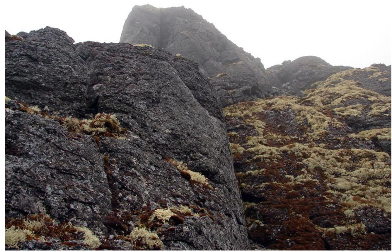
Photo 10. View of the "gendarme" from station
R3
Photo 11. Section R3–R4, bypassing the "gendarme" on the right along inclined
ledges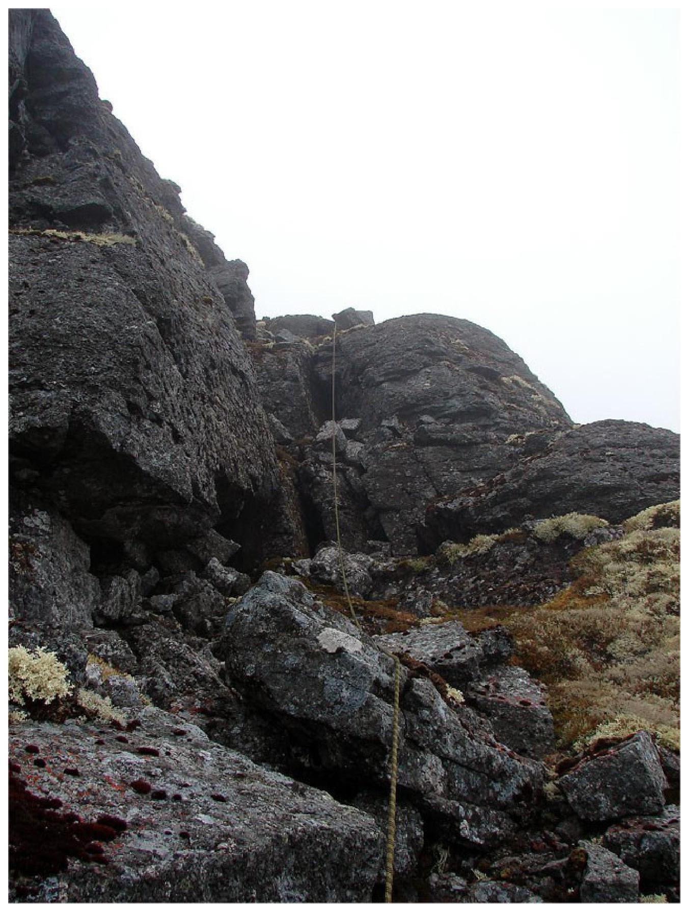
Photo 12. Section R3–R4, internal angle to the right of the
"gendarme"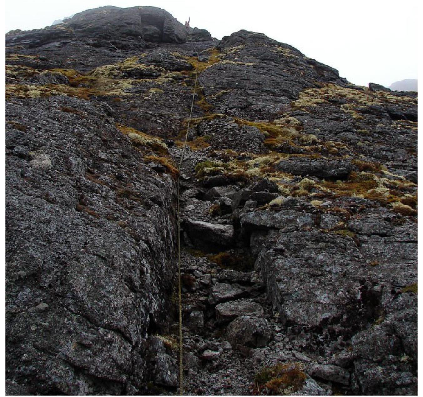
Photo 13. Section
R4–R5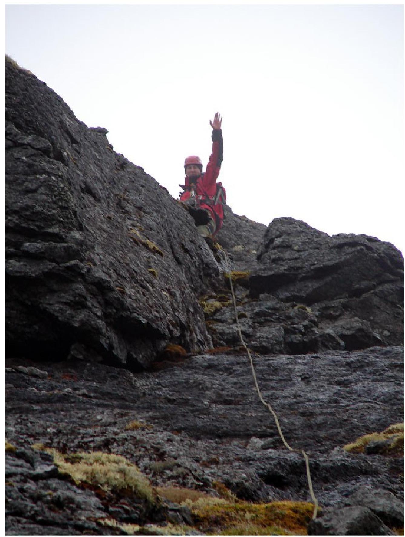
Photo 14. Upper part of section R4–R5
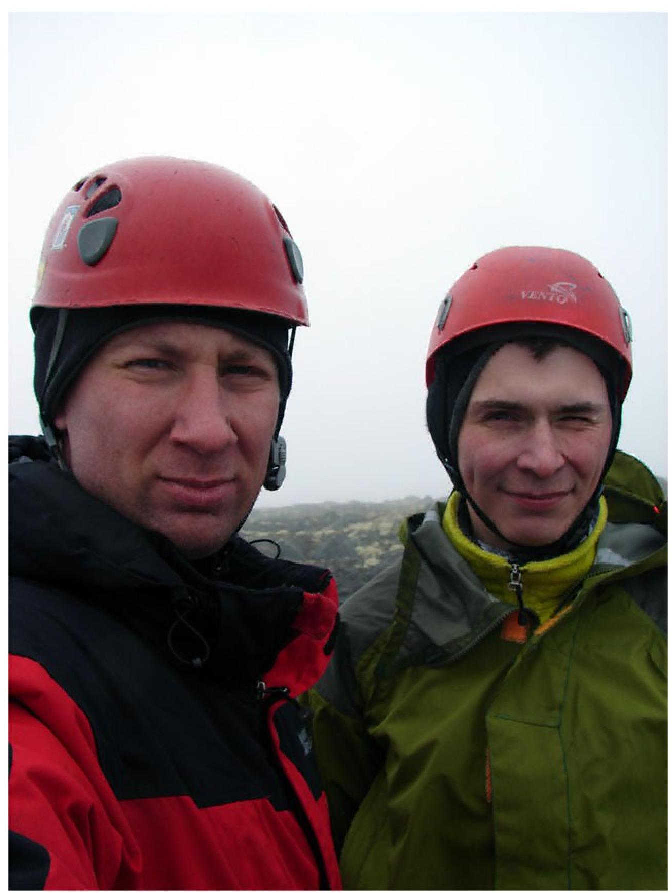
Photo 15. Team on the plateau


