St. Petersburg Championship 2015 Class of Technical Ascents
Report
on the ascent to the summit of Takhtarvumchorr Central First passage of the route along the inner corners of the center of the Cirque поясов wall
Team coach:
- Timoshenko T.A. — Master of Sports
- Semiletkin S.A. — Master of Sports
Leader:
- Murin E.G. — Master of Sports
Participants:
- Silin M.B. — 1st sports category
- Shabelnikov S.V. — Candidate Master of Sports
St. Petersburg 2015
Ascent Passport
- Murmansk region, Khibiny, Takhtarvumchorr ridge, section 8.6.1.
- Takhtarvumchorr Central, 1143 m, along the inner corners of the center of the Cirque поясов wall.
- Proposed 5B category of difficulty, first ascent.
- Route type: rock.
- Height difference of the route: 350 m. Route length: 400 m. Section lengths:
- V category of difficulty — 100 m.
- VI category of difficulty — 200 m. Average steepness of the route — 80°.
- Pitons left on the route: total — 10; including bolted pitons — 6. Pitons used on the route:
- stationary bolted pitons — 6 (including artificial aids — 3)
- removable bolted pitons — 0 (including artificial aids — 0). Total artificial aids used — many, very many.
- Team's total climbing hours: 23 hours, 4 days.
- Leader: Murin Evgeny Grigorievich, Master of Sports. Participants:
- Silin Mikhail Borisovich, 1st sports category.
- Shabelnikov Sergey Vladimirovich, Candidate Master of Sports.
- Coach: Timoshenko Tatiana Ivanovna, Master of Sports. Semiletkin Sergey Alekseevich, Master of Sports.
- Departure to the route: 13:00, March 16, 2015. Reached the summit: 14:30, March 19, 2015. Returned to the base camp: 18:00, March 19, 2015.
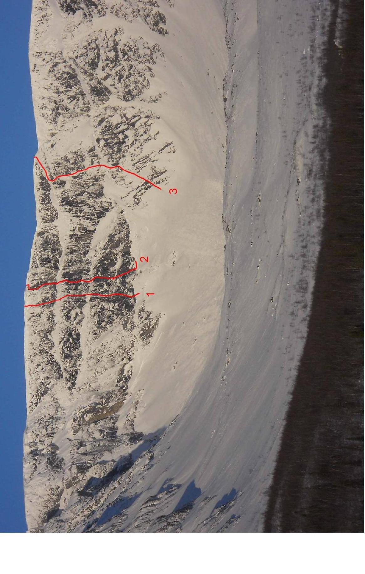
Photo 1. General photo of the Central circus (Cirque поясов). The route taken by the team (2) and nearby routes (1, 3) are shown:
- Takhtarvumchorr Central via the center of the wall, 5A (Andreev, 2004).
- Takhtarvumchorr Central via the NE buttress of the E wall of the Central circus, 2 (Ageev, 1994).
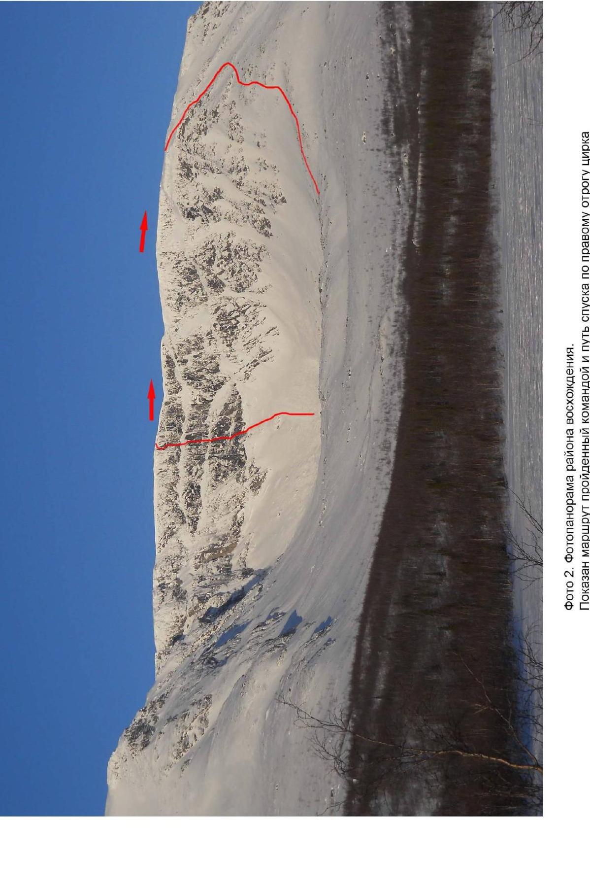
Photo 2. Photopanorama of the ascent area. The route taken by the team and the descent path along the right spur of the circus are shown.

Photo 3. Technical photo of the route. The route taken by the team is marked with a red line. The route is divided into sections, and bivouac locations are shown.
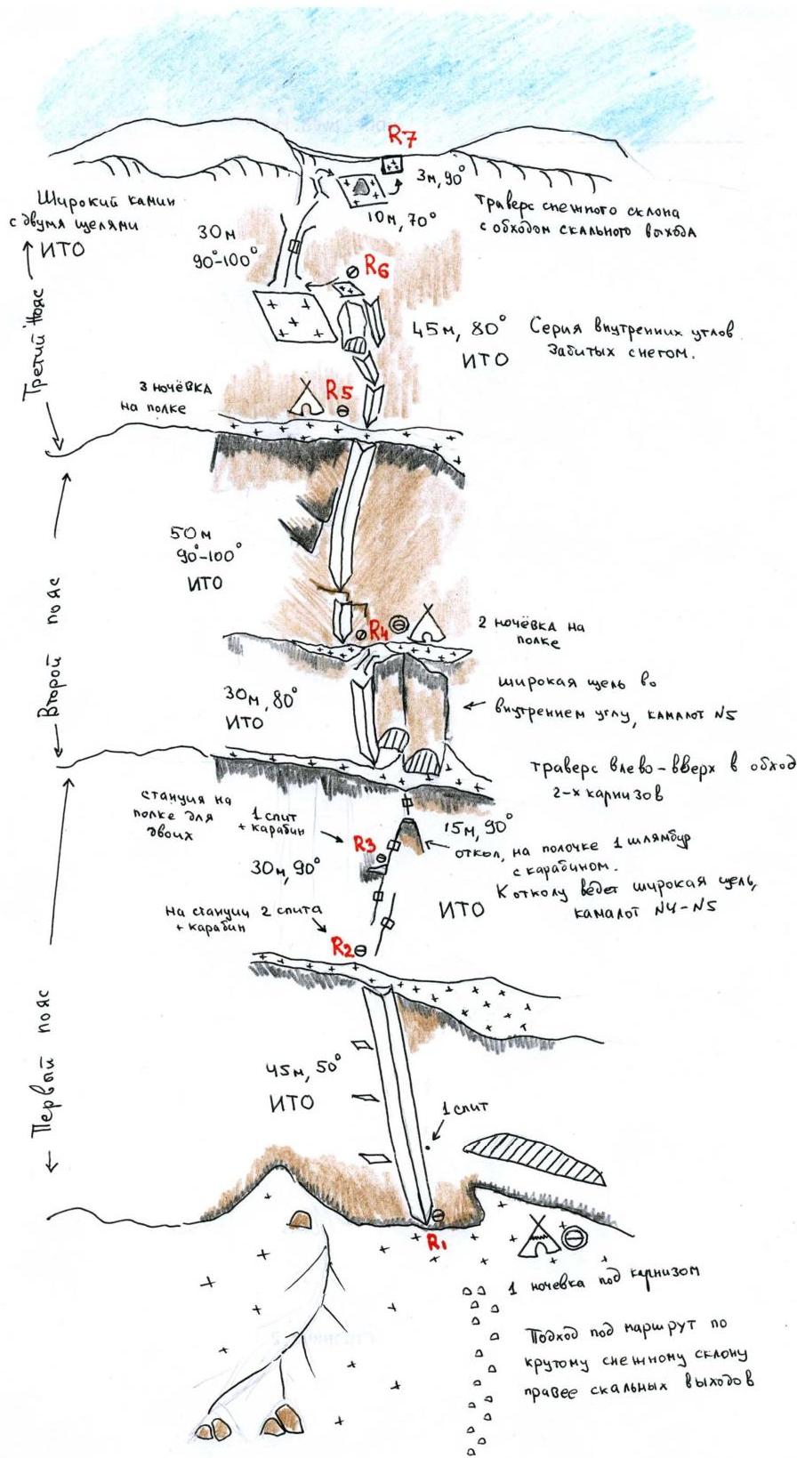
Route diagram in UIAA symbols.
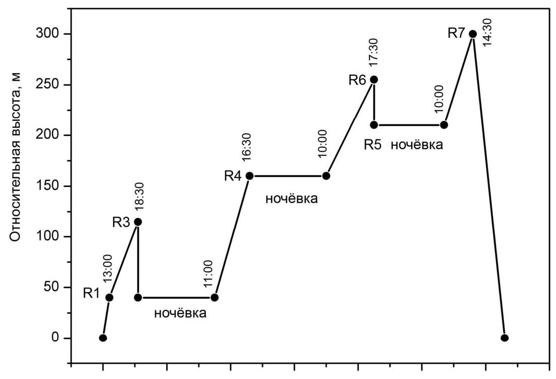
Ascent schedule.
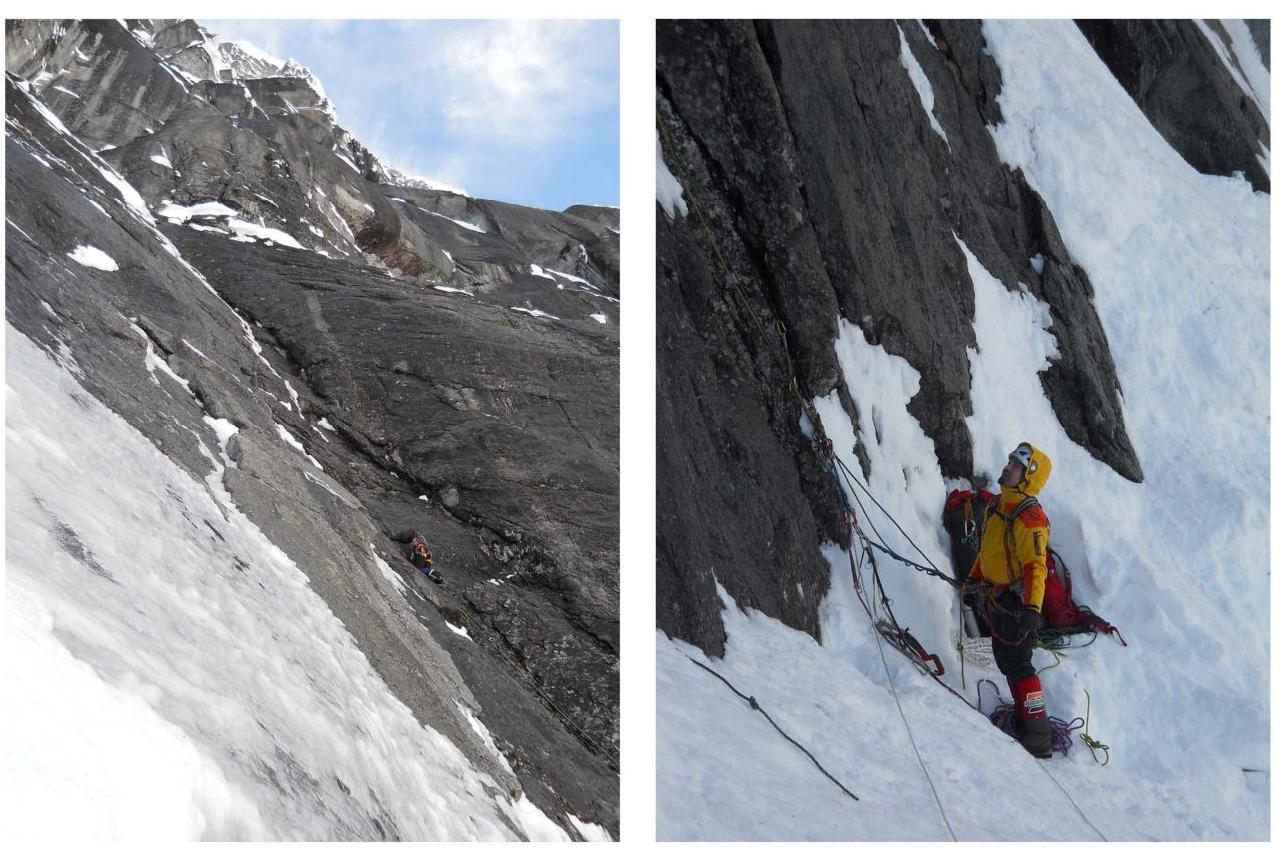
Section R1–R2.
Belay from R1.
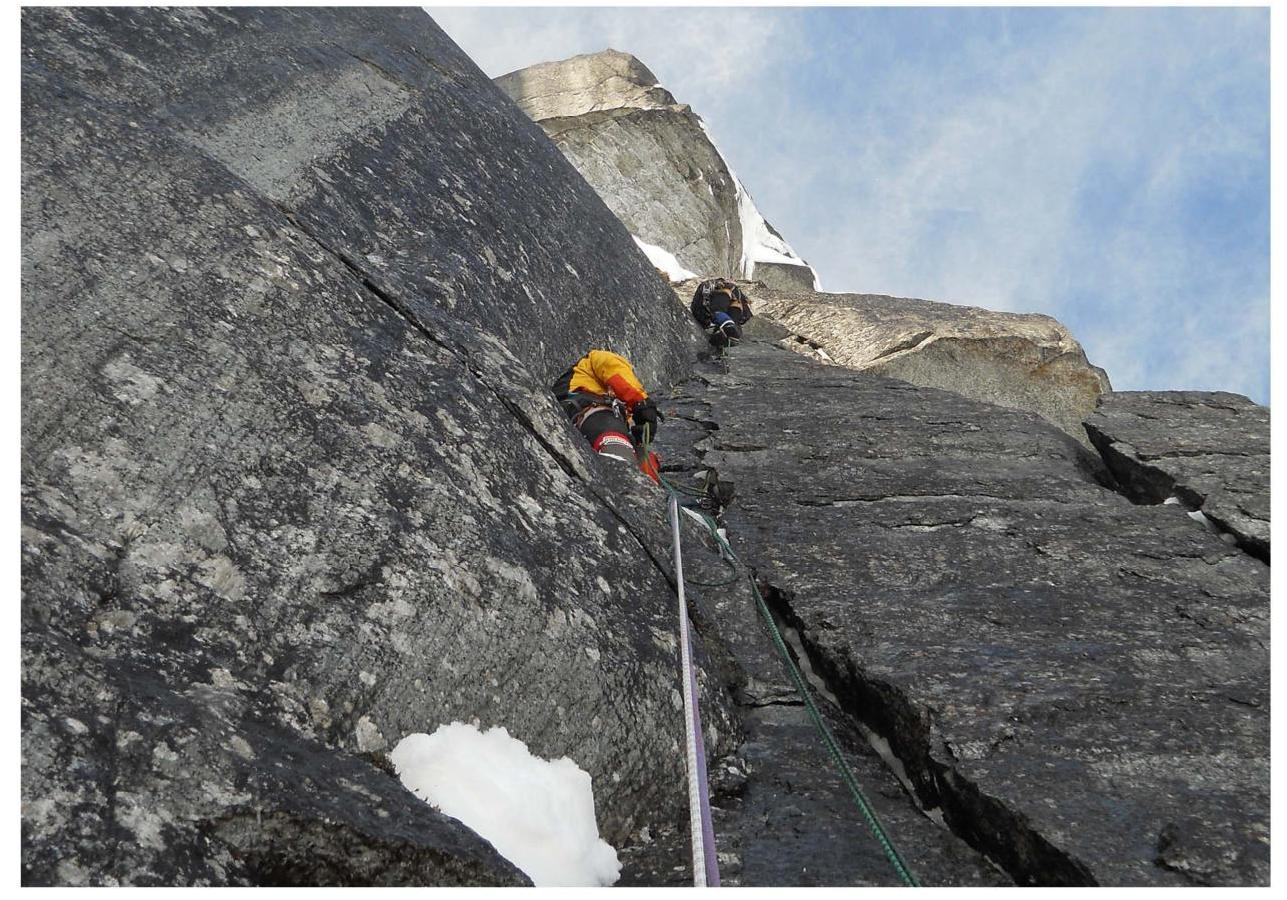
Station at R3.
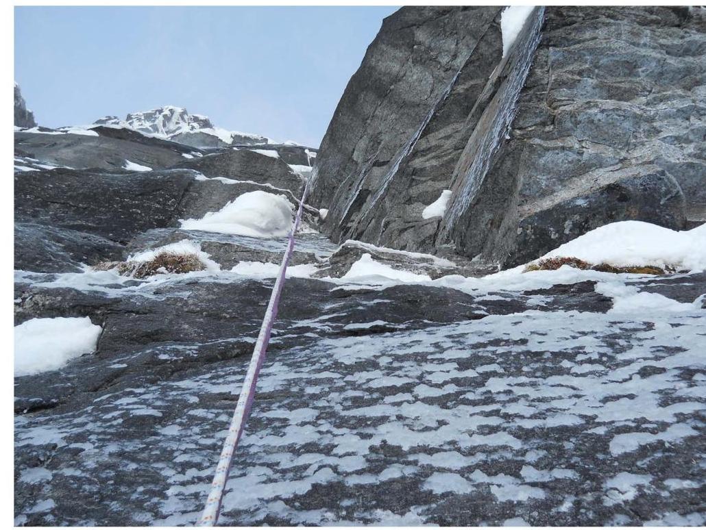
Cornices on section R3–R4.
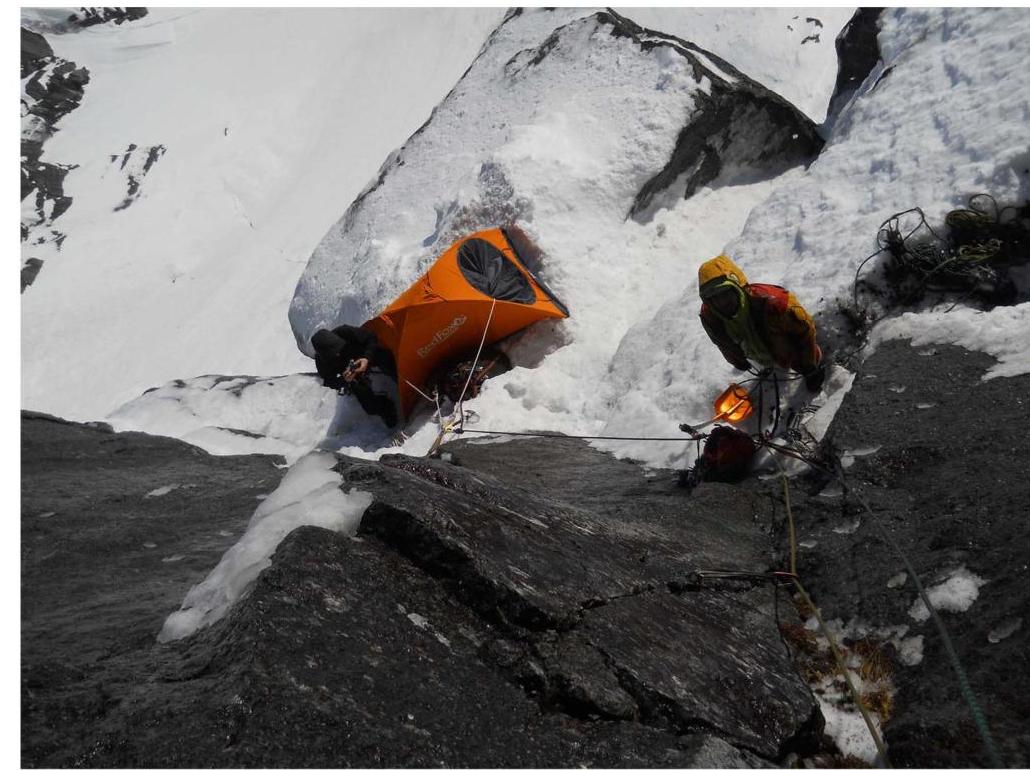
Morning at the bivouac, section R4.
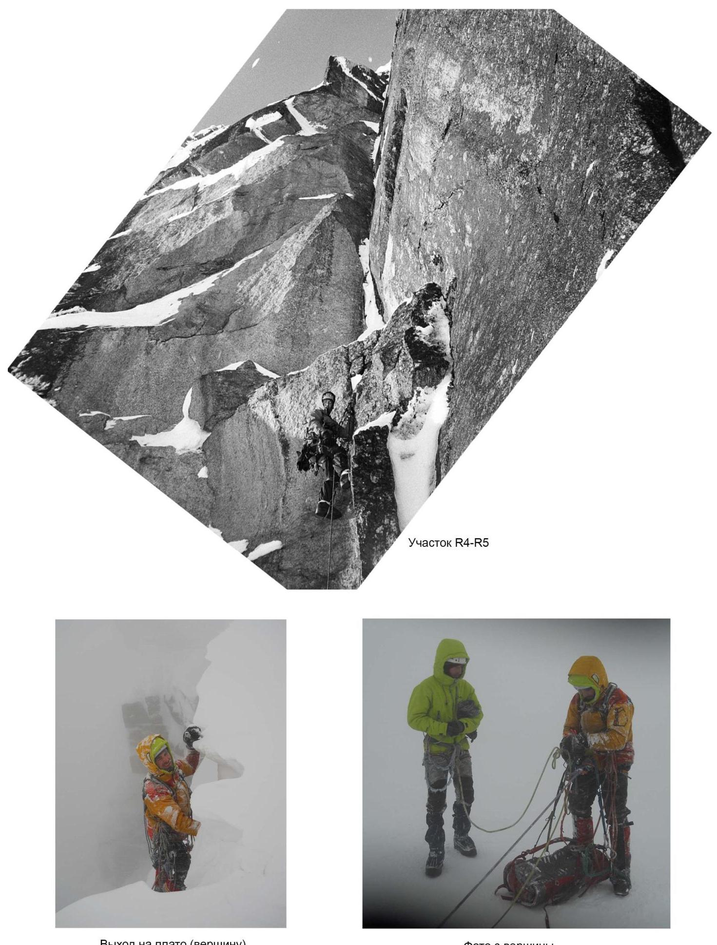
Exit to the plateau (summit).
Section R4–R5.
Photo from the summit.


