ST. PETERSBURG FEDERATION OF ALPINISM, ROCK CLIMBING AND ICE CLIMBING, LETI ALPCLUB
Report: Mt. Takhtarvumchorr, route - via the "Otkol" couloir from the North
Balagurin S. O.
Khibiny mountain range. Otkol cirque
Classification table section number: #8.6
Ascent Passport
- Kola Peninsula. Khibiny mountain range. Otkol cirque. Classification table section number: #8.6
- Peak name — Takhtarvumchorr 1143 m, route name — Otkol Couloir from the North.
- Proposed category of difficulty: 3B. First ascent
- Route characteristics: winter — combined, summer — rock.
- Route elevation gain: 550 m
Route length: 605 m. Section lengths: I cat. diff. — 300 m, II cat. diff. — 150 m, III cat. diff. — 40 m,
IV cat. diff. — 10 m, V cat. diff. — 5 m. Average steepness: main part of the route — 55°
- Number of pitons left on the route: total — 2; including bolted pitons — 0. Total number of artificial protection points (APPs) used: 1 point.
- Team's total climbing time: 3 hours
- Team: leader — Balagurin S.O. — 1st sports category.
Sedletskaya T.V. — 2nd sports category. Bykov A.P. — 2nd sports category. Kanonikhin I. — 2nd sports category.
- Coach: Timoshenko T.I. — Master of Sports
- Departure for the route: 8:15, April 9, 2013.
Reached the summit: 11:20, April 9, 2013. Returned to base camp: 13:30, April 9, 2013.
Descent from the summit: via 1B category difficulty route on "Otkol" through Geografov Pass
-
Organization — St. Petersburg Federation of Alpinism, Rock Climbing and Ice Climbing. LETI Alpinism Club
-
Responsible for the report: Balagurin S.O. Email and phone: skin128@yandex.ru, phone: +7 963 740 75 54 General photo of the summit.
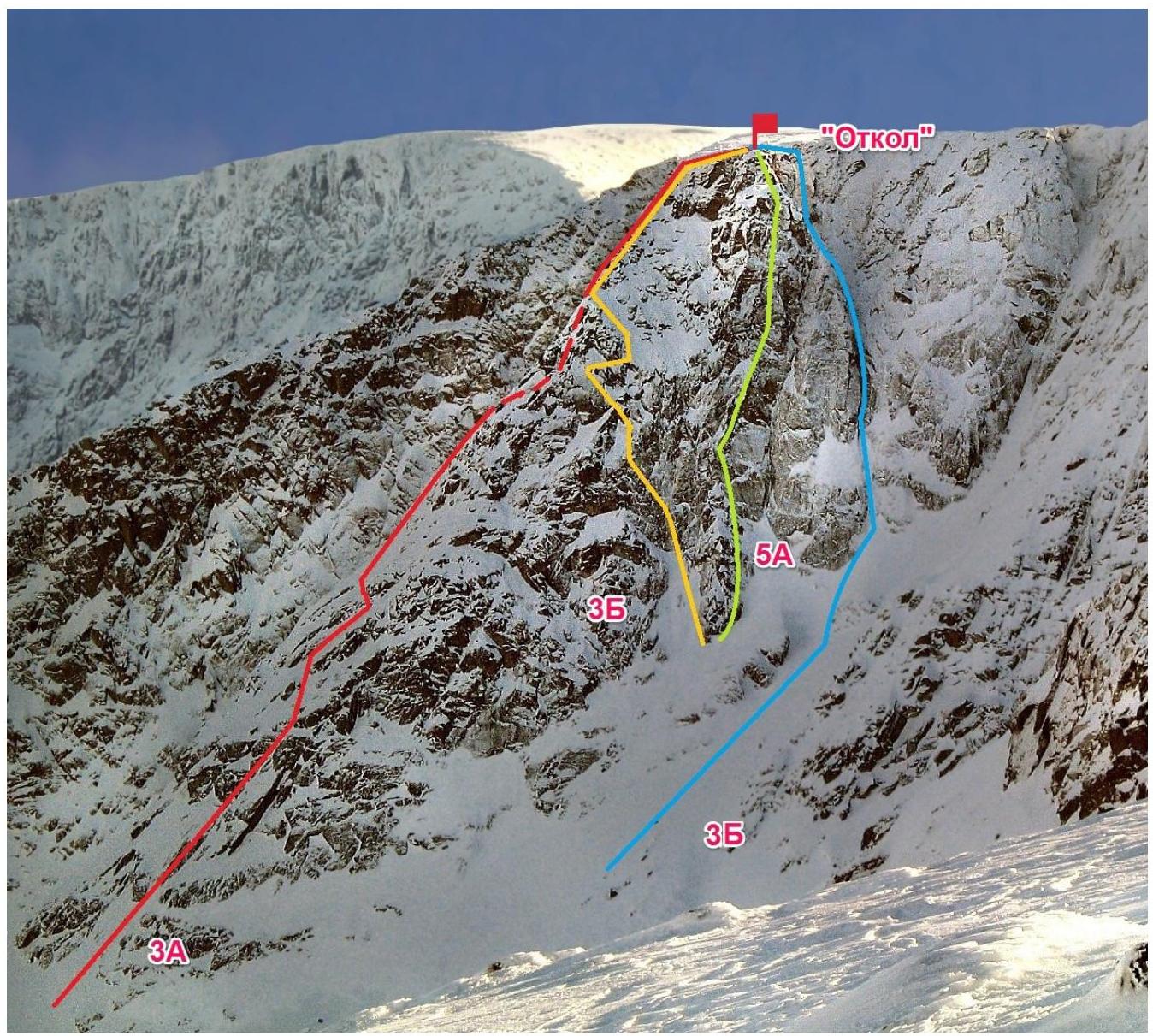
Time and location of the photo: February 27, 2006, Mt. Takhtarvumchorr (center) Route profile.
Time and location of the photo: February 27, 2006, Mt. Takhtarvumchorr (center)
Panorama of the ascent area.
Time and location of the photo: June 12, 2012, Mt. Takhtarvumchorr (center)
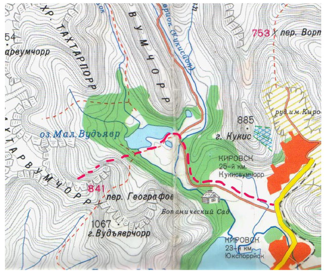
Ascent area map
| Section # | Length | Steepness | Terrain characteristics | Cat. diff. | # of pitons |
|---|---|---|---|---|---|
| R0–R1 | 300 m | 50° | Snow slope | I–II | 0 |
| R1–R2 | 80 m | 65° | Couloir | II–III | 0 |
| R2–R3 | 10 m | 90°–95° | Chimney with a plug | IV | 1 |
| R1–R4 | 40 m, 5 m | 55°, 90°–100° | Chimney with a plug | II–III, V | 2 |
| R4–R5 | 120 m | 55° | Couloir | I–II | 0 |
| R5–R6 | 10 m | 60° | Rocks | III | 0 |
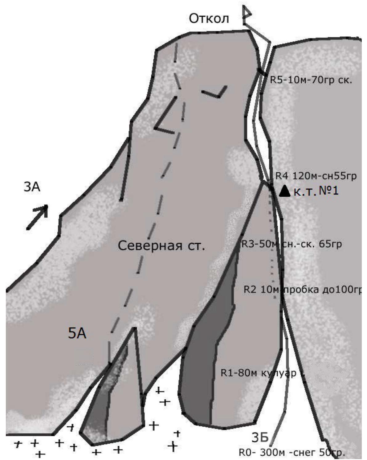
Route Description
Depart from "25 km" location and approach the Otkol cirque, then head towards Mt. Takhtarvumchorr massif. Bypassing the Otkol massif, ascend the snow slope to the base of the Otkol couloir from the north side (3 hours).
The route begins to the right of the routes "To 'Otkol' via the center of the north wall, 5A" and "Olenevodov, 3B".
R0–R1:
- Ascend a steep snow slope to the base of the couloir. 300 m. 50° I–II cat. diff.
R1–R2: Ascend a narrow couloir to the base of the chimney. 80 m. 65° II–III cat. diff.
R2–R3: Chimney is clogged with 2 plugs. The first plug is ascended directly. 90°–95° 10 m IV cat. diff.
R3–R4: Continue moving up the chimney. 55° 40 m II–III cat. diff. Approach the key section of the route, an overhanging plug. 5 m. 90°–100° V cat. diff. In winter, it is possible to use an artificial protection point (APP) to pass the plugs (the upper plug is frozen). Under the last plug, there is a control cairn (a can on a piton).
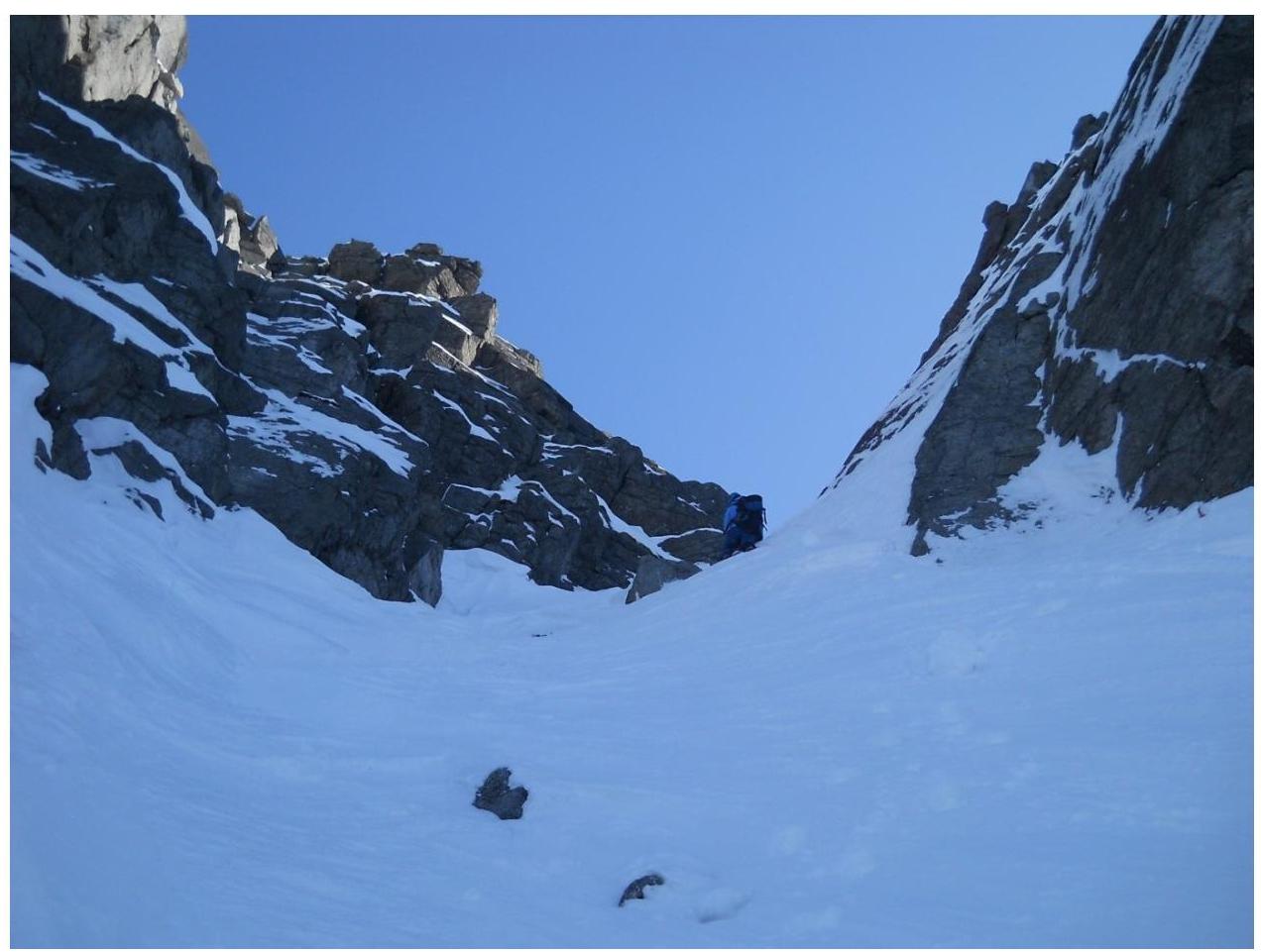
R4–R5: Ascend a wide couloir to a saddle between the Takhtarvumchorr ridge and "Otkol". 55° 120 m I–II cat. diff.
R5–R6: Ascend to "Otkol" via snow-covered rocks. 60° 10 m III cat. diff. Control cairn.
Descent from the summit: Cross a ridge connecting "Otkol" to the Takhtarvumchorr ridge, then descend the southern slope of the eastern spur of the Takhtarvumchorr ridge to the cirque under Geografov Pass (Ganesha cirque), and then to Maly Vudyavr Lake.
Safety Assessment Recommendations
The route is generally safe and logical, with good terrain for protection. The route is easy to access, and there is no desire to deviate from it.
The route is generally safe. Recommended as a first 3B route.
The following protection elements work well:
- small and medium-sized chocks
- hexes
- friends
There are also places for larger protection elements.
Recommended Equipment:
Ice axe (one per person) Ice screws — 2 pcs. Crampons (one per person) Chocks — 1 set. Large chocks — 2 pcs. Slings 2–3 m — 3–4 pcs. Quickdraws 70–80 cm — 2 pcs. Recommended climbing time — 3 hours Photo illustrations for the report.
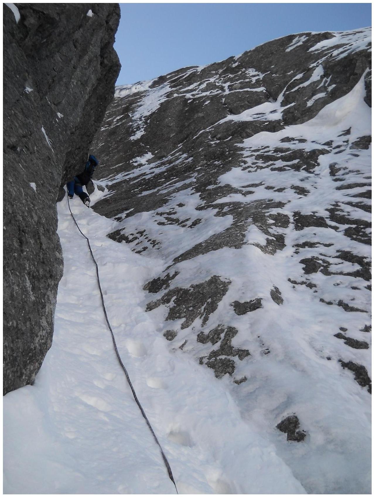
Section R2–R3 — below the first plug.
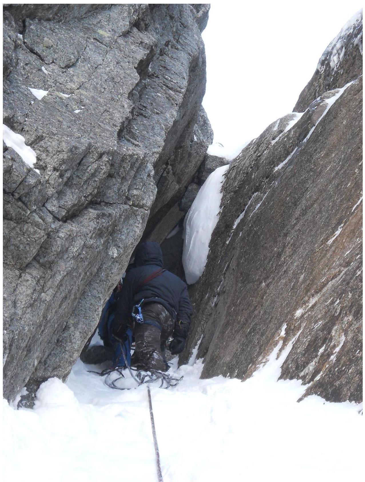
Section R3–R4 — below the second plug.
Section
R3–R4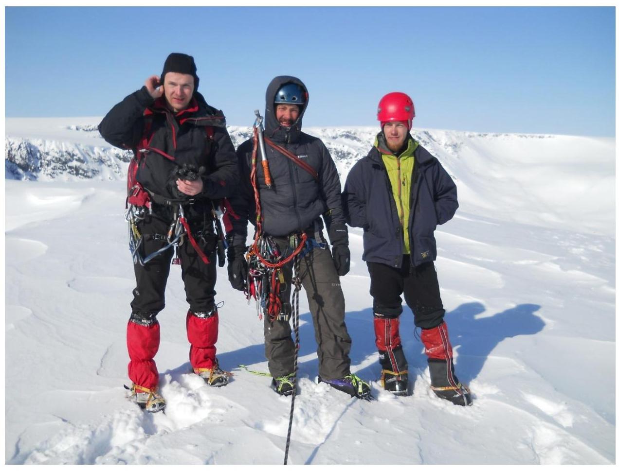 Summit


