Report
On the ascent
via the right rib of the N wall
Mt. Vudyavrcorr (B) (1068 m), "Gendarmerie" route (first ascent by Ageev N., 1995), 3B category of difficulty, Ganeshinga cirque, Khibiny (August 26, 2015, repeat ascent)
Leader: Goloborodko A. Coach: Ivanov D.
Apatity
2016
Ascent passport
-
Kola Peninsula. Khibiny mountain massif. Classification table section number: 8.6.1.
-
Route name — "Gendarmerie", via the right rib of the N wall of Mt. Vudyavrcorr (B) (1068 m).
-
Proposed 3B category of difficulty (first ascent: Ageev N.V., May 19, 1995; the route is established and popular, with multiple repeat ascents by groups from different regions in various seasons since 1995).
-
Route character: combined (winter); rock (summer).
-
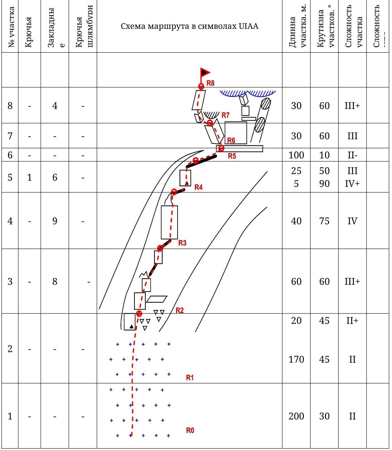
Height difference — 550 m. Total route length — 680 m. Technical section length — 310 m; section lengths:
- III category of difficulty — 145 m,
- IV category of difficulty — 45 m; Average route slope — 50°, key sections up to 90°.
- Pitons used on the route:
- friends and nuts — 27 pcs., pitons — 1 pc.;
- left behind — 0 pcs.
-
Team's walking hours: 8.5 hours (excluding approach and descent), approach from Lake Maly Vudyavr — 1.5 hours.
-
Leader: Goloborodko A. — 2nd sports category; participants: Danilov P. — 2nd sports category.
-
Coach: Ivanov D.
-
Time on the route:
- departure on the route — 9:00;
- reaching the summit — 17:30;
- descent to the valley — 18:30.
Descent from the summit:
- via the NE ridge of Vudyavrcorr (B) to the "Botanical Garden";
- possible descent via the southern slope of Vudyavrcorr (B) with exit through Geografov pass into Ganeshinga cirque and further into the valley of Lake Maly Vudyavr.
-
Organization: Apatity-Kirov Federation of Alpinism.
-
Report responsible: Goloborodko A., goloborodkoalex@gmail.com. Area map
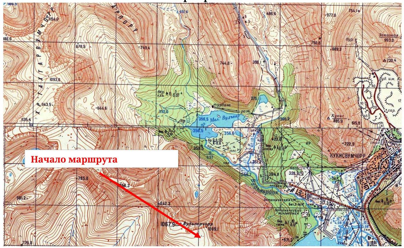
Fig. 1. Area map (fragment, scale — 1:50 000). Area panorama
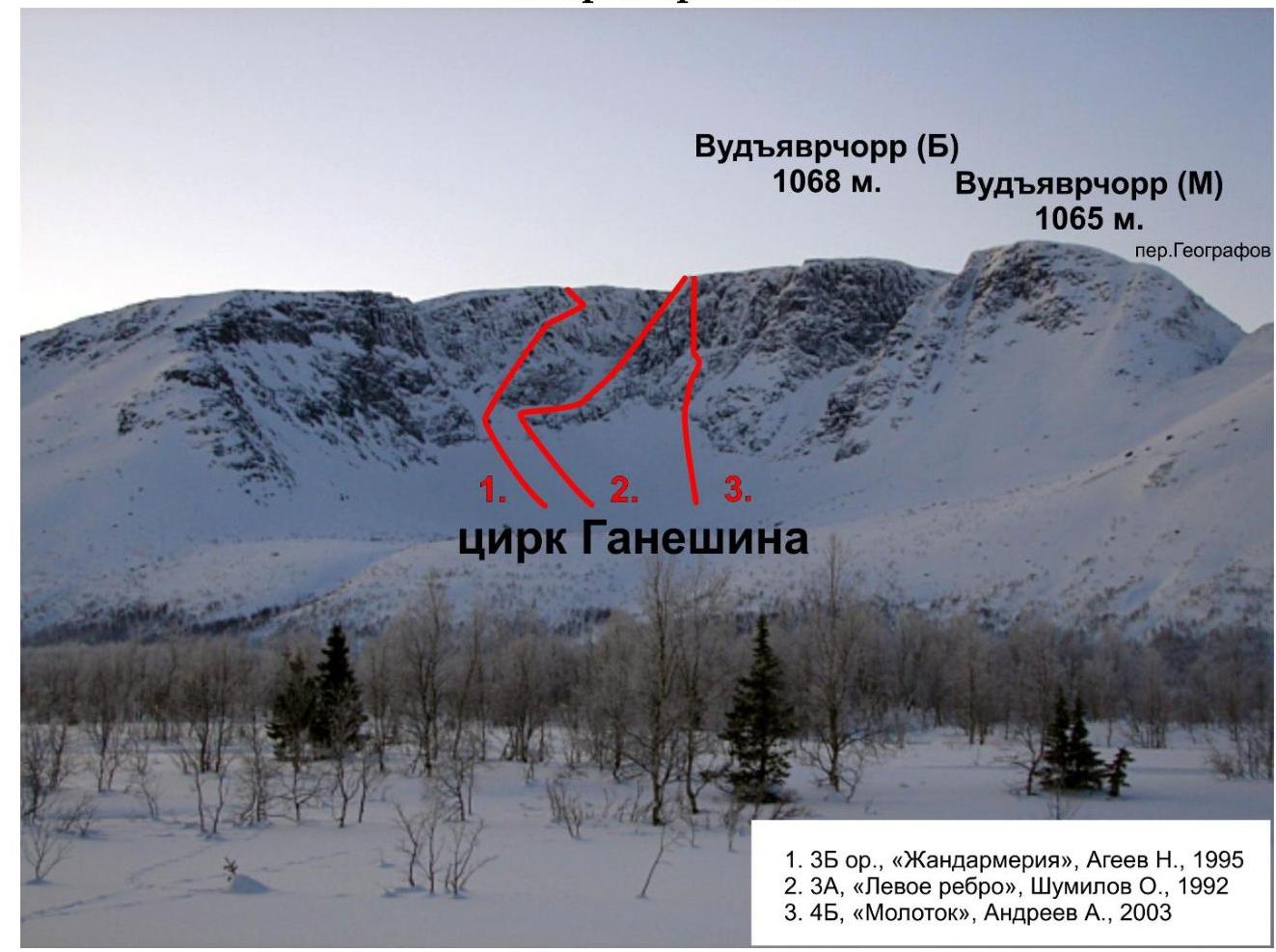
Fig. 2. Ganeshinga cirque, photo from Lake Maly Vudyavr
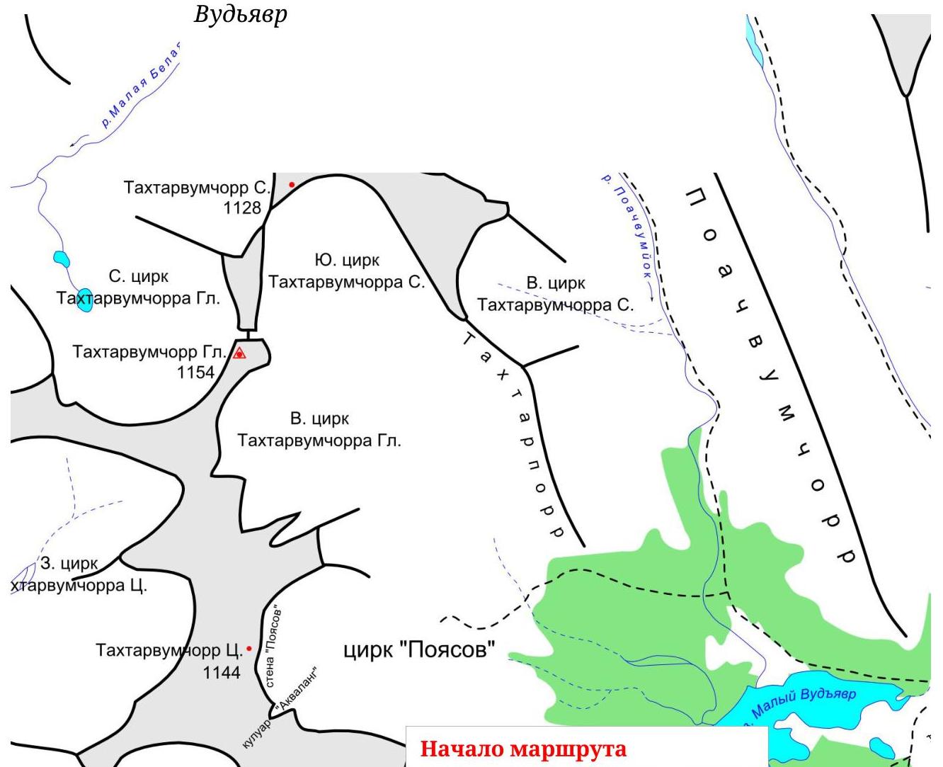
Fig. 3. Orographic scheme of the central part of Khibiny. General photos of the route
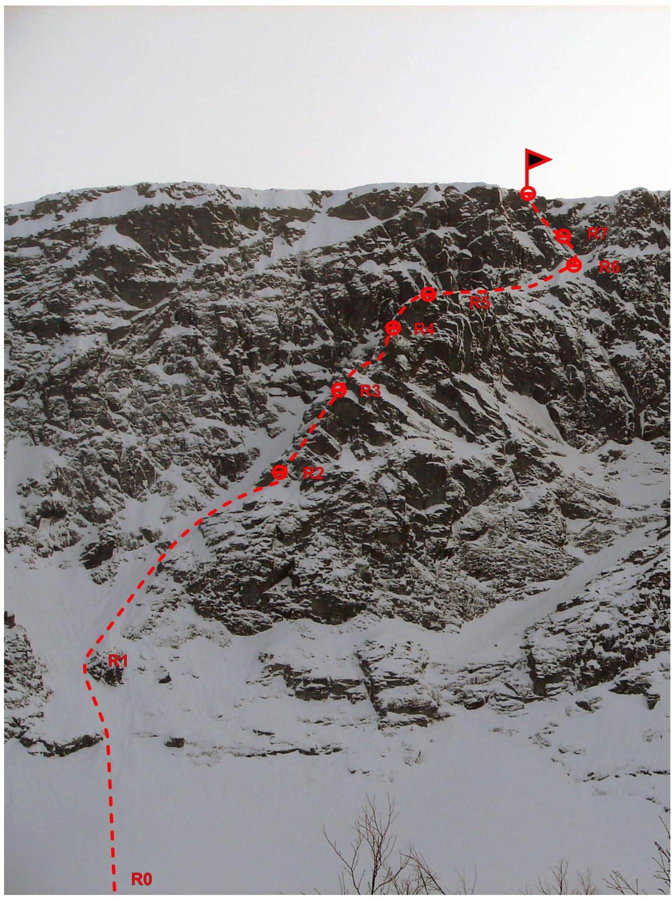
Fig. 4. Route profile
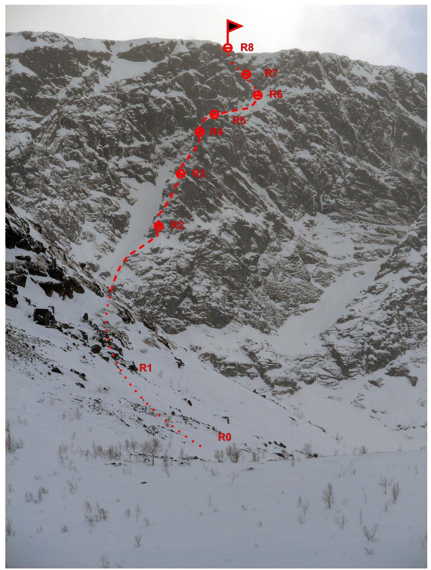
Fig. 5. Route line from the eastern end of Ganeshinga cirque
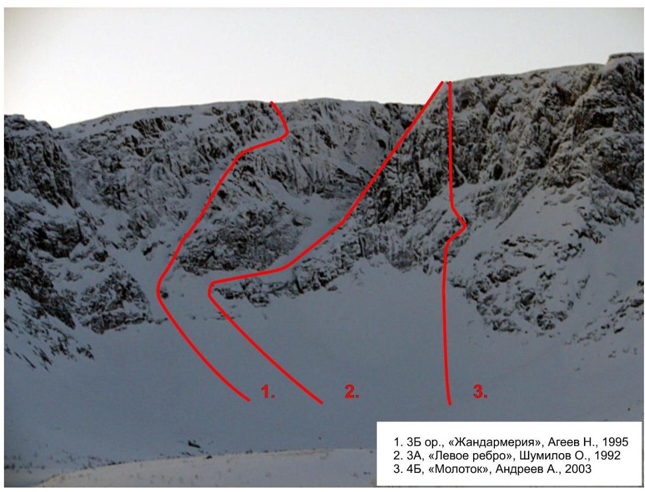
Fig. 6. "Gendarmerie" and nearby routes. Route scheme in UIAA symbols
Route description
Approach:
- from the crossing over the Vudyavryok river to Ganeshinga cirque — about 1 hour;
- then left into the depth of Ganeshinga cirque — 30 minutes.
R0–R1: via the snowy slope (in summer, via loose rocks and wet "ram's foreheads" with oblique ledges; the route is better started significantly to the right of the "winter line" via oblique ledges, bypassing wet "ram's foreheads") to the "rock gates", 200 m, 30°, II category of difficulty, avalanche danger.
R1–R2: via the snowy slope (in summer, via "ram's foreheads") through the "rock gates" under the start of the ridge, first gendarme with a control tour (can on a piton), 170 m, up to 45°, II category of difficulty, avalanche danger; ascent to the "gendarme" from the right via crumbling rocks under the wall of the next "gendarme", 20 m, up to 45°, II+ category of difficulty.
R2–R3: via small walls with steep ridge peaks, approach under the next "gendarme" (has a characteristic tusk-like shape), 60 m, 60°, III+ category of difficulty.
R3–R4: key section of the route, via the wall, ascent to the "gendarme" from the right side, exit to a narrow saddle with cornices before the next wall, 40 m, 75°, IV category of difficulty.
R4–R5: via a narrow saddle and a small wall, with a second control tour (can on a piton) 5 m, 90°, IV category of difficulty, then via a narrow steep section of the ridge with cornices, 25 m, 45°, III category of difficulty, exit to a flattening, station on ice axes.
R5–R6: via the ridge, exit to a narrow ledge under the pre-summit ascent, large snowy cornices above the ledge, 100 m, 10°, II category of difficulty.
R6–R7: from the horizontal ledge via a steep inclined ledge to the left under a cornice, 30 m, 60°, III category of difficulty.
R7–R8: from under the cornice to the left and up via inclined ledges (much thin ice) — exit to the plateau, 30 m, 60°, III+ category of difficulty. Control tour laid out with stones on the plateau. In winter — inaccessible.
In summer, a variant of passing R6–R8 via an oblique crack with a plug to the right of the horizontal ledge is possible ( "speleo" variant): from the plug to the left to a small ledge and up.
In winter, on this section:
- snowy cornices.
Descent:
- via the NE ridge of Vudyavrcorr (B) to the "Botanical Garden";
- possible descent via the southern slope of Vudyavrcorr (B) to Geografov pass and further into Ganeshinga cirque and the valley of Lake Maly Vudyavr.
Emergency descent: via the ascent route or into the left couloir (avalanche danger).
Recommended walking time:
- 9 hours (winter);
- 7.5 hours (summer).
Ascent photo illustrations
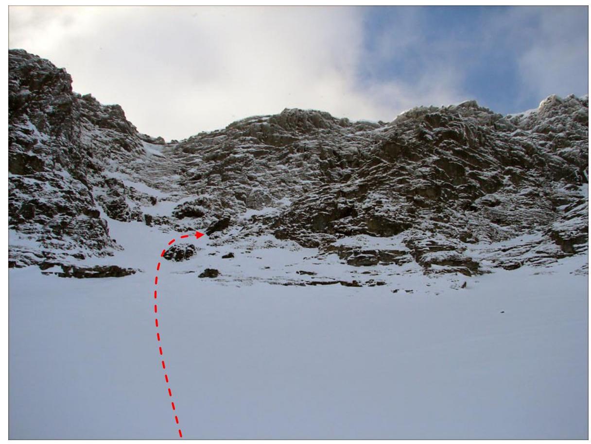
Fig. 7. Section R0–R1, passage through the "rock gates" (left) under the first "gendarme"
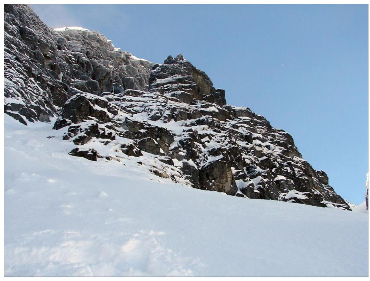
Photo 8. Photo from the middle of R1–R2, views of
- the first and second "gendarmes";
- start of R2–R3.
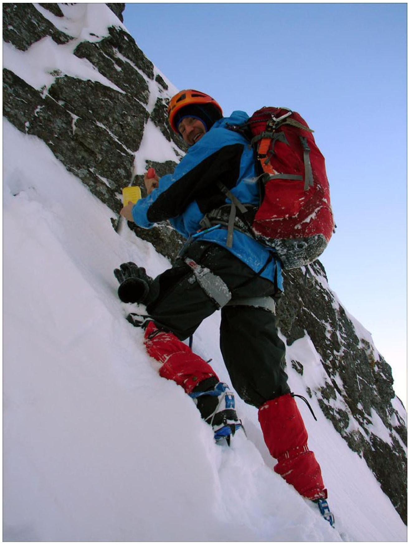
Photo 9. At the first control tour (under the wall of the first "gendarme")
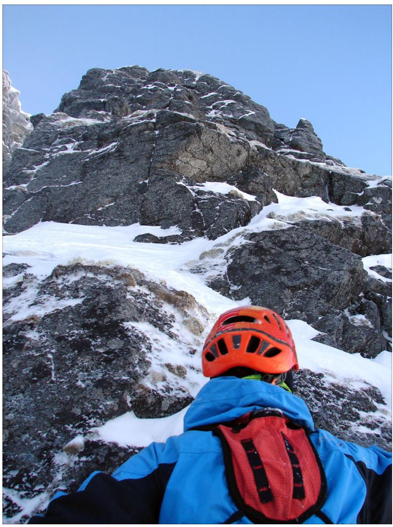
Photo 10. Start of section R2–R3, ascent to the second "gendarme"
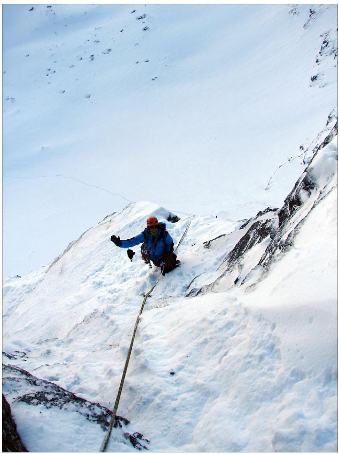
Photo 11. View down from station R3
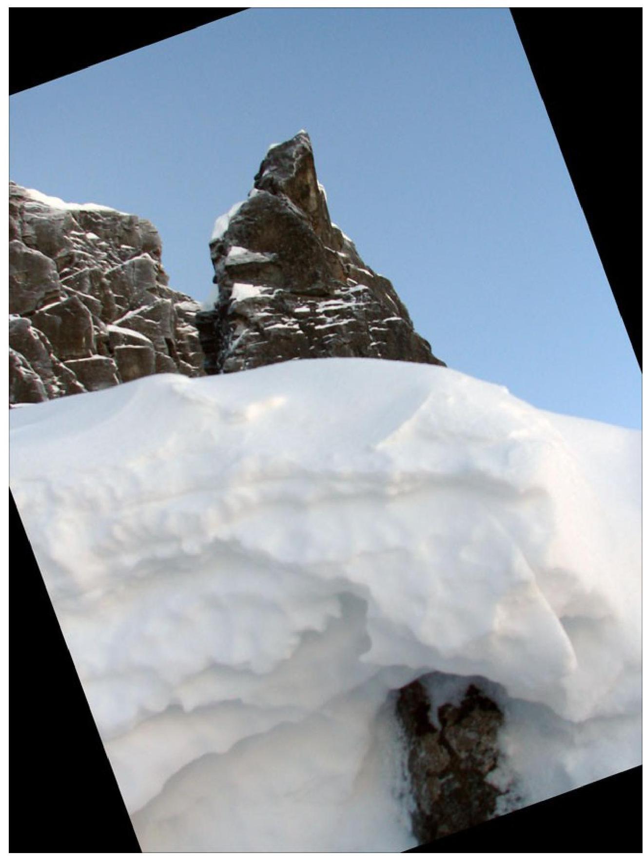
Photo 12. View from station R3 (cut into the snowy ridge) to the next "gendarme"

Photo 13. View from station R4 down (right upper "gendarme" from photo 11)
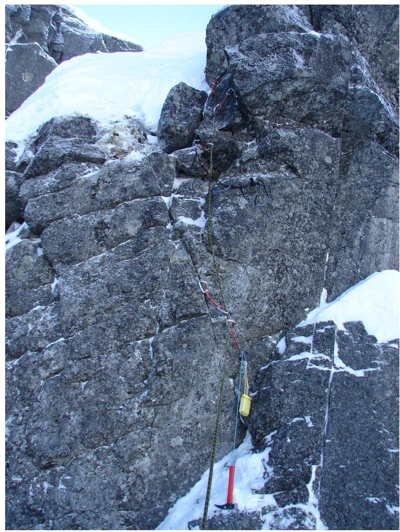
Photo 14. Wall on section R4–R5. Second control tour
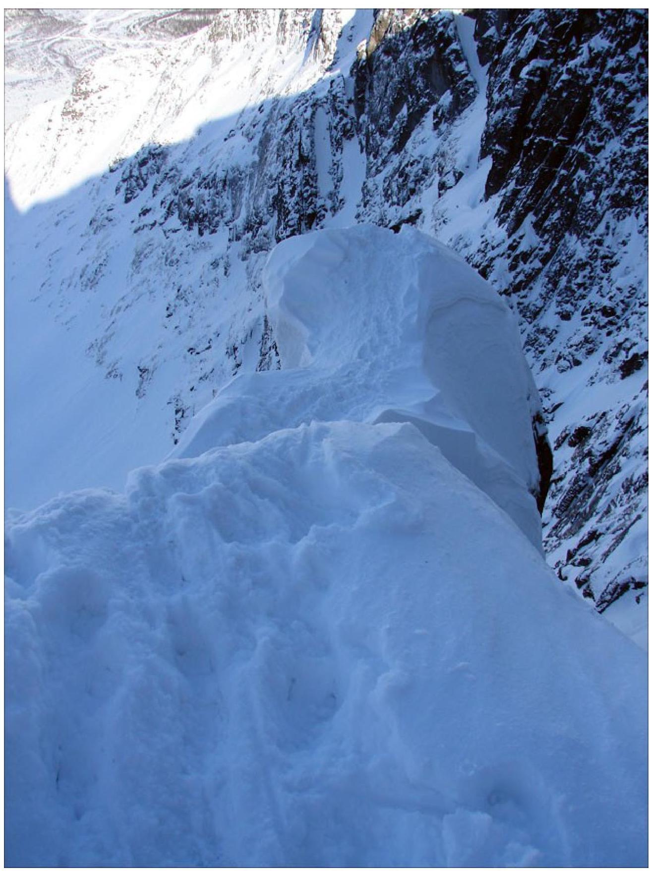
Photo 15. End of section R4–R5 (view from above)
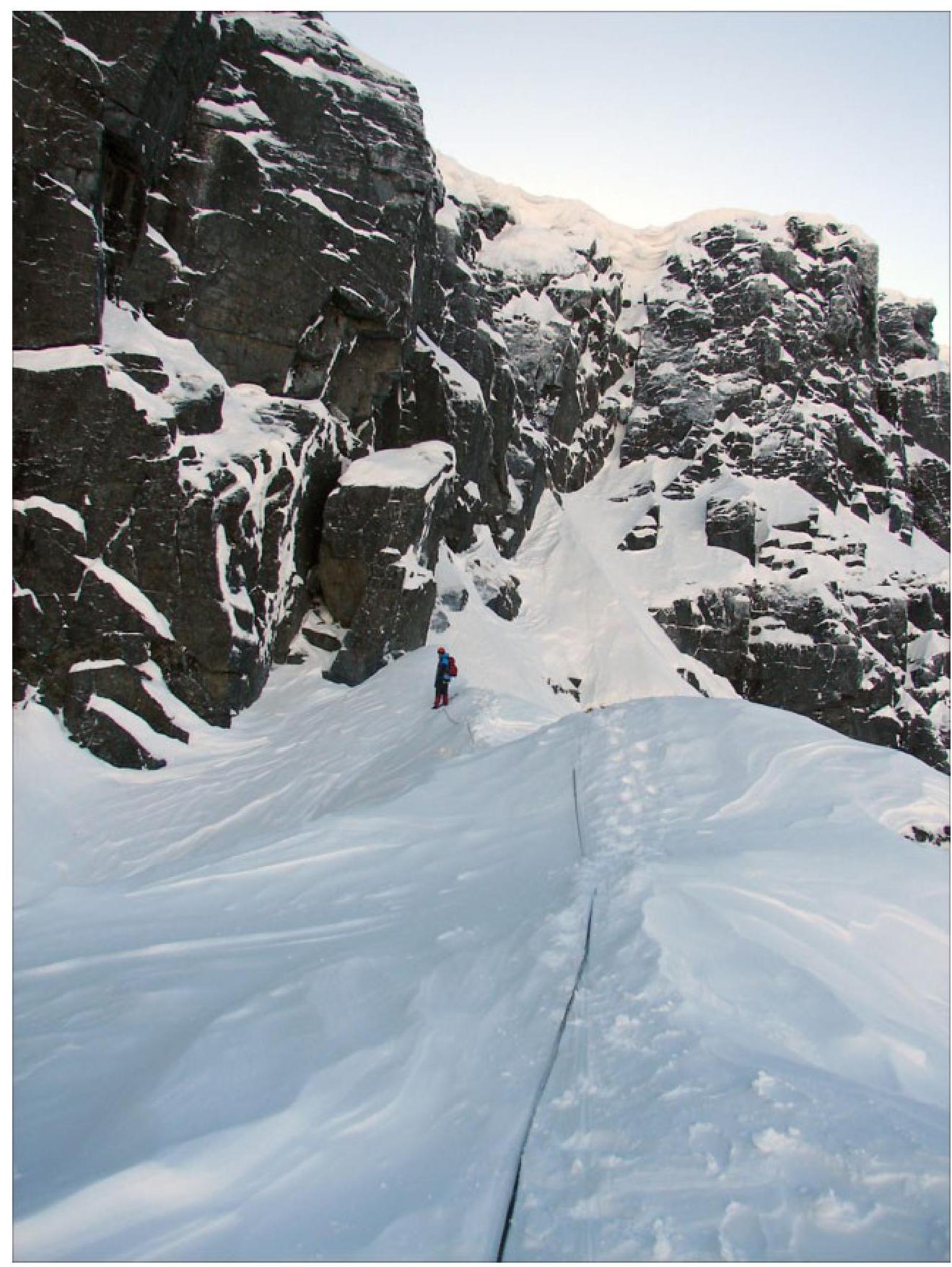
Photo 16. Section R5–R6, end of the ridge and ledge under the pre-summit ascent
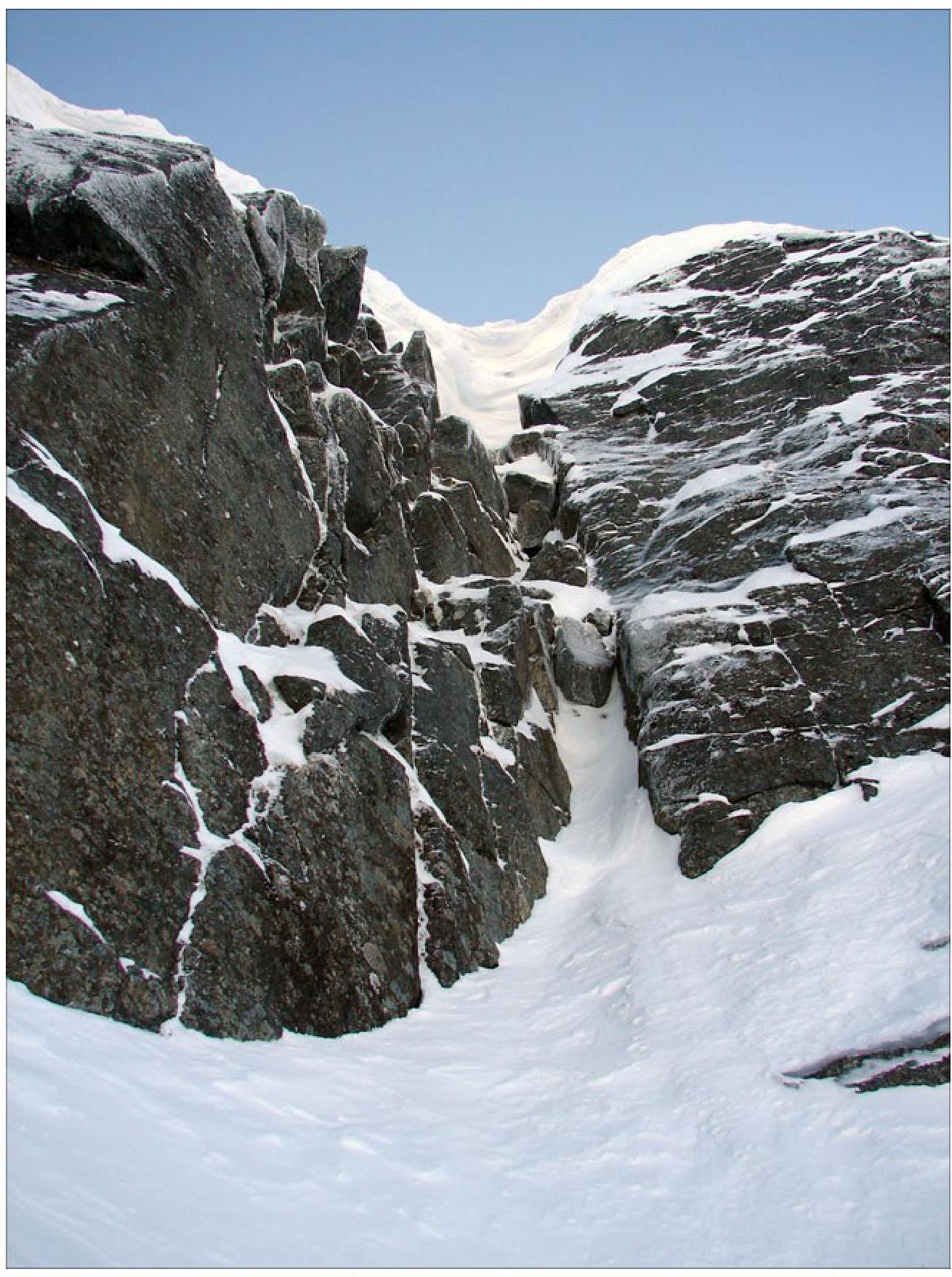
Photo 17. Crack with a plug to the right of the horizontal ledge (photo from station R6), section with a possible summer variant of R6–R8
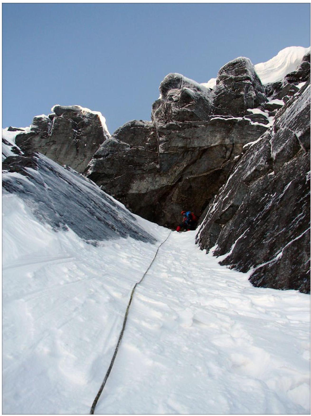
Photo 18. Station R7 under the cornice
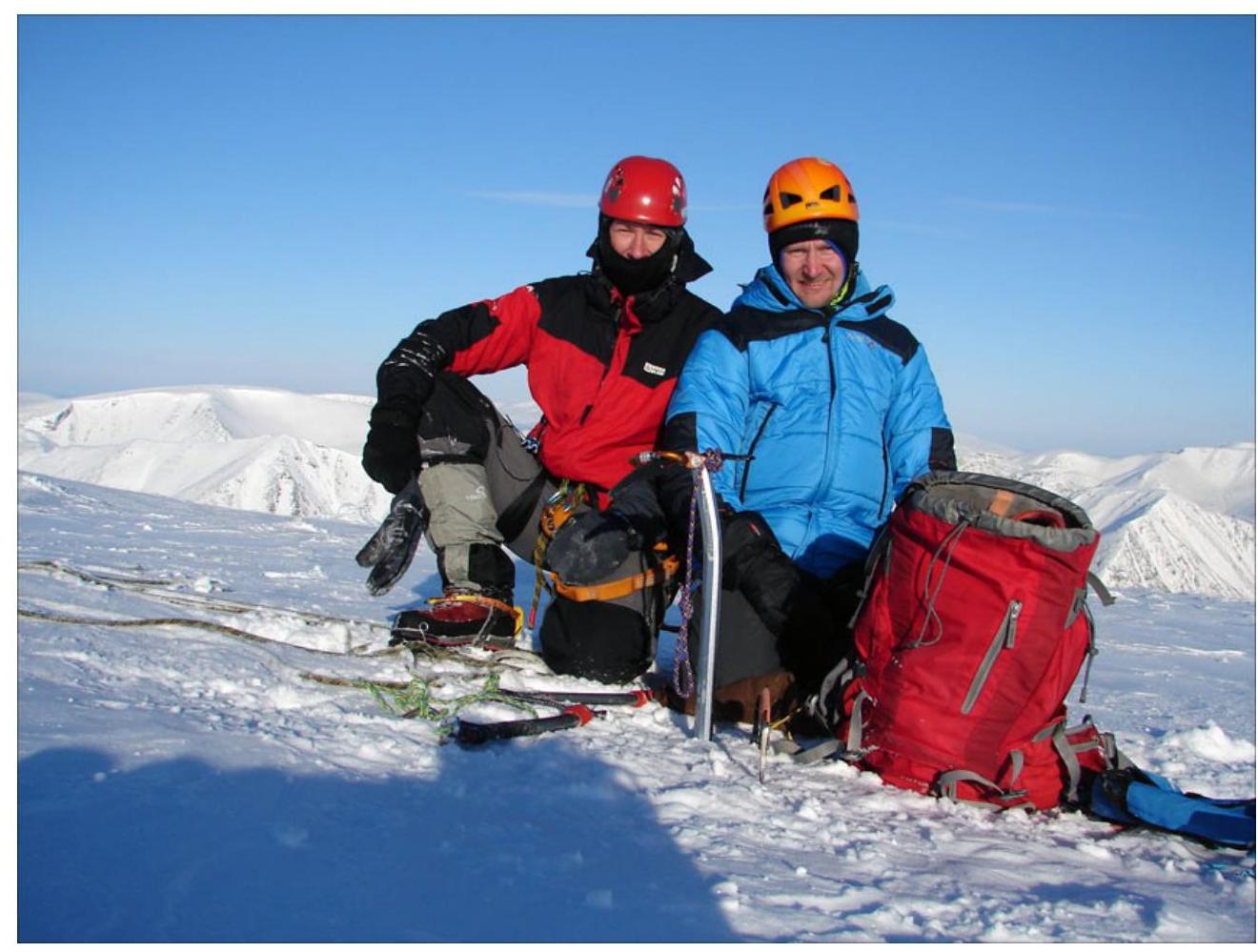
Photo 19. Team on the plateau