Report
On the ascent to the summit of Maly Vudyavrchorr via the Third buttress of the Eastern wall "Oguрец" route, category 4A, by the SKIF mountaineering club team on August 23, 2018.
I. Ascent Report
| № | General Information | |
|---|---|---|
| 1.1 | Full name, sports rank of the leader | Arvachev Dmitry Nikolaevich, 1st sports rank |
| 1.2 | Full name, sports rank of the participants | Frolova Anna Evgenievna, 2nd sports rank, Kuzmichev Alexey Igorevich, 3rd sports rank, Razyna Olga Anatolievna, 3rd sports rank |
| 1.3 | Full name of the trainer | Arvachev Dmitry Nikolaevich |
| 1.4 | Organization | SKIF Mountaineering Club, Moscow |
| 2. Characteristics of the Ascent Object | ||
| 2.1 | Region | Khibiny Mountains |
| 2.2 | Valley | Maly Vudyavr Lake valley, Ganechina cirque (Geografov pass) |
| 2.3 | Section number according to the 2013 classification table | 8.6.1. |
| 2.4 | Name and height of the summit | Vudyavrchorr, Maly 1065 m |
| 2.5 | Geographic coordinates of the summit (latitude/longitude), GPS coordinates | -- |
| 3. Route Characteristics | ||
| 3.1 | Route name | via the 3rd buttress of the Eastern wall "Oguрец" |
| 3.2 | Proposed category of difficulty | 4A |
| 3.3 | Degree of route development | - |
| 3.4 | Relief characteristics of the route | Rock |
| 3.5 | Height difference of the route (altimeter or GPS data) | 570 m (altimeter) |
| 3.6 | Route length (in meters) | 800 m |
| 3.7 | Technical elements of the route (total length of sections with varying difficulty) | 1st cat. rock — 100 m. 2nd cat. rock — 250 m. 3rd cat. rock — 300 m. 4th cat. rock — 50 m. 5th cat. rock — 60 m. |
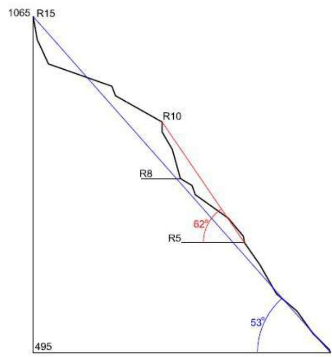
| 3.8 | Average slope of the route | 53° |
| 3.9 | Average slope of the main part of the route, (°) | 62° |
| 3.10 | Descent from the summit | Via Geografov pass |
| 3.11 | Additional route characteristics | - |
| 4. Team Actions Characteristics | ||
| 4.1 | Movement time (team travel hours, in hours and days) | 9 hours |
| 4.2 | Overnight stays | - |
| 4.3 | Route entry | 07:30, August 23, 2018 |
| 4.4 | Summit ascent | 16:30, August 23, 2018 |
| 4.5 | Return to base camp | 18:30, August 23, 2018 |
| 5. Person responsible for the report | ||
| 5.1 | Full name, e-mail | Frolova Anna Evgenievna, gapkina@yandex.ru |
II. Ascent Description
1. Characteristics of the Ascent Object
1.1. General photo of the summit
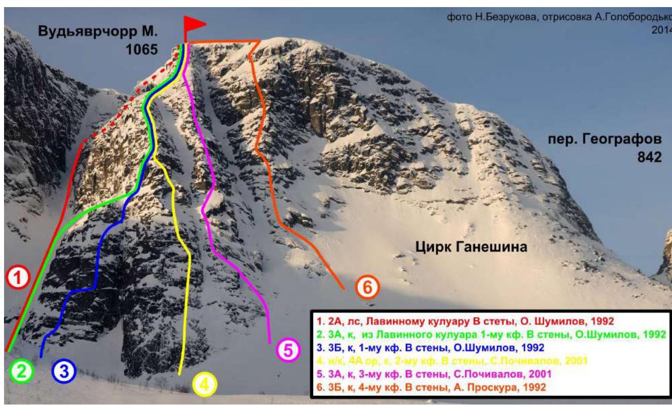 Maly Vudyavrchorr, 1065 m. Photo by N. Bezrukov, edited by A. Goloborodko, 2014. Ganechina cirque. Geografov pass, 842.
- 2A, l/s, to the Avalanche couloir of the Eastern wall, O. Shumilov, 1992.
- 3A, k, from the Avalanche couloir to the 1st buttress of the Eastern wall, O. Shumilov, 1992.
- 3B, k, to the 1st buttress of the Eastern wall, O. Shumilov, 1992.
- n/k, 4A o/r, k, to the 2nd buttress of the Eastern wall, S. Pochivalov, 2001.
- 3A, k, to the 3rd buttress of the Eastern wall, S. Pochivalov, 2001.
- 3B, k, to the 4th buttress of the Eastern wall, A. Proskura, 1992.
1.2. View of the summit from the south
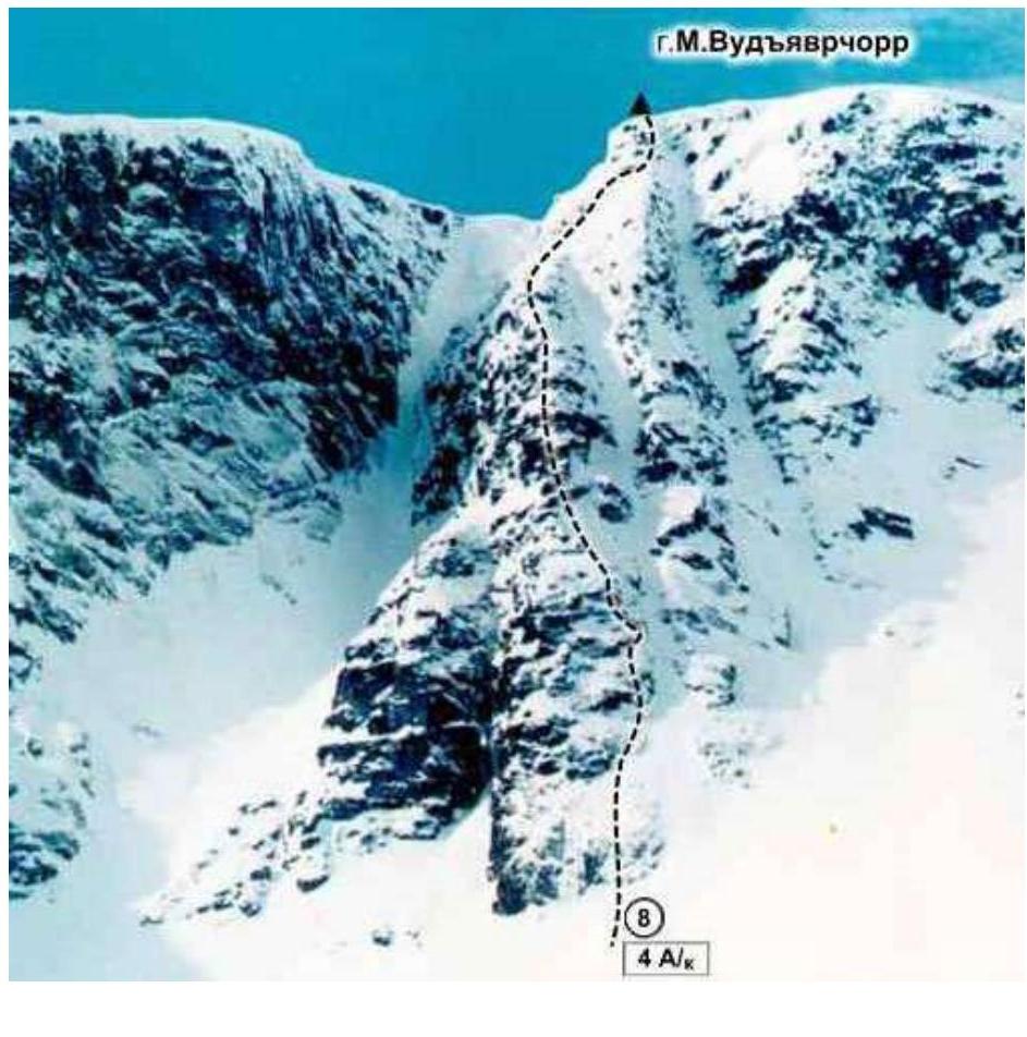 Maly Vudyavrchorr. Route 4A.
1.3. Drawn profile of the route
2. Route Characteristics
2.1. Technical photograph of the route

2.3. Technical characteristics of route sections
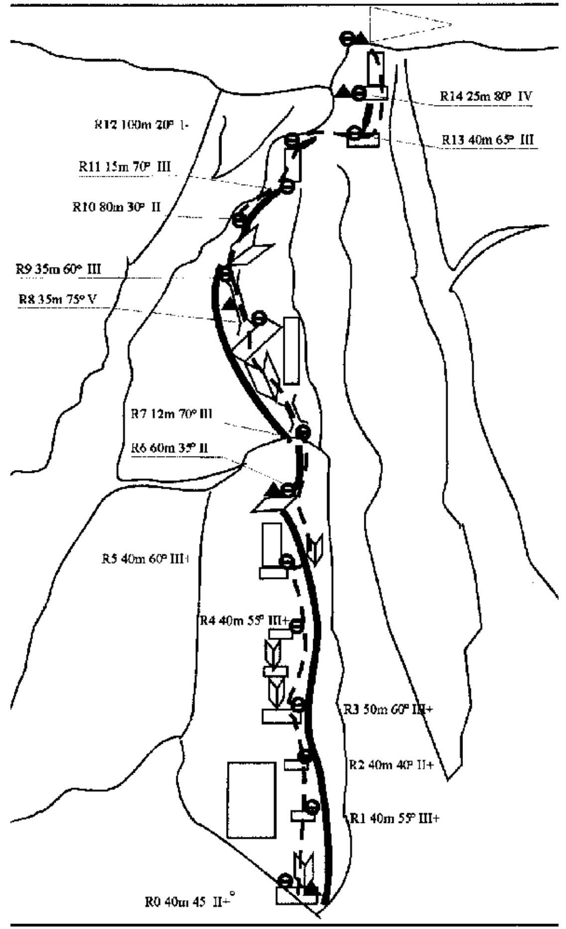
| Section № | Friends | Nuts | Pitons | UIAA symbol line | Difficulty symbol | Section length, m | Angle, ° |
|---|---|---|---|---|---|---|---|
| R14–R15 | 5/0 | 0/2 | 0/1 | IV | 30 m | 80 | |
| IV+ | 5 m | 80 | |||||
| R13–R14 | 5/0 | 4/0 | III+ | 40 m | 65 | ||
| R12–R13 | 5 | I | 100 m | 20 | |||
| R11–R12 | 4/0 | 1/0 | III | 15 m | 70 | ||
| R10–R11 | 3/0 | 4/0 | II | 80 m | 30 | ||
| R9–R10 | 4/0 | A | III | 15 m | 90 | ||
| 2/0 | 4/0 | III | 30 m | 60 | |||
| R8–R9 | 7/0 | 4/0 | 0/3 | )( | V | 45 m | 75 |
| R7–R8 | 5/0 | 1/0 | A | I | 20 m | 30 | |
| )( | IV | 15 m | 70 | ||||
| R6–R7 | 2/0 | 2/0 | II | 60 m | 35 | ||
| R5–R6 | 2/0 | 3/0 | III | 35 m | 50 | ||
| 5/0 | 1/0 | V+ | 10 m | 80 | |||
| R4–R5 | 5/0 | 4/0 | 1/0 | III+ | 40 m | 55 | |
| R3–R4 | 5/0 | 4/0 | 2/0 | III+ | 50 m | 60 | |
| R2–R3 | 2/0 | 5/0 | II+ | 40 m | 40 | ||
| R1–R2 | 5/0 | 4/0 | III+ | 40 m | 55 | ||
| R0–R1 | 2/0 | 1/0 | A | II+ | 35 m | 45 | |
| 5/0 | III | 5 m | 70 |
* Indicated as a fraction, where the numerator represents the number of used protection points, and the denominator represents the number of used artificial anchors.
3. Team Actions Characteristics
3.1. Brief description of the route passage
| Section № | Description | Photo № |
|---|---|---|
| R0–R1 | up the inner corner 5 m, 70° III cat., then exit right of the wall onto "ram's foreheads" 35 m, 45° II+ cat. | 3.1.1 3.1.2 |
| R1–R2 | along "ram's foreheads" and medium complexity rocks 40 m, 55° III+ cat. | |
| R2–R3 | along "ram's foreheads" 40 m, 40° II+ cat., exit onto a ledge | |
| R3–R4 | along "ram's foreheads" and medium complexity rocks to the right of two consecutive inner corners 50 m, 60° III+ cat., exit onto an inclined ledge | 3.1.3 |
| R4–R5 | along "ram's foreheads" and rocks 40 m, 55° III+ cat., exit onto a ledge | |
| R5–R6 | from the ledge to the right along the inner corner (5 m, 80° V+ cat.) using artificial anchors, then along the ridge and "ram's foreheads" 35 m, 50° III cat., exit onto an inclined ledge. Control tour № 2 — on a piton on the wall. | |
| R6–R7 | bypassing the wall on the right, along the ridge to the left 60 m, 35° II cat., exit onto the ridge to the wall. (To the left along the ledge — emergency exit to the 1st buttress and then along a large inclined ledge into the avalanche couloir) | |
| R7–R8 | to the left of the wall along a chimney and inner corner (12 m, 70° III+ cat.) to the right along an inclined ledge 20 m, 30° I cat., exit under the wall | |
| R8–R9 | along a wide chimney using artificial anchors 35 m, 75° V cat., exit onto the ridge. In the middle part of the chimney, control tour № 3. | 3.1.4 3.1.5 |
| R9–R10 | along the ridge 30 m, 2.1.6 | |
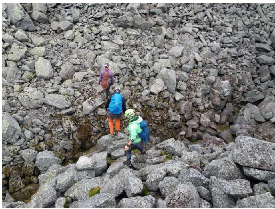
| R10–R11 | along the ridge 80 m, 30° II cat., approach under the wall | 3.1.6 |
| R11–R12 | along the wall 15 m, 70° III cat., exit onto the ridge. | |
| R12–R13 | along the ridge 90–100 m, 20° I cat., approach under the pre-summit tower, simultaneous movement | |
| R13–R14 | Along rocks 40 m, 65° III+ cat., exit onto a ledge; control tour № 3 is laid out from stones. | |
| R14–R15 | Along the wall 25 m, 80° IV+ cat. first along the inner corner 5 m using artificial anchors and ladders, then along rocks to the left and along the inner corner 10 m — exit onto the ridge and to the summit. | 3.1.7 3.1.8 |
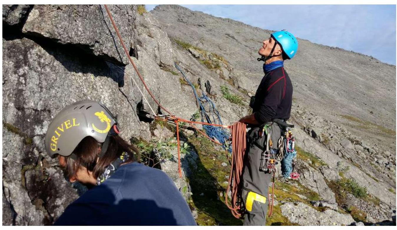
3.1.1. Approach to the route

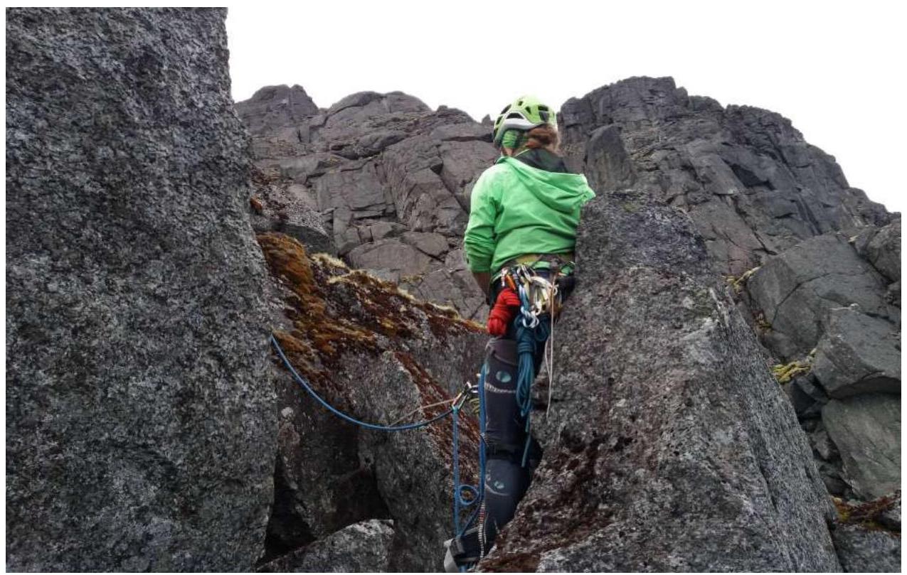
3.1.2. Start, R0
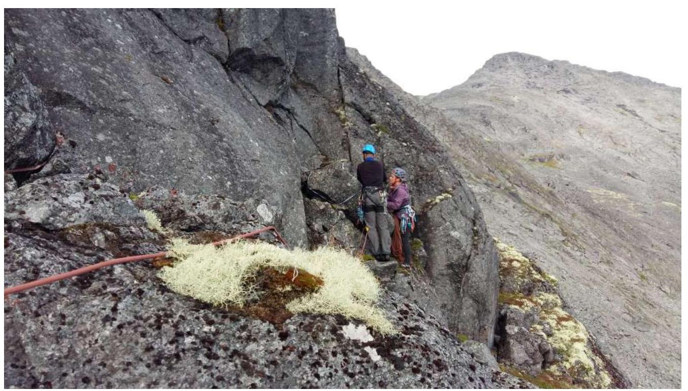
3.1.3. Station R3
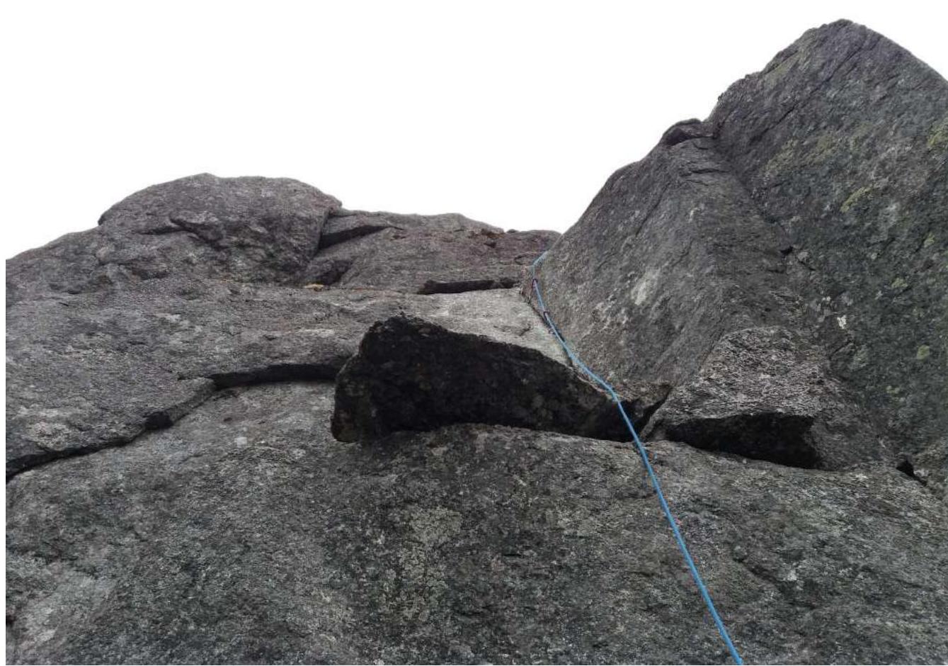
3.1.4. Rope R8–R9
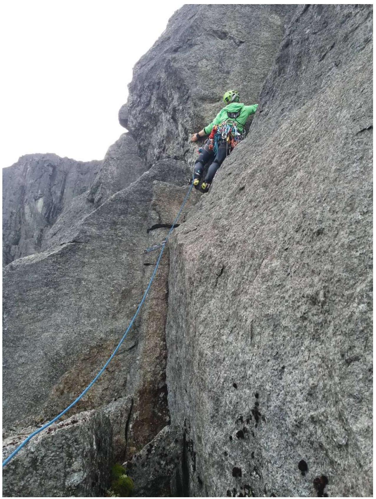
3.1.5. Rope R8–R9
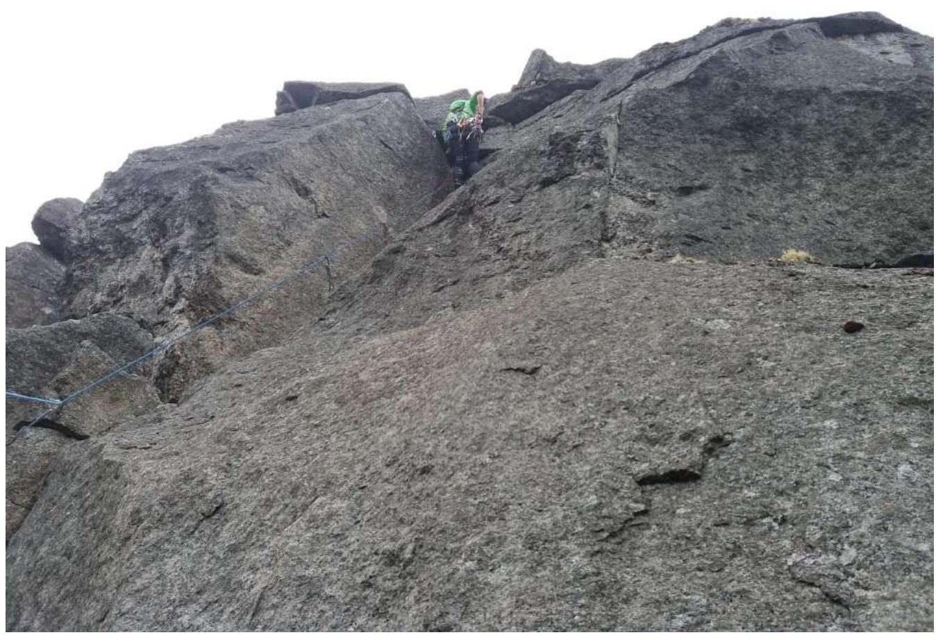
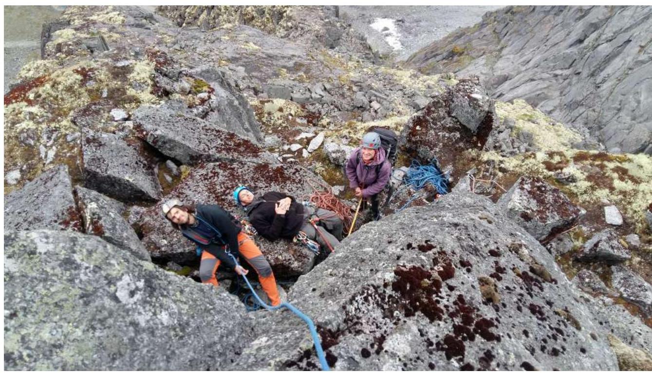
3.1.6. Station R12
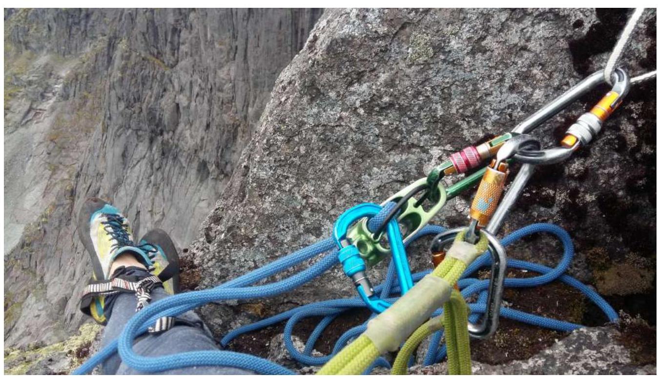
3.1.7. Station R14
3.1.8. Rope R14–R15
3.1.9. Station R15
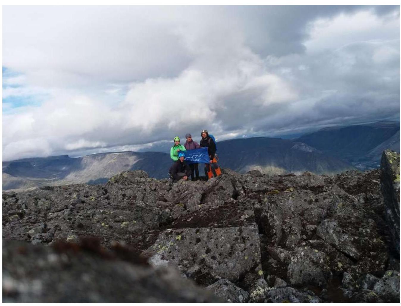
3.2. Team photo at the summit near the control tour
3.3. Route and safety assessment
The route is rocky, mostly monolithic, with "ram's foreheads" at the beginning of the route and a lack of sufficient belay points posing a danger. The thick growth of slippery, wet moss in the lower part of the route and on the "ram's foreheads" also poses a danger. This 4A can be characterized as a typical "4" for this area, recommended for a strong, confident, and cohesive group. Due to several challenging sections of climbing/artificial anchors, the route is considered more than corresponding to the 4A category. The route is significantly more challenging than the route along the 3rd buttress of the Southern part of the "Poyasov" cirque wall, which has a category of 3B in the classifier. The first ascent was made on August 11, 2001, by the team led by Pochivalov S.S. (Candidate for Master of Sports).
Descent from the summit: via Geografov pass or through the Avalanche couloir (in winter).
Emergency exit from the route: via the Avalanche couloir; via the couloir to the right or via the ascent route.
Preliminarily, the route is evaluated as a 4A category, compared to other classified routes of the same category in the experience of the team members.


