
Report
ON ASCENDING TELPOS-IZ EASTERN TELPOS-IZ WESTERN TRAVERSE 2A CAT. BY THE TEAM OF F.K.I.P.GP (UKHTA) FOR THE PERIOD FROM MARCH 25, 2023, TO MARCH 25, 2023
I. Ascent Passport
| №№ | 1. General Information | |
|---|---|---|
| 1.1 | Full name, sports rank of the leader | Yakimenko Oksana Anatolyevna, MS |
| 1.2 | Full name, sports rank of the participants | Goloviznin Roman Vladimirovich, zn; Manin Alexey Dmitriyevich, zn |
| 1.3 | Full name of the coach | Badich Nikolay Yevgenyevich |
| 1.4 | Organization | Federation of Clubs of Research and Travel of the Trade Union Movement of Gazprom Corporation |
| 2. Characteristics of the Ascent Object | ||
| 2.1 | Region | Northern Urals |
| 2.2 | Gorge | Valley of the Shchugor River, from the dry stream gorge |
| 2.3 | Section number according to the 2013 classification table | 8.2 |
| 2.4 | Name and height of the peak | Telpos-Iz Eastern (1617 m) – Telpos-Iz Western (1619 m) traverse |
| 2.5 | Geographical coordinates of the peak (latitude/longitude), GPS coordinates | Eastern 63.918586, 59.181804 Western 63.91927, 59.158434 |
| 3. Characteristics of the Route | ||
| 3.1 | Name of the route | E-W Traverse |
| 3.2 | Proposed category of difficulty | 2A |
| 3.3 | Degree of route exploration | – |
| 3.4 | Character of the route terrain | Combined |
| 3.5 | Height difference of the route (altimeter or GPS data) | 1035 m |
| 3.6 | Length of the route (in meters) | 6460 m |
| 3.7 | Technical elements of the route (total length of sections of varying difficulty with terrain character indication) | non-technical snow-ice – 4100 m I cat. snow-ice – 930 m II cat. combined – 1430 m III cat. ice/rock/combination – M IV cat. ice/rock/combination – M Movement on closed glacier – M Rappel descent (on descent) – |
| 3.8 | Descent from the peak | Via the ascent route |
| 3.9 | Additional route characteristics | – |
| 4. Characteristics of the Team's Actions | ||
| 4.1 | Time of movement | 8.5 hours |
| 4.2 | Overnights | – |
| 4.3 | Departure on the route | 7:00 March 25, 2023 |
| 4.4 | Arrival at the Eastern peak | 13:30 March 25, 2023 |
| 4.5 | Arrival at the Western peak | 15:30 March 25, 2023 |
| 4.6 | Return to the base camp | 21:30 March 25, 2023 |
| 5. Person Responsible for the Report | ||
| 5.1 | Full name, e-mail | Yakimenko Oksana Anatolyevna, locust@inbox.ru |
II. Ascent Description
1. Characteristics of the Ascent Object
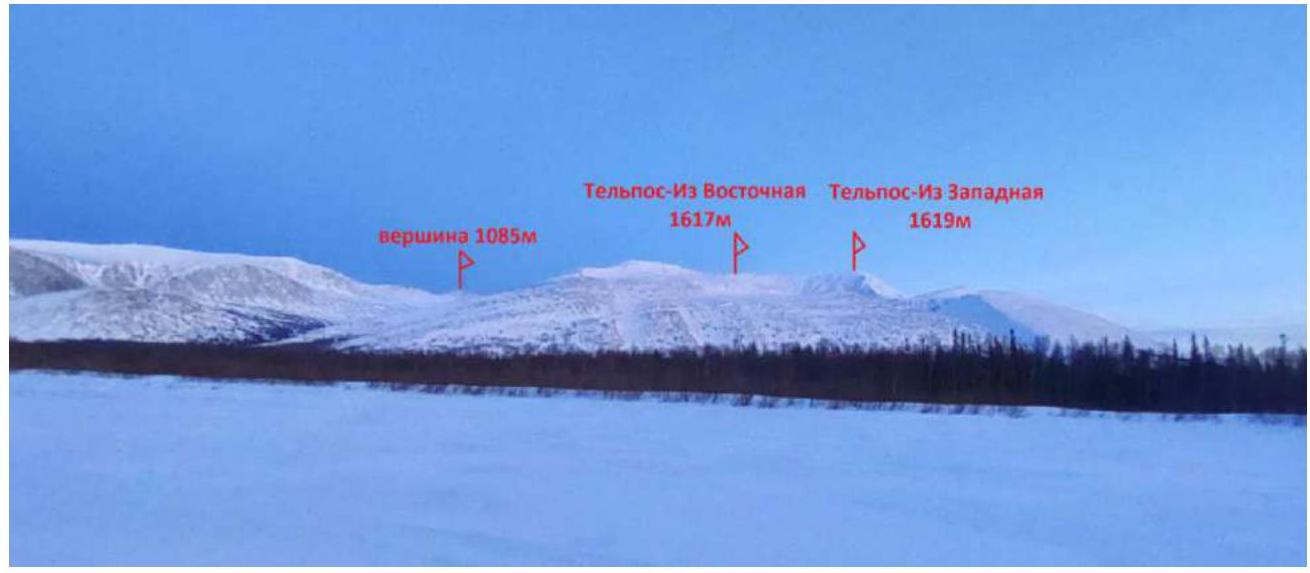
Fig. 1. Panorama of the massif. Taken on March 20, 2023, from the Shchugor River near the Glubnik shelter.
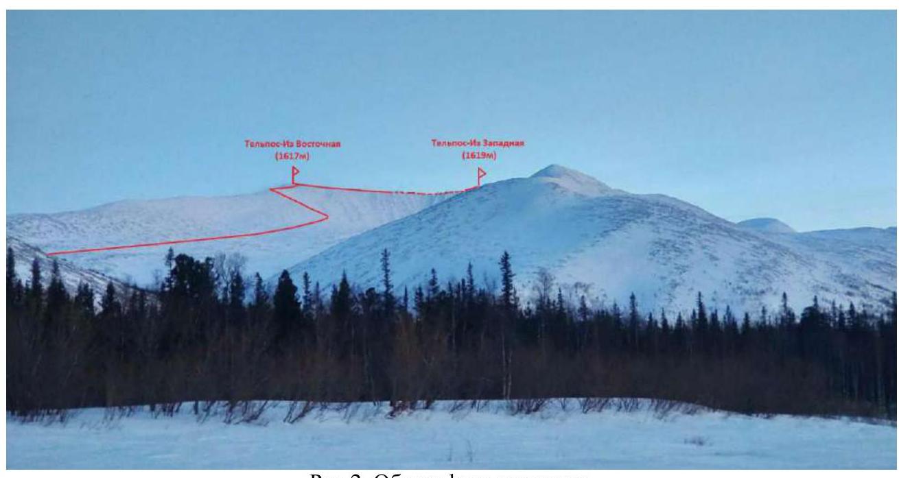
Fig. 2. General photo of the peak. Taken on March 20, 2023, from the Shchugor River a kilometer from the dry stream bed.
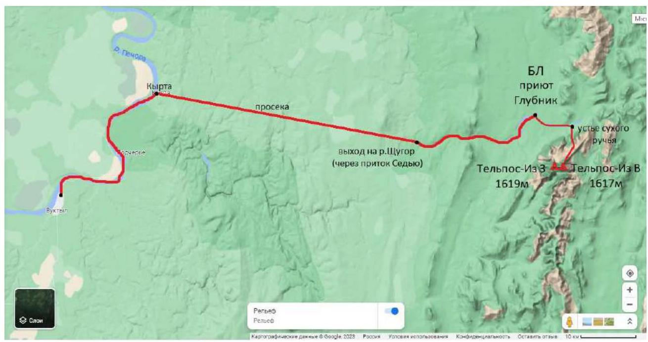
Fig. 3. Map-scheme of the location of the ascent object and nearby settlements.
The Telpos-Iz mountain (Komi Тӧлпосиз — wind nest mountain) is the main peak of the Northern Urals, located near the conventional border of the Northern Urals with the Subpolar Urals on the left bank of the Shchugor River in the Komi Republic, within the territory of the Yugyd Va National Park, Vuktyl urban district. It is a two-peaked mountain massif with peak heights: 1617 m Eastern and 1619 m Western.
In winter, when rivers are covered with ice, it is possible to reach the ascent area by snowmobiles via the following route: From Vuktyl to the Kyrta settlement, 38 km along the Pechora River, then 48 km along a forest clearing to the confluence of the Sedyu tributary and the Shchugor River, further 33 km along the Shchugor to the Glubnik tributary, where there is a tourist shelter of the same name of the national park "Yugyd Va". It is best to set up a base camp in the national park shelter, which consists of wooden houses with stoves. Wild animals live in the surrounding forests: during our stay in the area, six wolves were spotted, making tent accommodation unsafe.
The mountain is composed of crystalline schists, quartzite sandstones, and conglomerates. The slopes are covered with taiga forests, above 500 m — mountain tundra. The Telpos-Iz area is known for bad weather — strong winds carrying clouds, rain, or snow often blow from the top of the mountain. Due to this fact, several days should be allocated for the ascent to wait for a weather window.
In winter, there is a lot of deep snow in the gorges on the approach to the mountain; it is advisable to move either on ski-touring skis or snowshoes. The approach via the dry stream bed is convenient due to the short taiga section, allowing the use of a snowmobile, making the route from base camp to base camp a one-day journey.

Fig. 4. Map of the ascent area.
Description of points indicated on the map:
- Base camp, Glubnik shelter (wooden house with stove heating).
- Mouth of the dry stream, height 182 m.
- Narrowing of the gorge, rocky sides. In summer, there's a waterfall here, in winter, it's a good spot for snow activities. Height 340 m.
- Exit to the northwest slope through the ridge shoulder, start of the route, where crampons are put on. Height 584 m.
- Exit to a not clearly defined NE ridge edge. Height 1255 m.
- Exit to the NE ridge. Height 1480 m.
Description of distances and height differences:
1–2 – movement from the base camp to the mouth of the dry stream along the river 10 km. 2–3 – movement along the stream bed to the gorge narrowing 2 km (height gain 158 m). 3–4 – ascent to the ridge shoulder and exit through it to the northwest slope of the ridge 1.5 km (height gain 244 m). 4–5 – traverse movement along the snowy-icy northwest slope with a gradual height gain to the not clearly defined NE ridge edge 4.1 km (height gain 671 m). 5–6 – ascent along the snowy edge to the exit to the NE ridge 500 m (height gain 225 m).
6–Eastern peak – movement along the rocky snowy ridge, bypassing and through gendarmes to the eastern peak of Telpos-Iz 660 m (height gain 137 m). E-W peaks – passage along the ridge between the two peaks with descents, ascents on gendarmes, and bypassing them 1200 m (height gain 2 m).
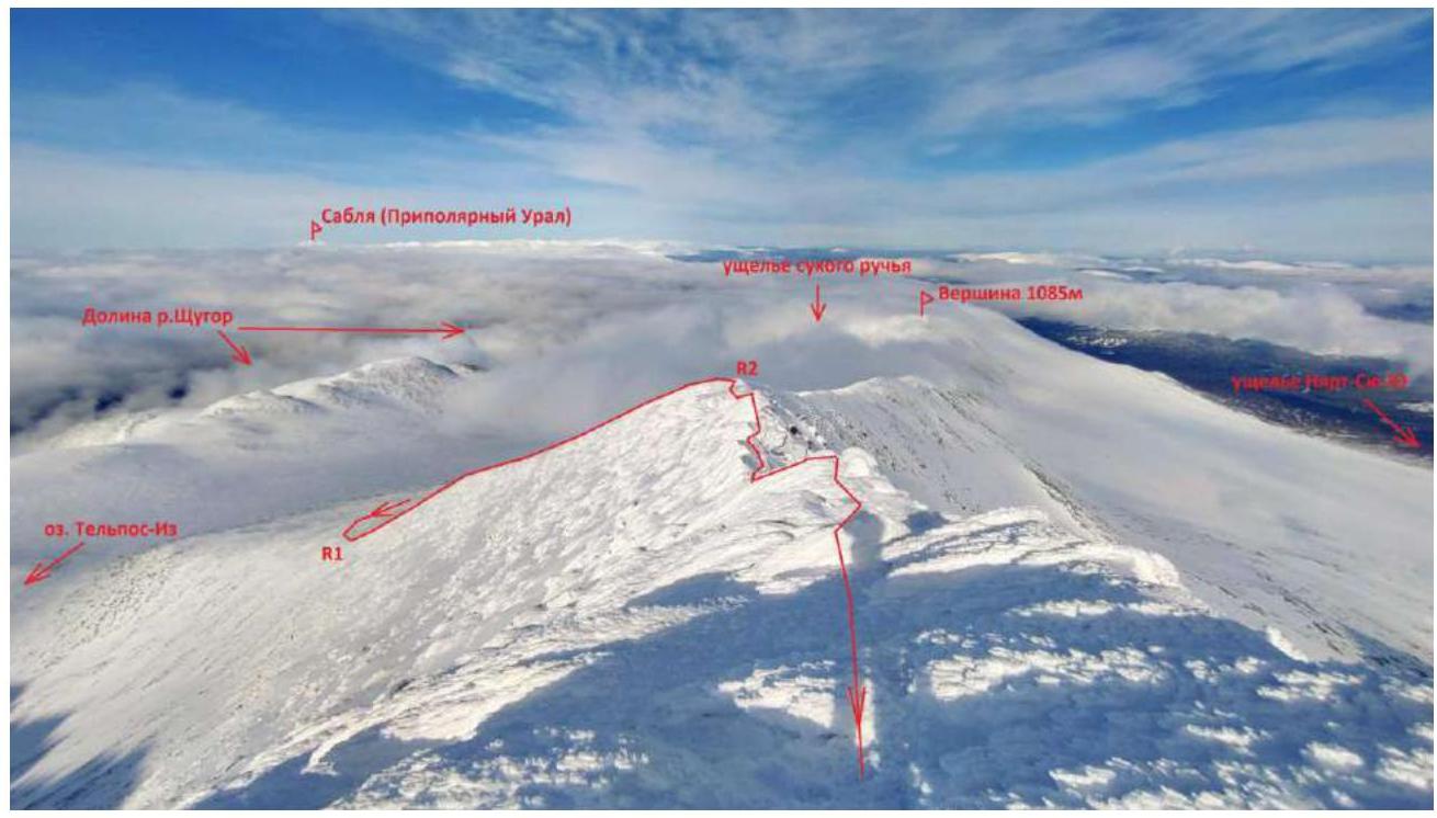
Fig. 5. Profile and thread of the first part of the route — ascent to the Eastern peak. March 25, 2023. Taken from under the Eastern peak.
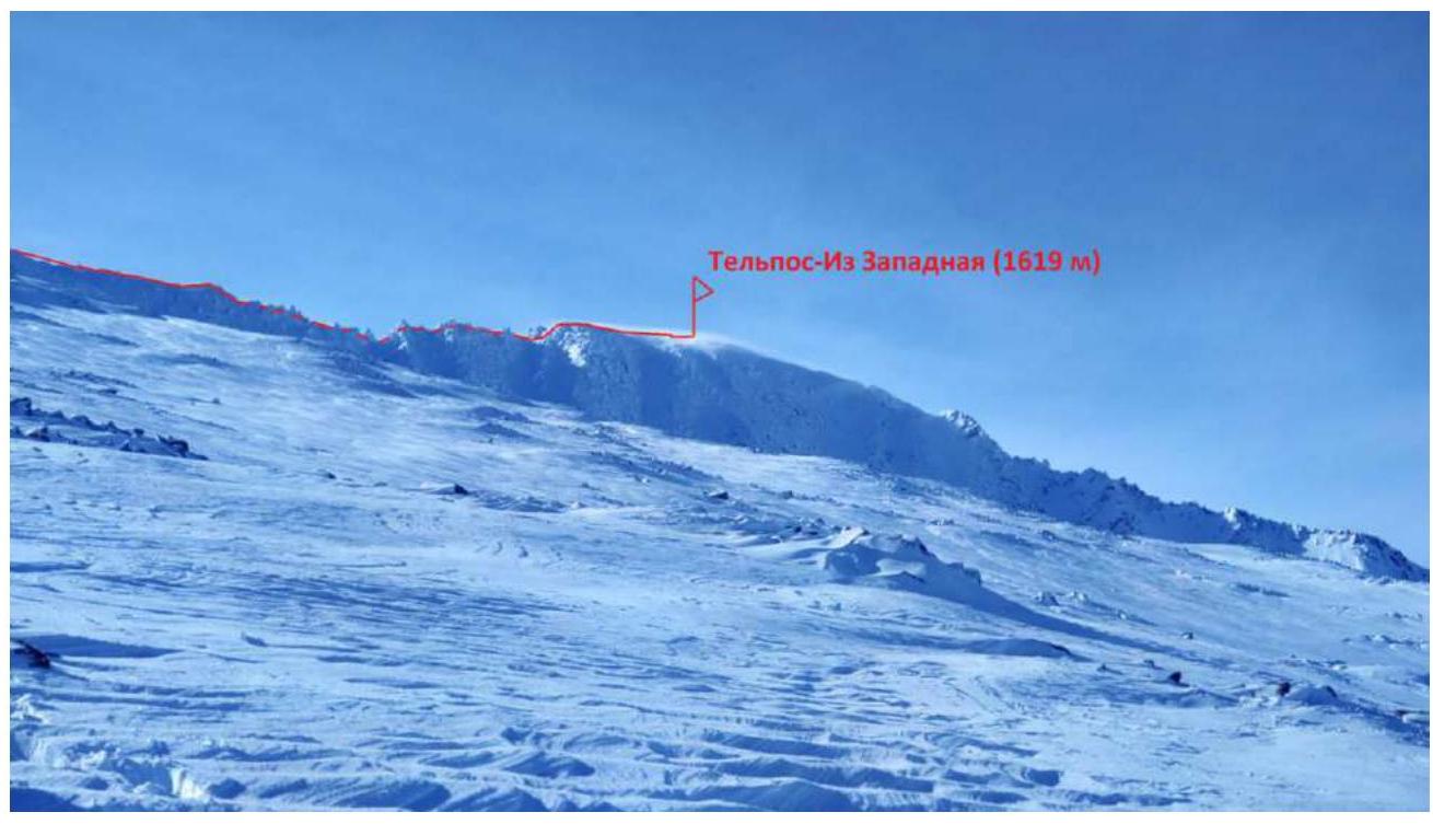
Fig. 6. Profile of the ridge between the Eastern and Western peaks.
2. Characteristics of the Route
Fig. 7. Scheme of the route.
3. Characteristics of the Team's Actions
A detailed description of the route passage to the Eastern peak and the team's actions is contained in the report on the ascent to Telpos-Iz Eastern via the NW slope and NE ridge 1B cat.
On March 25, the team reached the Eastern peak at 13:30. The further route along the ridge to the Western peak was estimated to be 1200 m. The preliminary difficulty of the ridge was assessed as 2A. The weather was almost windless, clear, with excellent visibility, and the forecast promised stability until the evening. Therefore, the strongest part of the team continued moving along the ridge to the Western peak, leaving a duo in sight near the Eastern peak on the sunny side for rest and observation of the moving rope team. It took 2 hours to pass the ridge. At 15:30, the trio reached the Western peak of the massif.
At the beginning of the path, the ridge is a fairly wide, snowy, gentle slope, but it gradually narrows, and snow-covered rocks appear. The passage is complicated by overcoming these rocks: in some places with a simple descent and ascent to the next gendarme, in some places bypassing gendarmes on the southern side and returning to the ridge. Closer to the Western peak, the ridge simplifies, widens, and becomes a snowy slope leading to the peak. The team moved simultaneously, wearing crampons and with ice axes, occasionally belaying each other through terrain folds.
The descent was planned via the ascent route. It took 1 hour to return to the Eastern peak along their tracks. At 16:45, the group continued the descent from the Eastern peak, began descending from the NE ridge at 17:30, reached the snowmobiles at 20:30, and returned to the base camp at 21:30.
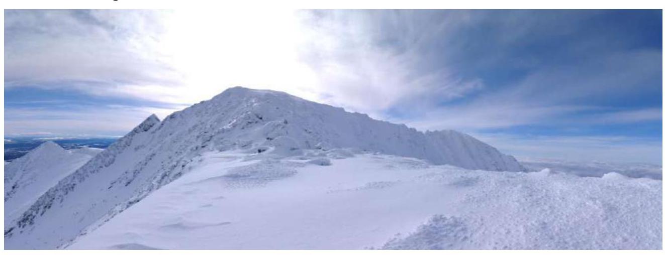
Fig. 8. Panoramic view of both Telpos-Iz peaks from the NE ridge.
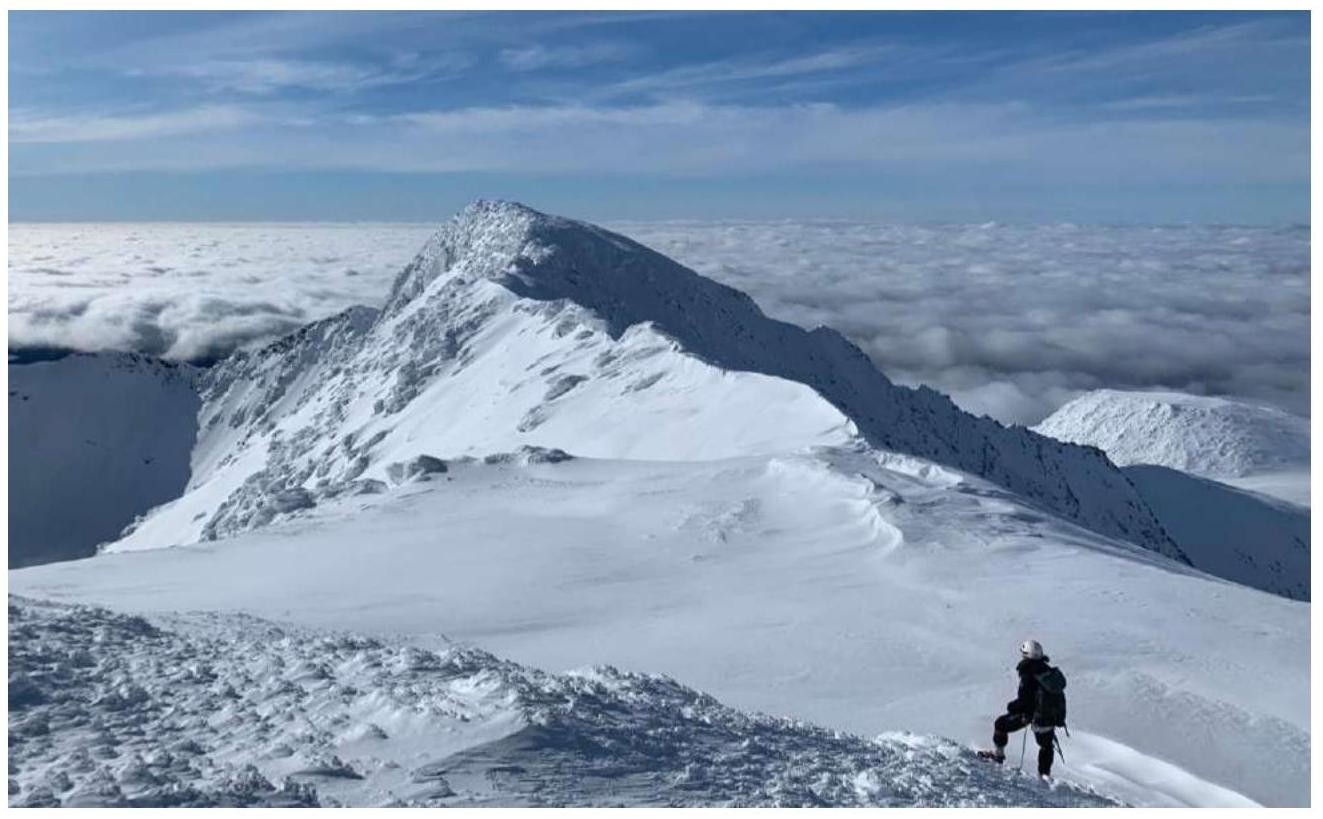
Fig. 9. View of the ridge towards the Western peak, taken from under the Eastern peak.
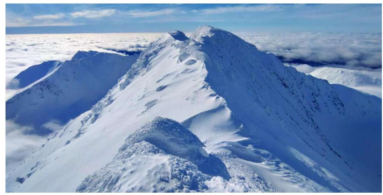
Fig. 10. Photo of the ridge on the way to the Western peak.
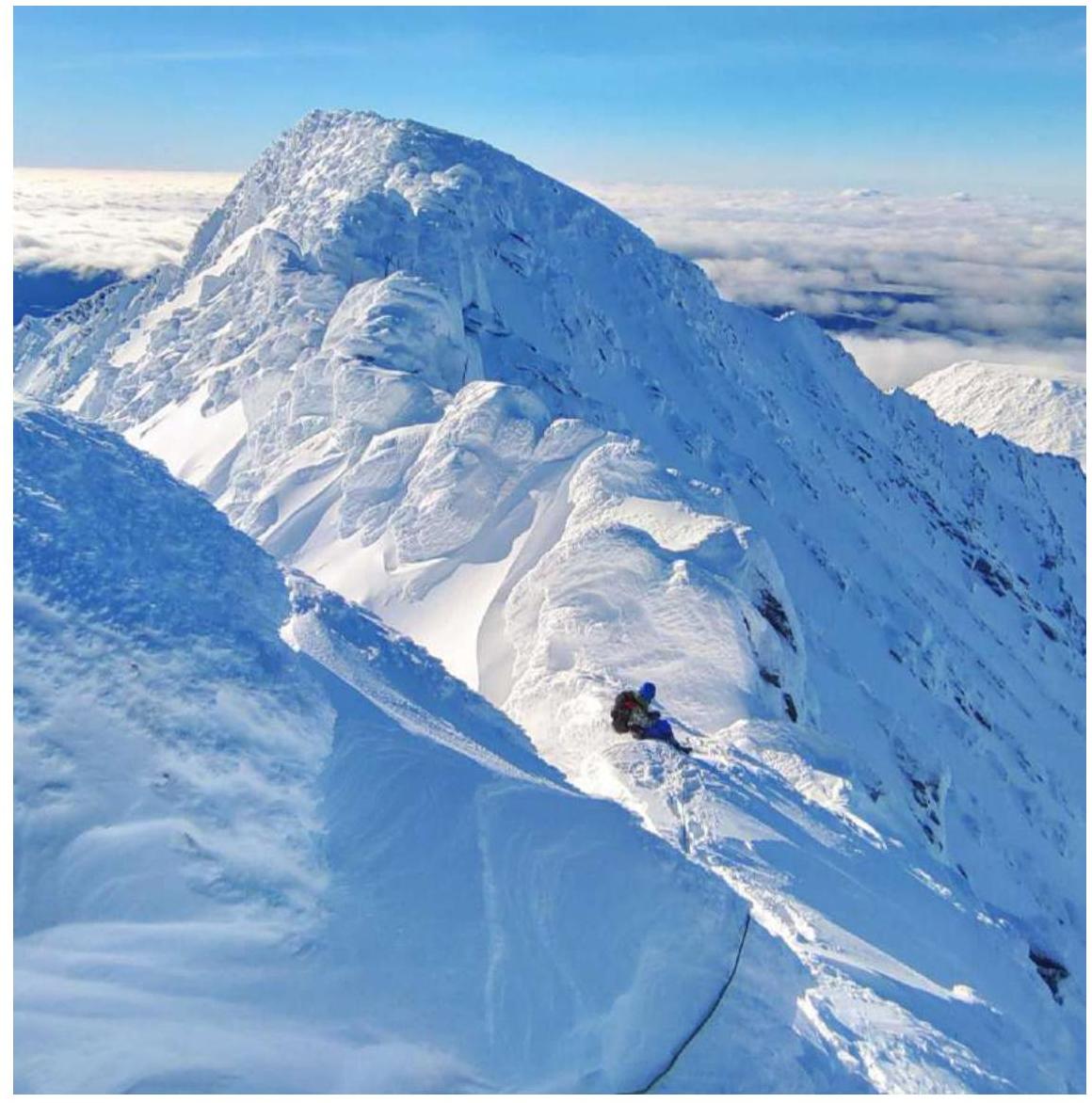
Fig. 11. Sections of the second category of difficulty on the ridge.

Fig. 12. Sections of the second category of difficulty on the ridge.
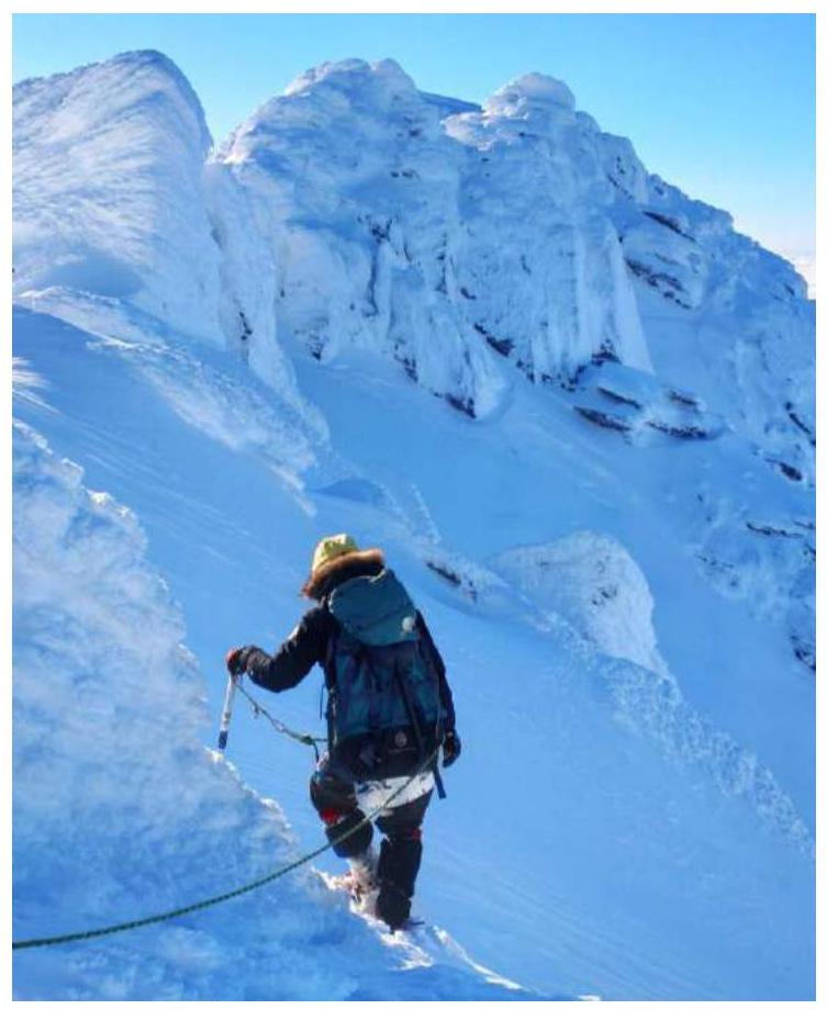
Fig. 13. Movement along the ridge.
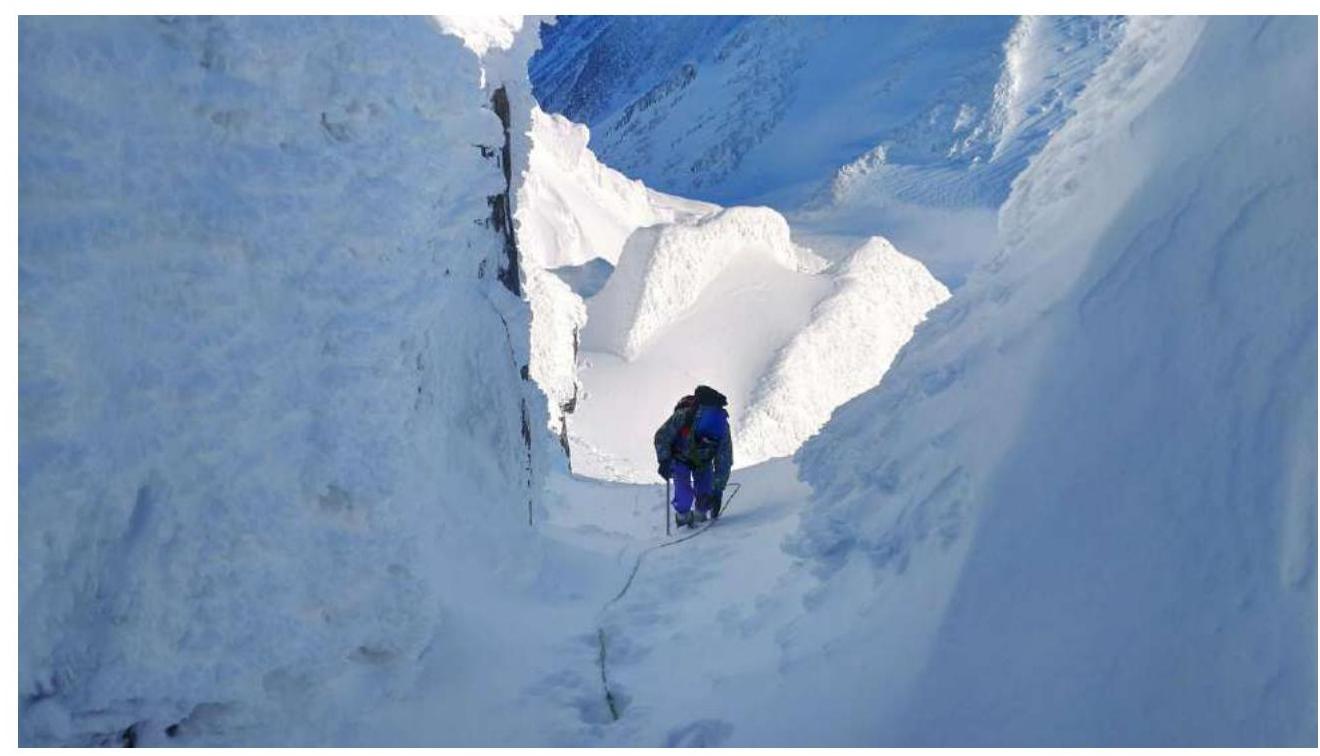
Fig. 14. Bypassing gendarmes.
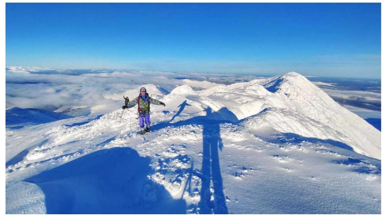
Fig. 15. Exit to the Western peak.
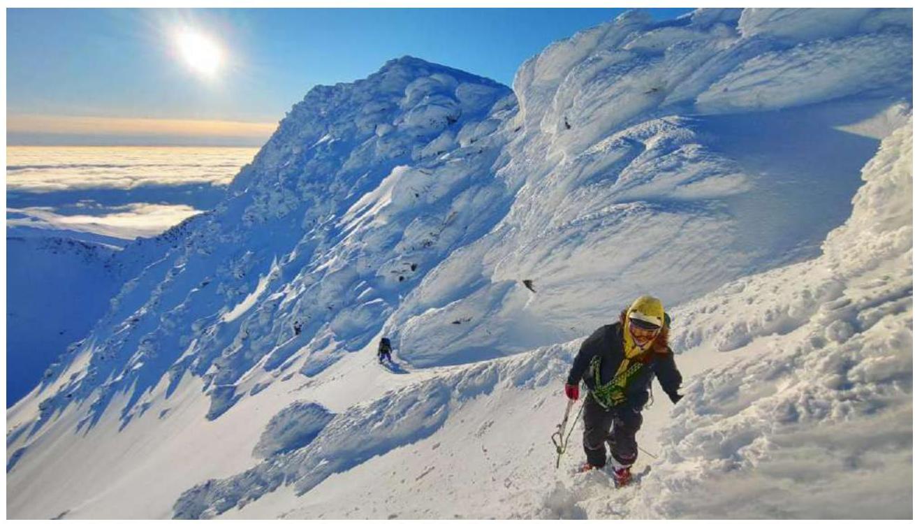
Fig. 16. Movement in the reverse direction.
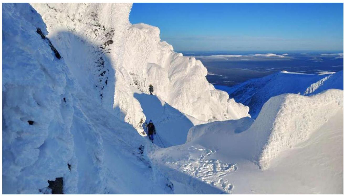
Fig. 17. Movement in the reverse direction.
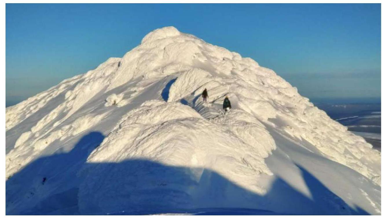
Fig. 18. Return to the Eastern peak.

Fig. 19. Descent to the NE ridge bypassing the Eastern peak.
4. Team Photos on the Peaks
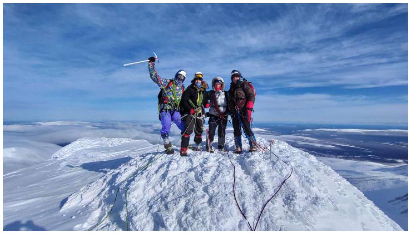
Fig. 20. Telpos-Iz Eastern. In the photo from left to right: Manin A, Goloviznin R., Osyotrov A., Likhomanov A., out of frame — Yakimenko O.A. The peak is snowy, there is no control tour.
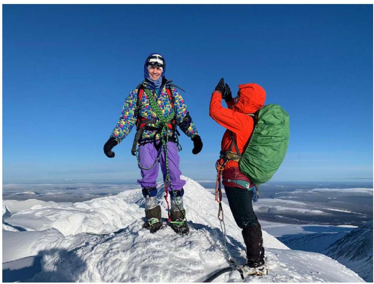
Fig. 21. Telpos-Iz Western. In the photo: Manin A, Yakimenko O.A., out of frame — Goloviznin R. In the background, the Eastern peak. The peak is also snowy, there is no control tour.
5. Route Assessment
The main hazards of the route and recommendations are described in detail in the report on the ascent to Telpos-Iz Eastern 1B cat.
The ridge between Telpos-Iz peaks is quite long, heavily dissected by large blocks in the middle part, and has many gendarmes that require bypassing, descents, and ascents. In winter, the rocky blocks are heavily covered with snow due to constant winds and precipitation. To pass, skills in walking in crampons with ice axe support, skills in climbing short steep snowy slopes using an ice axe, and self-arrest skills in case of slipping are required. Belaying is carried out using a rope to natural terrain folds and through an ice axe. At the same time, the climbing on the route is not particularly difficult. Considering the above, the traverse of the two Telpos-Iz peaks can be assessed as 2A in winter conditions.
The descent from the Western peak is via the ascent route, or a descent along the northern ridge to the lake is possible (shorter but steeper). The northern ridge of the Western peak has no recorded passages but potentially represents a route of the second category.
Comments
Sign in to leave a comment