ASCENT REPORT
- Region of ascent – Northern Urals, Konzhakovsky Kamen massif.
- Serebryansky Kamen peak via the Southern spur of the Western ridge.
- Expected category of difficulty – 2A winter.
- Height difference – 500 m, total route length – 1300 m.
- Number of travel hours – 5.
- Leader: Zemorov Vladimir Ivanovich, Master of Sports. Participants: Bunkov S.A., Master of Sports Zadvoryev Yu.V., Master of Sports Ryabov R.V., Master of Sports
- Departure to the route, ascent, and return on April 2, 1990.
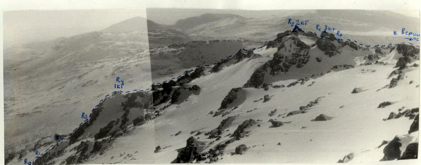
Photo 1. General view of the 2A category difficulty route (Southern spur of the Western ridge). Taken from the Southern ridge of Serebryansky Kamen peak (April 1990).
Area Map
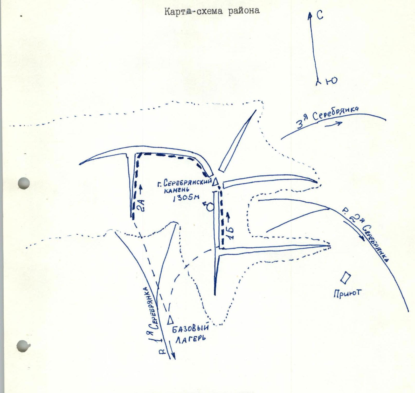
– – – group movement route — forest boundary (approximately 800 m above sea level) O+ — shooting point
ROUTE DESCRIPTION BY SECTIONS
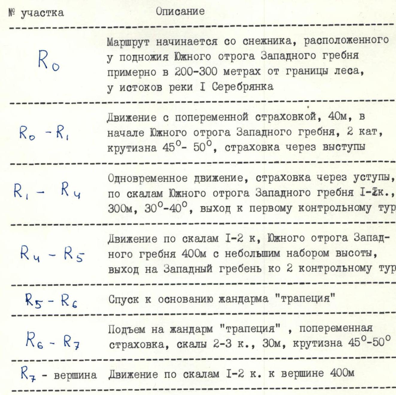
| Section № | Description |
|---|---|
| R0 | The route begins from a snowfield located at the foot of the Southern spur of the Western ridge, approximately 200–300 m from the forest boundary, near the source of the I Serebryanka river. |
| R0–R1 | Movement with alternate belay, 40 m, at the beginning of the Southern spur of the Western ridge, 2nd category, slope 45°–50°, belay through ledges. |
| R1–R4 | Simultaneous movement, belay through ledges, along the rocks of the Southern spur of the Western ridge, 1st-2nd category, 300 m, 30°–40°, exit to the first control cairn. |
| R4–R5 | Movement along rocks, 1st-2nd category, Southern spur of the Western ridge, 400 m with a slight altitude gain, exit to the Western ridge to the 2nd control cairn. |
| R5–R6 | Descent to the base of the "trapezoid" gendarme. |
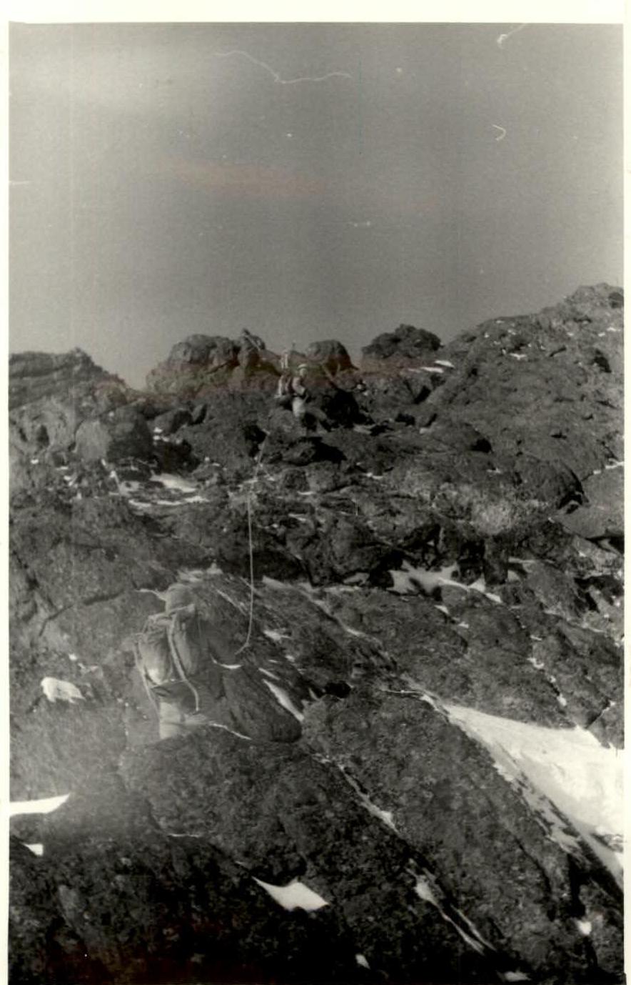
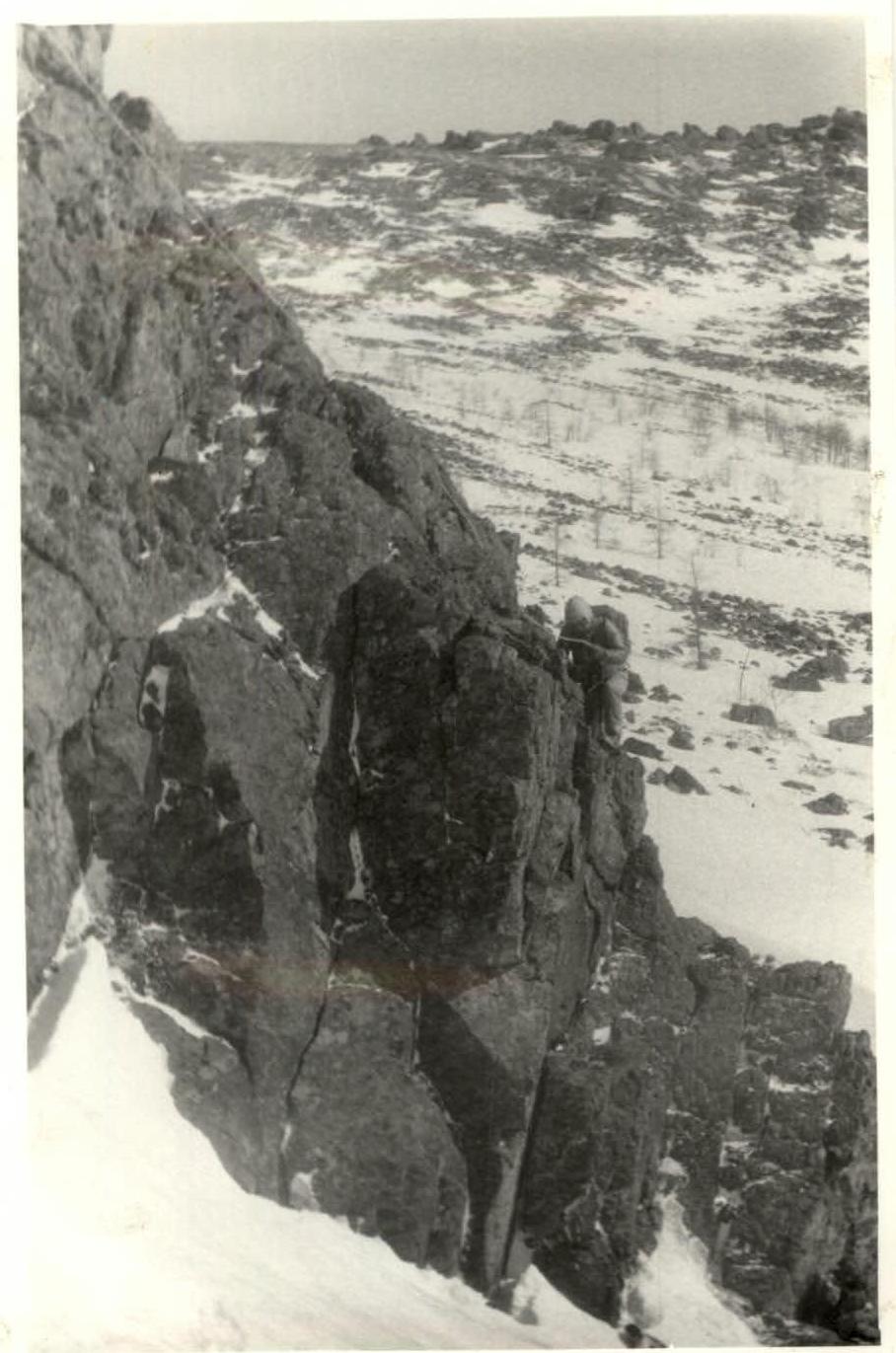
| R6–R7 | Ascent to the "trapezoid" gendarme, alternate belay, rocks 2nd-3rd category, 30 m, slope 45°–50°. |
| R7 – summit | Movement along rocks, 1st-2nd category, to the summit, 400 m. |
Photo 2. Beginning of the route. Section R0–R1.
Photo 4. Section R6–R7. Ascent to the "trapezoid" gendarme.