
Ascent Passport
- The route is combined, winter ascent via the couloir on the NORTH SLOPE, Northern Urals
- Region: Subpolar Urals, Kolokolnya massif
- Category of difficulty: 1B (3)
- Route length, height difference: 7000/684 m
- Piton placement: —
- Travel time: 5-7 hours
- Leader: Eremkin Mikhail Aleksevich
Participants:
- Polyakov Sergey Nikolaevich
- Votyakov Anatoly Borisovich
- Belozerov Ivan Nikolaevich
- Dumin Igor Aleksandrovich
- Rochev Nikolai Vasilievich.
- Coach: —
- Departure to the route: March 26, 1996, 5:00
- Summit: March 26, 1996, 10:30
- Return: March 26, 1996, 12:00
- Federation of Mountain Sports of the Komi Republic.
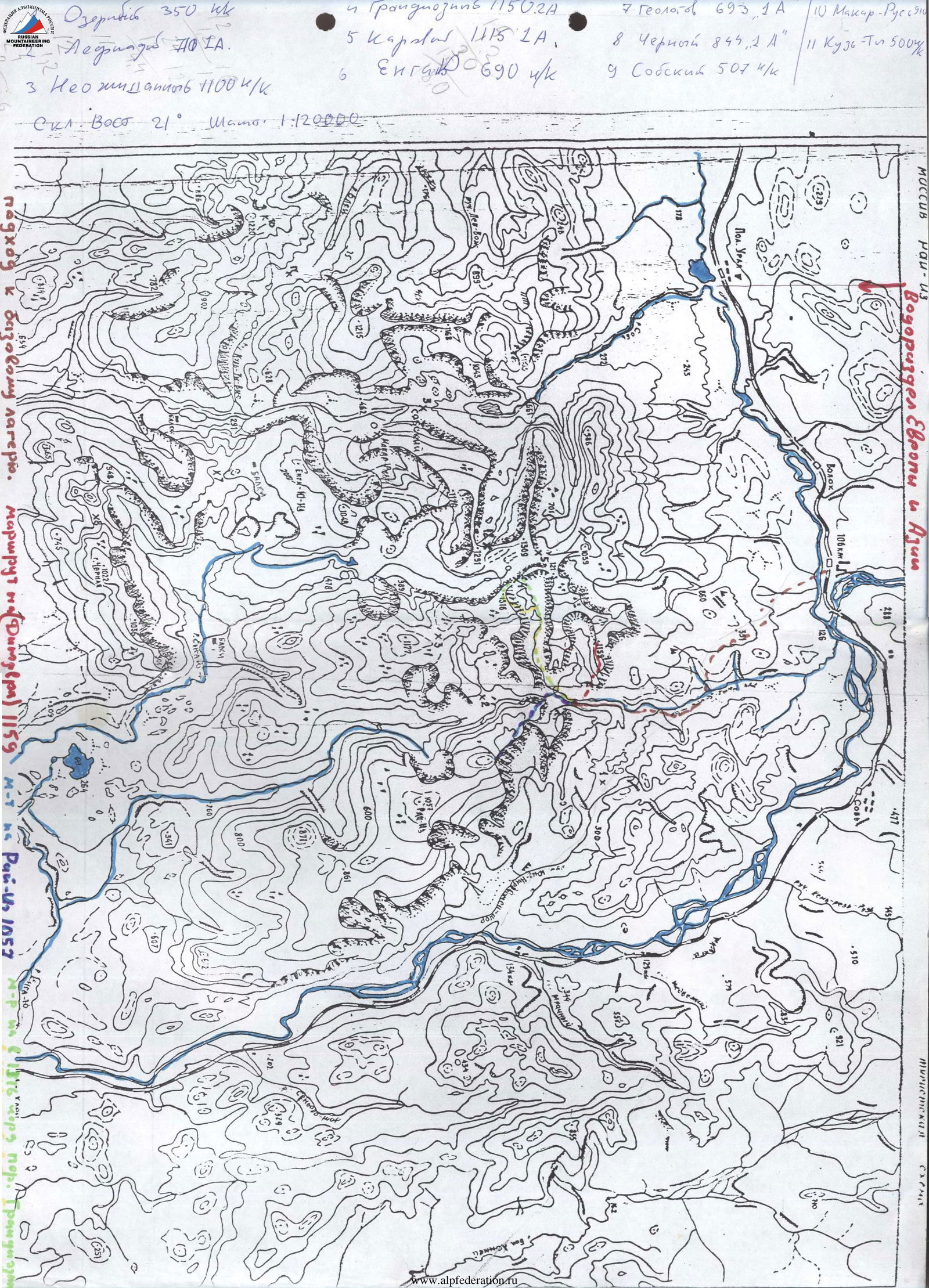
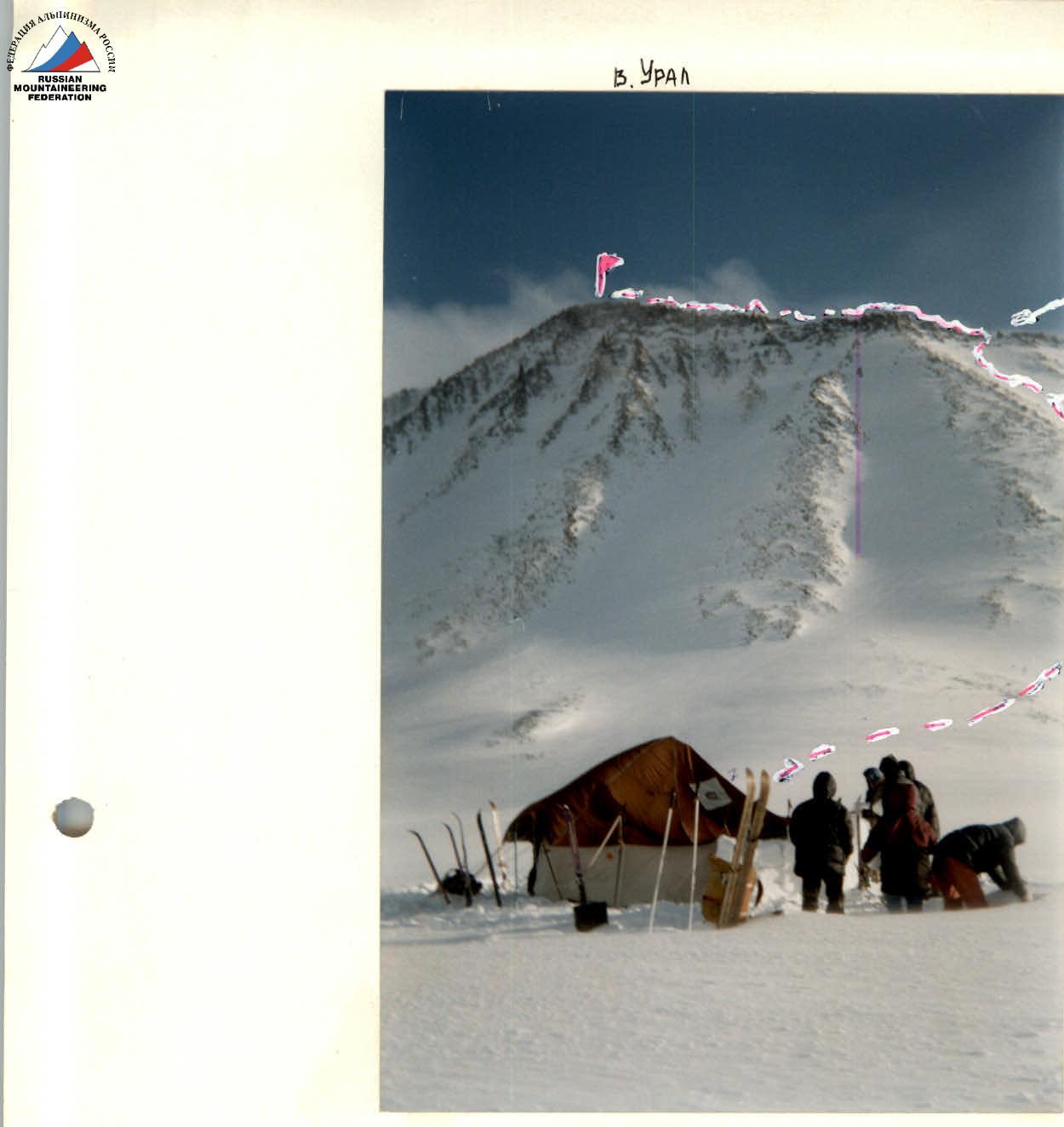
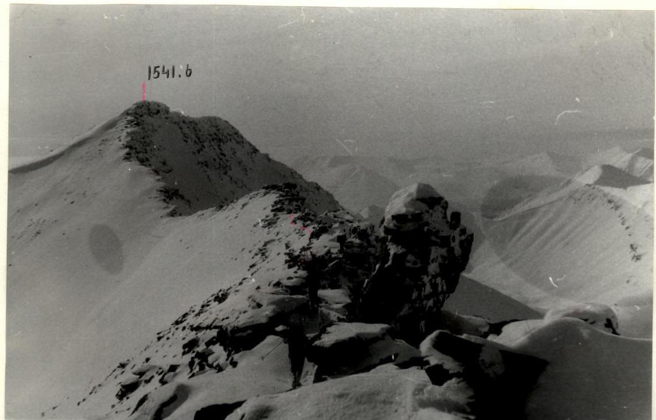
Ural Peak
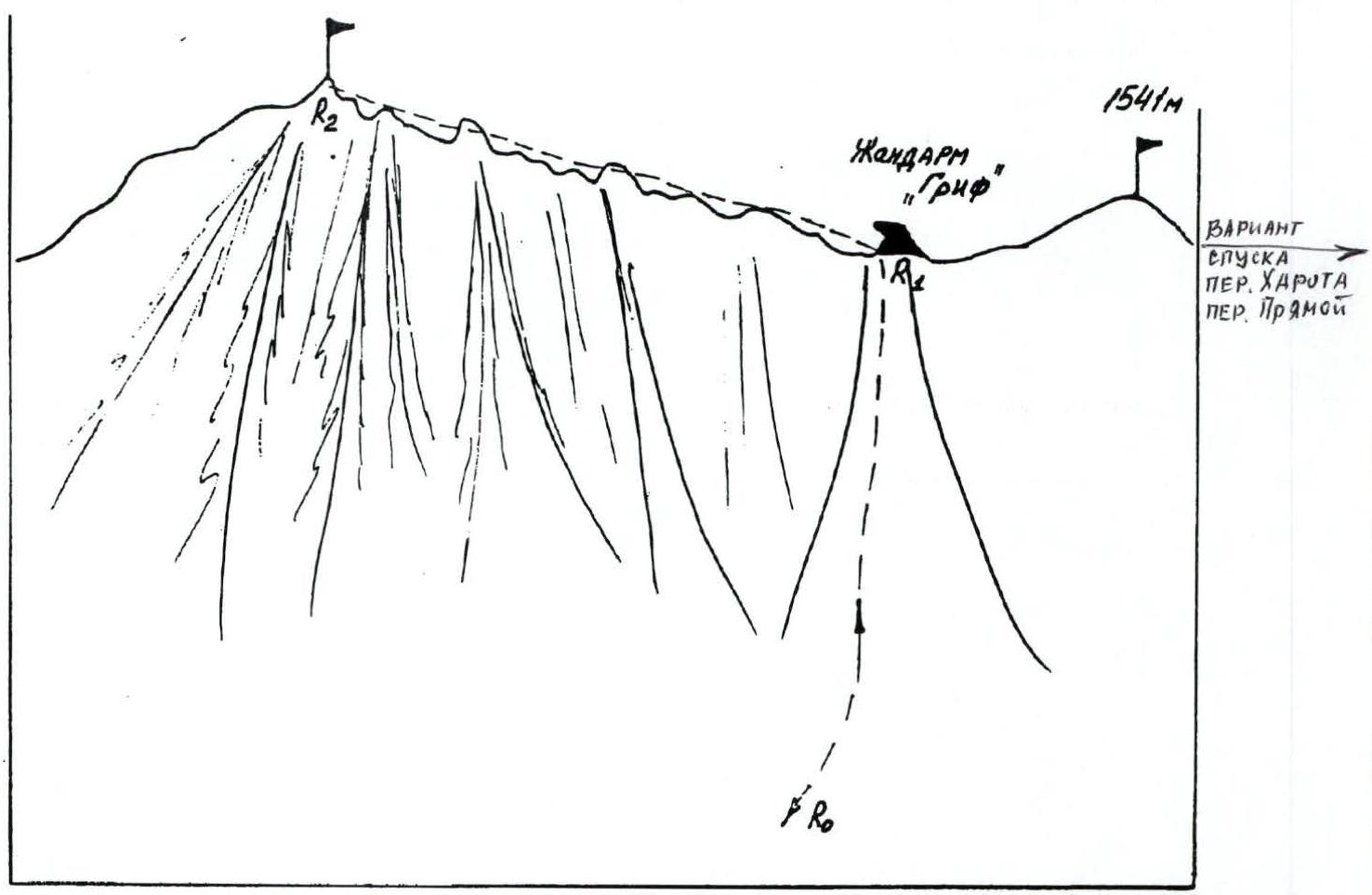
(plate III, photo 7,8) Ascent to the ridge of Ural peak via a wide snow couloir along a not very pronounced counterfort (slope 40°, crampons, 600 m). The ridge is not steep and is up to 10 m wide. Towards the northwest slope, there are droppings and snowdrifts. Ascent to the summit along the southern slope for 400 m.
The summit is a series of towers up to 10-15 m high, passed "head-on" by simple climbing; wide ledges.
Descent:
- Via the ascent route.
- Alternative descent to Kharota pass via the northwest ridge, to Pryamoy pass via the south ridge. BOTH VIA peak 1541 m.
Diagram 4. View from the Prof. Manaraga river
R1 600 m 40° crampons R1-R2 400 m rocky ridge 1-2
Descent via the ascent route
Comments
Sign in to leave a comment