
Ascent Log
- Ascent category — combined.
- Ascent area — Polar Urals, Khardius massif.
- Peak, its height, and route — via the N ridge of Mt. Skalnaya — 1178 m.
- Estimated category of difficulty — 2A.
- Route characteristics: from the base camp, the height difference is 660 m.
Length of sections, category of difficulty:
- 1 — 1700 m.
- 2 — 120 m.
- 3 — 80 m.
- Belaying — via rock outcrops and through an ice axe stuck in deep, dense rime on rocks. 2 pitons were hammered in.
- Number of walking hours — from the base camp to the summit — 3 h 30 min.
- Full name of the leader, participants, and their qualifications:
- Donyushko E.V. — leader, 3rd sports category in mountaineering and 1st sports category in rock climbing.
- Badich N.E. — participant, 3rd sports category in mountaineering and 2nd sports category in rock climbing.
- Team coach — Maltsev S.L., 1st sports category, 3rd category instructor.
- Date — April 15, 2001.
First Ascent
- Donyushko E.V. — leader, 3rd sports category in mountaineering and 1st sports category in rock climbing.
- Badich N.E. — participant, 3rd sports category in mountaineering and 2nd sports category in rock climbing.
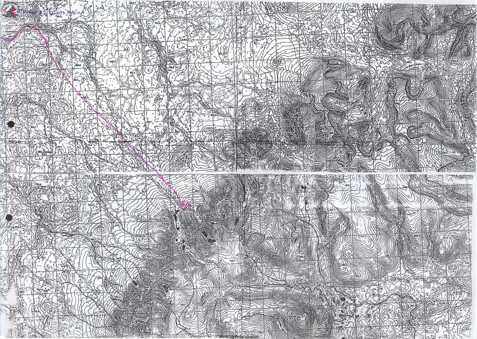
Ascent Scheme to Mt. Skalnaya (1178 m) from the Saddle of the North Ridge
Route
From the base camp at the confluence of two streams into the Bolshaya Niedzyu river at the foot of the mountain to the saddle of the North ridge and from there to the summit (a variant of the route along the North ridge).
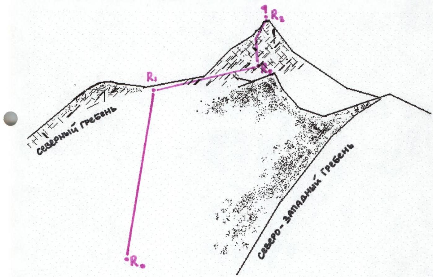
ASCENT: R0–R1 from the base camp to the saddle of the North ridge; 1; 1800 m, 30°; R1–R2 from the saddle, traverse along rocks to a convenient exit to the summit; 2; 120 m (3 ropes); 45°–50°; R2–R3 exit to the summit via steep rocks; 3; 80 m (2 ropes); 60°.
Descent
Descent via the ascent route.
Note
Almost the entire route is traversed in crampons: almost the entire path to the saddle and rocks near the summit are covered with dense firn or rime.
The classic route along the North ridge is traversed:
- from the beginning of the ridge through rock outcrops to the saddle;
- further along the rocks, exit to the summit (5 ropes).
Estimated category of difficulty 2B, but this route has not been climbed yet.
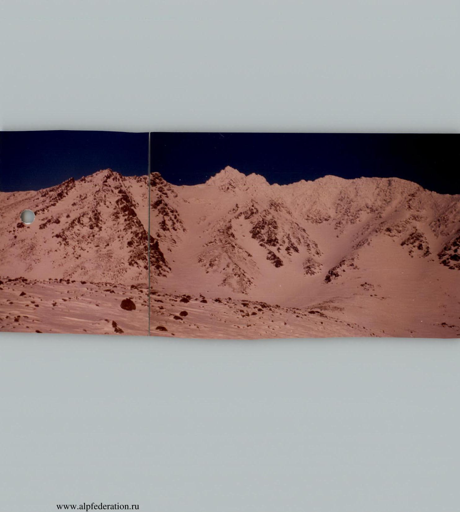
View of Mt. Skalnaya from the West
- Route from the saddle of the North ridge — 2A category of difficulty.
- Route along the North-West ridge — 1B category of difficulty. A — panoramic shooting point.
Description of the Area and Mt. Skalnaya
Mt. Skalnaya (1178 m) is part of the Khardius massif in the Polar Urals and is of great interest from an alpinist's point of view. Six ridges lead to the beautiful pointed summit, three of which are very thin and drop down with steep rocks.
The estimated categories of difficulty for the routes, most of which have not been climbed at all, vary from 1B to 3B, which is a great rarity for the mountains of the Polar Urals.
Skalnaya is practically unexplored by alpinists due to the inaccessibility of the area, harsh northern conditions, and the remoteness of the summit from other, already classified peaks.
The approach to the mountain from Sivaya Maska (the nearest railway station) takes an average of three days (about 60 km), but with good weather, and if the snow in the forest is covered with firn, it is possible to reach it in two days.
Serious obstacles on the way to the mountain can be:
- wide rivers Usa and Yunyakha — if the hike takes place from early May to late November;
- the floodplain of these rivers is covered with taiga mixed with a large number of swamps, which together create myriads of blood-sucking insects in the summer and generally make the path to the summit extremely difficult;
- in winter — short daylight hours and severe frosts.
Therefore, it is best to plan the hike for early spring, with skis. Late autumn is also quite risky, as the Usa river, about 500 m wide, may not be fully frozen.
Closer to the mountain, the taiga gradually turns into tundra, and 20 km away, there is no forest at all. In the Yunyakha river, approximately 30 km from the station, there is an abandoned farm with a bathhouse and decent housing with a stove. From the Gornyak settlement, located 4 km from the station, a log road leads to this farm.
It is worth paying attention to the harsh weather conditions of the Polar Urals. A blizzard or hurricane-force wind can strike at any moment, completely unexpectedly, so it is essential to take:
- a down jacket;
- a tent — in case the route takes a long time or it is difficult to find the base camp due to poor visibility.
The tent itself should be sewn firmly so that strong winds do not tear it away.
Despite the many difficulties that alpinists face on the way to the summit, the unique beauty of the local nature, the expanses of the endless tundra, and the mountain itself are all worth the effort. Skalnaya has no neighboring peaks to the east and west, and when you climb to the summit, you can see the endless Siberia on one side and the expanses of European Russia on the other. It is an unusual feeling:
- to see Asia first;
- to turn 180° and see Europe;
- and all this from a height of 1178 m.
Badich N.E. Ukhta 2001.
To the description given by the participant of our ascents above, I consider it necessary to add the following. The summit Skalnaya is located in the southern part of the Polar Urals (7 km from the Polar Circle). The Khardius ridge itself is of interest for traversing all the peaks of this massif. There is also a traverse of two peaks of Mt. Skalnaya (3A category of difficulty), climbed and described in April 1999 by K. Beketov (St. Petersburg). It is worth noting that in his report, he refers to these peaks as: "Northern Skalnaya" (1178 m) and "Southern Skalnaya" (slightly lower). According to our observations, the ridge from the main summit (1178 m) goes east. Accordingly, it would be more correct to call the traverse the Western-Eastern peaks of Mt. Skalnaya (3A category of difficulty).
In April 2001, due to bad weather, we were unable to repeat K. Beketov's route. Twice we tried to climb at least the main summit, but a very strong wind with snow prevented us from doing so. Only on April 15 (Easter), after lunch, the clouds cleared, and I decided to release the guys as a sports double for the ascent from the saddle of the North ridge. This time, the route was successfully completed, and the next day, we headed to Mt. Payer.
It is necessary to add that near the rock outcrop to the summit, just below the North-West ridge, snow cornices (drifts) constantly hang, which can slide down the slope. Therefore, it is necessary to avoid the possible trajectory of their descent and the cornices themselves (it won't take much time).
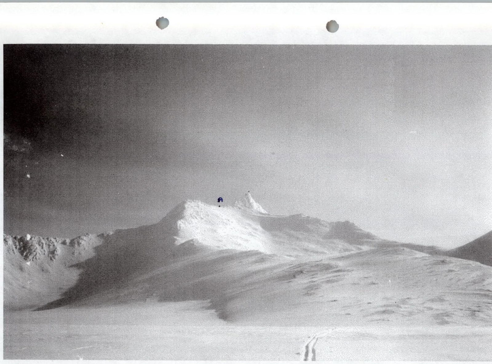
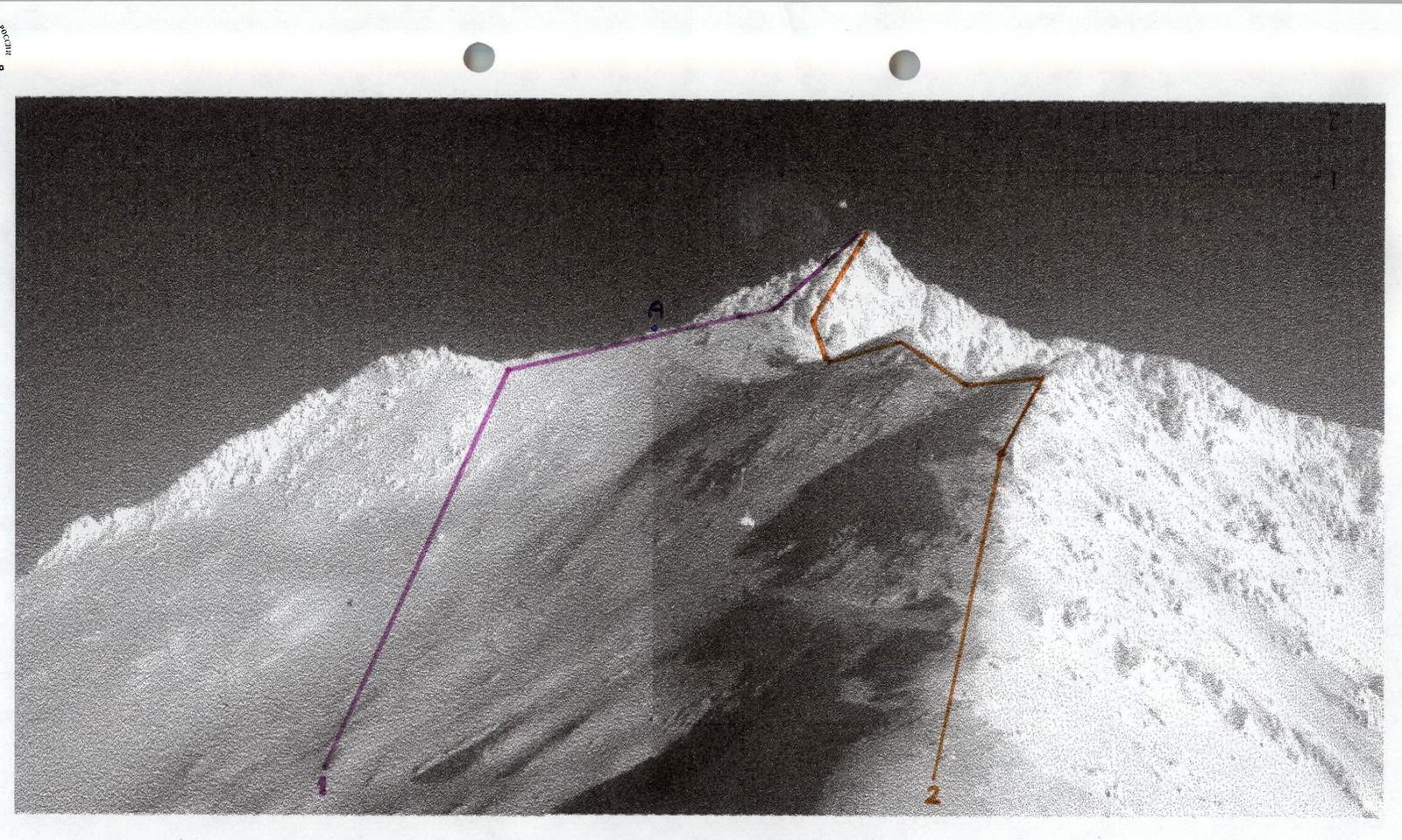
The ridge between the peaks of Skalnaya, climbed by K. Beketov and I. Zabelo in 1999 (3A category of difficulty). The saddle of the North ridge, April 1996. Summit Skalnaya 1178 m. North-West ridge, key section of the route. The shooting point on the distant views is marked "A".
View of Mt. Skalnaya from the north. A — Saddle of the N ridge, panoramic shooting point.
2017
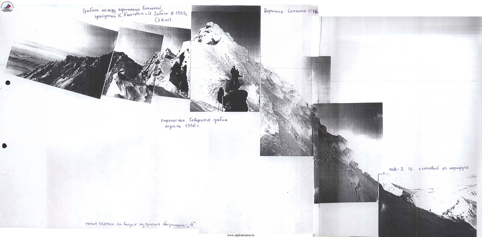
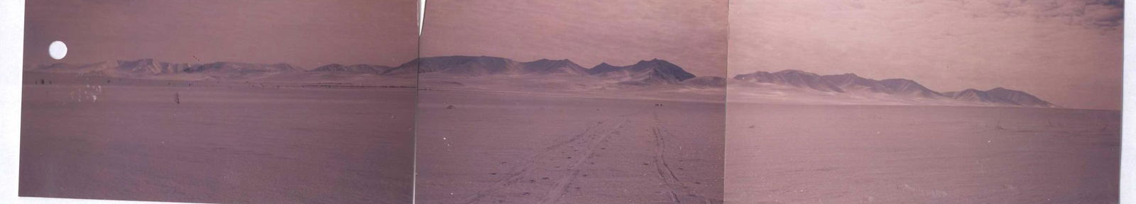 Summit Skalnaya 1178 m. View from the lake, April 1996. NW ridge.
team coach Maltsev S.L. Ukhta 2001.
Comments
Sign in to leave a comment