27.8
Lesson No. 11 from October 24, 1962
Ascent Passport
-
Route — Snow-ice
-
Region — Приполярный Urengoy, Sablin Ridge
-
Category of difficulty — 2B, proposed
-
Route length, height difference — 1000 m, 600 m
-
Piton placement — 2 (ice screw)
-
Movement hours — 8 hours
-
Leader — Eremkin Mikhail Alekseevich (Pr. Shkat.). Participants: Polyakov Sergei Nikolaevich (Gr. Skot.), Senyashkin Alexander Mikhailovich (Pr. U koyt)
-
Coach — Polyakov Sergei Nikolaevich
-
Route start — March 5, 1990 8:00 AM
-
Summit — March 5, 1990 1:00 PM
-
Return — March 5, 1990 3:00 PM
-
Alpinism Federation of the Komi Republic.
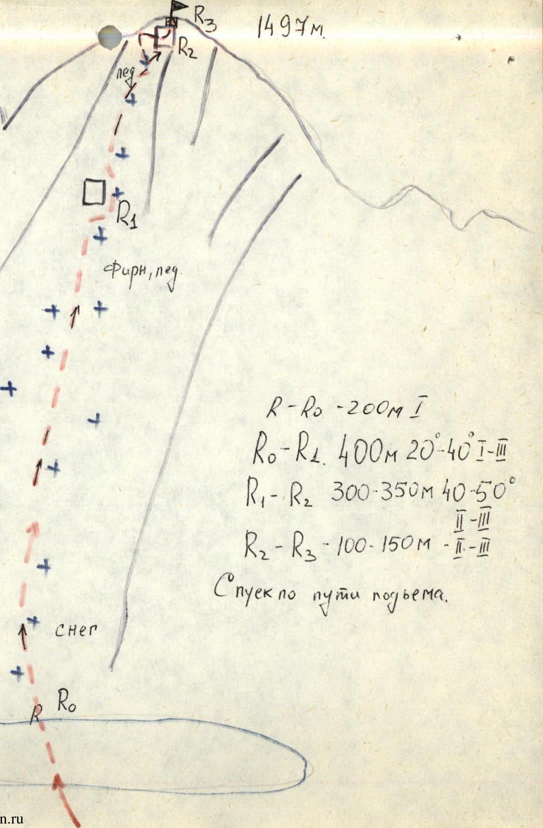
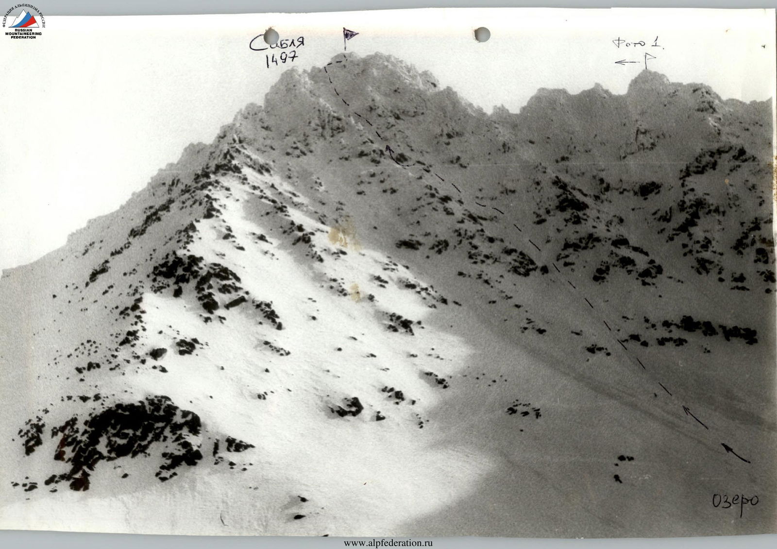
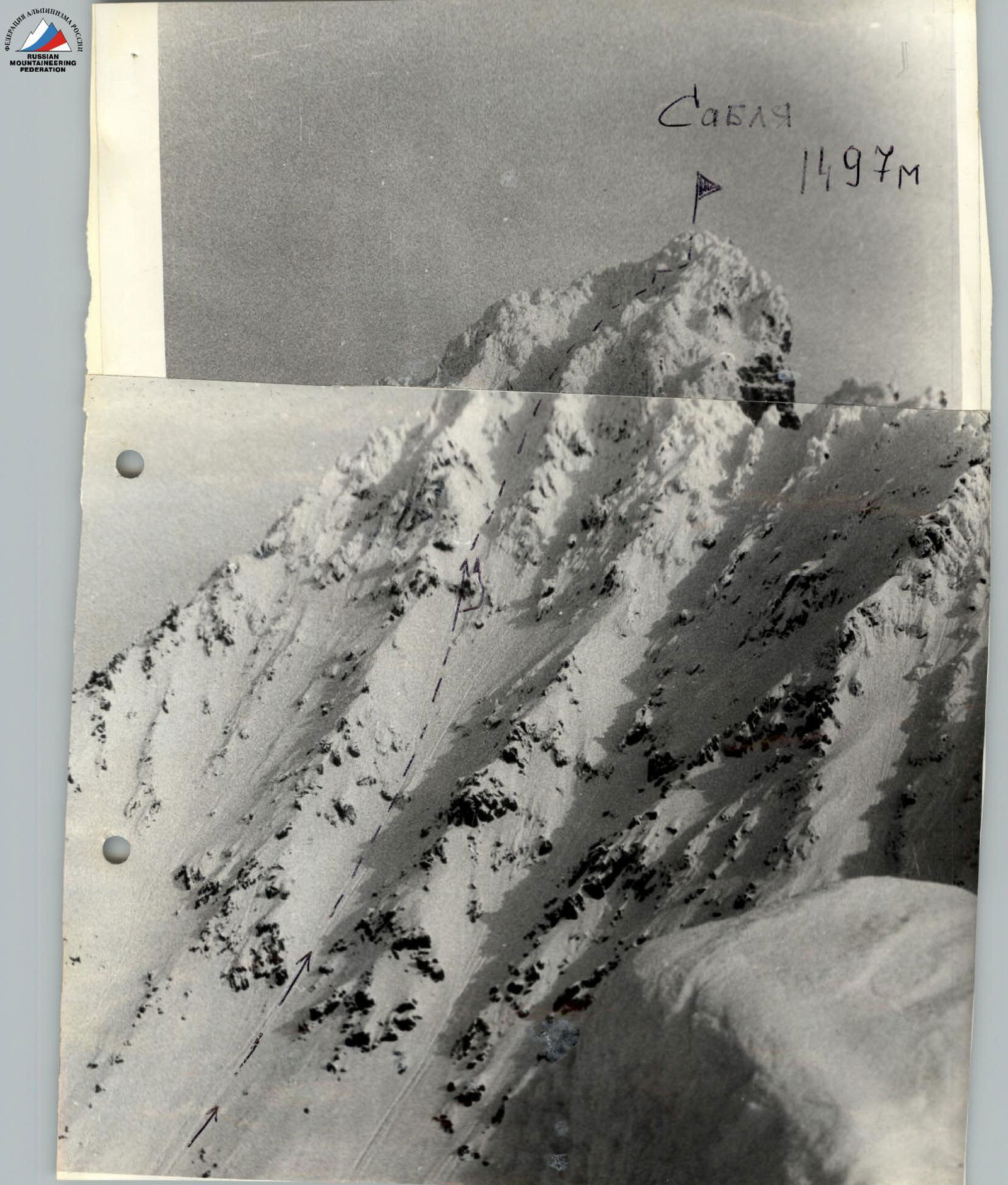
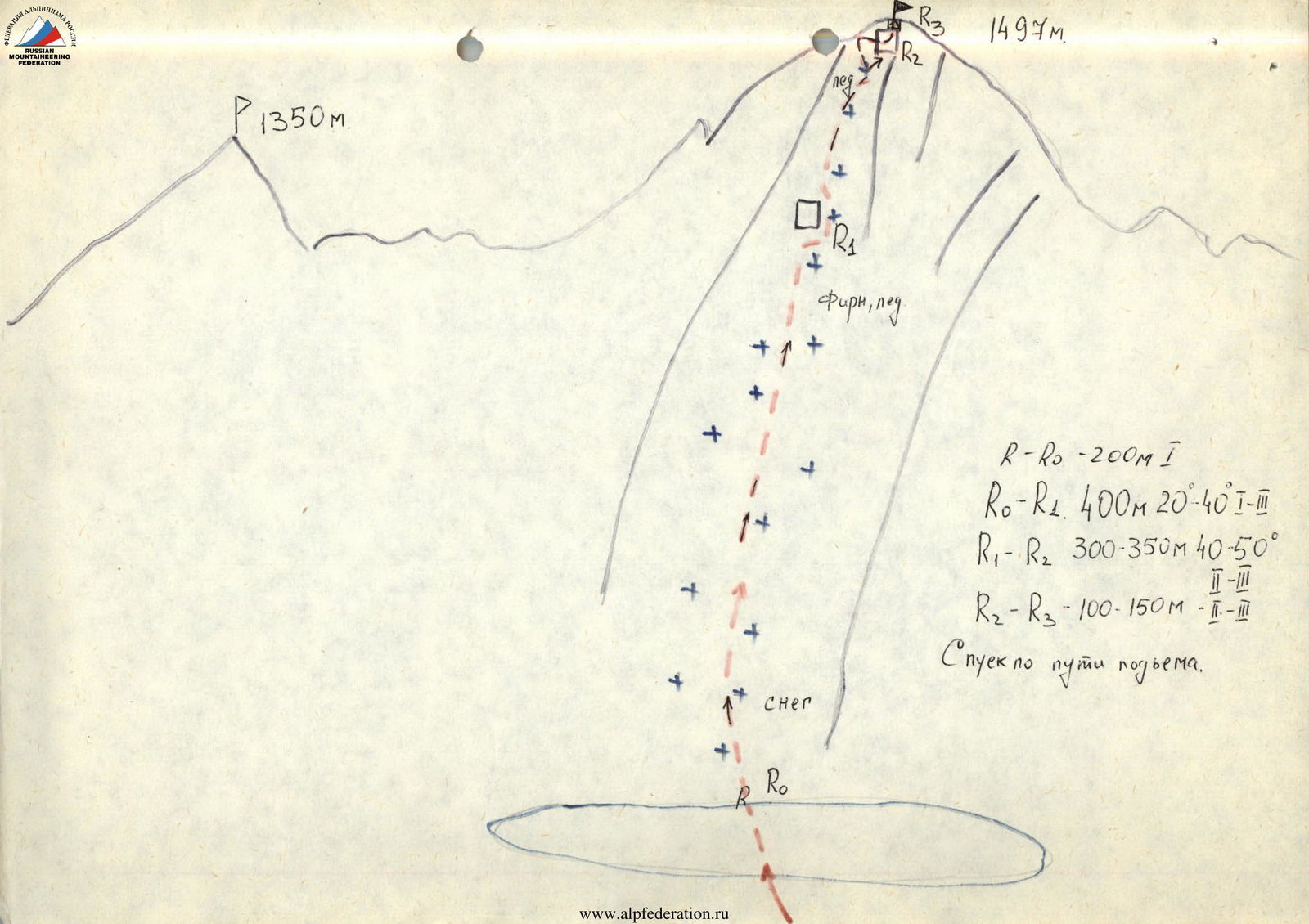
Description of the ascent to Sablya peak (1497 m) via the Central Western couloir. Winter route. Snow-ice. 2B category of difficulty.
From the base camp on the Lun-Vozh river, approach the Western wall of Sablya peak. Having passed the lake in the Western circus, start ascending the wide, gentle couloir. After 100–150 meters, the couloir narrows sharply, and the steepness increases to 35–40°.
Perform the ascent:
- initially along the left edge;
- then move into the LOB Chli, bypassing the cork-gendarme on the right;
- continue the ascent to the saddle. Caution, cornices! From the saddle, turn right, overcoming a short vertical wall, ascend to the summit of Sablya. Descent via the ascent route.
From the base camp on the Lun-Vozh river — 8 hours.
Route Details
- P 1350 m.
- R–R0: 200 m, category of difficulty 1.
- R0–R1: 400 m, 20–40°, category of difficulty 1–3.
- R1–R2: 300–350 m, 40–50°, category of difficulty 2–3.
- R2–R3: 100–150 m, category of difficulty 1–3.
- Descent via the ascent route.
Lake

- 2 rooms on site.
1494 m