Climbing Passport
prot. No. 150524/11-97 p. 33,183, to Zuatoul
- Route: combined, winter, Karpinsky - Narodnaya traverse
- Region: Subpolar Urals, Chesledovateysky ridge
- Cat. difficulty: 1B(3)
- Route length, height difference: 15000 m; 900 m
- Piton installation
- Moving hours: 7-9 hours
- Leader: Yeremkin Mikhail Alekseyevich, Syktyvkar, Dimitrova, 20-25
Team members: Polyakov Sergey Nikolayevich, Rochev Nikolay Vasilyevich, Votyakov Anatoly Borisovich, Belozerov Ivan Nikolayevich, Dumin Igor Alexandrovich.
- Coach
- Route entry: 7:00 March 18, 1996
- Summit: 12:00 March 18, 1996
- Return: 14:00 March 18, 1996
- Federation of Mountain Sports of the Komi Republic.
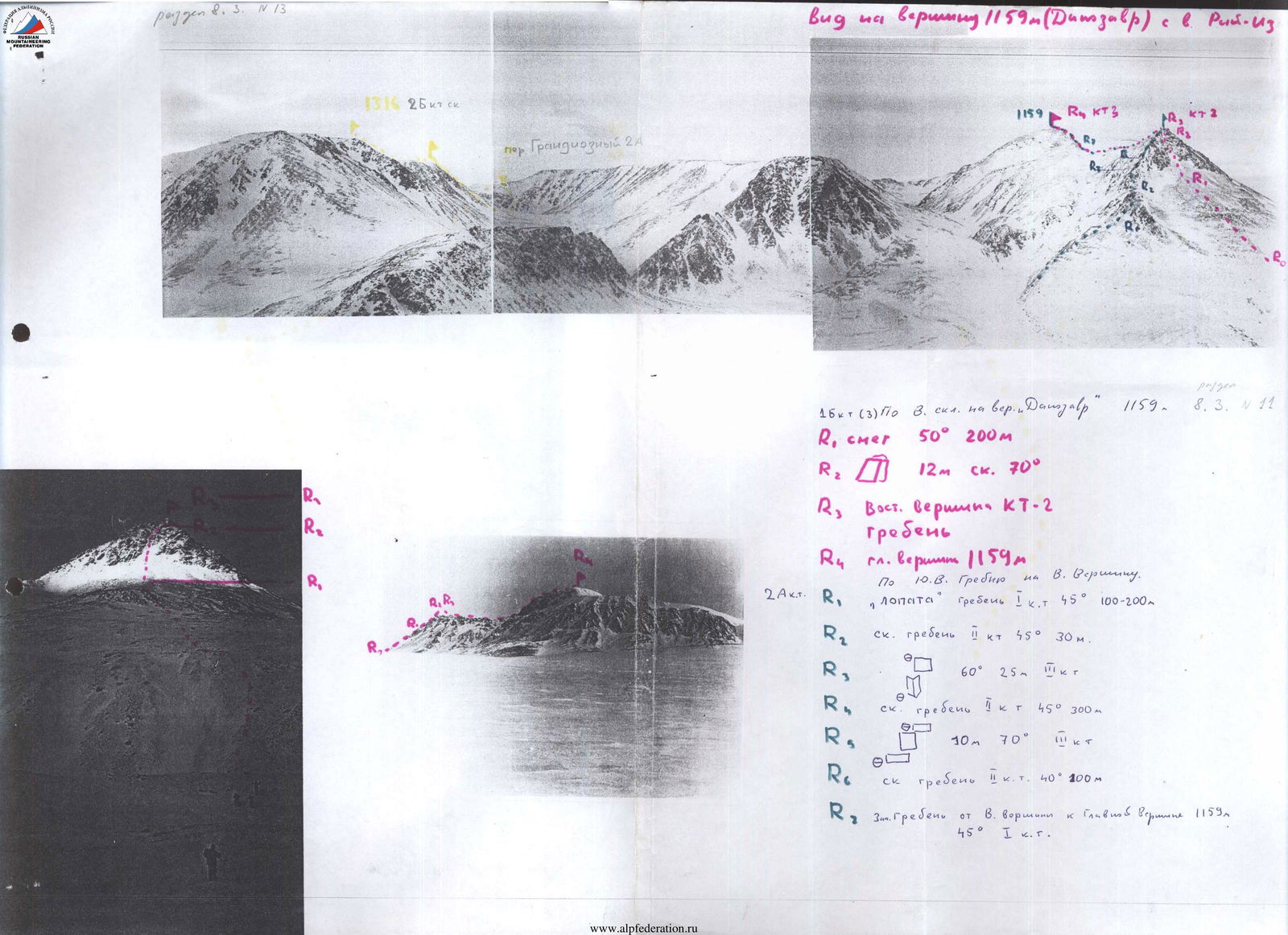
1B(3) Via W slope to Dinosaur peak 1159 m. March 8 No. 11 R1 snow 50° 200 m R2 12 m rock 70° R3 East Summit 2 ridge R4 main summit 1159 m 2A cat. diff. R. Via SE ridge to E Summit. "Shovel" ridge 1 45° 100-200 m R2 rock ridge 1 45° 30 m R3 60° 25 m 1 R4 rock ridge 1 45° 300 m R5 10 m 70° 1 R6 rock ridge 1 40° 100 m R7 Western Ridge from E summit to main Summit 1159 m 45° 1
Mt. Karpinsky (W slope) - Mt. Narodnaya. Traverse.
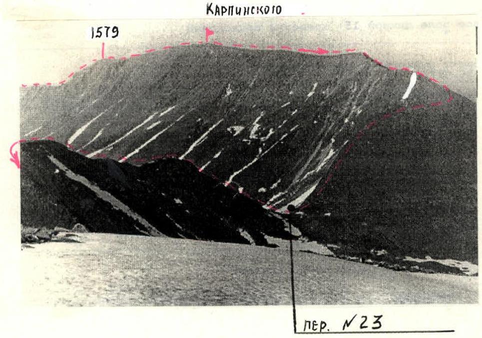
(pl. I, avg 1-4) Ascent to the northern ridge of Karpinsky via one of the "eroded" spurs of the western slope (snowfields, blown talus, 450 m, slope 35-40°). Before reaching the ridge, a rocky belt (100 m, slope 40°), and hanging ice. Further along the ridge to elevation 1579 (400 m). Before reaching the elevation, a snowy ascent (firn) 50 m, slope 45°. From the elevation, a broad plateau-like ridge. The summit is a rocky outcrop (5 m) with a reference point (hammer). Further, the ridge gradually narrows and smoothly turns west. Immediately before the descent, pass No. 23 - 200 m of a narrow (up to 5-10 m) ridge with small gendarmes. The section is traversed along the southern slope via ledges or "head-on". Descent to the pass 150 m, slope 30° via the blown-out (talus) southern slope. See SCHEME 1.
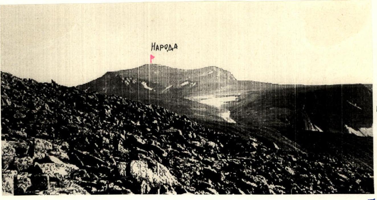
Ascent to the Narodnaya plateau (lower) - 200 m, slope up to 40° via a snowfield (firn) along the edge of a rocky ridge. The vast plateau of Mt. Narodnaya is supported by a rampart of coarse talus, on the edge of which (from the north) lies the pre-summit plateau. The pre-summit plateau is a large bowl tilted eastward. Along its edge, via an arc, ascent to the northern ridge, and further along it to the summit. Everywhere, from the lower plateau to the summit, the slope does not exceed 30°.
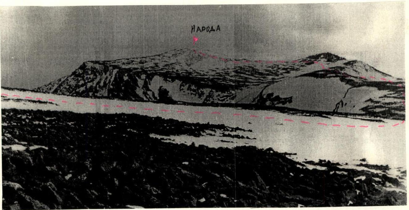
Descent from the summit to the lower plateau via the ascent route. Descent from the plateau to the Manaraga river valley via snowfields (firn) and medium-sized talus 500 m, slope 30-35°. See SCHEME 2.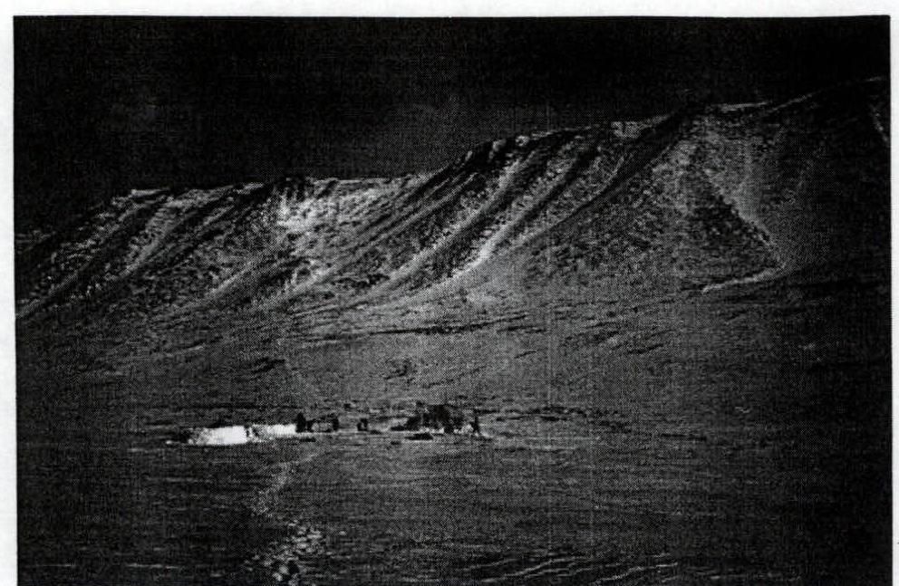
KARPINSKY RIDGE from the BALBANYU river valley
Scheme 2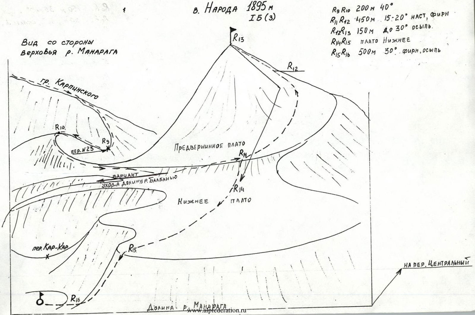 Scheme 1
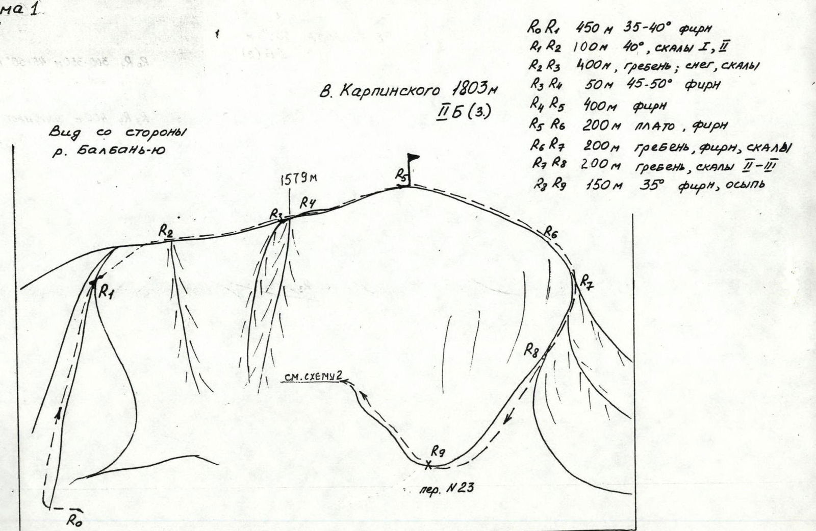

1