Passport
- Section number according to KMGV — 2010 — 8.3.
Polar Ural, Rai-Iz mountain massif, northwestern cirque
- Name of the peak: Peak 1176 (Yenga-Yu-Iz Northern)
- Height: 1176 m.
- Route: "Via the 1st counterfort of the western part of the northern slope (Route 'Zakovyчка')"
- Category of difficulty: approximately 2B — 3A (?)
- Nature of the route — rocky.
- Height difference of the route: 600 m
- Length of the route: 835 m
- Length of sections with the highest category of difficulty:
1st category — 2 sections — 400 m, 2nd category — 4 sections — 360 m, 3rd category — 2 sections — 70 m, 4th category — 1 section — 5 m, 5th category — 0 sections — 0 m, 6th category — 0 sections — 0 m.
- Average steepness: 50°.
- Pitons used:
Total used on the route:
- Rock pitons — 6 pcs
- Chocks — 12 pcs
- Stationary bolt hangers — 0
- ATO — 0
- Removable bolt hangers — 0
Left "pitons" on the route: total — 0 pcs; including bolt hangers — 0.
- Departure to the route — 6:00, August 5, 2014.
Reached the summit — 13:00, August 5, 2014. Returned to the base camp — 15:00, August 5, 2014.
- Team's walking hours: 9 hours.
- Leader: G. V. Skosyrev (Candidate for Master of Sports, instructor-methodologist 2nd category, Moscow).
Participants:
- V. Disnenko (Inta, 3rd sports category)
- A. Polishchuk (Syktyvkar, 3rd sports category)
- V. Vashchenko (Syktyvkar, 3rd sports category).
- Coach: Zhuravlev Sergey Vasilyevich (Candidate for Master of Sports, instructor-methodologist 1st category, Syktyvkar).

1176 (Yenga-Yu-Iz
Northern)
Description of the peak
Peak 1176 (Yenga-Yu-Iz Northern) is the northernmost of the three peaks of the Yenga-Yu-Iz mountain, which is part of the Rai-Iz mountain massif in the Polar Ural. It is located in the Yamalo-Nenets Autonomous Okrug (YaNAO) of the Tyumen Oblast, Ural Federal District, Russian Federation, in the upper reaches of the Sob River, in the northwestern cirque of the Rai-Iz massif.
Peak 1176 (Yenga-Yu-Iz Northern):
- Is a clearly defined mountain, easily identifiable from the Polar Ural railway station.
- The name is not indicated on the General Staff map; it was determined orographically.
- The name is given relative to the main peak of the Yenga-Yu-Iz mountain and serves to identify the peak.
Description of the route
The route "Via the 1st counterfort of the western part of the northern slope (Route 'Zakovyчка')" is a training and educational combined route of 2B category, possibly 3A category, with a full range of natural rock obstacles. Completing this route has not only aesthetic but also practical sports significance, as it allows for the practice of:
- Belaying techniques;
- Self-belaying techniques on complex rock terrain.
Equipment
To complete the ascent as part of a training and sports group of 4 people (3 participants + instructor), the following special equipment is necessary:
-
Personal — standard, including crampons and ice axe
-
Group:
- Main rope 10 mm — 2×50 m
- Rock hammer — 1 pc.
- Rock pitons — 4 pcs.
- Ice axe — 1 pc.
- Chock elements — 12 pcs.
- Quickdraws — 10 pcs.
- Loops — 10 pcs.
Approach
The ascent begins from the "First foothill lake" campsite. To reach the campsite: from the Polar Ural railway station, follow the left bank of the Sob River upstream from Lake Perevalnoye. Cross the river (possibly by fording) to the right bank in the upper reaches and ascend to the first foothill lake in the northwestern cirque of the Rai-Iz massif via scree and mountain tundra. The lake has suitable areas for tents and dense natural rocks ideal for training.
Approach to the start of the route: From the first foothill lake, ascend via scree and snowfields to the upper part of the northwestern cirque to the second foothill lake, located below the northwestern slope of Peak 1176 (Yenga-Yu-Iz Northern).
The northwestern slope is clearly defined and easily identifiable. The western part of the slope is determined by a distinct central counterfort. The first counterfort to the left is named "Zakovyчка" for identification purposes.
Technical part
The technical part of the route begins with an ascent from the lake to the base of the counterfort via a moderately steep snow slope. At the rocky blocks near the base of the counterfort, there is a convenient spot to organize a belay. Then, proceed via simple rocks to the crest of the counterfort and continue along the crest to an internal angle. The angle is technically complex, with subjective rockfall danger.
Next is the "Cascade" section, featuring a variety of rock relief:
- Walls,
- Slabs,
- Ledges up to 3–5 m,
requiring belay organization. The cascade of walls and ledges leads to the key section of the route.
The key section: a 5-meter chimney with a stone plug at the top. Steep — 90°. Passing this section requires skills in power climbing along overhangs. The rocks are dense, with reliable handholds.
After passing the key section, there is an exit to a simple rocky ridge and a continuation along it to a distinct long internal angle.
Internal angle:
- Is simpler than the chimney with a plug but significantly longer (50 m);
- Requires skills in organizing intermediate belay points;
- Has sufficient microrelief — cracks and fissures — for using chock elements (stoppers, hexes) and friends.
Climbing is complicated, on dense rocks; rockfall danger is subjective.
After passing the internal angle, continue along the ridge and exit to the summit plateau. On the plateau, it is possible to unrope, as the subsequent movement to the summit via scree is not challenging.
Summit
The summit is weakly expressed, with a wide scree plateau sloping south and southwest. A cairn is erected at the junction of the counterforts.
Descent from the summit
Descent from the summit is carried out:
- Along the western non-categorized slope to the descent couloir,
- Then, down the snowfield of the descent couloir directly to the base camp by the first foothill lake.
Recommendations for the instructor
The route is more complex than a traditional 2B category route and can be used for training groups NP-2 as a qualifying ascent only under the conditions of:
- Good rock climbing technical preparation of the participants;
- Additional training on organizing intermediate belay points and basic stations.
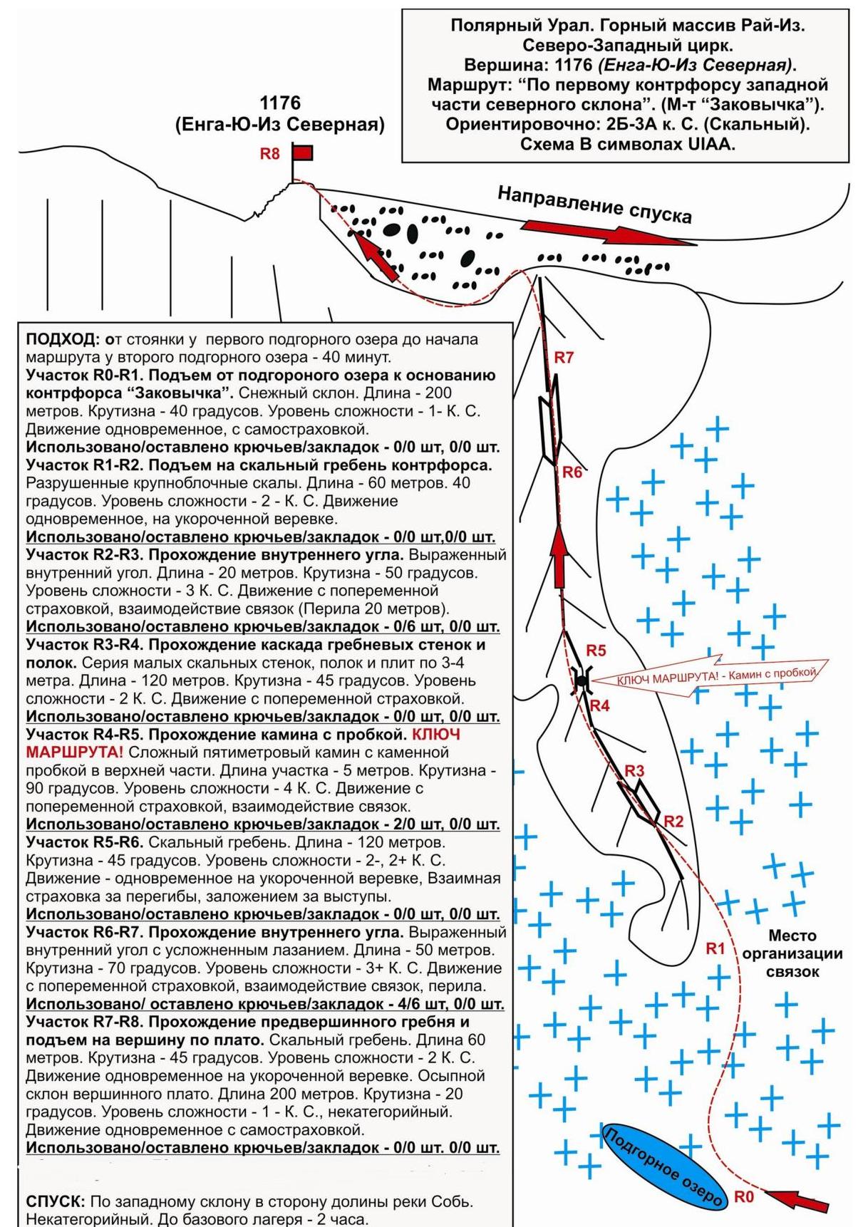
Polar Ural. Rai-Iz mountain massif, northwestern cirque. Peak: 1176 m (Yenga-Yu-Iz Northern).
Route: "Via the 1st counterfort of the western part of the northern slope (Route 'Zakovyчка')". Level of difficulty: approximately 2B–3A (?) category (rocky) (table of natural obstacles on the route)
| Section | Length | Steepness | Character of relief | Category | Number of pitons/chocks |
|---|---|---|---|---|---|
| APPROACH | From the base camp in the upper reaches of the Sob River by the first foothill lake — 40 minutes via mountain tundra, scree, snow. | ||||
| R0 — Medium-block scree at the base of the ridge | Second foothill lake — start of the route. | ||||
| :--: | :--: | :--: | :--: | :--: | :--: |
| R0–R1 Ascent via snow slope to the base of the counterfort | 200 | 40 | Snow. | 1 | Used 0/0 Left 0/0 |
| R1–R2 Ascent to the rocky crest of the counterfort | 60 | 40 | Large rocky blocks. | 2 | Used 0/0 Left 0/0 |
| R2–R3 Passage of the first internal angle. | 20 | 50 | Unstable rocky crest | 3- | Used 0/6 Left 0/6 |
| R3–R4 Passage of a cascade of small walls, ledges, and slabs. | 120 | 45 | Varied dense rocks of small forms — walls, slabs, ledges up to 2–5 m. | 2 | Used 0/0 Left 0/0 |
| R4–R5 KEY! Chimney with a plug | 5 | 90 | Rocky chimney with a plug (passage on the left) | 4 | Used 2/0 Left 0/0 |
| R5–R6 Ascent along the rocky crest. | 120 | 45 | Rocky crest of large rocky blocks. | 2 | Used 0/0 Left 0/0 |
| R6–R7 Passage of the internal angle | 50 | 70 | Monolithic rocks, internal angle. | 3 | Used 4/6 Left 0/0 |
| R7–R8 Ascent along the pre-summit crest | 60 200 | 45 20 | Unstable rocky crest. Scree slope. | 2 1 | Used 0/0 Left 0/0 |
| R8–Peak 1176 (Yenga-Yu-Iz Northern) | Plateau-like, not clearly expressed. Cairn erected at the junction of the counterforts of the northern slope. | ||||
| DESCENT | Along the western slope towards the Sob River valley. Non-categorized. |
Summary
Length of the route — 835 m. Average steepness — 50°
Character of relief — rocky
Technical sections:
- 1st category — 2 sections — 400 m
- 2nd category — 4 sections — 360 m
- 3rd category — 2 sections — 70 m
- 4th category — 1 section — 5 m
- 5th category — 0 sections — 0 m
- 6th category — 0 sections — 0 m
Pitons and chocks at the route: 6/12 pcs. Left pitons and chocks: 0/0 pcs.
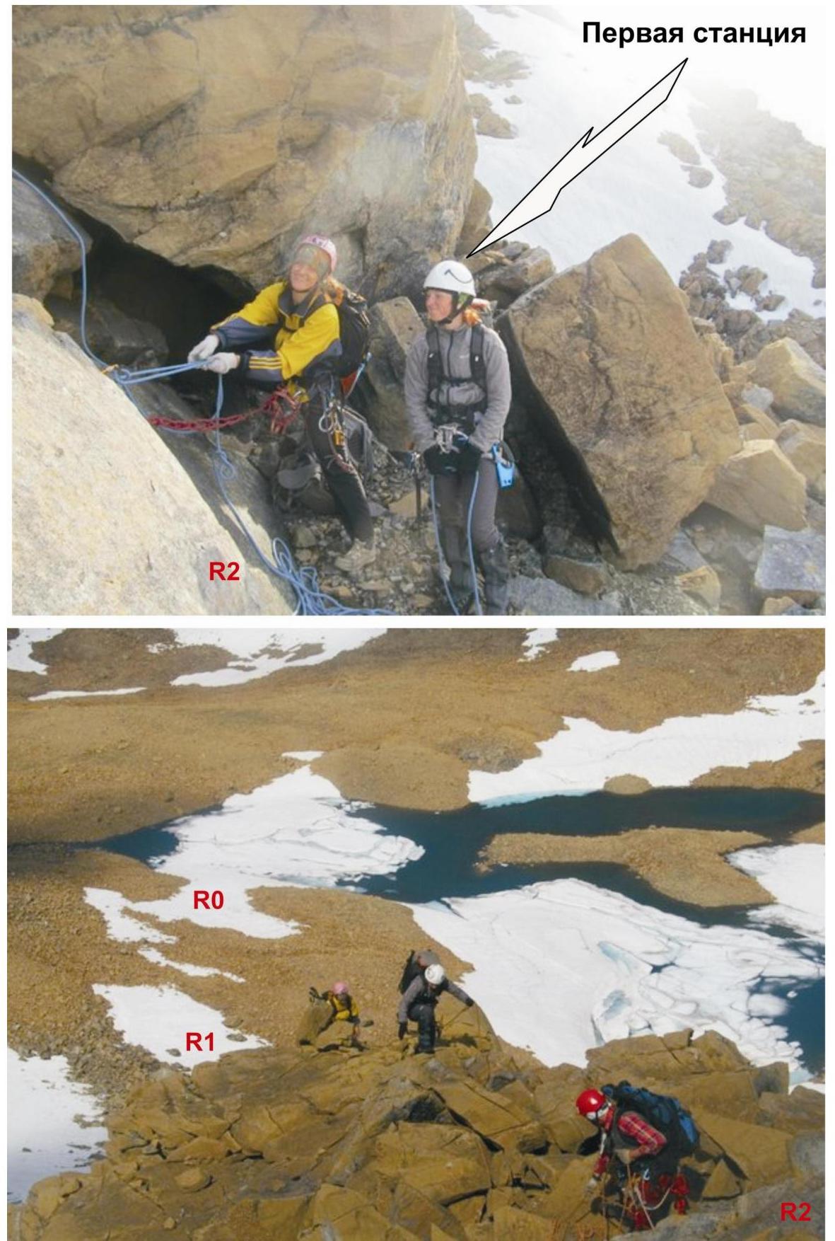
First station Polar Ural. Rai-Iz mountain massif. Northwestern cirque.
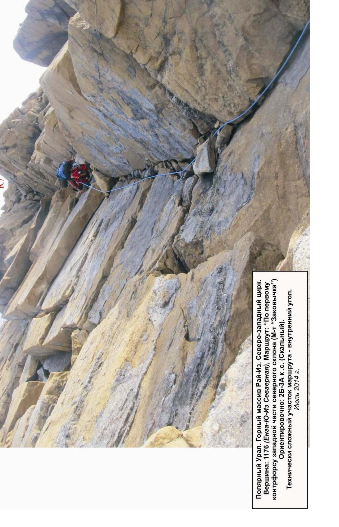
Peak: 1176 m (Yenga-Yu-Iz Northern). Route: "Via the 1st counterfort of the western part of the northern slope". (Route 'Zakovyчка'). Approximately: 2B–3A category. (Rocky). Section R4–R5. Approach to the key section of the route — chimney with a plug.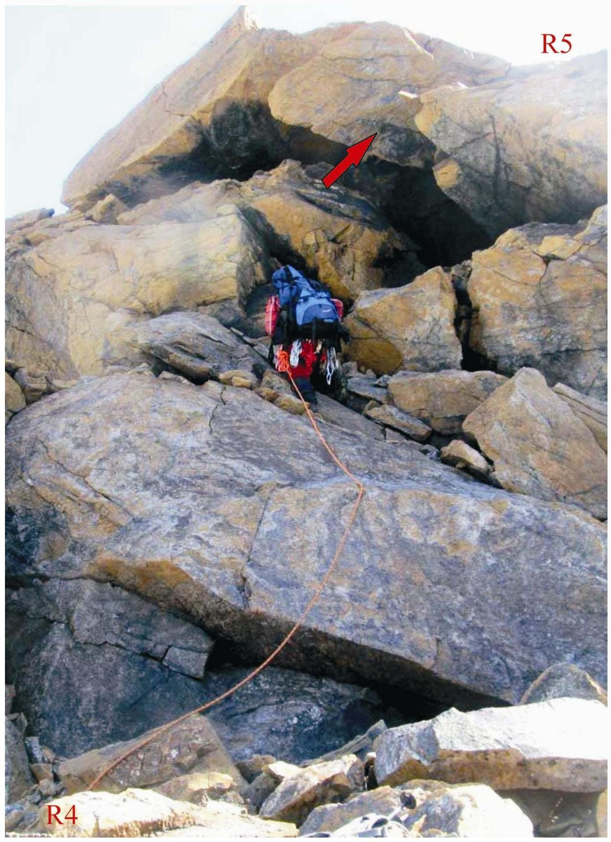
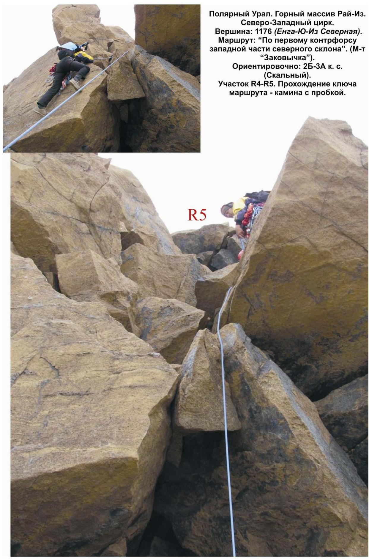
Polar Ural. Rai-Iz mountain massif. Northwestern cirque. Peak: 1176 (Yenga-Yu-Iz Northern). Route: "Via the 1st counterfort of the western part of the northern slope". (Route 'Zakovyчка'). Approximately: 2B–3A category. (Rocky). Section R4–R5. Passage of the key section of the route — chimney with a plug.