Route Description
-
Climbing type — combined.
-
Climbing area — Rai-Iz massif, Polar Urals.
-
Peak, its height, and route — 1159 m (1154 m — according to other sources). Via the center of the eastern slope, then along the eastern ridge.
-
Estimated difficulty category — 1B cat. diff. (z).
-
Route characteristics: height difference — 700 m. Length of sections by difficulty categories:
- 1 — 1500 m
- 2 — 200 m
- 3 — 10–15 m
- Average steepness — 40°.
-
Number of pitons for belaying:
- rock — 0
- ice — 0
Key sections of the route are traversed using chocks and slings, belaying via rock outcrops. Chocks — 5/0.
-
Number of climbing hours — 3.5 hours.
- To the first summit — 2 hours.
- From the first to the main summit — 1 hour 30 minutes.
-
The route was climbed by a team of two:
- Maltsev S.L. — 1st sports category — team leader.
- Nekrasov P.A. — 2nd sports category — team member.
-
Team coach — Fomenko F.N. — Candidate Master of Sports, 1st category instructor.
Date: May 2, 1995. First ascent: May 2, 1995.
- Maltsev Sergei Leonidovich — 1st sports category — 3rd category instructor-methodologist.
- Nekrasov Pavel Albertovich — 2nd sports category.
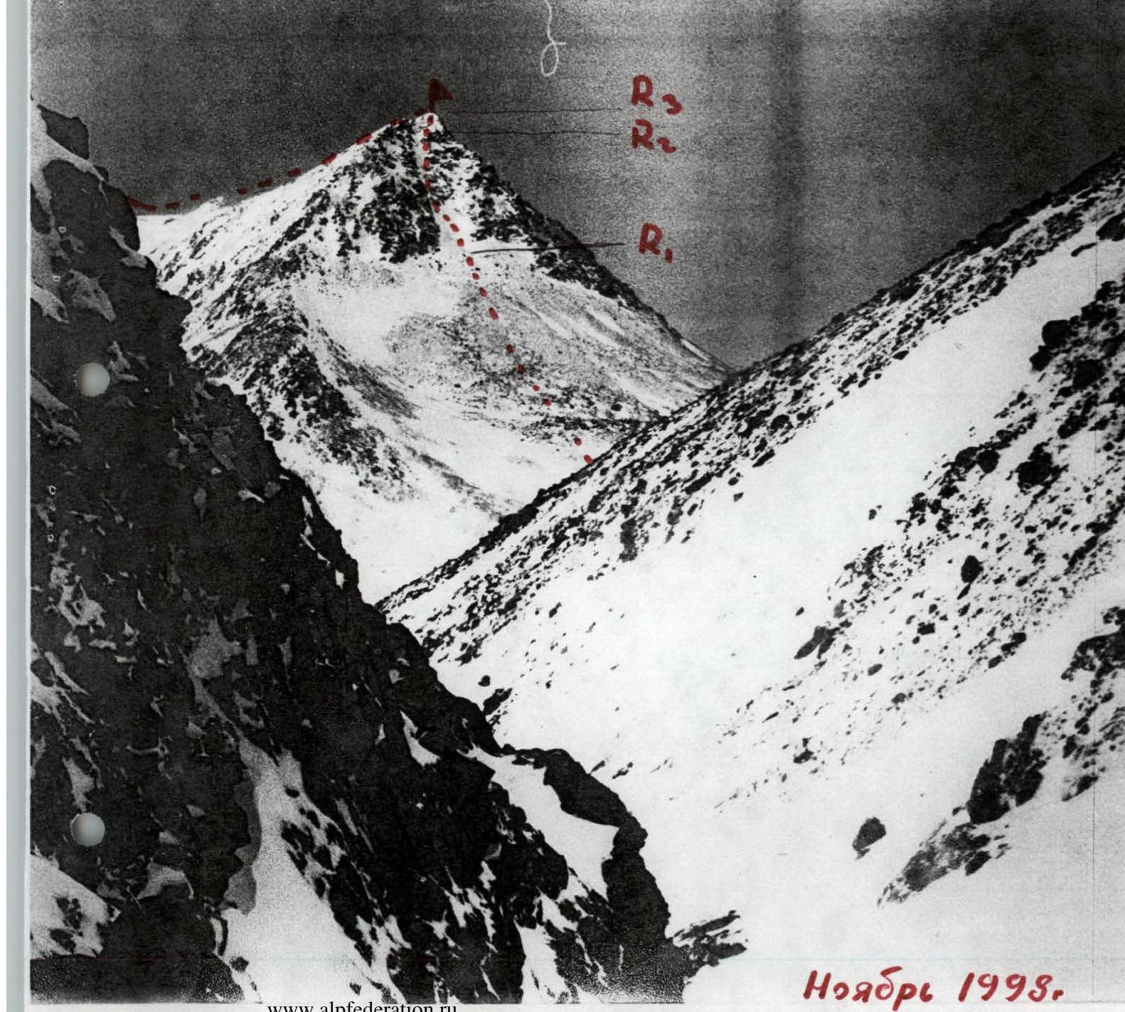
Brief description of the route to peak 1159 m (1154 m) "Dinosaur" 1B cat. diff. (z)
The peak is located west of the geologists' camps, on the other bank of the Vyrdavomeshor River. Initially, there is a steep 60 m ascent (hard firn, ice). Then the slope becomes gentler, reaching 30–35° — 700 m. Closer to the summit, the slope steepness increases — 45–50° (KO).
R1 — steep snowy slope 50–60° with rock outcrops. Belaying is organized using slings on rock outcrops (previously cleared of snow). It is convenient to use chocks. R1 — 200 m (cat. diff. 2). Control cairn T1, on a rock island.
R2 — rock tower 12–15 m, steepness 70° (cat. diff. 3). Ascent to the first summit. Control cairn T2.
R3–R4. Along the ridge — descent to a col and ascent to the main summit R4 — 700–800 m, cat. diff. 1, 45°.
Route composition:
- Descent along the ridge to a col.
- Ascent to the main summit.
Sections R1 and R2 are avalanche-prone after snowfalls; serious attention should be paid to belaying. Descent from the summit via the ascent route, or descent from the col between the 1st and 2nd summits via the southern couloir.
Equipment
- Main rope 40 m 11 mm — 1 piece.
- Auxiliary rope 40 m 8 mm — 1 piece.
- Slings — 5 pieces.
- Ice axes — for each participant.
- Crampons — for each participant.
- Carabiners — 10 pieces.
- First-aid kit — 1 piece.
- Set of chocks — 1 set.
- Harness — for each participant.
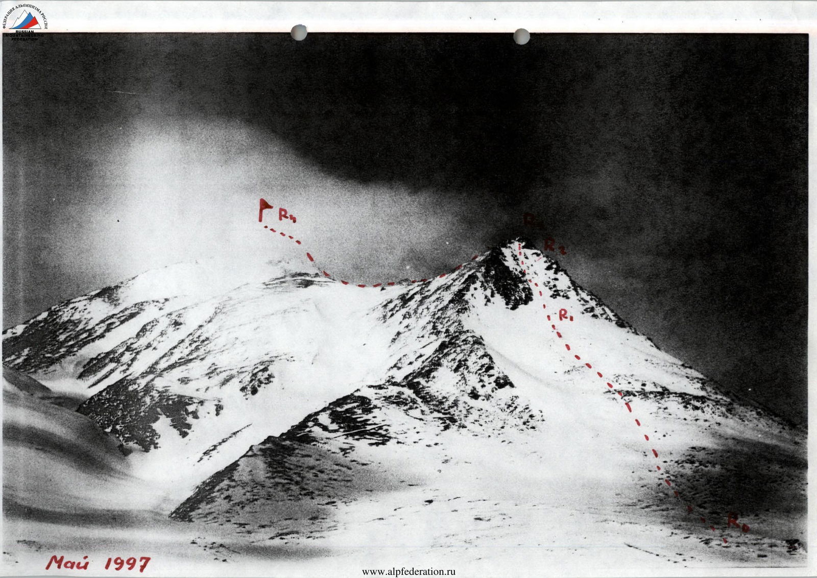
May 1997
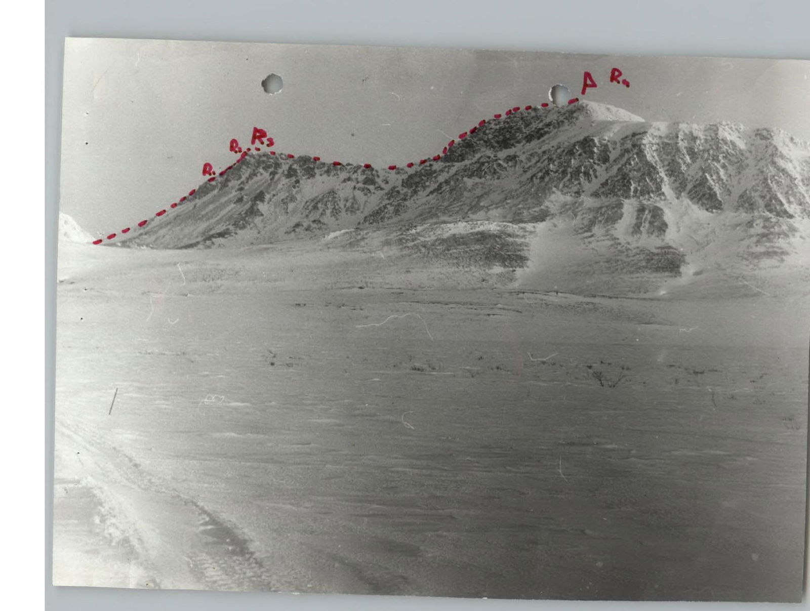
Ridge to the main summit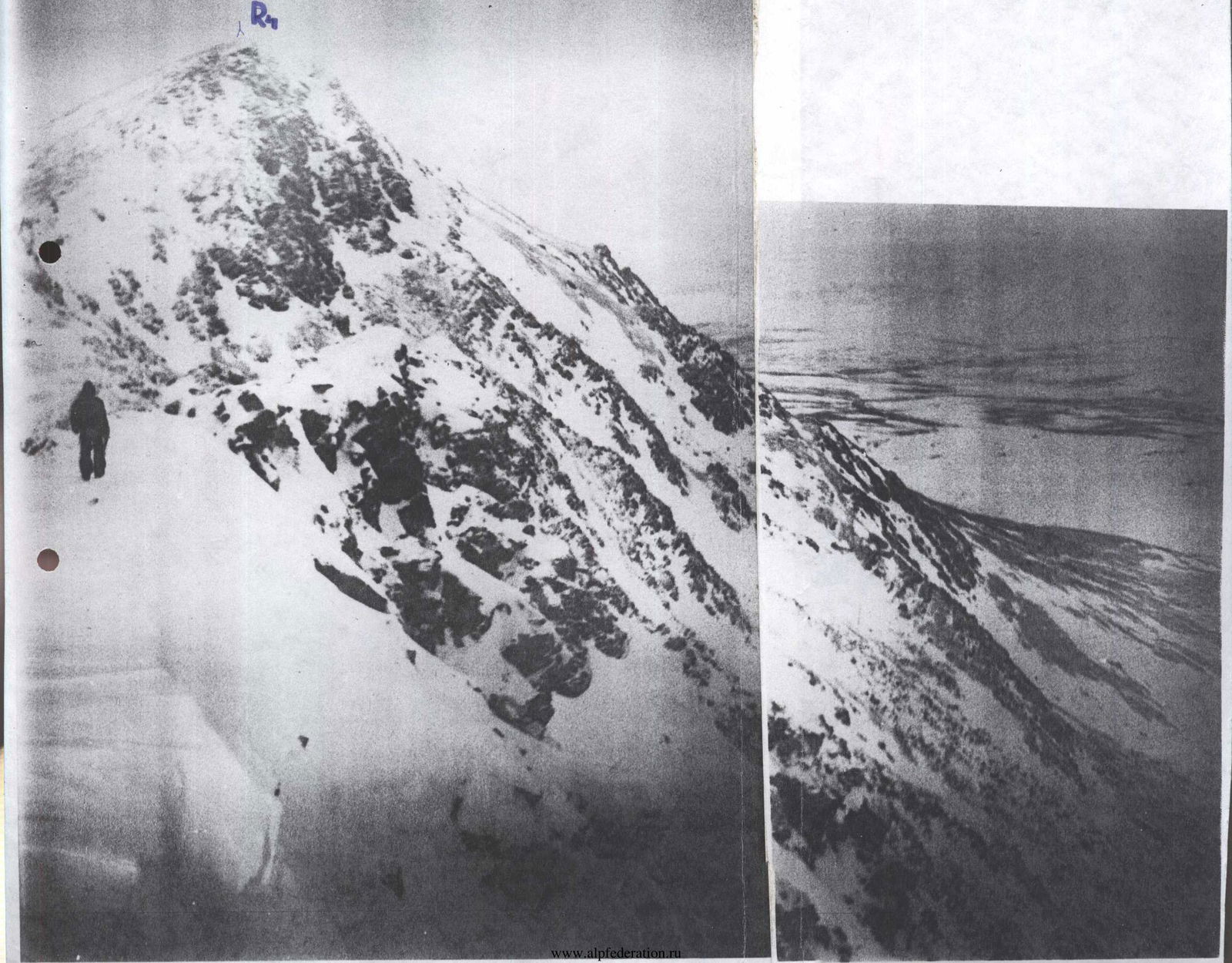
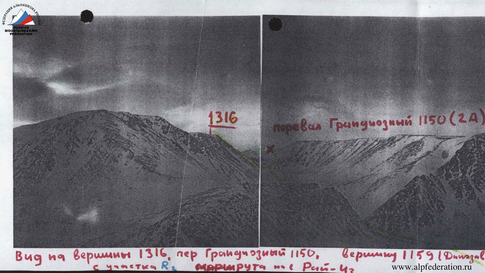
View of peaks 1316, Grandiozny Pass 1150, peak 1159 (Dinosaur) from section R2 of the route from Rai-42.