
ASCENT DOCUMENT
-
Region — Antarctica, Queen Maud Land, Wohlthat Mountains.
-
Peak — Shvartse (Valery Chkalov) 2510 m via the center of the southern wall.
-
Proposed route — Category 6B, first ascent.
-
Route type — Rock climbing.
-
Route characteristics:
- Height difference: 930 m
- Route length: 1120 m
- Category 6B sections: 635 m
- Category 5B sections: 160 m
- Average steepness of the wall: 79°
-
Equipment left on the route:
- Pitons: 15 (including 13 bolts)
- "Chocks" (protection gear): 10
Pitons used on the route:
- Stationary bolts: 13 (including 0 for artificial technical aids)
- Removable bolts: 40 (including 26 for artificial technical aids)
- Total artificial technical aids used: 244
-
Climbing time: 114 hours, total duration: 9 days (including acclimatization).
-
Team leader: Nikolai Nikolaevich Zakharov, Master of Sports of International Class.
Team members: Petr Valentinovich Kuznetsov, Master of Sports; Gleb Anatolievich Sokolov, Master of Sports; Oleg Valerievich Khvostenko, Master of Sports.
-
Team coach: Yuri Viktorovich Baikovskii, Master of Sports.
-
Departure date:
- On route: January 28, 2003, 14:00
- On summit: February 5, 2003, 7:00
- Return: February 5, 2003, 20:00.
-
Organization: International Mountaineering Club.

Peak Shvartse 2510 m. South wall.


Technical photo of the route.
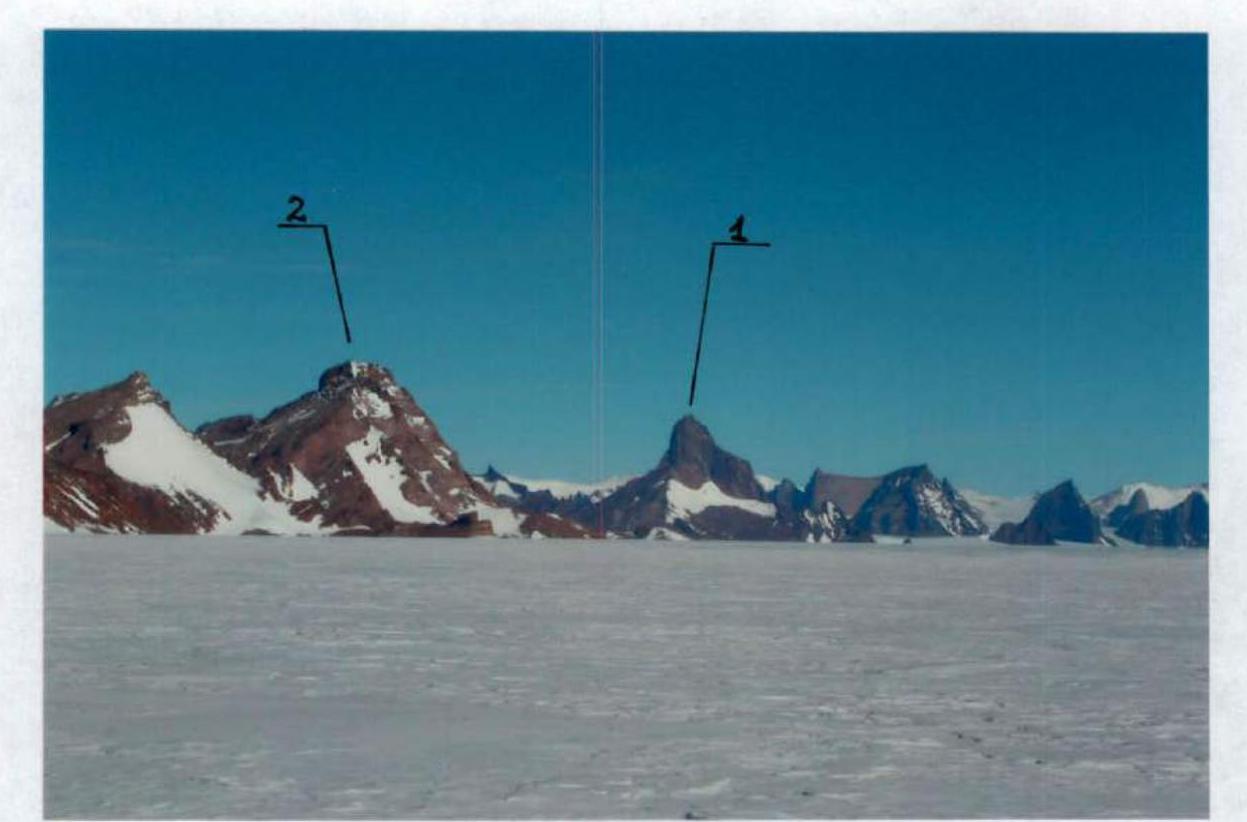
Panorama of the area (taken from the north, point 1 on the map).
- Peak Shvartse (V. Chkalov) 2510 m.
- Peak Vladimir 2239 m.
Approach from Novolazarevskaya airfield by all-terrain vehicles: 100 km (possible air drop by AN-2 to the Muskhetov glacier). The assault camp is located directly under the south wall of Peak Shvartse. Coordinates of the assault camp: S 71° 36′ 268″, E 12° 35′ 008″, Alt 1633 m. 25 minutes to the start of the route. Due to a large depression forming at the foot of the wall, a fixed rope was set for descent to the start of the route.
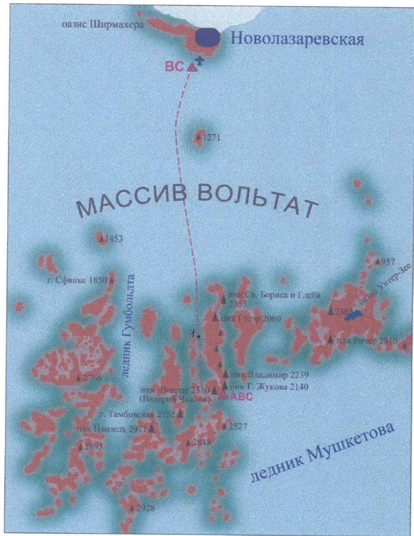
Area map, scale 1:700,000.
Climbing schedule.
UIAA diagram.
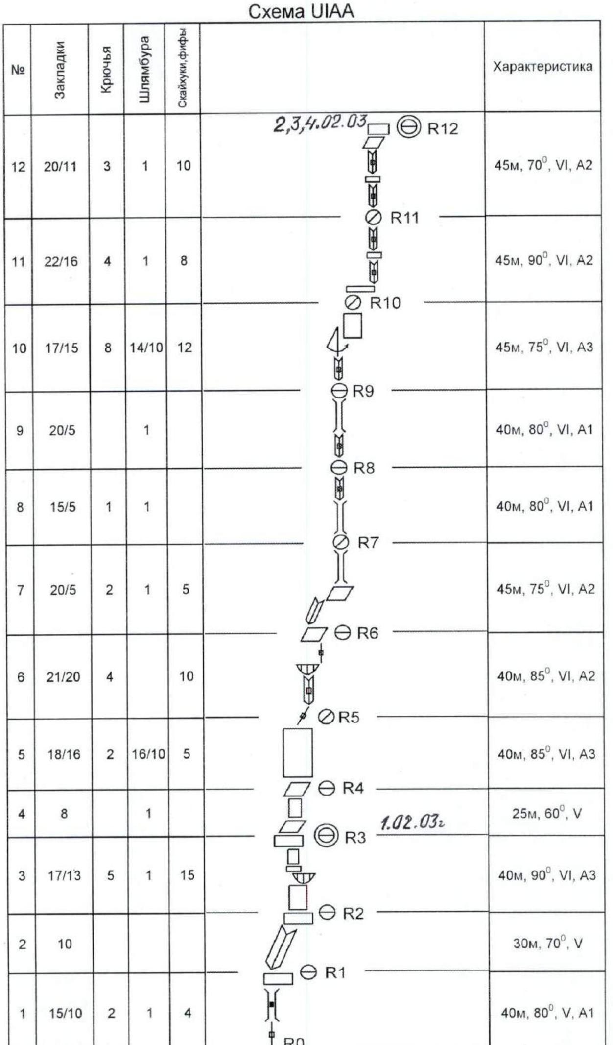
| Route characteristics | ||||||
|---|---|---|---|---|---|---|
| 388/218 | 43 | 53 / 26 | 97 | Peak Shvartse (V. Chkalov) | ||
| 22 | 14 | 300 m, 25°, III | ||||
| 21 | 12 | 20 m, 70°, V | ||||
| 20 | 24/18 | 1 | 6 / 4 | 40 m, 85°, VI, A2 | ||
| 19 | 26/16 | 3 | 4 / 2 | 45 m, 85°, VI, A2 | ||
| 18 | 18/10 | 15 m, 90°, VI, A2 25 m, 50°, IV, A1 | ||||
| 17 | 22/10 | 1 | 1 | 2 | 40 m, 80°, VI, A1 | |
| 16 | 18/16 | 5 | 1 | 11 | 45 m, 90°, VI, A3 | |
| 15 | 20/16 | 6 | 2 | 12 | 45 m, 90°, VI, A2 | |
| 14 | 15/13 | 2 | 1 | 3 | 25 m, 80°, VI, A2 | |
| 13 | 16/8 | 45 m, 70°, V, A1 |
Description of the route by sections
The route begins with an exit to a small ledge at the bottom of the wall (120 m), then follows a poorly defined counterfort upward and slightly rightward to reach the ridge.
Section 1: Through cracks, rightward and upward 20 m. Up a chimney rightward to a ledge 20 m. Station on the ledge.
Section 2: Along an angle to the next ledge 30 m.
Section 3: Wall 30 m with a small overhang at the top. The overhang is bypassed on the left via a crack. Exit to a small ledge. The upper layer of rock is crumbling; protection is difficult! Anchor pitons and "fifes" (spring-loaded camming devices) were widely used. Wall 10 m to a large ledge. Comfortable place for a bivouac.
Section 4: Series of ledges and walls 25 m. Station on a ledge.
Section 5: Wall with characteristic cavernous relief 40 m. Fragile rock! Protection on removable bolts. Hanging station on a bolt.
Section 6: Up a crack and rightward into an internal angle 10 m. Up the internal angle to a small overhang 20 m; the overhang is bypassed rightward. Exit to a small ledge. Up a wide crack turning into a chimney 10 m. Station on a diagonal triangular ledge in the internal angle.
Section 7: Up the internal angle 25 m. Exit rightward beyond the angle to a small ledge. From this point, the route follows a global internal angle. Up the chimney with free climbing 15 m. Semi-hanging station in the angle.
Section 8: Up the angle turning into a chimney 30 m. Protection in the chimney is difficult due to deep placements. Internal angle with a slight overhang 10 m. Station on a comfortable ledge in the widening chimney.
Section 9: Internal angle turning into a chimney 40 m. Station on a "plug" in the chimney.
Section 10: Up the internal angle to нависающие скалы of white color 15 m. End of the global internal angle. Start bypassing нависающие скалы on the right. Swing right 8 m. Up through cracks to an overhang and then along a slab rightward and upward 30 m. Fragile rock! Protection on removable bolts. Semi-hanging station on a small ledge under a large overhang.
Section 11: Along a ledge rightward beyond the angle and up to the next ledge in the internal angle 15 m. Up a нависающий угол 20 m. Beyond the bend, a small ledge; another 10 m up a vertical angle to the next ledge. Semi-hanging station.
Section 12: Up a vertical internal angle 20 m; beyond the bend, a good ledge. From the ledge up a vertical angle to the next bend 20 m. Series of ledges. Good place for a bivouac.
Section 13: Up a large internal angle toward a small shoulder 45 m. Station in the angle.
Section 14: Up the angle to a shoulder 15 m. From the shoulder rightward along a wall to a ledge under an overhang 10 m.
Section 15: The overhang is bypassed on the right. Then move leftward and upward along an angle 25 m. As a result, the first climber is directly above the belayer. Internal angle turns into a нависающий камин 15 m, which after a bend turns into an internal angle 5 m. Semi-hanging station in the internal angle.
Section 16: Rightward into the next internal angle 6 m. Internal angle turning into a chimney 25 m. Fragile rock! The chimney ends with an overhang 1 m. The overhang is passed head-on. Then up an angle to a good ledge 15 m. Crumbly rock! Many loose blocks!!! Anchor pitons and "fifes" were widely used.
Section 17: Further up, good relief is visible but it is heavily damaged; thus, start moving rightward and upward toward a large internal angle 15 m. Up the angle 15 m; exit to a good ledge. From the ledge up through cracks to a нависающий камин. Semi-hanging station at the start of the камин.
Section 18: The камин is bypassed on the left via a нависающая щель 10 m. Exit to a diagonal ledge. Along the ledge rightward and upward 30 m.
Section 19: From the end of the diagonal ledge up through a system of vertical angles alternating with ledges 45 m. General direction: up and slightly right.
Section 20: Continuation of the system of angles 40 m.
Section 21: Traverse leftward along a ledge under an overhang 10 m. Up an internal angle to exit onto the ridge with free climbing 10 m.
Section 22: Along the ridge to the summit, "sheep's foreheads" 300 m. Simultaneous climbing with a rope.
Descent via the ascent route.

Appendix
Historical background. Exploration of Queen Maud Land mountains
The mountain range in Queen Maud Land is known in mountaineering chronicles as DRONNING MAUD LAND. The mountains are several massifs protruding from the ice sheet. The height of rock peaks above the ice surface reaches 1 km; many walls have distinct, glacier-smoothed vertical faces.
Queen Maud Land (Dronning Maud Land), part of East Antarctica between 20° W and 45° E, is primarily the surface of a vast ice sheet rising to over 3500 m in the south. In the coastal strip, individual mountain ranges and peaks rise above the ice sheet, reaching heights of 3000 m or more. The shores, washed by the Lazarev, Riiser-Larsen, and Cosmonauts seas, are mostly ice shelves.
Queen Maud Land is a region of scientific research for Soviet (now Russian) Antarctic expeditions, as well as for expeditions from Belgium, South Africa, and Japan. Operating scientific stations include Novolazarevskaya (Russia), SANAE (South Africa), and Syowa (Japan). The name was given by the great Roald Amundsen in 1911, in honor of the then Norwegian queen.
Novolazarevskaya, a Russian Antarctic scientific station on Queen Maud Land, is located 80 km from the coast of the Lazarev Sea (East Antarctica). It was opened in early 1961, replacing the previously existing Lazarev station. The station is situated on ice-free ground in the Schirmacher Oasis (70°46′ S, 11°50′ E). It is supplied by expeditionary ships and via sledge-gus tracks. The annually changing personnel consists of 12-15 people. Aerometeorological, geophysical, and glaciological observations are conducted, along with medical research.
Norwegians, being one of the most "polar" nations with pioneers like Nansen and Amundsen, have always taken Antarctic research seriously. They refer to their sector of the ice continent simply as the Norwegian territory. The study of Queen Maud Land mountains was conducted using aerial photography. It cannot be said that anyone has complete information. Nevertheless, Norwegians have researched all mountain ranges in the Queen Maud Land sector and identified the highest point, deeming it the highest peak of Greater Norway.
Norwegians have identified several massifs in this territory: to the east are the Røndane mountains with the impressively beautiful peak Ronde Spire (2567 m). In the center are the Wohlthat, Humboldt, Orvin, and Mühlig-Hofmann massifs. In our literature, it is common to refer to this entire mountain range as the Drygalski Mountains. Norwegians, however, use this name for a separate, less significant mountain massif. There are also the Russian Mountains between 71°–72° 30′ S and 16°–19° E, comprising over 12 peaks (Zhelaniya, Karpinsky, Rusanov, Yakovlev, etc.) and nunataks up to 2500 m high. The peaks are free from ice and snow. The Russian Mountains were discovered by the 4th Soviet Antarctic Expedition in February 1959.
In the Mühlig-Hofmann massif, Norwegians identified the highest point of their country, naming the mountain with the poetic word "Kirksåta" or "Kirkjegga" (3096 m), which translates to "Sea-mount" or "Church peak." The preparation for the expedition involved the best Norwegian climbers, with Ivar Erik Tollefsen as the leader and driving force. Despite initial challenges, the idea, born in 1991, came to fruition in 1993. On December 21, 1993, they departed from Cape Town on the "Akademik Fedorov." A Russian helicopter transported the expedition directly under the mountain massif and landed practically on the highest point of Norway. On site, it was discovered that it was a mountain massif with almost a covering glaciation, and there was no distinct peak—just several protruding stones among the ice dome. They celebrated the conquest of Norway's highest peak on January 10, 1994. The peak was reached by the entire expedition (13 people). As first ascenders, the group named the peak after King Olav, with a height of 3194 m. A few days later, on January 14, a sports group (R. Kaspersen, J. E. Gundersen, and S. Nesheim) ascended a more challenging peak named G Hessnerstind (3020 m) in the same massif.
The most attractive goal for the expedition was the record-breaking climbing objects in the Orvin massif, particularly the central peak Uelvetanna (2910 m), described as a "gigantic, kilometer-high tooth sticking out of the ice sheet, surrounded by other teeth pointing in different directions." The name translates to "Wolf's Tooth." The assault on the main peak ended in success on February 3, 1994. Robert Kaspersen, Shør Nesheim, and Ivar Erik Tollefsen reached the summit. Their route along the West wall (990 m, VIII+, A2, 70°) was combined, with significant sections of snowy rocks. They climbed "capsule style" with multiple bivouacs in hammocks and on platforms (from January 24 to February 4). On February 6, they ascended the northern peak in the Holtanna group (to the south of Uelvetanna), naming it Holstind (2577 m). On the same day, they completed the first ascent of another rock peak in the massif, Kinntanna (2724 m), via a wall ascent. Their route followed a vertical 600-meter rib on the north wall, VII+, A1.
Meanwhile, a skiing group led by the experienced climber and polar explorer Odd Eliassen successfully traversed all three massifs—Mühlig-Hofmann, Orvin, and Wohlthat–Humboldt. In the Orvin massif, they ascended the highest point, Sandeggtind (3053 m). In the Wohlthat massif, they conquered the relatively easy peaks Gråthaug (2820 m) and Dronninga (2926 m). The historic 1993-1994 expedition accomplished 25 first ascents in the region.
At the end of 1996, Norwegians returned to achieve another prestigious first ascent. This time, their target was further east in the Røndane massif. Ronde Spire (2427 m) is one of the most beautiful mountains in the region, with the highest wall. The ascent lasted over two weeks, from December 23, 1996, to January 8, 1997. The team included veterans of Uelvetanna, R. Kaspersen and I. E. Tollefsen, along with Aslak Aaastorp and Håkon Stover. Route characteristics:
- 21 ropes
- 1030 m
- VI+
- A3+
A film about this ascent is available.
The Antarctic firm Adventure Network drew attention to the area and established an airstrip (Blue 1), regularly organizing guided expeditions. Typically, several relatively easy ascents were made. Guides included Conrad Anker, Alex Lowe, Vernon Tejas, David Hahn, and others. These top climbers fell in love with the harsh beauty of Antarctic mountains and sought to return whenever possible.
In the winter of 1996-1997, a group including Conrad Anker, Alex Lowe, Rick Ridgeway, writer John Krakauer, Mike Graber, and photographer Gordon Wiltsie visited the Mühlig-Hofmann massif. Their main goal was a peak called "Razor Blade," or Rakekniven in Norwegian (2365 m). The ascent of the NE wall took 10 days, with 800 m of height difference, free climbing up to F7a, and A3+. The rocks were of two types: gray, which were climbable, and orange, which were challenging.
Additionally, they ascended peaks Kubus (2985 m), Trollslottet, and Kirksåta (Kirkjegga).
In the winter of 2000-2001, two very strong climbing expeditions visited the area. One was organized by the renowned Belgian polar explorer and climber Alain Hubert. The team leaders were famous guides—Swiss André Georges and German Ralf Dujmovits.
Initially, they planned to ascend the pronounced north ridge of Holstind but turned back due to crumbly rocks and excessive danger. They switched to the South peak of Holtanna (2650 m), targeting its 850-meter vertical south counterfort. The south side, being the shaded side in Antarctica, had temperatures rarely above -20°C. They had to abandon the "capsule method" and set fixed ropes.
The decisive assault was launched on New Year's Eve, and the team reached the summit on January 1, between 1:00 and 3:30 AM, celebrating the start of a new millennium.
Route characteristics:
- 23 ropes
- VII+ (F6b)
- A2+
After this, André Georges turned his attention to a separate block (Tabernacle) adjacent to Uelvetanna, featuring an impressive crack. It took him 5 days to solo-climb it. The expedition also completed 8 more relatively easy first ascents, including the first traverses of Kinntanna and Sentinelle massifs.
Shortly after, a Spanish sports team from the famous TV team "Al Filo de lo Imposible" arrived. Starting from 1980, thanks to television support, they organized numerous mountaineering expeditions worldwide. This time, the team included Ferran Latorre, José Carlos Tamayo, and Mikel Zabalza. Their goal was a challenging direct ascent of the West wall on South Holtanna. After 6 days, they were forced to admit defeat.
The trio then repeated the Norwegian route on Kinntanna in 2 days and completed several easier routes. Toward the end of their stay, Latorre and Zabalza climbed a new route on the NE wall of South Holtanna in good time. The 500-meter wall was ascended in 12 hours.
The area remains highly potential for sports ascents, although the rock quality often does not meet optimistic expectations based on visual assessments. Weather conditions are generally stable, with extreme cold in shaded areas and frequent strong winds.
Source: www.clubalp.ru↗.
Section 1.

Sections 2, 3.
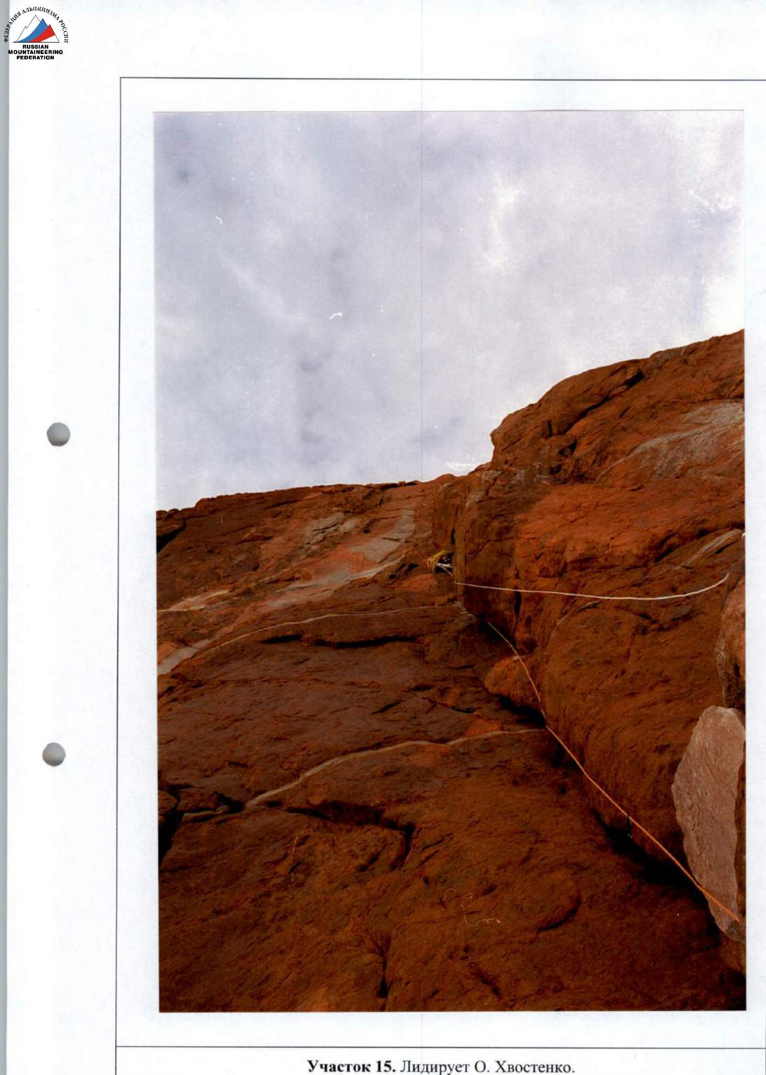
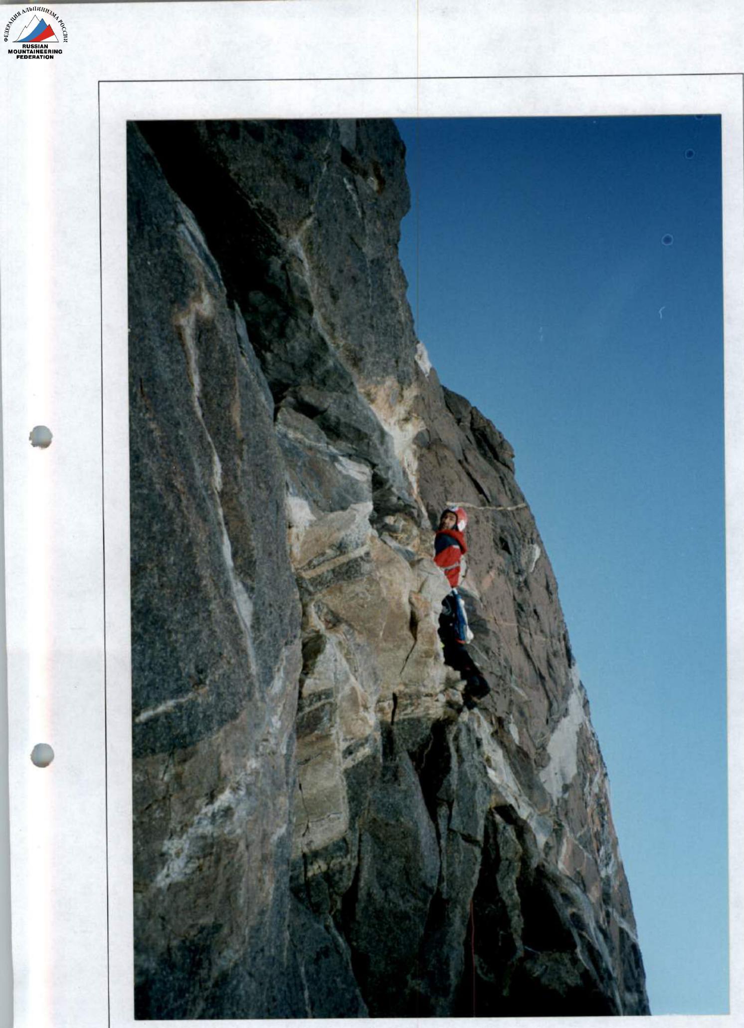
Section 3. O. Khvostenko is leading.
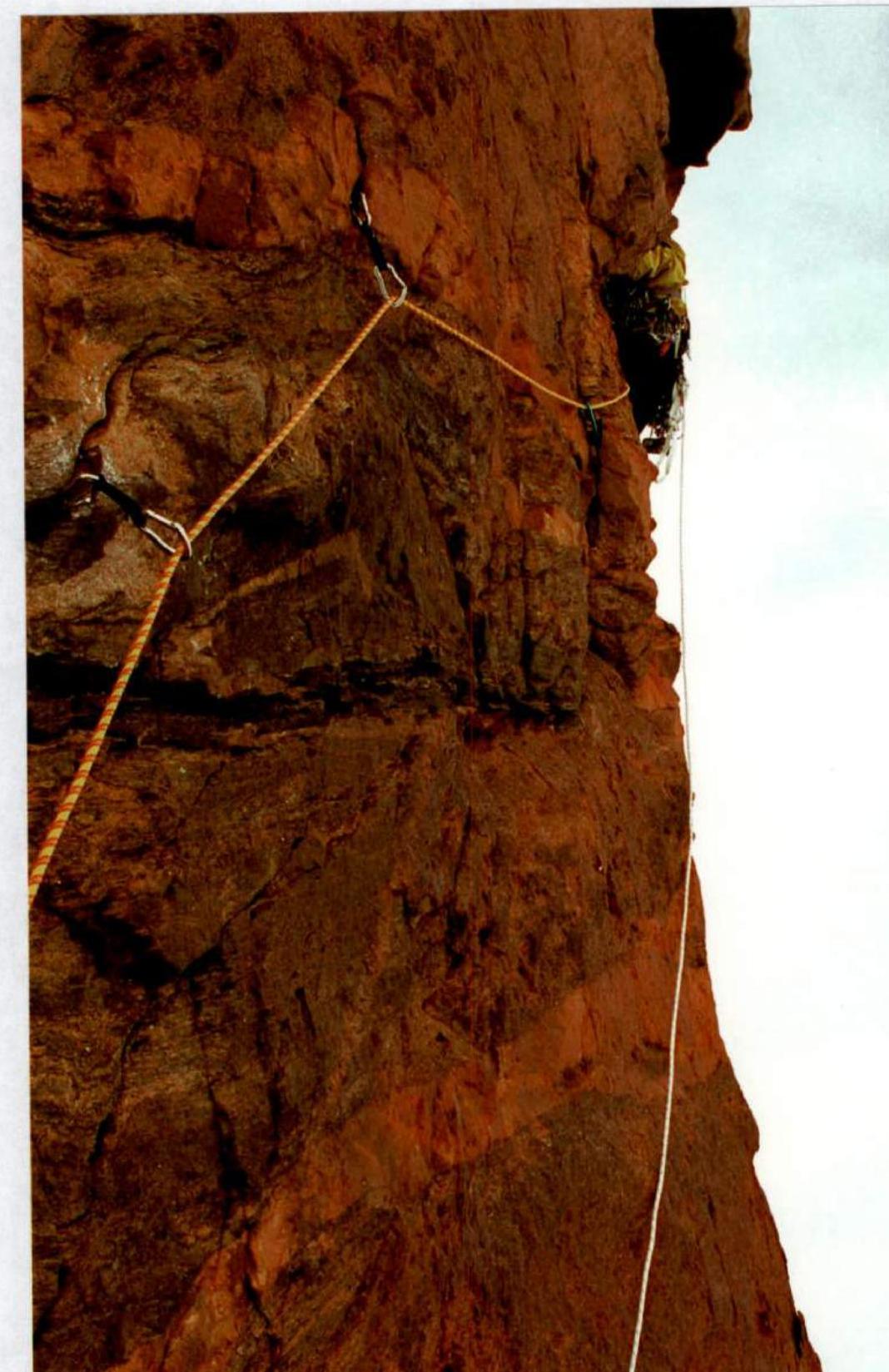
Sections 4, 5, 6.
Section 6. O. Khvostenko is leading.
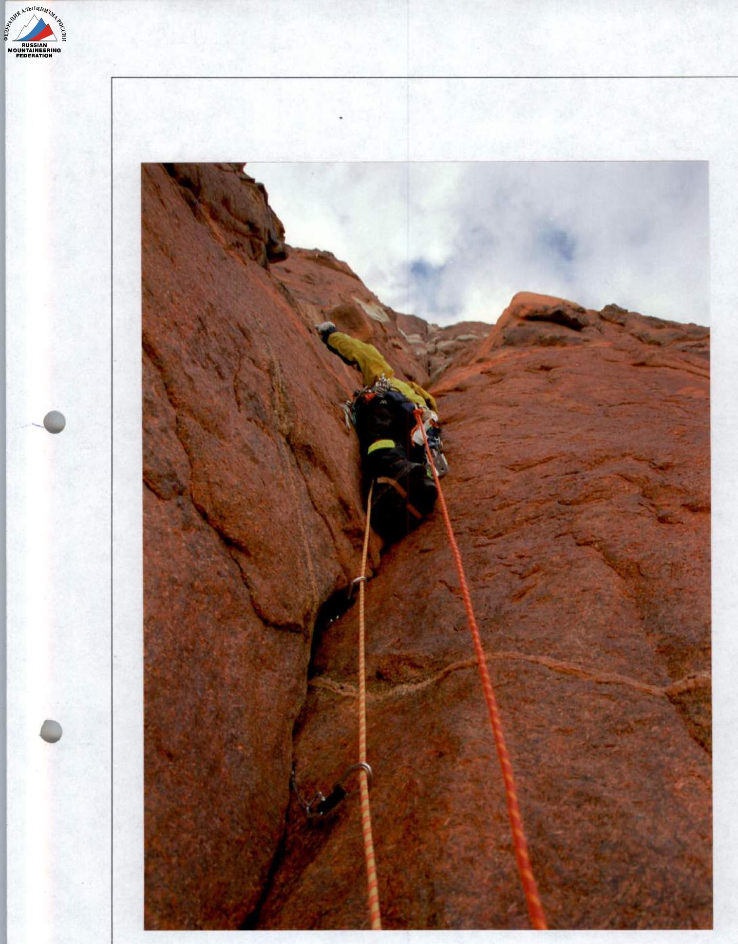
Section 7. O. Khvostenko is leading.
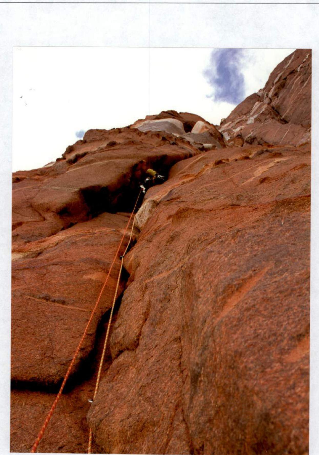
Section 8. O. Khvostenko is leading.
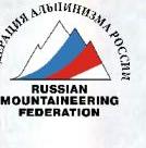
Section 11. O. Khvostenko is leading.
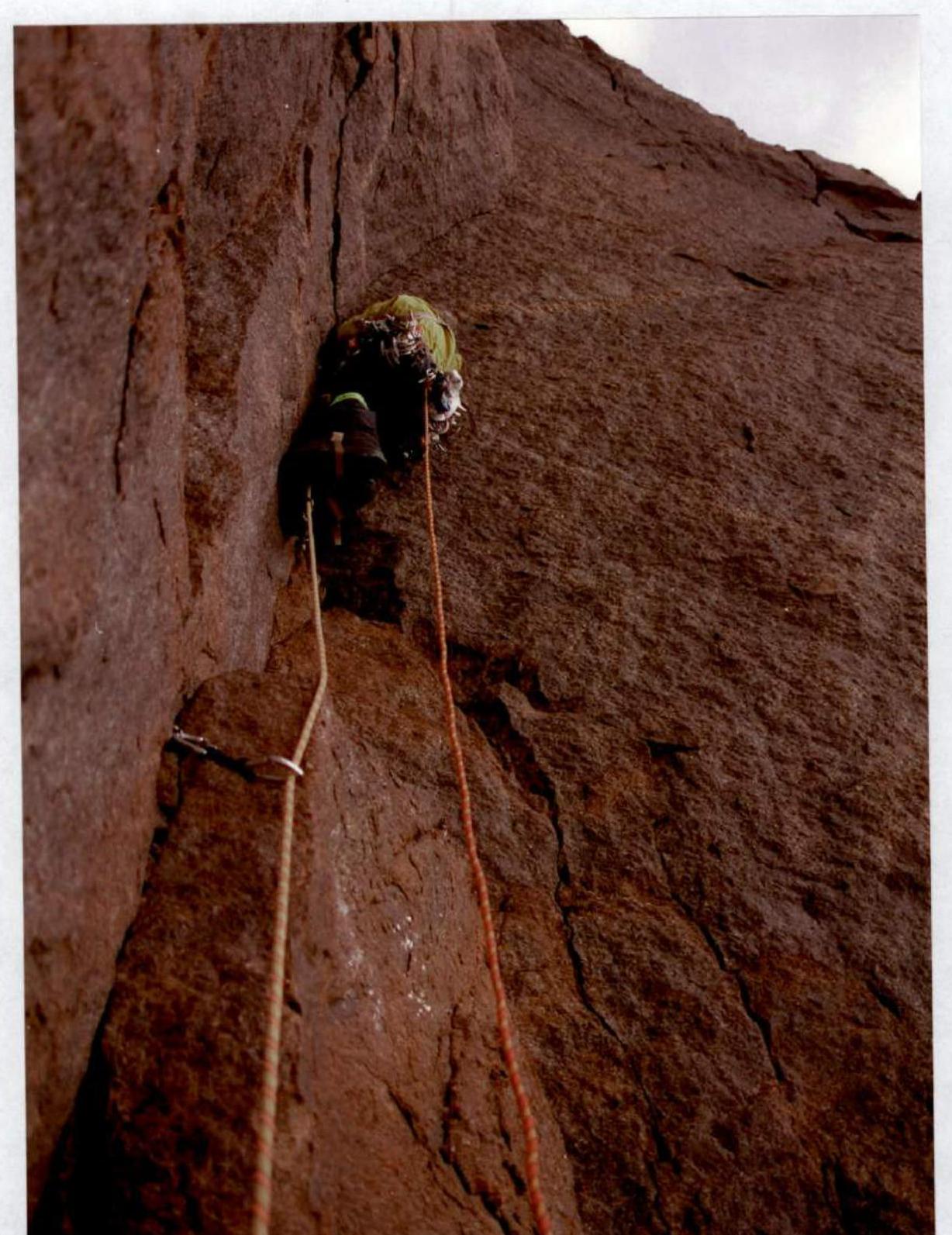
Section 15. O. Khvostenko is leading.
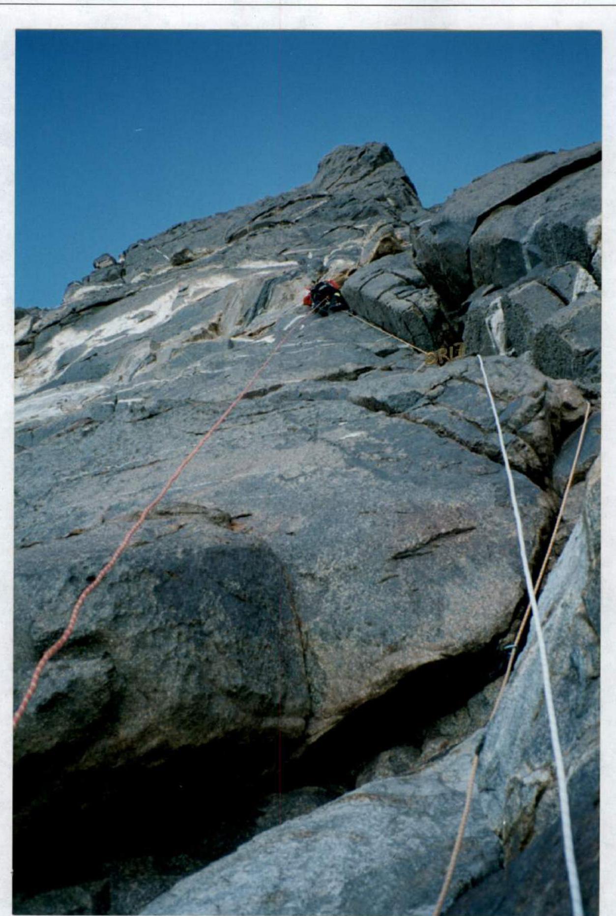
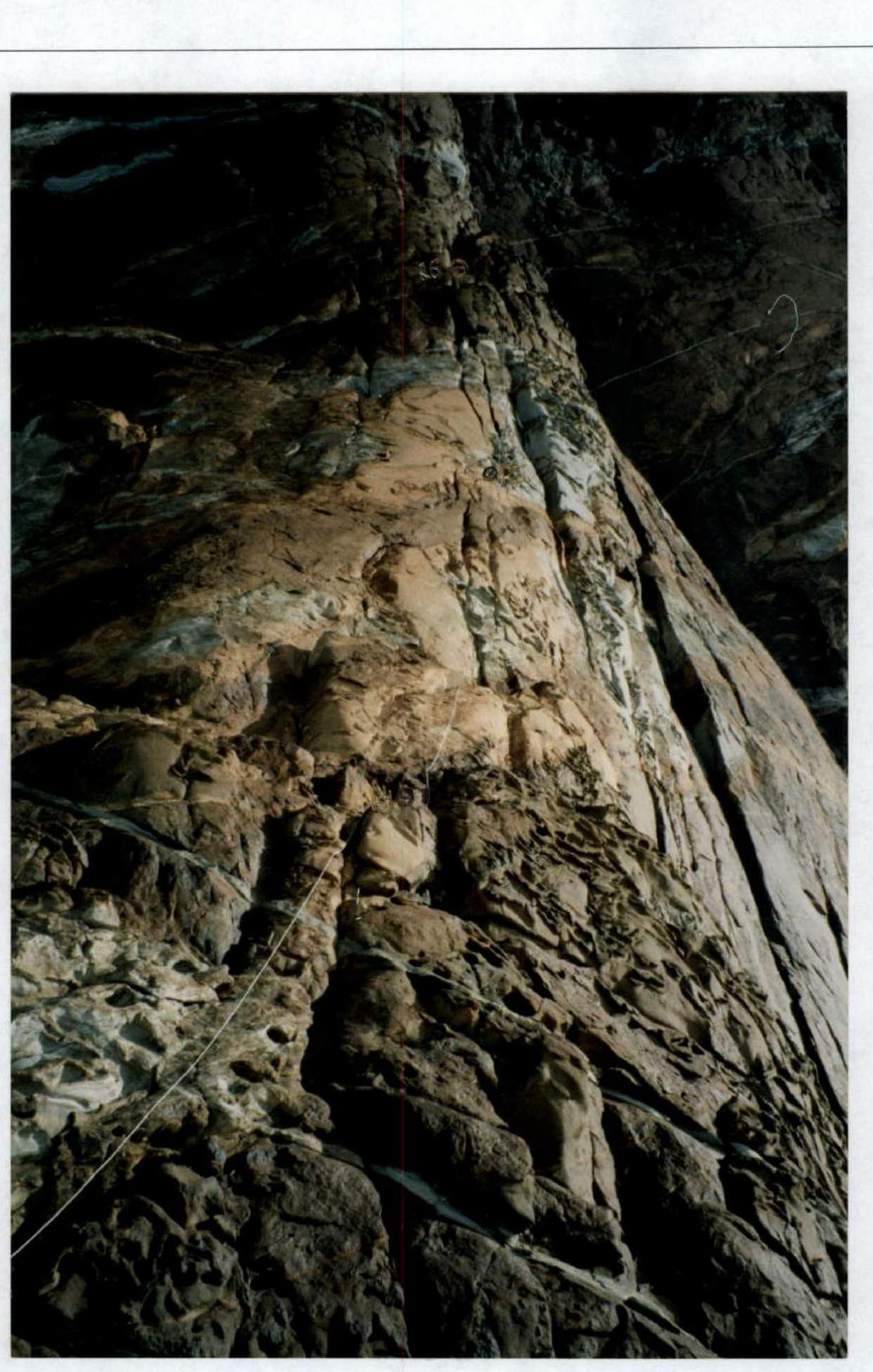
Sections 17, 18. P. Kuznetsov is leading.
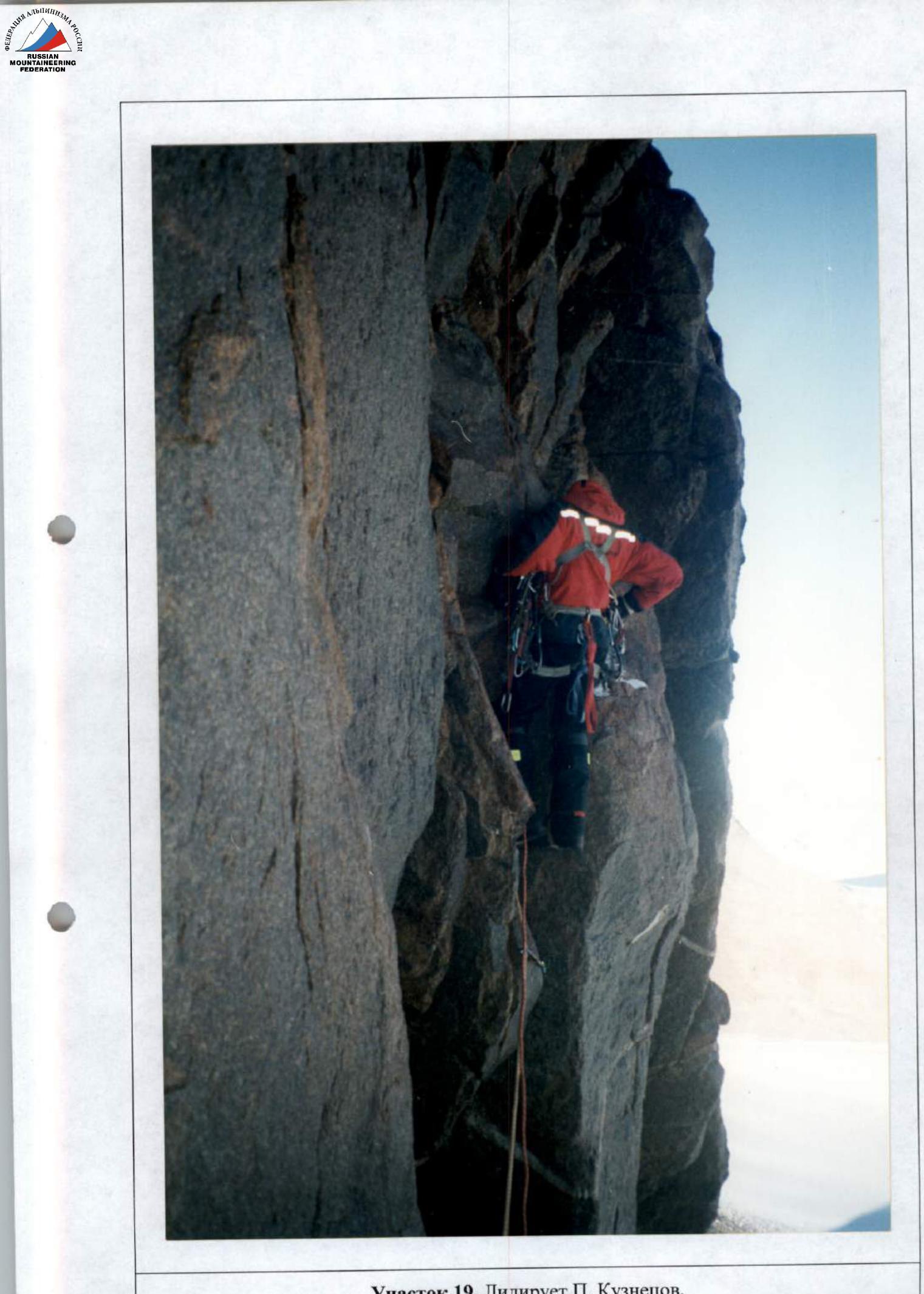
Section 19. P. Kuznetsov is leading.
Section 20. P. Kuznetsov is leading.