
Championship
Class of High-Altitude Ascensions
Report
On the ascent to the summit of Noshak 7492 m via the Northwest Ridge. 2011
Leader: Chizhik D.V. Participants:
- Apraksin Denis
- Shafikov Renat
- Bakhmurov Yuri
- Leontiev Valery
- Gromov Andrey
- Konstantin Korolev
Ascent Passport
- Afghanistan, Eastern Hindukush, Kazi Deh river valley
- Noshak_via Northwest Ridge
- Proposed — 5B, cat. diff.
- Route type: Combined
- Height difference of the route: 2492 m
Route length: 4000 m. Length of sections:
- 3 cat. diff. — 1200 m
- V cat. diff. — 200 m. Average steepness:
- main part of the route — 30degrees
- entire route — 40degrees
- Pitons left on the route: total 0; including bolted 0. Pitons used on the route: bolted stationary0, including ITO 0, bolted removable — 0including ITO 0. Total artificial support points (ITO) used — 0
- Team's walking hours: 38 h,5days
- Leader: surname, first name, patronymic sport. rank Chizhik Dmitry Vladimirovich 2nd sport. rank Participants: Apraksin Denis, Shafikov Renat, Bakhmurov Yuri, Leontiev Valery, Gromov Andrey, Konstantin Korolev
- Coach:
- Departure to the route: August 25, 2011 7:00 AM
Summit departure: August 28, 2011 2:30 PM Return to Base Camp: August 29, 2011 7:30 PM
Entry into the region was via Tajikistan, Ishkashim settlement. Visas were obtained in Khorog city. 30 km drive along the Panj River to Kazi Deh village.
In the Kazi Deh river valley, according to locals, there are uncleared minefields. They are located:
- on the old road along the valley floor;
- near and above the confluence of the Obi-Safed river.
A new road is built up the slope. The trail is carefully lined with stones. It's better not to deviate from it.
At 4600 m, there's an abandoned base camp — Iranian. However, we decided to set up our own base camp at 5000 m. It's closer to the glacier's water source than the previous camp.
General photo of the summit
Route via the northwest ridge. First ascended by Japanese climbers in 1960.
Route description:
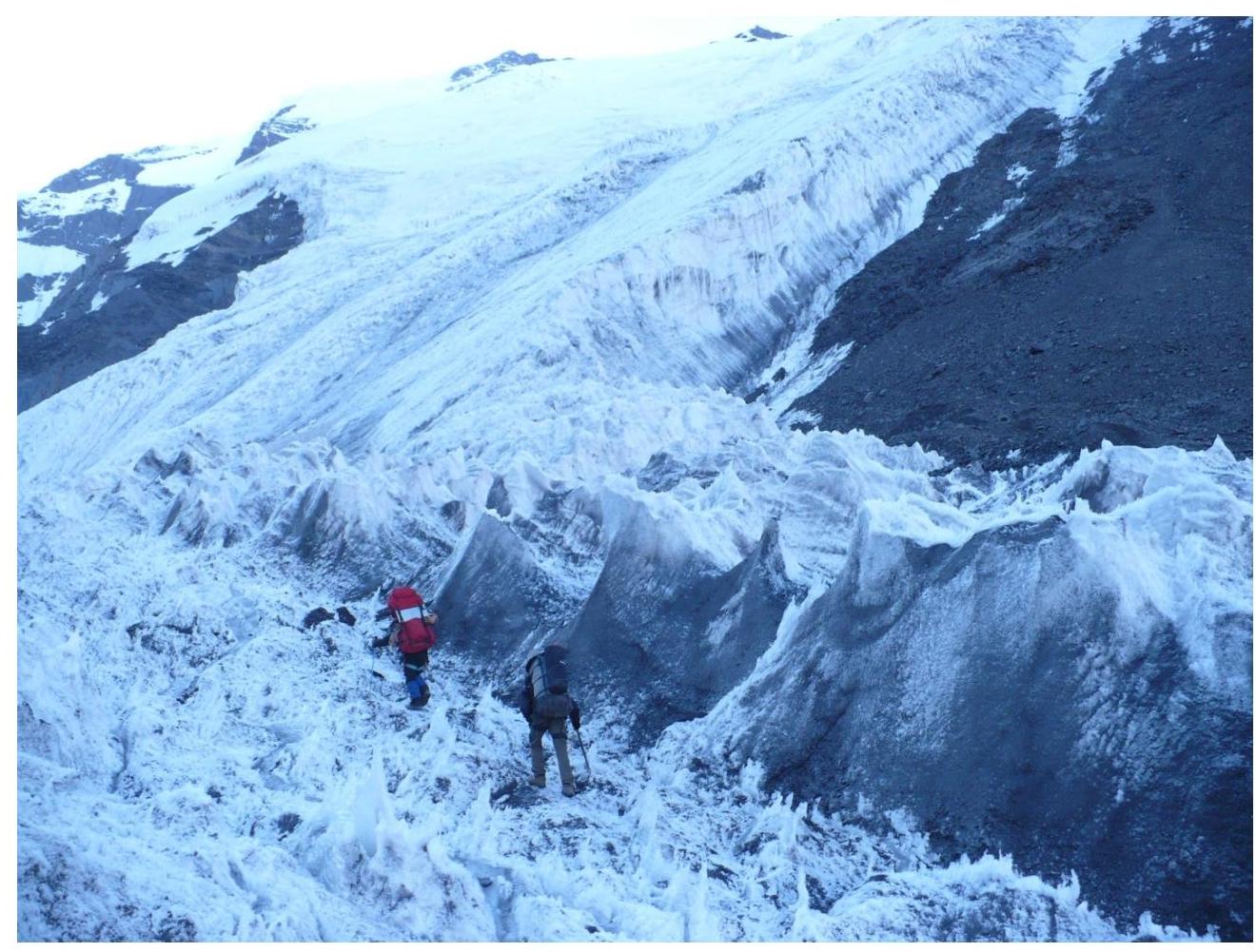
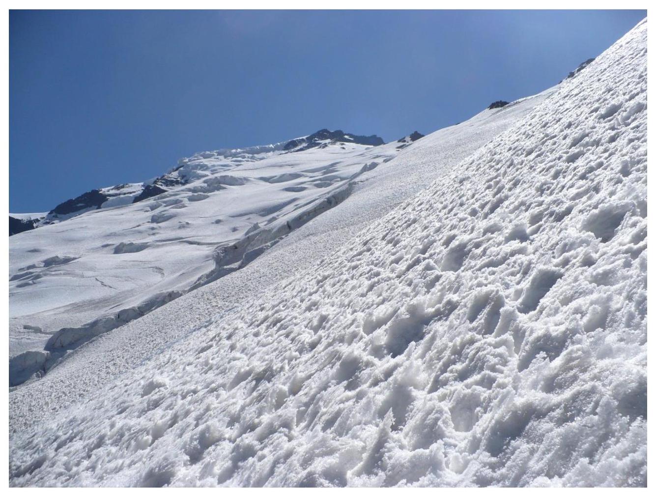
- *R0–R1. 450 m.**Ice ridge, 50 m wide, with 30 cm crampons. Steepness 30–40°. Open and closed crevasses. Simultaneous belay. Convenient spot for tents at the end of the section.
- **R1–R2. 900 m.**Ice ridge, 30°, occasionally up to 45°. Same slope character. All rocks are bypassed by traversing the slope to the left. Convenient spots for camps at the end.
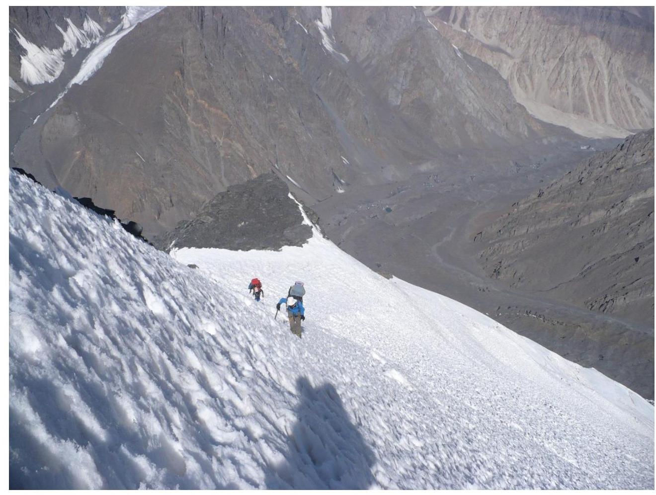
- **R2–R3. 150 m.**Snow-ice slope, 30°, with rock outcrops. Main rock outcrops are bypassed to the left.
- **R3–R4. 200 m.**Snow-ice slope, up to 35°. Deep, loose snow almost knee-deep. We try to bypass it via rock outcrops when possible. We move left of the hanging glacier's outcrop at 6900 m plateau and right of the main rock massif — towards snow couloir #2, cutting through the rock belt.
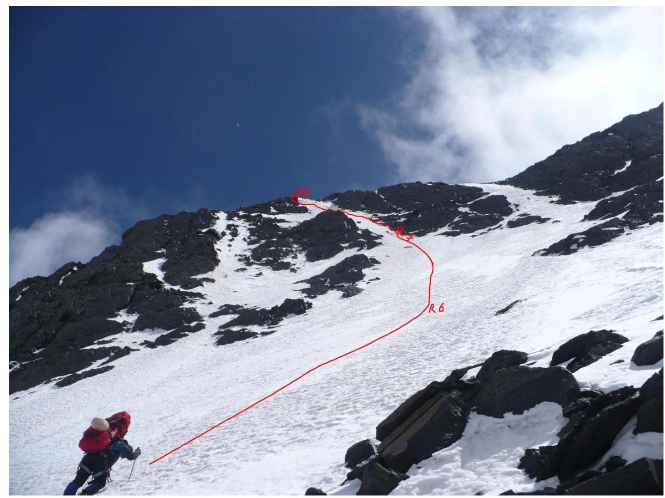
- **R4–R5. 45 m.**Rock-snow-ice slope, 45°. We place a rope. Anchor to a protruding rock.
- **R5–R6. 55 m.**Snow-ice slope, 45–50°. Rope. Anchor — ice axe.
- *R6–R7. 60 m.*Snow-ice slope, 55°. Rope. Anchor — rock outcrop at the start of the couloir.
- **R7–R8. 40 m.**Snow-rock-ice couloir, 60°. Last 7 m — 65–70°. Snow doesn't hold at the end, we have to climb out of the couloir to the left via rocks. Anchor to a protruding rock.
- **R8–R9.**Snow plateau, 400 m wide. Closed crevasses. Movement in teams.
- **R9–R10. 350 m.**Snow-rock-ice slope, steepness 35–40°. Exit to the pre-summit ridge. Simultaneous belay.
- **R10–R11. 250 m (section length — 2 km).**Rock-snow-ice ridge, 5 to 30 m wide. Steepness up to 30°. Simultaneous belay. Exit to the summit.
**Tactical actions of the team.**Initially, we planned to pre-process the rock belt (6650–6850), then descend to base camp (5000). However, during the ascent, we decided to go for the summit directly, as we didn't want to repeat the same route twice.
August 25, 2011
Started the ascent. 5 people. Reached the intermediate camp at 5450 m.
August 26, 2011
Two participants felt unwell. Went down. Apraksin, Bakhmurov, and Chizhik ascended to camp 6350 m.
August 27, 2011
Overcame the rock belt. Set up camp on the 6850 m plateau.
August 28, 2011
Reached the rock ridge. Bakhmurov returned from the assault camp due to a crampon breakage. Reached the summit at 2:30 PM. 6 hours 30 minutes from camp.
August 29, 2011
Waited for the sun to come out and descended via the same route.
Start of ascent
On the way to camp 5450 m
On the way to camp 6350 m
On the way to camp 6850 m
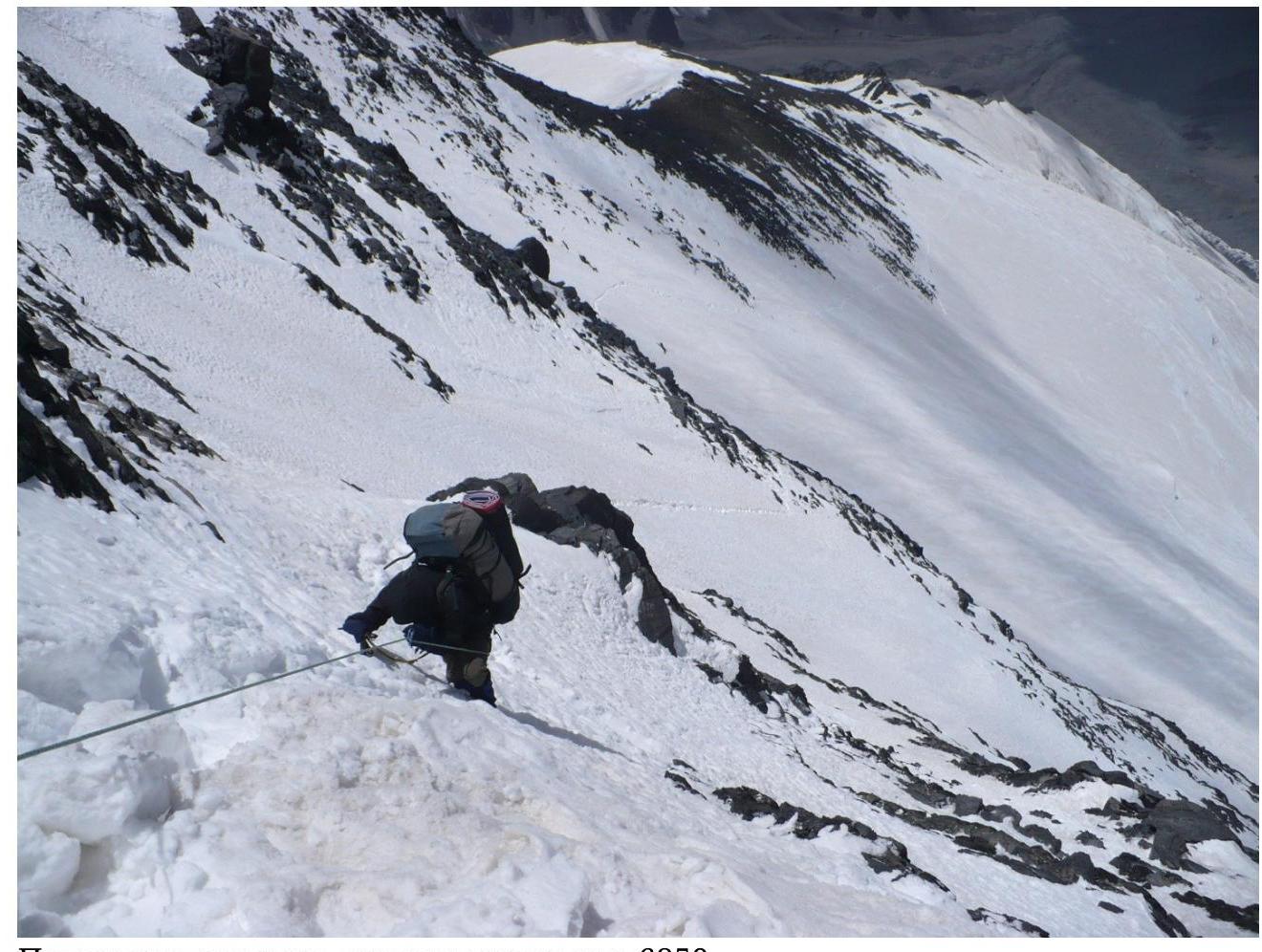
Last rope before reaching 6850 m
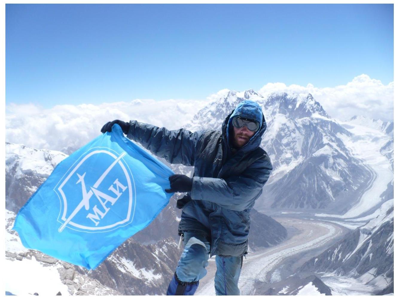
At the summit
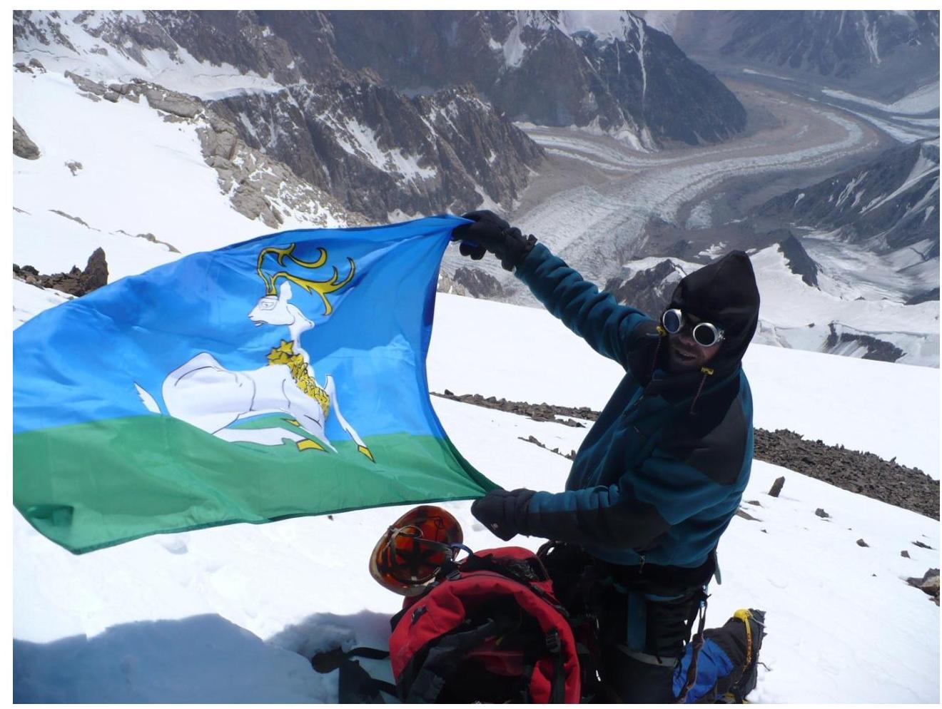
At the summit
Comments
Sign in to leave a comment