Passport
- Technical category.
- Indian Himalayas, Garhwal.
- Thalay Sagar peak (6904 m), via the center of the northern wall (“High Voltage”).
- Proposed route — 6B category of difficulty, first ascent.
- Elevation gain — 1480 m, total route length — 1815 m, including 1325 m of wall climbing.
Length of sections by category of difficulty:
- 5th category — 305 m.
- 6th category — 920 m.
Average steepness:
- Main part of the route — 73°
- Entire route — 66°
- Pitons used:
| Rock | Nuts | Ice | Bolts | Sky-hooks |
|---|---|---|---|---|
| 132/46 | 217/42 | 106/23 | 7/7 | 21/21 |
- Team's total climbing time — 76 hours, total days — 12, including 1 day for preparation.
- Overnight stays: on a platform.
- Team leader: Klenov Alexander Valerievich, Master of Sports of International Class (MSMK), home address: 620144, Yekaterinburg, Sheinkmana St., 128–125. Team members: Bolotov Alexey Vasilievich, Master of Sports (MS), Davy Mikhail Marenglenovich, MSMK, Pershin Mikhail Valerievich, MSMK.
- Coach: Ostanin Viktor Vasilievich, Master of Sports (MS), home address: 620003, Yekaterinburg, Rodonitovaya St., 30, apt. 120.
- Approach to the route: May 16, 1999.
Reached the summit: May 27, 1999. Return: May 30, 1999.
- Organizing body: Committee for Physical Culture and Sports of Sverdlovsk Region. 620151, Yekaterinburg, Malysheva St., 60.
Area Overview
The Garhwal mountain range is located in the Northeast of India, near the borders with China and Nepal. The journey to Garhwal begins from Delhi. We chose to travel to Delhi via Tashkent using Uzbekistan Airways from Yekaterinburg–Tashkent–Delhi. From Delhi, the journey continues by road. We rented a small bus and covered the route Delhi–Rishikesh–Uttarkashi–Gangotri over three days, with overnight stays at intermediate points. From Gangotri, a trail leads directly upwards with a significant elevation gain. The base camp is situated at an altitude of 4700 m near the Kedartal Lake. The ascent from Gangotri takes two days with an intermediate camp. Over these two days, we gain 1700 m in elevation. The ascent follows a good trail, although the slopes are occasionally rockfall-prone. The area is relatively frequented, but most visitors are trekkers and pilgrims whose path goes to the lake and back down. There are few mountaineering expeditions — about five or six in the entire Garhwal region per season. The climbing season in Garhwal is May–June and August–September. The approach to the route from the base camp with a load takes about 7–8 hours. The path initially follows a moraine along a trail marked by tourists, then crosses the glacier to the left and continues upwards, bypassing the icefall on the right towards a visible snowy-icy saddle.
Route Profile
M 1:6000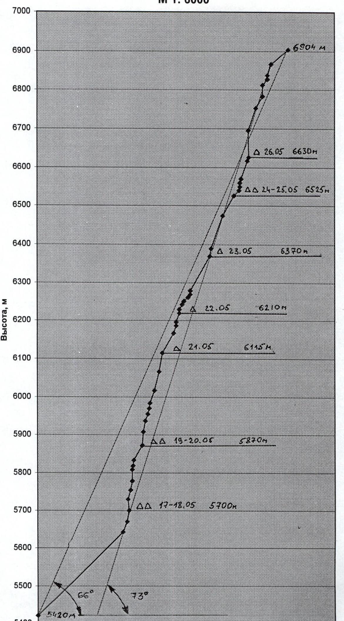
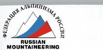
Bhrigupanth (6772 m)
Thalay Sagar (6904 m)
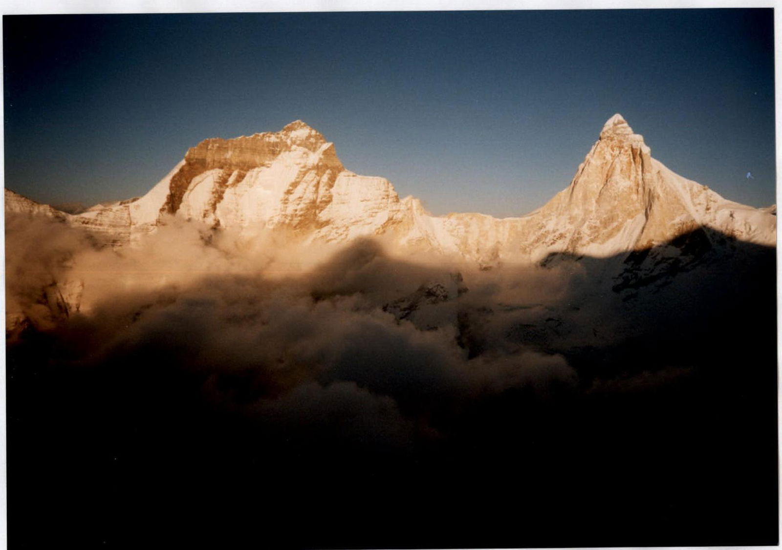
Technical Route Photo
Team's Tactical Actions
The team's tactical actions were determined based on previous experience in wall climbing and the specifics of this ascent. Many of the world's strongest climbers from all continents have attempted to ascend the northern wall of Thalay Sagar via a direct route, but all of them started via the central ice couloir, and only two teams reached the summit, bypassing the upper slate belt on the right or left. Therefore, the team prepared with particular thoroughness. Team members:
- regularly trained on artificial and natural climbing walls,
- have a "free climbing" level of 6C+, 7A.
In the winter, team members traveled to the mountains, where they climbed complex wall routes on:
- Ak-su peak (M. Pershin, first place at the Winter Championship of Russia),
- Grand Capucin peak (A. Klenov and M. Davy, third place at the Winter Championship of Russia).
In addition to participant training, special attention was given to equipment for this ascent. A tent with a new design platform was manufactured, featuring a curved stiffening rib in the middle of the bottom and a strong, high slope for protection against rocks, as the upper part of the wall has a belt of destroyed, rockfall-prone slates. This allowed for a "roof over their heads" and satisfactory rest during overnight stays up to 6600 m in bad weather conditions and the complete absence of ledges on the route. For the lower part of the route, the following were manufactured:
- Drill bits,
- Bolt hangers,
- Sky-hooks of original design.
For pulling loads on steep sections, lightweight and strong block-brakes of original design, manufactured by "Ural-Alp," were used.
The team's movement on the route was organized in a traditional manner. The first climber ascended without a backpack on a double rope (one with UIAA marking), with one of the ropes fixed as a handrail. The others climbed along the handrails with backpacks, using top or bottom belay. The platform was carried in an assembled state, allowing for quick organization of overnight stays on any terrain. Each day, a designated rope team worked ahead, and usually, there was a change of leader in the second half of the day. Each participant took turns leading — this allowed for an even distribution of the ascent's load. During the organization of a bivouac, the route was surveyed. On some days, when only two or three rope lengths were covered due to bad weather and complex terrain, the camp was not moved for safety reasons, resulting in double overnight stays. However, overall, the ascent was undoubtedly conducted in an alpine style, rather than a "capsule" style. This is particularly valuable for such a route, which is effectively a high-altitude technical ascent.
Diet regimen:
- Hot meal in the morning,
- Hot meal in the evening,
- Individual snacks during the day.
Throughout the route, there was stable radio communication with the base camp, where coach Viktor Ostanin and a liaison officer were stationed. In case of an emergency on the route, the liaison officer could call a helicopter and organize a rescue team from the Indian Army's mountain troops.
UIAA Scheme
M 1:2000
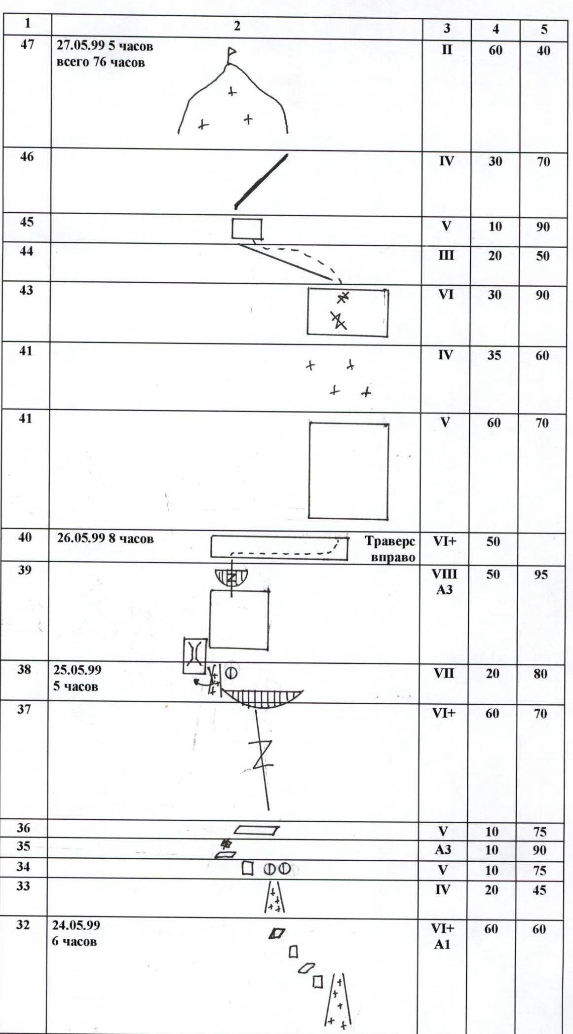
| Section # | Date, Time | Difficulty UIAA | Length, m | Steepness, ° |
|---|---|---|---|---|
| 0 | May 16, 1999, 3 h | III | 380 | 45 |
| 1 | V | 30 | 70 | |
| 2 | VII | 30 | 80 | |
| 3 | May 17, 1999, 7 h | VIII–А3 | 30 | 95 |
| 4 | VII А2 | 25 | 75 | |
| 5 | VIII–А3 | 25 | 80 | |
| 6 | VII А3 | 30 | 90 | |
| 7 | May 18, 1999, 6 h | VI+ А2 | 10 | 75 |
| 8 | VI+ А3 | 15 | 80 | |
| 9 | V | 45 | 60 | |
| 10 | May 19, 1999, 8 h | VI+ А2 | 35 | 85 |
| 11 | VII А3e | 30 | 80 | |
| 12 | V | 20 | 70 | |
| 13 | VI+ А2 | 15 | 75 | |
| 14 | May 20, 1999, 6 h | VIII А3e | 15 | 80 |
| 15 | VIII–А3 | 35 | 70 | |
| 16 | VIII–А3 | 50 | 75 | |
| 17 | May 21, 1999, 8 h | VIII–А3 | 50 | 80 |
| 18 | VI+ А2 | 60 | 60 | |
| 19 | VI+ | 20 | 70 | |
| 20 | VII А3 | 10 | 90 | |
| 21 | V | 25 | 60 | |
| 22 | VII А3 | 10 | 90 | |
| 23 | V | 15 | 60 | |
| 24 | VI+ | 10 | 60 | |
| 25 | IV | 15 | 45 | |
| 26 | IV | 10 | 45 | |
| 27 | V+ | 10 | 50 | |
| 28 | May 22, 1999, 7 h | VIII А3 | 10 | 90 |
| 29 | VIII–А1 | 105 | 60 | |
| 30 | VI+ | 20 | 80 | |
| 31 | May 23, 1999, 7 h | V | 90 | 70 |
| 32 | May 24, 1999, 6 h | VI+ А1 | 60 | 60 |
| 33 | IV | 20 | 45 | |
| 34 | V | 10 | 75 | |
| 35 | А3 | 10 | 90 | |
| 36 | V | 10 | 75 | |
| 37 | VI+ | 60 | 70 | |
| 38 | May 25, 1999, 5 h | VII | 20 | 80 |
| 39 | VIII А3 | 50 | 95 | |
| 40 | May 26, 1999, 8 h | Traverse right VI+ | 50 | – |
| 40 | V | 60 | 70 | |
| 41 | IV | 35 | 60 | |
| 41 | V | 60 | 70 | |
| 43 | VI | 30 | 90 | |
| 44 | III | 20 | 50 | |
| 45 | V | 10 | 90 | |
| 46 | IV | 30 | 70 | |
| 47 | May 27, 1999, 5 h | II | 60 | 40 |
Total 76 h.
Route Description by Sections
Section R0. Snow-ice slope with two bergschrunds.
Section R1–R4. To the right of the monolithic wall, via an internal corner.
Section R5–R9. Upward via cracks, then mixed terrain left-upward under the monolithic wall.
Section R10. Upward via a crack in ITO (Artificial Technical Obstacles) to the end.
Section R11. Upward in ITO on sky-hooks, belay via bolt hangers, pendulum right into a narrow internal corner with ice.
Section R12–R13. Upward via an internal corner and crack to the end.
Section R14. A slab overcome on sky-hooks.
Section R15–R17. Internal corner with several cornices.
Section R18–R19. Mixed terrain left-upward.
Section R20. Overhanging slab with a crack.
Section R21–R23. Left-upward via small walls and internal corners, snowy rocks.
Section R24–R26. Via a monolithic slab onto a snowy-icy field.
Section R27–R28. Via snowy rocks through an overhang of frozen "live" rocks.
Section R29–R30. Snowy rocks ending in a chimney with ice, leading into the central couloir of the North wall.
Section R31–R32. Up the couloir to the end, then via rocks left-upward.
Section R33–R36. Via monolithic snowy rocks, first upward, then bypassing a large cornice on the left via a vertical crack in ITO.
Section R37. An extended fault in crumbling rocks, very unreliable belay.
Section R38. Bypassing a cornice on the left, then upward via ice, pendulum left onto rocks.
Section R39. Very crumbling and steep rocks, danger of large block falls from the cornice.
Section R40. Traverse right via crumbling rocks and ice.
Section R41. Climbing via a slab, danger of "live" rocks.
Section R42. Ice patch.
Section R43. Via a chimney, then via a crack, crumbling rocks leading to the ridge.
Section R44–R46. Ridge with pinnacles.
Section R47. Snow-ice dome, with a cornice on the northern side at the summit.
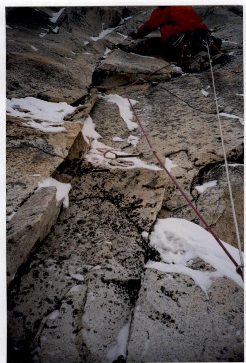
Photo 1. A. Klenov on section #5.
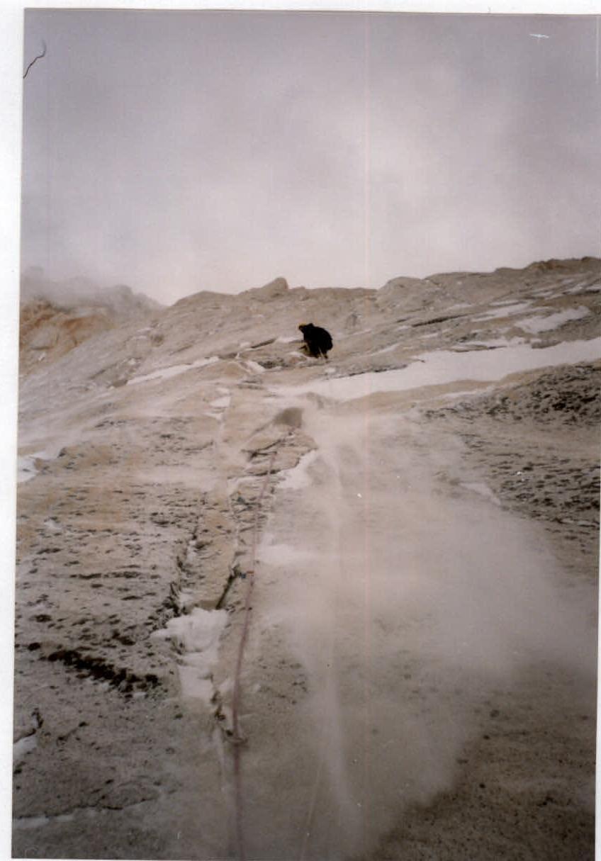
Photo 2. M. Davy on section #10.
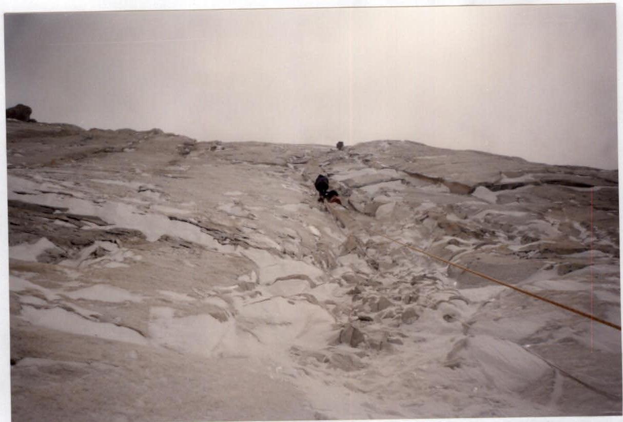
Photo 3. Sections #13, 14, 15.
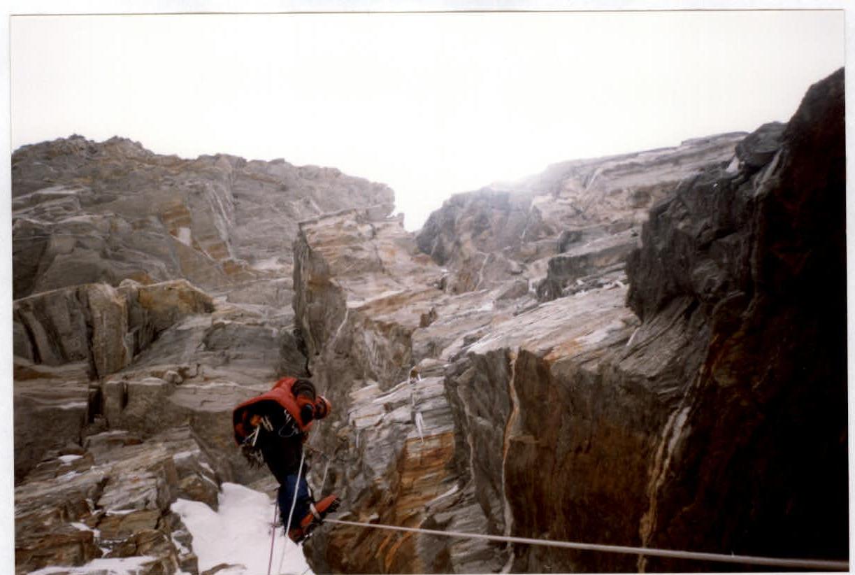
Photo 4. A. Klenov on section #39.
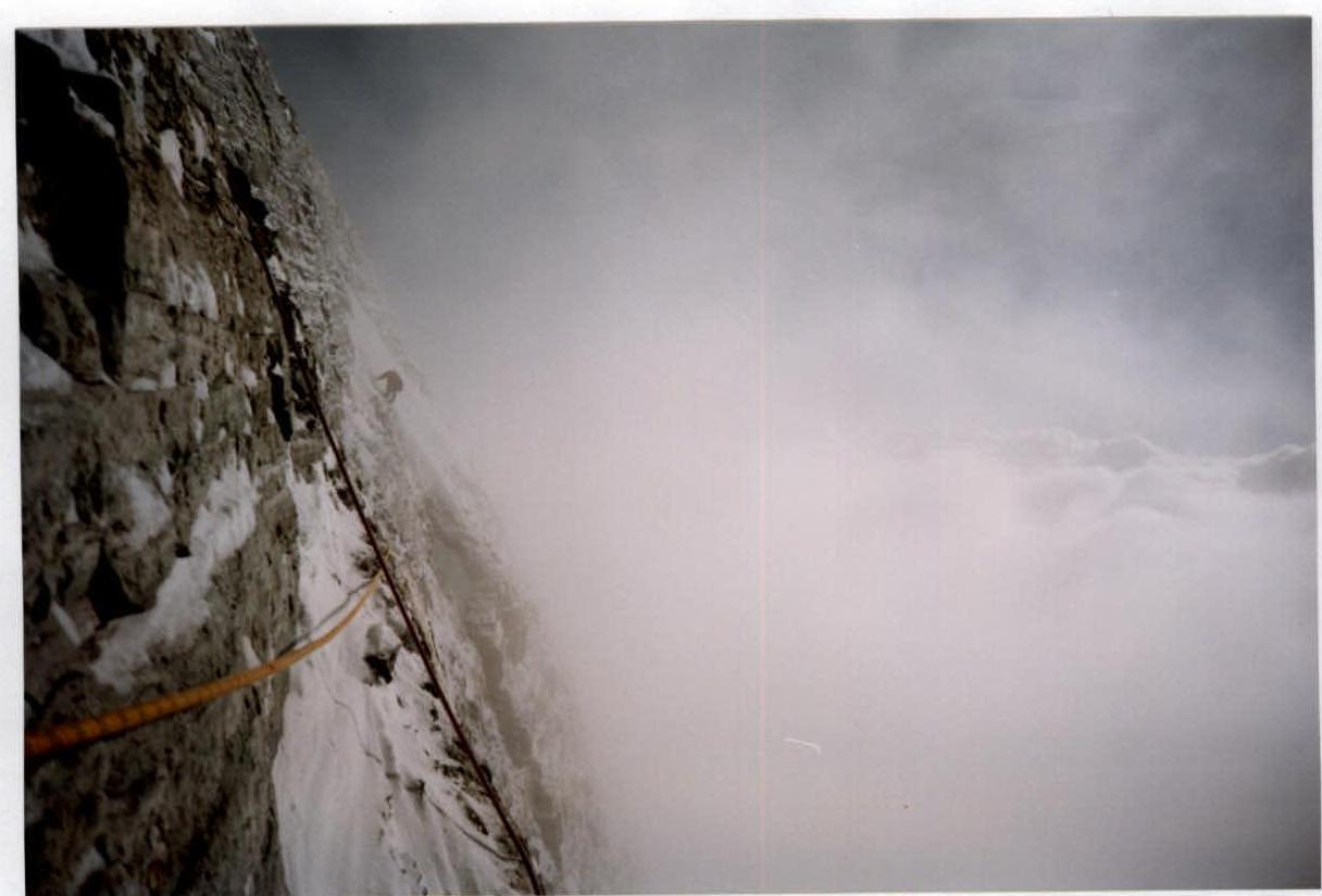
Photo 5. Traverse on section #40.
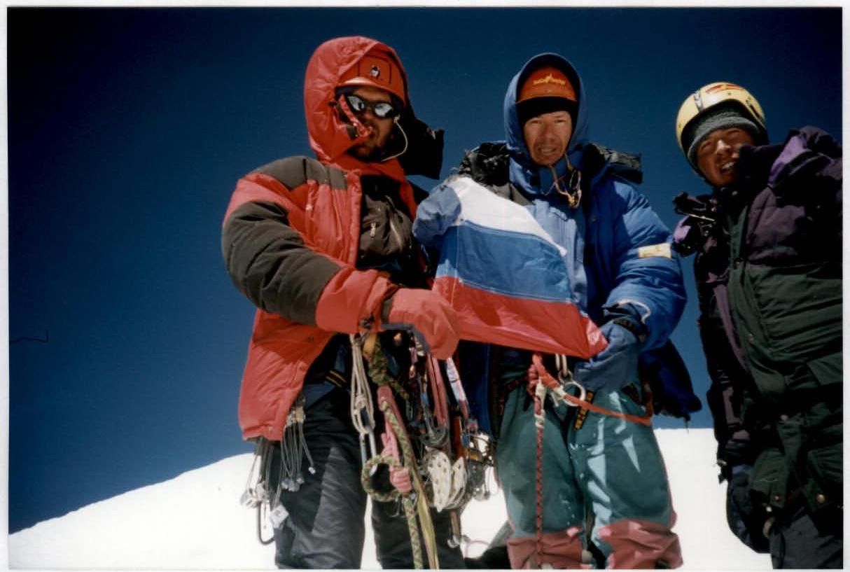
Photo 6. On the summit.
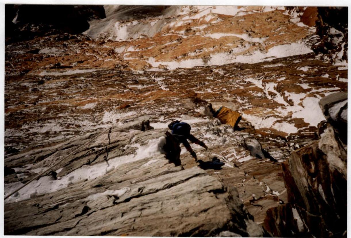
Photo 7. Descent from the summit to the storm camp. Sections #36–39.


