
Ascent Logbook
- Central China, Sichuan Province, Siguniang Gully, classified as "11.3. China"
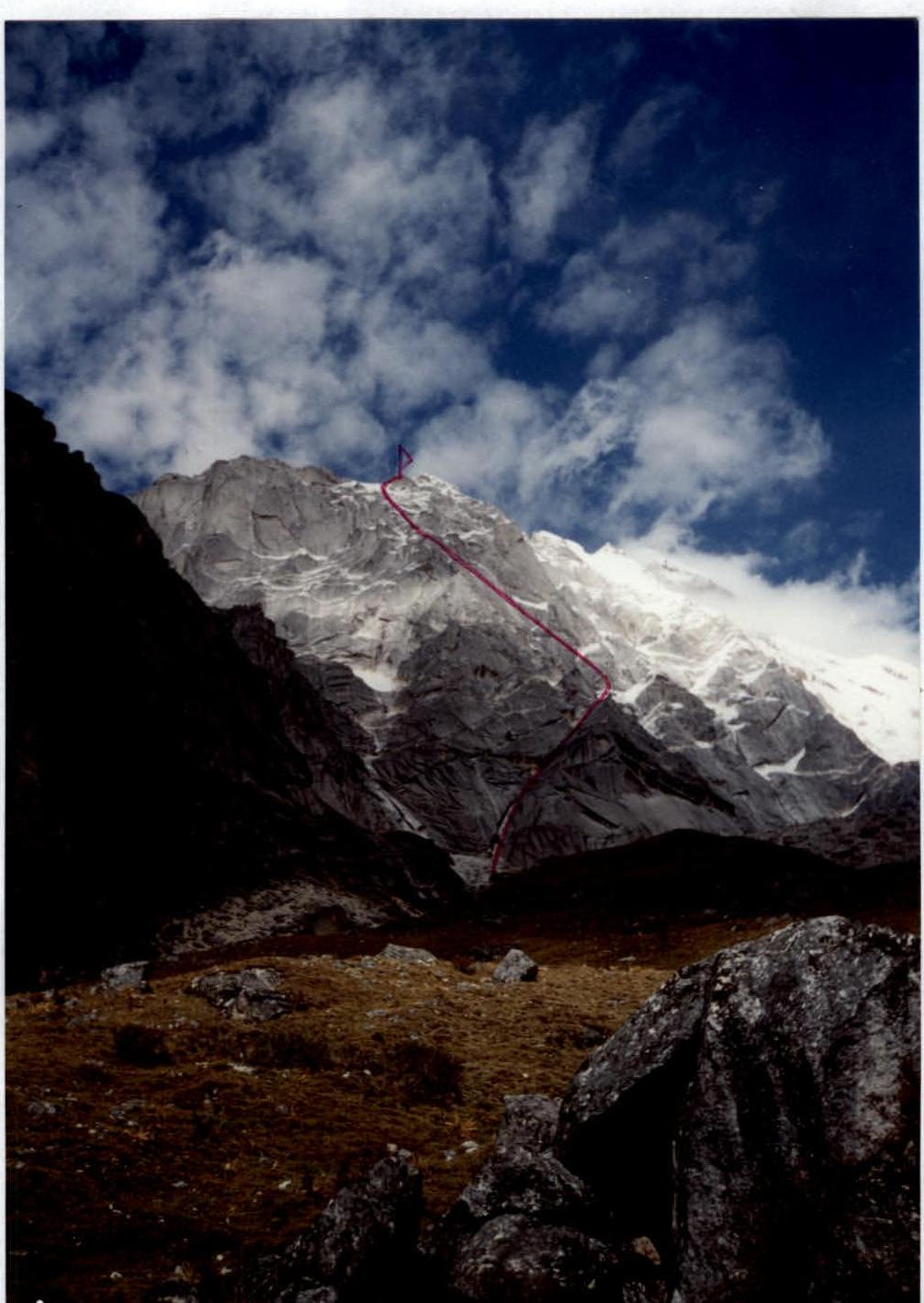
- Peak name: Siguniang(3) (6027 m), route name: via the left part of the south face
- Proposed - 6A category, first ascent
- Route type: combined
- Route elevation gain: 1407 m (by altimeter); including wall section: 1300 m. Route length: 1615 m. Length of sections: 5th category - 385 m, 6th category - 170 m. Average steepness: Main part of the route - 63°, entire route - 61°
- Pitons left on the route: total: 0 pcs., including bolted: 0 pcs. Pitons used on the route: Stationary bolted: 0 pcs., including ATO: 0 pcs. Removable bolted: 0 pcs., including ATO: 0 pcs. Total artificial support points (ATO) used: Pitons - 8 pcs., chocks - 5 pcs.
- Team's total climbing hours: 49 hours, 7 days
- Team leader: Igor N. Shapovalenko, Candidate Master of Sports Team members: Alexander V. Krasnolutsky, 1st class Randy Shantz, Canada
- Coach: I.N. Shapovalenko
- Departure for the route: 9:00, October 22, 2001 (with preliminary processing and a day of waiting due to bad weather) Summit reached: 15:00, October 25, 2001 Return to base camp: 19:00, October 26, 2001
Panoramic Photo of the Area with a General View of the Peak
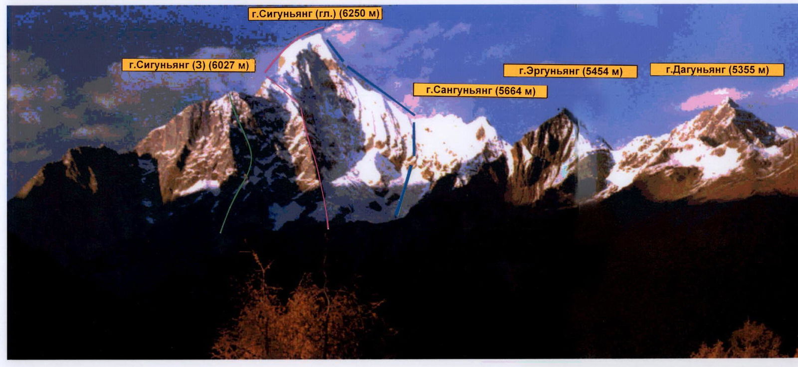
Photo taken in July 1994
- Blue - 1982 Japanese route
- Red - 1990 Japanese route
- Green - 2001 PFAiS route
Photo of the Wall Profile
 Hand-drawn profile of the route M 1:5000
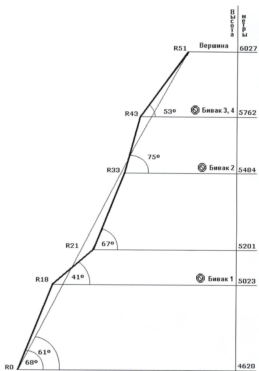
- Peak 6027 m
- R51
- R43 - Camp 3-4 (5762 m, 53°)
- R33 - Camp 2 (5484 m, 75°)
- R21 (5201 m, 67°)
- R18 - Camp 1 (5023 m, 41°)
- R0 (4620 m, 68°, 61°)
Overview of the Climbing Area
The mountain range where Siguniang peak is located is situated in the central part of Sichuan Province, People's Republic of China. Rilong town is the last point accessible by vehicle. From there, it takes 3-4 hours by a good trail to reach a large clearing opposite the western ridge of Siguniang peak, where the base camp is set up (3400 m). From the base camp, follow the valley upwards on a clear trail to the first moraine ridge, where there are cleared areas for tents and an upper base camp can be established (4525 m). To approach the route, cross the scree with a slight ascent towards a well-defined 400-meter gully. At its beginning, there's a cleared and safe spot for a tent (4620 m). The mountains in this area are primarily composed of fragile sedimentary rocks, particularly metamorphosed schist. However, the rocks forming Siguniang peak are robust, large-block granites that have intruded through the sedimentary rocks due to geological transformations. In October, the area is characterized by unstable weather. Periods of 2-3 days suitable for climbing are followed by bad weather with rain and snow, though not necessarily low temperatures. By the end of the month, snow can fall even in the lower base camp. From Rilong, a trekking trail leads through the valley and over two passes around Siguniang peak, with up to 700 people per day during peak season.

- Shenshan (Celestial Peak) 5413 m
- Siguniangshan (Mt. Siguniang) 6250 m
- Sanguniang 5664 m
- Erguniang 5454 m
- Daguniang 5355 m
- Rilong
- Balangshan (Mt. Balang) 4487 m
Ascent Graph
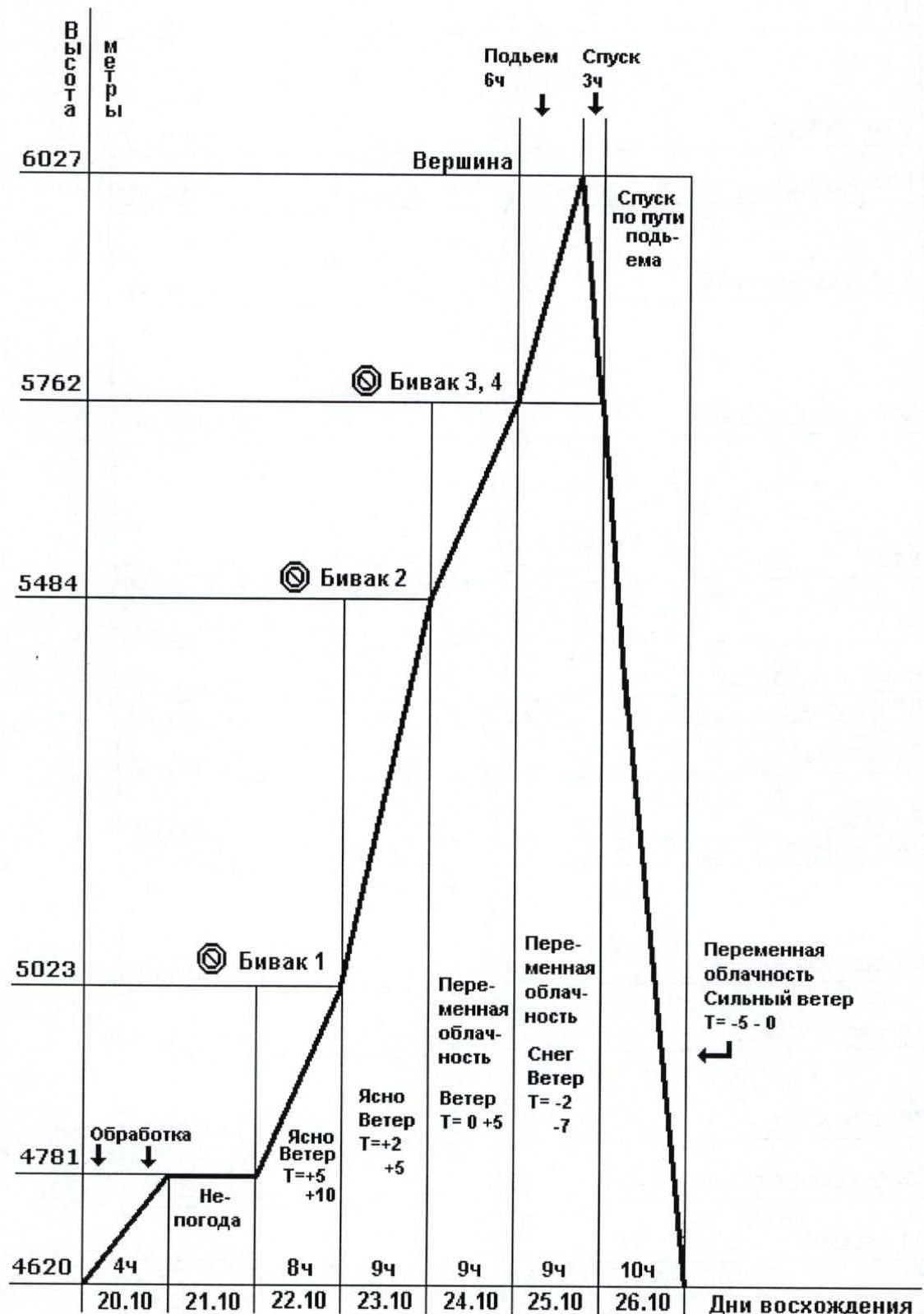
- Peak 6027 m
- Ascent 6 hours
- Descent 3 hours
- Descent via the ascent route
- Camp 3-4 (5762 m)
- Camp 2 (5484 m)
- Camp 1 (5023 m)
- Processing (4781 m)
- Bad weather (4620 m)
| Ascent Days | October 20 | October 21 | October 22 | October 23 | October 24 | October 25 | October 26 |
|---|---|---|---|---|---|---|---|
| 4 hours | 8 hours | 9 hours | 9 hours | 9 hours | 10 hours | ||
| Clear | Clear | Variable | Variable | Variable | Variable | Variable | |
| Wind | Wind | cloudiness | cloudiness | cloudiness | cloudiness | cloudiness | |
| T=+10°C | T=+2-5°C | Wind | Snow | Strong | |||
| T=0-5°C | Wind | wind | |||||
| T=-2-7°C | T=-5-0°C |
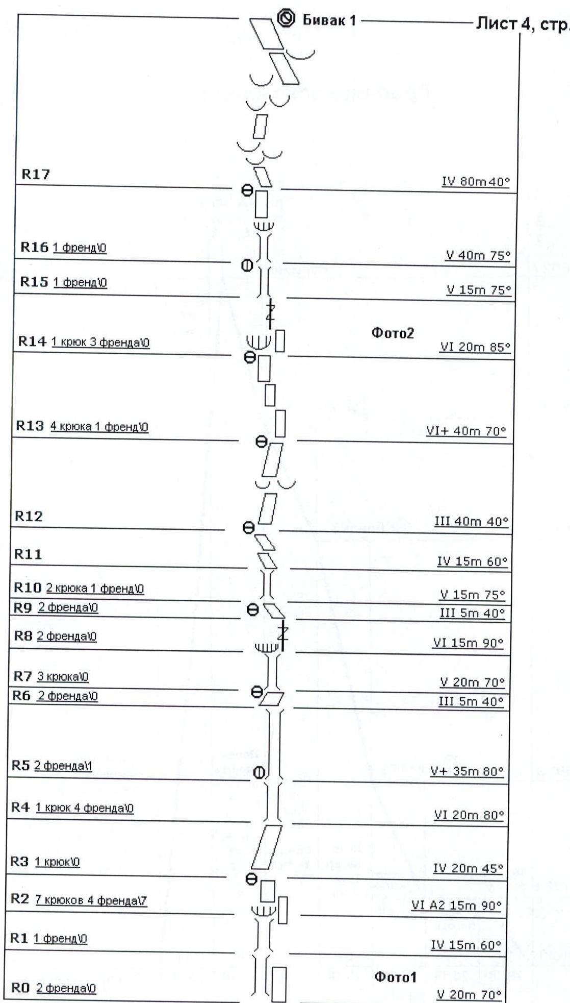
- R0 - 2 friends (5 20 m 70°)
- R1 - 1 friend (4 15 m 60°)
- R2 - 7 pitons, 4 friends (6 A2 15 m 90°)
- R3 - 1 piton (4 20 m 45°)
- R4 - 1 piton, 4 friends (6 20 m 80°)
- R5 - 2 friends (5+ 35 m 80°)
- R6 - 2 friends (3 5 m 40°)
- R7 - 3 pitons (5 20 m 70°)
- R8 - 2 friends (6 15 m 90°)
- R9 - 2 friends (3 5 m 40°)
- R10 - 2 pitons, 1 friend (5 15 m 75°)
- R11 (4 15 m 60°)
- R12 (3 40 m 40°)
- R13 - 4 pitons, 1 friend (6+ 40 m 70°)
- R14 - 1 piton, 3 friends (6 20 m 85°)
- R15 - 1 friend (5 15 m 75°)
- R16 - 1 friend (5 40 m 75°)
- R17 (4 80 m 40°)
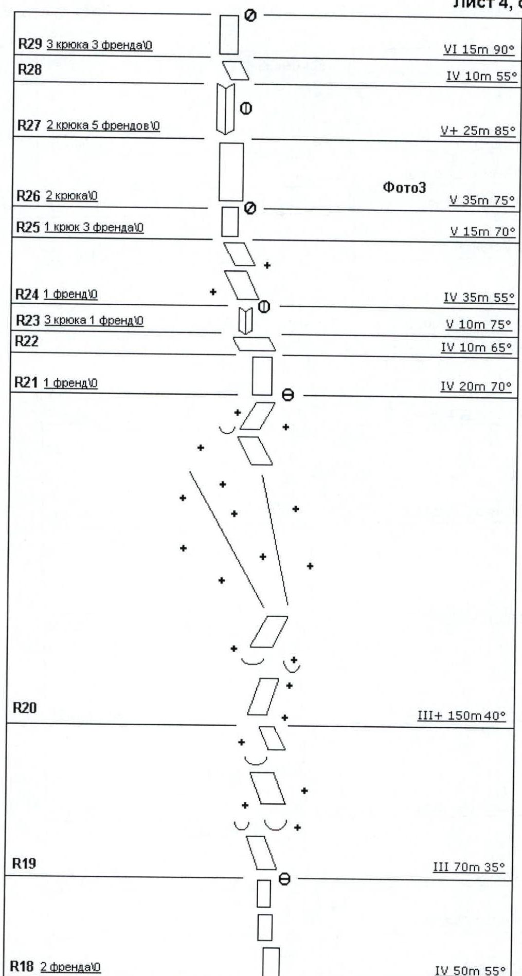
- R18 - 2 friends (4 50 m 55°)
- R19 (3 70 m 35°)
- R20 (3+ 150 m 40°)
- R21 - 1 friend (4 20 m 70°)
- R22 (4 10 m 65°)
- R23 - 3 pitons, 1 friend (5 10 m 75°)
- R24 - 1 friend (4 35 m 55°)
- R25 - 1 piton, 3 friends (5 15 m 70°)
- R26 - 2 pitons (5 35 m 75°)
- R27 - 2 pitons, 5 friends (5+ 25 m 85°)
- R28 (4 10 m 55°)
- R29 - 3 pitons, 3 friends (6 15 m 90°)
- R30 - 1 friend (3+ 25 m 55°)
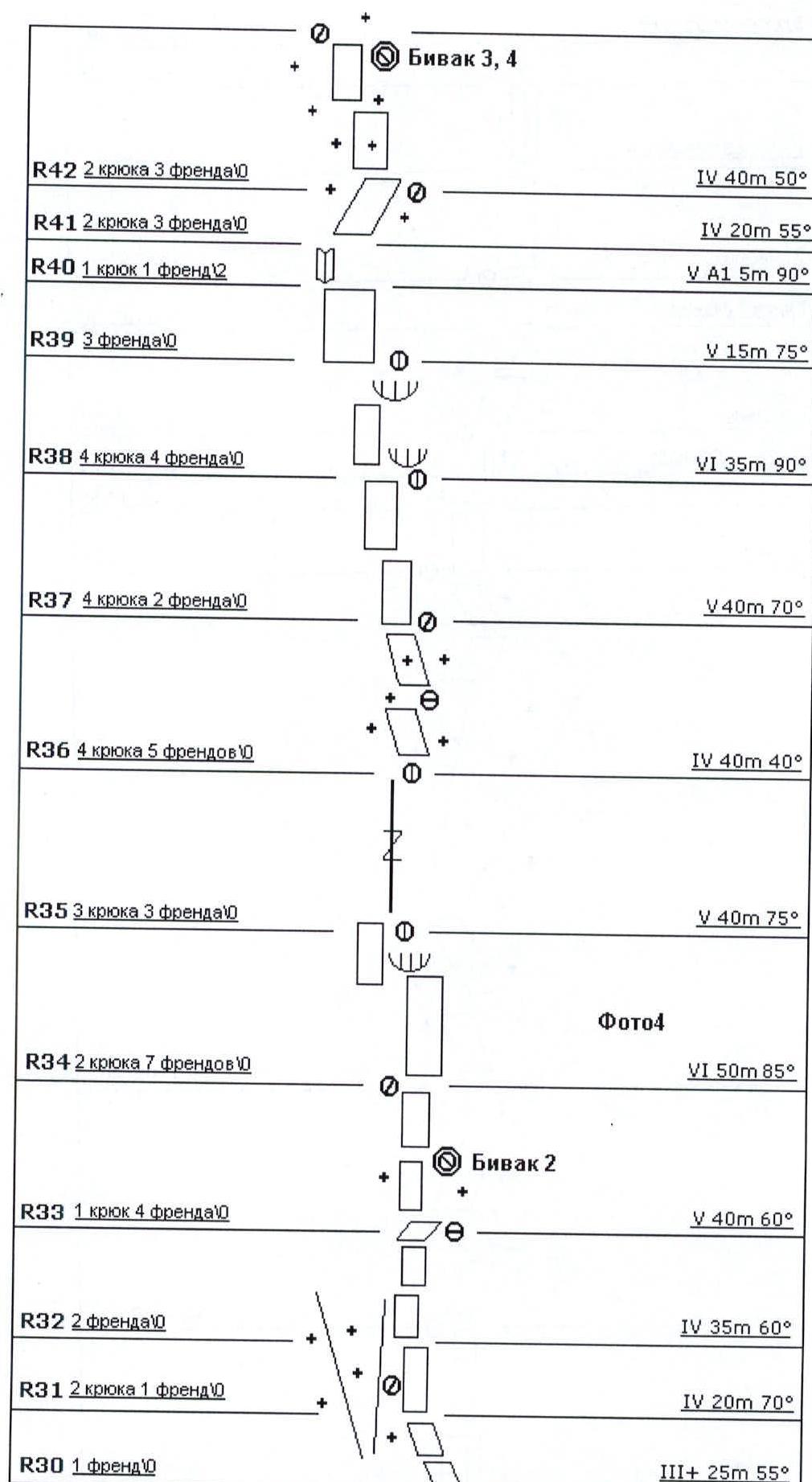
- R31 - 2 pitons, 1 friend (4 20 m 70°)
- R32 - 2 friends (4 35 m 60°)
- R33 - 1 piton, 4 friends (5 40 m 60°)
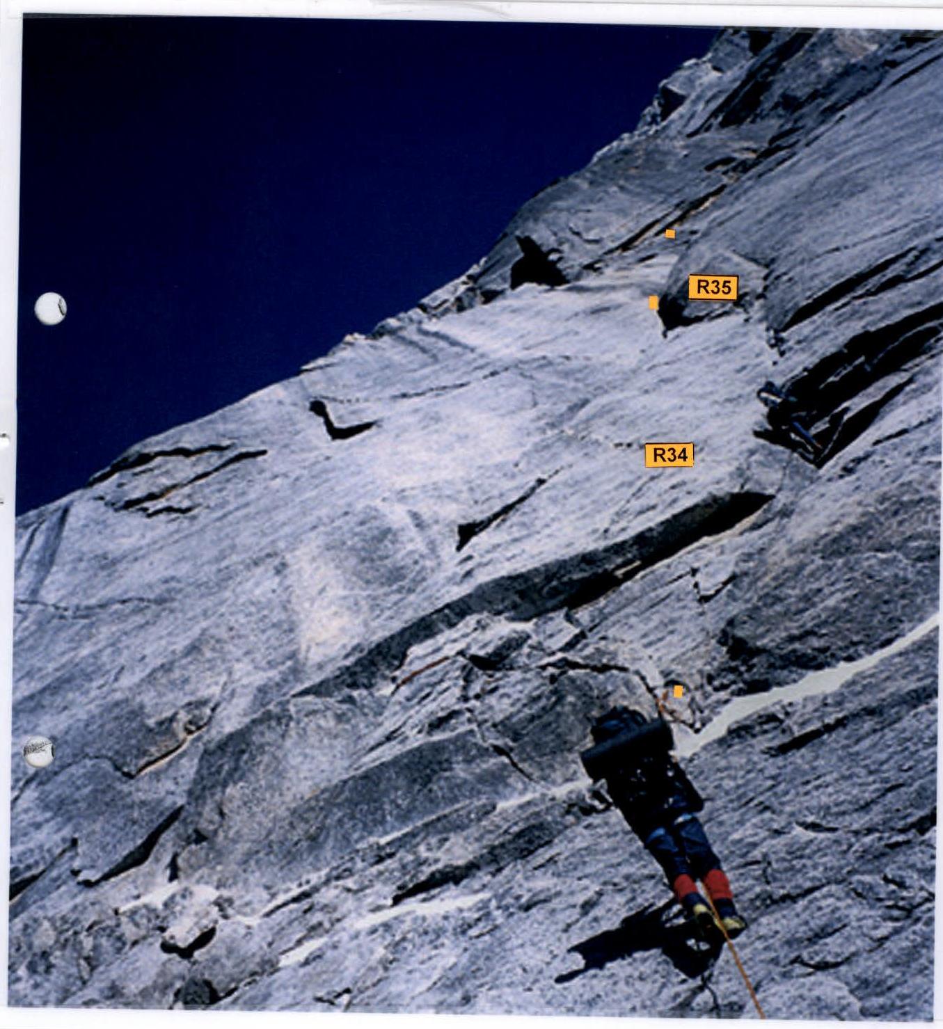
- R34 - 2 pitons, 7 friends (6 50 m 85°)
- R35 - 3 pitons, 3 friends (5 40 m 75°)
- R36 - 4 pitons, 5 friends (4 40 m 40°)
- R37 - 4 pitons, 2 friends (5 40 m 70°)
- R38 - 4 pitons, 4 friends (6 35 m 90°)
- R39 - 3 friends (5 15 m 75°)
- R40 - 1 piton, 1 friend (5 A1 5 m 90°)
- R41 - 2 pitons, 3 friends (4 20 m 55°)
- R42 - 2 pitons, 3 friends (4 40 m 50°)
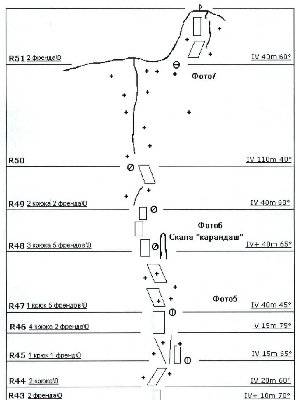
- R43 - 2 friends (4+ 10 m 70°)
- R44 - 2 pitons (4 20 m 60°)
- R45 - 1 piton, 1 friend (4 15 m 65°)
- R46 - 4 pitons, 2 friends (5 15 m 75°)
- R47 - 1 piton, 5 friends (4 40 m 45°)
- R48 - 3 pitons, 5 friends (4+ 40 m 65°)
- R49 - 2 pitons, 2 friends (4 40 m 60°)
- R50 (4 110 m 40°)
- R51 - 2 friends (4 40 m 60°)
Technical Photograph of the Route
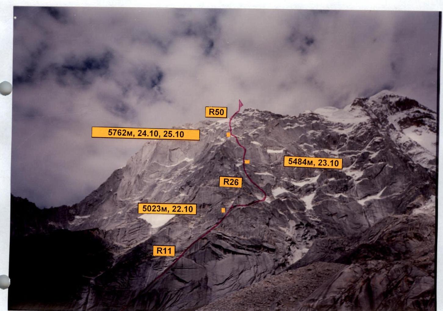
- R50 (5762 m, October 24-25)
- R26 (5484 m, October 23)
- R11 (5023 m, October 22)
Photo 1
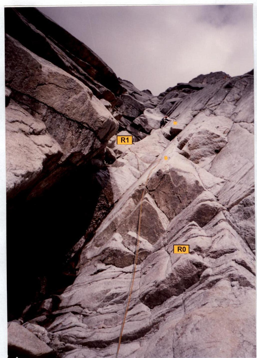
Processing on October 20, 1st rope of the route
Photo 2
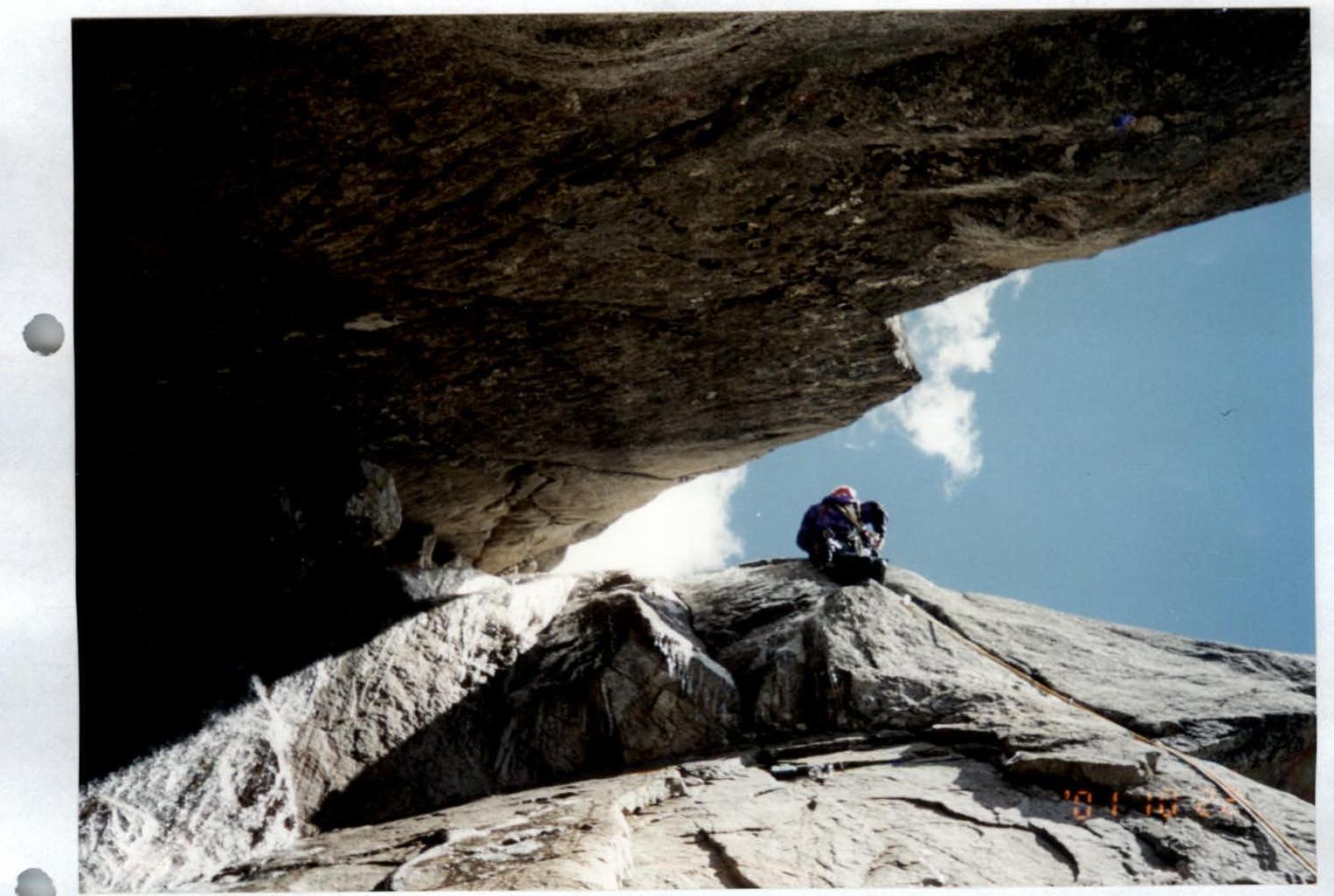
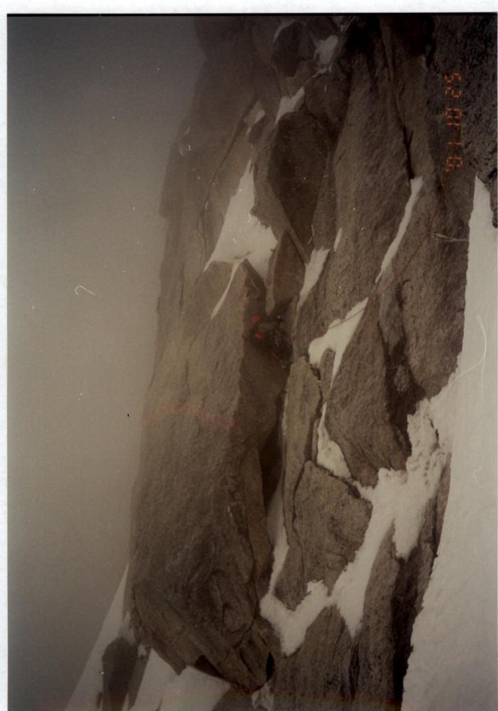
October 22, 7th rope of the route, section R14
Photo 4
October 24. Ascent from the second bivouac via pre-fixed ropes.
Photo 5
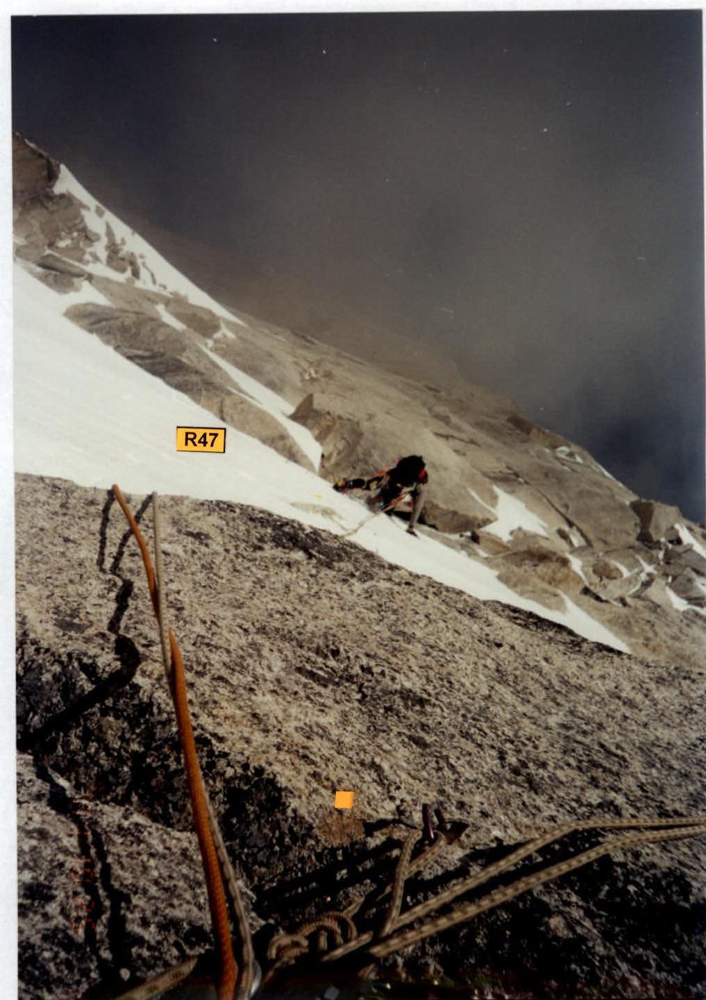
October 25. Section R47. Ascent on dense firn.
Photo 6
October 25. Section R48.