
Russian Alpine Federation
Moscow Alpine Championship 2012
Technical Class
Report
On the ascent of the CSKA team named after A.S. Demchenko to the summit of Cerberus Gendarme 1341 m
via the south wall, Touchstone Wall route Presumably 6A category.
The ascent was made by a team of two:
- N.E. Prilepskaya
- M.A. Nechaeva Coach: E.V. Kuznetsova.
USA 2012
Ascent Participants
-
Natalia Evgenievna Prilepskaya, Master of Sports, Moscow
Coach — E.V. Kuznetsova
- Phone: +7 903 186-80-80
- Email: nprilepskaya@gmail.com
-
Marina Alexandrovna Nechaeva, 1st sports category, Moscow
Coach — E.V. Kuznetsova
- Phone: +7 908 146-58-19
- Email: yamaga@yandex.ru
Contents
- Ascent Passport — 4
- General Summit Photo — 5
- Brief Overview of the Area and Climbing Object — 6
- Maps and Approach Route Photos — 8
- Technical Route Photo — 11
- UIAA Route Diagram — 12
- Illustrated Route Profile — 14
- Route Description by Sections — 15
- Ascent Schedule — 16
- Technique for Key Sections — 17
- Photos from the Route — 18
- Comparison of Complexity Categories Used in Different Countries — 27
Ascent Passport
-
Area: Zion National Park, Utah, USA, section number according to the 2011 classification table —
-
Summit: Cerberus Gendarme
Height: 1341 m. Route: Touchstone Wall (R. Olevsky, 1977).
-
Proposed category: 6A, first ascent.
-
Route type: rock climbing.
-
Route height difference: 393 m.
Route length: 461 m. Length of sections with V–VI category: 302 m. Average steepness:
- key sections: 87 °
- main part of the route: 83 °
- entire route: 67 °
-
Total equipment used on the route (total/ITO): 179/114
Stationary pitons (type "Piton", glued) — 43/24; Local pitons — 3/2; Chocks — 41/26; Friends — 92/62.
-
Team's total climbing hours: 12.5 hours, 2 days, including:
- April 4, 2012 — route preparation and descent to base camp — 4.5 hours
- April 5, 2012 — climbing the wall section, ascent to the summit — 8 hours
Departure from base camp: 7:00, April 5, 2012 Summit arrival: 17:30, April 5, 2012 Return to base camp: 21:00, April 5, 2012 Descent: from the summit, go to the end of the sharp northern ridge (40 m), one rappel (25 m) to the northern side, then turn south and rappel down the southern side to the base of the wall (5 rappels), then descend along the slope to the road, and drive back to camp.
-
Participants: ascent made by a team of two: Prilepskaya N.E. (Master of Sports) — Nechaeva M.A. (1st sports category). Coach: Kuznetsova Elena Valentinovna. Instructor certificate I category No. 539.
-
Organizations: Moscow Alpine and Rock Climbing Federation.
-
Report responsible: Prilepskaya N.E. email: nprilepskaya@gmail.com phone +7 903 186-80-80
General Summit Photo
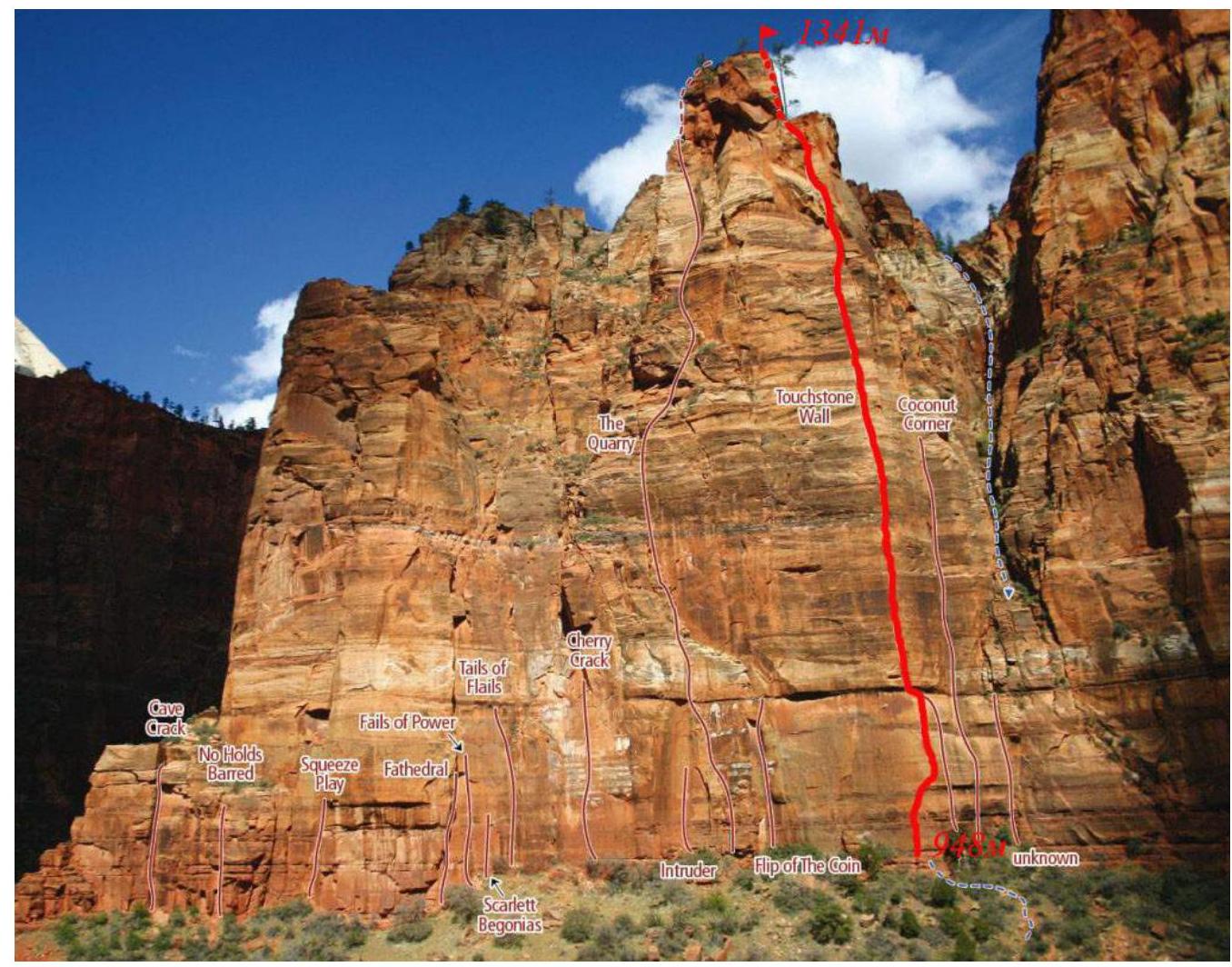
Photo 1. South wall of Cerberus Gendarme with route lines. Photo by Bryan Bird. Taken from the right bank of Virgin River.
The route climbed by the team is marked in red. Heights of characteristic sections are indicated:
- Height of Cerberus Gendarme summit — 1341 m;
- Height of the start of Touchstone Wall route (R. Olevsky, 1977) — 948 m.
Brief Overview of the Area and Climbing Object
Zion Park is one of the most beautiful national parks in the USA. The park is located in the state of Utah, near the town of Springdale, and covers an area of 593 km². The main attraction is the Zion Canyon, 24 km long and up to 800 m deep, carved by the northern arm of the Virgin River in the Navajo sandstones, colored in reddish and bronze hues.
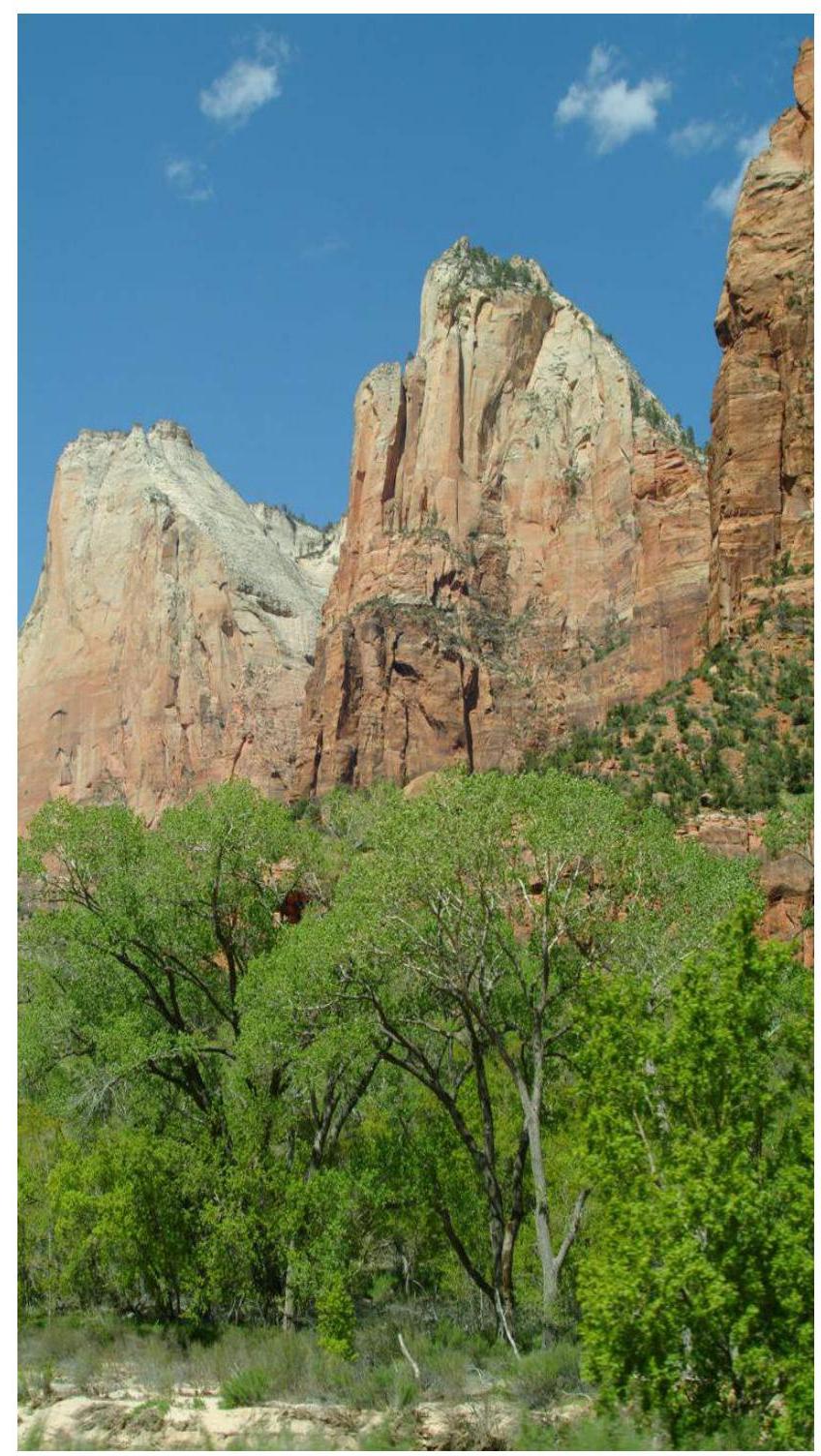
Photo 2. Rocks of Zion Canyon. Source: Internet resource. 13 million years ago, the rocks and Zion Canyon were a sea floor. Over time, the sea receded, and now the Virgin River flows through the Navajo sandstones. The rocks, consisting of white and red sandstone, rise above the river like stone towers, reaching over 700 m in height! The further upstream, the narrower the gorge becomes.
Climbing in Zion Park began to develop in the 20s of the XX century with William Evans' ascent to the summit of Great White Throne. Since then, the park has gained notable popularity among professional climbers and rock climbers due to the large number of big wall routes of high complexity and the specific structure of the rocks, requiring special climbing skills.
The rocks in Zion are composed of sandstone, which provides good friction but does not always allow for reliable protection. Due to the high hygroscopicity of this rock type, it is not recommended to climb in wet or humid weather. After rain, it is necessary to wait a day or two for the rocks to dry completely.
There are many routes on Cerberus Gendarme, but most of them are short and consist of G1 or G2 pitches. Only two routes go to the summit of Cerberus Gendarme: The Quarry and Touchstone Wall.
The author of the Touchstone Wall route is Ron Olevsky, who climbed it solo in 1977. In 2006, Mike Anderson and Rob Pizem first climbed Touchstone Wall using free climbing. It should be noted that the free climbing variant starts to the right of the traditional route start and follows a thin crack, which after 25–30 m intersects with the original line. The Touchstone Wall route cannot be recommended for those just starting to master big wall techniques.
Attention! To minimize the use of ITO on the route, good crack climbing skills are necessary.
The ascent took place in Zion National Park, Utah, USA. The team departed from the base camp located in the Watchman Campground towards Cerberus Gendarme on April 5, 2012.
To reach the start of the Touchstone Wall route, follow these steps:
- drive from the campground to the Big Bend stop;
- walk 150 m downstream from the bus stop;
- climb up the trail under the wall to a characteristic ledge at the base of the wall.
The approach from the base camp to the start of the route takes 1 hour.
Maps and Approach Route Photos
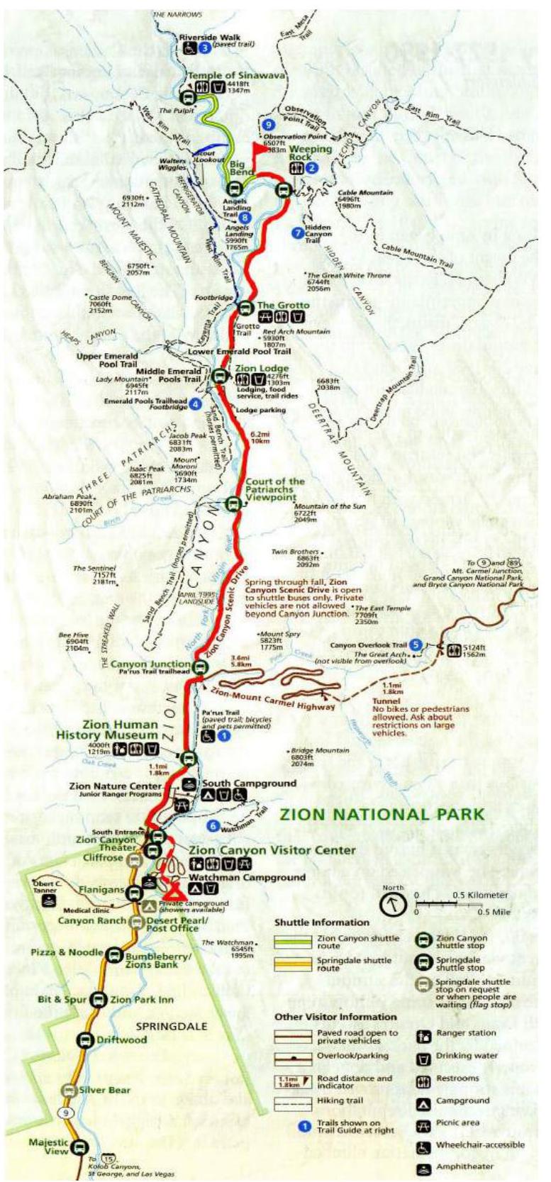
Fig. 1. Map of the ascent area. Source: Internet resource.
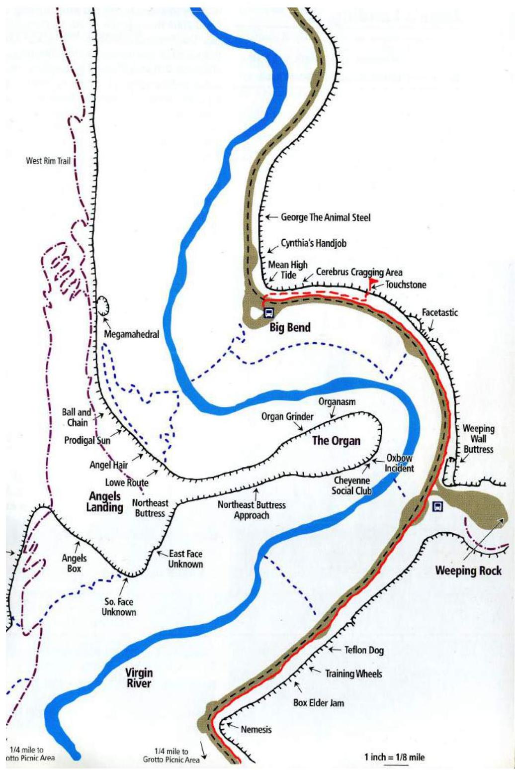
Fig. 2. Map of the ascent area with the approach route. Source: Internet resource.
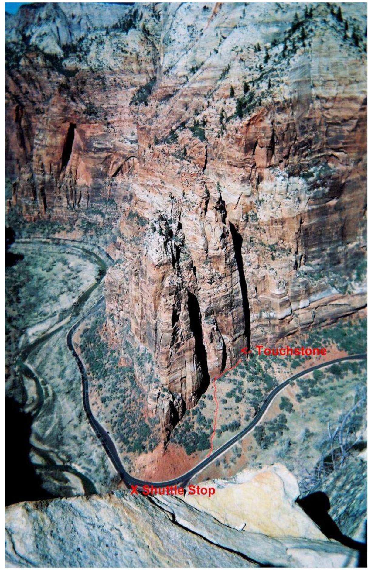
Photo 3. Approach to the start of the route from the road. Source: Internet resource.
Technical Route Photo
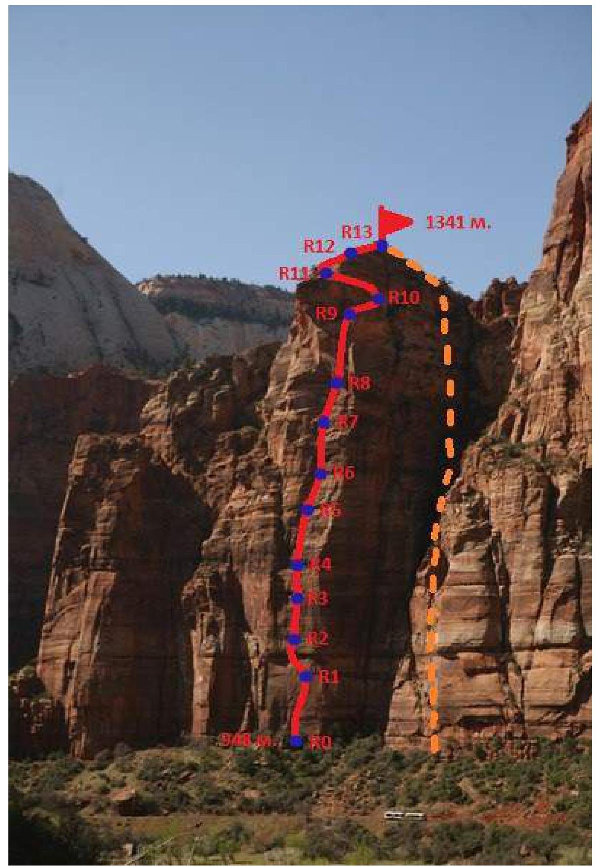
Photo 4. Route line climbed by the team on the south wall of Cerberus Gendarme. Photo by Bryan Bird. Taken from the right bank of Virgin River.
UIAA Route Diagram
| Section # | Chocks and Friends | Pitons | Bolts | UIAA Difficulty | USA Difficulty | Section Length, m | Section Steepness, ° |
|---|---|---|---|---|---|---|---|
| R0–R1 | 16/16 | – | 10/7 | A1/A2 | A1/A2 | 40 | 85 |
| R1–R2 | 9/9 | 2/2 | 6/3 | A2/IX– | A2/5.12+ | 25 | 92 |
| R2–R3 | 10/10 | – | 2 | A1/VII+ | A1/5.11 | 15 | 90 |
| R3–R4 | 18/11 | 1 | 2 | A1/VII+ | A1/5.11 | 30 | 85 |
| R4–R5 | 12/7 | – | 3 | A1/VI+ | A1/5.10a | 25 | 80 |
| R5–R6 | 15/6 | – | 3 | A1/VI | A1/5.9 | 40 | 81 |
| R6–R7 | 10 | 1 | 2 | V, VI | 5.7, 5.8 | 35 | 78 |
| R7–R8 | 10/2 | – | – | A1/VI–, VI+ | A1/5.8, 5.9 | 35 | 86 |
| R8–R9 | 15/10 | – | – | VI, VII– | 5.8, 5.10b | 45 | 75 |
| R9–R10 | 2 | – | – | II | – | 8 | 30 |
| R10–R11 | 2 | – | 4 | V–, V+ | 5.7 | 20 | 59 |
| R11–R12 | 6 | – | – | III, VI– | 5.4 | 23 | 47 |
| R12–R13 | 1 | – | – | II, III | 5.3, 5.4 | 120 | 35 |
Illustrated Route Profile
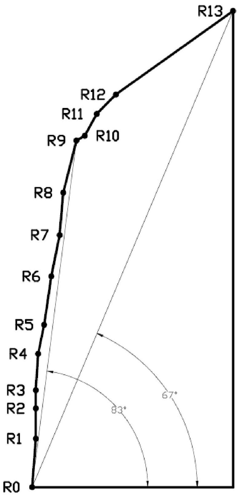
Fig. 3. Illustrated profile of the Touchstone Wall route on Cerberus Gendarme.
Route Description by Sections
| Section # | Brief Description of Sections |
|---|---|
| R0–R1 | From the top of the characteristic ledge at the base of the wall, move upwards along the "mirror" gradually moving to the right (there are stationary pitons), to a very thin crack. Move up the crack (using your own protection) to the station. The station is hanging and equipped with pitons. ITO A1, small sizes of chocks and friends. Prilepskaya N. led first. |
| R1–R2 | Move up the thin crack under the large overhang. Under the overhang, make an uncomfortable traverse left 3 m and exit onto the overhang. There are several local pitons up to the overhang. Attention: the piton hammered above the overhang has a broken ear! From the overhang, move up the thin crack to the station under a small overhang. The station is hanging on local pitons. The section is climbed using artificial aids. ITO A2 or 5.12+ free climbing (a comparison table of complexity categories used in the USA and UIAA is provided on p. 27). Small sizes of chocks and friends. Prilepskaya N. led first. |
| R2–R3 | Move up the slightly widening crack using your own protection (small and medium chocks go well) to a hanging station on stationary pitons. The section is climbed using artificial aids. ITO A1 or 5.11 free climbing. Prilepskaya N. led first. |
| R3–R4 | Continue moving up the crack. Medium and large friends are used. ITO with transition to very difficult climbing. ITO A1 or 5.11 free climbing. The station is equipped. Nechaeva M. led first. |
| R4–R5 | Climb up the "fist-sized" crack 25 m to a ledge with a station. It is recommended to set up a station here because the rope drags heavily due to friction on the ledge. ITO with transition to difficult climbing. ITO A1 or 5.10a free climbing. Nechaeva M. led first. |
| R5–R6 | Climb up the crack that narrows towards the top. ITO with transition to very difficult climbing. ITO A1 or 5.9–5.10c free climbing. The station is on a ledge where an overnight stay is possible. Nechaeva M. led first. |
| R6–R7 | From the right part of the ledge, move up through a system of cracks to the next ledge. Interesting climbing. Large friends are required (it is advisable to have 2 friends with a maximum opening range of at least 114.3 mm). Climbing difficulty 5.7–5.8. Nechaeva M. led first. |
| R7–R8 | Move up the thin crack 7 m, then traverse 2 m to the right to another crack. Continue up the flake, using body positioning. Large friends are used. Unpleasant section before reaching the station. Climbing difficulty 5.8–5.9. Prilepskaya N. led first. |
| R8–R9 | Move up through a system of cracks and flakes. The terrain becomes gentler. Before reaching the ledge, there is a short and unpleasant chimney (squeeze). The station is on a tree. Large friends are used. Climbing is partly difficult with a transition to ITO A1. Climbing difficulty 5.8–5.10b. Prilepskaya N. led first. |
| R9–R10 | Traverse along the inclined ledge 8 m to the right along the wall. There is space for a tent. |
| R10–R11 | Climb up the wall, moving significantly to the left. There are pitons. Exit onto a large ledge. The station is on a tree. Climbing difficulty 5.7. Prilepskaya N. led first. |
| R11–R12 | Move 10 m to the left from the tree to the start of a simple chimney, which leads to the pre-summit ridge. Climbing difficulty 5.4. Prilepskaya N. led first. |
| R12–R13 | 120 m along the ridge to the summit. Rock complexity II category. |
Descent: from the summit, go to the end of the sharp northern ridge (40 m), one rappel (25 m) to the northern side, then turn south and rappel down the southern side to the base of the wall (5 rappels), then descend along the slope to the road, and drive back to camp.
Ascent Schedule
 On April 5, 2012, the ascent was complicated by gusty winds (up to 17 m/s), making it difficult to pass key sections.
Technique for Key Sections
When climbing key sections (R0–R6), the team used ITO and free climbing techniques in first-grade climbing shoes. The first climber worked on a double rope. The second climber ascended on a top rope with upper protection. The load was pulled up by the second participant. The route was climbed without falls.
- On sections R0–R3 (led by Prilepskaya N.), ITO technique was used.
- On sections R3–R6 (led by Nechaeva M.), ITO technique was used with a transition to free climbing.
The team took 4 liters of water, assuming 1 liter per person per day. Nutrition was individual snacks. In case of bad weather, they had Gore-Tex jackets. For a cold overnight stay or emergency situation, they had an emergency blanket. A first-aid kit was available on the route. A rescue team was stationed at the base camp. Observers were positioned under the route. Communication was maintained using mobile phones. For communication between participants on the route, they had portable Motorola radios, which significantly simplified their work in gusty winds.
To climb the route and key sections, the team had:
- Main rope (60 m) (2 pieces)
- Friends (1.5 sets)
- Chocks (1.5 sets)
- Rock shoes (2 pairs)
- Piton hammers and ladders (2 pairs)
- Quickdraws with carabiners (13 pieces)
- Extension slings (4 pieces)
- Climbing carabiners (3 pieces)
- Extraction tool (1 piece)
Photos from the Route
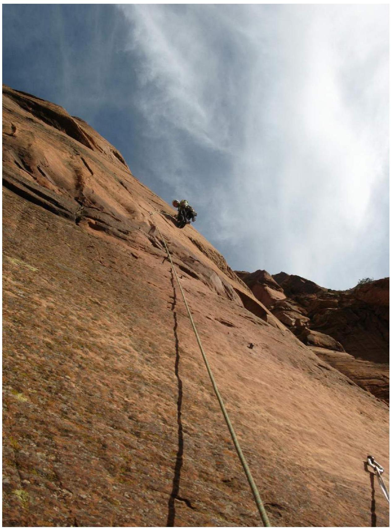
Photo 5. Middle of key section R0–R1. Prilepskaya Natalia is leading.
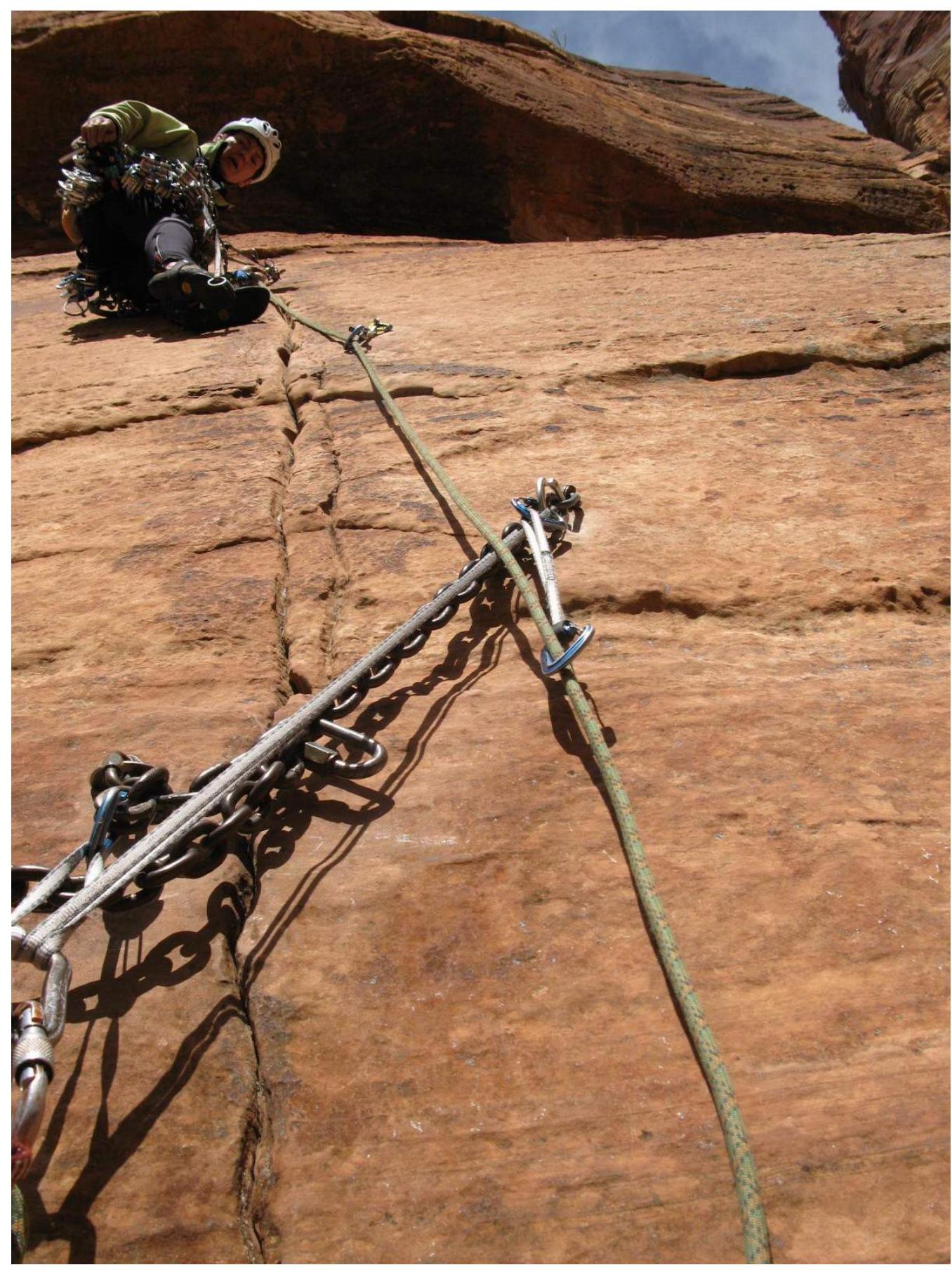
Photo 6. Start of key section R1–R2. Prilepskaya Natalia is shown.
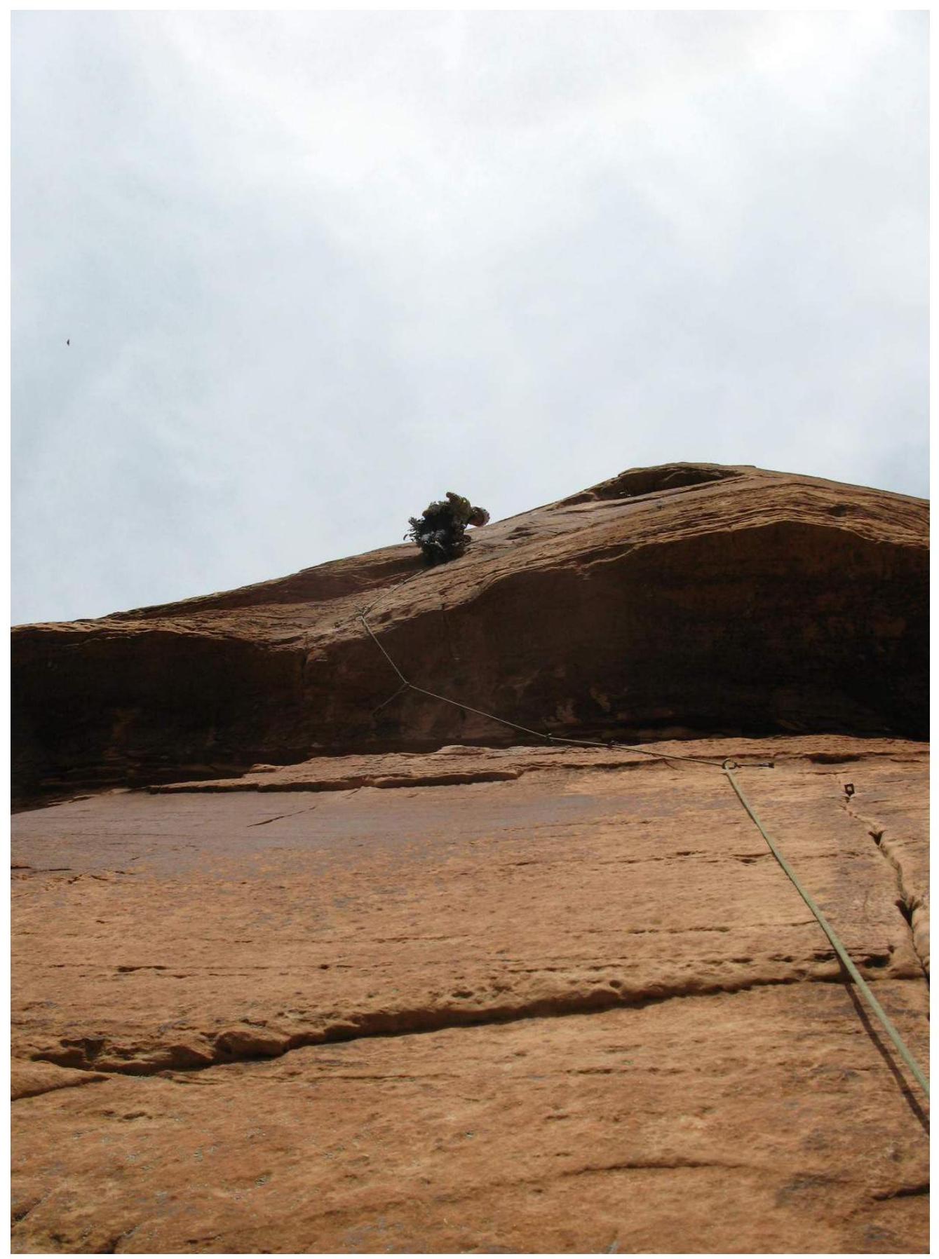
Photo 7. Exit through the overhang on key section R1–R2. Prilepskaya Natalia is climbing.
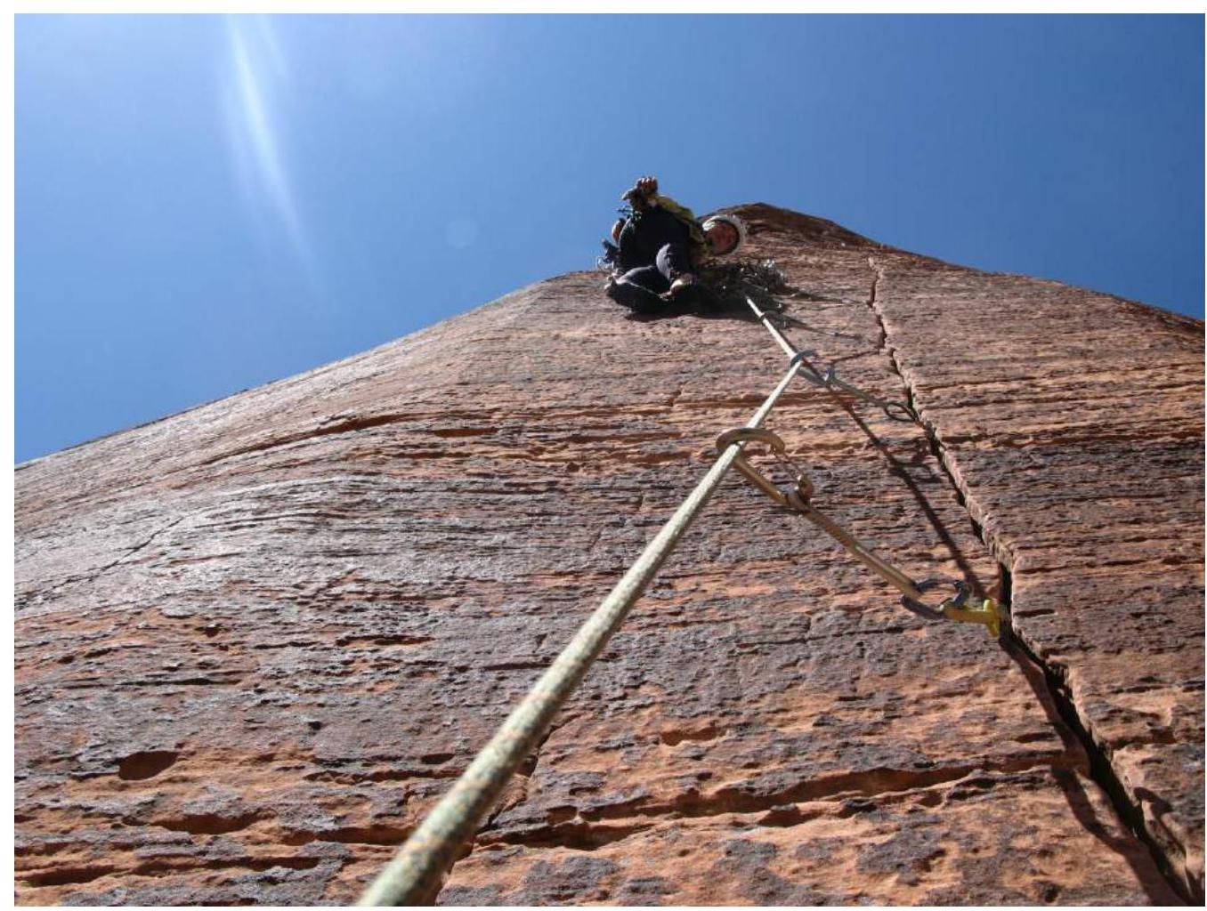
Photo 8. Key section R2–R3. Prilepskaya Natalia is shown.
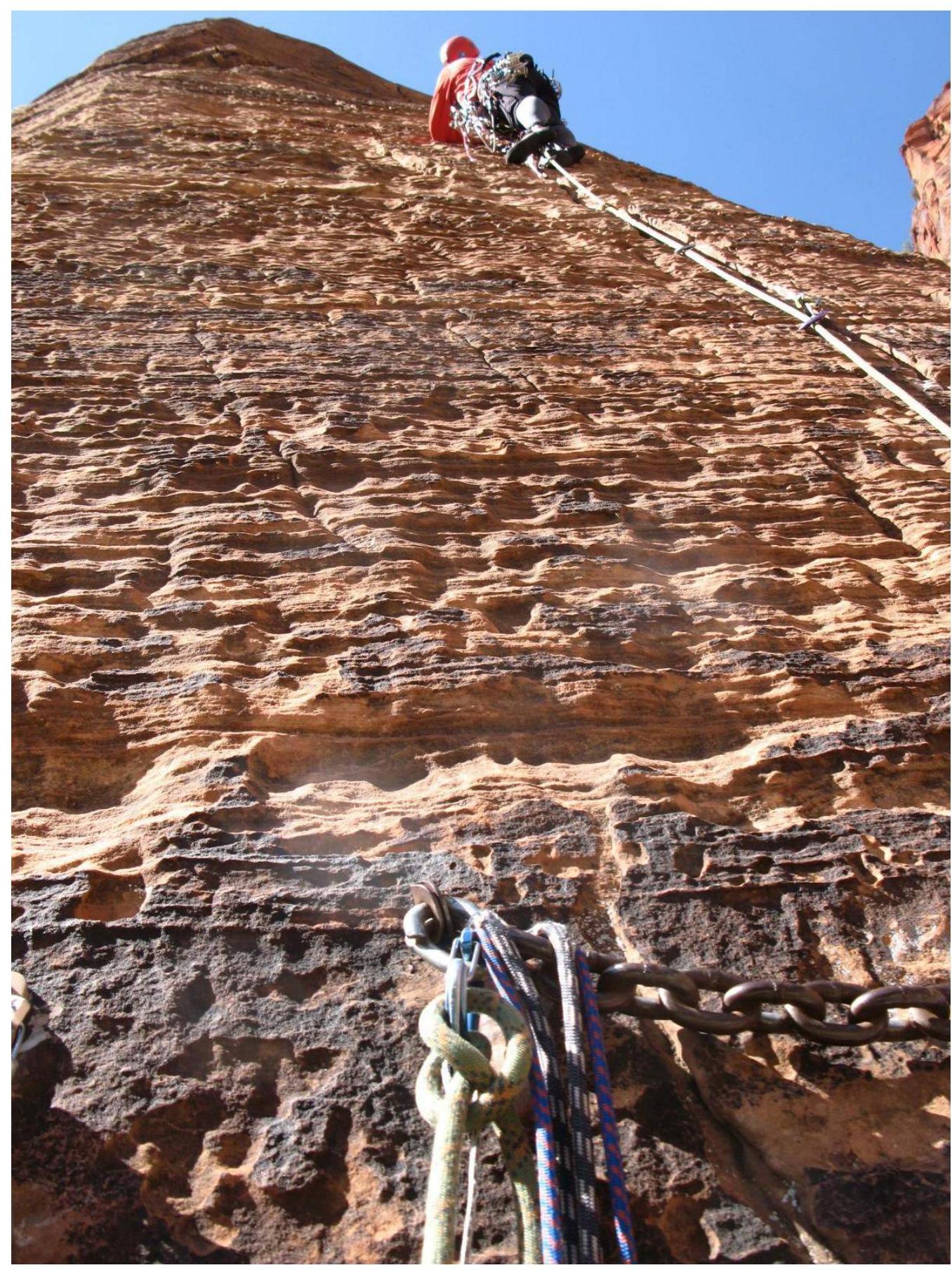
Photo 9. Key section R3–R4. Nechaeva Marina is leading.
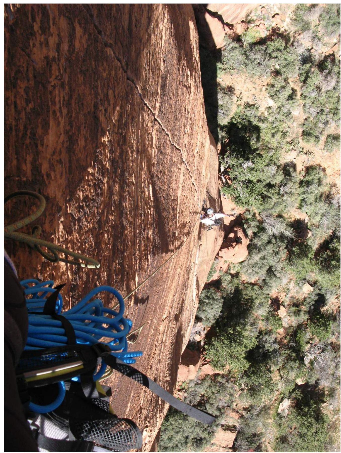
Photo 10. View down to the wall from key section R3–R4. Prilepskaya N. is ascending to the station.
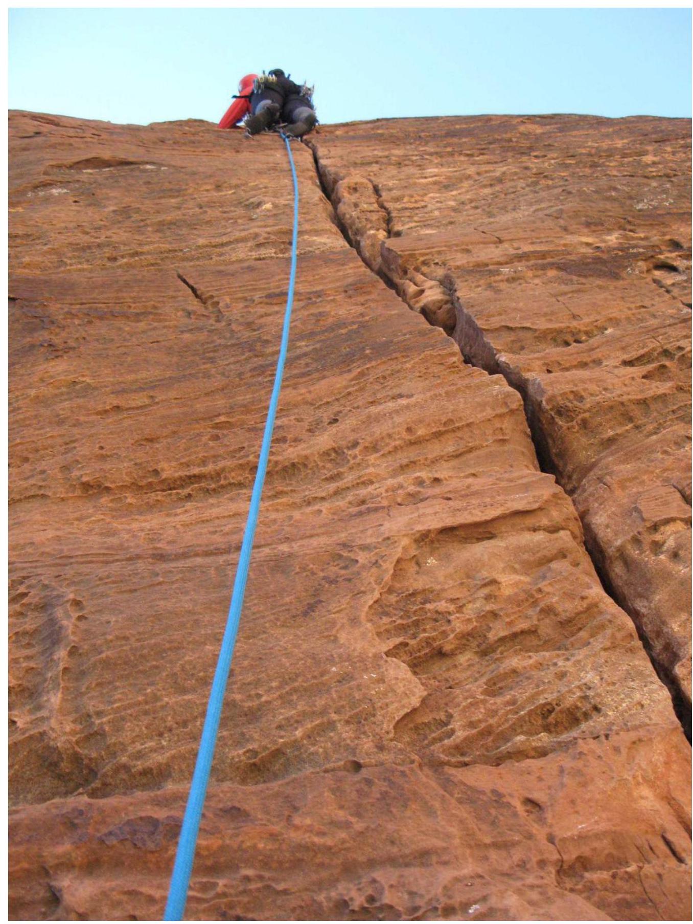
Photo 11. Key section R4–R5. Nechaeva Marina is leading.
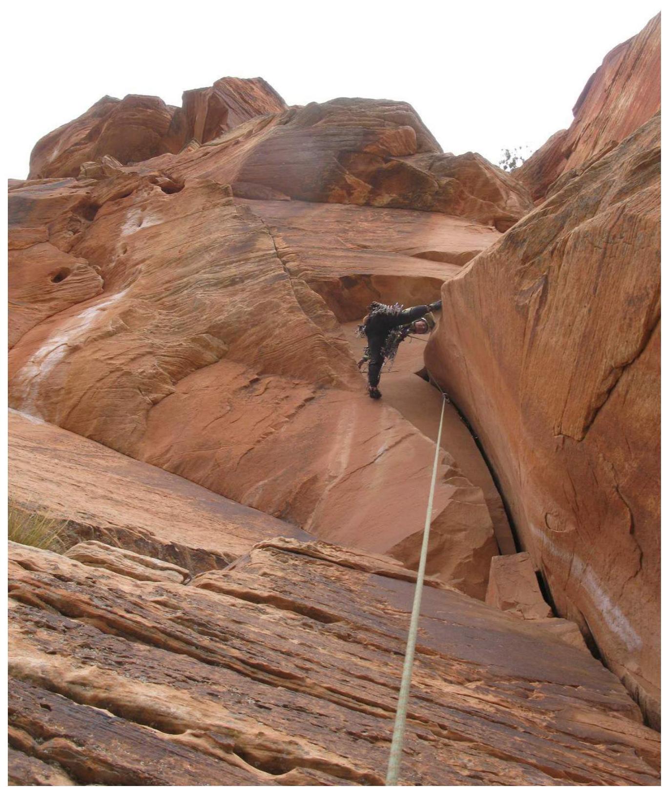
Photo 12. Section R8–R9. Prilepskaya Natalia is climbing.
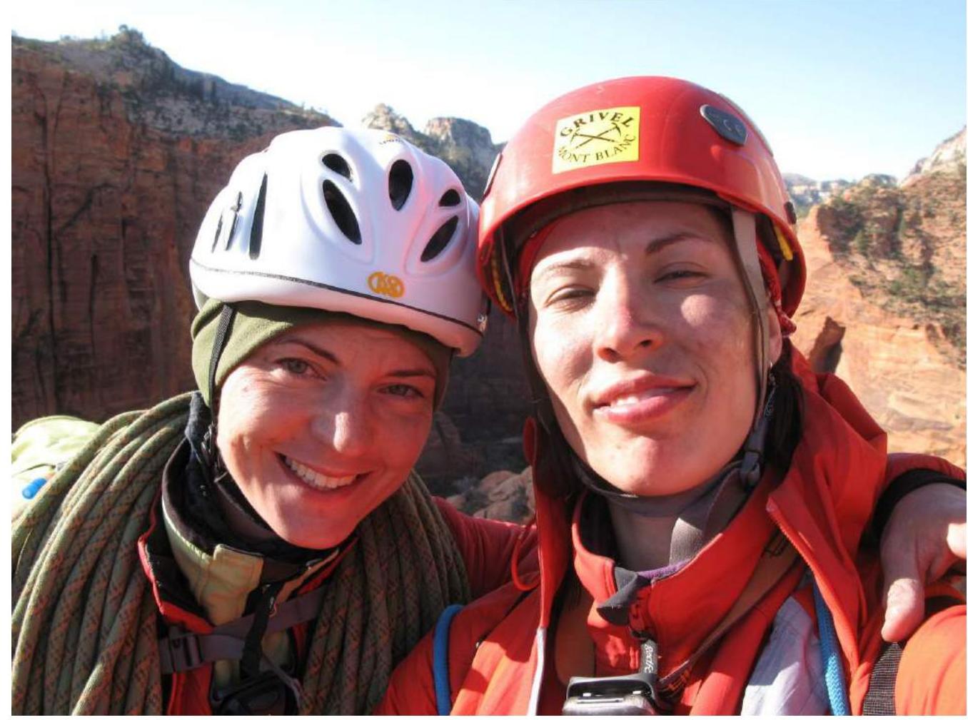
Photo 13. Prilepskaya Natalia and Nechaeva Marina at the summit of Cerberus Gendarme 1341 m.
Comparison of Complexity Categories Used in Different Countries
GRADING COMPARISONS
| UIAA | UK | France | USA | DDR | Australia |
|---|---|---|---|---|---|
| III | V Diff | III | 5.4 | III | 12 |
| IV– | M Severe | IV– | IV | ||
| IV | IV | 5.5 | |||
| IV+ | IV+ | ||||
| V– | 4a | V– | 5.6 | V | 13 |
| V | 4Б | V | 5.7 | VI | 14 |
| V+ | V+ | VIIa | 15 | ||
| VI– | 4C | 5b | 5.8 | VIIb | |
| VI | 5a | 5c | 16 | ||
| VI+ | 5Б | 6a | 5.9 | VIIc | 17, 18 |
| VII– | 5.10a | VIIIa | 19 | ||
| VII | 5C | 6Б | 5.10b, 5.10c | VIIIb | 20 |
| VII+ | 6C | 5.10d | VIIIc | 21 | |
| VIII– | 6a | 5.11a, 5.11b | IXa | 22 | |
| VIII | 7a | 5.11c, 5.11d | IXb | 23 | |
| VIII+ | 6Б | 7b | 5.12a, 5.12b | IXc | 24 |
| IX– | 5.12c, 5.12d | Xa | 25 | ||
| IX | 6c | 7c | Xb | 26 | |
| IX+ | 5.13a, 5.13b | Xc | 27 | ||
| 28 | |||||
| 29 |
Source: Griffin, Lindsay. Mont Blanc Massif. — 3rd ed. Vol. II, Selected Climbs. Alpine Club. London, 1991, p. 20.
Comments
Sign in to leave a comment