Report
On the ascent of Aiguille de Tour South via the East Wall, category 1B, by the "Polytechnic" mountaineering club on July 26, 2018. Glacier du Tour, Chamonix (France), Alps.
I. Ascent Report
| № | 1. General Information | |
|---|---|---|
| 1.1 | Full name, sports rank of the team leader | Roman Voskoboev, 1st sports rank |
| 1.2 | Full name, sports rank of the participants | Danilchuk Valeria Dmitrievna, 3rd sports rank; Samsonova Valeria Mikhailovna, badge; Kalayda Viktor Vitalievich, badge; Charin Ruslan Viktorovich, badge; Varshavchik Lidiya Aleksandrovna, badge |
| 1.3 | Full name of the coach | - |
| 1.4 | Organization | Mountaineering club "Polytechnic" |
| 2. Characteristics of the ascent object | ||
| 2.1 | Region | Alps, France, Chamonix area |
| 2.2 | Valley | Glacier du Tour |
| 2.3 | Section number according to the 2013 classification table | 10.3 |
| 2.4 | Name and height of the summit | Aiguille du Tour, 3542 m |
| 2.5 | Geographic coordinates of the summit, GPS coordinates | 45°59′39.9″ N 7°0′35.4″ E |
| 3. Characteristics of the route | ||
| 3.1 | Route name | To Aiguille de Tour South via the East Wall |
| 3.2 | Proposed category of difficulty | 1B |
| 3.3 | Degree of route exploration | - |
| 3.4 | Terrain characteristics of the route | Rock climbing |
| 3.5 | Elevation gain of the route | 100 m |
| 3.6 | Route length | 200 m |
| 3.7 | Technical elements of the route | II category rock climbing — 140 m, III category rock climbing — 60 m |
| 3.8 | Descent from the summit | Via the ascent route |
| 3.9 | Additional route characteristics | Lack of water |
| 4. Characteristics of the team's actions | ||
| 4.1 | Time taken | 8 hours |
| 4.2 | Overnight stays | Not required |
| 4.3 | Departure for the route | 4:00, July 26, 2018 |
| 4.4 | Reaching the summit | 9:00, July 26, 2018 |
| 4.5 | Return to the base camp | 12:00, July 26, 2018 |
| 5. Person responsible for the report | ||
| 5.1 | Full name, e-mail | Samsonova Valeria Mikhailovna lerik.sun.ls@ya.ru |
II. Ascent Description
1. Characteristics of the Ascent Object
1.1. General photo of the summit
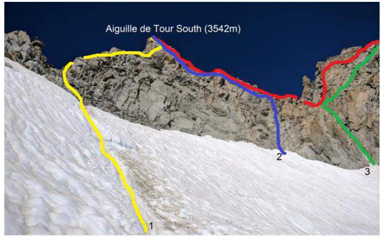
Aiguille de Tour South 3542 m. Photo taken on July 26, 2018.
Routes on the photo:
- Route via the East Wall to the South Summit
- Route via the North-East Ridge to the South Summit
- Classic route to the North Summit
- Traverse from the South to the North Summit
1.2. Photo of the route profile.
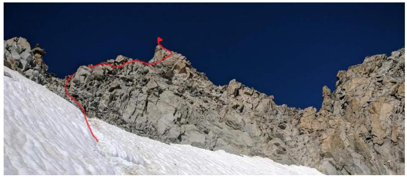
Photo taken on July 26, 2018.
1.3. Photopanorama of the Glacier du Tour area

Photo taken from www.camptocamp.org↗
1.4. Map of the area
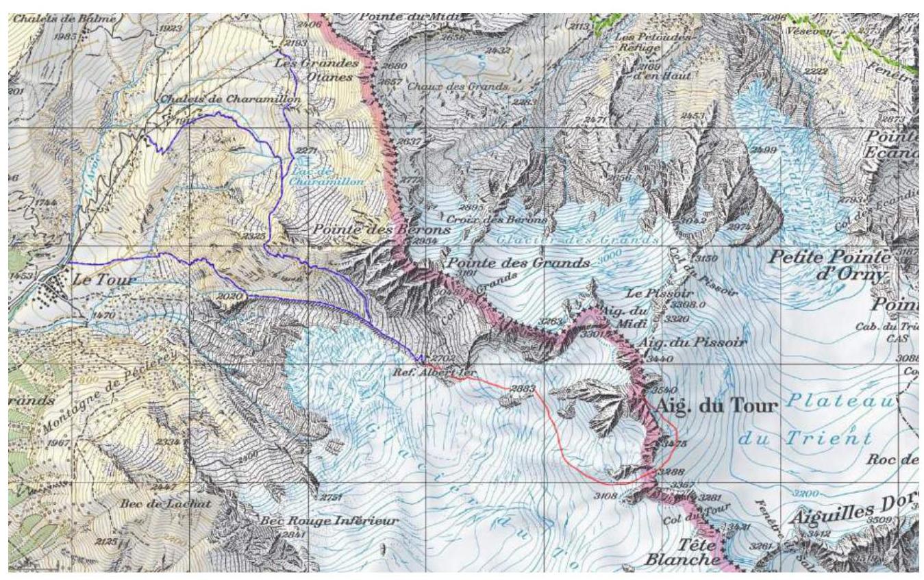
Photo taken from www.cosleyhouston.com↗
Approach to the refuge. There are three possible approaches depending on the use of the cable car.
- If not using the cable car, from the village Le Tour, head to the right lateral moraine of the Glacier du Tour. The path to the moraine is visible from the cable car station.
- If using the first stage of the cable car, from Charamillon station, head up to the right along a good path, then traverse around the spur of Pointe des Berons, and reach the moraine of the Glacier du Tour in its upper part.
- Alternatively, if starting from the upper station Les Autannes, traverse to the path of the second option.
In the upper part of the moraine is the Alber Premier refuge (2702 m).
2. Characteristics of the Route
2.1. Technical photo of the route
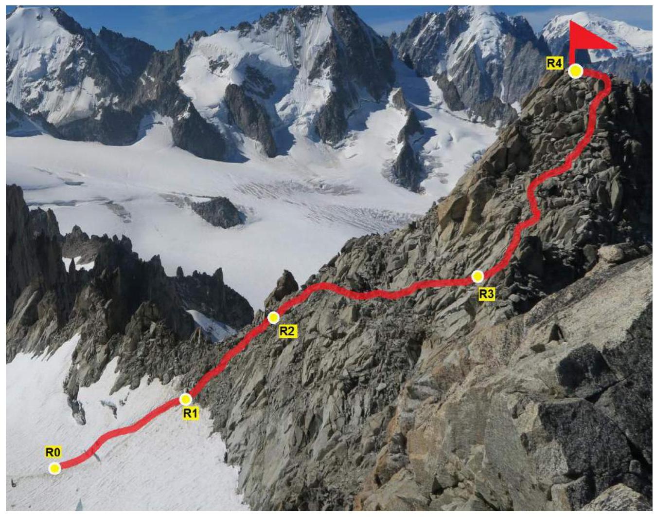
View from the North Summit of Aiguille du Tour to the South Summit 3542 m.
2.2. Technical characteristics of the route sections
| Section | Length | Steepness | Terrain characteristics | Category of difficulty | Number of pitons |
|---|---|---|---|---|---|
| R0–R1 | 50 m | 30° | Snow | II | 0 |
| R1–R2 | 30 m | 30° | Rock | II | 0 |
| R2–R3 | 60 m | 20° | Rock | II | 0 |
| R3–R4 | 60 m | 40° | Rock | III | 0 |
3. Characteristics of the Team's Actions
3.1. Brief description of the route passage by sections.
Aiguille de Tour South is located at 3542 m, in France, in the Alps, in the Glacier du Tour area.
| Section | Description | Photo number |
|---|---|---|
| Approach | From the Alber Premier refuge, move along the path marked by cairns. Reach the Glacier du Tour. Put on crampons and rope up, as the further movement will be on a closed glacier. There are crevasses. Bypass the Signal Reilly rock (2883 m) from the north. Continue moving along the glacier on a gentle slope to the Col du Tour Supérieur. Be careful not to miss this pass, which is a snowy slope bounded by rocky ridges on two sides. The pass is rocky. The pass is rockfall-prone; if there are several groups on the route, coordinate movement. After the pass, continue moving along the Plateau du Trient to the start of the route to Aiguille du Tour. | 1 |
| R0–R1 | Snowy approach section. There is a bergschrund. Overcome it in crampons and continue up the snow to a sandy ledge. Then remove crampons and continue. | 2 |
| R1–R2 | The section is sometimes a loose slope with many loose rocks. Belaying is done using the terrain. | 3 |
| R2–R3 | Movement on this section is along a horizontal ledge on simple rocks. Belaying is done using the terrain. | 4 |
| R3–R4 | Comfortable climbing, category 3 difficulty, up to the summit. Belaying is done using the terrain. | 5 |
| Descent | Descent is via the ascent route, climbing and belaying using the terrain. | - |

Photo 1. Col du Tour Supérieur.
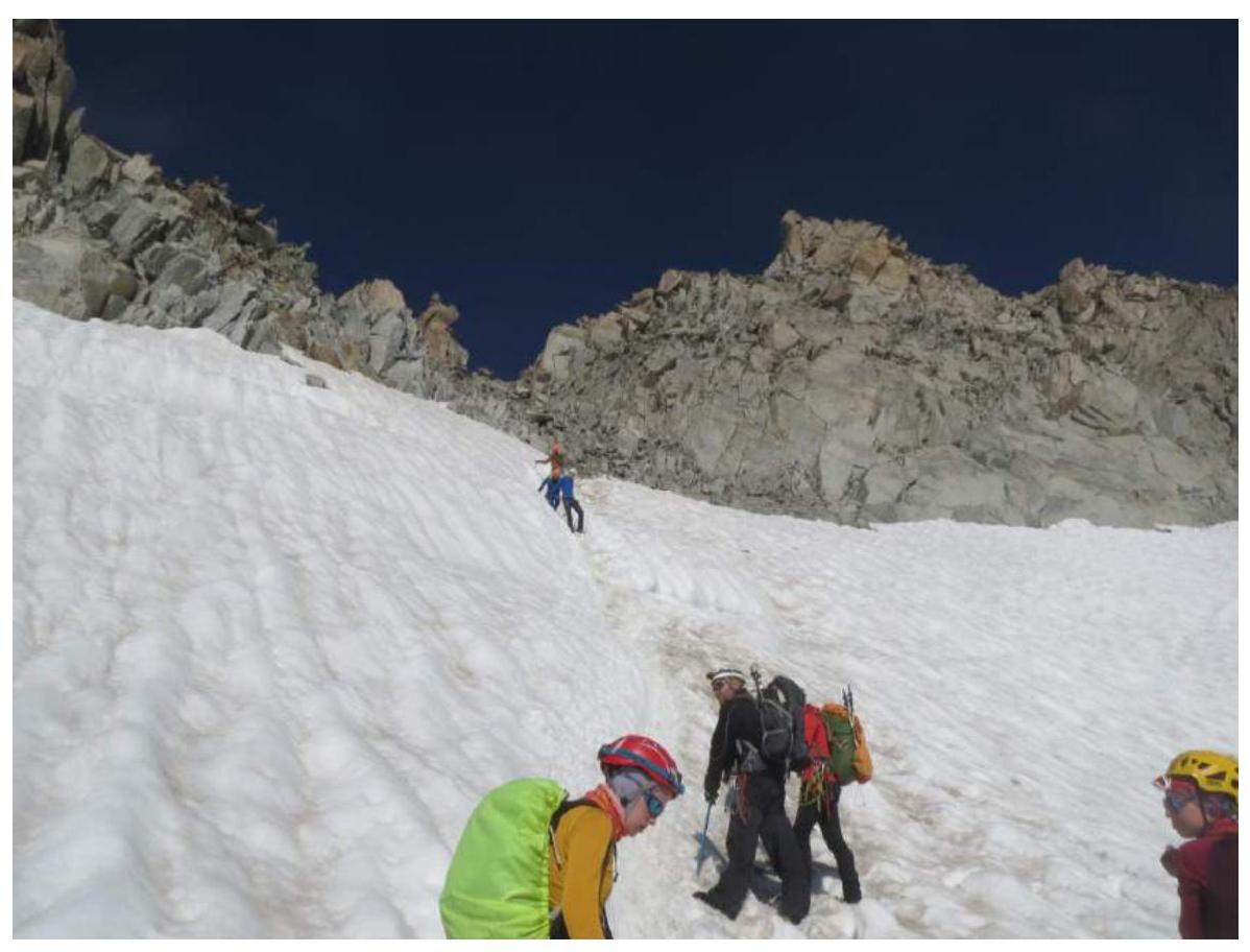
Photo 2. Section R0–R1
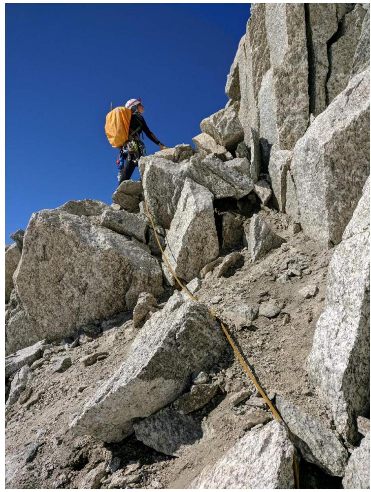
Photo 3. Section R1–R2
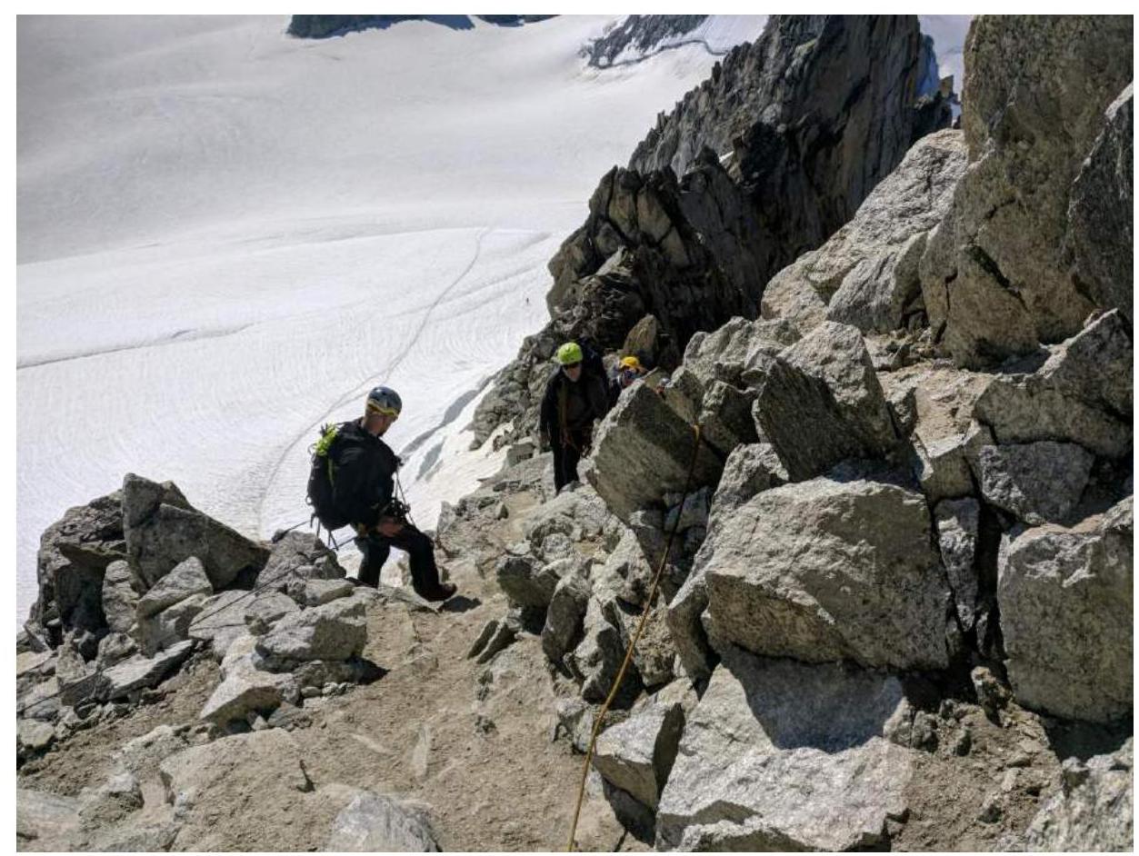
Photo 4. Section R2–R3
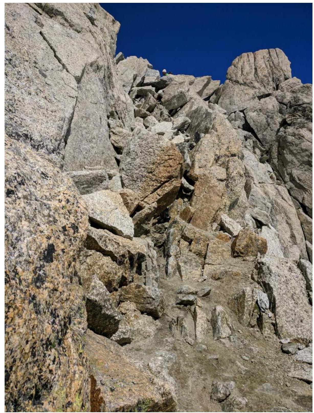
Photo 5. Section R3–R4.
3.2. Photo of the team at the summit with the control cairn
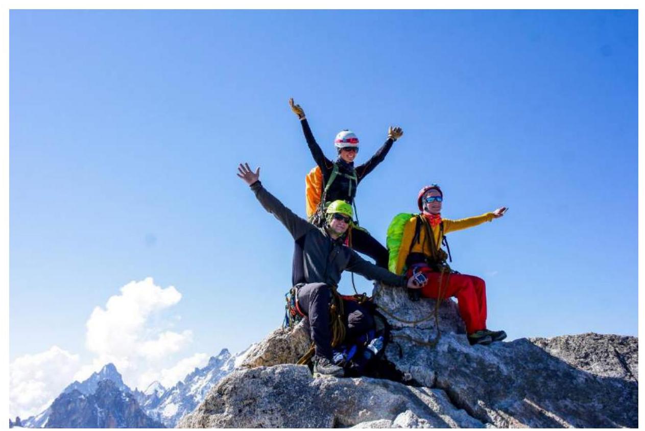
Photo 6. Team photo at the summit.
3.3. Route recommendations.
The route is quite quick and without technical problems. It is recommended to start early to avoid queues, as it is a frequently visited route.
When moving on the glacier, it is mandatory to:
- move in a rope team;
- use GPS in conditions of poor visibility.
It is recommended to carefully study the approach map and not miss the entry to the Col du Tour Supérieur.


