Report
On the ascent of the CSKA team named after Demchenko to the summit of Aiguille du Tour South (3544 m) via the classic route from Albert Premier refuge, 1B cat. dif., Savoy Alps, Chamonix area
Leader: A. V. Yurkin Senior coach: E. V. Kuznetsova Moscow 2014
Ascent Details
-
France. Savoy Alps, Chamonix area. Section No. 10.3 (according to KGBM 2013).
-
Summit Aiguille du Tour (Aiguille du Tour) 3544 m. "Classic" from Albert Premier refuge (C. G. Heathcote, M. Andermatten, 1864).
-
Proposed category – 1B cat. dif.
-
Route type: combined.
-
Route elevation gain: 800 m.
Route length: 3400 m. Section lengths:
- V cat. dif. — m.
- VI cat. dif. — m.
Average slope:
- main part of the route – 60 °
- entire route – 23 °
-
Number of pitons left (used) on the route: total 0; including bolting —
-
Team's climbing hours: 4 hours (excluding descent).
-
Leader: Yurkin A. V., Master of Sports.
Participants: Beschastnova Yu. V., 1st sports category.
-
Coach: Yurkin A. V.
-
Departure from the Albert Premier refuge: 9:00, June 25, 2014. Summit arrival: 12:00, June 25, 2014. Return to the refuge: 16:15, June 25, 2014. Descent from the summit: via the ascent route.
-
Organization: CSKA training camp named after Demchenko (Moscow).
-
Responsible for the report: Yurkin A. V.
Email: S2_aleks@mail.ru
General Information about the Climbing Area
The summit Le Tour (Aiguille du Tour) 3544 m, which was the target of the ascent, is located in the Chamonix valley area. This valley is situated within the Savoy Alps in southern France. Chamonix is known for its developed mountain infrastructure, rich mountaineering traditions, and history. The highest point in the Chamonix area and the Savoy Alps is Mont Blanc 4808 m, which is the highest peak in the Alps.
The ascent to Le Tour was part of the CSKA training camp named after Demchenko (Moscow) in June-early July 2014. The base camp of the training camp was located in the Montroc campsite. Montroc is:
- the highest village after Le Tour (Le Tour is slightly higher but is off the main road to the pass from Chamonix to the neighboring valley)
- the last settlement in the Chamonix valley.
Elevation above sea level – 1300–1400 m.
Most mountaineering routes of interest are located in the Mont Blanc massif. Since the summit elevations are around 3500–4000 m, various forms of terrain are present – rocks, ice, snow, etc. There are many combined routes. The area offers a wide variety of rock, ice, and combined routes from 1B to 6A cat. dif.
The immediate access to the route was from Albert Premier refuge. The refuge is located at the foot of the Glacier du Tour at an elevation of 2702 m. The classic route to the summit of Aiguille du Tour was first ascended by C. G. Heathcote and M. Andermatten on August 18, 1864.
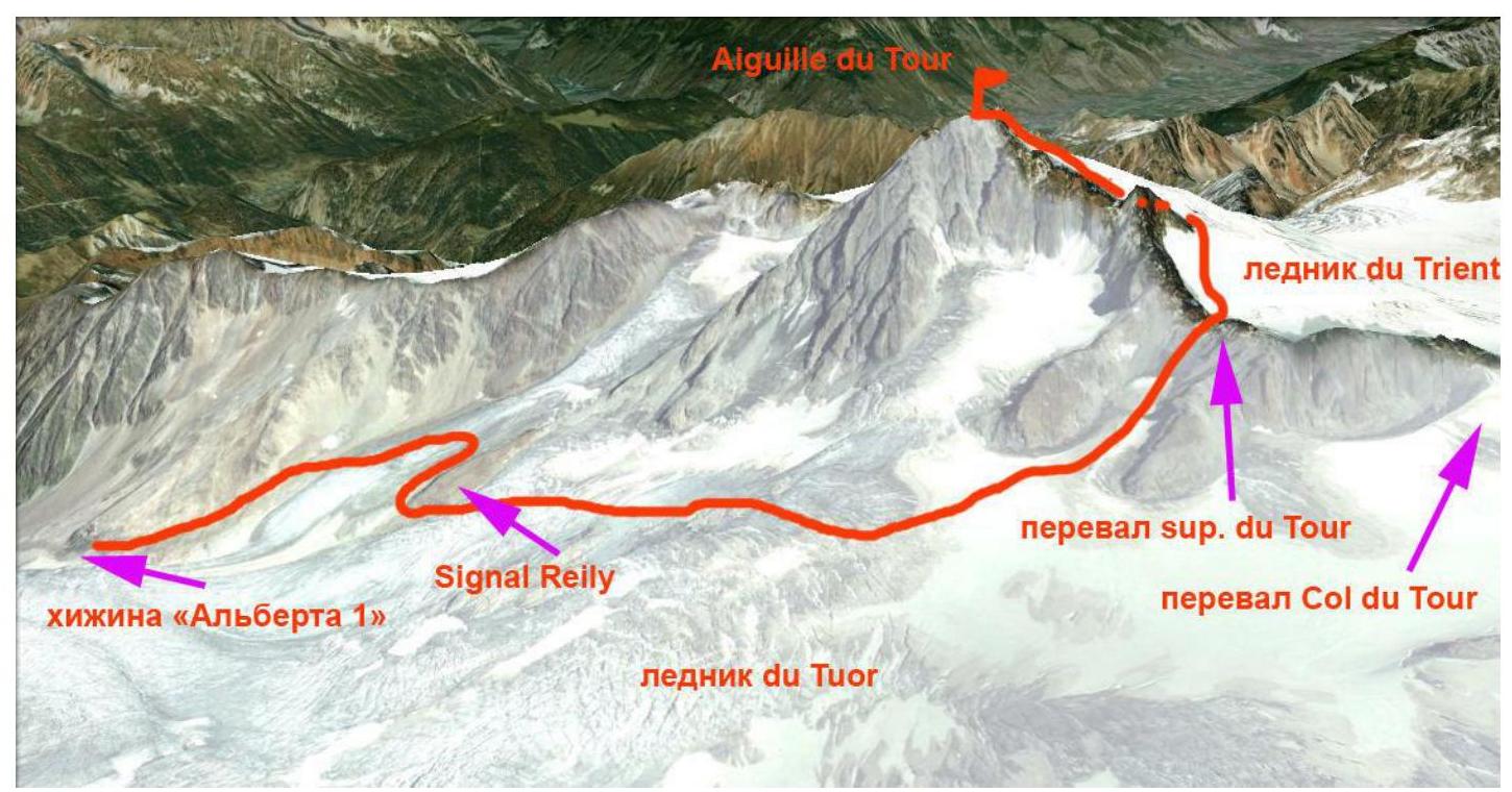
Some GPS coordinates along the route: Aiguille du Tour summit: 45°59′39.67″ N 7°0′35.95″ E Col du Tour: 45°59′18.62″ N 7°0′42.60″ E Signal Reilly: 45°59′40.18″ N 6°59′54.40″ E Albert Premier refuge: 45°59′48.36″ N 6°59′11.66″ E
Area Photopanorama
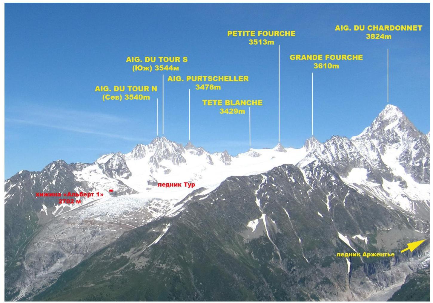
Photo of the Glacier du Tour area. Taken from Lac Blanc on July 3, 2014.
Area Map

Approach to Albert Premier Refuge
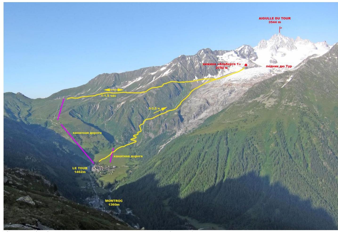
Approach route from Le Tour village to Albert Premier refuge
Almost all ascents in the Glacier du Tour area start from Albert Premier refuge. The approach can be made via two paths.
- From Le Tour village, take the two-stage cable car to the start of the trail to the refuge. Then, follow the trail to the right with a gentle ascent, following the signs, to reach the refuge. The travel time from the cable car is 1–1.5 hours.
- From the outskirts of Le Tour village, cross a large field with a small cable car towards the Glacier du Tour. From the edge of the field, the trail will wind its way up the left side of the rocky outcrops and glacier debris. On the rocky sections of the trail, there are red paint markings. Midway through the ascent, there is a helipad where you can rest. From there, the path continues along the moraine trail. The total ascent time from the village to Albert Premier refuge is 3–3.5 hours.
Summit Photograph
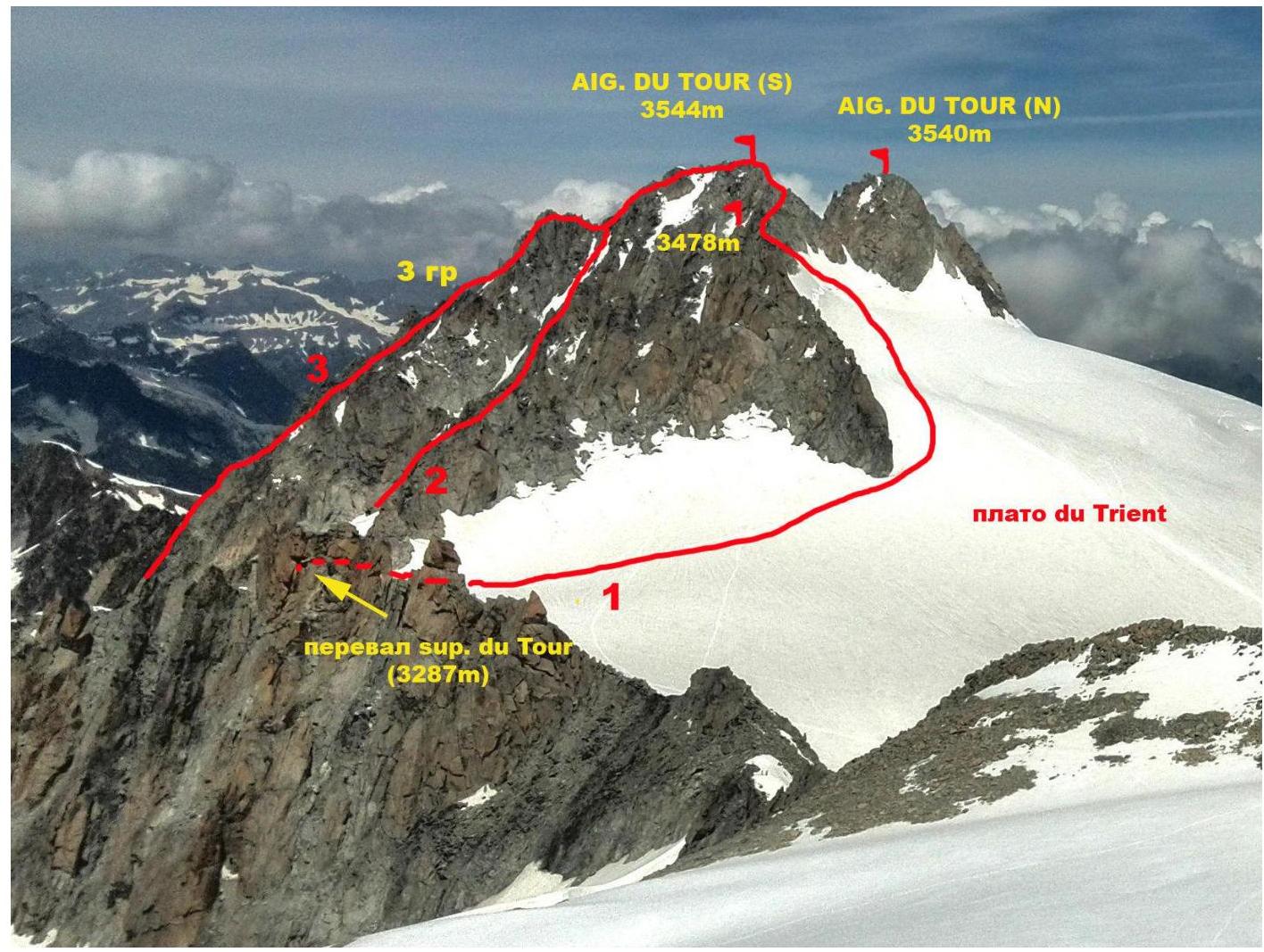
Photo of Aiguille du Tour South summit. Taken from Petit Fourche summit on August 27, 2014.
Annotations on the photo:
- Classic route from Albert Premier refuge via the eastern slope, 1B cat. dif. (C. G. Heathcote, M. Andermatten, 1864).
- Route via the Table couloir (colour Table) 2A–2B cat. dif. [PD+ (French)] (S. Cachat-Rosset, D. Samblanet, 1974).
- Route via the 3rd grade (through the Table gendarme) 2B cat. dif. [PD (French)] (M. Dreyfus, A. and R. Duval, 1926).
Route Overview
Route Profile Photo
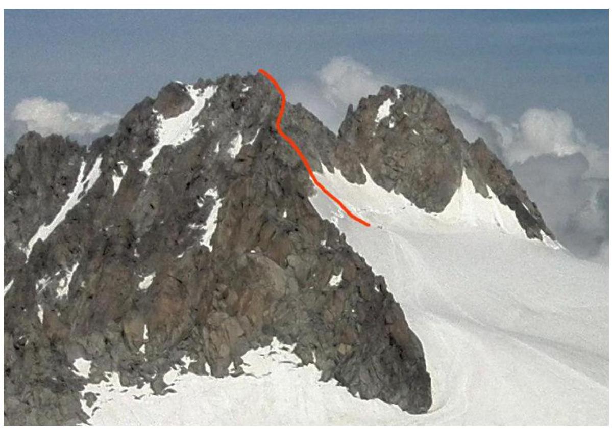
Technical Photograph of the Route
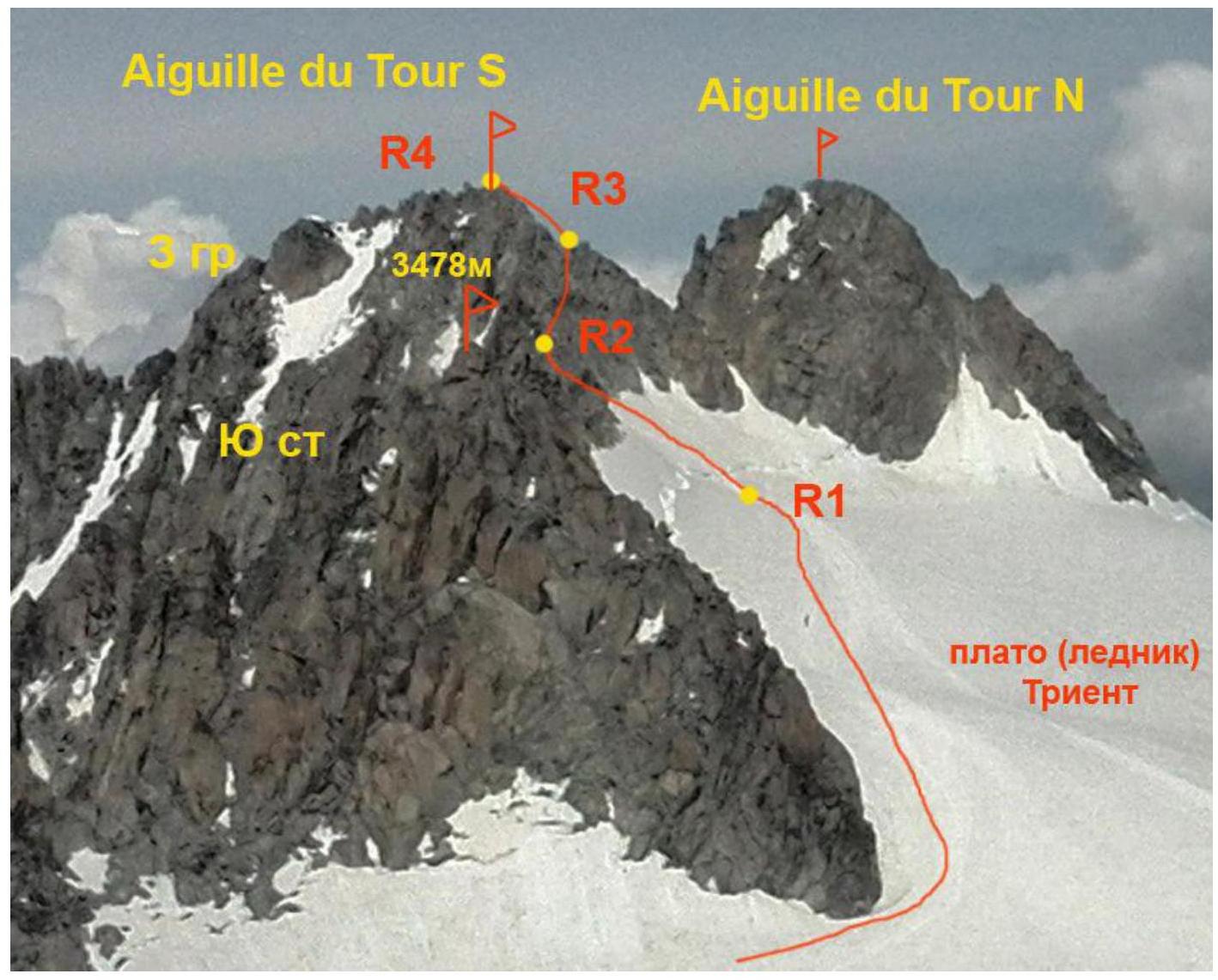
Photo taken from Petit Fourche summit on June 27, 2014.
Description of Route Section Difficulties
| Section | Length | Steepness | Terrain Type | Cat. Dif. | Number of Pitons |
|---|---|---|---|---|---|
| R0–R1 | 3100 m | 15–30° | Snow, firn, ice | I | 0 |
| R1–R2 | 100 m | 50° | Snow-ice slope | II | 0 |
| R2–R3 | 100 m | 65° | Rocky ridge | II | |
| R3–R4 | 50 m | 65° | Rocky ridge | II |
Brief Description of Route Passage by Sections
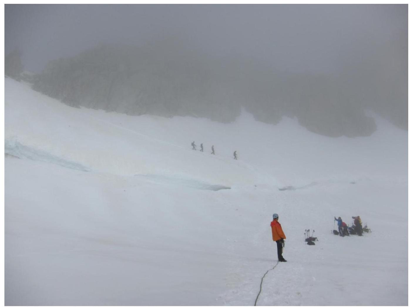
R0–R1 From the refuge, move along the rocky moraine alongside the glacier, then turn left. Reach the glacier and put on climbing gear. (20 minutes) I 20°, 400 m.
Continue on the glacier, bypassing the cirque to the left, to reach the foot of Signal Reilly (2883 m). Follow the gentle glacier towards the large reddish "gates" – the approach to Col du Tour. I 20°, 1500 m.
From the large reddish rock on the right – ascend to Col du Tour. The upper part of the col is rocky. I 30°, 400 m.
From the col – ascend along the slope towards the prominent pyramid of Purtscheller peak. Continue along the ridge to the snowy base of Aiguille du Tour. I 25°, 800 m.
R1–R2 Cross the bergschrund (II 60°, 20 m) and ascend the snowy slope to the ridge. Snow-ice. Ice axe belay II 50°, 80 m.
R2–R3 Move right along the ledges on the ridge. Ascend to the intersection with the Eastern ridge. Rock. II+ 65°, 100 m.
R3–R4 Ascend the rocky ridge (with some underclimbs) to the summit II 70°, 100 m.
Descent
Descend via the ascent route.
Route Recommendations
The route is generally considered relatively safe. Key hazards include glacier travel on the approach, potentially crevassed areas, and the risk of getting lost in poor visibility on the large glacier (GPS or compass recommended). The snow bridge over the bergschrund under the summit may be in poor condition.
Photo Illustrations

Upper section of the approach to the route
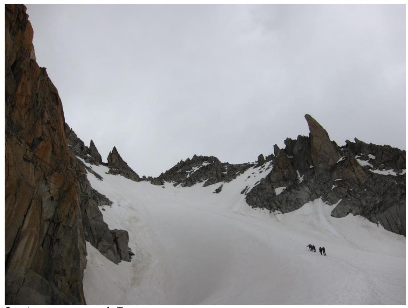
Approach to Col du Tour
Before the bergschrund. Section R1–R2
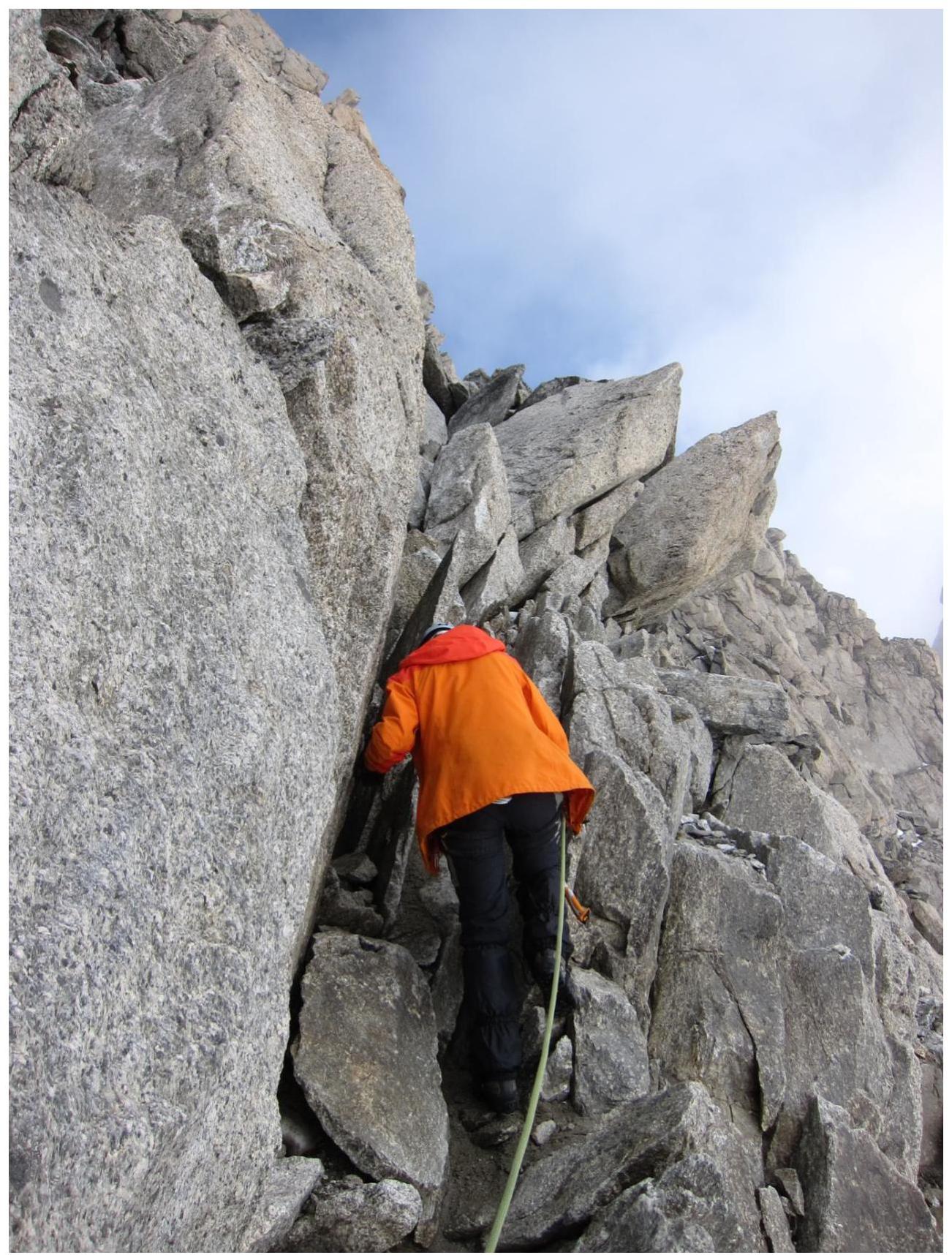
Section R2–R3
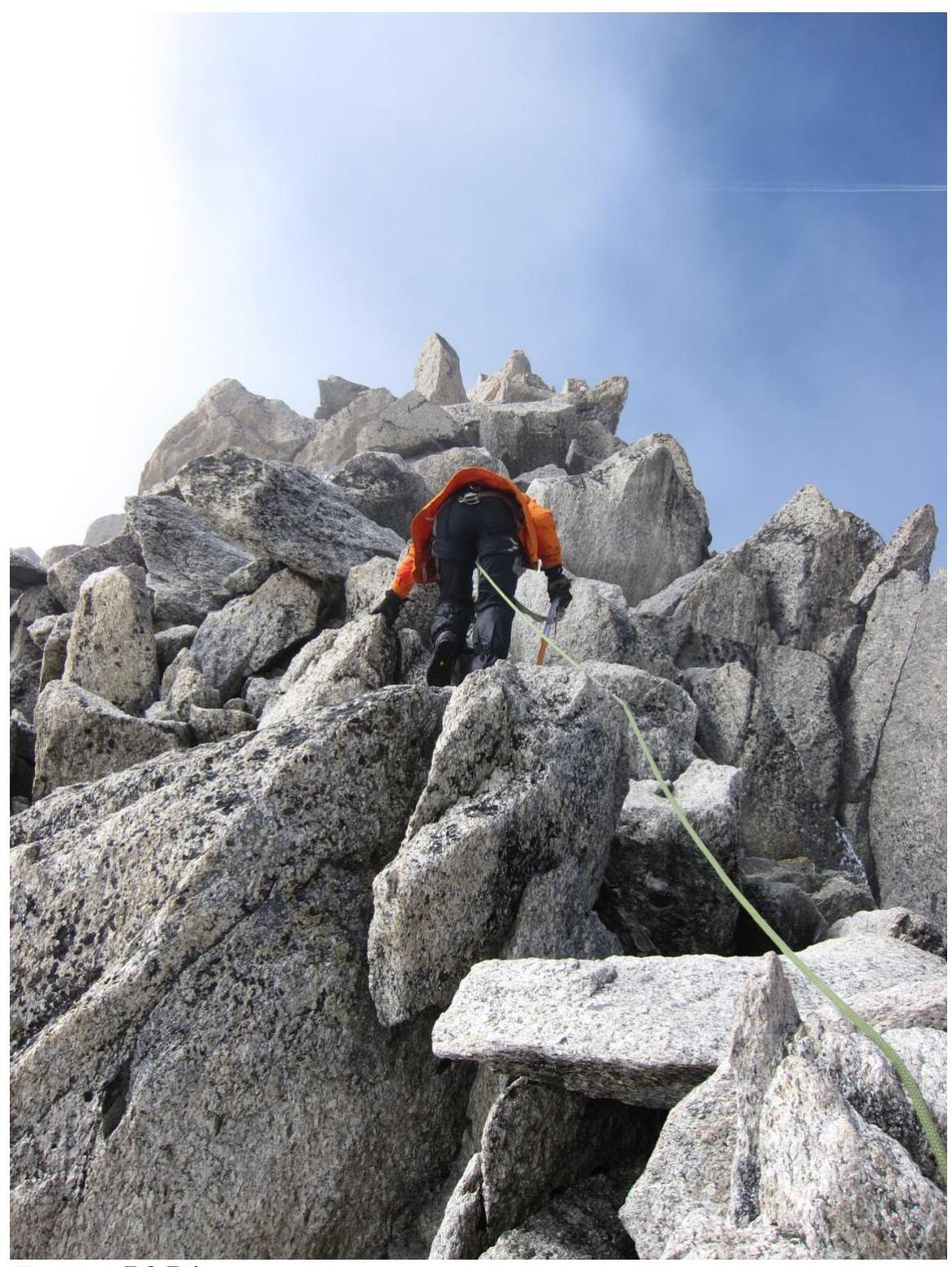
Section R3–R4
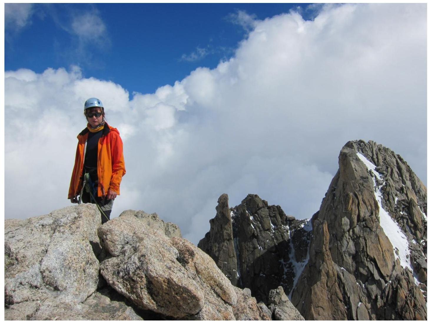
On the summit. In the background, Aiguille du Tour North peak