Report
On the ascent of the CSKA team named after Demchenko to the summit of Aiguille du Tour North (3540 m) via the SW ridge, category 3A, Savoy Alps, Chamonix area
Ascent Details
- France. Savoy Alps, Chamonix area. Section No. 10.3 (according to KGBM 2013)
- Summit Aiguille du Tour North (Aiguille du Tour N) 3540 m.
Via SW ridge
- Proposed category: 3A
- Route type: combined
- Height difference: 700 m
Route length: 3000 m. Section lengths:
- Category V:
- Category VI:
Average steepness:
- Main part of the route: 60°
- Entire route: 23°.
-
Pitons left (used) on the route: total 0; including drilled pitons:
-
Team's total climbing time: 7 hours (excluding descent)
-
Team leader: Korol E.M., Master of Sports
Team members:
- Galimzyanov T. 3rd category
- Galinova T. 3rd category
- Tsepnyakov P. 3rd category
- Golyakov V. 3rd category
- Galkina N. 2nd category
- Epaneshnikova E. 1st category
- Coach: Korol E.M., Master of Sports
- Departure from Albert 1 Refuge at 6:00, August 27, 2014. Summit reached at 13:00, August 27, 2014. Return to refuge at 18:15, August 27, 2014. Descent via South slope (category 2A)
- Organized by: CSKA named after Demchenko (Moscow) training camp
- Report responsible: Galimzyanov T.R.
Email: gal_timur@yahoo.com
Panoramic View of the Area
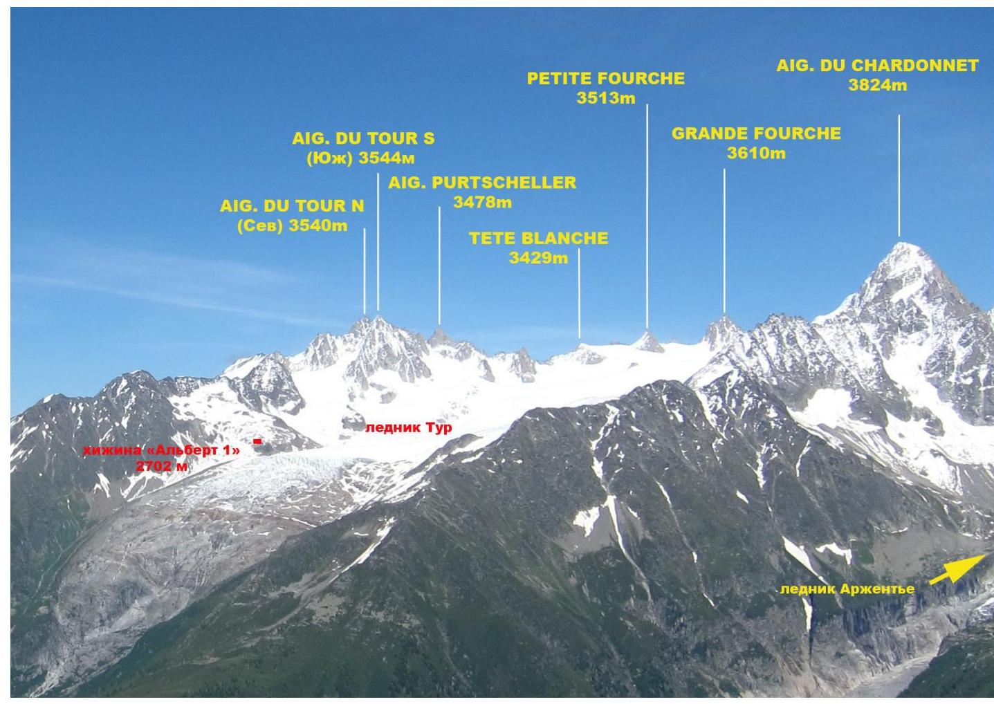
View of the Aiguille du Tour area. Photo taken from Lac Blanc on July 3, 2014.
General Information about the Climbing Area
The summit Aiguille du Tour North (Aiguille du Tour N) 3540 m, which was the target of the ascent, is located in the Chamonix valley area. This valley is part of the Savoy Alps in southern France. Chamonix is known for its well-developed mountain infrastructure and rich mountaineering traditions and history.
The highest point in the Chamonix area and the Savoy Alps is Mont Blanc (4808 m), the highest peak in the Alps.
The ascent to Aiguille du Tour was part of the CSKA named after Demchenko (Moscow) training camp in June and early July 2014. The base camp was located in the Montroc campsite. Montroc is the highest settlement in the Chamonix valley, with an elevation of 1300–1400 m.
Most mountaineering routes are located in the Mont Blanc massif. The height of the peaks in the area ranges from 3500 to 4000 m, featuring various types of terrain:
- Rock
- Ice
- Snow
There are many combined routes. The area offers a wide variety of rock, ice, and snow routes, as well as combined routes, ranging from category 1B to 6A.
The immediate approach to the route was made from the Albert 1 Refuge. The refuge is located at the foot of the Glacier du Tour at an elevation of 2702 m. The names of the first ascendants of the route repeated by the CSKA team are unknown.
Some GPS coordinates along the route: Aiguille du Tour North summit: 45°59′42.50″ N 7°0′40.01″ E; Col du Tour: 45°59′18.62″ N 7°0′42.60″ E; Signal Rey: 45°59′40.18″ N 6°59′54.40″ E; Albert 1 Refuge: 45°59′48.36″ N 6°59′11.66″ E
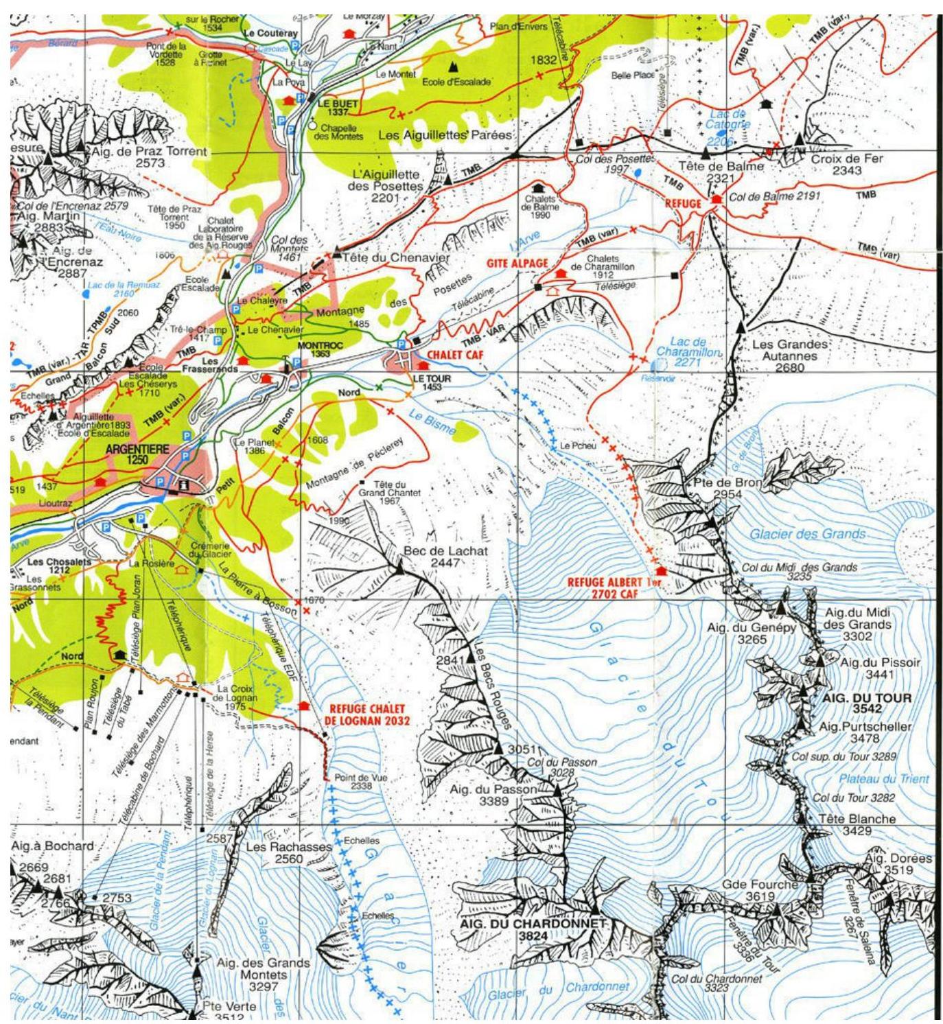
Area Map
Approach to Albert 1 Refuge
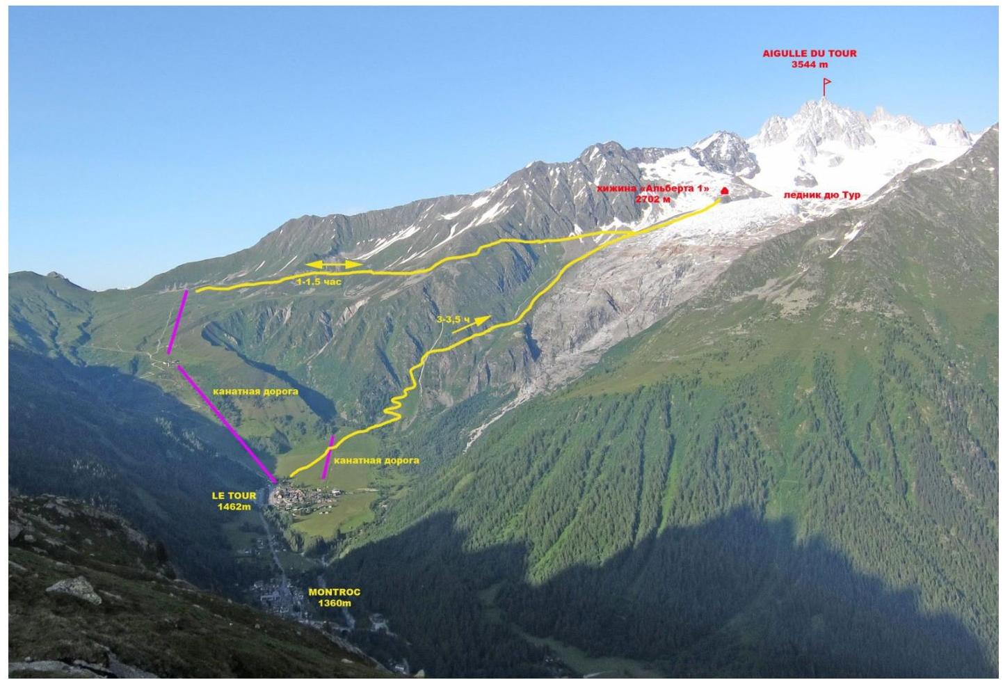
Approach route from Le Tour village to Albert 1 Refuge
Most ascents in the Glacier du Tour area start from the Albert 1 Refuge. The approach can be made via two paths.
- From Le Tour village, take the cable car to the start of the trail to the refuge. Then follow the trail to the right, with a gentle ascent, to reach the refuge. The journey from the cable car takes 1–1.5 hours.
- From the outskirts of Le Tour village, cross a large field with a small cable car towards the Glacier du Tour. From the edge of the field, the trail begins to ascend in a series of zigzags on the left side of the rocky outcrops and glacial moraine. The trail is marked with red paint on the rocky sections. About halfway up, there is a helipad where you can rest. From there, the path continues along the moraine. The total ascent time from the village to Albert 1 Refuge is 3–3.5 hours.
General photo of the summit.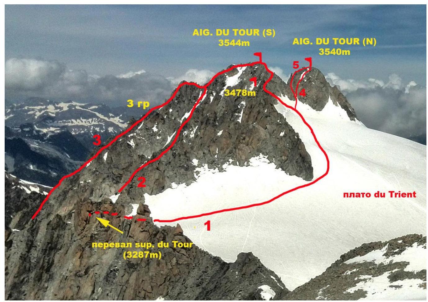
Photo of Aiguille du Tour South and North summits. Photo taken from the summit of Petit Fourch in June 2014. Labels on the photo:
- Aiguille du Tour (S) Classic route from Albert 1 Refuge via East slope, category 1B (C.G. Heathcote, M. Andermatten, 1864)
- Aiguille du Tour (S) Route via Couloir Table 2A–B category [PD+ category (French)][PD+ к/тр (French)] (S. Cachat-Rosset, D. Samblanet, 1974)
- Aiguille du Tour (S) Route via 3rd grade (through Gendarme Table) 2B category [PD category (French)][PD к/тр (French)] (M. Dreyfus, A. and R. Duval, 1926)
- Aiguille du Tour (N) Route via South slope (category 2A);
- Aiguille du Tour (N) Route via SW ridge (category 3A)
Route Profile
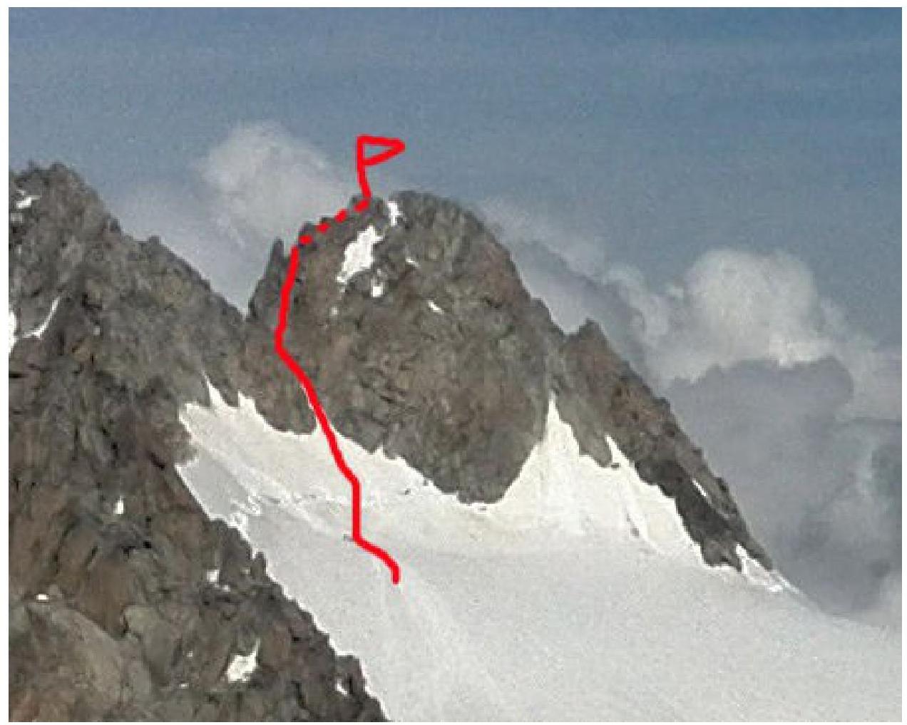
Photo of the main part of the route in profile (taken from the summit of Petit Fourch)
Technical Photograph of the Summit
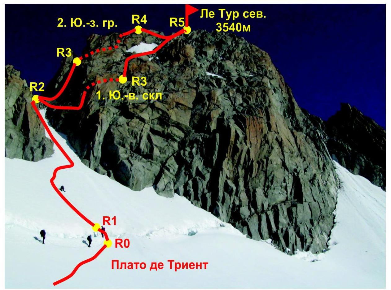
Photo of Aiguille du Tour North summit. Photo taken from the Glacier (plateau) de Trient on August 26, 2014.
Routes:
- Route 1 — via SE slope (2A)
- Route 2 — via SW ridge (3A)
Description of Route Difficulties
| Section | Length | Steepness | Terrain Characteristics | Category | Number of Pitons |
|---|---|---|---|---|---|
| R0–R1 | 7 m | 60° | Snow-ice slope, bergschrund | III | 0 |
| R1–R2 | 100 m | 30° | Snow-ice slope | II | 0 |
| R2–R3 | 50 m | 80° | Rocky slope, chimney | III+ | 6 |
| R3–R4 | 50 m | 80° | Rocky slope | IV | 10 |
| R4–R5 | 20 m | 20° | Rocky ridge | II+ | 1 |
Brief Description of Route Passage by Sections
R0–R1: Cross the bergschrund. Early in the season, there may be snow bridges; a 2–3 m snow wall may need to be climbed.
R1–R2: Ascend the snowy couloir to the col; move in linked pairs simultaneously. Category II, 30°, 100 m.
R2–R3: From the col, move left towards the SW ridge. Climb 30 m up the chimney to a narrow col. Category III+, 80°, 50 m.
R3–R4: From the col, traverse the NW slope to a pronounced internal angle. Climb up the angle to the ridge. Move along the ridge to a gendarme. Category IV, 80°, 50 m.
R4–R5: From the gendarme to the summit along the ridge. Climb up and traverse the ridge to the right. Category II, 20°, 250 m.
Descent
Descent from the route is made via Route 1, category 2A.
Route Recommendations
The route is generally considered relatively safe. Belays can be organized without significant problems. The route is suitable for training purposes.
Hazardous moments on the route:
- Glacier travel on the approach, with crevasses in some areas (crevasses!)
- Large glacier area where it's easy to get lost in poor visibility (recommended to bring a GPS or compass and stay on the trail)
The key section in terms of difficulty is R3–R4, with belays on medium-sized protection.
Photo Illustrations
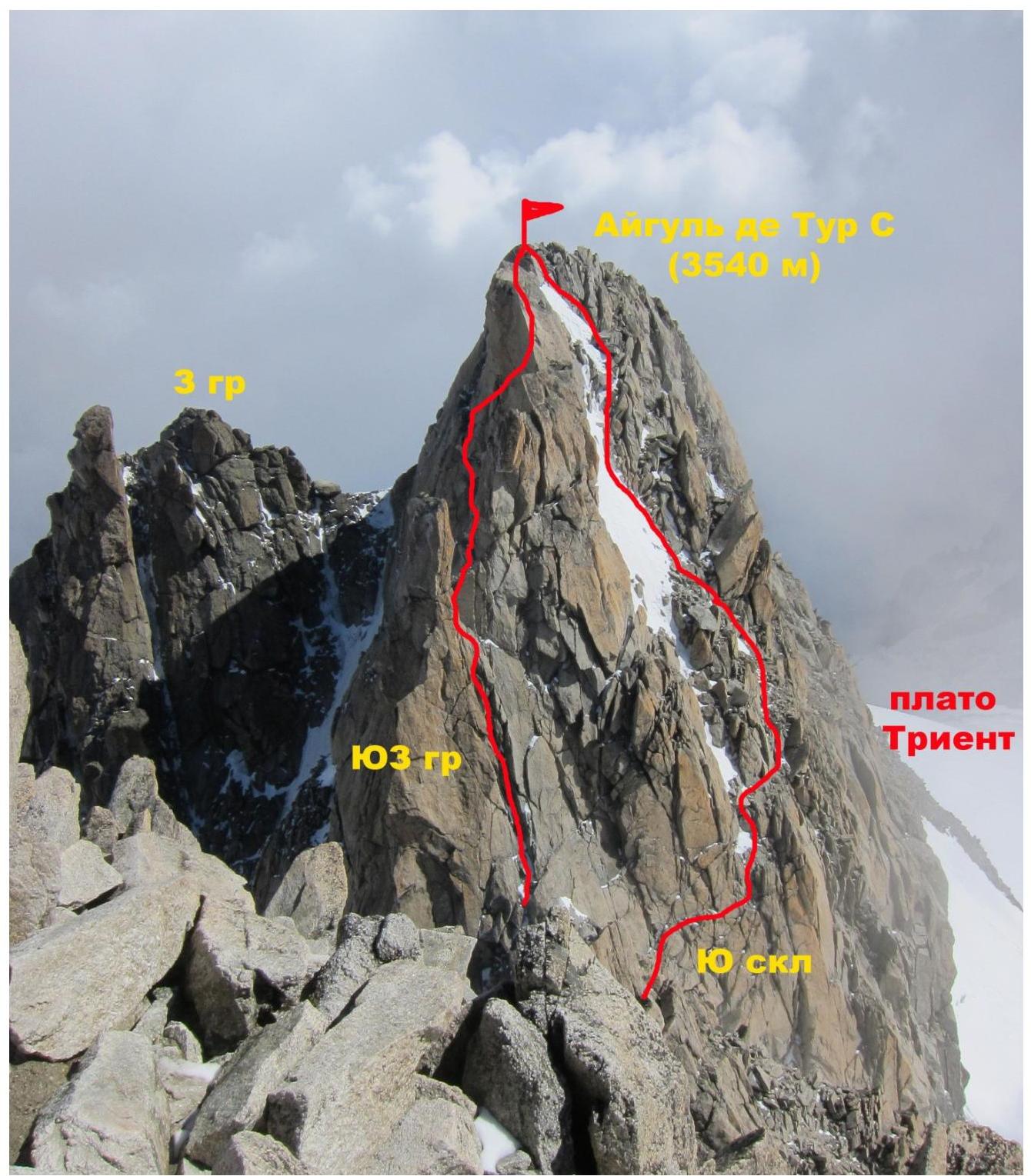
Photo of Aiguille du Tour North summit from the South summit. The route via SW ridge (3A) is on the left, and the route via South slope (2A) is on the right.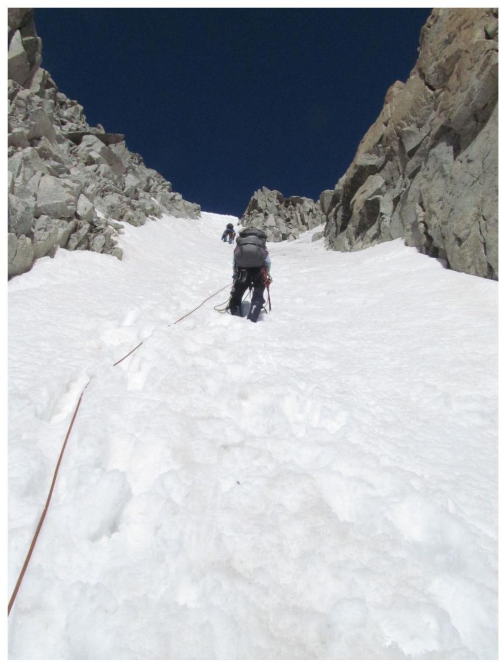
Passage of section R1–R2 (photo taken from a report of the same team's ascent via route 2A on the South slope)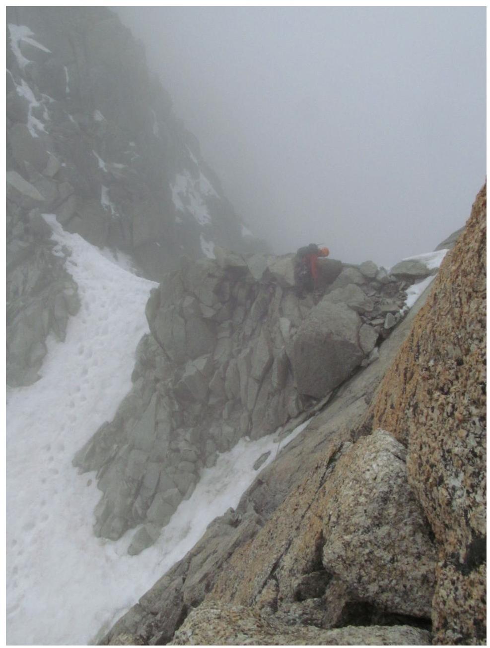
Col at point R2 (photo taken from a report of the same team's ascent via route 2A on the South slope)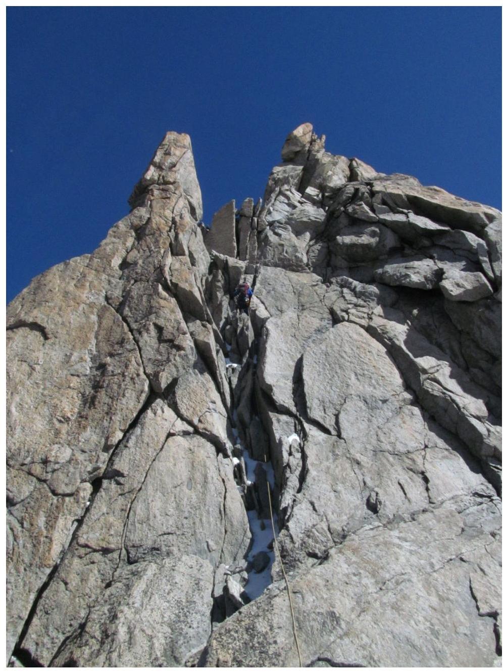
Passage of the chimney and rocky slope on section R2–R3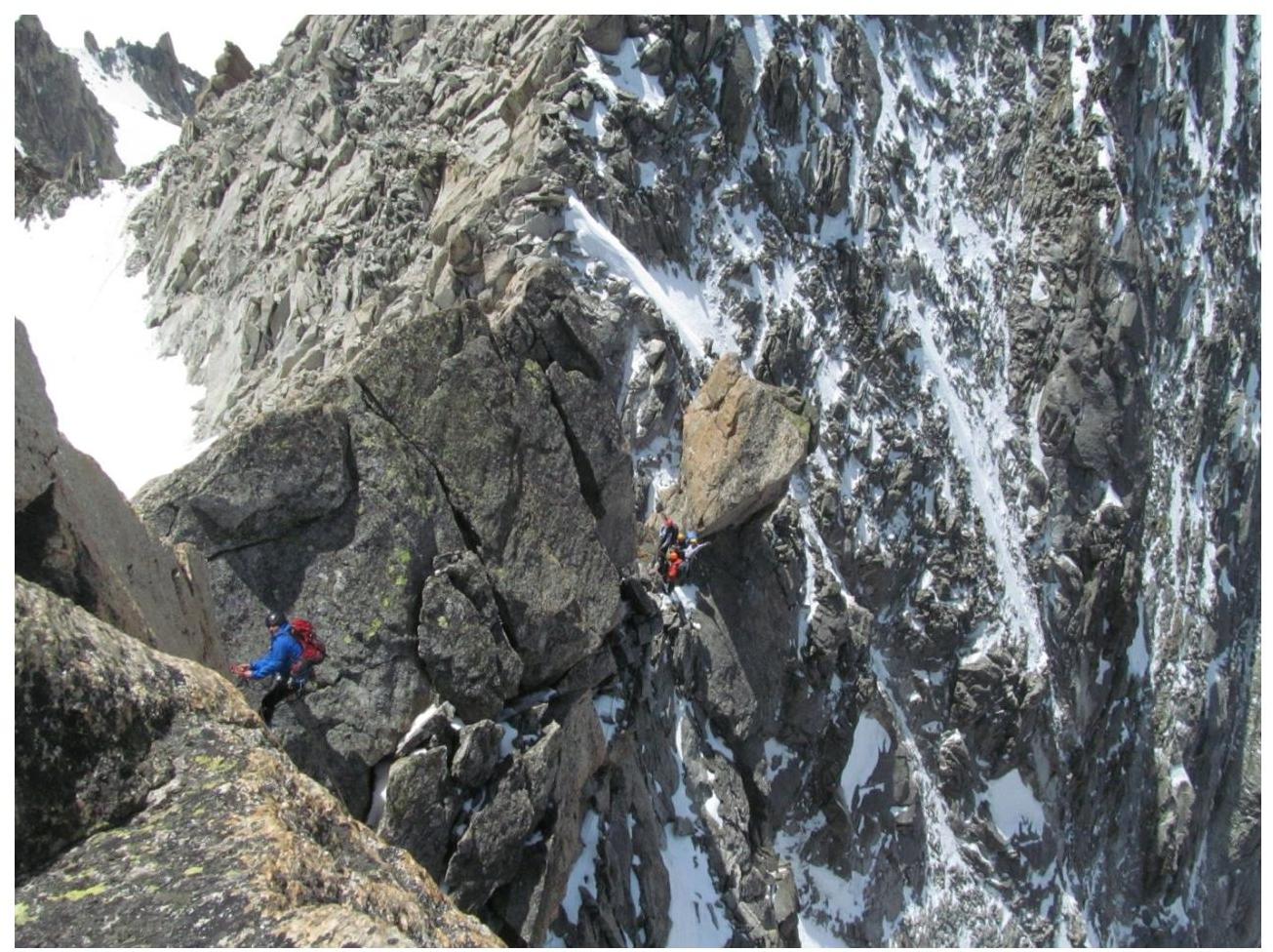
Section R3–R4, photographed from point R4. The group is visible at point R3.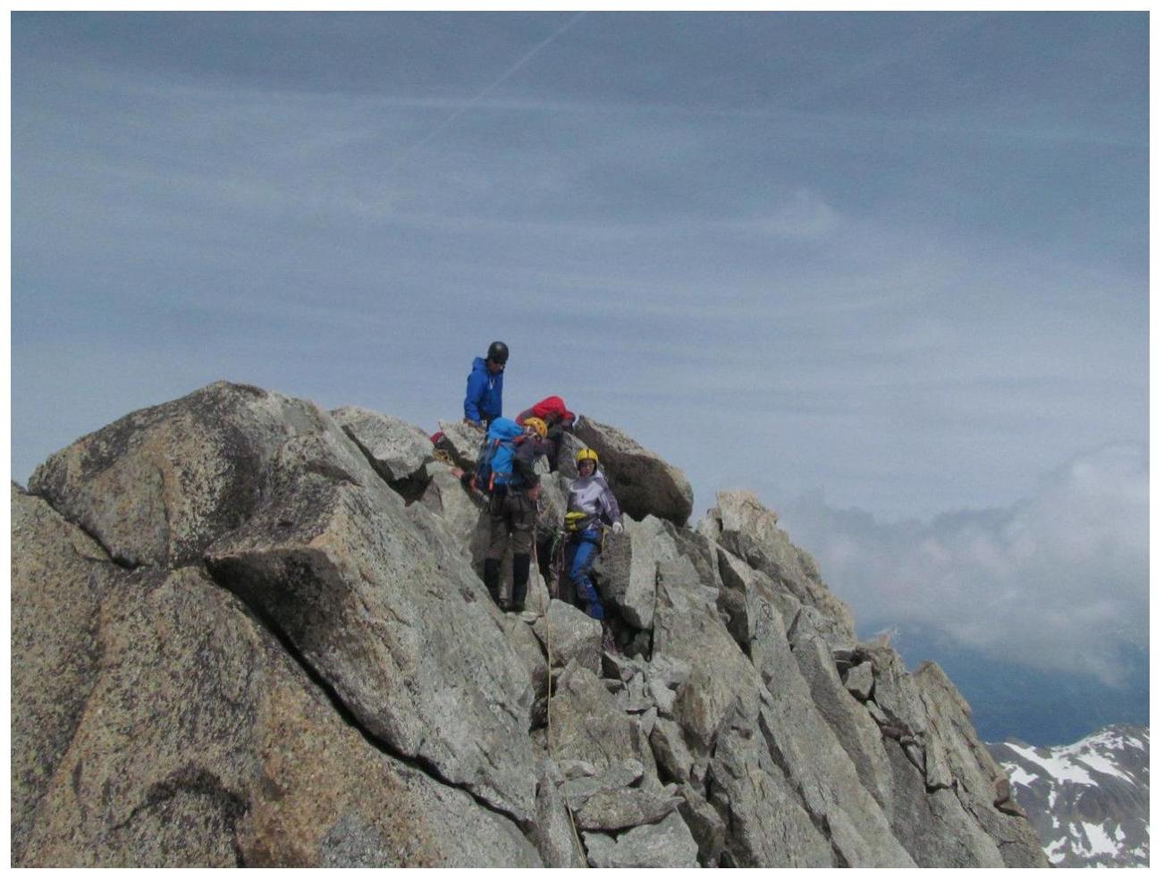
At the summit