
Report
On the ascent to the summit of Aiguille du Midi via the route Eperon des Cosmiques Category 3B by the training department of the Polytechnic tourist club under the guidance of Molodozhen V. A. August 1, 2018
I. Ascent Report
| № | 1. General Information | |
|---|---|---|
| 1.1 | Full name, sports rank of the leader | Molodozhen V. A., Master of Sports |
| 1.2 | Full name, sports rank of participants | Fineeva A. A. 3rd sports category, Sadovsky S. V. 3rd sports category, Duplyak A. K. 3rd sports category, Lymanyuk A. Yu. 3rd sports category, Bakharev N. N. 3rd sports category |
| 1.3 | Full name of the coach | Molodozhen V. A. |
| 1.4 | Organization | Polytechnic tourist club St. Petersburg |
| 2. Characteristics of the Ascent Object | ||
| 2.1 | Region | France, Haute-Savoie, Chamonix valley |
| 2.2 | Glacier | Glacier du Geant |
| 2.3 | Classification table section number (2013) | 10.3 |
| 2.4 | Name and height of the summit | Aiguille du Midi, 3842 m |
| 2.5 | Geographic coordinates of the summit (latitude/longitude), GPS coordinates | geo: 45.878611, 6.887222, GPS: 45°52′44″ N 06°53′15″ E |
| 3. Route Characteristics | ||
| 3.1 | Route name | Eperon des Cosmiques |
| 3.2 | Proposed category of difficulty | 3B |
| :--: | :--: | :--: |
| 3.4 | Terrain type of the route | Rock |
| 3.5 | Height difference of the route | Elevation of the campsite — 3532 m; Height at the start of the route — 3600 m; Summit height – 3842 m; Height difference from campsite to summit — 310 m; Height difference from the base of the rock ascent to the summit – 242 m. |
| 3.6 | Route length | Distance from campsite to the base of the rock ascent (approach length) — 850 m; Distance from the start of the route to the summit — 915 m; Descent from the summit — 1500 m; Total route length — 2415 m; Distance from the descent to the campsite — 850 m; Total route length including approach and return to campsite — 3765 m |
| 3.7 | Technical elements of the route | Category I rock — 130 m, Category II rock — 360 m, Category III rock — 40 m, Category IV rock — 90 m, Category V rock — 70 m |
| 3.8 | Descent from the summit | Along the eastern ridge of Aiguille du Midi to Vallee Blanche to the Col du Midi |
| :-- | :-- | :-- |
| 3.9 | Additional route characteristics | - |
| 4. Team Actions Characteristics | ||
| 4.1 | Travel time | 0 days 8 hours 30 minutes |
| 4.2 | Overnight stays | Site |
| 4.3 | Start of the route | 6:30 August 1, 2018 |
| 4.4 | Reaching the summit | 15:00 August 1, 2018 |
| 4.5 | Return to base camp | 16:00 August 1, 2018 |
| 5. Responsible for the report | ||
| 5.1 | Full name, e-mail | Duplyak A. K., dupliaka@gmail.com |
II. Ascent Description
1. Characteristics of the Ascent Object

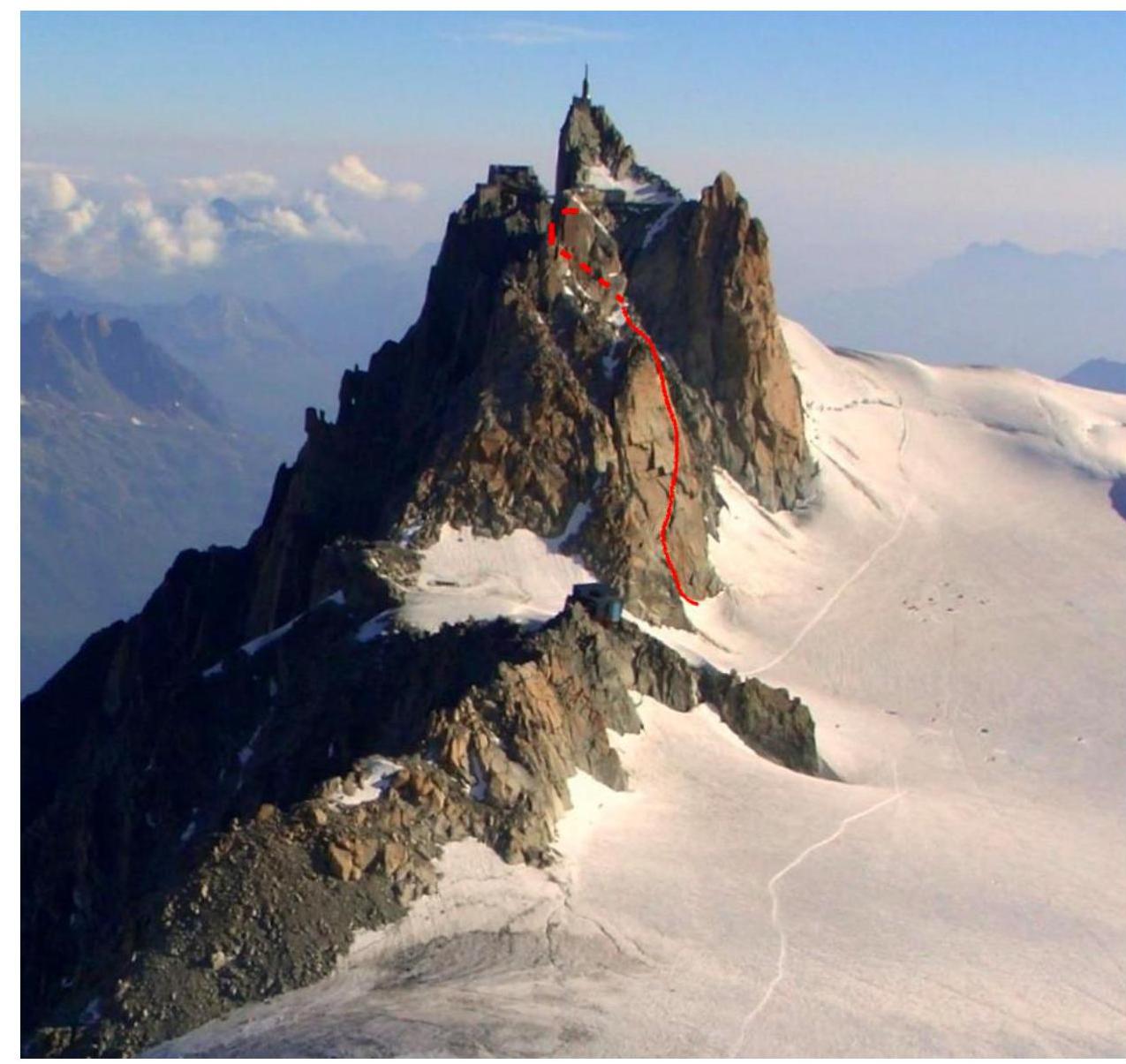
1.1. General photo of the summit Photo 1. Date — September 10, 2010. Author — Lacassin R. Location — Glacier du Geant, France, view of the south slope of Aiguille du Midi.
Routes:
- Route along the Arete des Cosmiques — Category 3A;
- Route via Eperon des Cosmiques — Category 3B.
1.2. Route profile
Photo 2. Date — August 2, 2018. Location — west slope of Mont Blanc du Tacul, France, view of the southwest ridge of Aiguille du Midi
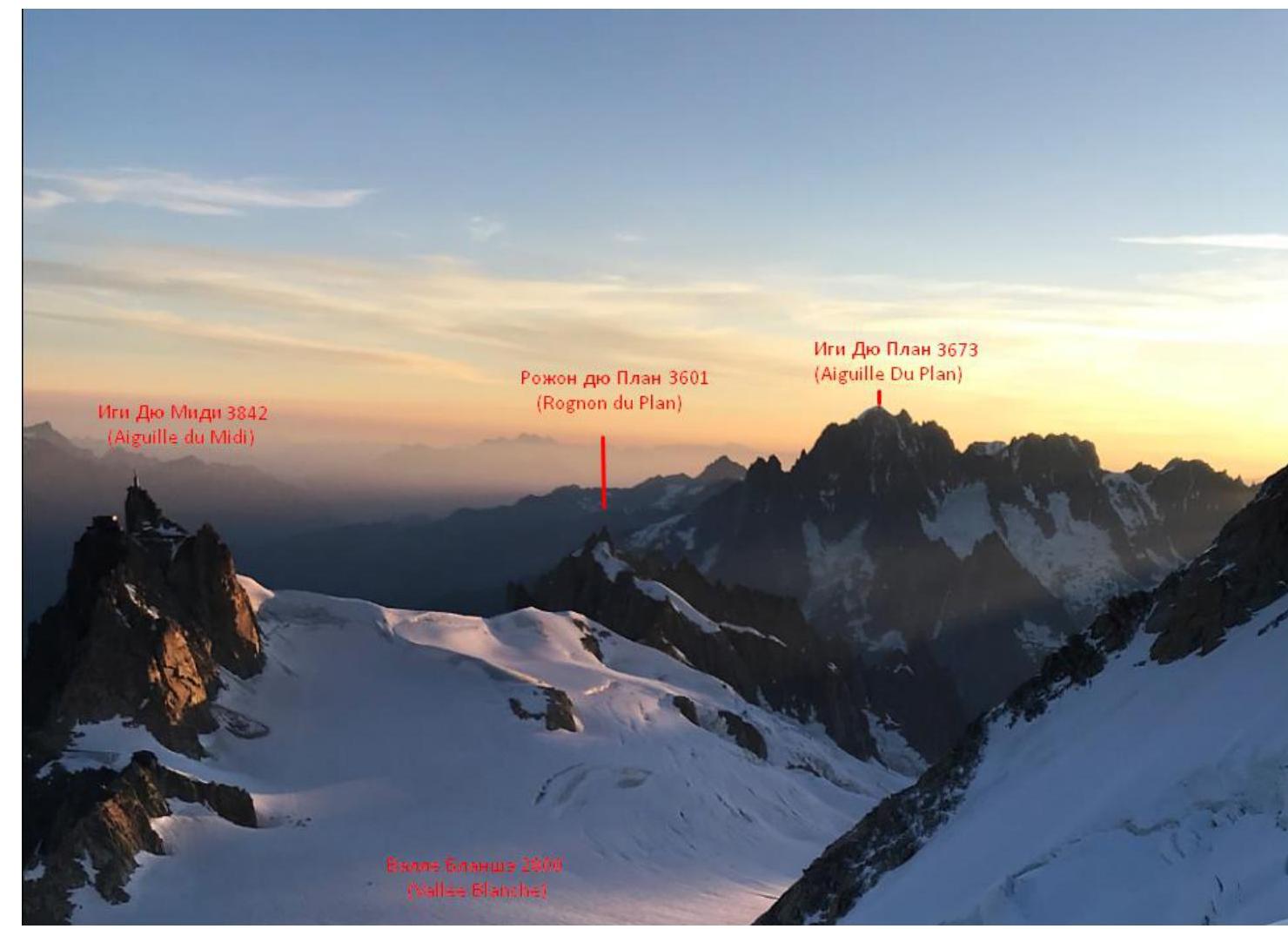
1.3 Photopanorama of the area
Photo 3. Date — August 2, 2018. Location — north slope of Mont Blanc du Tacul. View of the southwest ridge of Aiguille du Midi

Photo 4. Map of the area
2. Route Characteristics
2.1 Technical photograph of the route
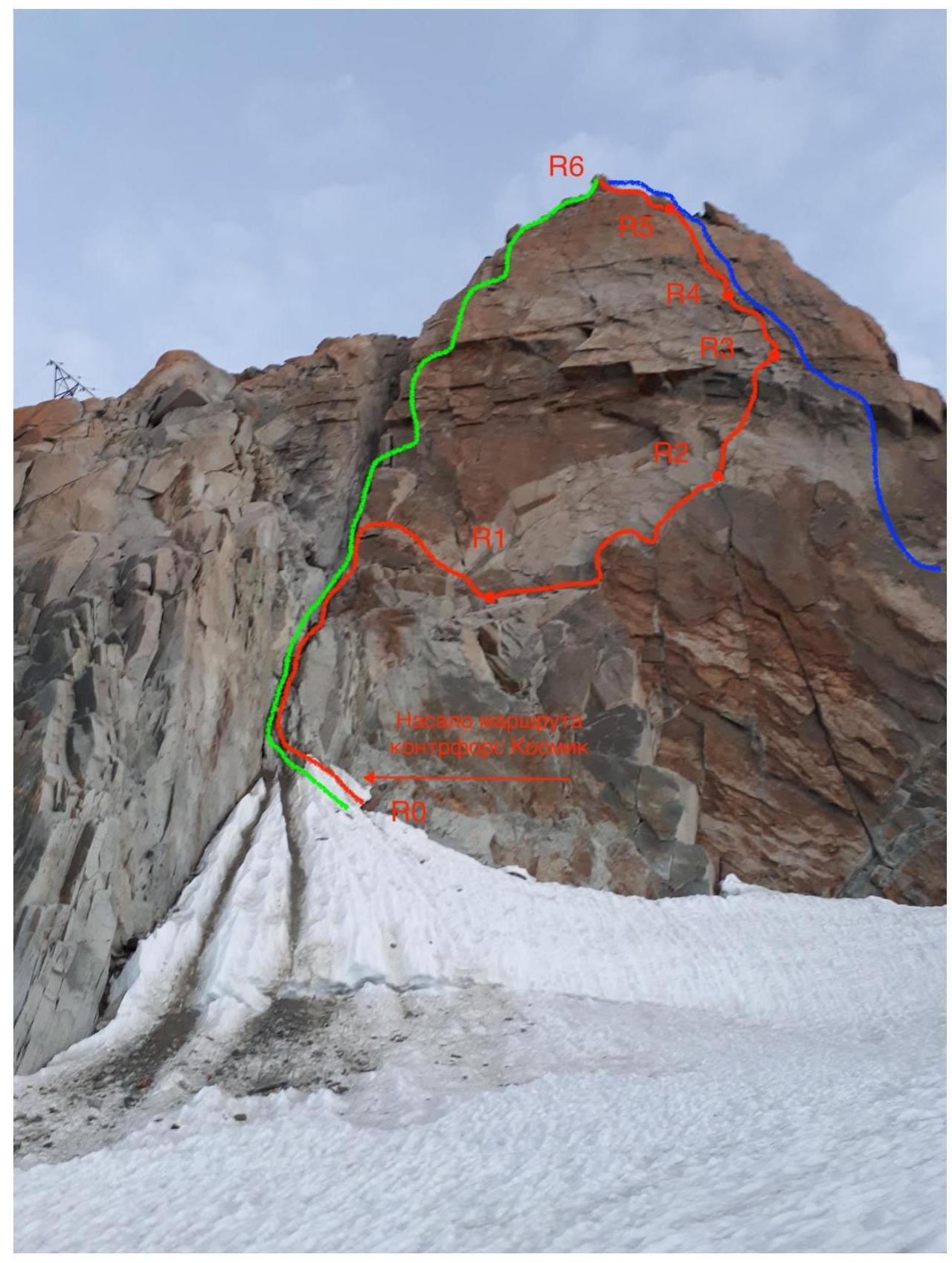
Photo 5. Date — August 1, 2018. Location — Vallee Blanche. View of the south spur of Aiguille du Midi
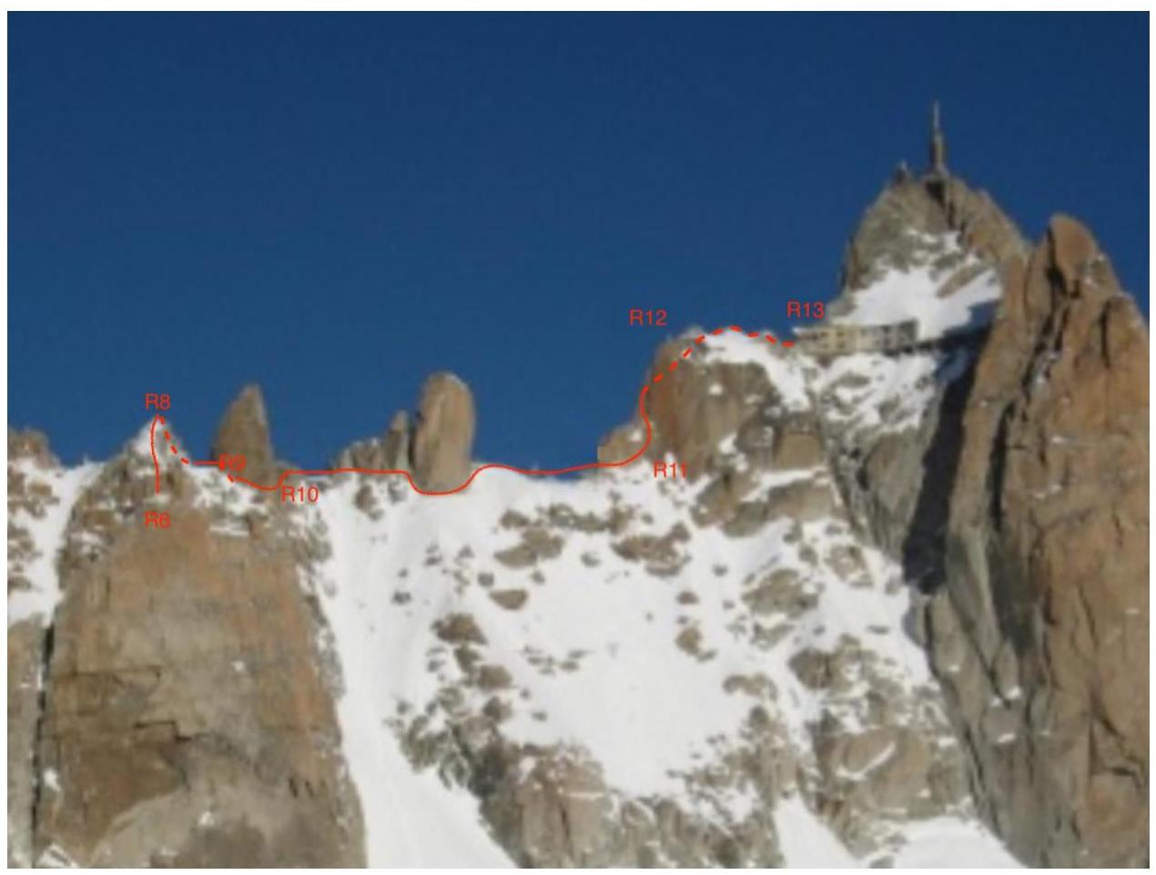
Photo 6. Date — August 1, 2015. Source: https://www.vacancesvuesdublog.fr/actualite-evenement/cet-hiver-faites-un-pas-dans-le-vide-laiguille-du-midi/ ↗ Location — Vallee Blanche. View of the ridge of Aiguille du Midi from the south. The area where the summit is located is in France on Vallee Blanche. This is a snowfield that is part of the Mer de Glace glacier, lying south of Chamonix.
The campsite can be reached via a trail or by using a funicular. The trail takes 2 days with a total ascent of 2807 m. From the funicular station to the camp is a 40-minute (2 km) walk with a descent of 310 m. From the Plan du Midi station, follow the eastern ridge through closed glaciers to the snowfield on Vallee Blanche. Along the snowfield, head southwest along Aiguille du Midi to the rock outcrop where the "Cosmic" hut is located. The campsite is 50 m from the base of the outcrop.
To approach the start of the route, move from the base camp along the trail through closed glaciers northeast along the south slope of Aiguille du Midi to the first couloir. Exit onto small ledges under the route at the narrowest part of the couloir. Further movement is done by free climbing to the gendarme, then along simple rocks along the ridge.
Descent from the route is done along the southeast snow ridge towards the Col du Midi and takes approximately 1 hour.
| Section № | Terrain type | Category | Length | Type and number of protection |
|---|---|---|---|---|
| R0–R1 | rock | 2 | 30 | 8 stoppers |
| R1–R2 | rock | 3 | 30 | 6 stoppers |
| R2–R3 | rock | 5 | 30 | 10 stoppers |
| R3–R4 | rock | 5 | 40 | 12 stoppers |
| R4–R5 | rock | 4 | 50 | 14 stoppers |
| R5–R6 | rock | 4 | 40 | 8 stoppers |
| R6–R7 | rock | 2 | 80 | 8 stoppers |
| R7–R8 | rock | rappel | 20 | - |
| R8–R9 | rock | 2 | 50 | 5 stoppers |
| R9–R10 | rock | rappel | 25 | - |
| R10–R11 | rock | 2 | 100 | 3 stoppers |
| R11–R12 | rock | 3 | 60 | 8 stoppers |
| R12–R13 | rock | 2 | 50 | 6 stoppers |
3. Team Actions Characteristics
3.1 Brief description of the route passage
| Section № | Description | Photo № |
|---|---|---|
| R0–R1 | Rockfall hazard, alternating movement, protection using stoppers. Recommended to make a belay station after reaching a wide ledge, as the bend creates excessive rope friction. | 7 |
| R1–R2 | Simultaneous movement with belay organization on natural terrain. | 8 |
| R2–R3 | Belay through a station. Alternating movement with a section of aid climbing or IV+ climbing. Small and medium cams are suitable. | 9 |
| R3–R4 | Section of crack climbing, alternating movement with belay through a station. An alternative route to the right is possible — the climbing is simpler there. | 10 |
| R4–R5 | Simple climbing along a crack. Alternating movement with belay using stoppers. | 10 |
| R5–R6 | Exit to the ridge. Simultaneous movement from the middle of the rope. Belay using stoppers and terrain. | 11 |
| R6–R7 | Transition from the buttress to the ridge through a loose scree. Rockfall hazard. Belay through terrain. Movement — simultaneous. | 11 |
| :--: | :--: | :--: |
| R7–R8 | Rappel 20 m on a bolt. Multiple rappel anchors are present. Descent into the couloir. | - |
| R8–R9 | Small section of easy climbing between rappels. Simultaneous. | - |
| R9–R10 | Rappel 25 m. Bolt anchors and rappel loops are plentiful. | - |
| R10–R11 | Bypassing the gendarme from below, movement is simple and alternating. Slight amount of snow on the ridge. Belay on terrain. | 12 |
| R11–R12 | Crack climbing. Alternating movement. Many belay points on medium cams. | 12 |
| R12–R13 | Final ascent. Simple climbing. Simultaneous movement. Belaying on large, loose rocks. | 13 |
| Descent | Descent from the route along the approach trail from the funicular station to the base camp. Simultaneous. |
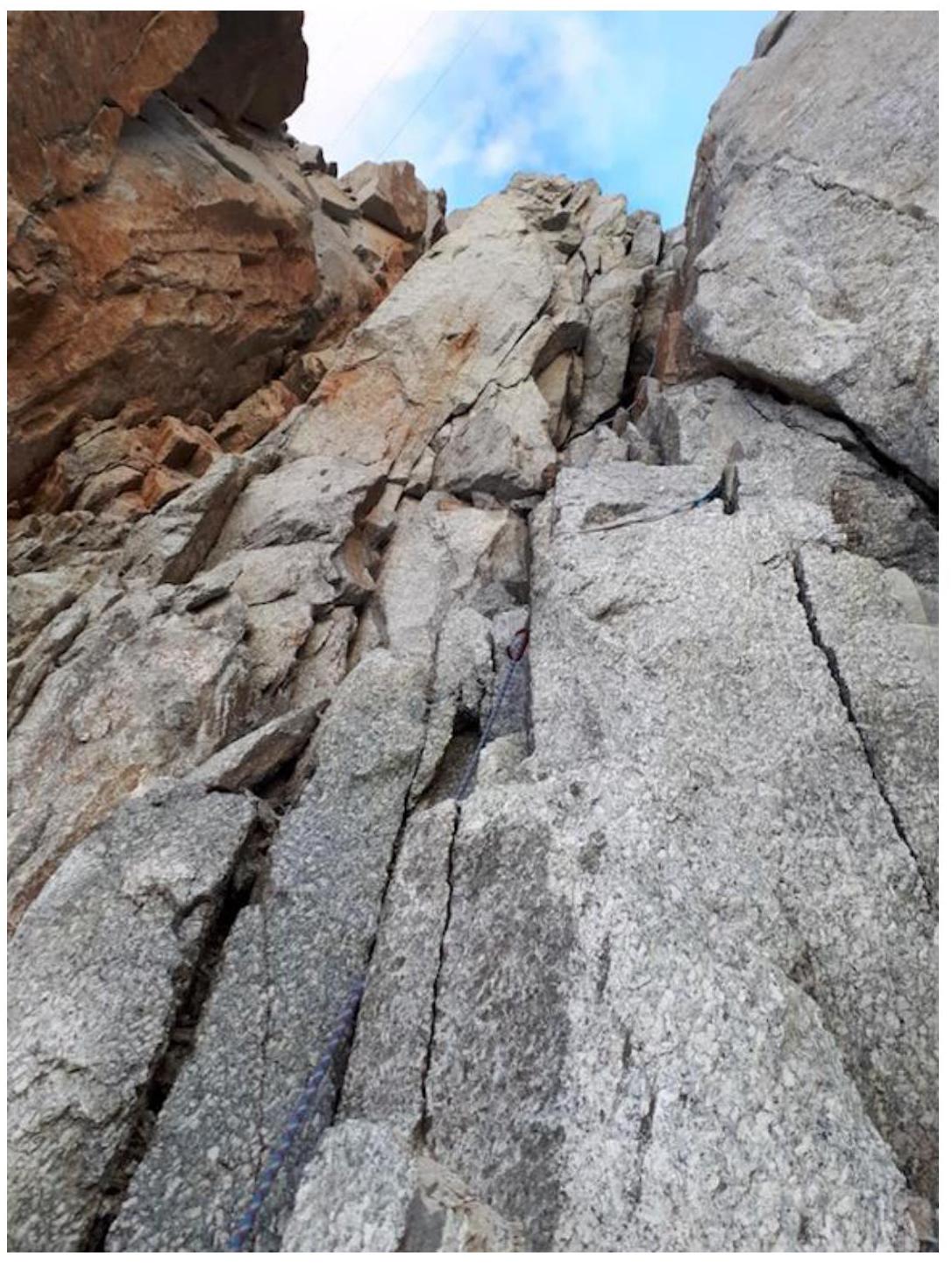
Photo 7. R0–R1. Rockfall hazard in the initial couloir.
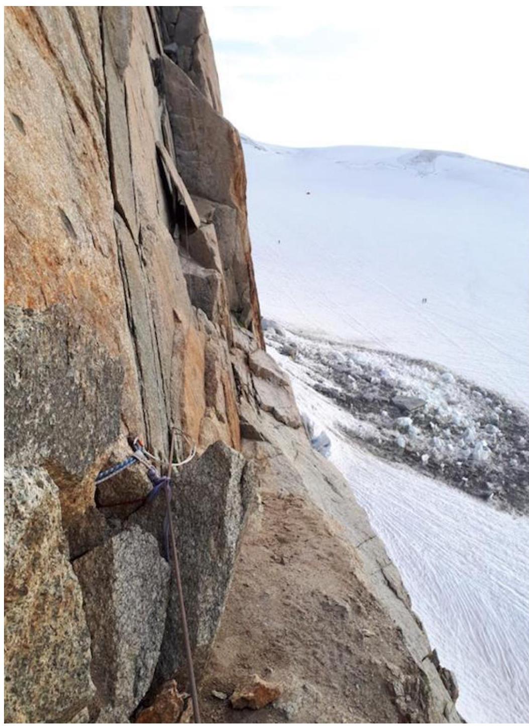
Photo 8. R1–R2. Long and wide horizontal ledge with protruding slabs.
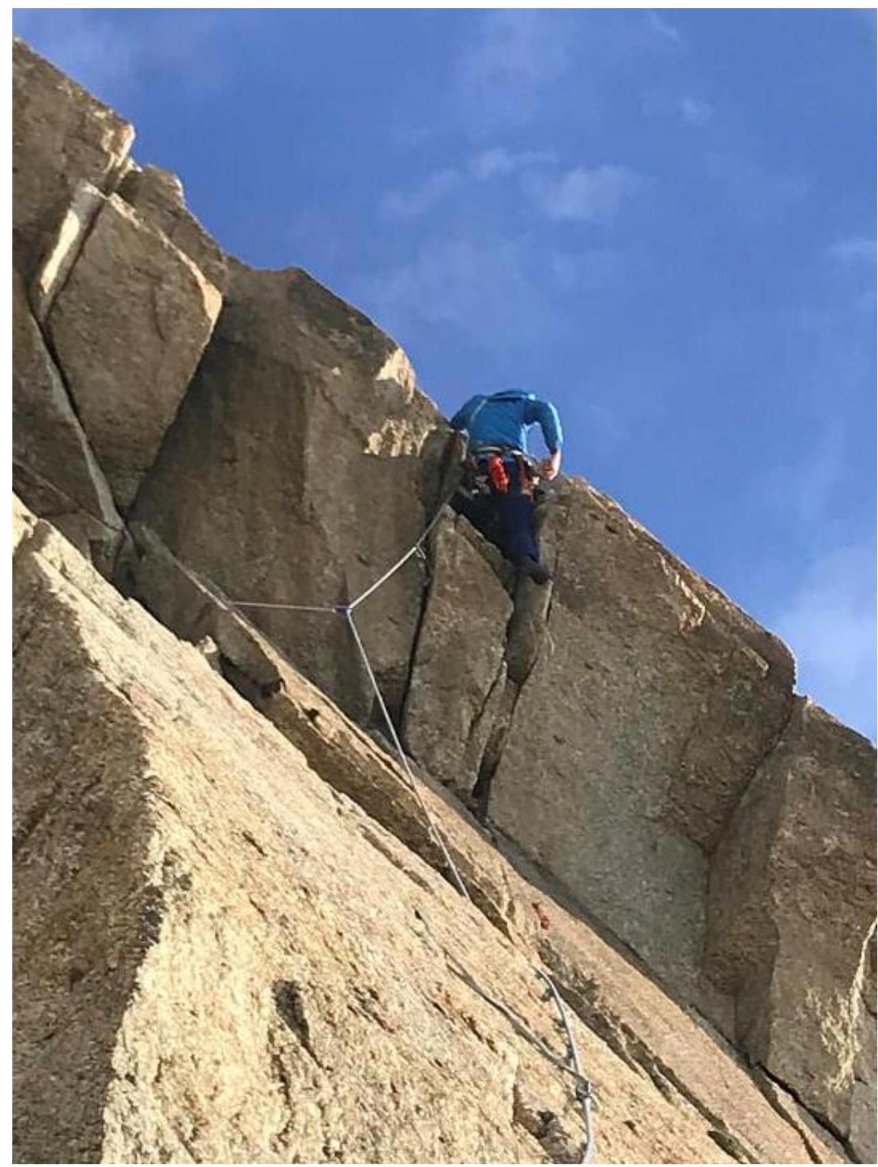
Photo 9. R2–R3. Crux overhang on the route. Requires a single powerful move from under the overhang to a convenient handhold or using a medium cam as an artificial support.
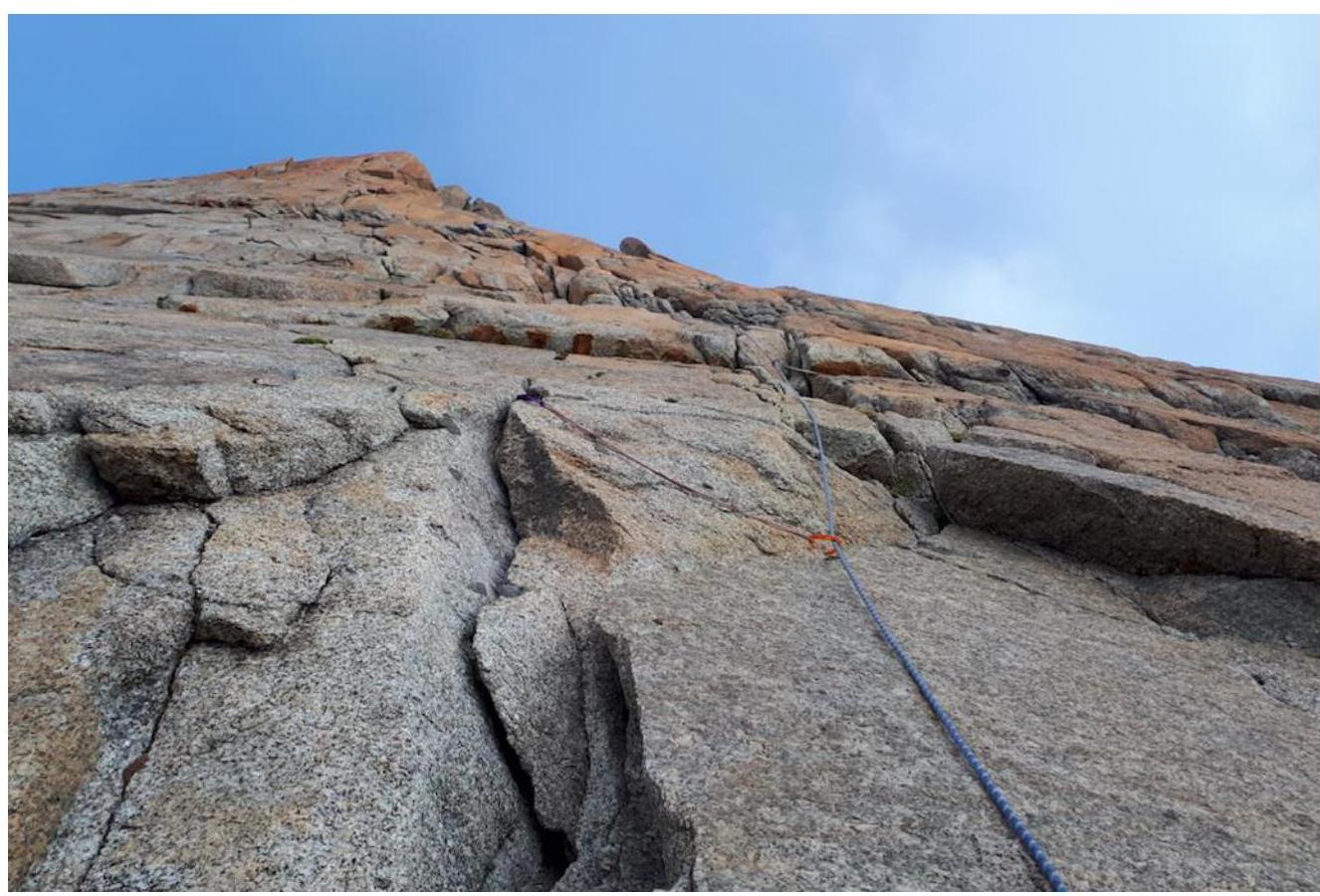
Photo 10. R3–R5. View from station R3 below to the summit pinnacle.
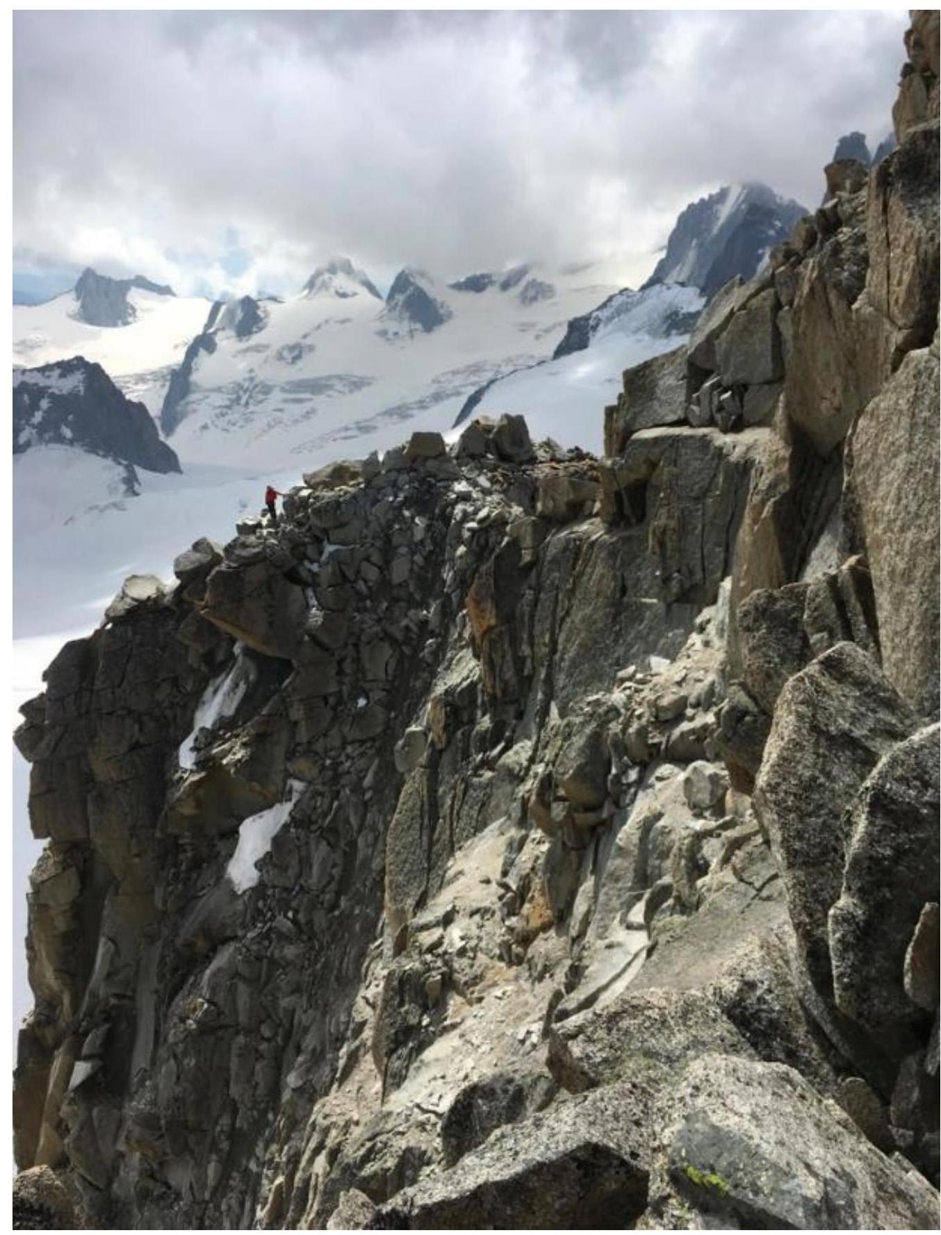
Photo 11. R5–R7. View to the summit pinnacle (south) from the location of the first rappel.
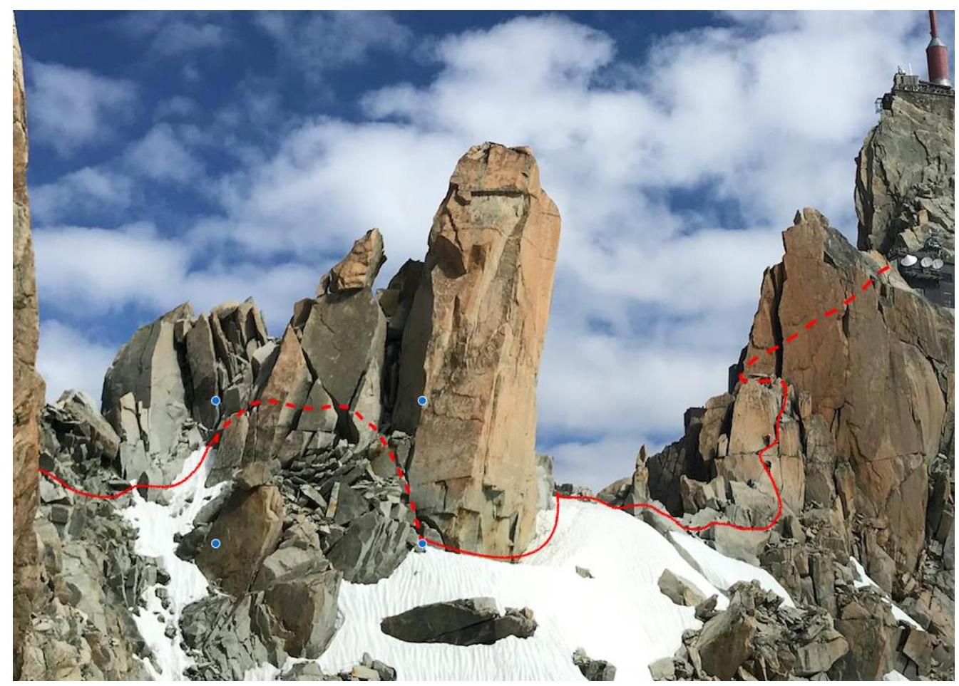
Photo 12. R10–R12. View of the Midi ridge (north).
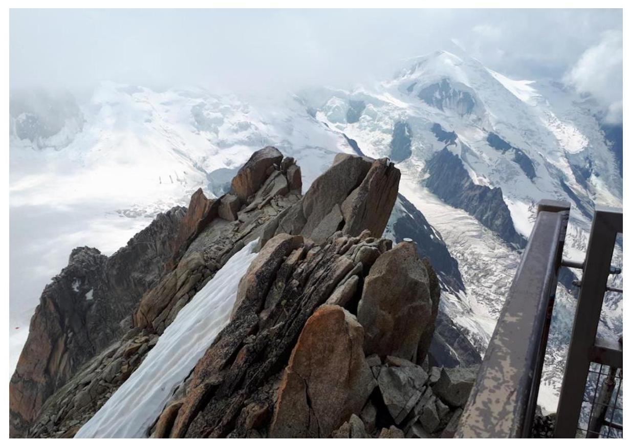
Photo 13. R12–R13. Photo of the pre-summit ridge from the summit viewpoint.
3.2. Team photo on the summit with the control post
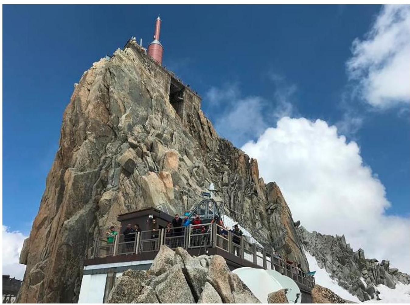
Photo 14. Participants on the summit viewpoint of Aiguille du Midi
3.3. Route safety assessment
The route is one of the most popular and beautiful for climbing. Nevertheless, it is very prone to rockfall in the first third. Mobile phone coverage is available for almost the entire length of the route. The proposed route assessment is Category 3B.
Comments
Sign in to leave a comment