
Report
On the ascent of the 8th team via the right part of the East buttress of Aiguille de la Glière (2852 m), 2B category of difficulty. Area of Aiguilles Rouges, Chamonix, France.
Saint Petersburg 2018
Leader: N.R. Ivanov Coach: N.R. Ivanov
I. Ascent Passport
| № | 1. General Information | |
|---|---|---|
| 1.1 | Full name, sports rank of the leader | Ivanov N.R., Master of Sports |
| 1.2 | Full name, sports rank of the participants | Kolesova A.Yu., Lazarev A.Yu., Lazareva E.Yu., Khrapov S.N., Shadrin A.A., Yakovleva A.N. |
| 1.3 | Full name of the coach | Ivanov N.R. |
| 1.4 | Organization | a/c Polytechnik, St. Petersburg |
| 2. Characteristics of the Ascent Object | ||
| 2.1 | Area | Alps. Chamonix. Upper Savoy. Aiguilles Rouges massif. France |
| 2.2 | Valley | - |
| 2.3 | Section number according to the 2013 classification table | 10.3 |
| 2.4 | Name and height of the summit | Aiguille de la Glière. Height 2852 m |
| 2.5 | Geographical coordinates of the summit (latitude/longitude) | 45.969008° north latitude, 6.868542° east longitude (45.969008° N / 6.868542° E) |
| 3. Characteristics of the Route | ||
| 3.1 | Name of the route | Aiguille de la Glière summit (2852 m), via the right part of the East buttress (2836 m) |
| 3.2 | Proposed category of difficulty | 2B category of difficulty |
| 3.3 | Degree of route development | First ascent on September 1, 1998, by Julien Cellier, Manu Méot. |
| 3.4 | Character of the route relief | Rock climbing |
| 3.5 | Height difference of the route (altimeter or GPS data) | 90 m |
| 3.6 | Length of the route (in meters) | 165 m |
| 3.7 | Technical elements of the route (total length of sections of varying difficulty with indication of relief character (ice-snow, rock)) | 3rd category of difficulty — rock — 150 m, 2nd category of difficulty — rock — 15 m |
| 3.8 | Descent from the summit | via the couloir between Aiguille de la Glière and Aiguille de l'Index back to the Index lift |
| 3.9 | Additional characteristics of the route | Water is absent |
| 4. Characteristics of the Team's Actions | ||
| 4.1 | Time of movement (team's walking hours, in hours and days) | 6 hours, descent 1.5 hours |
| 4.2 | Overnights | no |
| 4.3 | Exit to the route | Exit from the base camp: 7:00, August 2, 2018. Route started (from the lift): 8:30, August 2, 2018. |
| 4.4 | Reach the summit | 14:30, August 2, 2018. |
| 4.5 | Return to the base camp | Descent from the summit (to the lift): 16:00, August 2, 2018. Return to the base camp: 18:00, August 2, 2018. |
| 5. Responsible for the Report | ||
| 5.1 | Full name, e-mail | Kolesova A.Yu. alexanderakolesova@gmail.com |
II. Ascent Description
1. Characteristics of the Ascent Object
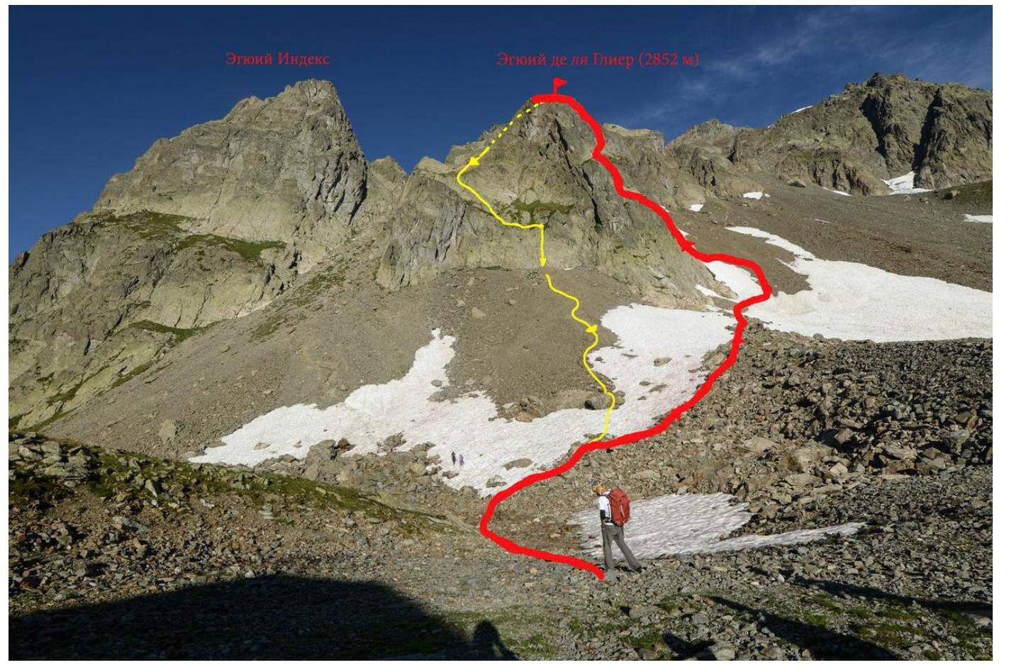
Photo 1. General photo of the summit. Red line — ascent (not passing the summit, which is hidden from this angle, but marked with a flag), yellow — descent.
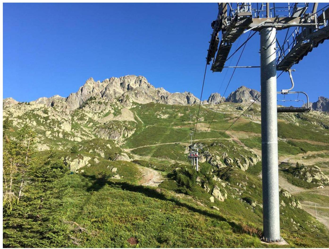
Photo 2. View of the route from the Index lift.
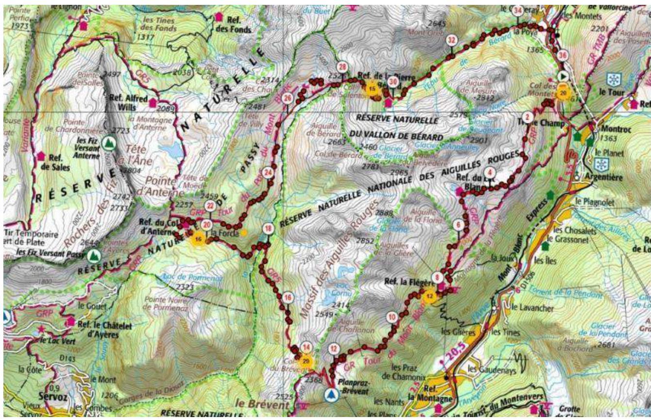
Photo 3. Map-scheme of the Aiguilles Rouges region.
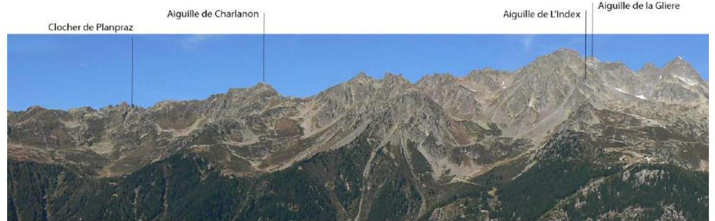
Photo 4. Panorama of the Aiguilles Rouges region.
These "needles" lie like a balcony facing the northern part of the Mont Blanc massif. The gneiss of Aiguilles Rouges is less coarse than the red granite of Mont Blanc, but it is full of sharp holds — climbing is very pleasant and technical.
In the Aiguilles Rouges group, there are countless trad and modern routes. The latter are often visited due to the high-quality gneiss and have become popular over the last 20 years. The Aiguilles Rouges area is beautiful due to its wonderful surroundings, short approaches, a huge number of multi-pitches of all categories, and an extraordinary view of Mont Blanc.
Information about the Summit
Aiguille de la Glière is a gneiss tower overlooking Chamonix, belonging to the Aiguilles Rouges mountain group, located directly opposite Mont Blanc. The route leads to the summit of the East buttress (2836 m), called Nez Rouge in French guidebooks. Geographical coordinates of the summit: 45.969008° N, 6.868542° E. The team's ascent to the East buttress of Aiguille de la Glière started from the base camp in Les Chosalets, then from the Index lift. According to the European classification, the route has a difficulty category of D 5a (French). Average steepness: the entire route — 71°. Total number of pitons left on the route: 0, used: 15 friend-cams. First ascent — Ouverture on September 1, 1998, by Julien Cellier, Manu Méot.
2. Characteristics of the Route
2.1. Technical Photograph of the Route

Photo 5. Route with marked ropes (image taken from a European guidebook, made early in the season).
2.2. Technical Characteristics of Route Sections
| Section № | Length, m | Steepness, ° | Character of relief | Category of difficulty | Number of pitons |
|---|---|---|---|---|---|
| R0–R1 | 60 m | 80° | rock | 3 | 9 |
| R1–R2 | 15 m | 65° | rock | 2 | 4 |
| R2–R3 | 30 m | 70° | rock | 3 | 6 |
| R3–R4 | 30 m | 65° | rock | 3 | 5 |
| R4–R5 | 30 m | 75° | rock | 3 | 6 |
3. Characteristics of the Team's Actions
3.1. Brief Description of the Route Passage by Sections
| Section № | Description | Photo № |
|---|---|---|
| Approach | From the Index lift, move slightly left and up the moraine, crossing a small snowpatch. Approach the base of the East buttress of Aiguille de la Glière with established routes. In the late season, the start of the route will be hidden by a hanging snow tongue. The start of the route can also be found by orienting towards the neighboring, fully equipped route Modern Times, 40 m to the right of it. Another landmark — 2 m to the right of a not very pronounced angle. | 7 |
| R0–R1 | Up the wall with not very pronounced features, which turns into a more even slab. The key is a traverse with friction climbing, 30 m after the start (5a). Then — up another 20 m to an equipped belay station. 60 m. | 8 |
| R1–R2 | Climb slightly left on simple rocks to a station on a dark section of stones (4a). 15 m. | 9 |
| R2–R3 | Straight up the dark rocks to an equipped station (4c). 30 m. | 10 |
| R3–R4 | Cross the couloir to the right of the station, then continue climbing up the system of ledges to the end of the tower (4c). Move right to a common station with the neighboring route Modern Times (which goes to the left). 30 m. | 11 |
| R4–R5 | Move to the right to the far side of a small couloir and then — up the rocks to the summit of the East buttress (5a). 30 m. | 12 |
| Descent | Descend along the path towards the couloir between Aiguille de la Glière and Aiguille de l'Index. From the summit, a steep and clear path leads down; it is recommended to use trekking poles. At the end of the descent, the path comes to a sloping ledge, where there are 2 options: 1) continue descending by climbing into the trodden couloir on the right side of the ledge (5a) or (preferably) continue along the sloping ledge to an equipped station (bolts + Prusik backup) and rappel 28 m to a gentle rock talus. Walk down 15 minutes to the Index lift. | 13 |
3.2. Team Photo at the Summit with the Control Tour

Photo 6. General photo of the team at the summit of the East buttress of Aiguille de la Glière.
3.3. Route Safety Assessment
The approach to the route is not long but passes through very unpleasant rock talus. A pleasant rock route for practicing climbing, with the key (traverse 5a) on the 1st rope. Almost the entire route is equipped, but it is well-suited for learning to trad climb — there is plenty of additional space for one's own protection. It is recommended to use friends and cams. All stations are equipped with bolts. To speed up the passage of the route, it is recommended to take more quickdraws and protection gear (at least 2 sets). In the early season, the route may start 20 m higher due to high snow.
Recommendations
- To speed up the passage of the route, it is recommended to take more quickdraws and protection gear (at least 2 sets).
- In the early season, the route may start 20 m higher due to high snow.
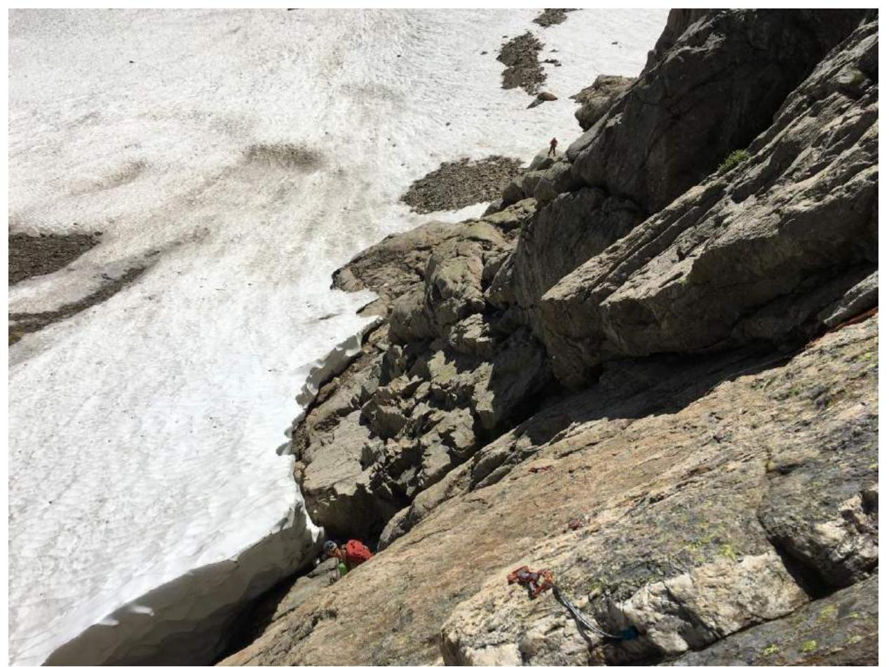
Photo 7. Approach. The start of the route — under the snow tongue, photo taken from station R1.
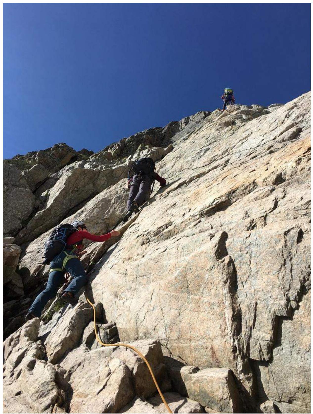
Photo 8. Passage of R0–R1, approaching the key traverse on the route.
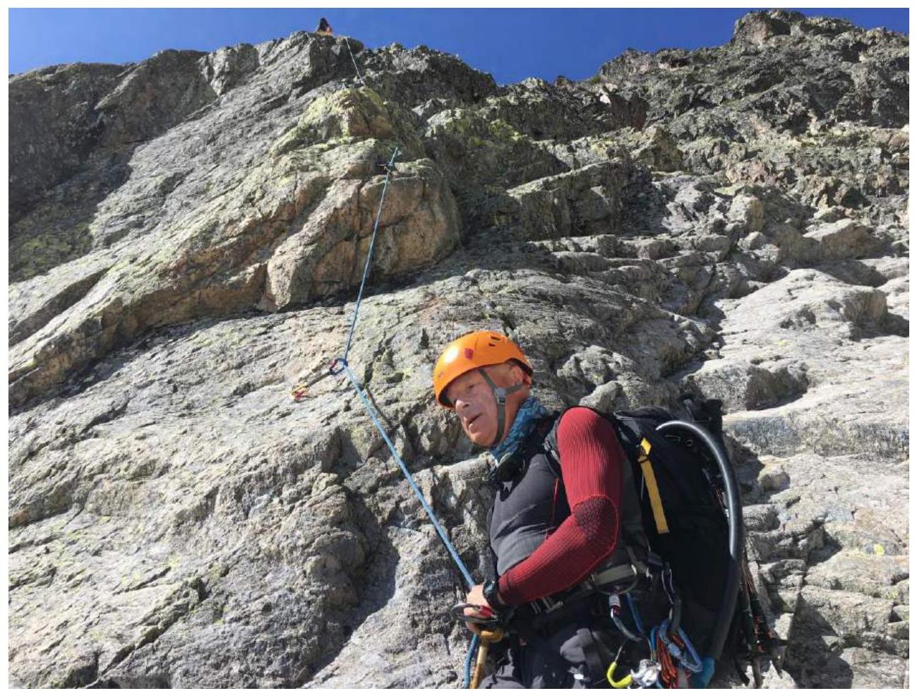
Photo 9. Section R1–R2.
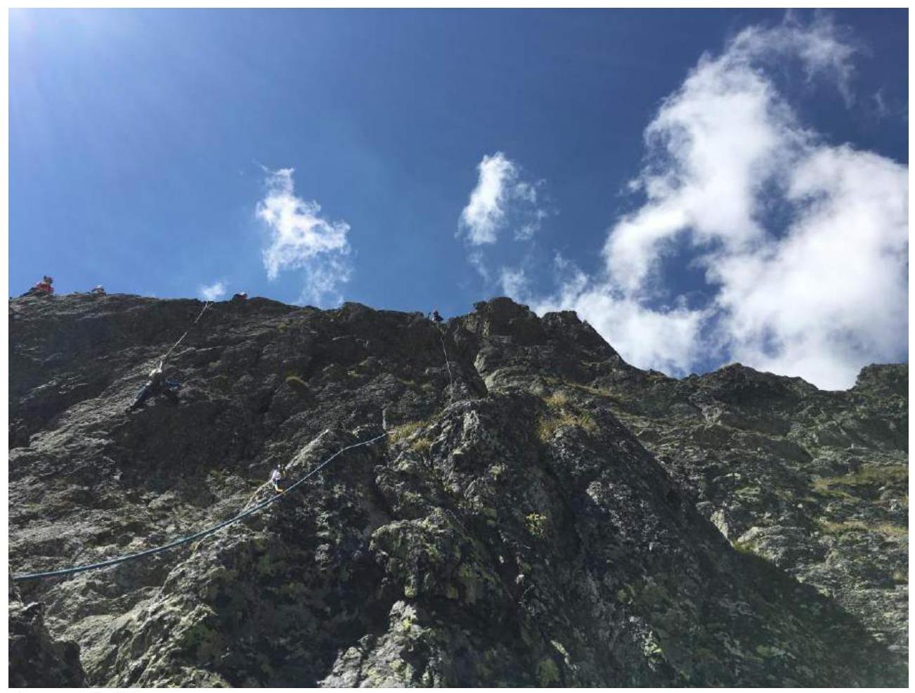
Photo 10. Section R2–R3.
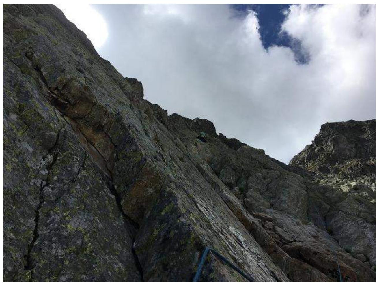
Photo 11. Section R3–R4.
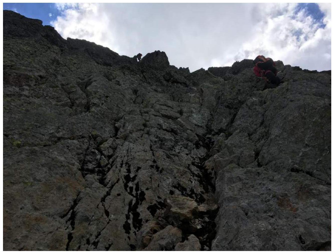
Photo 12. Section R4–R5.
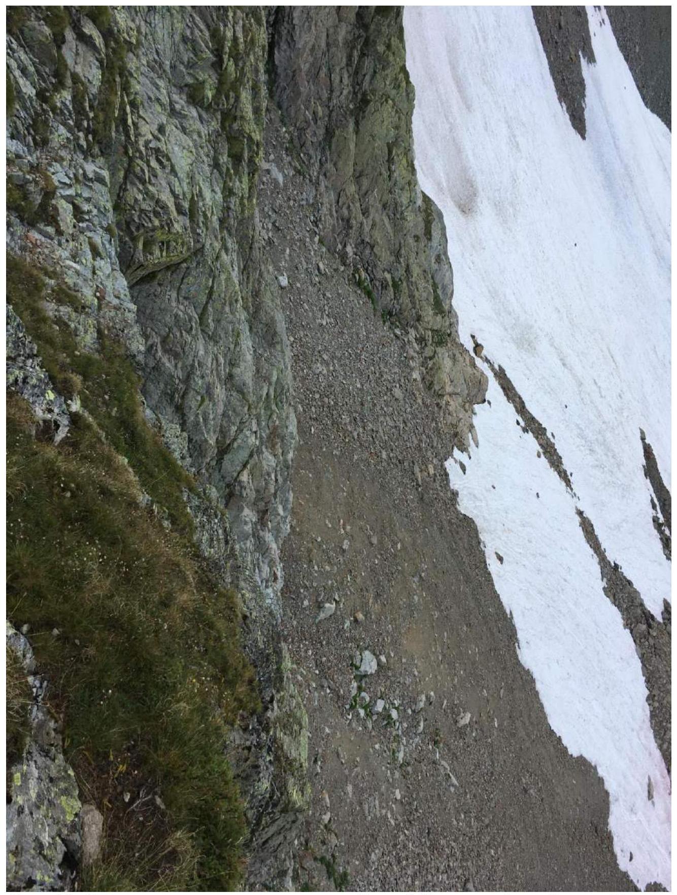
Photo 13. View of the descent through the couloir between Aiguille de l'Index and Aiguille de la Glière.