
Report
On the ascent of the CSKA team named after Demchenko to the summit of Ciarforon (3640 m) via the NE ridge, category 2B. Graian Alps, Valle d'Aosta region (Valle d'Aosta) Gran Paradiso National Park
Leader: E. V. Kuznetsova Senior Coach: E. V. Kuznetsova
Ascent Details
- Graian Alps (Italy). Gran Paradiso region. № 10.3 (according to KGBM 2011)
- Ciarforon (3640 m) via NE ridge (W. A. B. Coolidge, C. Almer, R. Almer, 1888).
- Proposed category: 2B
- Route type: combined,
- Height difference: 600 m Route length: 960 m. Length of challenging sections: 5th category complexity - m, 6th category complexity - m. Average steepness: main part of the route – 50°; entire route – 40°.
- Number of pitons left on the route: total; including expansion bolts
- Team's total climbing hours: 10 hours, 1 day
- Leader: Kuznetsova E. V., CMS, instructor
Participants:
- Vinokurova S. I., MS
- Strebkova D., badge holder
- Kuznetsova V., badge holder
- Shtykovsky P., badge holder
- Sholeninov S., badge holder
- Mezentsev A. M., CMS
- Mezentseva E. A., badge holder
- Coach: Kuznetsova E. V.
- Departure from Base Camp: hour, date, month, year Route started: "5:00" July 7, 2012 Reached the summit: "12:30" July 7, 2012 Returned to Base Camp: "17:00" July 7, 2012 Descent from the summit: via the ascent route;
- Organization: CSKA training camp named after Demchenko (Moscow)
- Responsible for the report: Kuznetsova E. V., Yurkin A.V.
Email: 1961morendo@gmail.com
General Photo of the Summit
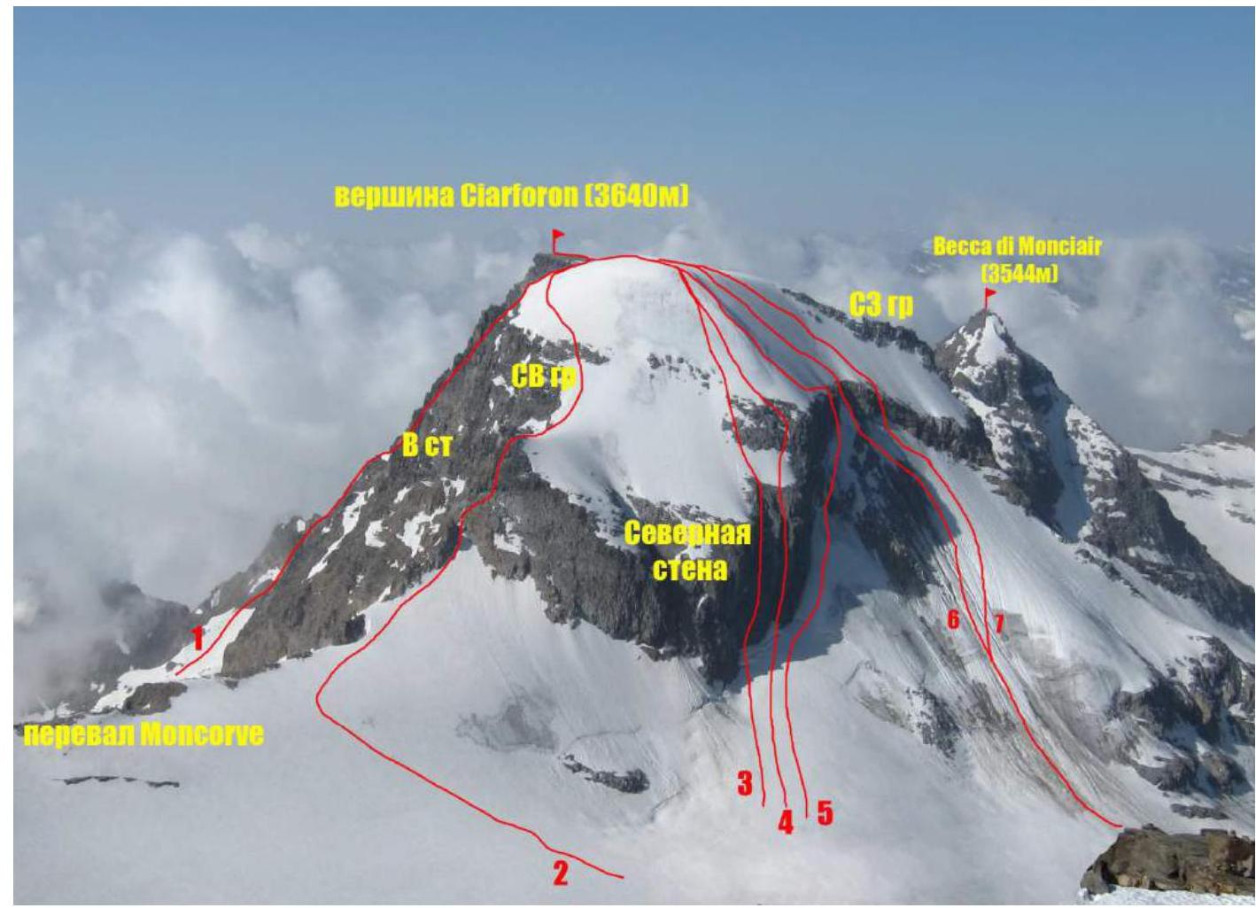
Photo of Ciarforon summit taken from the middle part of the western slope of Gran Paradiso peak.
Routes on the photo:
- route via the East face (A. Bonacossa, A. Sarfatti, 1923)
- team's route
- route via the N face (Angelo Bozzetti, solo, 1962).
- route via the N face (V. Epis, L. Perin, E. Regazzi, 1966)
- route via the N face (A. Barberis +5, 1941)
- route via the center of the N face, category 4B (it. TD–) (Giacomo and Enrico Chiara, Enrico Cattinelli, 1939).
- route via the center of the N face, category 3A (AD) (E. Allegra, U. Sandrinelli, P. Daynè, 1902).
Photo of the Route Profile
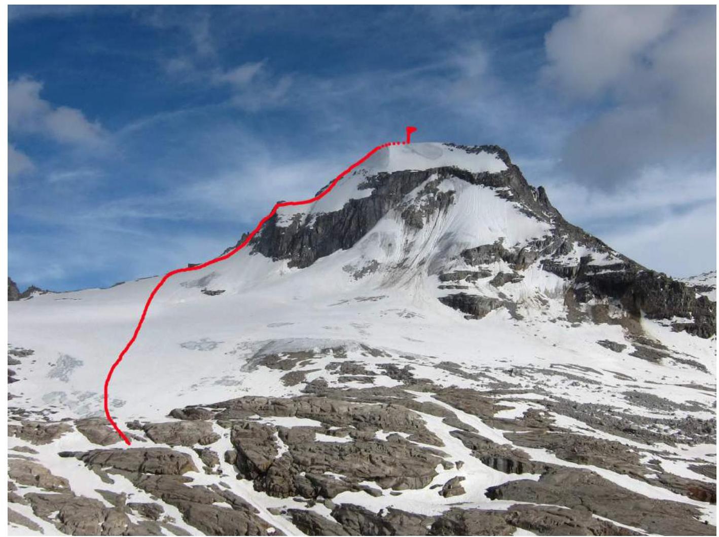
Photo of the team's route profile. Taken near Vittorio Emanuele II hut
Panoramic Photo of the Area
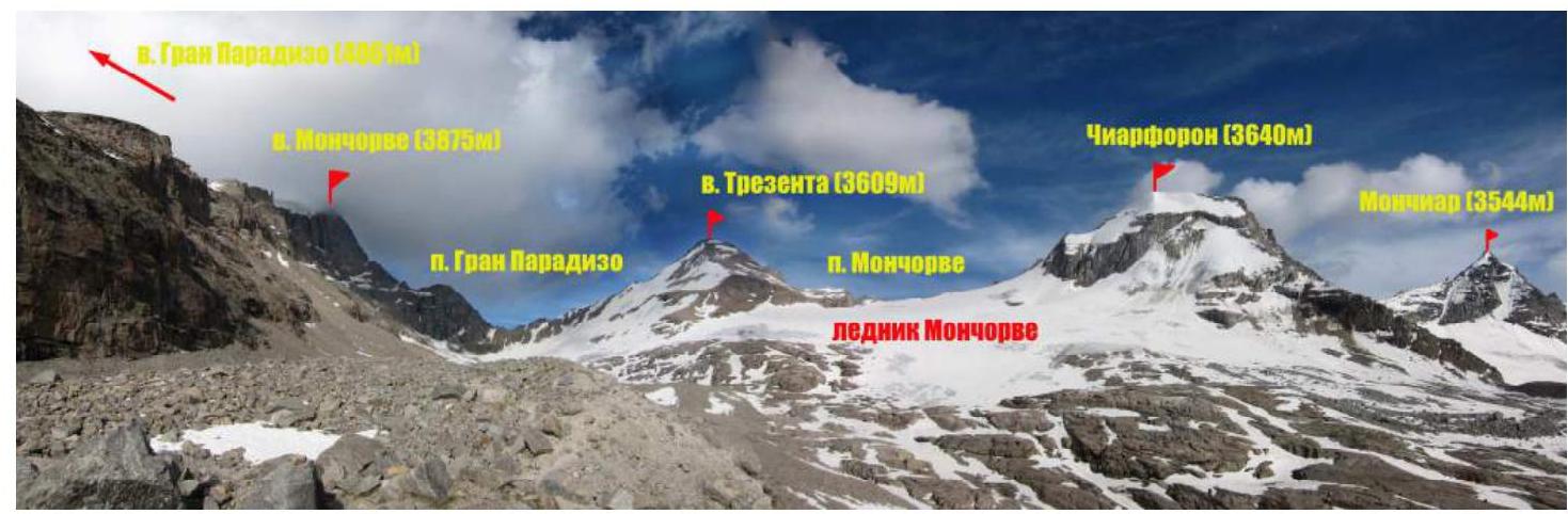
Overview of Gran Paradiso Area
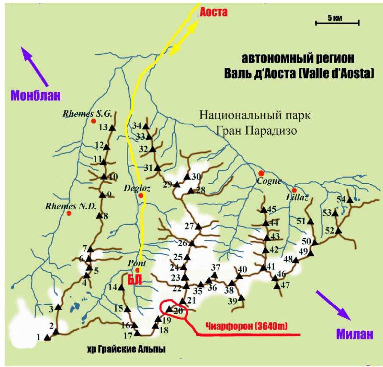
| Peak designations (with heights) on the map: | |
|---|---|
| 1 Punta Galisia 3346 m | 28 Punta Rossa della Grivola 3630 m |
| 2 Punta Basei 3338 m | 29 La Grivola 3969 m |
| 3 Punta Gran Vaudala 3272 m | 30 Grivoletta 3514 m |
| 4 Taou Blanc 3438 m | 31 Gran Nomenon 3488 m |
| 5 Aouillé 3440 m | 32 Mont Favret 3173 m |
| 6 Cima di Entrelor 3430 m | 33 Punta Valletta 2793 m |
| 7 Punta Percià 3227 m | 34 Becca Piana 2271 m |
| 8 La Roletta 3384 m | 35 Punta Ceresole 3777 m |
| 9 Punta Bianca 3427 m | 36 Testa della Tribolazione 3642 m |
| 10 Punta Bioula 3414 m | 37 Testa di Valnontey 3562 m |
| 11 Punta del Ran 3272 m | 38 Becca di Gay 3621 m |
| 12 Punta Chamoussière 2942 m | 39 Becco Meridionale della Tribolazione 3360 m |
| 13 Monte Paillasse 2414 m | 40 Roccia Viva 3650 m |
| 14 Cima dell'Arolley 2996 m | 41 Torre del Gran San Pietro 3692 m |
| 15 Cima di Seiva 3075 m | 42 Punte Patri 3581 m |
| 16 Punta Fourà 3411 m | 43 Punta Valletta 3356 m |
| 17 Mare Pércia 3385 m | 44 Punta di Valmiana 3244 m |
| 18 Denti del Breuil 3454 m | 45 Punta Fenilia 3053 m |
| :---------------------------------------------------------------: | :-- |
| 19 Becca di Monciair 3544 m | 46 Punta d'Ondezana 3452 m |
| 20 Ciarforon 3642 m | 47 Becco di Valsoera 3369 m |
| 21 La Tresenta 3609 m | 48 Punta delle Sengie 3408 m |
| 22 Becca di Moncorvè 3875 m | 49 Monveso di Forzo 3322 m |
| 23 Gran Paradiso 4061 m | 50 Grande Arolla 3246 m |
| 24 Piccolo Paradiso 3923 m | 51 Punta della Tsesère 3117 m |
| 25 Becca di Montandayné 3838 m | 52 Torre di Lavina 3308 m |
| 26 Herbetet 3778 m | 53 Punta di Acque Rosse 2952 m |
| 27 La Gran Serra 3552 m | 54 Punta Nera 3064 m |
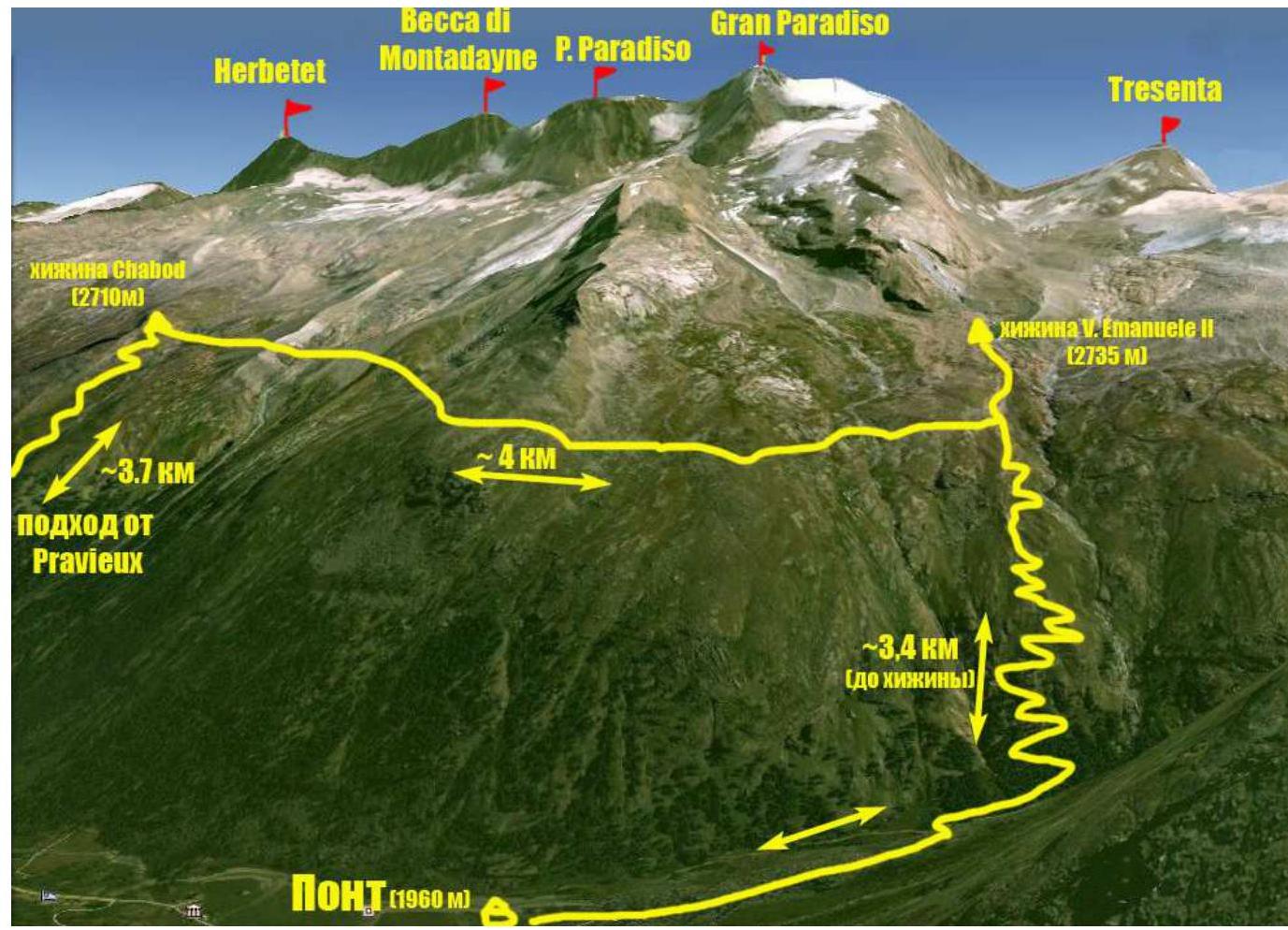
The summit of Ciarforon (3640 m) that the team ascended is located in the Gran Paradiso National Park area. The park is situated within the Graian Alps in the autonomous region of Valle d'Aosta in northern Italy. The highest point in the Gran Paradiso area is 4061 m, making it the seventh highest peak in the Alps (Mont Blanc being the first). The Valle d'Aosta region is densely mountainous, featuring some of the most iconic Italian and Alpine peaks such as Monte Bianco (Mont Blanc), Gran Jorasses, Cervino (Matterhorn), and Gran Paradiso. Most mountaineering routes of interest are found in the Gran Paradiso range. With peak elevations between 3500–4000 meters, the area offers a variety of terrain including rocks, ice, and snow, making it suitable for numerous combined routes. The majority of routes fall within categories 1–4, with some category 5 routes available. The ascent of Ciarforon was part of the CSKA training camp named after Demchenko (Moscow) held in June and early July 2012. The base camp for the training was set up in the Pont campsite, which is the highest and most remote settlement in the Valsavaranche valley, at an elevation of 1950–2000 meters above sea level. The immediate access to the route was from the Vittorio Emanuele II hut, located at the foot of Gran Paradiso peak at an altitude of 2732 meters. The approach from Pont village to the hut takes about 2 hours via a comfortable trail. Ciarforon is situated in the ridge between the peaks of Tresenta (3609 m) and Monciair (Becca di Monciair) 3544 m. The geographical coordinates of the summit are 45°29′35.09″ N, 7°14′53.47″ E. In the Italian classification, the route via the NE ridge is rated PD.
Technical Photo of the Route

| Section № | Length, m | Steepness, ° | Terrain Type | Complexity Category | Number of Pitons |
|---|---|---|---|---|---|
| R0–R1 | 300 | 25 | snow | 1 | |
| R1–R2 | 150 | 30–45 | Rocks–snow | 2 | |
| R2–R3 | 40 | 60 | Rocks | 3 | set |
| R3–R4 | 35 | 65 | Rocks | 3 | set |
| R4–R5 | 35 | 55 | Rocks | 3 | set |
| R5–R6 | 100 | 25 | Rocks–snow | 2 | |
| R6–R7 | 150 | 30 | Rocks–snow | 2 | |
| R7–R8 | 100 | 40 | snow | 2 | |
| R8–R9 | 150 | 20 | Snow–rocks | 1 |
Brief Description of the Route by Sections
Approach
From the hut, proceed towards the Moncorvè glacier via a trail on the moraine ridge above the lake. The trail initially follows a large stream from the glacier, then crosses to the right side at the gentle roche moutonnée and continues over rocks and snow through large gullies. The orientation point is the start of the NE ridge of Ciarforon and the pass between Tresenta and Ciarforon. Before reaching the glacier, be cautious of potential crevasses and small depressions. Then move upwards towards the pass. In the summer season, the trail is well-trodden due to the route's popularity.
R0–R1 — From the flat part of the glacier, ascend the snowy slope towards the start of the NE ridge. R1–R2 – Before the pass, turn right and ascend the snow-ice slope to the saddle behind the first gendarme. Use ice axes for protection. R2–R3 — From the saddle, ascend to the rocky bastion of the NE ridge. The first rope goes up-right. Large blocky rocks. Stations at the bottom and top are secured with expansion bolts and stationary pitons. R3–R4 — Ascend via an inside corner, with a station on a good ledge. Expansion bolt. R4–R5 – Continue up the inside corner until reaching a ledge before exiting onto the ridge. R5–R6 — Transition from the rocky part of the ridge to the gentler part. Caution! Watch for rockfall and cornices on the left! R6–R7 – Ascend the snowy slope directly upwards towards a horizontal rocky ridge. In the easiest part of the ridge, ascend (rocky section 10–15 m). For added safety, there's an expansion bolt on the upper ledge. R7–R8 – Continue up the snow, bypassing the snowy summit dome on the left. R8–R9 – Traverse from the snowfield onto the flat rocks of the summit plateau via a gentle trail.
Descent is via the ascent route.
The route is logical and safe, making it interesting for training ascents as it includes almost all types of terrain. In bad weather, orientation difficulties may arise around the summit snowy dome. In case of poor visibility, it's recommended not to deviate from the trail or, as a last resort, stay close to the rocky outcrops of the NE ridge.
Photo Illustrations of the Report
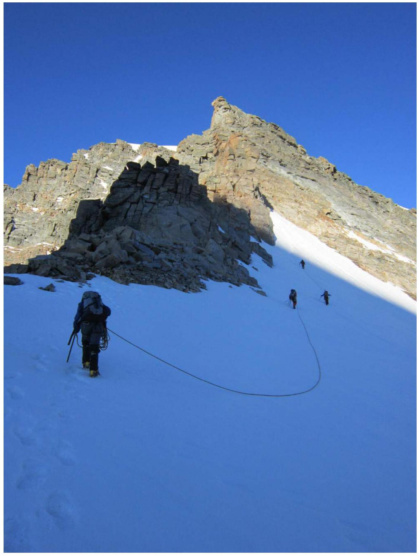
Photo 1. Section R1–R2. Approaching the first gendarme
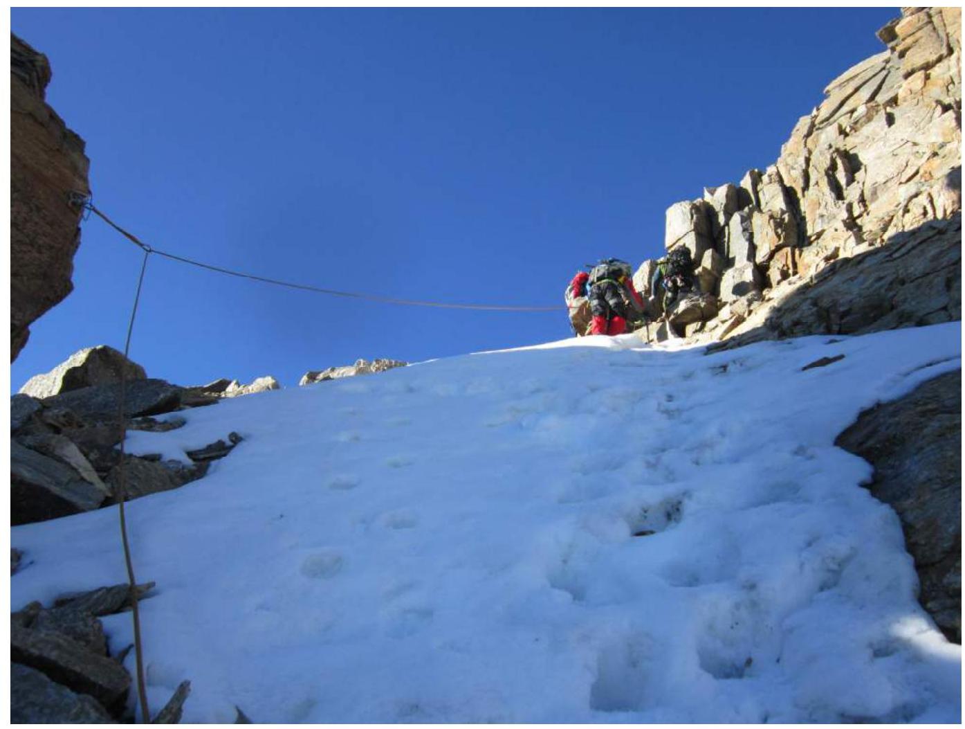
Photo 2. Saddle between the first gendarme and the rocky bastion of the NE ridge
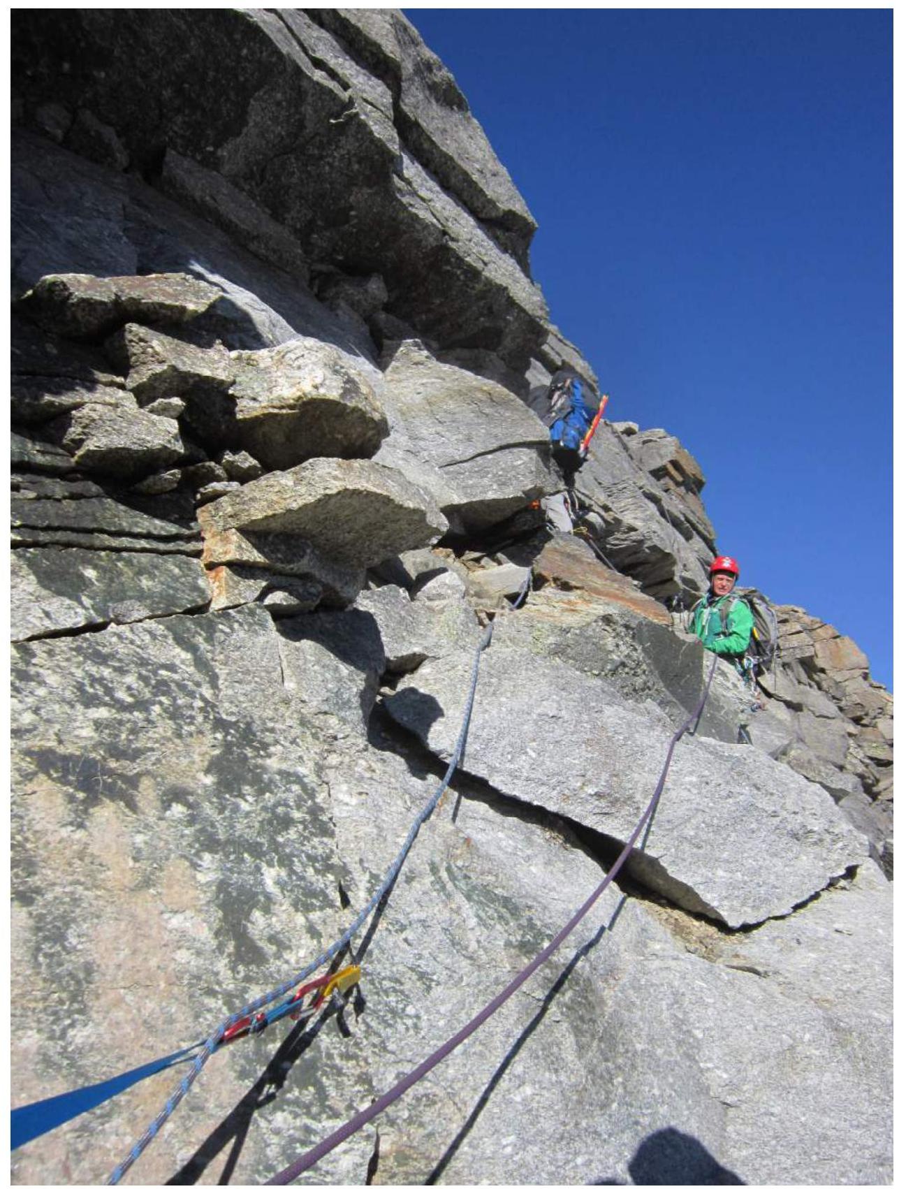
Photo 3. Section R2–R3. Approaching the station via fixed ropes
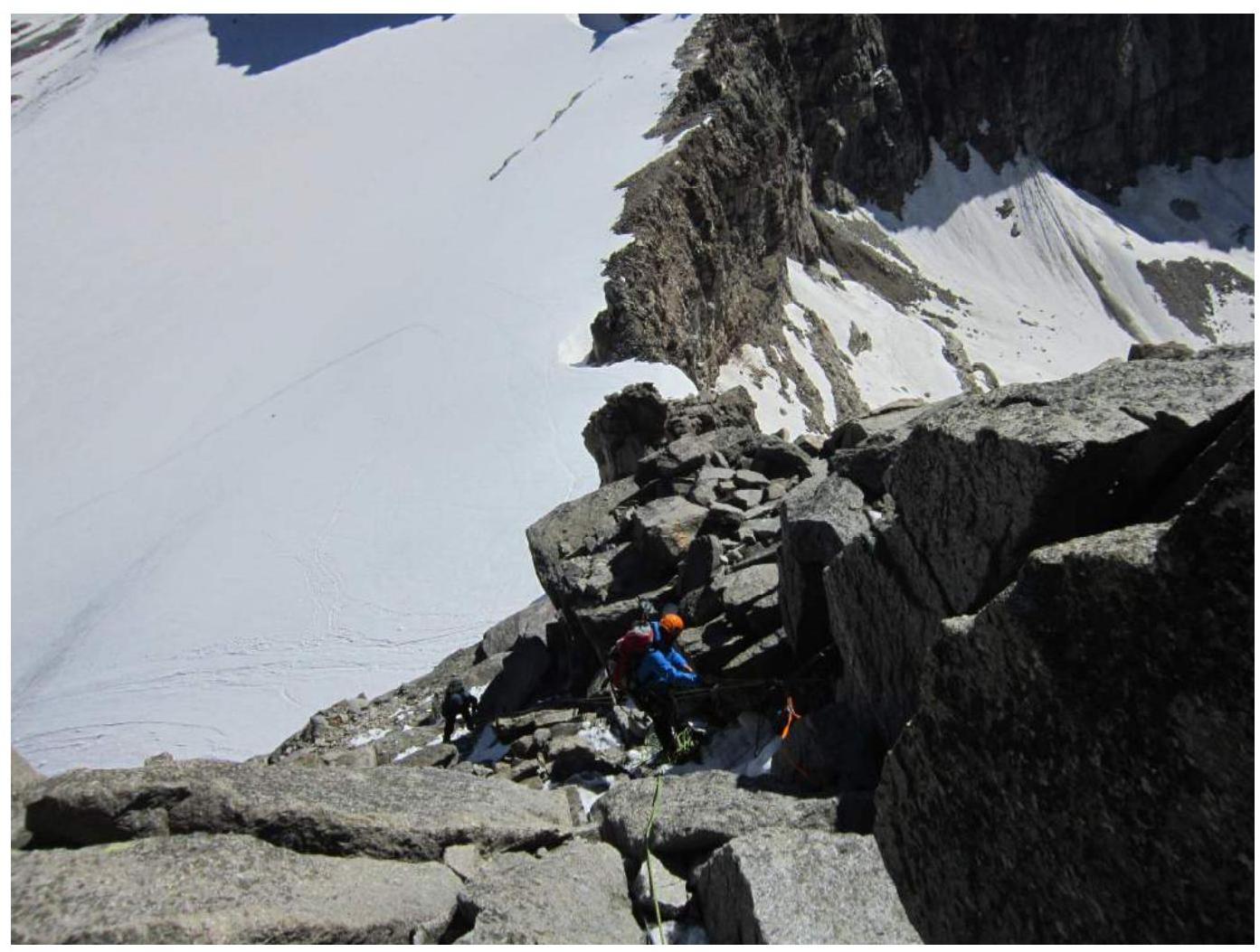
Photo 4. Section R4–R5.
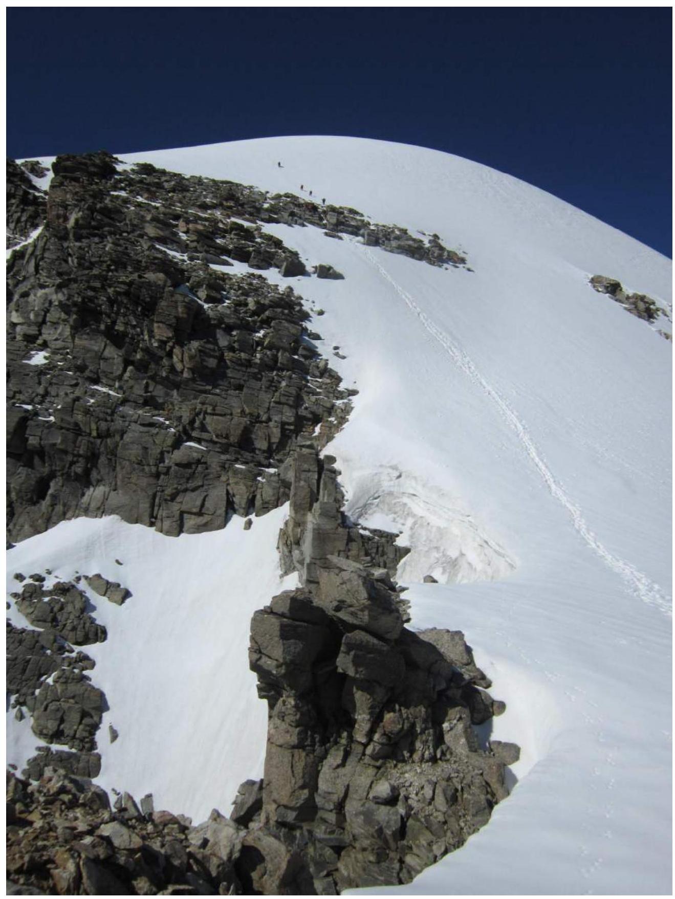
Photo 5. Section R6–R8. Ascending the snowy slope and Gc traversing rock band.

Photo 6. Team at the summit
Comments
Sign in to leave a comment