
Alpine Federation of Russia
REPORT
on the ascent to Mt. Five Fingers (Funffingerspitzen, 2996 m) in the Dolomites (Italy) — traverse of the massif from East to West, category 3B, approximately on August 16, 2010.
Leader: Smirnov V.V. Participants: Penyaev I.N. Mikhaylova I.V. Team Coach: Smirnov V.V.
St. Petersburg 2010
Ascent Passport
1. Ascent Area: Dolomites (Italy), Val di Fassa, Sassolungo Massif, section 10.3. 2. Summit Name: Five Fingers (Funffingerspitzen, 2996 m) Route Name: traverse of the massif from East to West 3. Route Category: 3B, approximate 4. Route Type: rock 5. Route Elevation Gain: 210 m Route Length: 930 m Section Lengths:
- I–II category: 285 m
- III category: 320 m
- IV category: 180 m Average Steepness: 49 ° 6. Number of Pits and Protection Used: 38 7 Team's Moving Time: 7 h 8. Leader: Smirnov Viktor Valerievich, Master of Sports Participants:
- Penyaev Ilya Nikolaevich, 2nd sports category
- Mikhaylova Irina Vasilievna, 3rd sports category 9. Coach: Smirnov Viktor Valerievich 10. Route Start: at 8:00 on August 16, 2010 Summit Arrival: at 15:00 on August 16, 2010 Return to Base Camp: at 18:30 on August 16, 2010

Fig. 1. General photo of the summit
Fig. 2. Photopanorama of the area
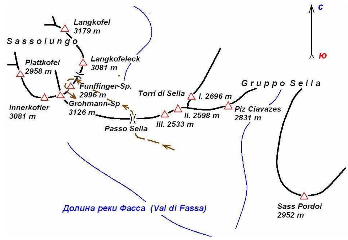
Fig. 3. Area map
Route Description by Sections
| Section # | Length, m | Steepness, ° | Terrain Type | Category | # of Pits |
|---|---|---|---|---|---|
| R0–R1 | 20 m | 70 ° | Rock | IV | 3 |
| R1–R2 | 40 m | 25 ° | Rock | I | - |
| R2–R3 | 30 m | 70 ° | Rock | III | 2 |
| R3–R4 | 30 m | 80 ° | Rock | III+ | 2 |
| R4–R5 | 30 m | 10 ° | Rock | II | - |
| R5–R6 | 25 m | 75 ° | Rock | IV | 3 |
| R6–R7 | 25 m | 80 ° | Rock | IV– | 3 |
| R7–R8 | 30 m | 65 ° | Rock | IV– | 4 |
| R8–R9 | 35 m | 85 ° | Rock | IV+ | 5 |
| R9–R10 | 30 m | 60 ° | Rock | III | 1 |
| R10–R11 | 40 m | 20 ° | Rock | II | - |
| R11–R12 | 40 m | Rock | Rappelling | ||
| R12–R13 | 45 m | 80 ° | Rock | III | 2 |
| R13–R14 | 45 m | 85 ° | Rock | IV | 4 |
| R14–R15 | 45 m | 60 ° | Rock | III | 3 |
| R15–R16 | 25 m | 70 ° | Rock | III | 2 |
| R16–R17 | 15 m | 50 ° | Rock | III | - |
| R17–R18 | 80 m | 15 ° | Rock | II | - |
| R18–R19 | 25 m | Rock | Rappelling | - | |
| R19–R20 | 50 m | 20 ° | Rock | III | 2 |
| R20–R21 | 15 m | Rock | Rappelling | - | |
| R21–R22 | 15 m | 10 ° | Rock | II | 2 |
| R22–R23 | 15 m | Rock | Rappelling | - | |
| R23–R24 | 80 m | 20 ° | Rock | II | - |
| R24–R25 | 50 m | 45 ° | Rock | III | - |
| R25 | 50 m | Rock | Rappelling | - |
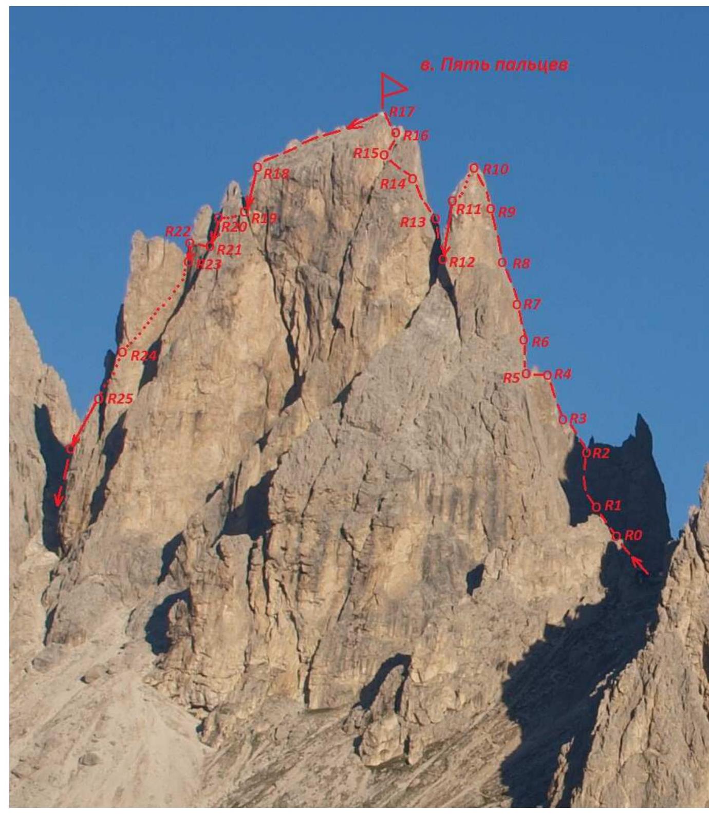
Fig. 4. UIAA Route Diagram

Fig. 5. Technical photo of the route
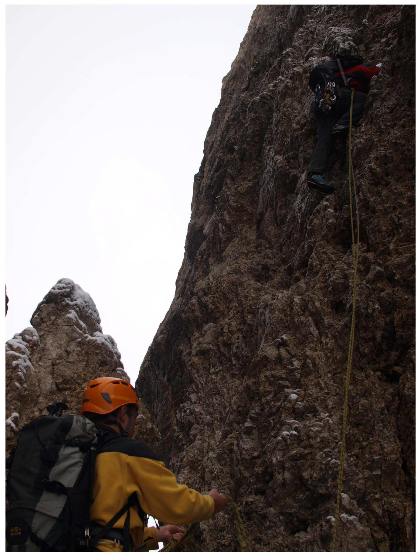
Fig. 6. Passage of section R6. Smirnov V. leads

Fig. 7. Beginning of section R12. Penyaev I. belays
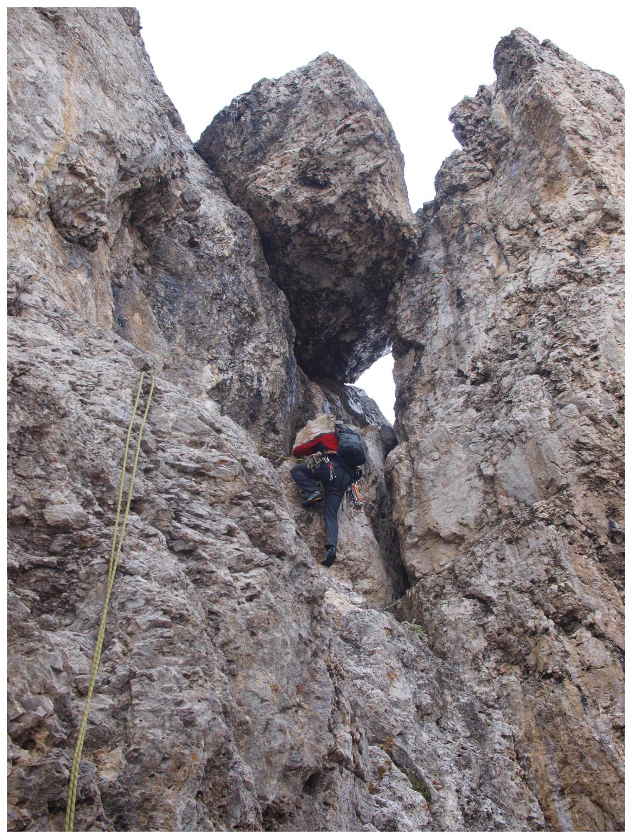
Fig. 8. Upper part of section R13
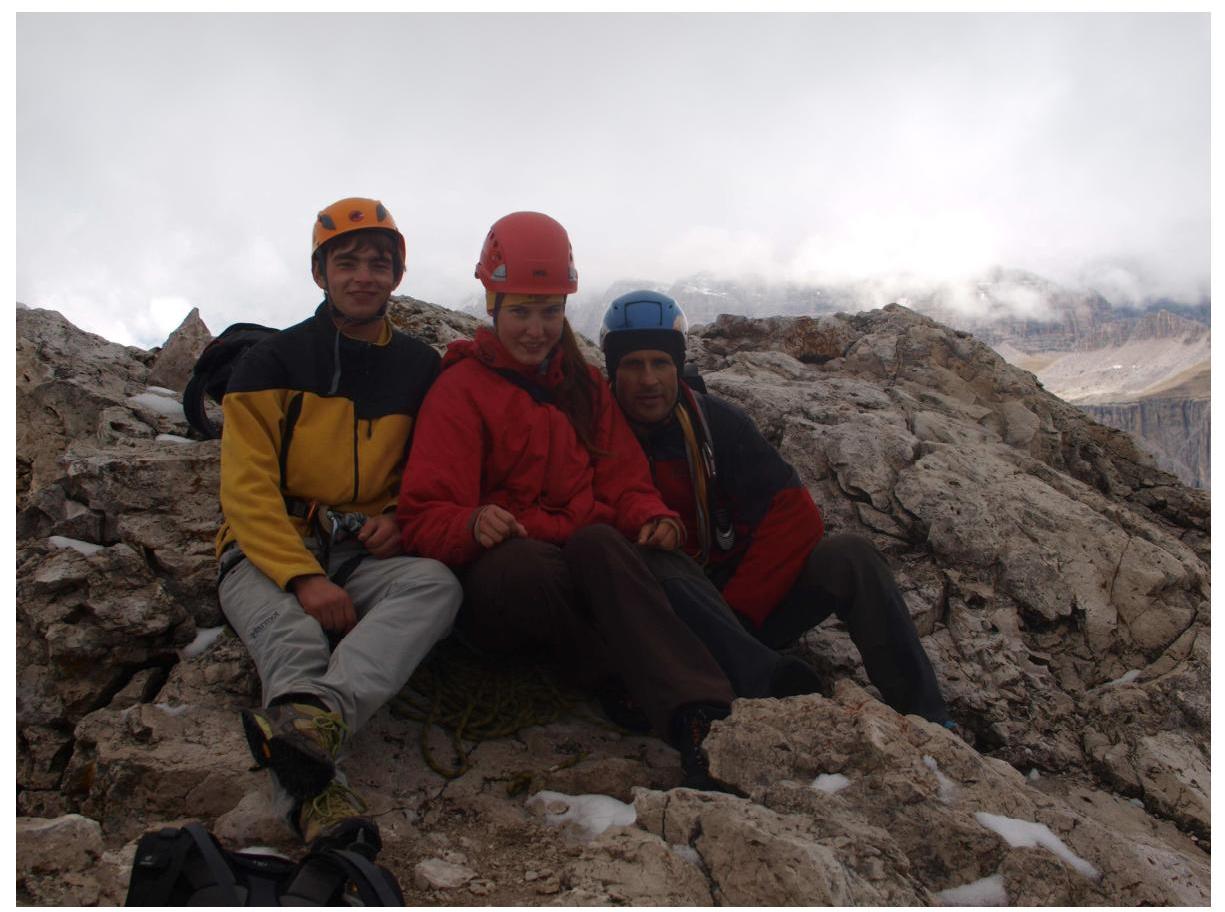
Fig. 9. Section R15
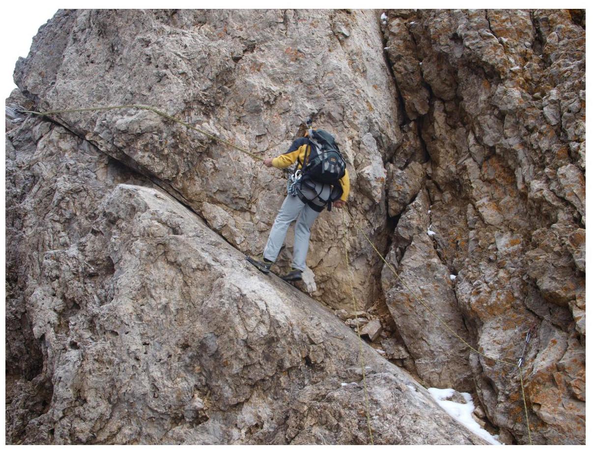
Fig. 10. On the summit
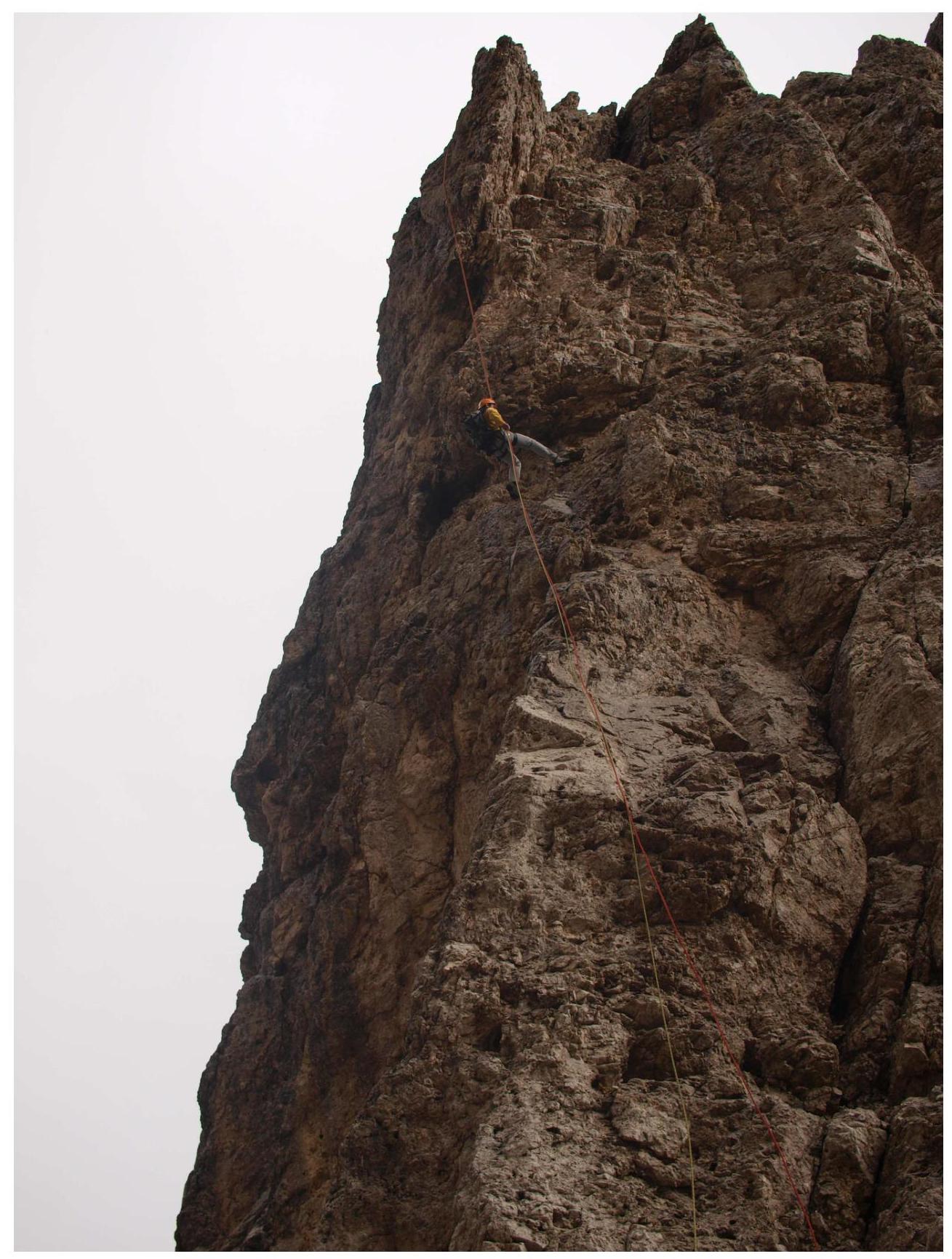
Fig. 11. Descent on section R20
Fig. 12. Rappelling on section R25


