Report
On the ascent of the 8th group to the summit of Petit Aiguille Verte (3512 m) via the NW ridge, category 2B. Grands Montets glacier area, Mont Blanc massif, Chamonix, France.
Leader: N.R. Ivanov Coach: N.R. Ivanov
St. Petersburg 2018
I. Climbing Report
| № | 1. General Information | |
|---|---|---|
| 1.1 | Full name, sports rank of the leader | Ivanov N.R., Master of Sports |
| 1.2 | Full name, sports rank of the participants | Kolesova A.Yu., Lazarev A.Yu., Lazareva E.Yu., Khrapov S.N., Shadrin A.A., Yakovleva A.N. |
| 1.3 | Full name of the coach | Ivanov N.R. |
| 1.4 | Organization | alpinist club "Polytechnic", St. Petersburg |
| 2. Characteristics of the Climbing Object | ||
| 2.1 | Area | Graian Alps. Grands Montets glacier area, Mont Blanc massif, Chamonix, France. |
| 2.2 | Valley | |
| 2.3 | Section number according to the 2013 classification table | 10.3 |
| 2.4 | Name and height of the summit | Petit Aiguille Verte, height 3512 m |
| 2.5 | Geographical coordinates of the summit (latitude/longitude), GPS coordinates *(1) | 45.9479° N, 6.9586° E (45.94790° N / 6.995860° E) |
| 3. Characteristics of the Route | ||
| 3.1 | Name of the route | Petit Aiguille Verte — via NW ridge (classic route via SW ridge) |
| 3.2 | Proposed category of difficulty | 2B |
| 3.3 | Degree of route exploration | - |
| 3.4 | Nature of the route terrain | combined |
| 3.5 | Height difference of the route (altimeter or GPS data) | 150 m |
| 3.6 | Route length (in meters) | 275 m |
| 3.7 | Technical elements of the route (total length of sections of varying difficulty with terrain type) | II — ice-rock/snow-rock/snow/rock — 225 m; III — rock — 50 m |
| 3.8 | Descent from the summit | Via the ascent route |
| 3.9 | Additional route characteristics | Water is absent |
| 4. Characteristics of the Team's Actions | ||
| 4.1 | Time on the move (team's travel hours, in hours and days) | 5.5 hours, descent 3 hours |
| 4.2 | Overnights | none |
| 4.3 | Departure on the route | Departure from base camp: 7:00, July 31, 2018. Route started (from the lift): 9:00, July 31, 2018. |
| 4.4 | Summit arrival | 14:30, July 31, 2018. |
| 4.5 | Return to base camp | Descent from the summit (to the lift): 17:30, July 31, 2018. Return to base camp: 22:30, July 31, 2018. |
| 5. Person responsible for the report | ||
| 5.1 | Full name, e-mail | Kolesova A.Yu. alexanderakolesova@gmail.com |
II. Description of the Ascent
1. Characteristics of the Climbing Object
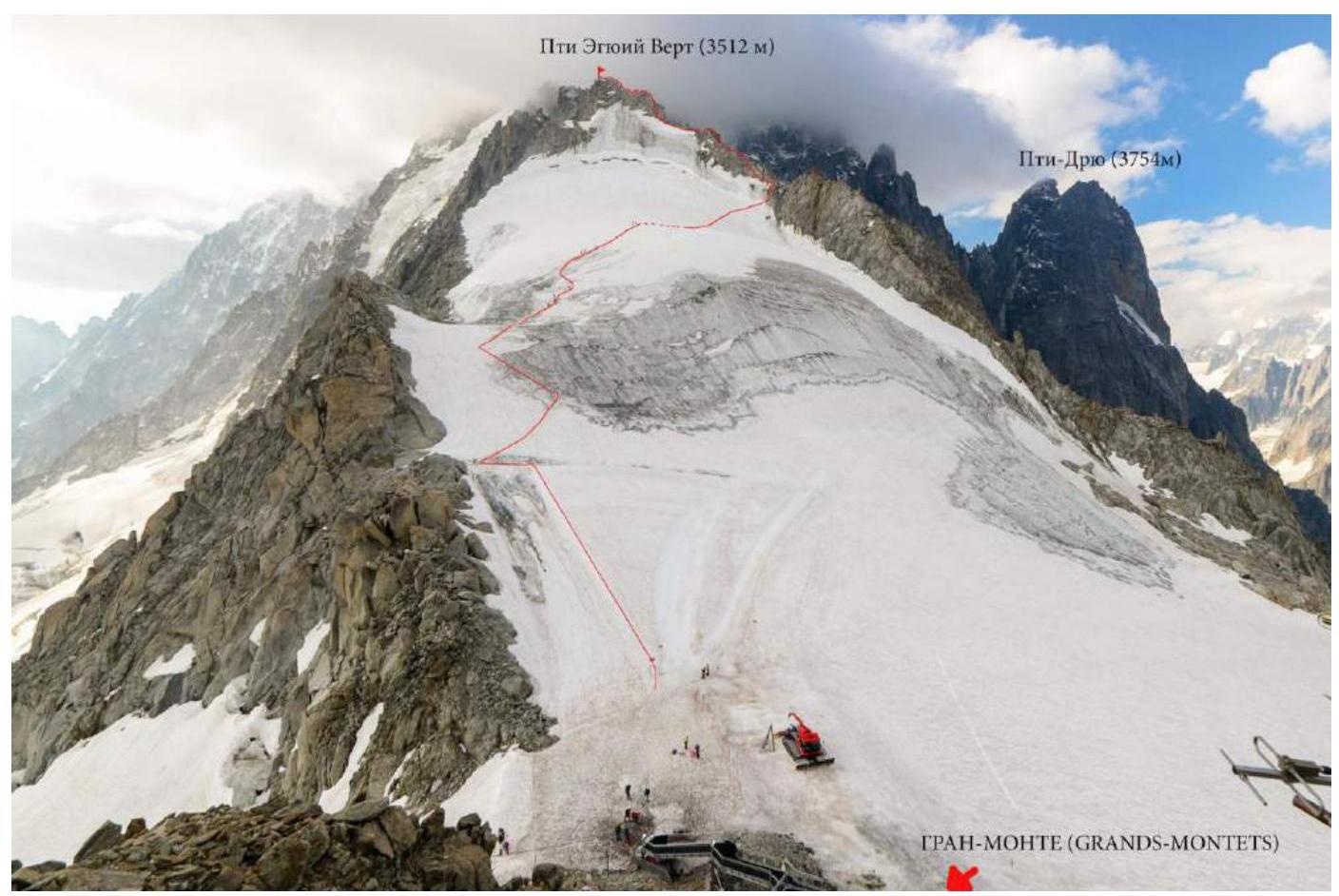
Photo 1. General photo of the route. View from the Grands Montets lift, July 31, 2018.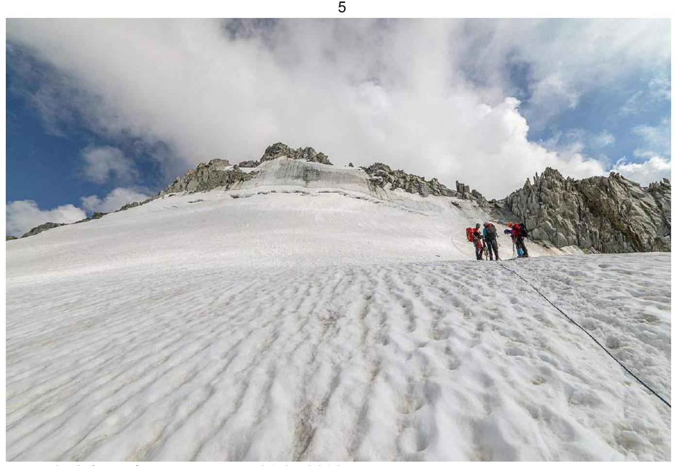
Photo 2. General photo of the summit, July 31, 2018.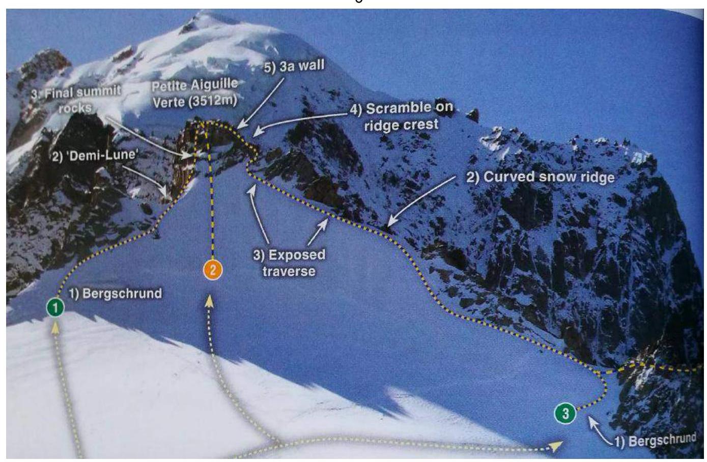
Photo 3. Route diagram (marked as number 3) from the Chamonix valley guidebook (photo taken at the beginning of the season). Overview of the Grands Montets glacier area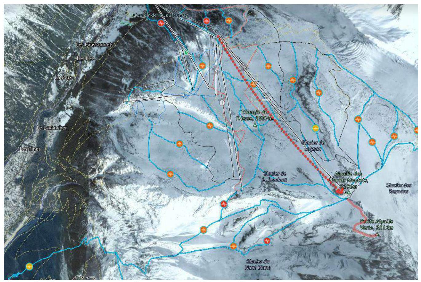
Photo 4. Area diagram with the full route line, including the approach via the lift (image taken from fatmap.com).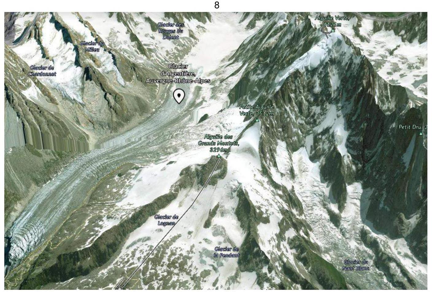
Photo 5. View of the Argentière and Grands Montets glaciers from the west.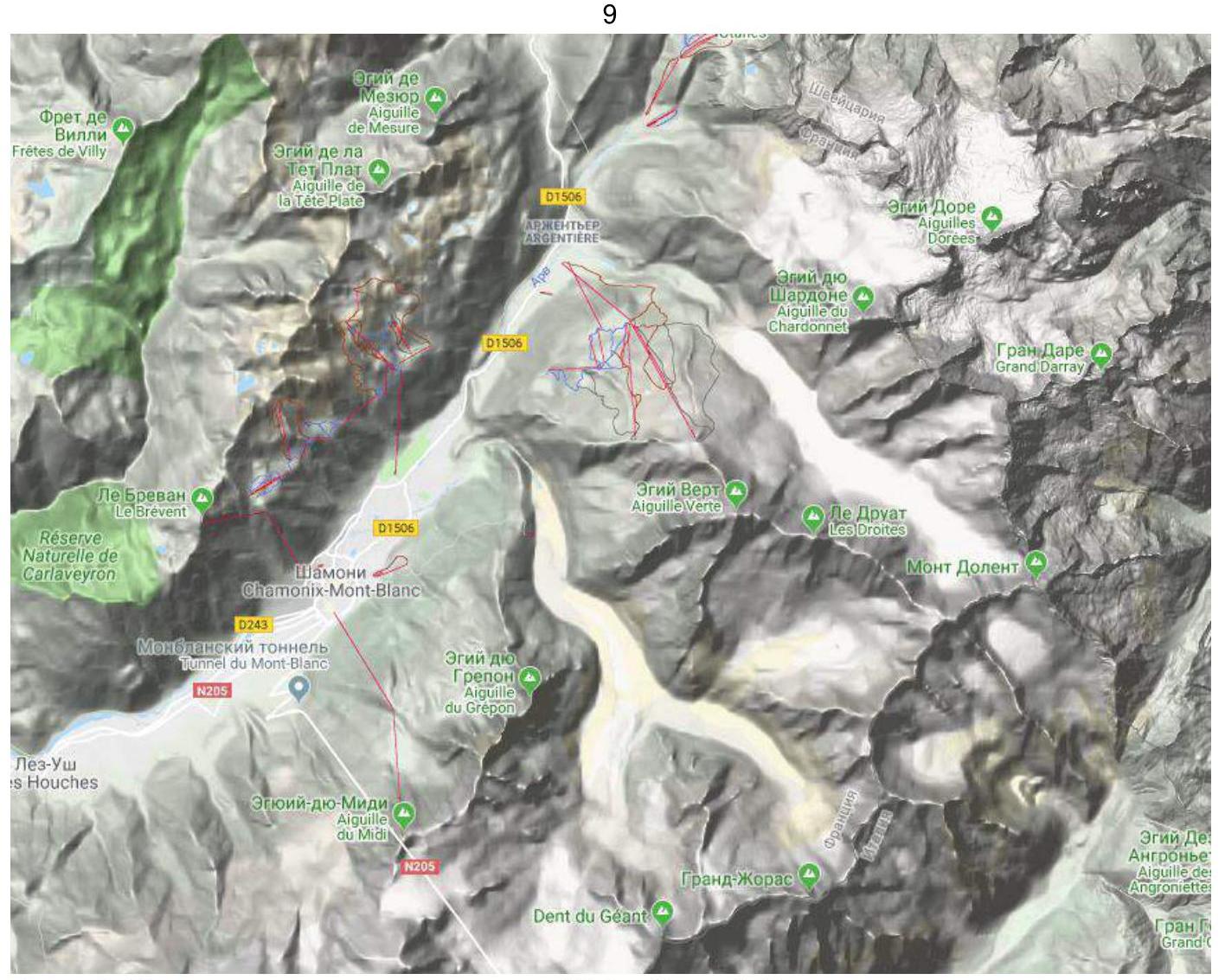
Photo 6. Map of the summit and surroundings of Petit Aiguille Verte
Information about the Summit
Petit Aiguille Verte is a summit with a height of 3512 m above sea level, located in the Mont Blanc massif in the French Alps, between the Mer de Glace and Argentière glaciers. The approach to the summit is typically made from the Grands Montets lift via the Grands Montets glacier. On a clear day, the summit offers excellent views of Petit Dru, Aiguille d'Argentière, Aiguille du Chardonnet, and Aiguille Verte. Information about the first ascent is unknown. Geographical coordinates of the summit: 45.94790° N / 6.995860° E. The team's ascent to the summit began from the base camp in Les Chosalets, then from the Grands Montets lift (3300 m). The time taken to ascend the glacier from the lift to the start of the route (bergshrund) is 40–50 minutes maximum. According to the European classification, the route has a category of PD (French).
2. Characteristics of the Route
2.1 Technical Photograph of the Route
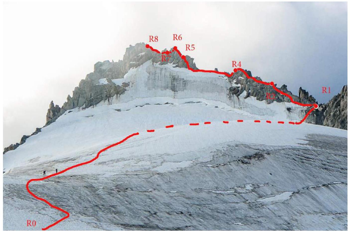
Photo 7. Route with marked rope sections.
2.2 Technical Characteristics of Route Sections
| Section № | Length, m | Steepness, ° | Terrain Type | Difficulty Category | Number of Pitons |
|---|---|---|---|---|---|
| R0–R1 | 30 | 45 | ice-rock | 2 | 4 |
| R1–R2 | 35 | 35 | snow-rock | 2 | 3 |
| R2–R3 | 20 | 35 | rock | 2 | 2 |
| R3–R4 | 50 | 45 | snow-rock | 2 | 3 |
| R4–R5 | 70 | 55 | snow-rock | 1–2 | 4 |
| R5–R6 | 20 | 70 | rock | 3 | 3 |
| R6–R7 | 20 | 35 | rock | 2 | 0 |
| R7–R8 | 30 | 70 | rock | 3 | 3 |
3. Characteristics of the Team's Actions
3.1 Brief Description of the Route Passage by Sections
| Section № | Description | Photo № |
|---|---|---|
| Approach | From the Grands Montets lift, move up the glacier to the rock start of the SW ridge. Approach the bergshrund. During the season, a path is trodden here, and numerous groups follow the route. | 9 |
| R0–R1 | Bypass the bergshrund on the right, approach the 45-degree ice slope, and ascend it to the SW ridge, with ice axe protection predominantly, and a stance on personal anchors. 25 m. | 10 |
| R1–R2 | Ascend destroyed rocks. Bypass a rock outcrop on the left via snow. Ascend a crevice 15 m. Protection on personal anchors and natural features. Stance on "hourglass." 35 m. | |
| R2–R3 | Ascend the ridge, bypassing sharp outcrops on the left. Protection on slings and natural features. Stance on "sand hourglass" near a large boulder. 20 m. | |
| R3–R4 | Move up a 45-degree slope, with protection on natural features and personal anchors, bypassing large outcrops on the left. Final ascent — pass between two large outcrops, stance before descending height on a large boulder. 50 m. | |
| R4–R5 | Slight descent, then move up the ridge, emerging onto snow, traverse on snow, total 60 m. Then ascend rocks 10 m, protection on personal anchors. Stance under an overhanging boulder. 70 m, 50°. | |
| R5–R6 | Climb up a steep ridge along a large crevice. Protection on personal anchors, stance on a boulder. 20 m, 70°. | 11 |
| R6–R7 | Move up the ridge 20 m, protection on natural features, stance on a boulder before a wall. 20 m, 35°. | 12 |
| R7–R8 | Key climbing up 10 m on a 70-degree wall, protection on personal anchors. Then move forward along the ridge and descend, protection on natural features with subsequent down-climbing, then traverse to the summit, total 20 m. 30 m. | 13 14 |
| Descent | Descend via the ascent route, with two rappels before the key wall and from station R6 on slings. Optionally, a rappel can be made to the glacier on the middle of the second rope (there is a stationary sling), but the risk of rockfall should be assessed. | 15 16 |
3.2 Photo of the Team at the Summit with the Control Pole
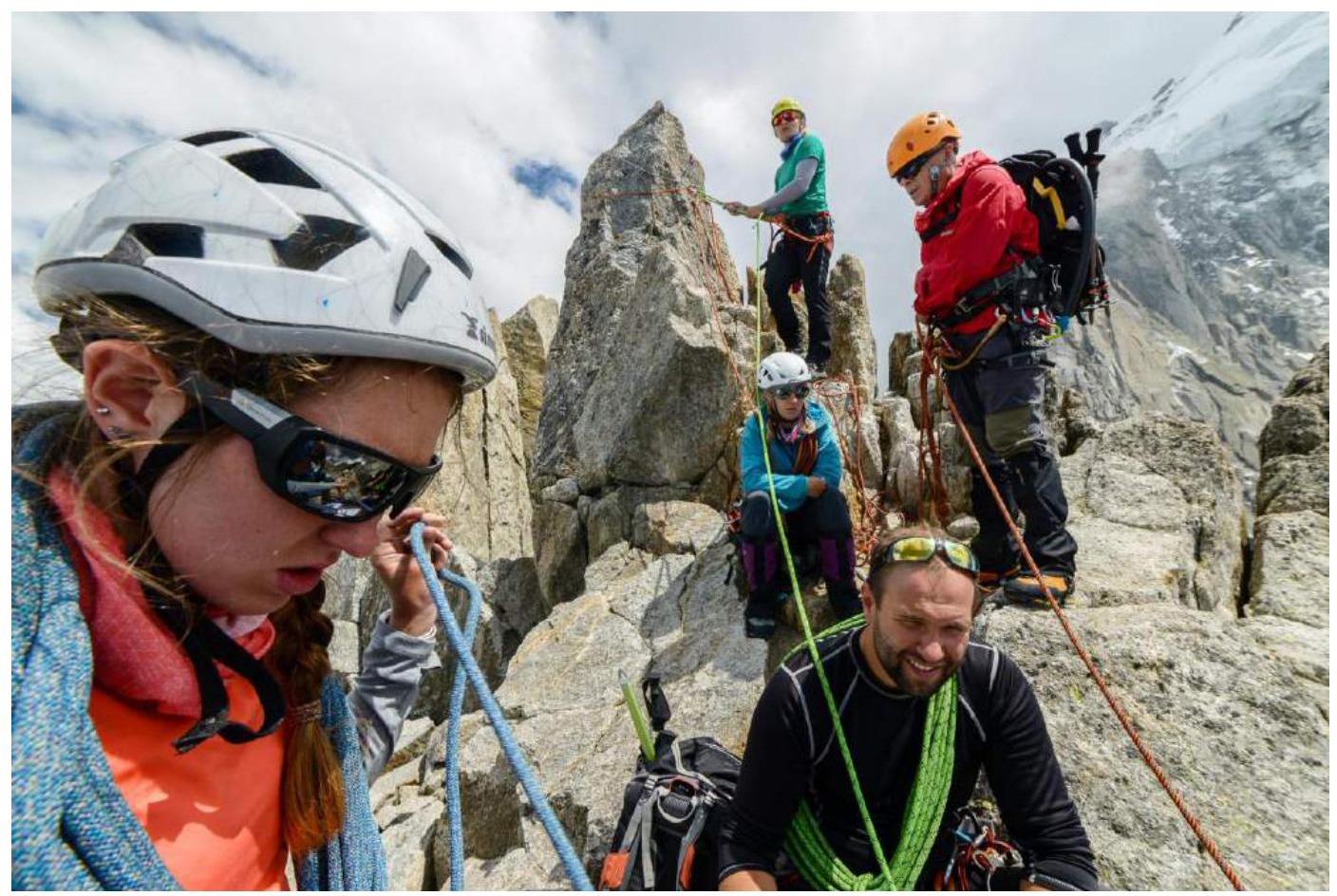
Photo 8. General photo of the team.
3.3. Route Safety Assessment
The route is popular among climbers due to its proximity to the lifts (30–40 minutes approach to the start of the route), but this is also a disadvantage, as many people are on the route simultaneously, creating difficulties for each other.
The high season for climbing is almost year-round.
Suitable for training ascents:
- practicing movements in teams on the ridge;
- practice in setting anchors and protection on natural terrain features.
When approaching the start of the route, it is necessary to move in teams and wear crampons; the last 100–150 m before the start of the route are rockfall-prone, and rocks periodically fall in the second half of the day.
The average steepness of the route is 48°.
Throughout the route, there are station slings, many of which are regularly updated.
Descent from the route via rappel near the summit is possible but not recommended due to rockfall risk.
It is advisable to descend to the lift before 16:00 due to its closure at 16:30 and the high probability of rockfall.
A total of 0 pitons were left on the route, and 12 friends/chocks were used.
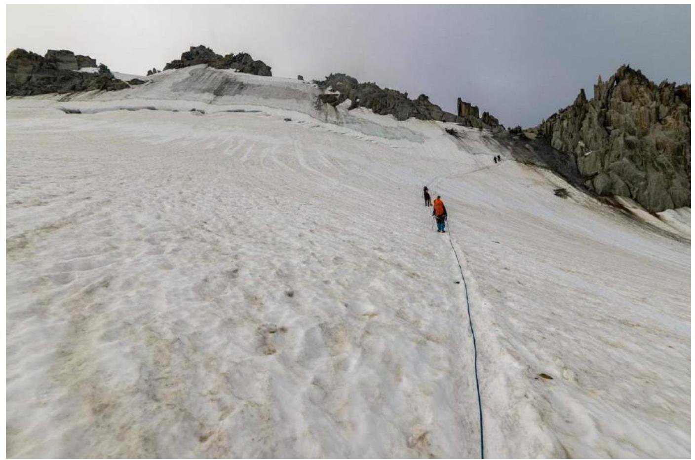
Photo 9. Approach.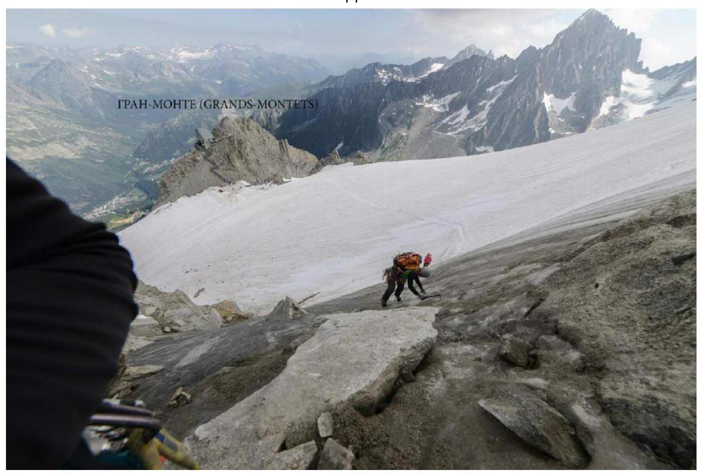
Photo 10. Passage of the ice section R0–R1. View from R1.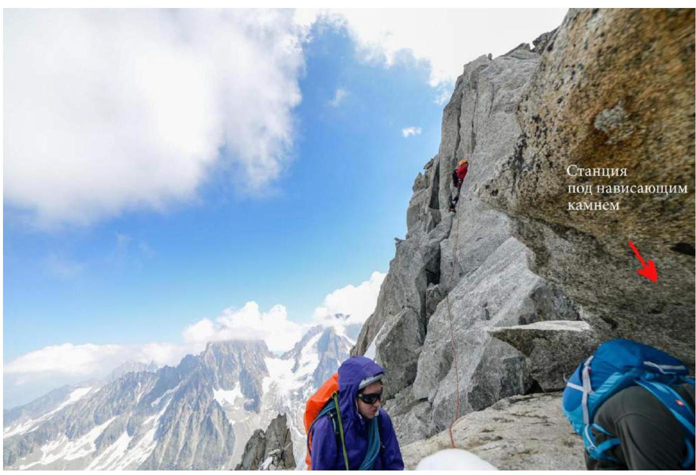
Photo 11. R5–R6. Climbing up a steep ridge along a large crevice.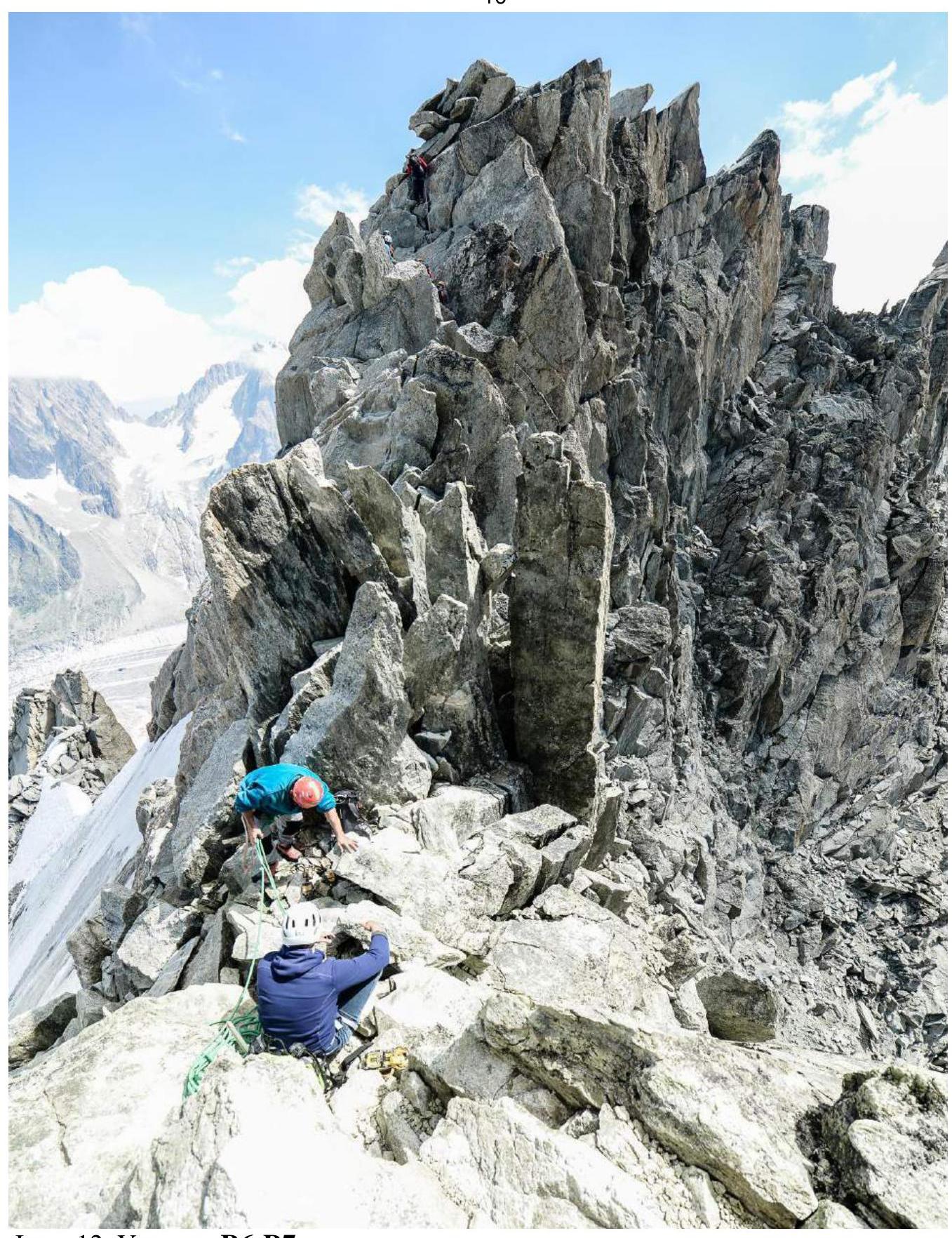
Photo 12. Section R6–R7.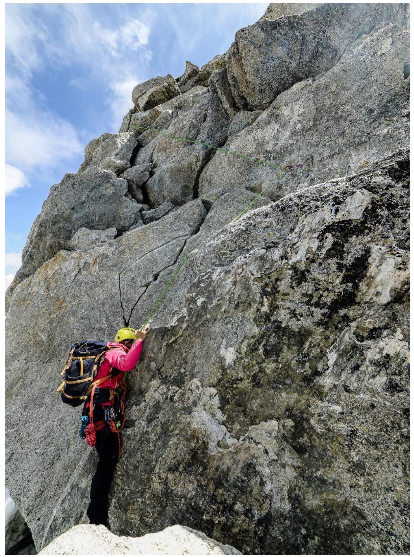
Photo 13. Start of the section with key climbing R7–R8.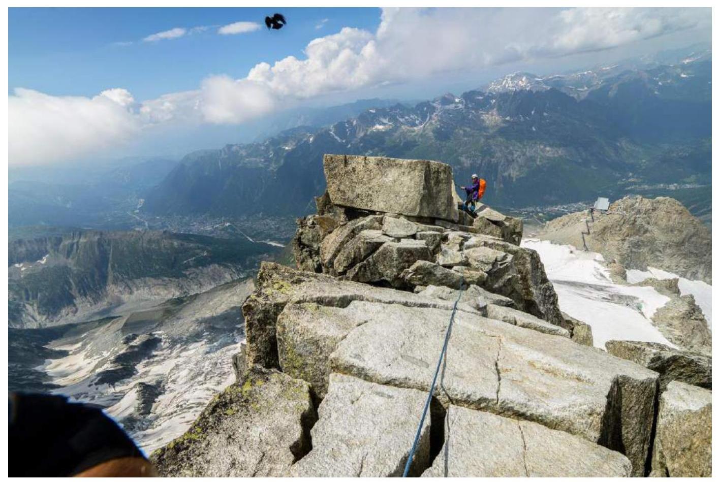
Photo 14. Section R7–R8. Ridge. View of the Chamonix valley (left) and the Grands Montets mountain and lift (right).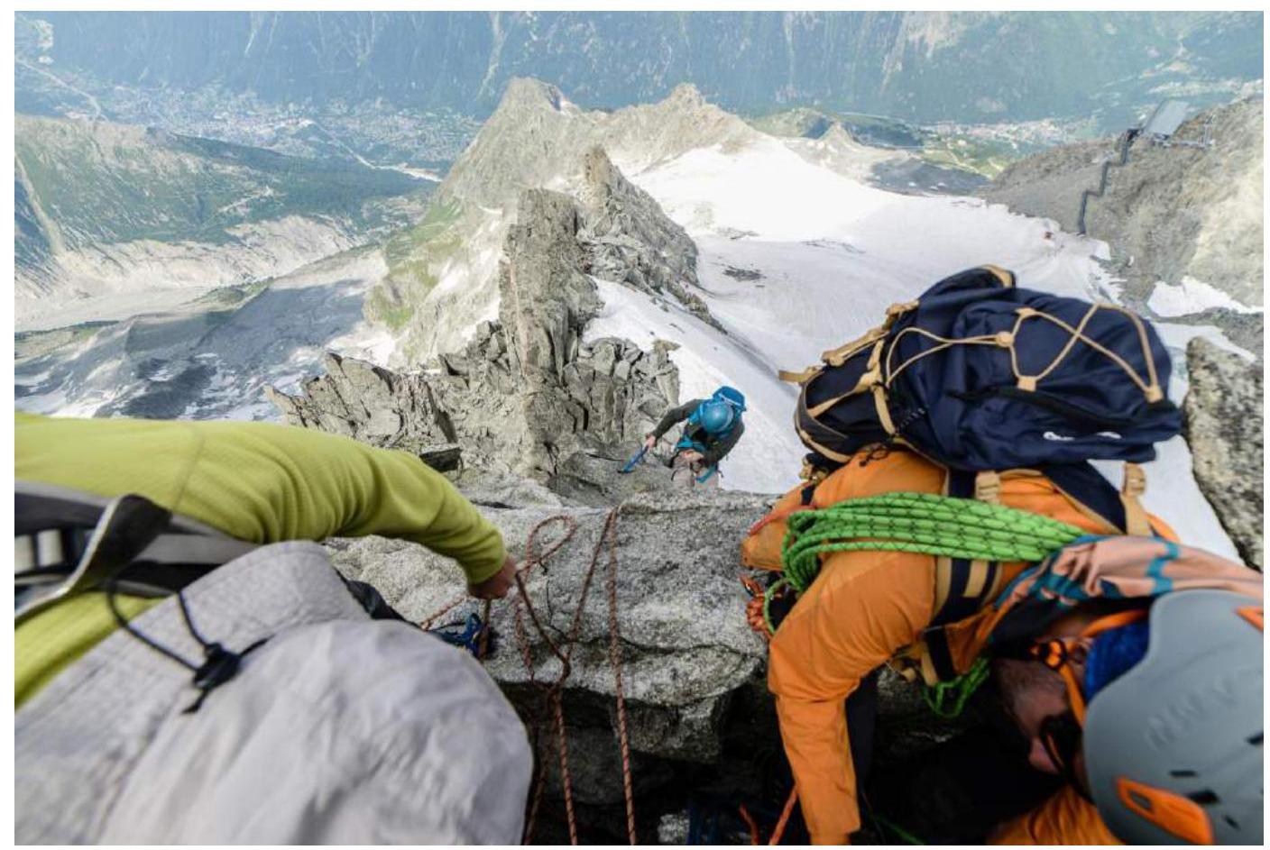
Photo 15. Descent. Rappel from station R6 on slings. A European guide-client pair is also seen on the photo.
Photo 16. Descent on the Grands Montets glacier.


