
Report
On the ascent of the CSKA team named after Demchenko to the summit of Monciar (3544 m) via the NW ridge, 3B category of difficulty, Graian Alps, Valle d'Aosta region (Valle d'Aosta) Gran Paradiso National Park
Team Leader: M.V. Bogdanov Senior Coach: E.V. Kuznetsova
Ascent Details
- Italy. Graian Alps, Valle d'Aosta region (Valle d'Aosta) Gran Paradiso National Park. Section No. 10.3 (according to KGBM 2011)
- Summit of Monciar (Becca di Monciair) 3544 m via the NW ridge (G. Yeld, F. and S. Pession, 1897)
- Proposed category of difficulty – 3B–4A,
- Route type: combined
- Elevation gain: 600 m Route length: 900 m. Average slope: main part of the route – 60°, entire route – 45°.
- Number of " закладок" (protection placements) used on the route: 2 sets
- Team's total climbing hours: 14.5 h (excluding descent)
- Team Leader: Bogdanov M.V. 1st sports category Team Members: Stepanenko E. 2nd sports category, Banasyukevich D. 3rd sports category, Belova T. 3rd sports category, Galkina N. 3rd sports category, Petrova V. 3rd sports category, Petrova T. 3rd sports category
- Coach: Kuznetsova E.V.
- Departure from Base Camp: 05:00 July 4, 2012 Route started: 8:30 July 4, 2012 Summit reached: 23:00 July 4, 2012 Return to Base Camp: 7:15 July 5, 2012 Descent from the summit: via the NE ridge route, 1B category of difficulty, to the Vittorio Emanuele hut
- Organizing body: CSKA training camp named after Demchenko (Moscow)
- Person responsible for the report: Bogdanov M.V., Yurkin Email: lis_fox@pisem.net
General photo of the summit.
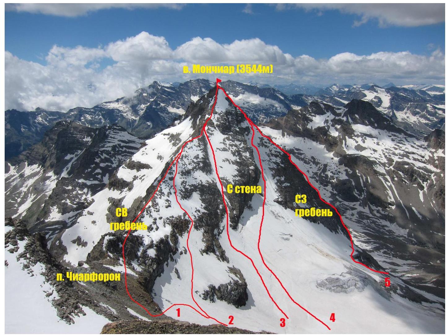
Photo of the summit of Monciar (Becca di Monciair) from the NW ridge of Ciarforon. July 2012. Labels on the photo:
- route via the NE ridge, 1B–2A category of difficulty [PD– category (Italian)] (G. Frasca and G. Blanchetti, 1881)
- route (variant) via the NE ridge, 1B–2A category of difficulty [PD category (Italian)] (E. Boyer, C. Carrezzana, A. Weber, 1902)
- route via the N face and NE ridge («via the couloir through the gendarme» (Italian)) 2A category of difficulty [PD category (Italian)]
- route via the N face, 3B category of difficulty [AD category (Italian)] (E. Barisone, S. Gallo, and M. Strumia, 1920)
- route via the NW ridge [AD+ category (Italian)] (G. Yeld, F. and S. Pession, 1897)
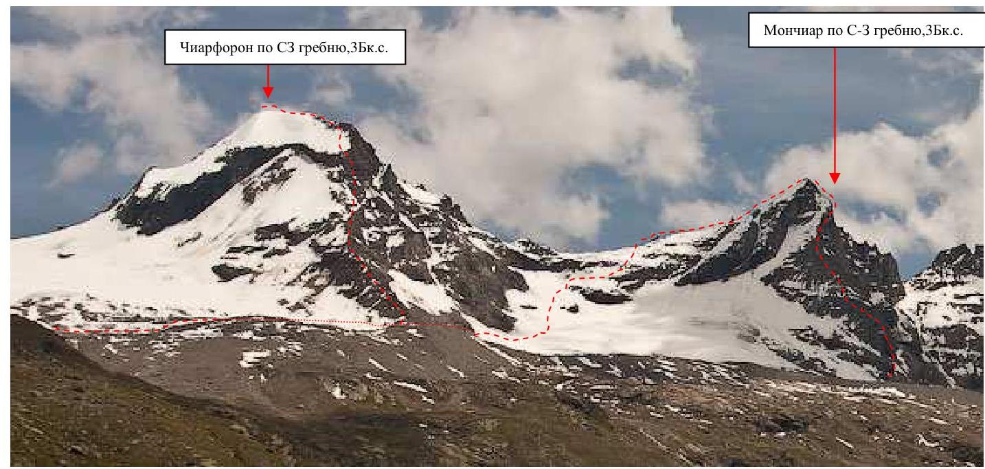
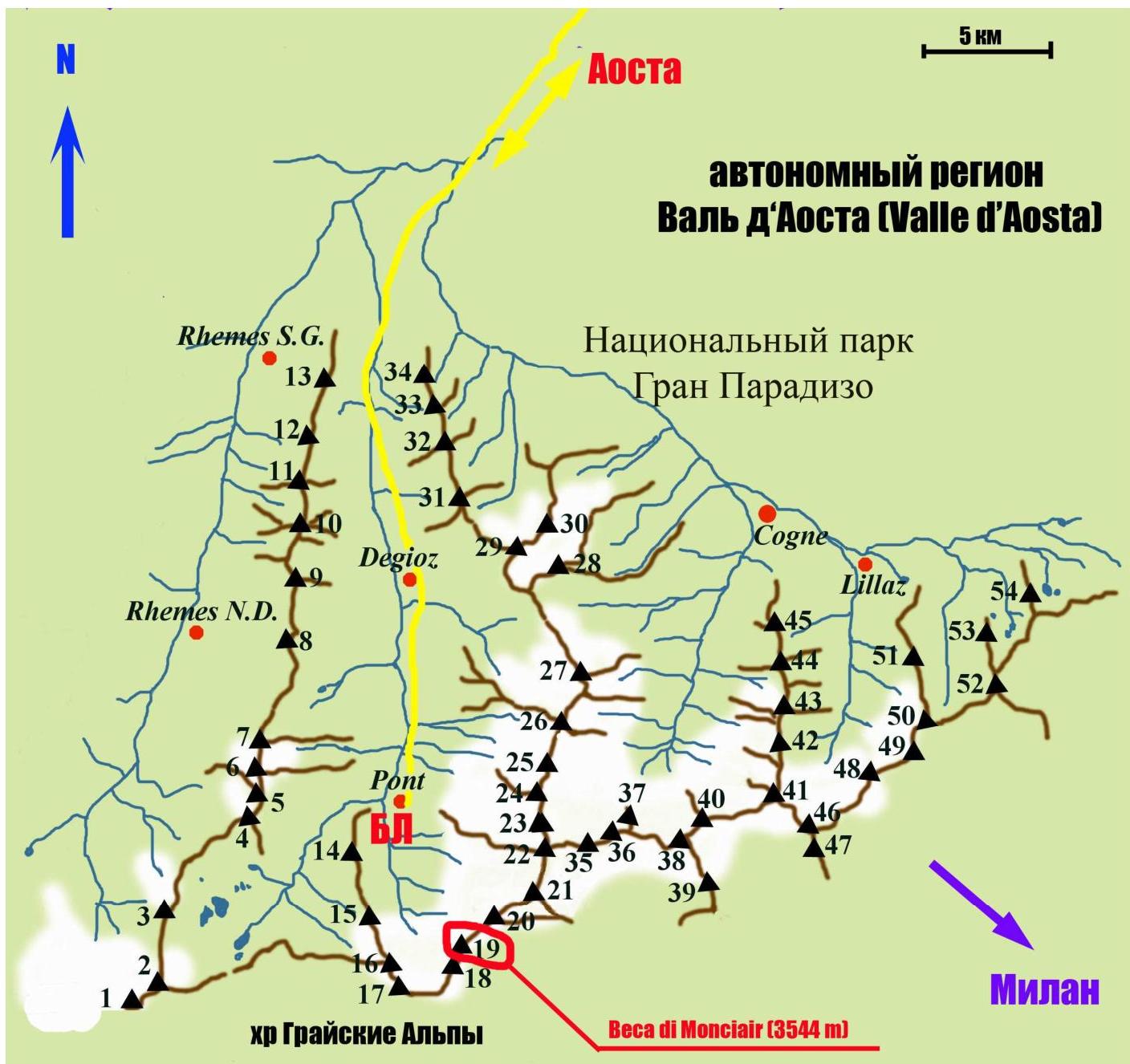
Photo of the route profile
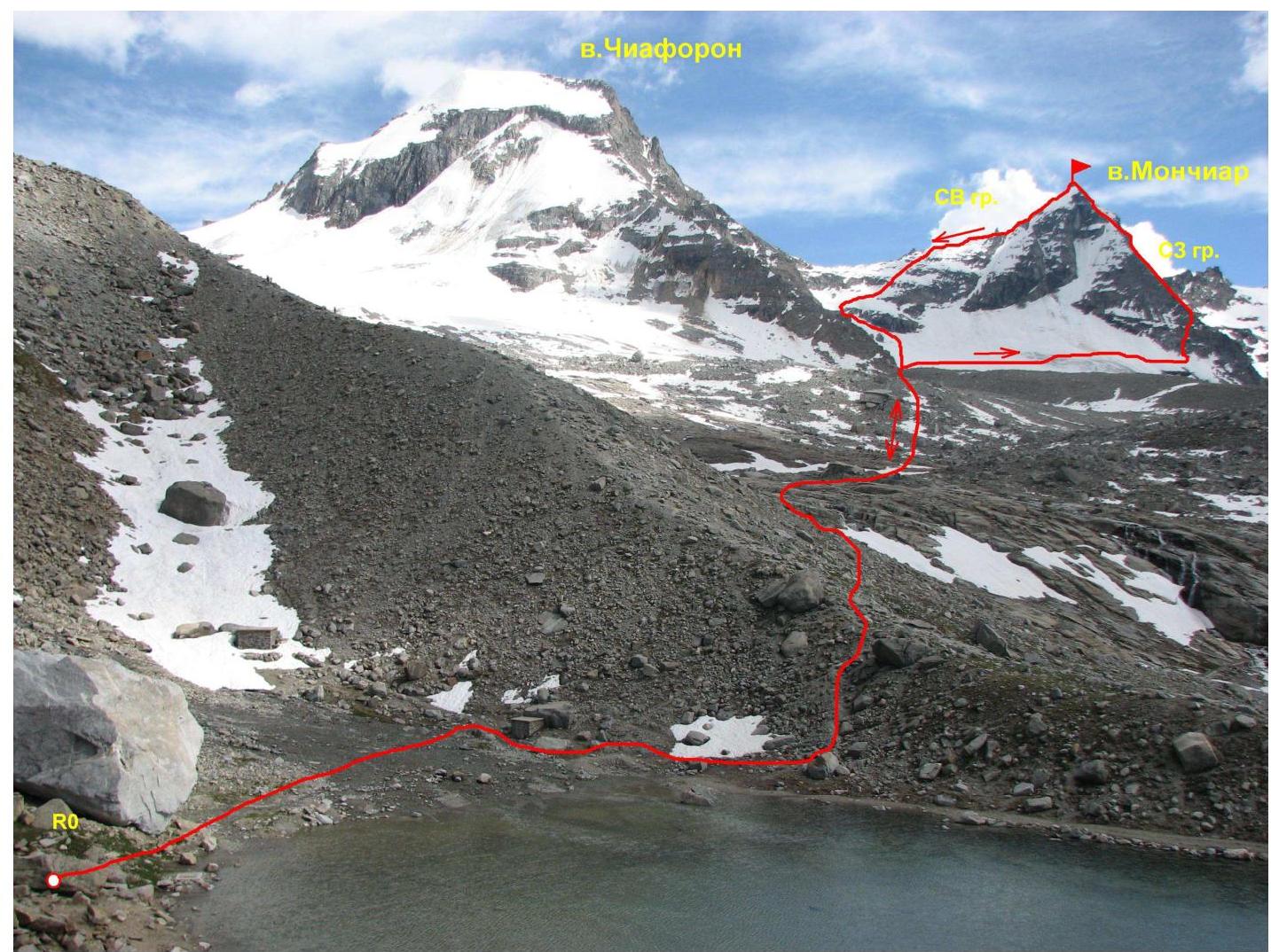
Photo panorama of the area.
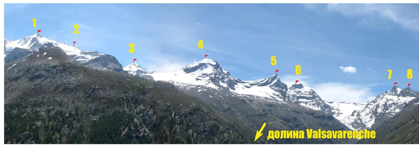
Labels on the photo:
- Gran Paradiso peak 4061 m
- Becca di Moncorvè peak 3875 m
- La Tresenta peak 3609 m
- Ciarforon peak 3642 m
- Becca di Monciair peak 3544 m
- Denti del Broglio peak 3454 m
- Mare Pércia peak 3385 m
- Punta Fourà peak 3411 m
Map of the area
| Peak labels (with elevations) on the map: | |
|---|---|
| 1 — Punta Galisia 3346 м | 28 — Punta Rossa della Grivola 3630 м |
| 2 — Punta Basei 3338 м | 29 — La Grivola 3969 м |
| 3 — Punta Gran Vaudala 3272 м | 30 — Grivoletta 3514 м |
| 4 — Taou Blanc 3438 м | 31 — Gran Nomenon 3488 м |
| 5 — Aouillé 3440 м | 32 — Mont Favret 3173 м |
| 6 — Cima di Entrelor 3430 м | 33 — Punta Valletta 2793 м |
| 7 — Punta Percià 3227 м | 34 — Becca Piana 2271 м |
| 8 — La Roletta 3384 м | 35 — Punta Ceresole 3777 м |
| 9 — Punta Bianca 3427 м | 36 — Testa della Tribolazione 3642 м |
| 10 — Punta Bioula 3414 м | 37 — Testa di Valnontey 3562 м |
| 11 — Punta del Ran 3272 м | 38 — Becca di Gay 3621 м |
| 12 — Punta Chamoussière 2942 м | 39 — Becco Meridionale della Tribolazione 3360 м |
| 13 — Monte Paillasse 2414 м | 40 — Roccia Viva 3650 м |
| 14 — Cima dell'Arolley 2996 м | 41 — Torre del Gran San Pietro 3692 м |
| 15 — Cima di Seiva 3075 м | 42 — Punte Patri 3581 м |
| 16 — Punta Fourà 3411 м | 43 — Punta Valletta 3356 м |
| 17 — Mare Pércia 3385 м | 44 — Punta di Valmiana 3244 м |
| 18 — Denti del Broglio 3454 м | 45 — Punta Fenilia 3053 м |
| 19 — Becca di Monciair 3544 м | 46 — Punta d’Ondezana 3452 м |
| 20 — Ciarforon 3642 м | 47 — Becco di Valsoera 3369 м |
| 21 — La Tresenta 3609 м | 48 — Punta delle Sengie 3408 м |
| 22 — Becca di Moncorvè 3875 м | 49 — Monveso di Forzo 3322 м |
| 23 — Gran Paradiso 4061 м | 50 — Grande Arolla 3246 м |
| 24 — Piccolo Paradiso 3923 м | 51 — Punta della Tsesére 3117 м |
| 25 — Becca di Montandaynè 3838 м | 52 — Torre di Lavina 3308 м |
| 26 — Herbetet 3778 м | 53 — Punta di Acque Rosse 2952 м |
| 27 — La Gran Serra 3552 м | 54 — Punta Nera 3064 м |
The summit of Monciar (Becca di Monciair) 3544 m, to which the ascent was made, is located in the Gran Paradiso National Park area.
The ascent to the summit of Monciar took place as part of the CSKA training camp named after Demchenko (Moscow) in early July 2012.
The base camp of the training camp was located in the Pont campsite. The village is the highest and last settlement in the Valsavaranche valley. Elevation: 1950–2000 m.
The immediate departure to the route was made from the Vittorio Emanuele II hut. The hut is located at the foot of the Gran Paradiso peak at an elevation of 2732 m.
The approach via a convenient trail from the Pont village takes about 2 hours.
The route began under good weather conditions. A thunderstorm started at 16:00, and the team waited until 17:30 below the ridge at station R6.
According to the Italian classification, the route via the NW ridge has a difficulty rating of AD+.
Description of route sections.
| Section # | Length, m | Angle, ° | Terrain type | Category of difficulty | Protection placements |
|---|---|---|---|---|---|
| R0–R1 | approach | Rocks—snow—ice | |||
| R1–R2 | 50 | 45–60 | Rocks | 4 | full set |
| R2–R3 | 50 | 55–65 | Rocks | 4 | full set |
| R3–R4 | 120 | 30 | Rocks | 2 | |
| R4–R5 | 300 | 40–50 | Rocks | 3 | full set |
| R5–R6 | 100 | 45–55 | Rocks | 3 | full set |
| R6–R7 | 50 | 35 | Rocks | 2 | |
| R7–R8 | 100 | 40 | Snow | 3 | full set |
| R8–R9 | 120 | 65–80 | Rocks | 4 | full set |
Technical photo of the route
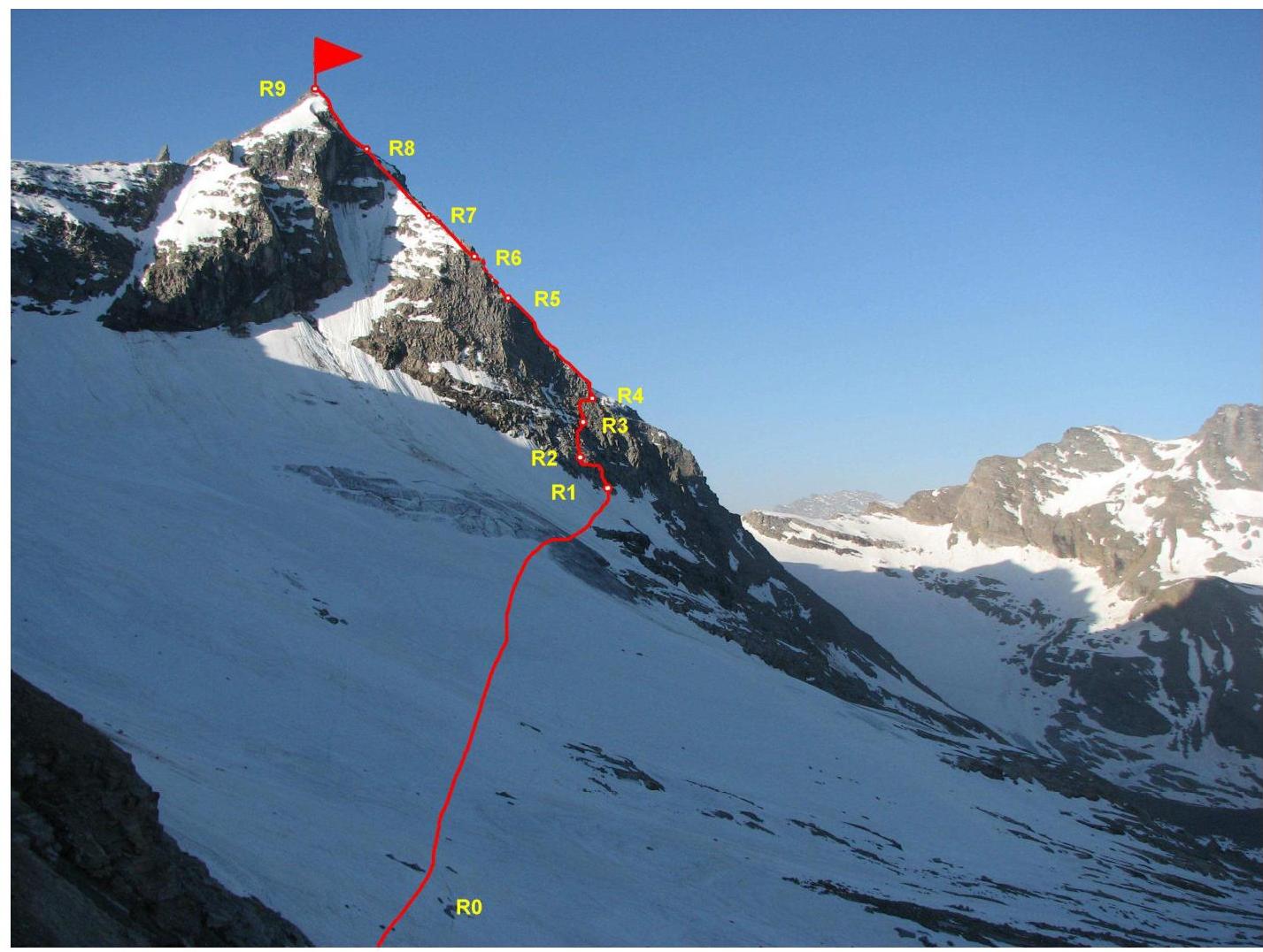
Photo from the NW ridge of Ciarforon
Brief description of the route passage by sections.
R0–R1 From the Vittorio Emanuele hut, follow the trail to the moraine. After crossing the stream from the glacier in the lower part, ascend on the right side of the moraine towards the beginning of the NW ridge of Ciarforon. Reach a small saddle on the moraine ridge. To the left along the ridge, there is a good trail. Approximately 1.5–2 hours.
Then:
- Descend to the glacier
- Traverse towards a small snow patch at the base of the NW ridge of Monciar.
An alternative start to the route is at the beginning of the NW ridge. Cross the glacier in crampons. It is advisable to put on harnesses and hang "hardware" before reaching the glacier, as there are few safe and convenient places afterwards. Be cautious near the rocky ridge due to potential rockfall.
R1–R2 Begin the route from a small ledge at the start of the snow patch. Ascend directly up the smooth rocks to a large ledge (40 m), then traverse left along the ledge (10 m) to another convenient wide ledge.
R2–R3. Ascend upwards and to the right along inclined smooth rocks to reach a scree slope. There are few places for intermediate protection, and the area is not convenient for a "station." The rocks are wet, and there are "live" stones.
R3–R4. Traverse to the right along the scree slope to reach the ridge.
R4–R5. Move along the ridge, bypassing "gendarme" peaks to the right. Move carefully due to many "live" stones. Reach a small depression before a "gendarme."
R5–R6 Bypass the depression on the left side, approach the wall of the "gendarme," and traverse to the right along a narrow ledge to reach the slope. The passage is very cautious! "Live" slabs! Rockfall hazard! When rocks fall, there is a high risk of damaging the rope. After traversing 30–40 m along the slope, ascend to the ridge via a small wall (10 m).
R6–R7 Move along the ridge to reach the snow.
R7–R8 Ascend up the snow to the pre-summit ridge. The intermediate station is not convenient due to shallow snow and "live" slabs.
R8–R9 Ascend up rocks of medium difficulty to the summit. There are some pre-placed " крючья" (pitons) on this section. The section is hazardous due to rockfall, with "live" stones.
Descent via the NE ridge route, 1B category of difficulty.
The entire route is hazardous due to rockfall and requires attention and caution. Not recommended for groups larger than 6 people.
Photo illustrations of the report
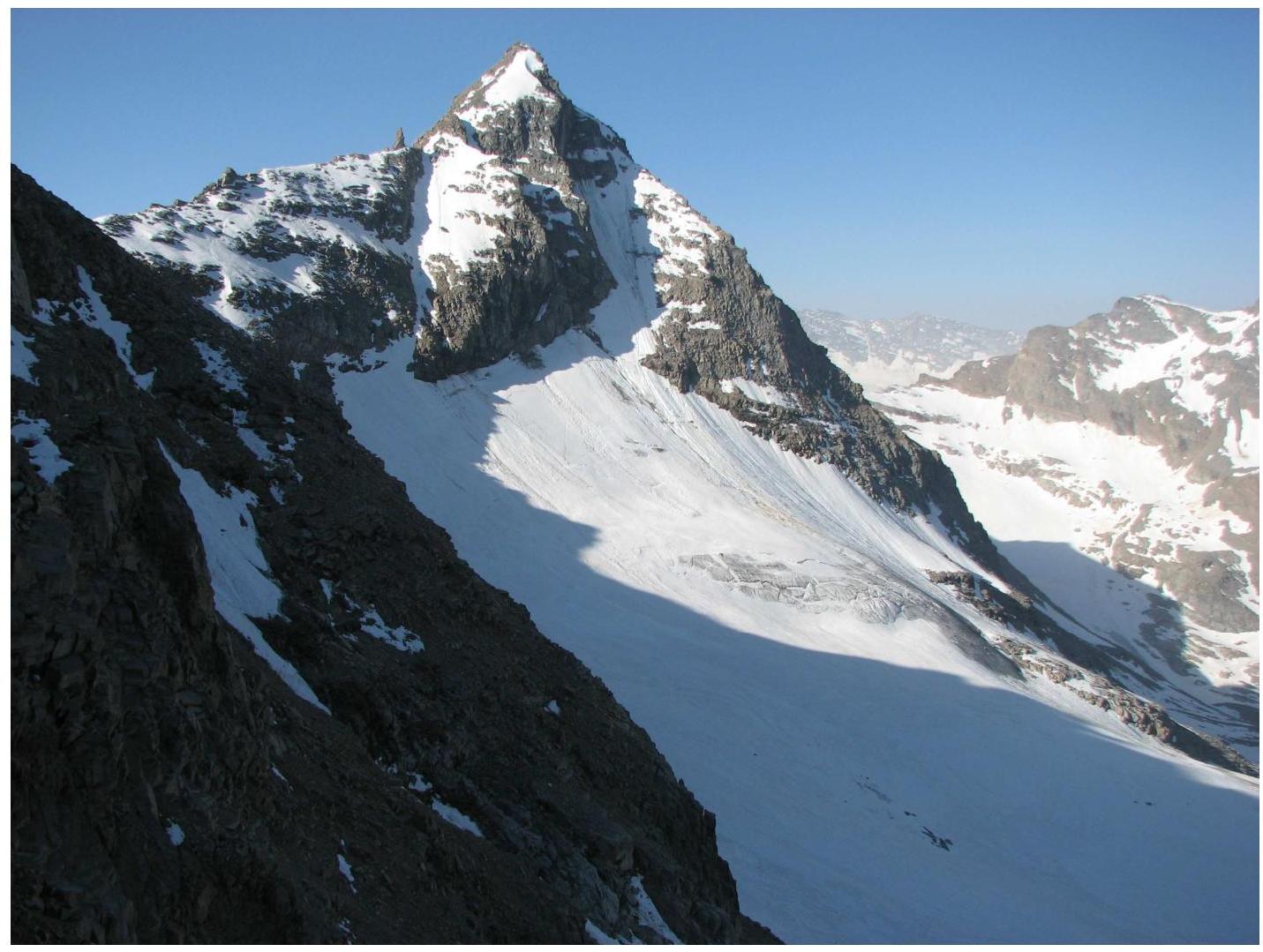
Photo of the NW ridge

Photo of section R0–R1

Photo of section R4–R5. There is no photo from the summit as the ascent was made under poor weather conditions in the evening.