Report
On the Ascent of the Combined Team from Moscow, Tomsk, and Omsk Region to Mont Blanc 4810 m
via the Central Counterfort of the Southeast Face with the Eccles Pass, Innominata Route
Presumably 5B Category of Difficulty
Smailkina S.V. — Team Leader
Prilepskaya N.E.
Gorodetskaya O.A.
Climbing Team Members
- Smailkina Svetlana Vladimirovna, Master of Sports, Tomsk. Coach — Sapunova Yu.V. Phone: +7 923 409 10 17. Email: talery@mail.ru
- Team Leader — Prilepskaya Natalia Evgenievna, Master of Sports. Coach — Kuznetsova E.V.
- Gorodetskaya Olga Alexandrovna, 1st Sports Category, Omsk. Coach — Zdanovich I.A.
Contents
Climb Passport.......................................................................................4 Overall Summit Photograph...................................................................5 Route Profile Photograph......................................................................6 Drawn Route Profile.............................................................................7 Area Photopanorama...........................................................................8 Brief Overview of the Area and Climb Object........................................9 Maps and Photographs of the Climb Area and Approach Route............13 Route Diagram in UIAA Symbols..........................................................17 Technical Photographs of the Route.......................................................20 Route Description by Sections...........................................................22 Comparison of the Proposed Category of Difficulty of the Climbed Route with Classified 5B Category Routes....................................24 Team Tactical Actions........................................................................26 Ascent Schedule................................................................................28 Photographs of Individual Route Sections.........................................29
Climb Passport
-
Region: Alps, section number according to the 2011 classification table – 10.3
-
Summit: Mont Blanc
Height: 4810 m
Route: via the central counterfort of the Southeast Face with the Eccles Pass, Innominata Route (S.–L. Courtauld, E.–G. Oliver, A. Aufdenblatten, A. and H. Rey, 1919)
Proposed Category: 5B, first ascent.
-
Route Character: Combined
Route Height Difference: 830 m
Route Length: 2460 m
Length of Sections with V–VI Category of Difficulty: 240 m
Average Steepness:
- Main Part R1–R17 — 54°
- Entire Route — 43°
-
Pitons Used on the Route (Total/ITО):
- Ice Pitons — 4
- Stationary Pitons — 8
- Chocks and Friends — 51
-
Team Climbing Hours: 14.5 hours (1 day)
-
Team Leader: Smailkina Svetlana Vladimirovna, Master of Sports, Coach Sapunova Yu.V.
Team Members: Prilepskaya Natalia Evgenievna, Master of Sports, Coach Kuznetsova E.V. Gorodetskaya Olga Alexandrovna, 1st Sports Category, Coach Zdanovich I.A.
-
Date and Time of Departure from Eccles bivouac 3850 m — August 20, 2013, at 3:30
Date and Time of Route Start (Eccles Pass 3980 m) — August 20, 2013, at 7:40 Date and Time of Reaching Mont Blanc Summit 4810 m — August 20, 2013, at 22:10 Date and Time of Descent to Vallot bivouac, 4362 m — August 20, 2013, at 23:30 Descent from the summit via the Northwest Ridge on the "Goûter" route to Goûter Hut.
-
Organizations: Moscow Alpine and Rock Climbing Federation, Tomsk Alpine Federation, Omsk Region Alpine Federation
-
Report Responsible:
- Prilepskaya N.E. email: nprilepskaya@gmail.com, phone: +7 903 186 80 80
- Smailkina S.V. email: talery@mail.ru, phone: +7 923 409 10 17
Overall Summit Photograph
Major routes on the South Face of Mont Blanc:
- — via the central counterfort of the Southeast Face with the Eccles Pass, Innominata Route (team's route)
- — Brouillard ridge — on the left against the sky
- — Peuterey ridge — on the right against the sky
- — Pilier Rouge de Brouillard (Bonatti)
- — Pilier du Freney (Gervasutti)
- — Pilier Central du Freney (Bonington)
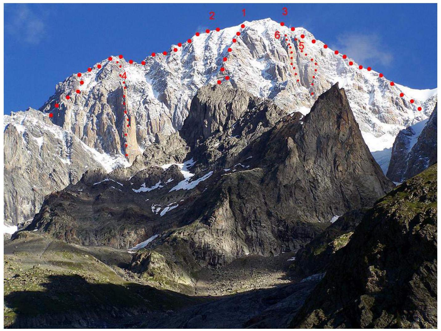
Photo 1. South face of Mont Blanc massif. Source: Internet resource.
Route Profile Photograph
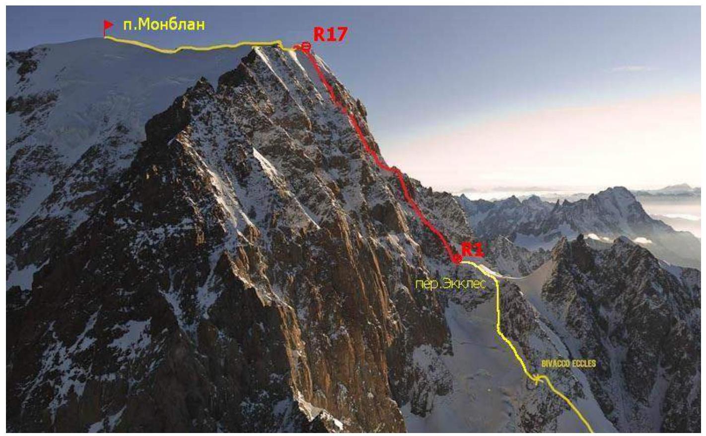
Photo 2. Profile of the Innominata Route on Mont Blanc. View from the southwest. Source: Internet resource.
Drawn Route Profile
Average Steepness:
- Main part of the route 54°
- Entire route 43°
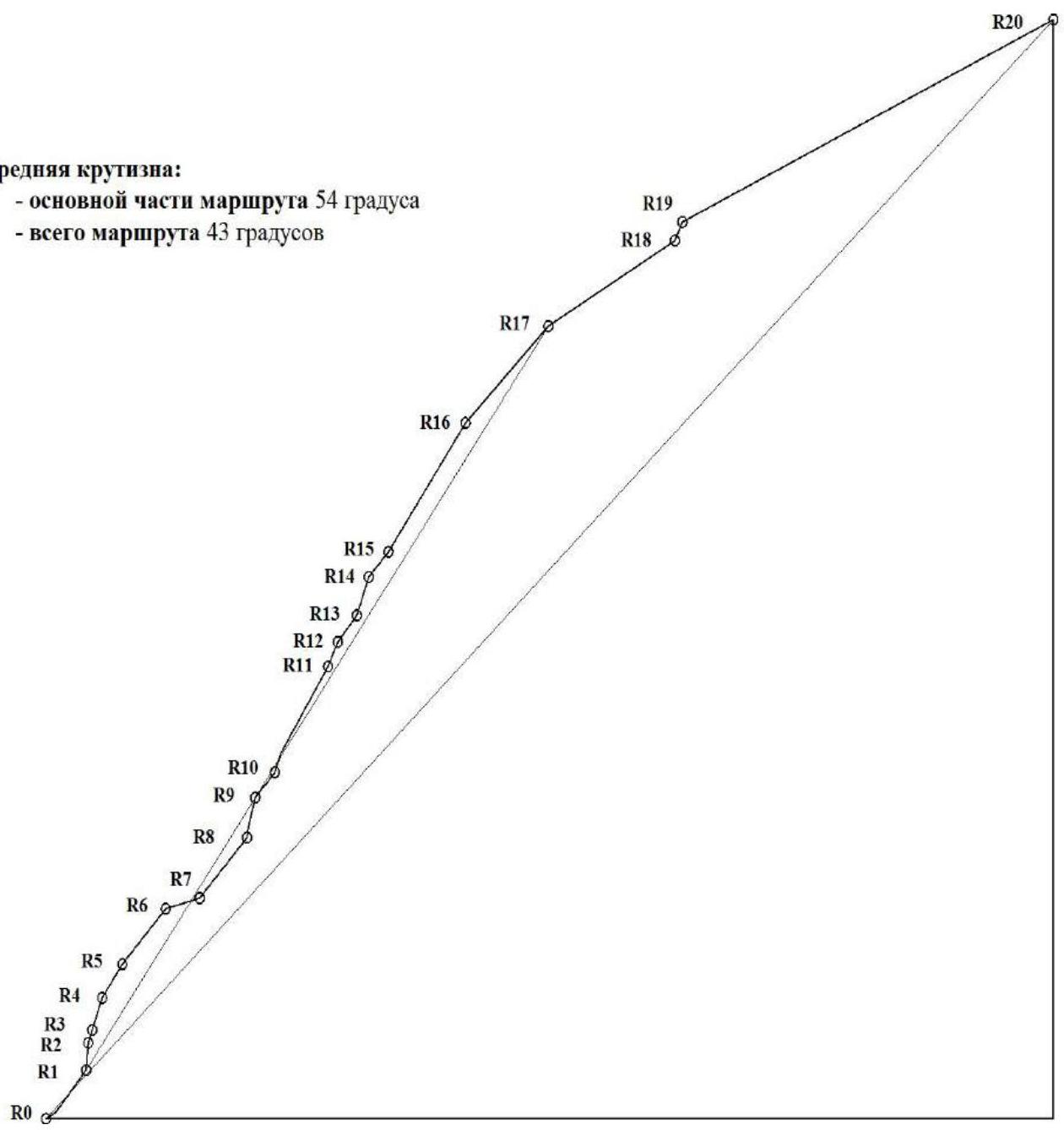
Fig. 1. Drawn profile of the Innominata Route on Mont Blanc.
Area Photopanorama
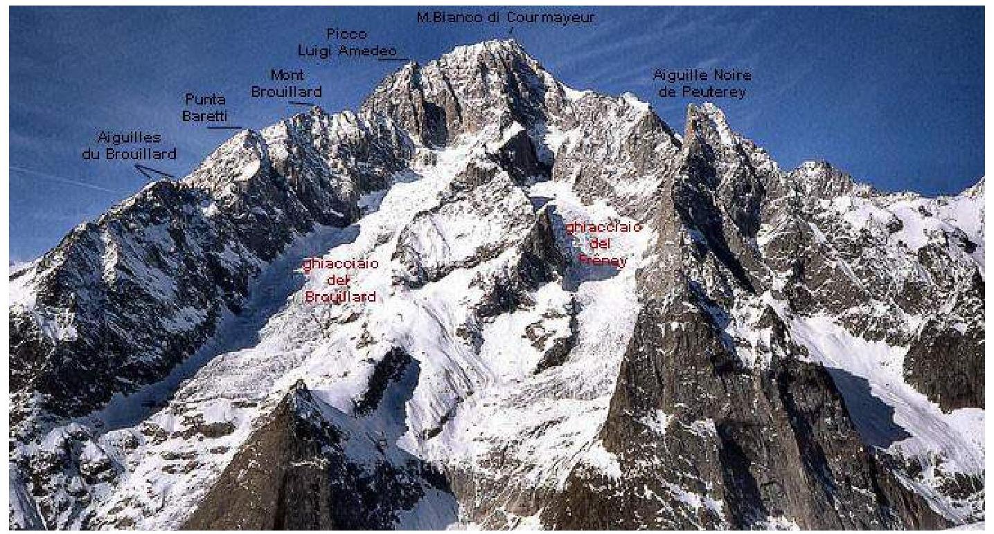
Photo 3. View of the Mont Blanc massif from the south (from Italy). Source: Internet resource.
Brief Overview of the Area and Climb Object
The Alps are the highest mountain range in Western Europe, forming a complex system of ridges and massifs stretching in a northwest-convex arc from the Ligurian Sea to the Middle Danube Plain. The Alps are located across eight countries:
- France
- Monaco
- Italy
- Switzerland
- Germany
- Austria
- Liechtenstein
- Slovenia
The total length of the Alpine arc is about 1200 km, with an inner edge length of about 750 km and a width of up to 260 km. The highest point of the Alps is Mont Blanc (4810 m).

Photo 4. Europe's highest summit — Mont Blanc 4810 m. Source: Internet resource.
The Alps are a popular international center for mountaineering, skiing, and tourism. Due to their favorable location in the heart of Western Europe, the Alps are one of the most studied mountain ranges in the Western scientific tradition. Many concepts related to mountain ranges worldwide are named after the Alps (Alpine climatic zone, Alpine orogeny, Alpine meadows, mountaineering, etc.).
The Alps are divided into the higher Western Alps (up to 4810 m, Mont Blanc) and the lower and wider Eastern Alps (up to 4049 m, Bernina) by a transverse valley between Lake Constance and Lake Como.
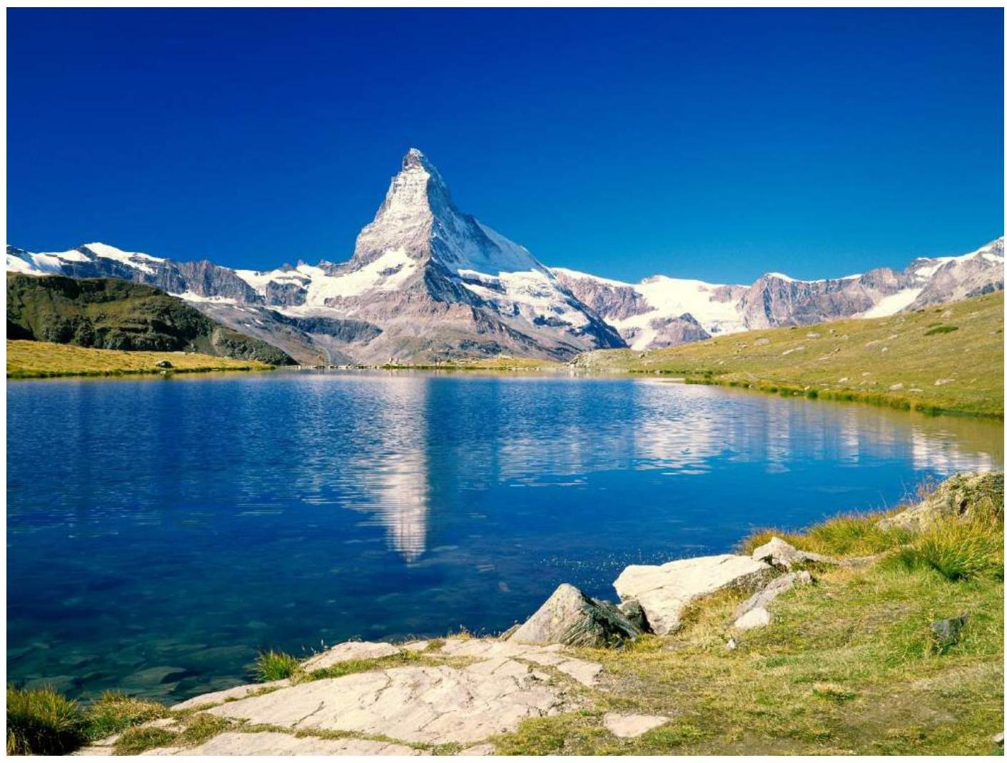
Photo 5. The Matterhorn summit (4478 m) is located on the border between Switzerland and Italy. Source: Internet resource.
The Alpine belt is characterized by a significant presence of glacial landforms. In the mountains, above 3000 m above sea level, more snow falls in winter than can melt. The snowline lies at around 2.5 km on the north side and between 3 and 3.2 km on the south side. The total area of modern glaciation is 4140 km², with around 1200 glaciers, the largest being the Aletsch Glacier in the Bernese Alps, covering 169 km².
The Alps are considered the "cradle" of mountaineering. In 1786, M. Paccard and J. Balmat ascended Mont Blanc at the initiative of Horace-Bénédict de Saussure. This event is believed to have marked the beginning of mountaineering worldwide.
The strongest mountaineers from Alpine countries such as Italy, Germany, Austria, France, and the UK have been prominent in this field. By the early 20th century, all Alpine summits had been conquered, and climbers began seeking new, more challenging routes.
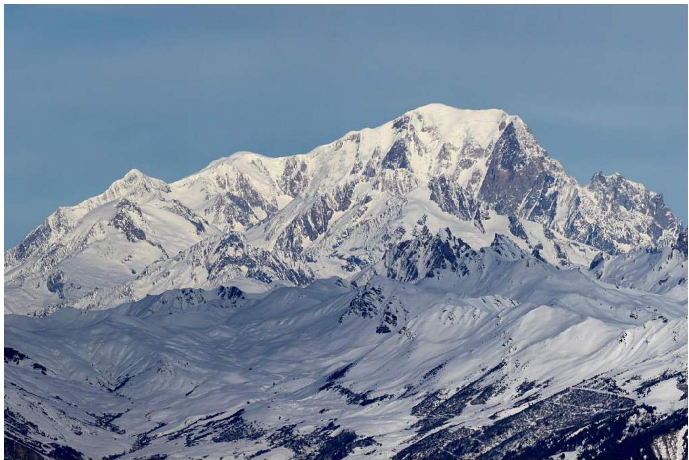
Photo 6. South side of Mont Blanc. Source: Internet resource.
Mont Blanc (4810 m) is located at 45°49′58″ N, 6°51′53″ E, on the border between France and Italy. It is the highest peak in Western Europe, with an ice coverage area of over 200 km². Major glaciers include "la Mer de Glace" and the Argentière glacier on the French side, and the Miage glacier on the Italian side.
The first ascent of Mont Blanc was made by Jacques Balmat and Dr. Michel Paccard on August 8, 1786, following the initiative of Horace-Bénédict de Saussure.
Currently, numerous routes of varying difficulty lead to Mont Blanc's summit. The ascent requires serious physical and technical preparation, as well as a well-planned tactical approach.
The Innominata Route ascends Mont Blanc from the Italian side, via the central counterfort of the Southeast Face with the Eccles Pass. It was first climbed by S.–L. Courtauld, E.–G. Oliver, A. Aufdenblatten, A., and H. Rey on August 19–20, 1919. This route is not listed in the Russian climbing classification.
The approach involves driving or taking public transport from Courmayeur to the start of the ascent to Monzino Refuge (2580 m), which takes about 2.5 hours. From Monzino Refuge, climbers ascend to Eccles bivouac (3850 m), a 4.5-hour journey involving moraine and glacier travel.
From Eccles bivouac to Eccles Pass (3980 m) takes about 2.5 hours. Climbers can either ascend via a snowy-icy couloir or through the Eccles peak. The height difference from Eccles bivouac to Mont Blanc's summit is 960 m, and from Monzino Refuge to the summit is 2230 m.
The safest descent route follows the Northwest Ridge via the "Goûter route" to Vallot Hut (4362 m), then to Goûter Hut (3817 m). The ridge can be sharp, with closed crevasses.
Maps and Photographs of the Climb Area and Approach Route
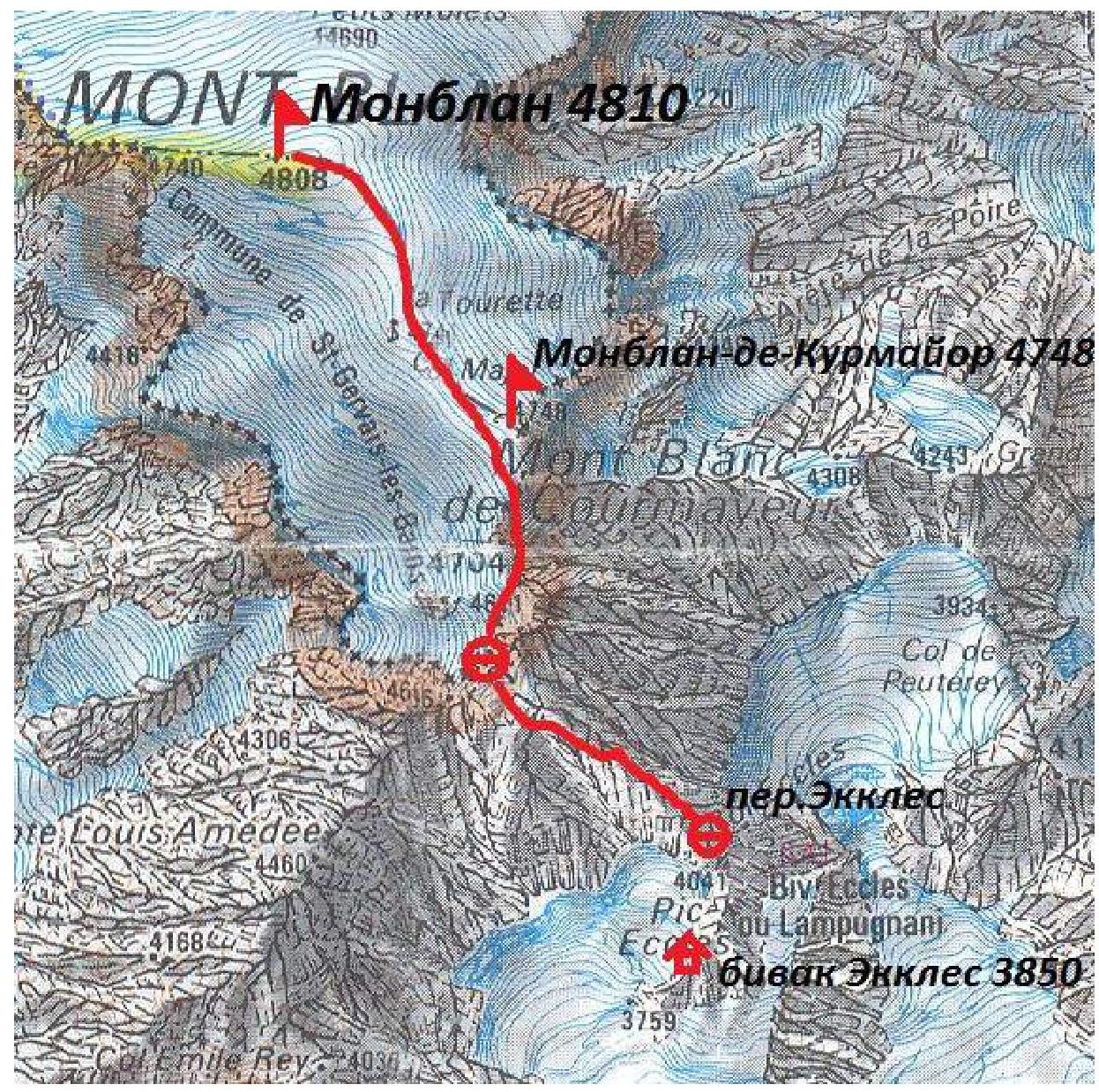
Fig. 2. Map of the climb area with the route. Source: Internet resource.
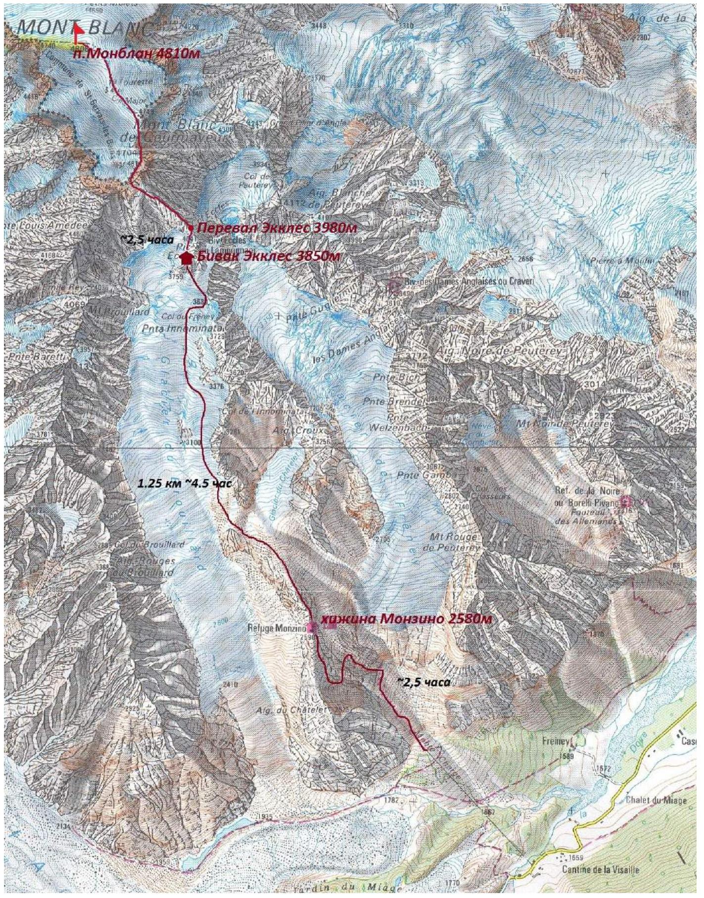
Fig. 3. Map of the climb area and approach route with times. Source: Internet resource.
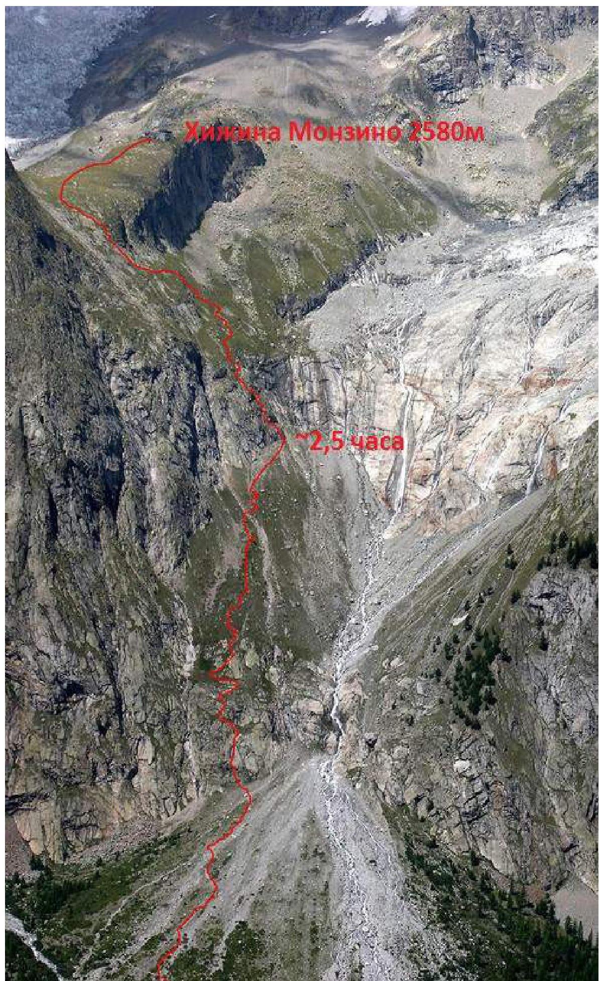
Photo 7. Approach route to Monzino Refuge. Photo by Livio Zefiro.
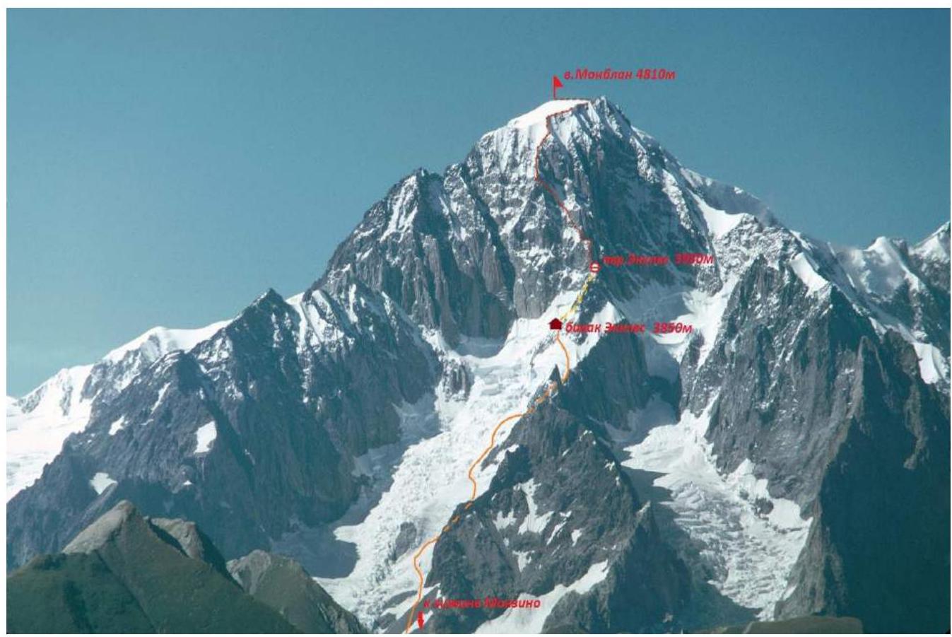
Photo 8. Approach route to Eccles bivouac and Eccles Pass. Source: Internet resource.
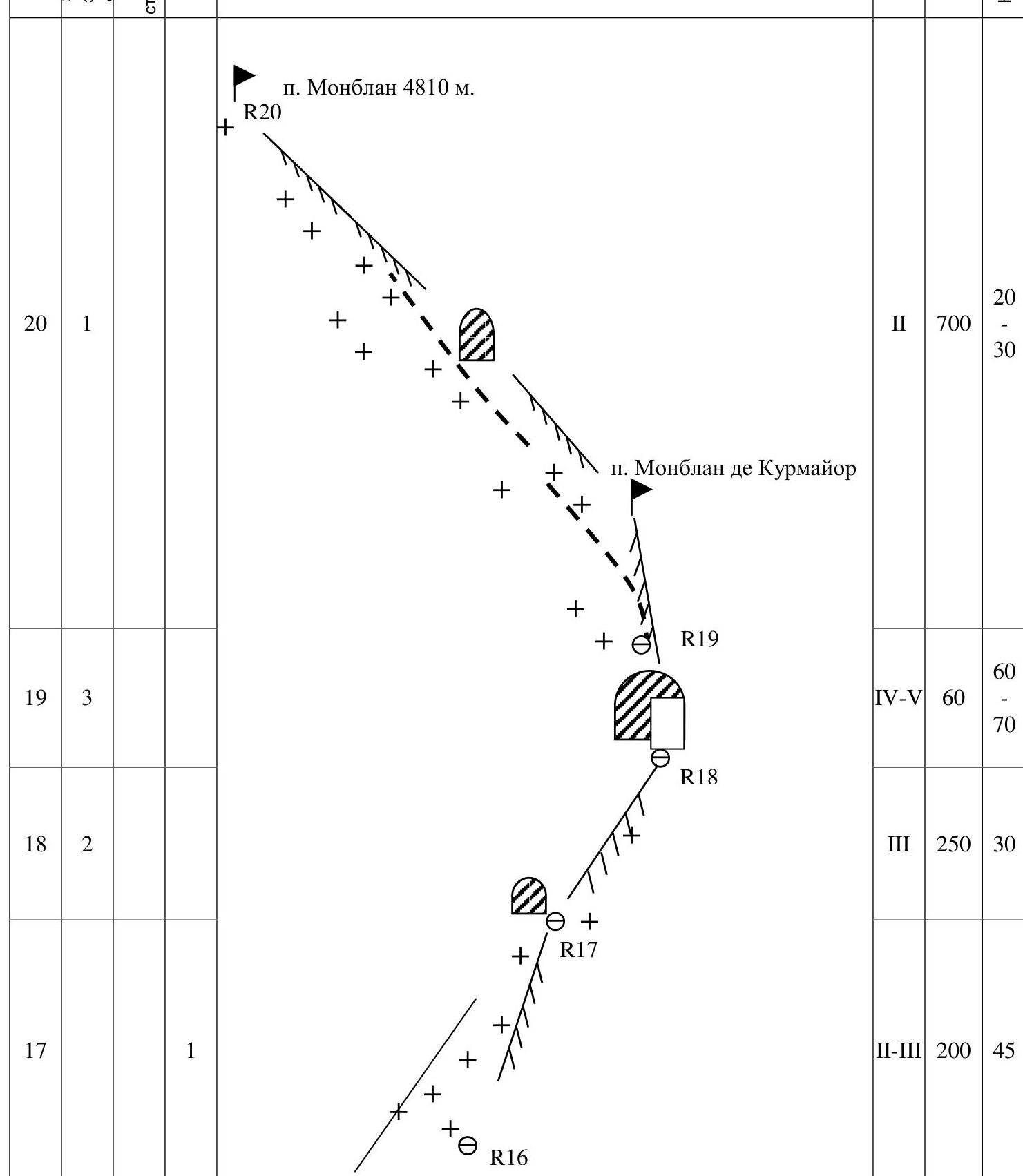
Route Diagram in UIAA Symbols
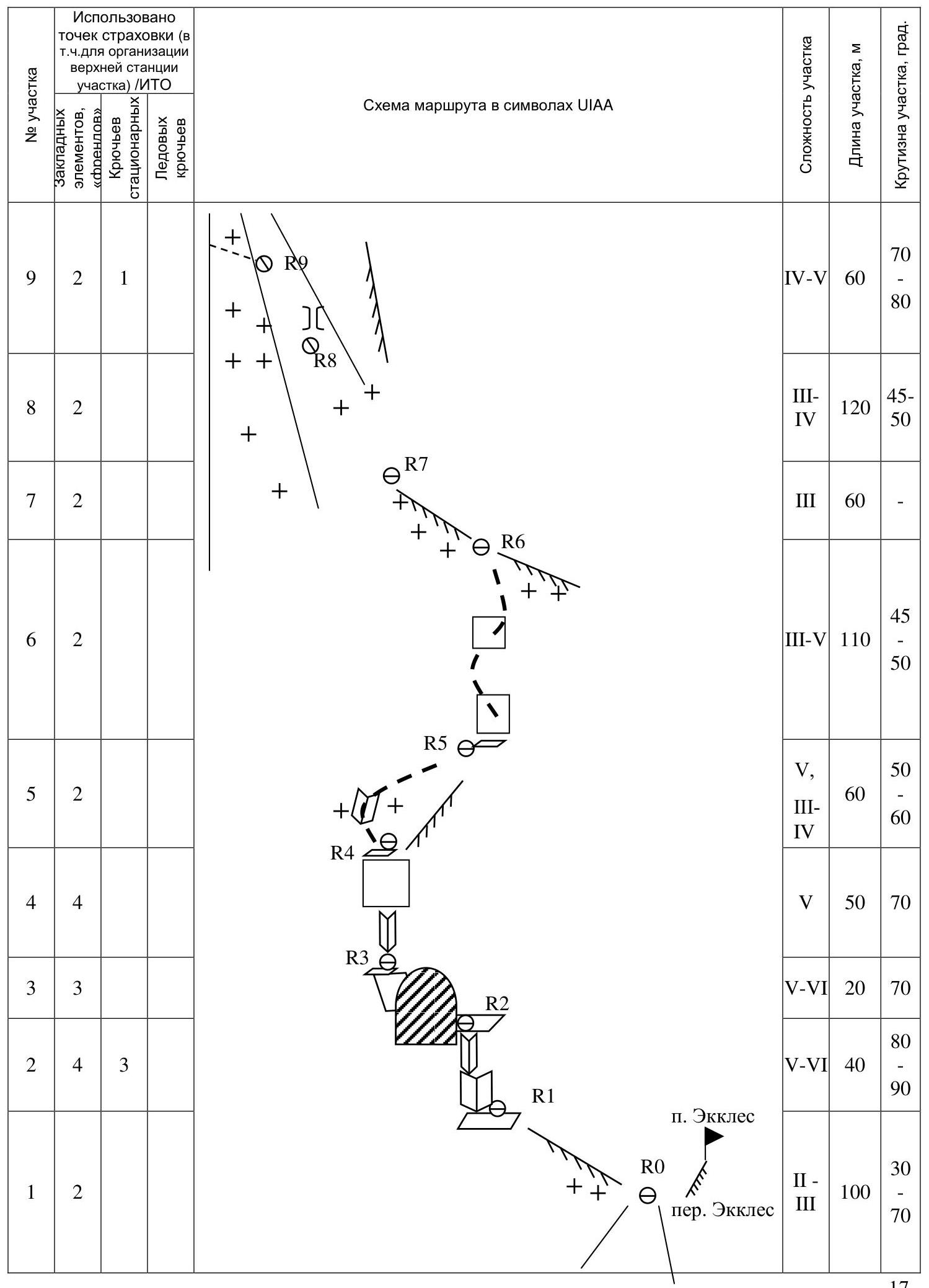
| Section # | Chocks and Friends | Stationary Pitons | Ice Pitons | Section Difficulty | Section Length, m | Section Steepness, deg. |
|---|---|---|---|---|---|---|
| 1 | 2 | II–III | 100 | 30–70 | ||
| 2 | 4 | 3 | V–VI | 40 | 80–90 | |
| 3 | 3 | 3 | V–VI | 20 | 70 | |
| 4 | 4 | V | 50 | 70 | ||
| 5 | 2 | V, III–IV | 60 | 50–60 | ||
| 6 | 2 | III–V | 110 | 45–50 | ||
| 7 | 2 | III | 60 | - | ||
| 8 | 2 | III–IV | 120 | 45–50 | ||
| 9 | 2 | 1 | IV–V | 60 | 70–80 | |
| 10 | 1 | III | 50 | 45–50 | ||
| 11 | 4 | V, II | 180 | 70–45 | ||
| 12 | 4 | 2 | IV–V | 40 | 60–70 | |
| 13 | III | 50 | 50 | |||
| 14 | 5 | 1 | IV–V | 60 | 60–80 | |
| 15 | 2 | IV | 50 | 45–60 | ||
| 16 | 6 | 1 | 3 | III–V | 200 | 50–60 |
| 17 | 1 | II–III | 200 | 45 | ||
| 18 | 2 | III | 250 | 30 | ||
| 19 | 3 | IV–V | 60 | 60–70 | ||
| 20 | 1 | II | 700 | 20–30 |
Technical Photographs of the Route
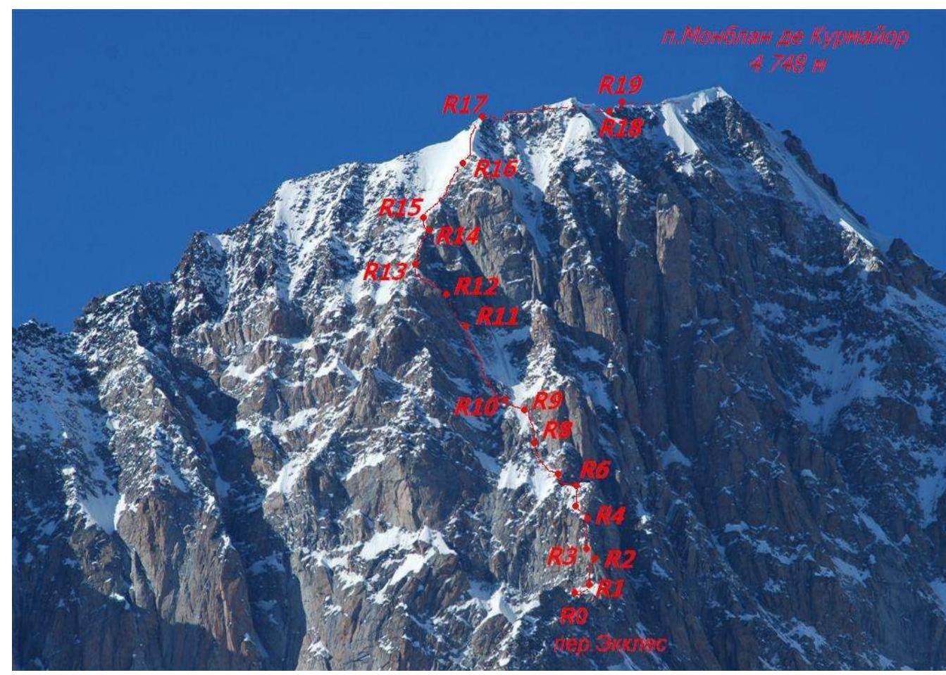
Photo 9. Lower part of the Innominata Route on Mont Blanc. Source: Internet resource.
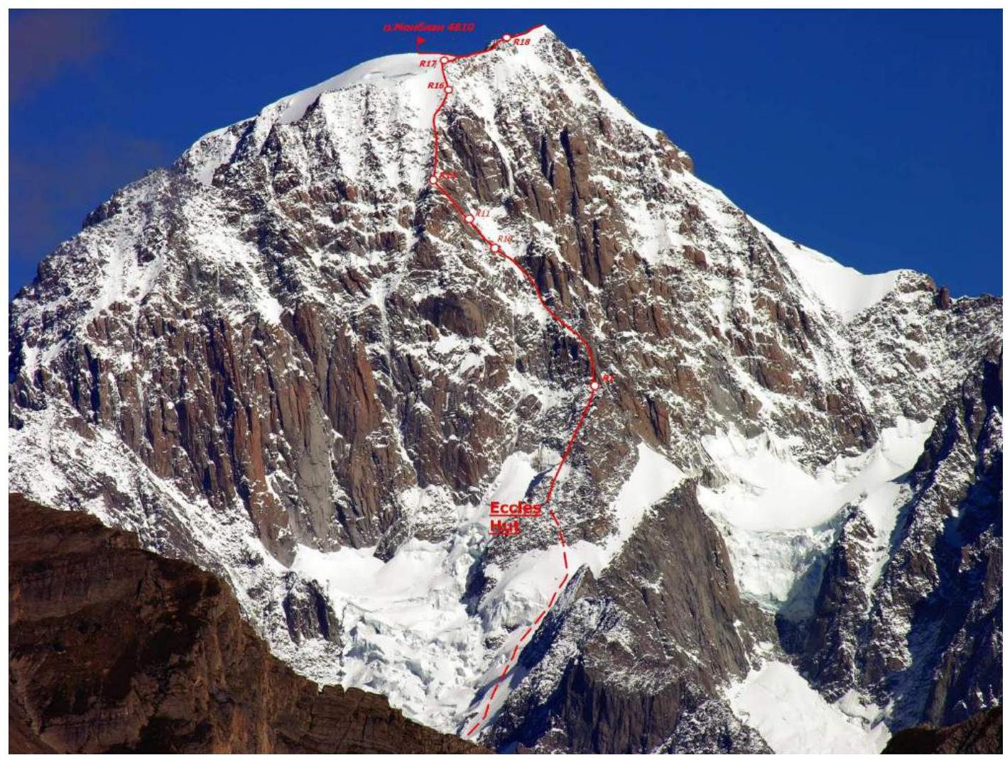
Photo 10. Upper part of the Innominata Route on Mont Blanc. Source: Internet resource.
Route Description by Sections
From Eccles bivouac, two paths lead to the start of the route:
- Ascend to Eccles peak via easy rocks, then rappel 40 m to Eccles Pass.
- Descend from the upper Eccles bivouac hut via a 15 m rappel, traverse a snowy-icy slope, and ascend to Eccles Pass.
R0–R1 — Ascend the ridge from Eccles Pass: initially a sharp snowy ridge (20–30 m), followed by easy rocks (70–80 m, up to 70°, III) to a ledge under a large inner corner.
R1–R2 — Vertical inner corner with stationary pitons. 40 m, up to 90°, V–VI.
R2–R3 — Traverse the ridge to the right via a sloping ledge, then an inclined slab and inner corner to a station in a "saddle" on the ridge. 20 m, 70°, V–VI.
R3–R4 — Wall with a wide crack; initial section has a slight overhang. 50 m, 70°, V.
R4–R5 — Traverse the ridge to the left via snow and an overhanging inner corner (up to V category), then easy terrain. 60 m, 50–60°, III–IV.
R5–R6 — Snow-covered rocks, difficulty up to IV, 110 m, 45–50°. Movement can be alternating or simultaneous depending on rock conditions.
R6–R7 — Ascend leftward via a snowy rocky ridge, then enter a rocky couloir. 60 m, III.
R7–R8 — Traverse the right side of a rocky-snowy couloir. 120 m, 45–50°. Potential rock and ice fall from the rocky peak to the right!
R8–R9 — Ascend a chimney (rocks, ice, 20 m, up to 80°, V category) to a wall (with a piton), then traverse more gentle icy rocks (40 m) to a station on a rocky outcrop.
R9–R10 — Traverse a snowy couloir (20–30 m). Potential rock and ice fall!
R10–R11 — Ascend a large snowy-rocky couloir along the left side. 180 m. Potential rock and ice fall!
R11–R12 — Exit the "Grand Couloir" leftward via a rocky-icy couloir. 40 m, IV–V category, up to 70°.
R12–R13 — Ascend a snowy-icy slope to the ridge. 50 m, 50°, III.
R13–R14 — Ascend a rocky ridge with inner corners and walls. Difficulty up to V category, 60 m.
R14–R15 — Traverse leftward via steep snow and mixed terrain. 50 m, 45–60°, IV.
R15–R16 — Ascend snowy rock slabs (120 m, difficulty up to IV, 50–60°), then ice with rock outcrops (110 m). Exit onto a snowy ridge.
R16–R17 — Simultaneous movement along the snowy ridge (200 m, II–III, 45°) to rocks on the main ridge.
R17–R18 — Simultaneous movement along a snowy rocky ridge, then traverse leftward (right side has cornices). Continue along the snowy ridge.
R18–R19 — Overcome a rocky "gendarme," then ascend a snowy rocky ridge.
R19–R20 — Ascend rocks, then traverse left of the ridge. 300–350 m, steep slope.
Comparison of the Proposed Category of Difficulty with Classified 5B Category Routes
The Innominata Route on Mont Blanc is compared with three classified 5B category routes.
Table 1
| Summit: Mont Blanc | Summit: Ullutau Main | Summit: Bodhona | Summit: Free Korea |
|---|---|---|---|
| Route: via central counterfort of SE face with Eccles Pass, Innominata Route | Route: via rocky islands on S face, 3A (Mal’tsev’s Route) | Route: via NW counterfort (Gul’nev’s Route) | Route: via couloir on S face (Barber’s Route) |
| Category of Difficulty: 5B (proposed) | Category of Difficulty: 5B | Category of Difficulty: 5B | Category of Difficulty: 5B |
| Height: 4810 m | Height: 4207 m | Height: 5138 m | Height: 4740 m |
| Route Character: Combined | Route Character: Combined | Route Character: Rock (classified), Combined (actual) | Route Character: Ice-Snow |
| Height Difference: 830 m | Height Difference: 700 m | Height Difference: 1438 m | Height Difference: 850 m |
| Route Length: 2460 m | Route Length: 1000 m | Route Length: 3020 m | Route Length: 1050 m |
| Length of Sections with V–VI Category: 240 m. | Length of Sections with V–VI Category: 210 m. | Length of Sections with V–VI Category: 231 m. | Length of Sections with V–VI Category: 600 m. |
| Average Steepness: Main Part — 54°, Entire Route — 43° | Average Steepness: Main Part — 63°, Entire Route — 60° | Average Steepness: Main Part — 58°, Entire Route — 45° | Average Steepness: Main Part — 70°, Entire Route — 60° |
- Due to climatic changes in the Fann Mountains (cooling), Gul’nev’s Route on Bodhona is no longer purely rocky.
- Barber’s Route on Free Korea is entirely ice-snow (except for a 50 m pre-summit tower).
The Innominata Route requires significant climbing experience due to its length, height, combined nature, potentially deteriorated terrain, and unpredictable weather.
Team Tactical Actions
The team studied various Mont Blanc routes and chose the Innominata Route for its logic and beauty.
The team ascended to Monzino Hut, then to Eccles bivouac, where they waited two days due to bad weather. They departed Eccles bivouac at 3:30 AM on August 20.
The team was equipped with necessary gear, including:
- 2 x 60 m climbing ropes
- Crampons and ice axes
- Ice screws and friends
- Rock shoes and climbing hardware
The ascent was conducted in pairs, with varying leads on different sections.
The team carried emergency gear, including down jackets, windproof jackets, and an emergency blanket.
Communication with local rescue services was possible via cell phones.
The team had enough food for a snack, dinner, and breakfast at Vallot Hut.
The descent began at 22:30, and the team reached Vallot bivouac at 23:30 without incident.
Ascent Schedule
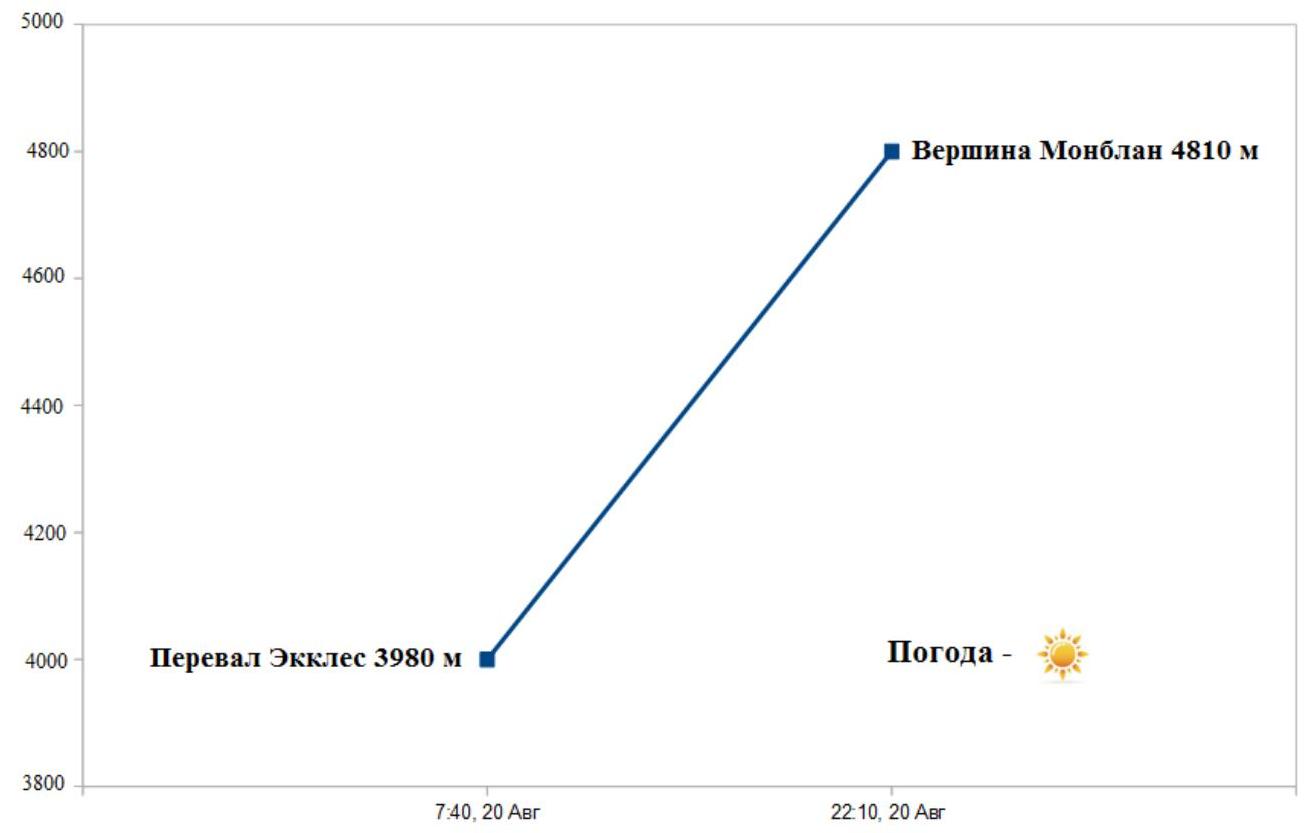
Fig. 4. Team movement schedule on the Innominata Route.
Photographs of Individual Route Sections

Photo 12. Section R1–R2. Smailkina S. overcoming a vertical inner corner.
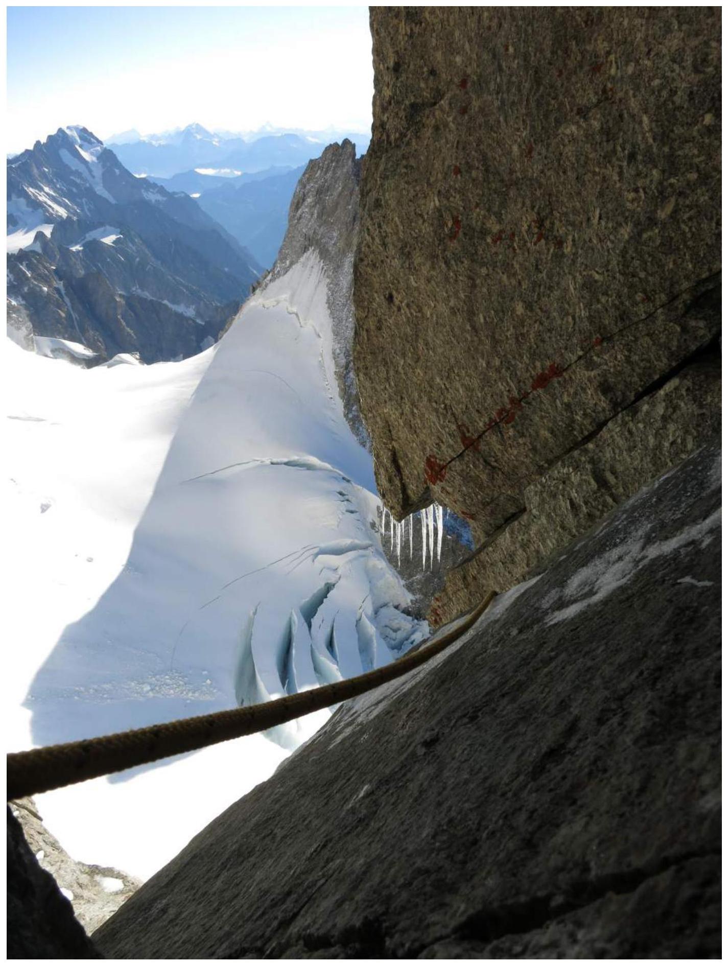
Photo 13. Upper part of section R2–R3. Photographed from the station.
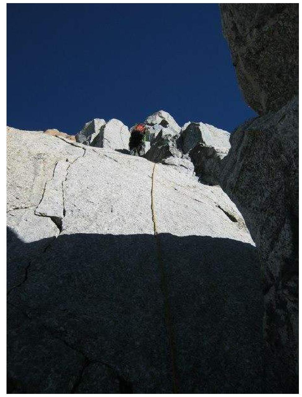
Photo 14. Section R3–R4. Prilepskaya N. ascending with top rope on a wall with a crack.
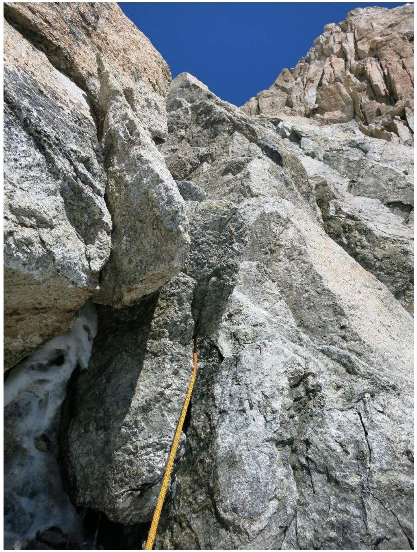
Photo 15. Section R8–R9. Start of the chimney leading to icy rocks.
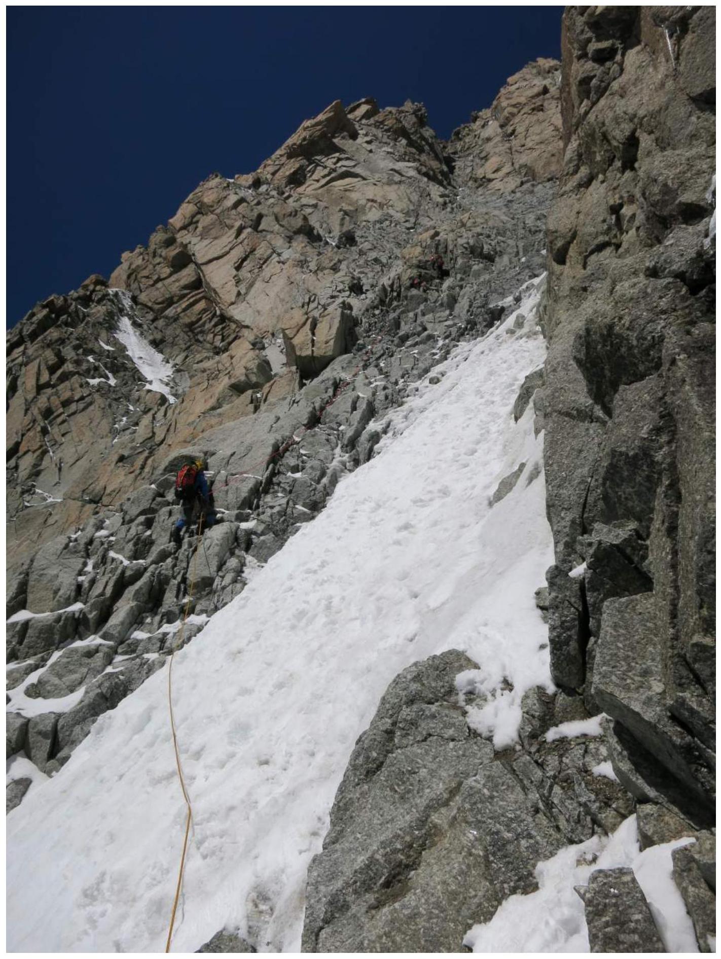
Photo 16. Section R9–R10. Gorodetskaya O. ascending with top rope on slabs and snowy rocks.

Photo 17. Steep rock slab on section R10–R11.
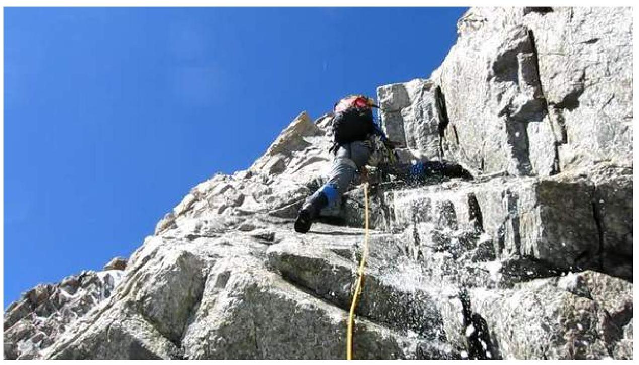
Photo 18. Section R10–R11. Gorodetskaya O. jumaring on a steep rock slab.
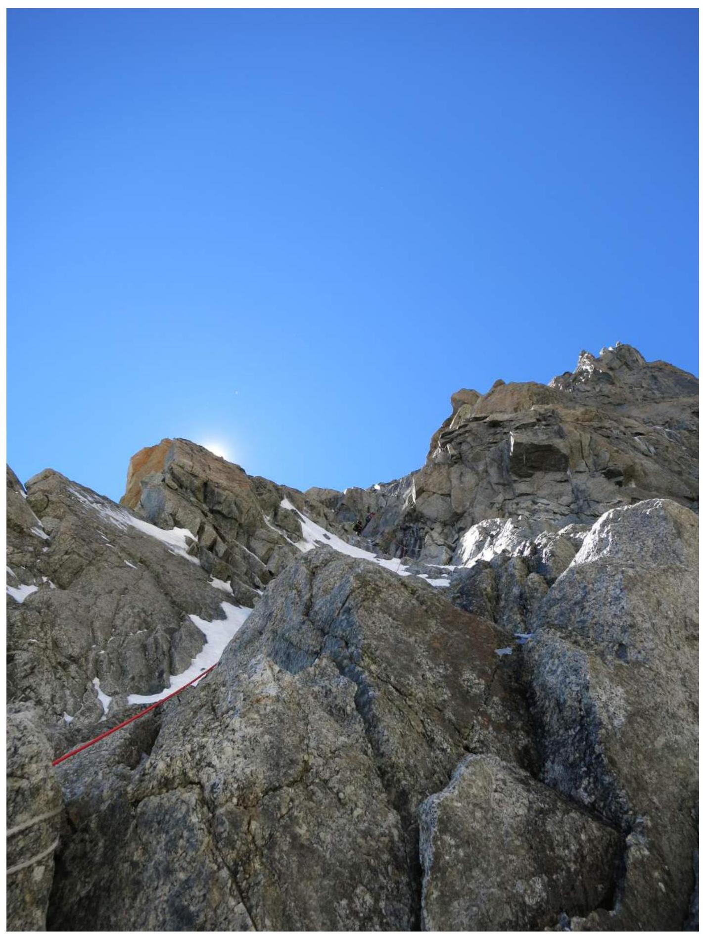
Photo 19. Section R11–R12. Exiting the "Grand Couloir" leftward via a rocky-icy couloir.
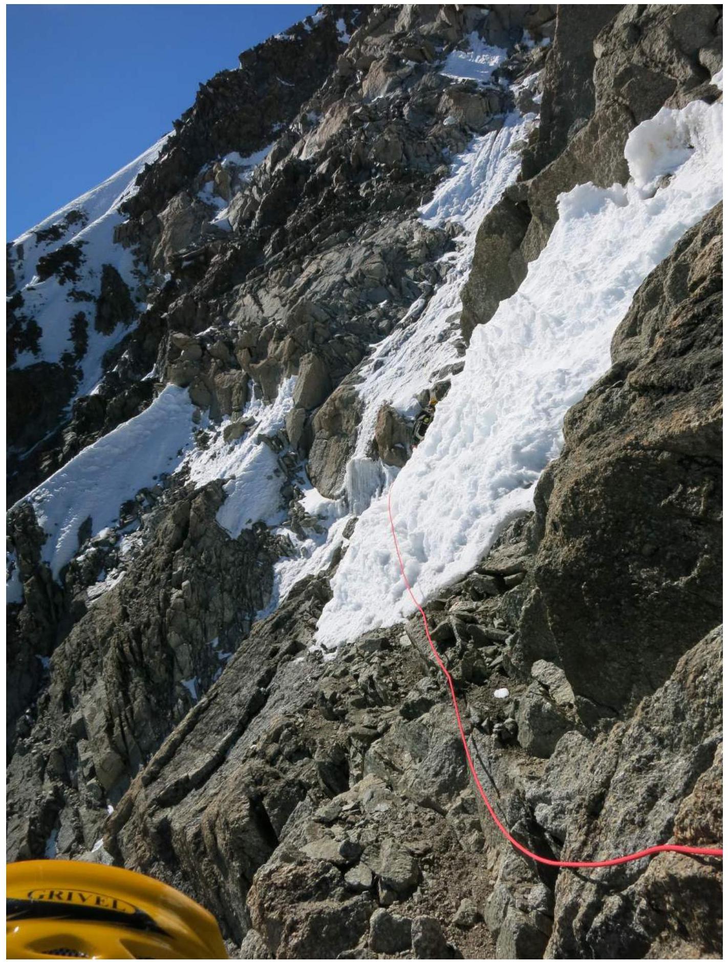
Photo 20. Section R14–R15. Traversing leftward on steep snowy slope and mixed terrain.

Photo 21. Section R15–R16. Gorodetskaya O. ascending on heavily snowy rock slabs.
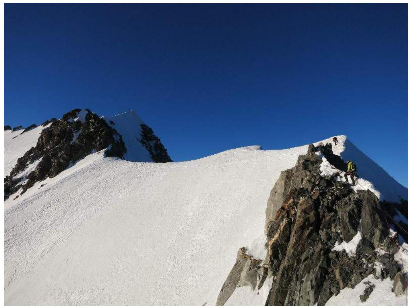
Photo 22. Section R17–R18. Simultaneous movement on a snowy rocky ridge.
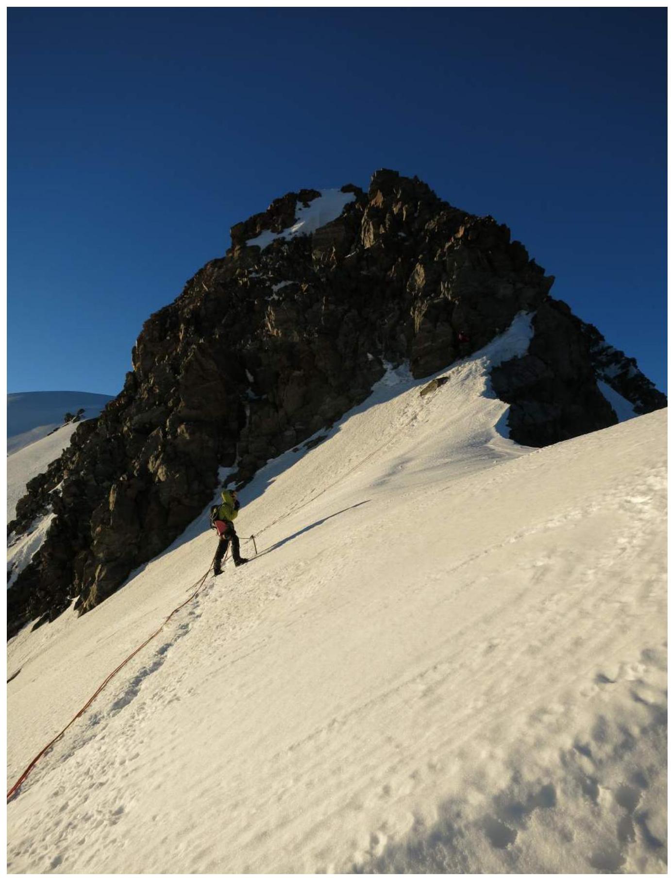
Photo 23. Section R17–R18. Before a rocky "gendarme" on the ridge.
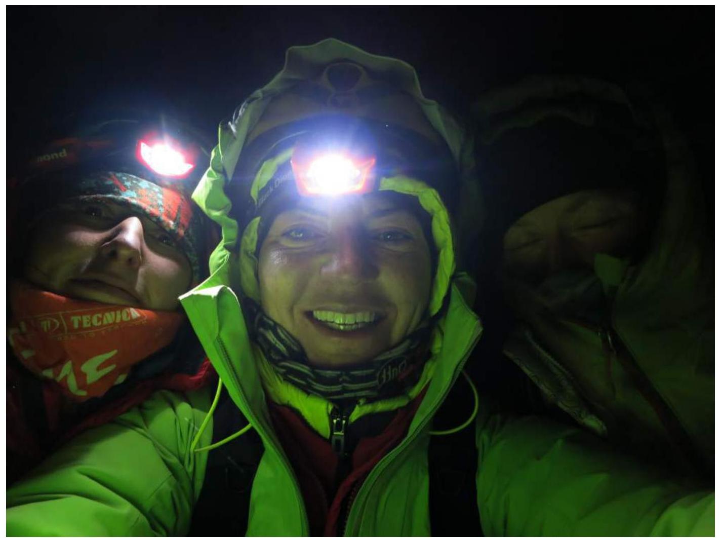
Photo 24. At Mont Blanc summit 4810 m:
- Gorodetskaya O.
- Prilepskaya N.
- Smailkina S.


