Ascent Report on Mont Blanc via "Traverse of the Three Peaks" Route, Category 2B, by the Academic Section of the "Polytechnic" Sports Club under the Leadership of V.A. Molodozhen on August 8, 2018
I. Ascent Passport
| № | 1. General Information | |
|---|---|---|
| 1.1 | Full Name, Sports Rank of the Leader | V.A. Molodozhen, Master of Sports |
| 1.2 | Full Names, Sports Ranks of the Participants | V.A. Molodozhen, Master of Sports; A.K. Dupliak, 3rd Sports Rank; A.Yu. Limanyuk, 3rd Sports Rank; N.N. Bakharev, 3rd Sports Rank |
| 1.3 | Full Name of the Coach | V.A. Molodozhen |
| 1.4 | Organization | "Polytechnic" Sports Club, St. Petersburg |
| 2. Characteristics of the Ascent Object | ||
| 2.1 | Region | France, Haute-Savoie, Chamonix valley |
| 2.2 | Valley | Glacier du Géant |
| 2.3 | Section Number according to the 2013 Classification Table | 10.3 |
| 2.4 | Name and Height of the Summit | Mont Blanc, 4808 m |
| 2.5 | Geographical Coordinates of the Summit (Latitude/Longitude), GPS | GPS: 45°49′58″ N, 6°51′53″ E. Geographical: 45.832780, 6.864720 |
| 3. Characteristics of the Route | ||
| 3.1 | Name of the Route | Traverse of the Three Peaks |
| 3.2 | Proposed Category of Difficulty | 2B |
| 3.3 | Degree of Route Exploration | Well-trodden |
| 3.4 | Character of the Route Terrain | Snow |
| 3.5 | Height Difference of the Route | Height of campsite — 3532 m; Height at the start of the route — 3600 m; Summit height — 4808 m; Height difference from campsite to summit — 1276 m; Height difference from the base of Triangle du Tacul to summit — 1200 m |
| 3.6 | Length of the Route | Distance from campsite to the base of the rock ascent (approach length) — 1000 m; Distance from the start of the route to the summit — 6480 m; Descent from the summit — 6480 m; Total route length — 7480 m; Distance from the end of the route to campsite — 1000 m; Total route length including approach and return to campsite — 14960 m |
| 3.7 | Technical Elements of the Route | Easy snow slope — 2280 m; Category I snow slope — 1800 m; Category II snow slope — 2350 m; Category III snow slope — 50 m |
| 3.8 | Descent from the Summit | Via the ascent route |
| 3.9 | Additional Characteristics of the Route | - |
| 4. Characteristics of the Team's Actions | ||
| 4.1 | Time of Movement | 0 days, 14 hours, 00 minutes |
| 4.2 | Overnight Stays | Campsite |
| 4.3 | Departure onto the Route | 1 hour 00 minutes, August 8, 2018 |
| 4.4 | Arrival at the Summit | 8 hours 00 minutes, August 8, 2018 |
| 4.5 | Return to Base Camp | 15 hours 00 minutes, August 8, 2018 |
| 5. Person Responsible for the Report | ||
| 5.1 | Full Name, e-mail | A.K. Dupliak, dupliaka@gmail.com |
II. Description of the Ascent
1. Characteristics of the Ascent Object
1.1. General Photo of the Summit
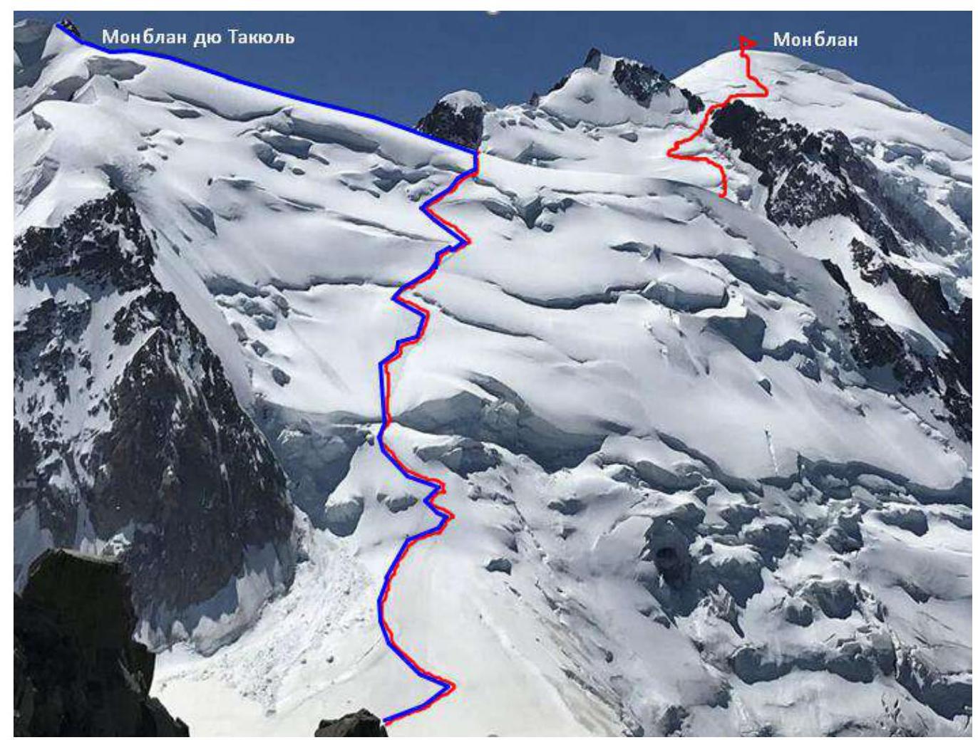
Photo 1. Date taken: August 8, 2018. Location: southwestern ridge of Aiguille du Midi. View of the southwestern slope of Mont Tacul. Routes:
- Route to Mont Blanc via "Traverse of the Three Peaks" — Category 2A;
- Route to Mont Blanc du Tacul via the northwestern slope — Category 2A;
1.2. Profile of the Route
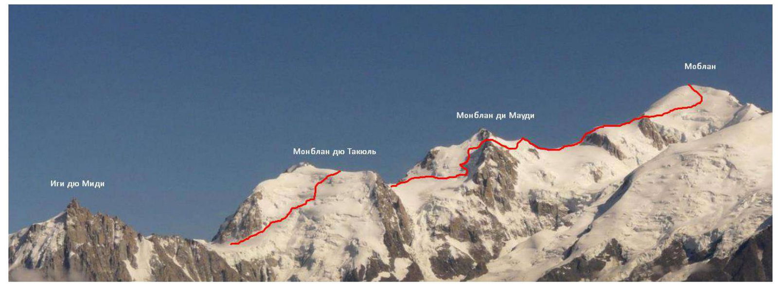
Photo 2. Date taken: July 25, 2009. Source: https://www.camptocamp.org/images/178536/fr/les-3-mont-blanc↗
1.3. Photopanorama of the Area
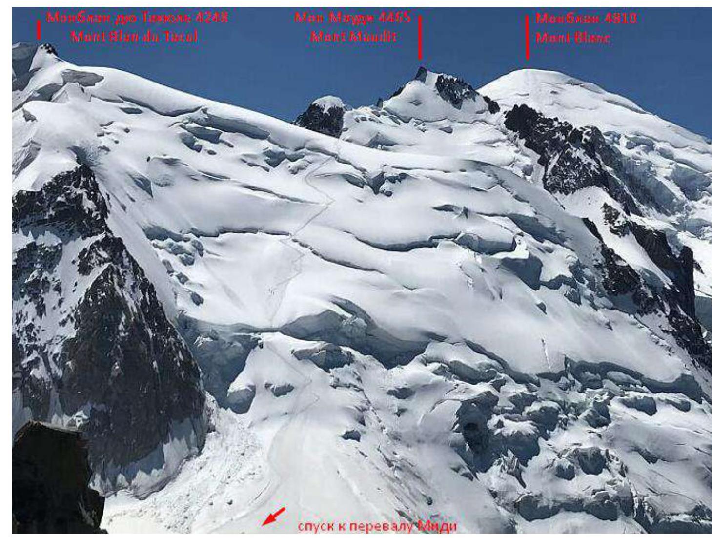
Photo 3. Date taken: August 2, 2018. Location: southwestern ridge of Aiguille du Midi. View of the southern slope of Mont Tacul.
1.4. Map of the Area
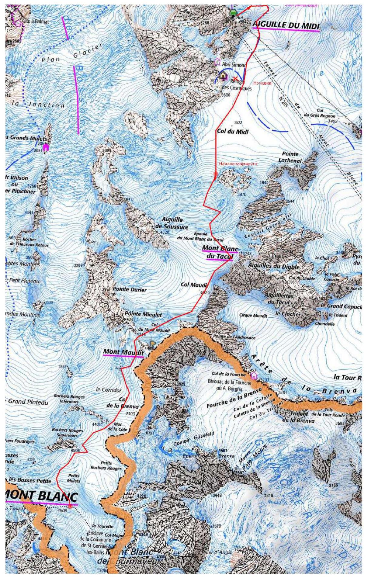
Photo 4. Map of the area of the three peaks of Mont Blanc
The area where the summit is located is in France. Vallée Blanche is a snowfield that is part of the Mer de Glace glacier, located south of Chamonix.
The campsite can be reached by trail or by using a funicular.
The trail takes 2 days with a total ascent of 2807 m. From the funicular station to the campsite — 40 minutes (2 km) of walking with a descent of 310 m.
From Plan du Midi station:
- follow the eastern ridge through closed glaciers to the snowfield on Vallée Blanche;
- move along the field towards Aiguille du Midi to the southwest until a rocky outcrop with the "Cosmic" hut;
- the campsite is located 50 m from the base of this outcrop.
To approach the route:
- move from the campsite for 40 minutes in a southwest direction along the Glacier du Géant
- pass through Col du Midi
- head towards the right side of Triangle du Tacul
- the start of the route is 100 m to the right of the base of Triangle du Tacul
Descent from the route is via the ascent path.
2. Characteristics of the Route
2.1. Technical Photograph of the Route
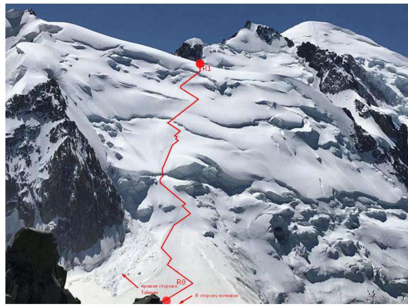
Photo 5. Date taken: August 1, 2018. Mont Blanc du Tacul. Location: southwestern ridge of Aiguille du Midi. View of the southwestern slope of Mont Tacul.
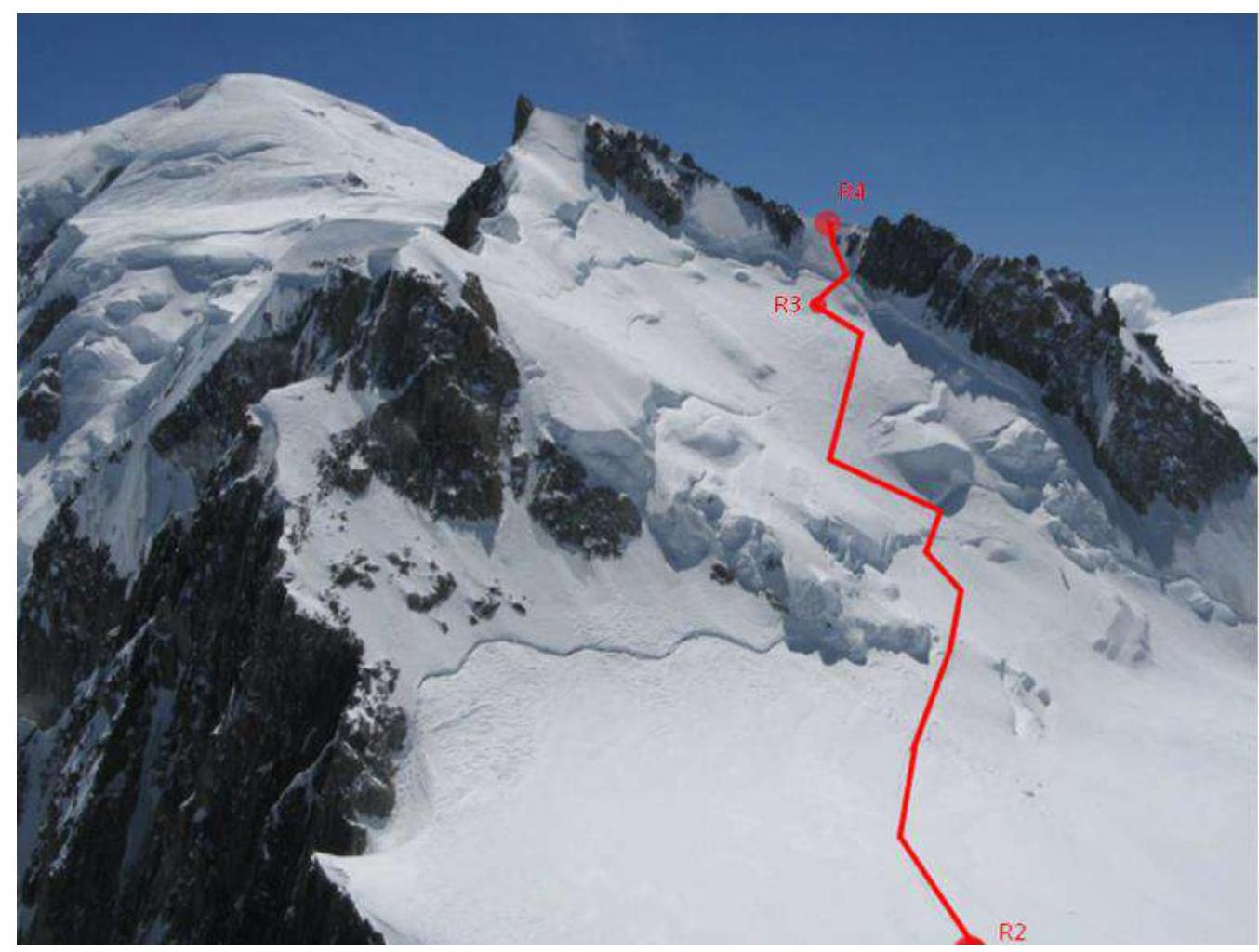
Photo 6. Date taken: June 6, 2016. Mont Maudit. Source: http://www.skitour.fr/sommets/mont-maudit,1276.html↗
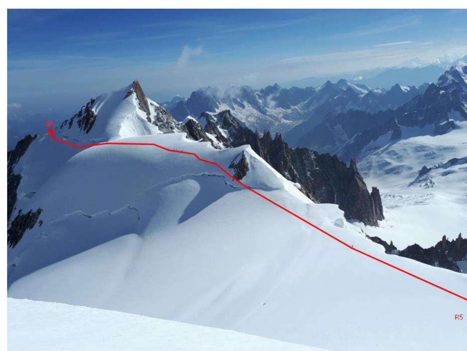
Photo 7. Date taken: August 8, 2018. Mont Blanc du Tacul. View of Mont Maudit from the northwestern slope of Mont Blanc.
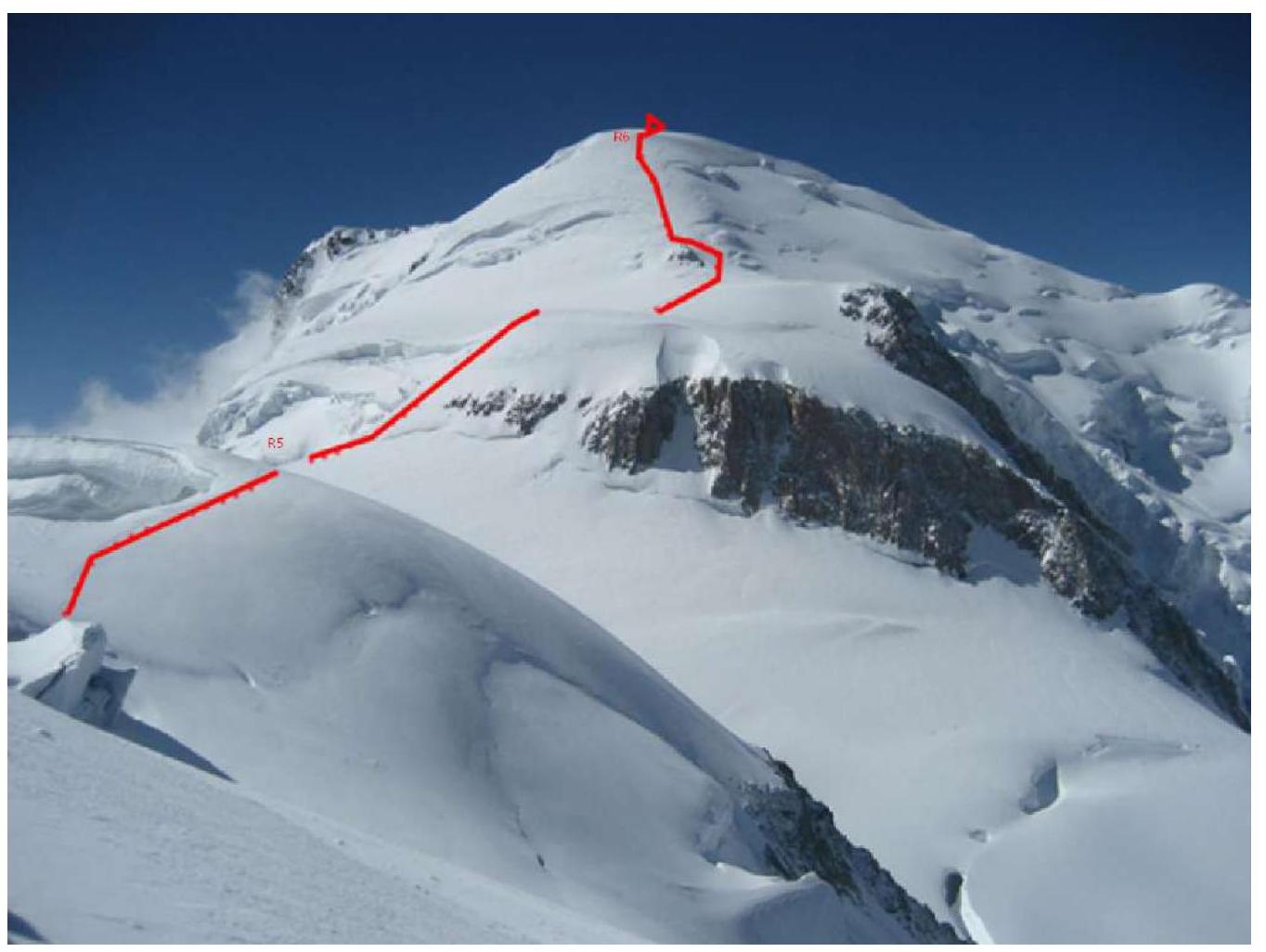
Photo 8. Date taken: August 8, 2018. View of Mont Blanc from Col du Maudit.
| Section | Terrain Character | Category of Difficulty | Length | Type and Number of Anchors |
|---|---|---|---|---|
| R0–R1 | Snow | 2 | 1400 m | 0 anchors |
| R1–R2 | Snow | Easy | 1080 m | 0 anchors |
| R2–R3 | Snow | 2 | 950 m | 0 anchors |
| R3–R4 | Snow | 3 | 50 m | 2 anchors |
| R3–R4 | Snow | Easy | 1200 m | 0 anchors |
| R4–R5 | Snow | 1 | 1800 m | 0 anchors |
3. Characteristics of the Team's Actions
3.1. Brief Description of the Route Passage
| Section | Description | Photo Number |
|---|---|---|
| R0–R1 | 35-degree slope, simultaneous movement, first crossing a large crevasse, then depending on the route condition, choose to go over the shoulder or around it (caution! Risk of serac collapse). There's a safety loop above the large crevasse. If moving over the shoulder, another horizontal crevasse follows. After that, the ascent to the shoulder of Tacul begins | 9–10 |
| R1–R2 | From the shoulder, move towards the northern slope of Mont Maudit. Simultaneous movement. Gentle descent from the southern slope of Mont Blanc du Tacul along the northwestern Col du Midi. Then, navigate around seracs and start ascending. | - |
| R2–R3 | On Mont Maudit's slope, to the right of the summit, move towards Col du Maudit (4345 m). | 11 |
| R3–R4 | The section below the col (50 m) with a 50-degree slope is traversed simultaneously with intermediate anchors — ice screws. It is also equipped with an intermediate belay station on a rock in the middle. | 11 |
| R4–R5 | After the col, traverse southwest to Col de Brenva. Simultaneous movement. Long transition with minimal height difference. | 12 |
| R5–R6 | Move towards Mur de la Côte. Then, slope with 20 to 30-degree inclination, sometimes moving in three steps. Then, move along the snow slope to the summit. | 13 |
| Descent is via the ascent route, moving simultaneously, except when crossing crevasses and Col du Maudit. Descent includes two rappels, and on crevasses, protection via ice axe. | - |
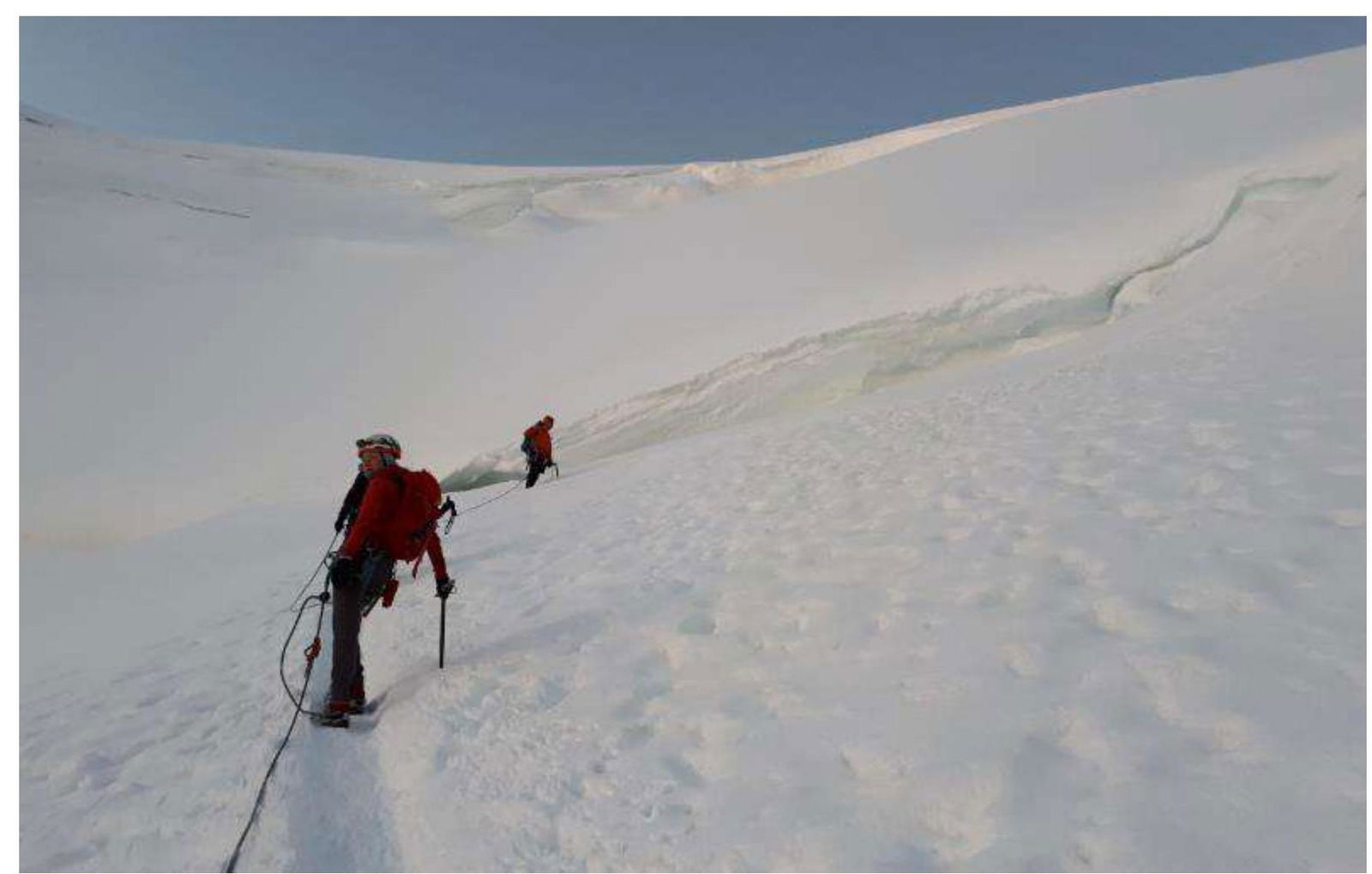
Photo 9. R0–R1. Team approaching the first crevasse.
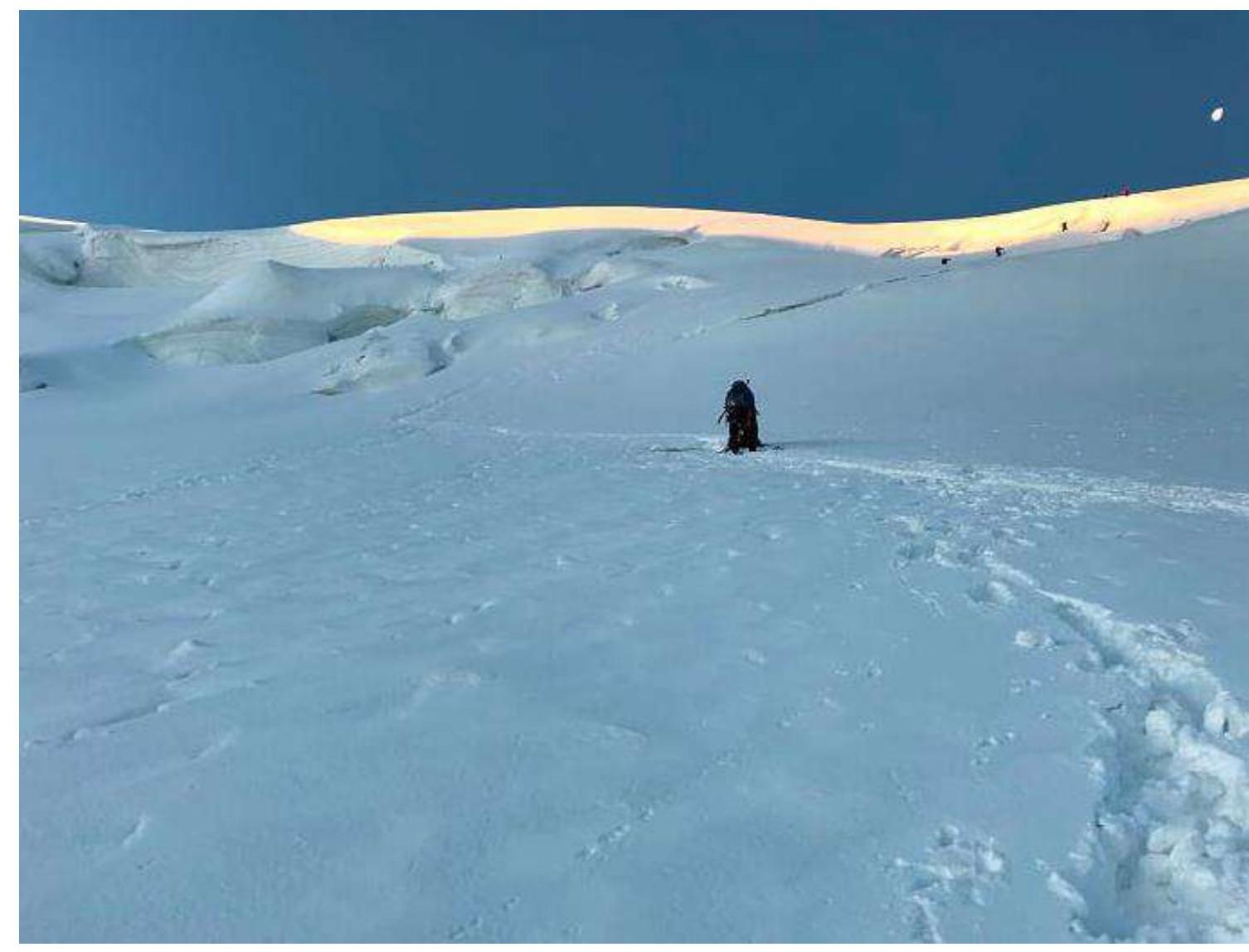
Photo 10. R0–R1. Team approaching the second crevasse.
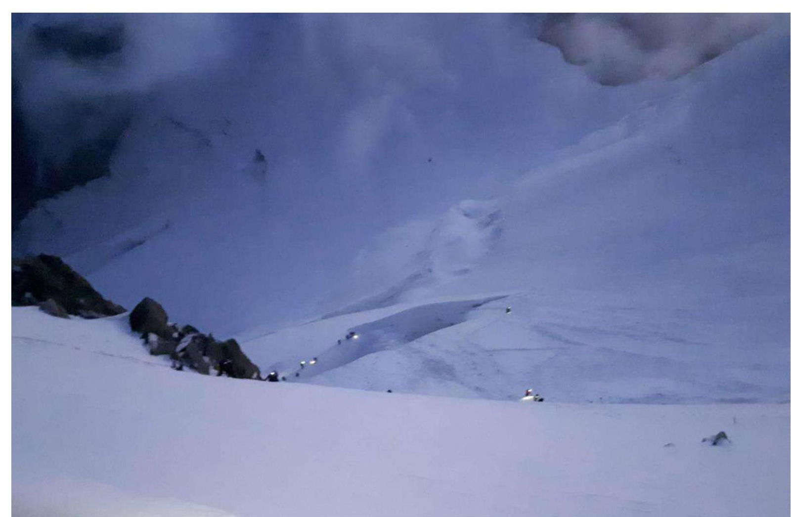
Photo 11. R1–R4. View of the key section from Col du Maudit to the northern col of Maudit.
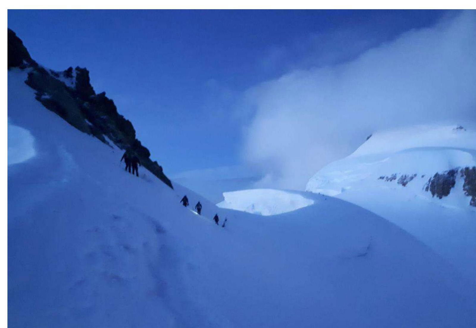
Photo 12. R4–R5. Photo from Col du Maudit to Mur de la Côte.
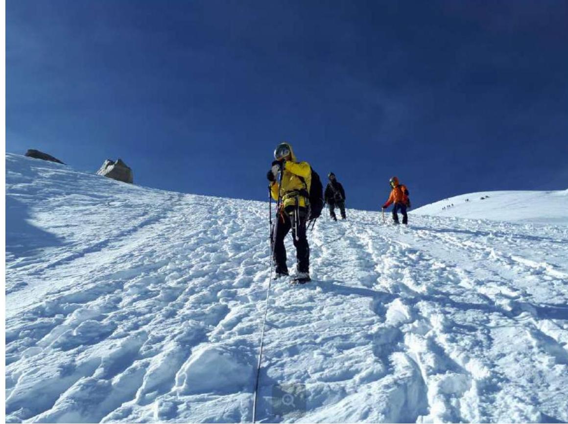
Photo 13. R5–R6. Pre-summit ascent to Mont Blanc.
3.2. Photo of the Team at the Summit with the Control Pole
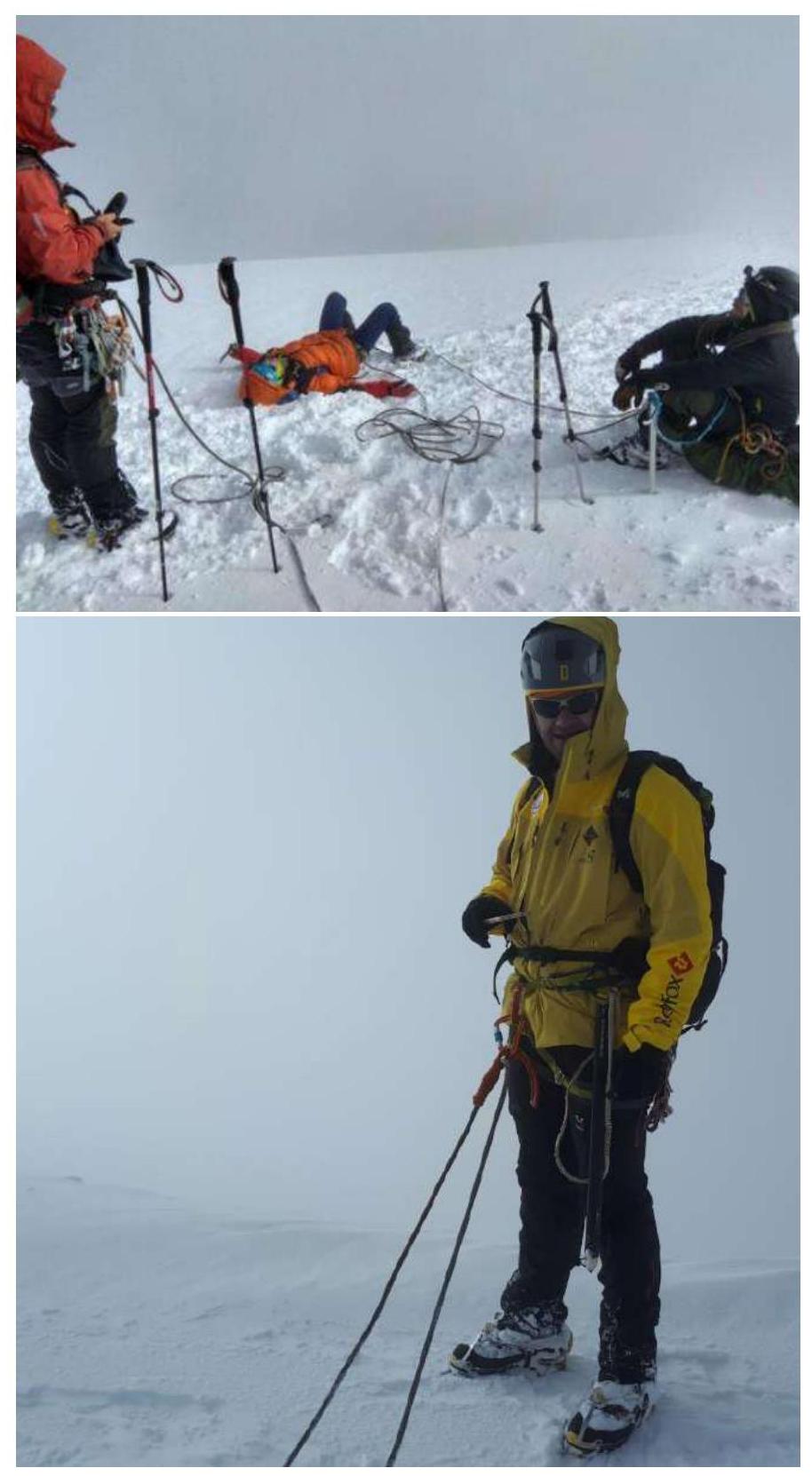
Photos 14, 15. Team at the summit.
3.3. Safety Assessment of the Route
The route is very popular but changes significantly depending on weather conditions.
It's advisable to start the route as early as possible: it's easier to walk on frozen snow, and the flow of descending climbers is not as heavy, allowing for less waiting in queues while crossing crevasses and Col du Maudit.


