Report
Climbing the Southern and Northern peaks of Aiguilles Crochues: traverse from the Southern to the Northern peak (France, "Haute-Savoie" area, "Aiguilles Rouges" massif), 2840 m, category 1B.
Leader: Olennikov S. A. Coach: Olennikov S. A.
I. Climbing Report
| № | 1. General Information | |
|---|---|---|
| 1.1 | Full name, sports rank of the leader | Olennikov Sergey Alexandrovich, CMS. Sharapova E. V., 3rd sports rank. Nesterova V. O., 3rd sports rank. |
| 1.2 | Full name, sports rank of participants | Andriyash A. A., badge holder. Teslenko S. V., badge holder. Tsybyrnak D. G. |
| 1.3 | Full name of coach | Olennikov Sergey Alexandrovich, CMS. |
| 1.4 | Organization | A/C "Polytechnic". |
| 2. Characteristics of the Climb | ||
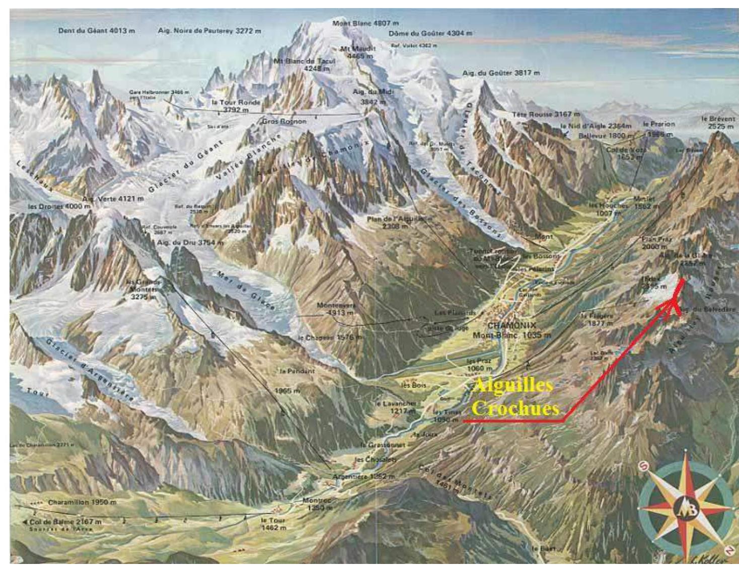
| 2.1 | Area | France, Alps, "Haute-Savoie" area |
| 2.2 | Valley | "Aiguilles Rouges" massif |
| 2.3 | Classification table section number (2013 edition) | - |
| 2.4 | Name and height of the peak | "Aiguilles Crochues" ("Crooked Needles" in French). Height 2840 m. |
| 2.5 | Geographical coordinates of the peak (latitude/longitude), GPS coordinates | 45.981830, 6.873383 |
| 3. Route Characteristics | ||
| 3.1 | Route name | Traverse from the Southern to the Northern peak. |
| 3.2 | Proposed category of difficulty | 1B category (PD) |
| 3.3 | Route освоенности degree | - |
| 3.4 | Route terrain character | combined |
| 3.5 | Route elevation gain (altimeter or GPS data) | 1007 m–2840 m |
| 3.6 | Route length (m) | 1000 m |
| 3.7 | Technical elements of the route (total length of sections with varying difficulty and terrain character) | I Average scree/snow 400 m II Large boulders/average scree 50 m II Rocks/snow 50 m II Rocks 400 m III Rocks 100 m |
| 3.8 | Descent from the peak | Descent from the Northern peak to "BLANC" lake, then along a well-marked trail SW to the "INDEX" cable car. |
| 3.9 | Additional route characteristics | lack of water |
| 4. Team Actions | ||
| 4.1 | Movement time (hours) | 5 hours, descent 3 hours. |
| 4.2 | Overnight stays | No. |
| 4.3 | Route start | 10:35, July 31, 2018. |
| 4.4 | Peak ascent | Ascent to the Southern peak: 13:10, July 31, 2018. Ascent to the Northern peak: 13:55, July 31, 2018. |
| 4.5 | Return to base camp | 18:00, July 31, 2018. |
| 5. Report Responsible | ||
| 5.1 | Full name, e-mail | Tsybyrnak D. G. tsybyrnak@mail.ru |
II. Climbing Description
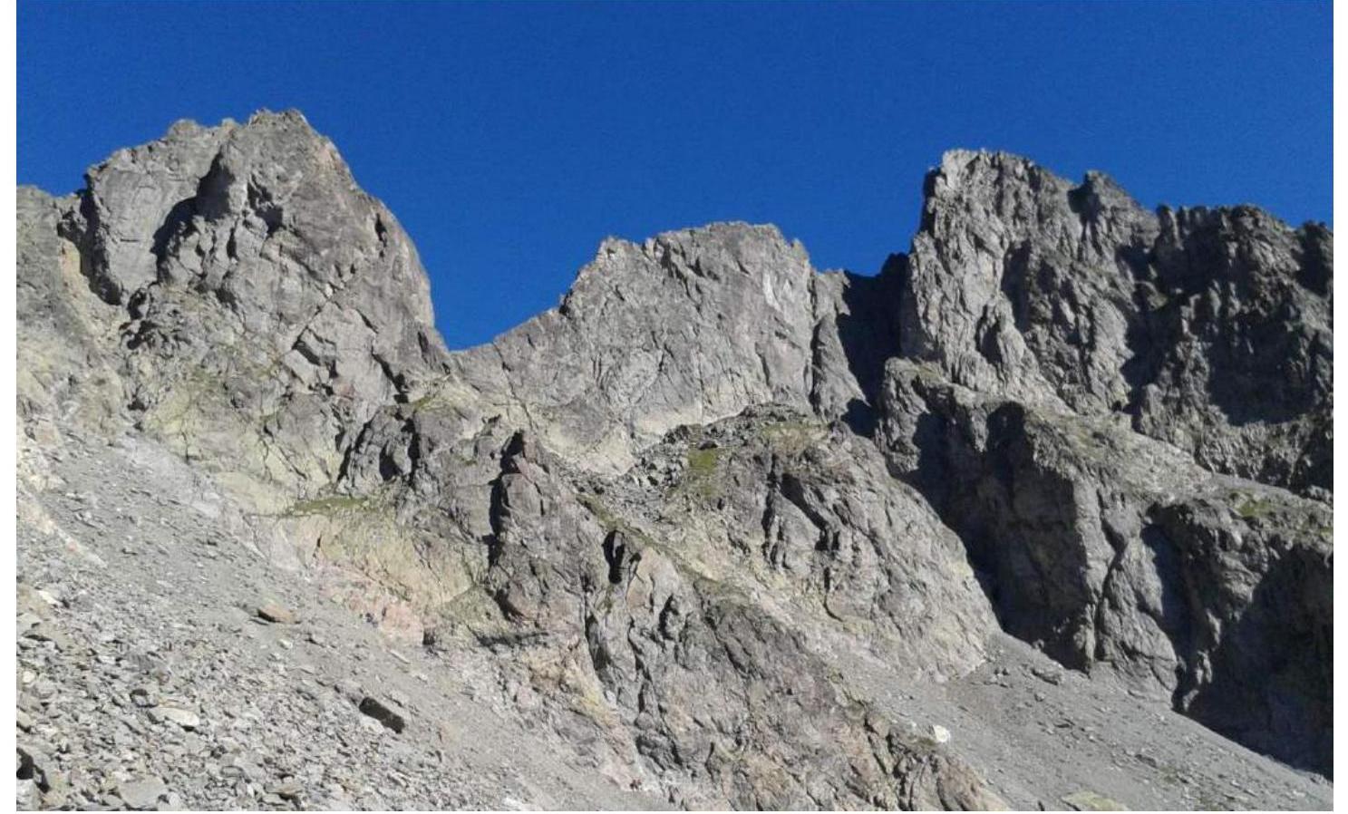
1.1. General Photo of the Peak
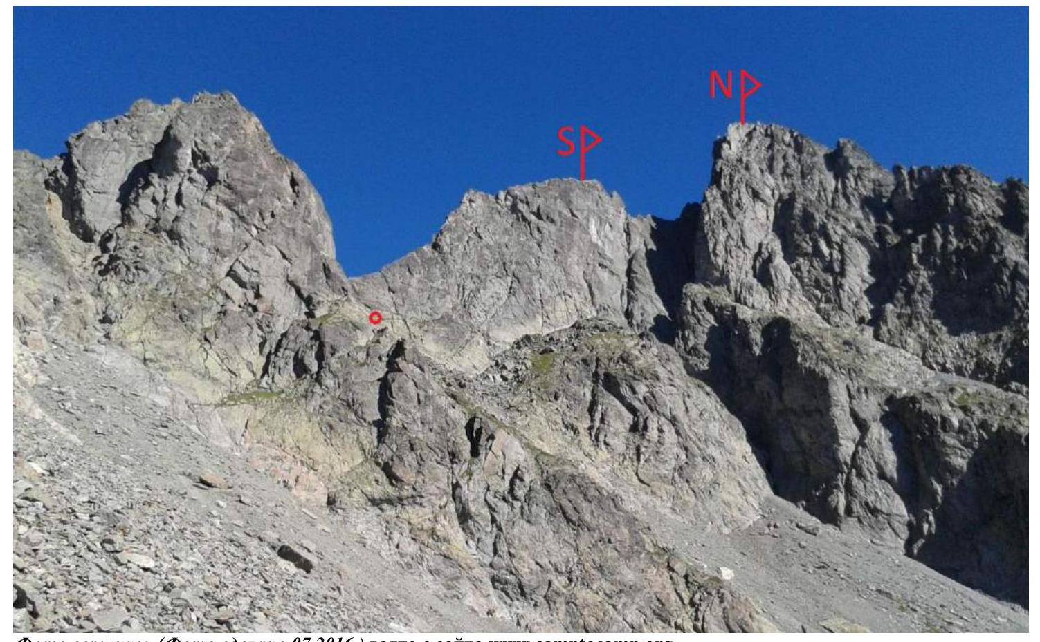
Photo of the peak (taken in 07.2016) from www.camptocamp.org↗.
1.2. Route Profile Photo
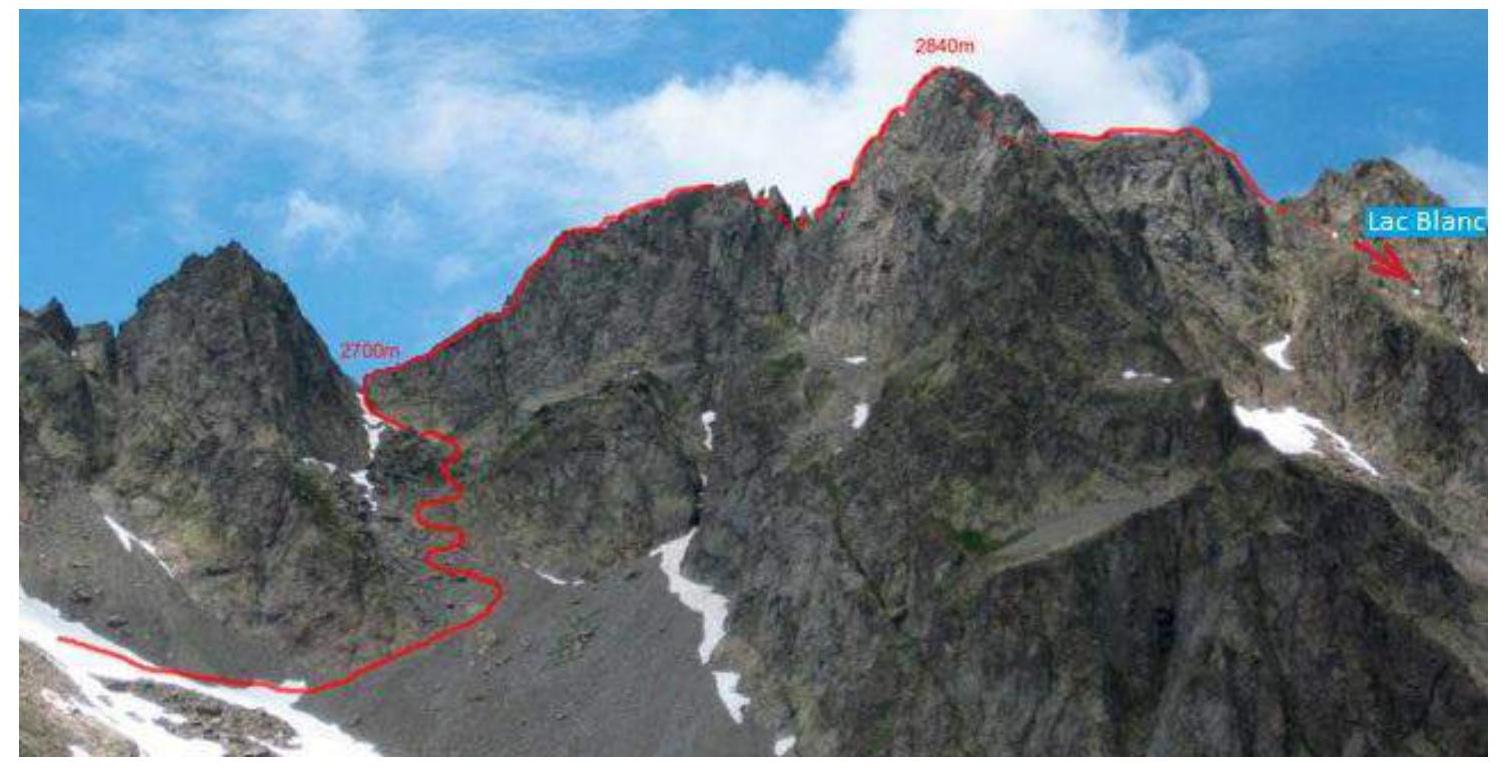
Route profile photo (taken in 07.2017) from www.camptocamp.org↗.
1.3. "Aiguilles Rouges" Massif Diagram
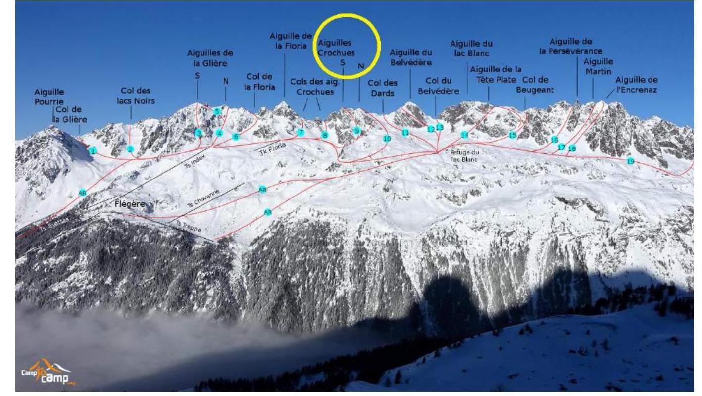
1.4. "Haute-Savoie" Area Diagram
"Haute-Savoie" area diagram from www.chamonix.net↗. "Aiguilles Rouges" massif diagram from www.camptocamp.org↗.
2.1. Technical Route Photo
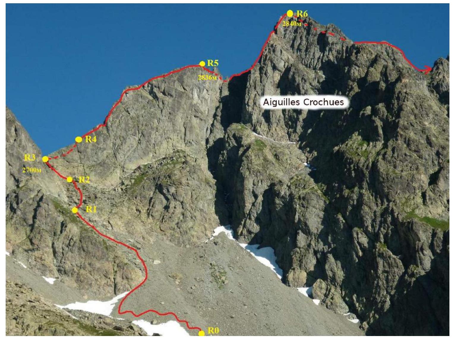
Photo taken in 08.2017 from www.camptocamp.org↗.
2.2. Technical Characteristics of Route Sections
| Section № | Length (m) | Steepness (°) | Terrain character | Difficulty category | Number of pitons |
|---|---|---|---|---|---|
| R0–R1 | 400 | 25 | Average scree/snow | 1 | |
| R1–R2 | 50 | 35 | Large boulders/average scree | 2 | |
| R2–R3 | 50 | 35 | Rocks/snow/narrow grotto | 2 | |
| R3–R4 | 100 | 30 | Good monolithic rocks | 3 | |
| R4–R5 | 200 | 40 | Good monolithic rocks | 2 | |
| R5–R6 | 100 | 45 | Rocks across the saddle | 2 | |
| R6 | 100 | 30 | Good monolithic rocks | 2 |
3. Team Actions Characteristics
3.1. Brief Route Description
Approach
From the "INDEX" cable car station, follow a good, wide trail downhill towards "BLANC" lake, following signs on posts. Walk 130 m to the hut. Continue along the trail another 200 m downhill to the "FLORIA" cable car support (small houses). Continue descending along the marked trail. After 150 m, the trail will head NE, and the ascent will begin. Follow the trail for 500 m.
R0–R1. Continue moving NW across medium-sized scree (possible snow patches). 400 m, 30°, 1st category.
R1–R2. Ascend a short section of large scree (50 m), approaching the start of the route, the "Col des Aiguilles Crochues". 50 m, 30°, 2nd category.
R2–R3. Ascend the col. There is a narrow grotto on the way. Insurance through bends. 50 m, 35°, 2nd category.
R3–R4. Ascend the chimney on the northern side of the ridge. Insurance through bends. 100 m, 30°, 3rd category.
R4–R5. Move along the sharp rocky ridge to the Southern peak, insurance through bends. 200 m, 40°, 2nd category.
R5–R6. Cross the saddle. Insurance points required for descent into the saddle and the pre-summit ascent (60/120 cm loops). On the pre-summit ascent, move along the northern side of the ridge. Insurance through bends. 100 m, 30°, 2nd category.
R6. Move along the rocky ridge to the descent into the "BLANC" lake valley. 100 m, 30°, 2nd category.
Descent
When descending into the valley NE, use glissading on snowy sections. Bypass "Blanc" lake from the west, and the adjacent part of the lake from the south - bypass from the east (via "The Lac Blanc Refuge" hut).
After the lake:
- Move along the trail north for 300 m to the fork, turn NW.
- Continue along the good trail for 2.4 km to the "INDEX" cable car station.
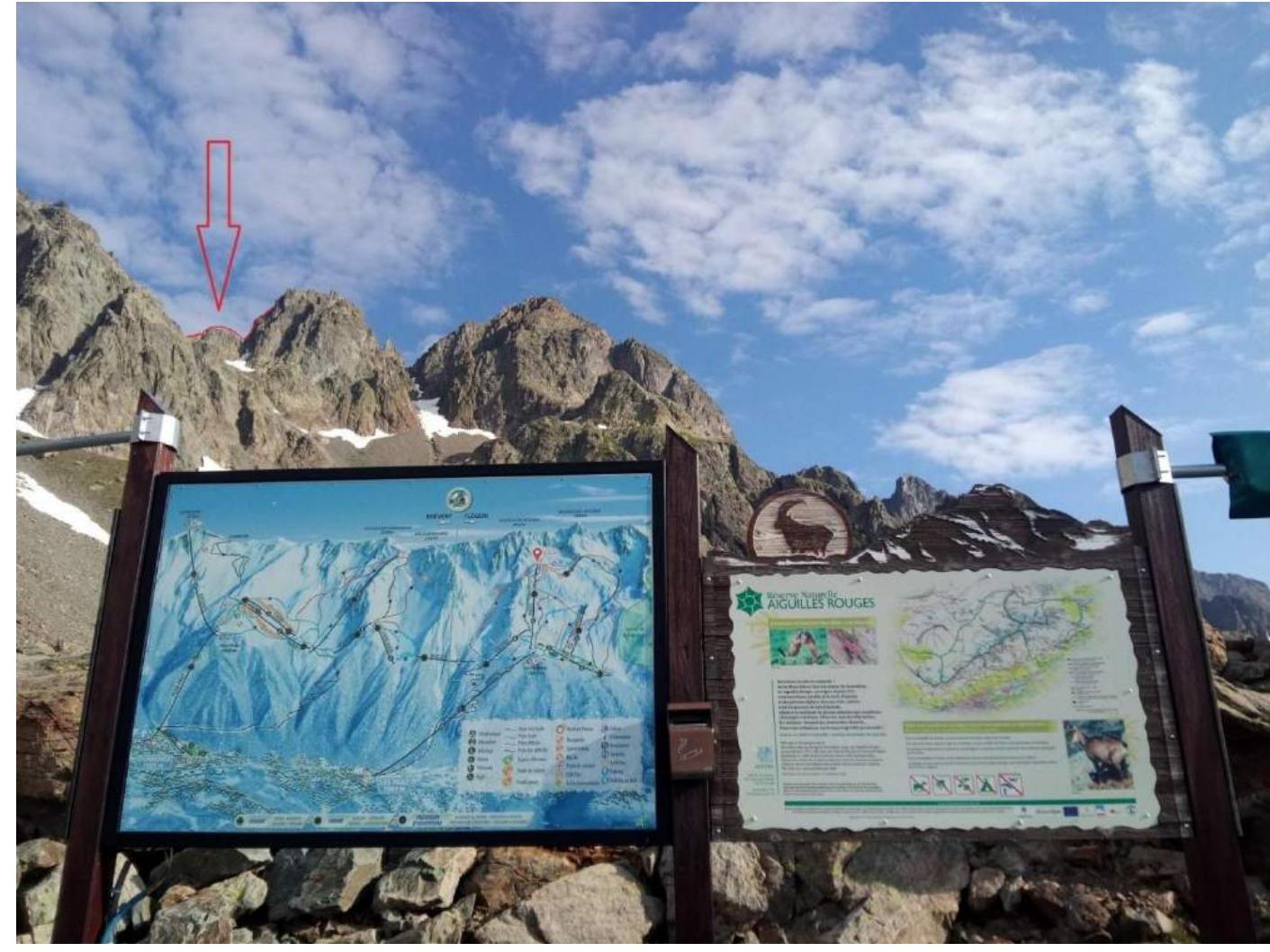
Photo 1. Lower part of the route. Photo from the upper station of the "INDEX" cable car, July 31, 2018.
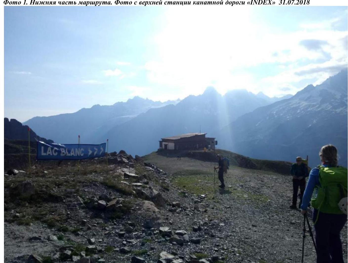
Photo 2. Descent along the trail towards "BLANC" lake.
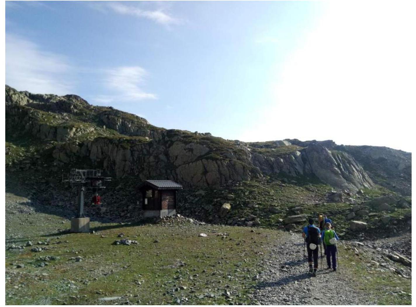
Photo 3. Descent along the trail towards "BLANC" lake.

Photo 4. Approach to the route.
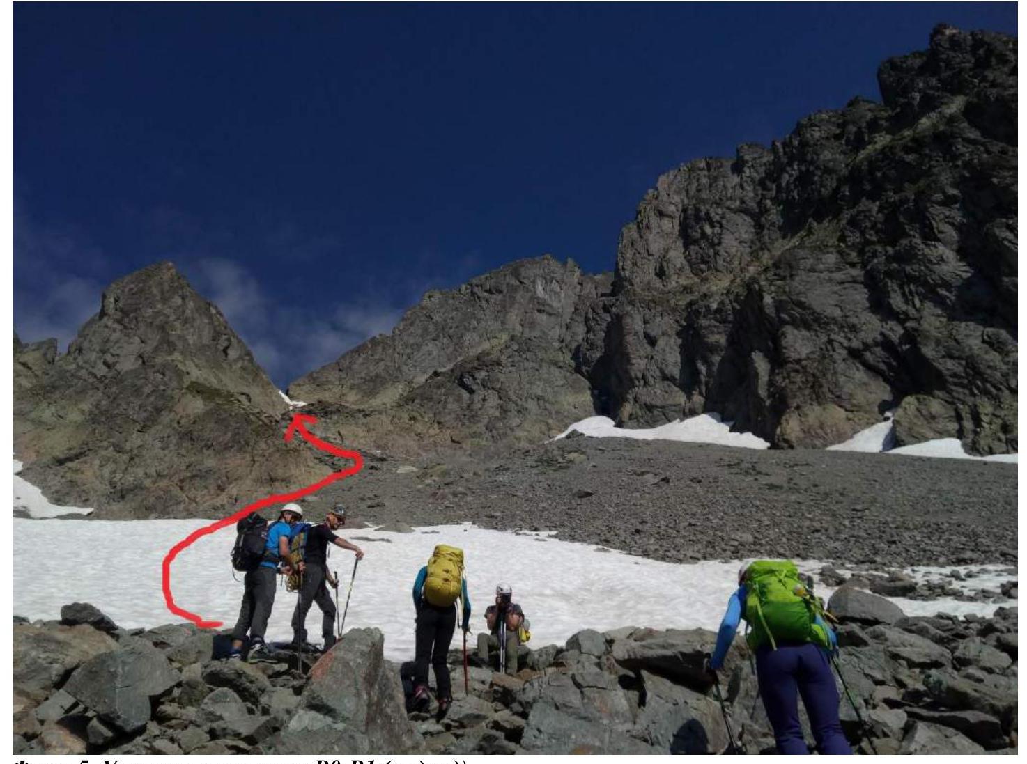
Photo 5. R0–R1 section (approach).
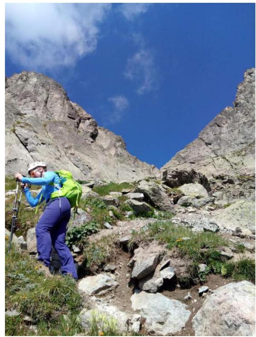
Photo 6. R1–R2 section.
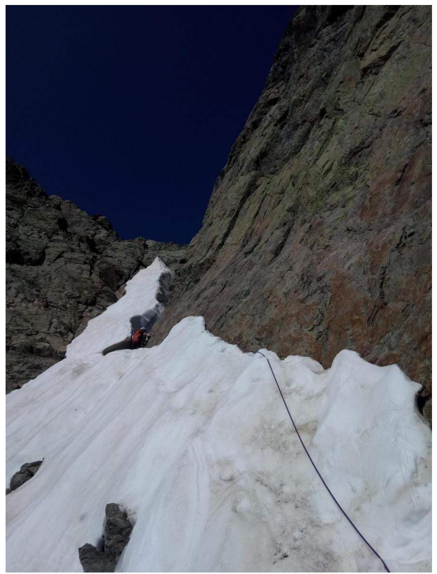
Photo 7. R2–R3 section. Col (with a narrow grotto at the end).
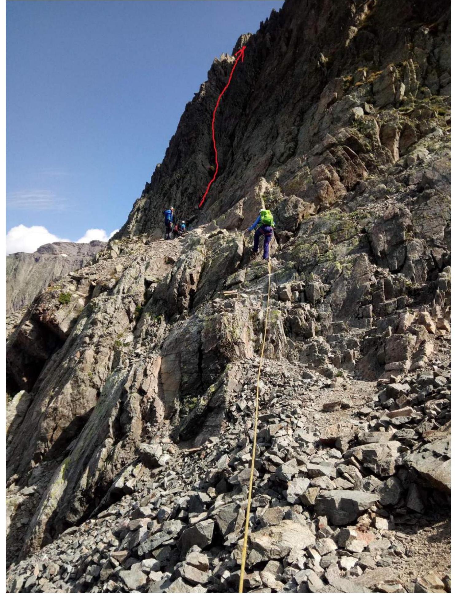
Photo 8. R3–R4 section. Movement along the northern side of the ridge through the chimney.
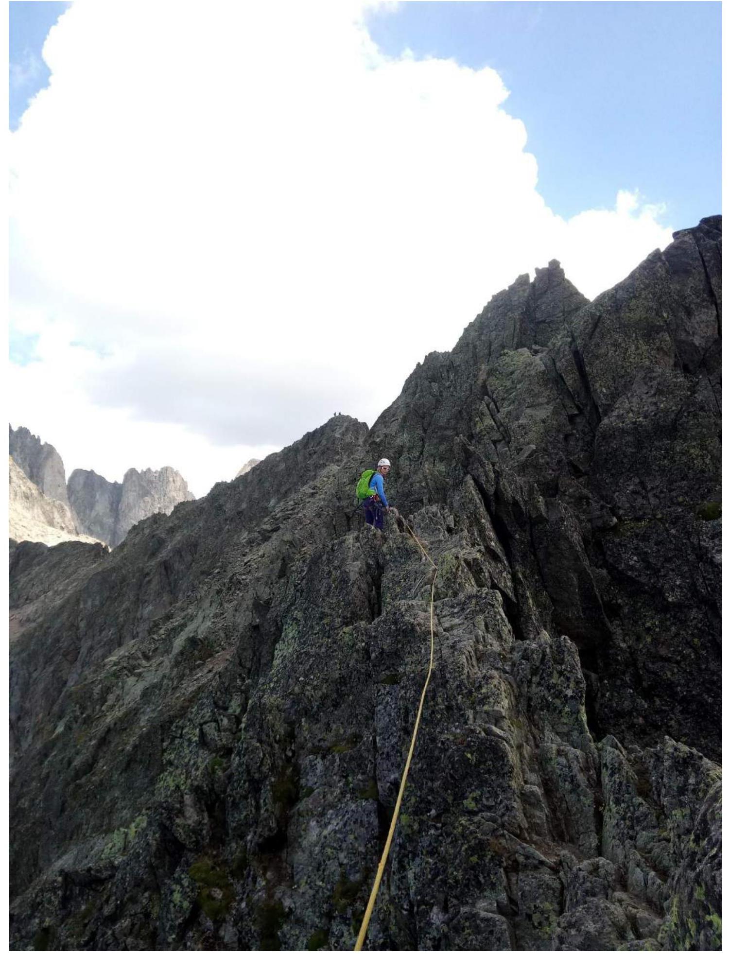
Photo 9. R4–R5 section. Ridge before the Southern peak.
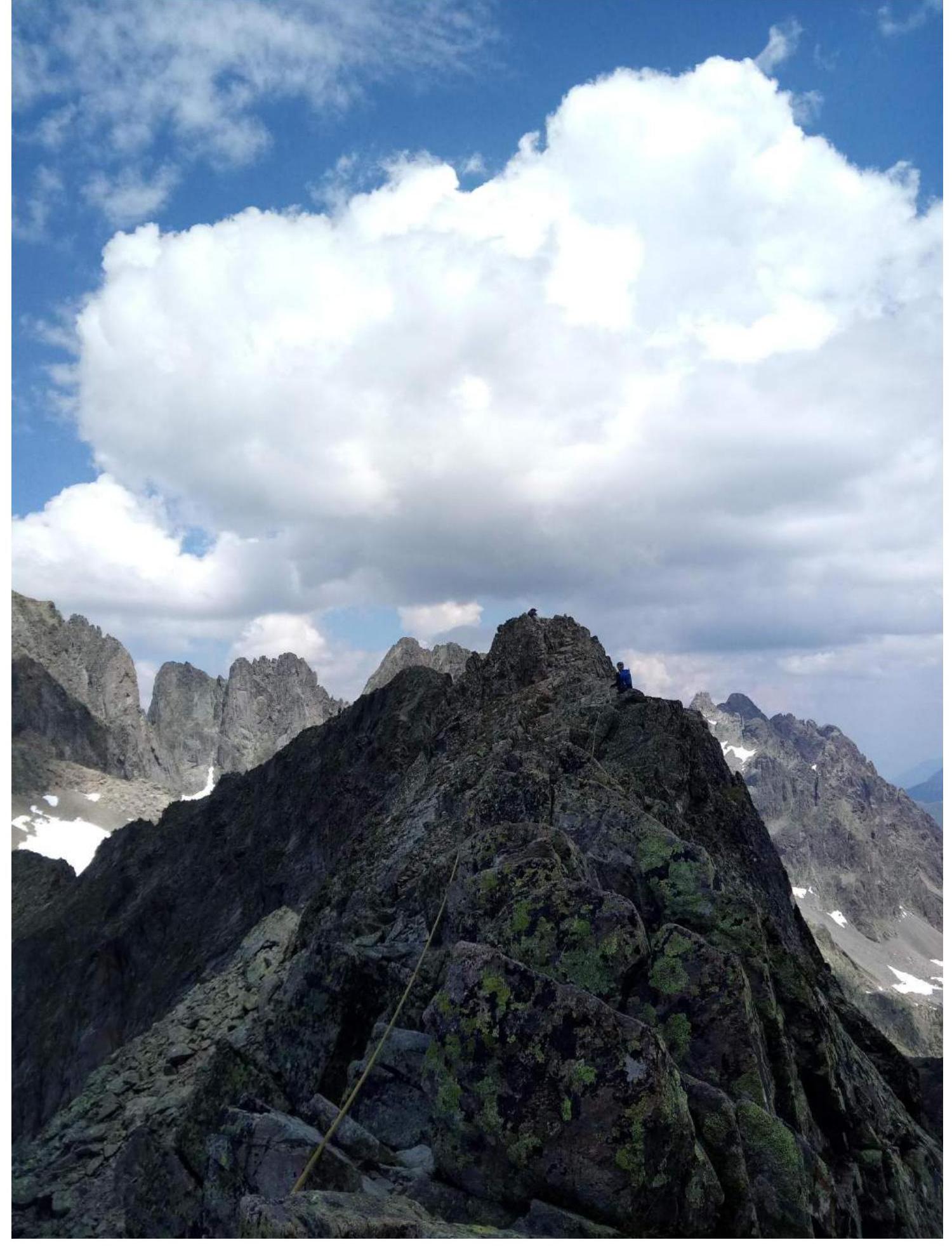
Photo 10. R5–R6 section. Ridge to the Northern peak.
3.2. Team Photo on the Peak

Photo 11. Northern peak.
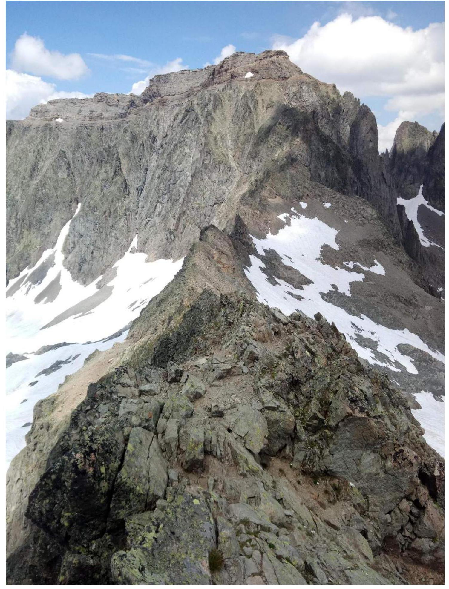
Photo 12. Descent into the "BLANC" lake valley.
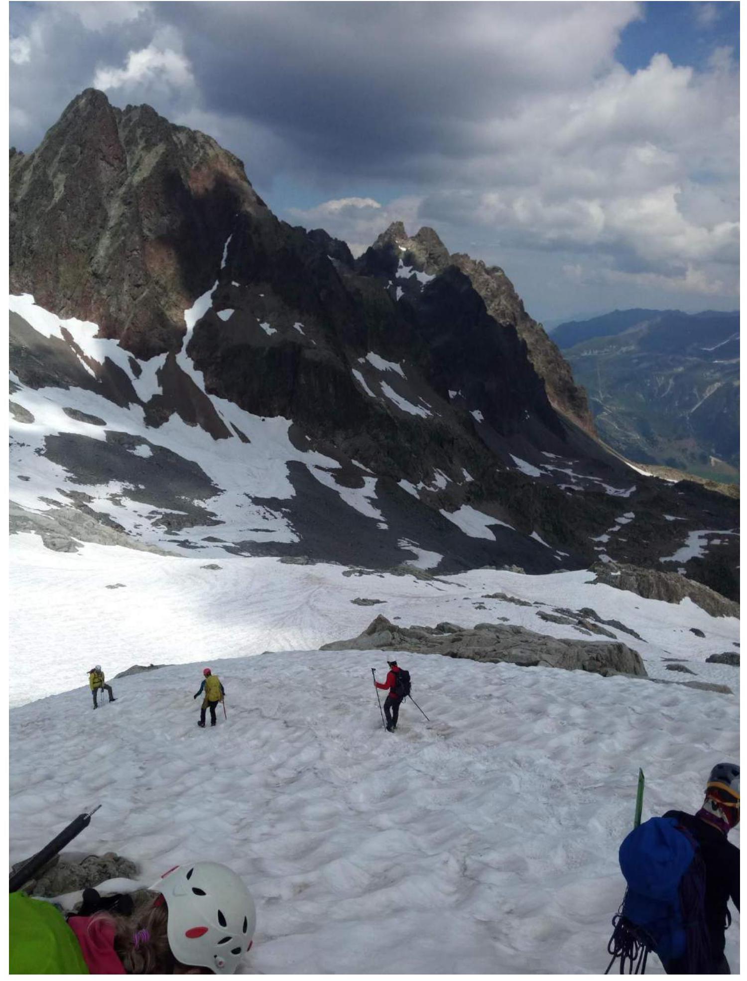
Photo 13. Descent into the "BLANC" lake valley, using glissading on snowy slopes.
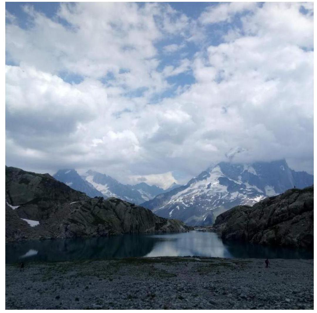
Photo 14. "BLANC" lake (bypass from the right, then from the left near the hut).
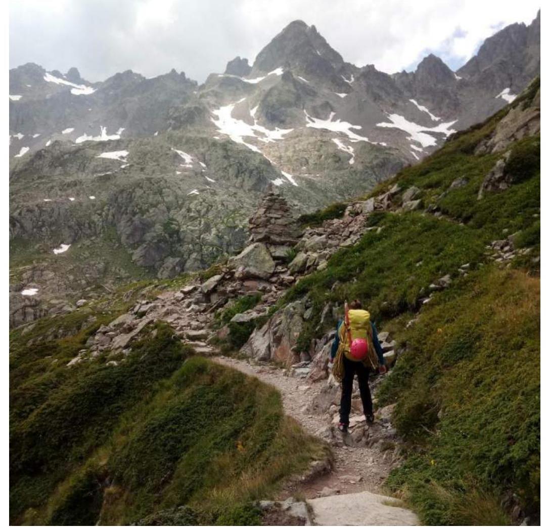
Photo 15. Descent to the "INDEX" station along a good marked trail.
3.3. General Route Recommendations
The route is popular, with 4 groups encountered. It is interesting for training ascents, as it requires navigation skills during approach and descent. For training groups, it is recommended to bring:
- a set of friends
- loops for organizing intermediate points. A good water supply for the day is necessary. There are no bolts on the route. Weather forecasts should be monitored, as the route is lengthy. Trekking poles are recommended.
Simple truths:
- Feed the coach regularly, qualitatively, and with flair.
- Apply sunscreen.
- Bring a good water supply or plan the route through water sources.
- For emergency cases, have a GPS tracker.
- Study the routes with the entire group.
- Regularly check weather forecasts (even on the route). Good luck!