REPORT ON THE ASCENT OF CLOCHER DE PLANPRAZ VIA THE COCHER-COCHON ROUTE CATEGORY 3A BY THE EDUCATIONAL DEPARTMENT OF A/C "POLITECHNIK" UNDER THE GUIDANCE OF MOLODOZHEN V.A. August 4, 2018
1. Ascent Passport
| № | 1. General Information | |
|---|---|---|
| 1.1 | Full Name, Sports Rank of the Leader | Molodozhen V.A. — Master of Sports |
| 1.2 | Full Name, Sports Rank of the Participants | Fineeva A.A. — 3rd sports rank, Sadovsky S.V. — 3rd sports rank, Duplak A.K. — 3rd sports rank, Limanyuk A.Yu. — 3rd sports rank, Bakharev N.N. — 3rd sports rank |
| 1.3 | Full Name of the Coach | Molodozhen V.A. |
| 1.4 | Organization | A/C "Politechnick" |
| 2. Characteristics of the Ascent Object | ||
| 2.1 | Region | France, Haute-Savoie, Chamonix valley, Aiguilles Rouges, Planpraz plateau |
| 2.2 | Valley | Planpraz plateau |
| 2.3 | Section Number according to the 2013 Classification Table | 10.3 |
| 2.4 | Name and Height of the Summit | Clocher de Planpraz 2428 m |
| 2.5 | Geographical Coordinates of the Summit (latitude/longitude), GPS Coordinates | 45°56′47.8″N 6°50′44.9″E |
| 3. Characteristics of the Route | ||
| 3.1 | Route Name | Cocher-Cochon |
| 3.2 | Proposed Category of Difficulty | 3A |
| 3.3 | Degree of Route Exploration | – |
| 3.4 | Relief Characteristics of the Route | Rock |
| 3.5 | Height Difference of the Route (data from altimeter or GPS) | Height of campsite (base camp), lower cable car station — 1035 m; height of start of approach to the route (upper cable car station) — 1999 m; height of summit — 2428 m; height difference from start of route to summit — 428 m; height difference from campsite to summit — 1393 m. |
| 3.6 | Route Length (in meters) | Distance from lower cable car station to upper — 4600 m (possible to use cable car); distance from upper cable car station to start of route — 1300 m; distance from start of route to summit — 340 m; descent from summit to upper cable car station — 1650 m; total route length (from lower cable car station) — 12490 m; |
| Total route length (from lower cable car station) with cable car use — 3290 m. | ||
| 3.7 | Technical Elements of the Route (total length of sections of various difficulty categories with indication of relief type (ice-snow, rock)) | 3rd cat. diff., rock — 15 m; 4th cat. diff., rock — 30 m; 5th cat. diff., rock — 145 m; 6th cat. diff., rock — 65 m; rappel on the route — 12 m. |
| 3.8 | Descent from the Summit | Rappel to the northwest from the summit tower 22 m to a hiking trail |
| 3.9 | Additional Route Characteristics | Route is partially equipped with stations and bolts. Water is absent. |
| 4. Characteristics of the Team's Actions | ||
| 4.1 | Time of Movement (team's walking hours, in hours and days) | Ascent was made using a cable car. Movement from upper cable car station and return took 5 hours. |
| 4.2 | Overnights | Campsite (base camp) |
| 4.3 | Departure from Overnights | 7:30 August 4, 2018 |
| 4.4 | Start of Ascent from Lower Cable Car Station | 8:15 August 4, 2018 |
| 4.5 | Start of Movement from Upper Cable Car Station | 9:00 August 4, 2018 |
| 4.6 | Arrival at the Start of the Route | 9:45 August 4, 2018 |
| 4.7 | Reaching the Summit | 13:00 August 4, 2018 |
| 4.8 | Descent from the Route to Upper Cable Car Station | 14:30 August 4, 2018 |
| 4.9 | Return to Overnights | 16:30 August 4, 2018 |
| 5. Responsible for the Report | ||
| 5.1 | Fineeva Anastasia Andreevna | fin_a_a@mail.ru |
2. Ascent Description
1.1. Characteristics of the Ascent Object
1.1. Photo of the Summit
Cocher-Cochon TD-6a 240m. The route starts at the toe of a small buttress with a nice warm-up pitch, well equipped with ring bolts. It is one of the best routes in this area and the final pitch is outstanding. It is gaining in popularity but is still often quiet outside July and August.
- 4b, 30m. Climb the slabby corner and the rib above to reach a grassy ledge. Cross this and climb another 5m buttress before stepping right to a peg and bolt belay.
- 5c, 30m. Follow the arête above the belay, staying just to the right of the crest, on positive holds to a steep pull through a vertical wall on thin holds. This leads to a slab, which is followed rightwards to a belay on a thin ledge.
- 5b, 40m. Go up and right 5m from the belay and climb the excellent wall above. Move left at the top and follow the rib for 5m to a long ledge with the belay at the right-hand end.
- 6a, 25m. The slab above the belay leads to a fantastic pillar, which is climbed on its crest, or just to the right, and leads to a grassy ledge. The belay is 4m to the left.
- 5a, 25m. Cross the gully behind the belay and climb the rib above for 12m. When this ends, step across another gully to the left and climb the steep 4m wall on the far side of it onto slabs above. These lead easily to the belay. Make a slightly awkward 14m abseil from here down to boulders and then walk/scramble north for 100m, hugging the steep walls on the left, to the next pitch which starts at a series of steep cracks in a grey wall.
- 5c, 30m. Climb the cracks either on the left (5c) or the right (6a) – neither is a pushover – to easier slabs above and follow these to an uncomfortable hanging belay.
- 5a, 20m. Carry on up the slab in much the same vein, then follow the crest of the ridge above. When this ends, step off left, walk across and come back right to an exposed ledge with a belay at the far right end.
- 6a, 40m. THE Pitch! Climb the arête above the belay until, after four bolts, it leads you rightwards through a little steepening and onto the southwest ridge of the Clocher de Planpraz. Follow this in a fantastic position to the summit. FA. M. and J.Franc, M.Méot, C.Mussat 19.8.2000
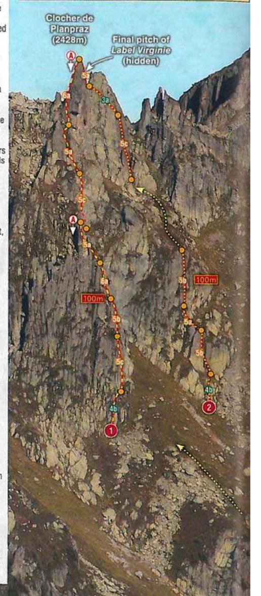
Fig. 1. Source — guide "Chamonix by Charlie Boscoe with Jack Geldard". Location — Planpraz plateau, France, view of the south slope of Clocher de Planpraz.
Routes:
- Cocher-Cochon — 3А cat. diff.;
- Label Virginie — 2Б cat. diff.
1.2. Photo of the Route Profile
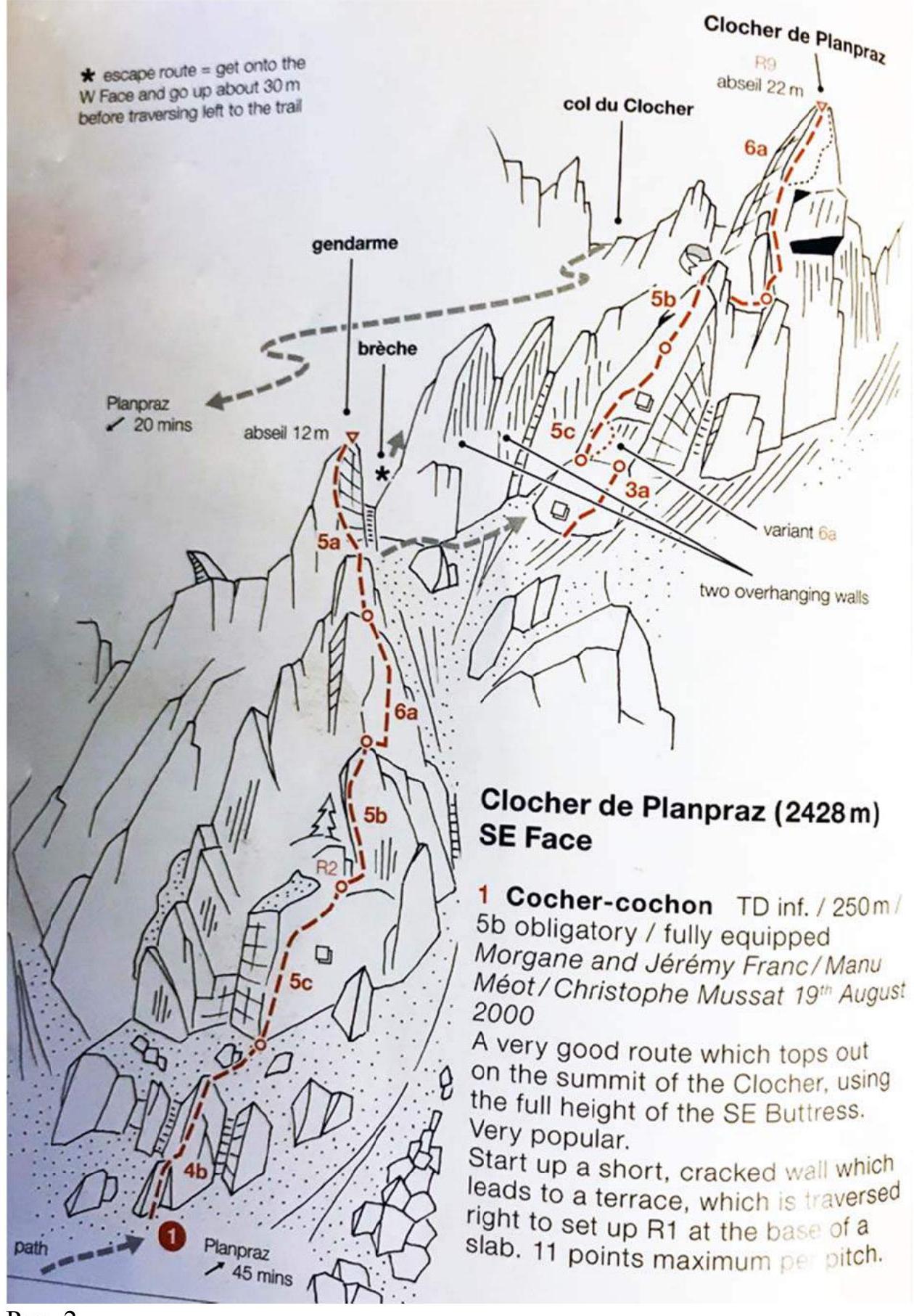
Fig. 2.
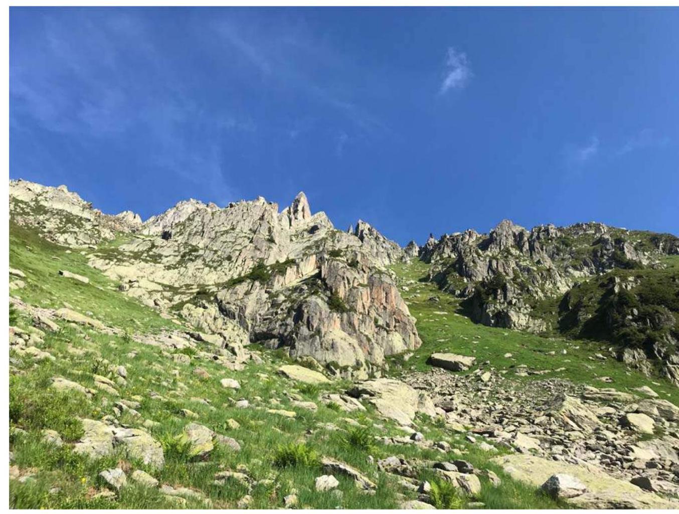
1.3. Photopanorama of the Area
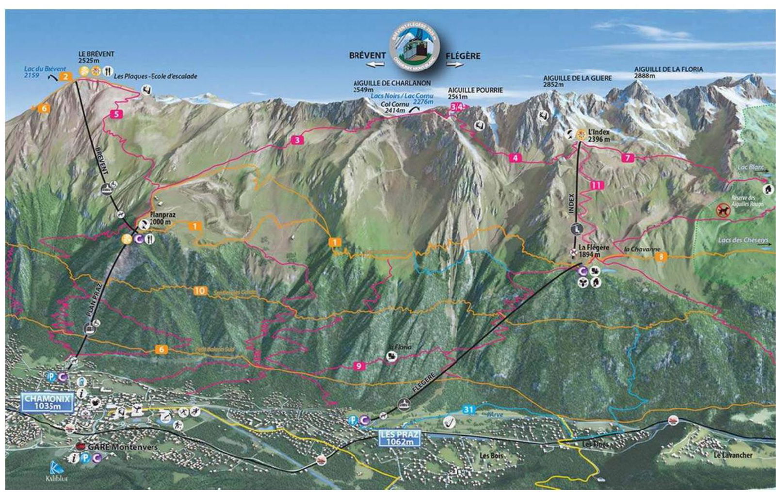
Fig. 3. Source — https://www.chamonix.com/↗ Location — Aiguilles Rouges massif, France, view of the east slope of the ridge.

Fig. 4. Source — https://map.wanderland.ch/↗
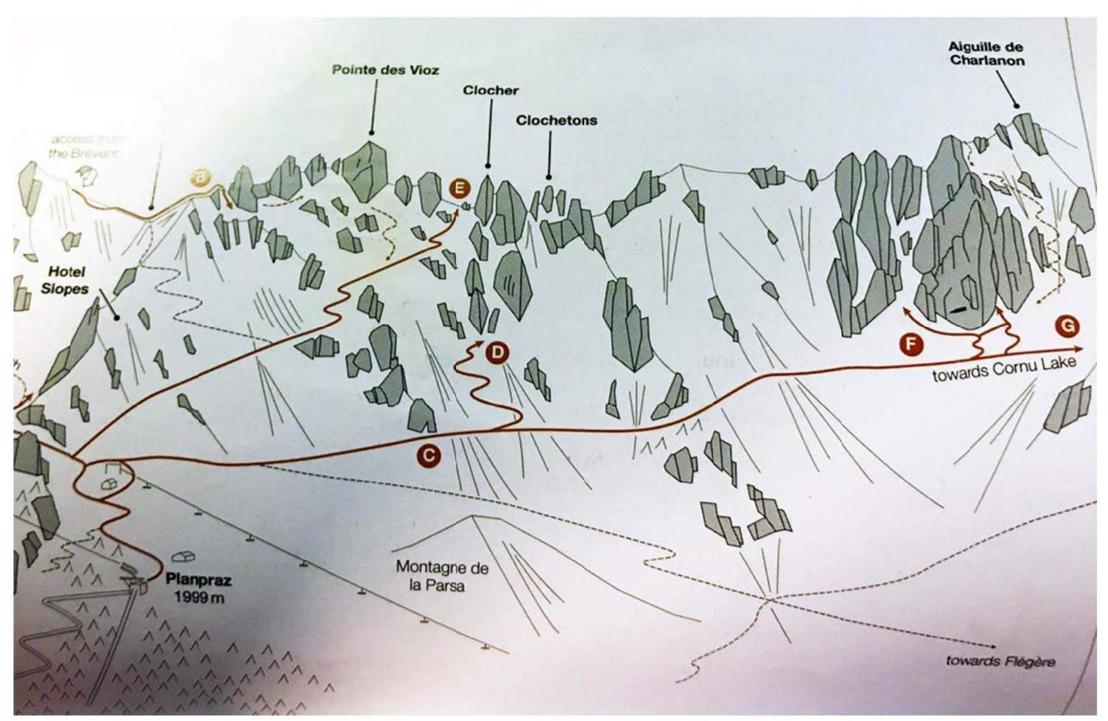
Fig. 5. The area where the summit is located is in France in the Chamonix valley on the Aiguilles Rouges massif to the west of Chamonix town on the Planpraz plateau.
Ascent from Chamonix town is possible via a cable car from du Brévent station to de Planpraz station, as well as by a trail that winds under the cable car line. In this case, the path will take about 2 hours. The height difference is 854 m, the distance is 4600 m.
From the upper cable car station de Planpraz, one needs to move northwest along the trail towards the talus slope, which should remain on the left during the movement, and then ascend the grassy slope to the west to the base of the rock massif, from which the rock route begins.
The route starts with a small buttress with pleasant warm-up pitches of 4b–5c difficulty with a well-equipped path of bolted hooks. The final pitch is key and the most outstanding on the route, making it very popular in the region.
Descent from the route is by rappel to the northwest from the summit tower 22 m to a hiking trail leading to the upper cable car station.
2. Route Characteristics
| № Section | Relief Character | Category of Difficulty, CIS (FR) | Length |
|---|---|---|---|
| R0–R1 | Rocks | 3 (4b) | 30 m |
| R1–R2 | Rocks | 4 (5c) | 30 m |
| R2–R3 | Rocks | 4 (5b) | 40 m |
| R3– C4 | Rocks | 5 (6a) | 25 m |
| R4–R5 | Rocks | 4 (5a) | 25 m |
| R5–R6 | Rocks | – | 75 m |
| R6–R7 | Rocks | 2 (3a) | 25 m |
| R7–R8 | Rocks | 5- (5c) | 30 m |
| R8–R9 | Rocks | 4 (5b) | 20 m |
| R9–R10 | Rocks | 5+ (6a) | 40 m |
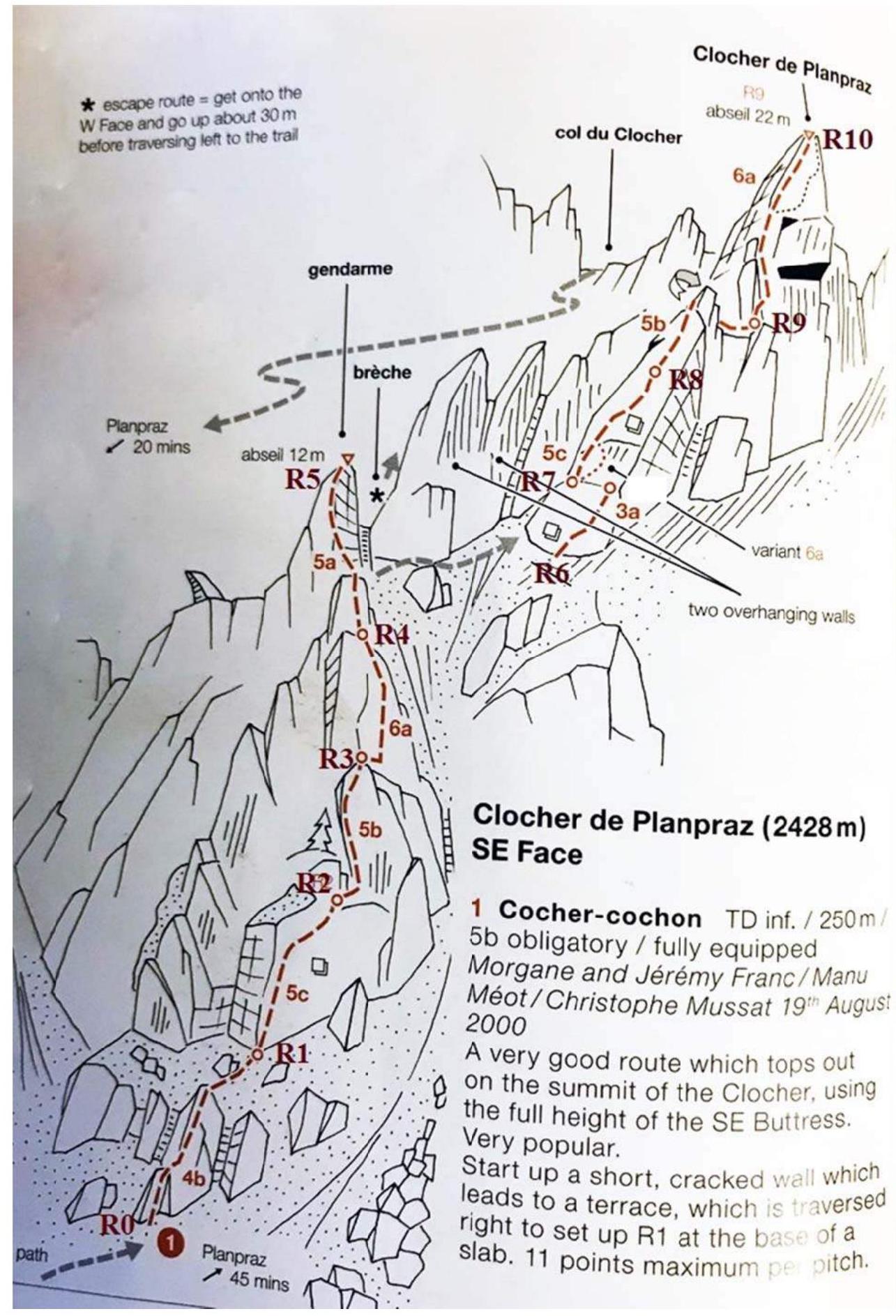
Fig. 6. R0–R1 — 3 (4b), 30 m. Climbing the rib to a grassy ledge, cross it and climb another 5m buttress, reach the belay station; R1–R2 — 4 (5c), 30 m. Sharp ridge, then leave the ridge on the right and move on active holds to a steep vertical wall with thin holds; R2–R3 — 4 (5b), 40 m. Ascend and move 5 m to the right from the belay, climb the excellent wall above. Move left upwards along the rib 5 m to a long ledge with the belay at its right end; R3–R4 — 5 (6a), 25 m. Rock slab above the belay leads to a column, which is climbed on its crest or just to the right. Exit to a grassy ledge. Belay is 4 m to the left.
R4–R5 — 4 (5a), 25 m. Cross the gully behind the belay and climb the rib above for 12 m. When it ends, step across another gully to the left and climb the steep 4 m wall on the far side onto slabs above. This path leads to the belay.
R5–R6 — slightly awkward rappel 14 m, then carefully move along the trail to the north about 100 m, hugging the wall on the left, carefully cross the gully, from which stones may fall, to rocks with horizontal cracks and easy climbing; R6–R7 — 2 (3a), 15 m. Traverse along easy rocks to the next pitch, which starts left of the cracks on the grey wall above the gully; R7–R8 — 5- (5c), 30 m. Climb the cracks on the left (5c) or right (6a) upwards along the path of bolted hooks; R8–R9 — 4 (5b), 20 m. Continue climbing the slabs in the same manner, then follow the crest of the ridge above. When it ends, step off left, cross it and return right to an exposed ledge with a belay at its right end; R9–R10 — 5+ (6a), 40 m. Key pitch. Climb the arête above the belay until, after the fourth bolt, it leads rightwards onto the southwest ridge of Clocher de Planpraz. Follow this in a fantastic position to the summit.
3. Characteristics of the Team's Actions
| № Section | Description | Photo Number |
|---|---|---|
| R0–R1 | Alternate movement in three-person links | №1, №2 |
| R1–R2 | Alternate movement in three-person links | – |
| R2–R3 | Alternate movement in three-person links | – |
| R3–R4 | Alternate movement in three-person links | – |
| R4–R5 | Alternate movement in three-person links | №3 |
| R5–R6 | Alternate movement in three-person links | №3 |
| R6–R7 | Simultaneous movement in three-person links | – |
| R7–R8 | Simultaneous movement in three-person links | №4 |
| R8–R9 | Alternate movement in three-person links | №5, №6 |
| R9–R10 | Alternate movement in three-person links | №7, №8 |
The route is one of the most popular and beautiful for ascent. The danger of rockfall is assumed in the area of R5–R7 due to the need to cross the gully. The proposed assessment of the route is 3A.
Photo №1
Approach to the start of the route R0.
Photo №2
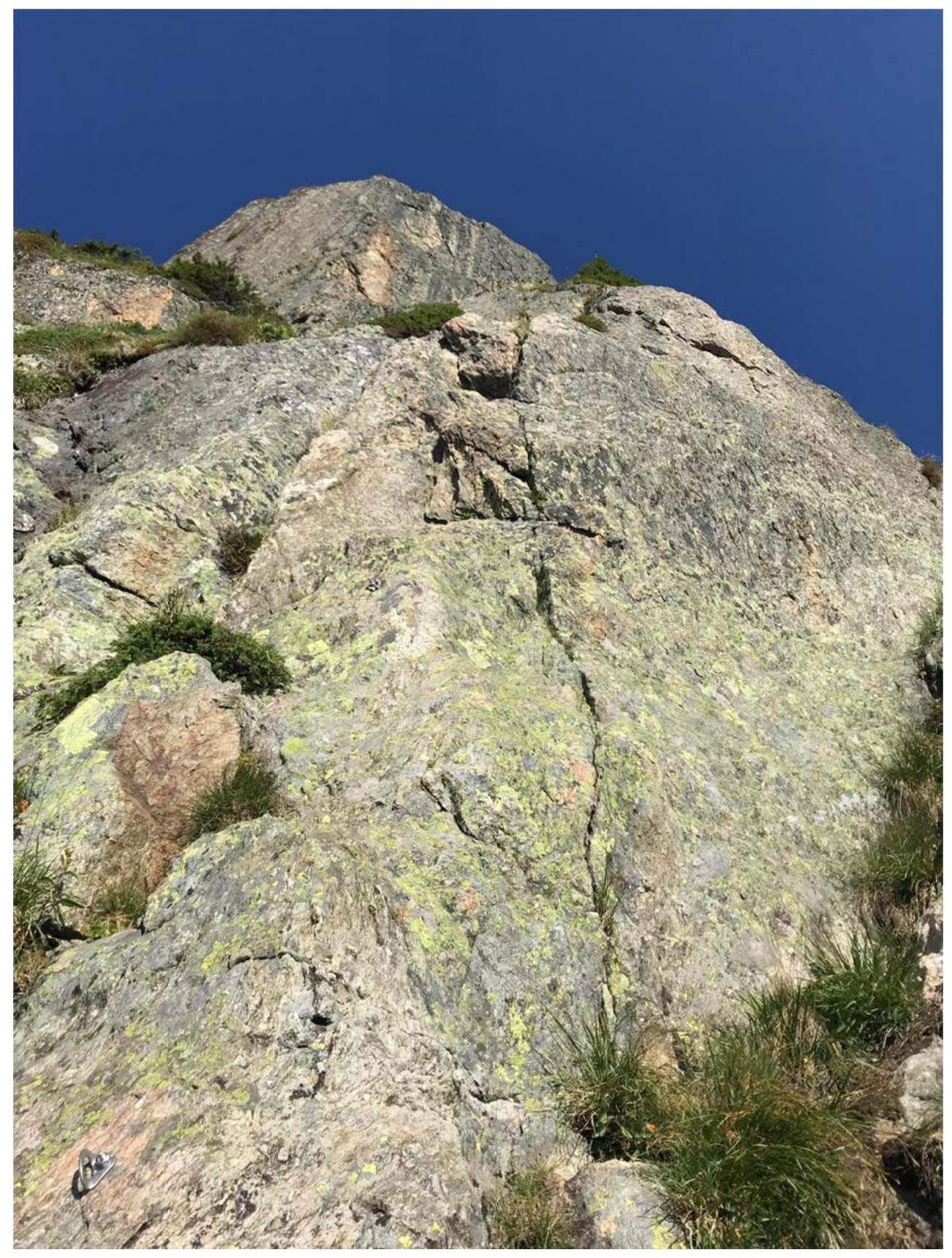
Start of the route, section R0–R1.
Photo №3
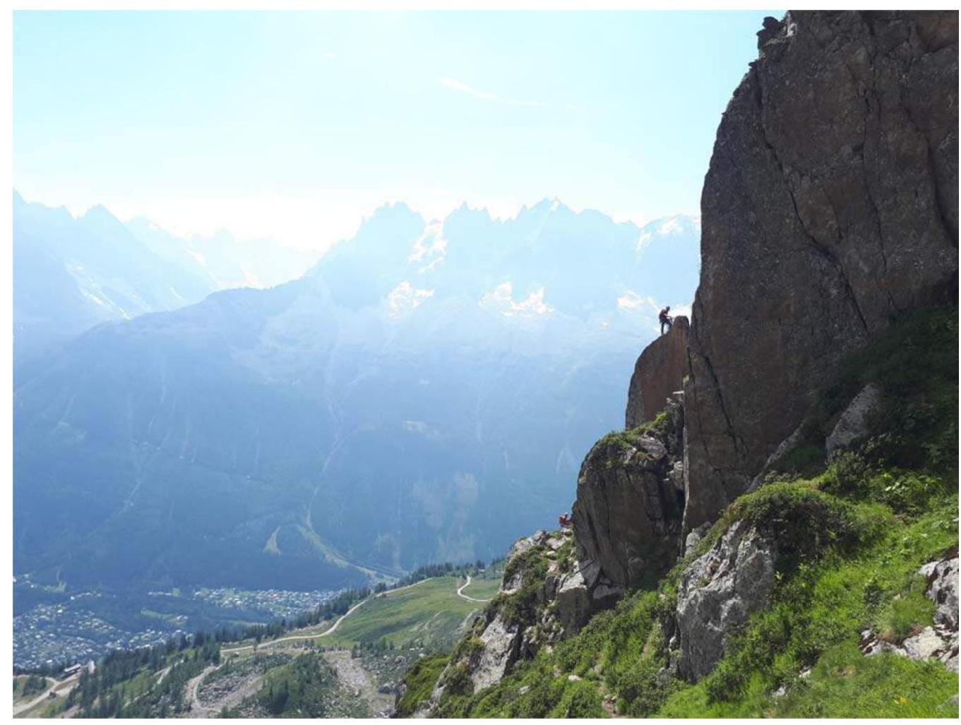
Section R4–R5. Participant on belay R5 receives a partner.
View of the hiking trail R5–R6.
Photo №4

Section R7–R8.
View from belay R7 towards the summit.
Photo №5
Section R8–R9.
Photo №6

View from belay R9 on section R5–R7. Belay R7 is 2 m to the right of the participants waiting below.
Photo №7
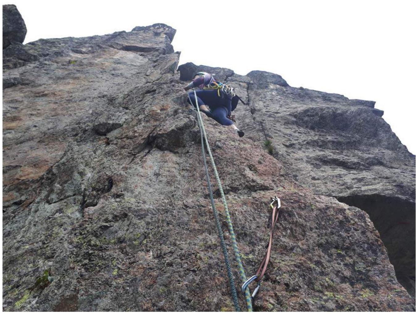
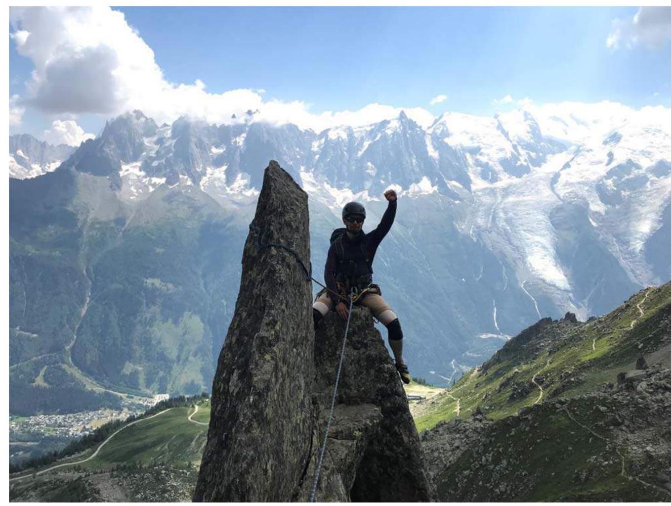
Section R9–R10. Key pitch.
Photo №8
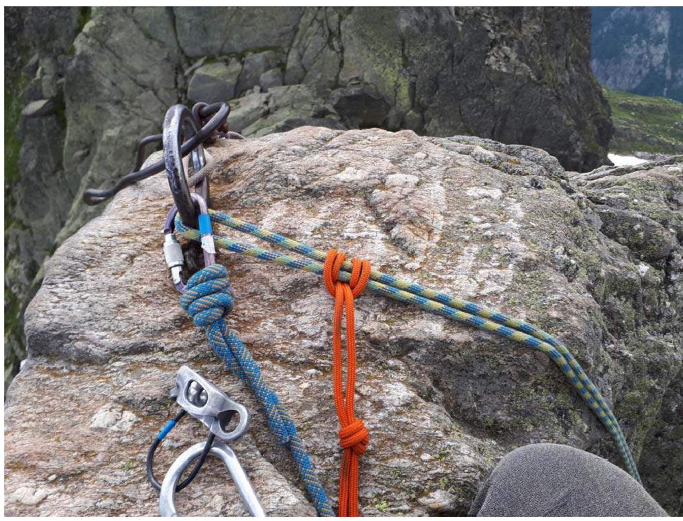
R10. Belay station on the summit.
Photo №9

Start of descent, view of the trail and upper cable car station. To the left is the wall from which the descent from the summit is made.


